EP0448059B1 - Automatic travelling apparatus - Google Patents
Automatic travelling apparatus Download PDFInfo
- Publication number
- EP0448059B1 EP0448059B1 EP91104266A EP91104266A EP0448059B1 EP 0448059 B1 EP0448059 B1 EP 0448059B1 EP 91104266 A EP91104266 A EP 91104266A EP 91104266 A EP91104266 A EP 91104266A EP 0448059 B1 EP0448059 B1 EP 0448059B1
- Authority
- EP
- European Patent Office
- Prior art keywords
- vehicle
- max
- target
- maximum permissible
- steering
- Prior art date
- Legal status (The legal status is an assumption and is not a legal conclusion. Google has not performed a legal analysis and makes no representation as to the accuracy of the status listed.)
- Expired - Lifetime
Links
- 238000012545 processing Methods 0.000 claims description 9
- 230000015654 memory Effects 0.000 claims description 6
- 238000006243 chemical reaction Methods 0.000 description 6
- 230000009466 transformation Effects 0.000 description 4
- 230000006870 function Effects 0.000 description 3
- 230000008901 benefit Effects 0.000 description 2
- 230000004069 differentiation Effects 0.000 description 2
- 238000001514 detection method Methods 0.000 description 1
- 238000010586 diagram Methods 0.000 description 1
- 238000000605 extraction Methods 0.000 description 1
- 238000000034 method Methods 0.000 description 1
- 230000008569 process Effects 0.000 description 1
- 230000004044 response Effects 0.000 description 1
Images


Classifications
-
- G—PHYSICS
- G05—CONTROLLING; REGULATING
- G05D—SYSTEMS FOR CONTROLLING OR REGULATING NON-ELECTRIC VARIABLES
- G05D1/00—Control of position, course, altitude or attitude of land, water, air or space vehicles, e.g. using automatic pilots
- G05D1/02—Control of position or course in two dimensions
- G05D1/021—Control of position or course in two dimensions specially adapted to land vehicles
- G05D1/0231—Control of position or course in two dimensions specially adapted to land vehicles using optical position detecting means
- G05D1/0246—Control of position or course in two dimensions specially adapted to land vehicles using optical position detecting means using a video camera in combination with image processing means
-
- G—PHYSICS
- G05—CONTROLLING; REGULATING
- G05D—SYSTEMS FOR CONTROLLING OR REGULATING NON-ELECTRIC VARIABLES
- G05D1/00—Control of position, course, altitude or attitude of land, water, air or space vehicles, e.g. using automatic pilots
- G05D1/02—Control of position or course in two dimensions
- G05D1/021—Control of position or course in two dimensions specially adapted to land vehicles
- G05D1/0212—Control of position or course in two dimensions specially adapted to land vehicles with means for defining a desired trajectory
Definitions
- the present invention relates to an automatic travelling apparatus according to the preamble part of claim 1.
- Such an automatic travelling apparatus is known from the EP 0 354 561 A2.
- This known automatic travelling apparatus estimates the target steering amount to permit the vehicle to follow the target course on the basis of the instantaneous running conditions; however, it does not take into account the current state of the road surface. This might lead to problems if the current state of the road surface deviates from the normal state of the road surface, for example, a wet road.
- the steering amount or a tire steering angle, respectively, which might be appropriate for a normal dry road can be too high for the current road conditions. In this case, the lateral load of the vehicle or the yaw rate of the vehicle will be too high with respect to the road condition, which leads to unstable steering of the vehicle, for example because of skidding or veering off of the vehicle.
- an object of the invention to provide an automatic travelling apparatus capable of stable and steady steering of the vehicle to permit the vehicle to follow the target course.
- This object is achieved by the automatic travelling apparatus having the features of claim 1.
- This automatic travelling apparatus limits the target steering amount or the target control value issued by the steering control means to the steering drive so the steering angle does not exceed a maximum permissible steering angle corresponding to the maximum permissible steering amount.
- the maximum permissible steering amount is determined on the basis of the maximum permissible lateral load or the maximum permissibly yaw rate, which, in turn, are determined on the basis of the current state of the road surface, e.g., the wetness or dryness of the road surface, the target steering amount or the tire steering angle, respectively, will never be too high with respect to the road condition so that a stable and steady steering control of the vehicle is realized and a skidding or veering off being avoided, which allows the vehicle to follow the target course in conformity with the actual running condition. Therefore, a major advantage over the prior art is achieved.
- Fig. 1 is a block diagram showing a structure of an automatic travelling apparatus embodying the present invention.
- Fig. 2 shows line segments of a road edges obtained by data processing of an image taken by a video camera.
- Fig. 3 shows an image obtained by projective transformation of the image shown in Fig. 2.
- Fig. 4 shows an example of a target course set in a permissible travelling area between detected road edges.
- Figs. 5 (a) and 5 (b) show target courses set on a road which a vehicle is to travel at a low speed (a) and a high speed (b) respectively.
- Fig. 6 shows a relationship between a target course and a presumed course.
- Fig. 7 shows a relationship between a vehicle's steering angle and its turning radius.
- Fig. 8 shows an example of a travelling course which a vehicle takes to attain a target course.
- Fig. 9 shows a characteristic curve of maximum permissible lateral load of a vehicle depending on degree of wetness or dryness of ground surface.
- Fig. 10 shows a characteristic curve of maximum permissible yaw rate of a vehicle depending on degree of wetness or dryness of ground surface.
- Fig. 11 (a) and (b) show examples of travelling courses which a vehicle takes to attain a target course.
- Fig. 12 shows a line segment in the X-Y coordinates.
- Fig. 13 shows a point in the ⁇ - ⁇ point coordinates obtained by the Hough conversion of the line segment shown in Fig. 10.
- Fig. 14 shows an example of a flow of control according to the present invention.
- 1 is an image pick-up device
- 2 is an image processor
- 3 is a means for determining a permissible travelling area
- 4 is a means for setting a target course
- 5 is a control means
- 6 is a running speed sensor
- 7 is a Yaw rate sensor
- 8 is a steering angle sensor
- 9 a steering controller
- 10 a steering drive
- 11 is a vehicle.
- Characters RA denote a permissible travelling area
- characters OC denote target courses
- character P denotes a position of a vehicle.
- an automatic travelling apparatus comprises: an image pick-up device 1 such as a video camera attached to a vehicle for continuously picking up subsequent images of an area ahead of the vehicle; means 2 for processing the images taken by the image pick-up device 1 to extract therefrom segments of continuous lines such as road edges and the like; means 3 for determining, on the basis of the obtained continuous line segments, a permissible travelling area such as a road in the direction in which the vehicle is to travel; means 4 for setting a target course in the permissible travelling area thus determined; means 5 for determining the instantaneous running condition of the vehicle on the basis of an output signal from a speed sensor 6 representing the vehicle's running speed "v", an output signal from a yaw rate sensor 7 representing the yaw rate "T” and an output signal from a steering angle sensor 8 representing the tire angle " ⁇ " which varies with the steering of the vehicle, and for estimating, on the basis of the instantaneous running condition, a steering amount to permit the vehicle to follow the target course
- microcomputer aided control is used in place of means 2, 3, 4 and 5, and means 9 can be included in the microcomputer aided control, if occasions demand.
- each image supplied from the image pick-up device 1 is subjected to differentiation process for detection of the road edges.
- an automatic threshold setting circuit in the image processing means 2 sets an optimum threshold value in consideration of the degree of shade of the road edge image information just processed.
- the road edge image will be subjected to binary transformation.
- the images may be subjected to binary transformation, and then the binary data may be subjected to differentiation.
- binary transformation poly-digitization may be performed to express some shade details of image.
- Digitized image information will be subjected to the Hough conversion to convert the X-Y linear coordinates to the corresponding ⁇ - ⁇ point coordinates, thus eliminating isolated points and plotting to provide a continuous line segments of the road edges as shown in Fig. 2.
- ⁇ stands for an angle formed between the X-axis and a perpendicular from the origin of the X-Y coordinates to a line segment
- ⁇ stands for the length of the normal line.
- the line L in the X-Y coordinates in Fig. 10 is expressed as the point 01 in the ⁇ - ⁇ point coordinates in Fig. 11.
- edge tracing may be performed on the basis of binary-coded image information to obtain a continuous road edge.
- the Hough conversion, edge tracing and other appropriate processings may be performed simultaneously, and then synthetic judgement may be made on the results of these processings to obtain a precise road edge information. More accurate road edge information may be taken out when the above-mentioned image processings are made with progressively developing an input image area as the vehicle travels.
- the image taken by a video camera represents a perspective view.
- the perspective road edge image as shown in Fig. 2 can be converted into a non-perspective road edge image as shown in Fig. 3 according to the known projective conversion process.
- the permissible travelling area determining means 3 has a projective conversion characteristics set in consideration of the perspective characteristics of associated video cameras.
- the permissible travelling area determining means 3 can determine, on the basis of the non-perspective road image obtained by projective conversion, for instance, an area between the continuous road edges E1 and E2 shown in Fig. 4 as a permissible travelling area RA in the X-Y coordinates wherein the Y-axis corresponds to the direction in which the image is taken by the image pick-up device 1, i.e., the vehicle 11 is to travel.
- a instantaneous position of the vehicle 11 is indicated at a point "P"
- the video camera of the image pick-up device 1 is mounted at a predetermined position on the vehicle whereat the point "P" may appear at the center lower point of the display screen as the origin of the X-Y coordinates.
- the target course setting means 4 wild select a course most appropriate for running in the permissible travelling area, and will set the so selected course as a target course to follow.
- the course may be determined in consideration of the road contour and the running speed of the vehicle to meet the instantaneous travelling condition of the vehicle.
- the course may be basically determined in the width of the road as follows:
- a target course OC will be set a given constant distance "w" (for instance, 1.5 meters) apart from the left edge of the road, as shown in Fig. 4.
- a target course will be set along the center line (not shown) of the road.
- the coordinates of the target course are stored in the memories of the target course setting means 4 and are continuously renewed as the vehicle is running.
- the divisions of the X-Y coordinates for the permissible travelling area and the target course are selected in compliance with the magnification of the video camera of the image pick-up device 1.
- the target course setting means 4 finds that the running speed measured by the speed sensor 6 is below a predetermined speed, the target course OC will be set in conformity with the road contour as seen from Fig. 4.
- a target course OC of reduced curvature is set so as to reduce the lateral force which is applied to the vehicle.
- control means 5 After setting a target course in the road, the control means 5 will estimate a steering amount to permit the vehicle to follow the target course as follows:
- the control means 5 presumes, on the basis of the currently detected running condition, a course which the vehicle will run along; calculates a deviation of the presumed running course from the target course; determines a correction value of steering angle for bringing the vehicle to follow the target course and estimate therefrom a target steering amount.
- the position where the vehicle will attain is presumed as a point located apart from the X-axis by a specified distance in the X-Y coordinates having the Y-axis representing the running direction of the vehicle and the lateral deviation of the presumed point from the target point set on the target course is measured to finally determine thereby a corresponding correction value of the steering angle.
- the positive sign of yaw rate ⁇ represents that the presumed course AC turns to the left whereas the negative sign indicates the presumed course turning to the right.
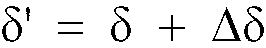
- the steering amount ⁇ ' for permitting the vehicle to get on the target course OC can be determined as follows:
- the steering control means 9 In response to the steering amount ⁇ ' given from the control means 5 the steering control means 9 issues a drive command to the steering drive 10 which in turn steers the vehicle toward the target course OC.
- the distance L on the Y-axis (the perpendicular distance L from the X-axis to the target point on the target course) is set, it may be treated as a variable depending on the vehicle running speed v detectable by the running speed sensor 6. Namely, when vehicle running at a lower speed, the distance L may be set to shorter one for the purpose of permitting the vehicle to travel the reduced distance from Point P and thereby to fast attain the target course OC. On the contrary, when vehicle running at a higher speed, the distance L may set to longer one for the purpose of permitting the vehicle to travel the increased distance from Point P and thereby to gently get on the target course OC.
- the automatic travelling apparatus further includes means for determining the maximum permissible steering angle from the vehicle characteristics such as maximum lateral load, maximum yaw rate and so on, and means for limiting the target steering amount below the maximum permissible steering angle.
- control means 5 determines, on the basis of a vehicle running speed detected by the speed sensor 6 and a value of maximum lateral load G max stored in the vehicle characteristics file of its memory, the maximum permissible steering angle ⁇ max of a vehicle when turning at the detected running speed v and at a radius R of curvature by the following operation expression:
- Both the maximum permissible lateral load G max and the maximum yaw rate ⁇ max can vary depending on how much the road is wetted or dried as shown in Fig. 9 (for G max) and Fig. 10 (for ⁇ max).
- the values of G max and ⁇ max previously determined at every degrees of wetness and dryness of the road surface according to the characteristic curves of Figs. 9 and 10 are stored in the memory of the control means and, when the degree of wetness or dryness of the road surface is detected, the corresponding value of the maximum permissible lateral load G max or yaw rate ⁇ max will be read out.
- the wetness or dryness of the road surface may be detected by brightness of the image of the permissible travelling area taken by the video camera.
- the control means 5 can also limit the target control value of steering angle ⁇ ' not to exceed the maximum permissible steering angle ⁇ max when steering the vehicle to follow the target course OC.
- the limiting operation is performed as follows:
- control means 5 increases the distance L from the present position P to the target course OC by the predeterminate extent in accordance with the excess value of the steering angle ⁇ ' over the maximum permissible steering angle ⁇ max, then estimates a new target value of steering angle ⁇ ' not exceeding the maximum permissible value ⁇ max, and then conducts the steering control with the newly determined steering amount for permitting the vehicle to follow the target course OC.
- Fig. 14 shows a flow of control according to the present invention.
- Figs. 11 (a) and (b) show the relationship between the travelling courses P1 and P2 which the vehicle takes to get on the target course OC at the steering angle ⁇ ' exceeding the maximum permissible steering angle ⁇ max and at the steering angle ⁇ ' not exceeding the maximum permissible steering angle ⁇ max respectively.
- L1 is an initial set value of the distance L whereat the steering angle ⁇ ' exceeds the maximum permissible steering angle ⁇ max
- L2 is a subsequently set value of the distance L, which is selected in accordance with the excess value of steering angle ⁇ ' over the maximum permissible steering angle ⁇ max.
- the automatic travelling apparatus which is capable of finding a permissible travelling area ahead of a running vehicle by use of an image pick-up device attached to the vehicle, setting a target course in the determined permissible travelling area, estimating steering amount for permitting the vehicle to follow the target course and steering the vehicle with reference to the target steering amount, offers such an advantage that by limiting the target steering amount below the maximum permissible steering angle it can realize steady steering control of the vehicle to follow the target course in conformity with actual running condition.
- an automatic travelling apparatus which is capable of finding a permissible travelling area ahead of a running vehicle by use of an image pick-up device attached to the vehicle, setting a target course in the determined permissible travelling area, estimating steering amount for permitting the vehicle to follow the target course and steering the vehicle with reference to the target steering amount, and also provides the possibility of estimating the maximum permissible steering angle at the present running speed from the characteristic data such as the maximum permissible lateral load and maximum permissible yaw rate etc., and limiting the target steering amount not to exceed the maximum steering amount.
Landscapes
- Engineering & Computer Science (AREA)
- Physics & Mathematics (AREA)
- Radar, Positioning & Navigation (AREA)
- Aviation & Aerospace Engineering (AREA)
- Remote Sensing (AREA)
- General Physics & Mathematics (AREA)
- Automation & Control Theory (AREA)
- Multimedia (AREA)
- Electromagnetism (AREA)
- Computer Vision & Pattern Recognition (AREA)
- Control Of Position, Course, Altitude, Or Attitude Of Moving Bodies (AREA)
- Navigation (AREA)
- Image Processing (AREA)
- Closed-Circuit Television Systems (AREA)
- Steering Control In Accordance With Driving Conditions (AREA)
Description
- The present invention relates to an automatic travelling apparatus according to the preamble part of claim 1.
- Such an automatic travelling apparatus is known from the
EP 0 354 561 A2. This known automatic travelling apparatus estimates the target steering amount to permit the vehicle to follow the target course on the basis of the instantaneous running conditions; however, it does not take into account the current state of the road surface. This might lead to problems if the current state of the road surface deviates from the normal state of the road surface, for example, a wet road. The steering amount or a tire steering angle, respectively, which might be appropriate for a normal dry road can be too high for the current road conditions. In this case, the lateral load of the vehicle or the yaw rate of the vehicle will be too high with respect to the road condition, which leads to unstable steering of the vehicle, for example because of skidding or veering off of the vehicle. - In view of the foregoing, it is an object of the invention to provide an automatic travelling apparatus capable of stable and steady steering of the vehicle to permit the vehicle to follow the target course.
- This object is achieved by the automatic travelling apparatus having the features of claim 1. This automatic travelling apparatus limits the target steering amount or the target control value issued by the steering control means to the steering drive so the steering angle does not exceed a maximum permissible steering angle corresponding to the maximum permissible steering amount. Since the maximum permissible steering amount is determined on the basis of the maximum permissible lateral load or the maximum permissibly yaw rate, which, in turn, are determined on the basis of the current state of the road surface, e.g., the wetness or dryness of the road surface, the target steering amount or the tire steering angle, respectively, will never be too high with respect to the road condition so that a stable and steady steering control of the vehicle is realized and a skidding or veering off being avoided, which allows the vehicle to follow the target course in conformity with the actual running condition. Therefore, a major advantage over the prior art is achieved.
- Fig. 1 is a block diagram showing a structure of an automatic travelling apparatus embodying the present invention.
- Fig. 2 shows line segments of a road edges obtained by data processing of an image taken by a video camera.
- Fig. 3 shows an image obtained by projective transformation of the image shown in Fig. 2.
- Fig. 4 shows an example of a target course set in a permissible travelling area between detected road edges.
- Figs. 5 (a) and 5 (b) show target courses set on a road which a vehicle is to travel at a low speed (a) and a high speed (b) respectively.
- Fig. 6 shows a relationship between a target course and a presumed course.
- Fig. 7 shows a relationship between a vehicle's steering angle and its turning radius.
- Fig. 8 shows an example of a travelling course which a vehicle takes to attain a target course.
- Fig. 9 shows a characteristic curve of maximum permissible lateral load of a vehicle depending on degree of wetness or dryness of ground surface.
- Fig. 10 shows a characteristic curve of maximum permissible yaw rate of a vehicle depending on degree of wetness or dryness of ground surface.
- Fig. 11 (a) and (b) show examples of travelling courses which a vehicle takes to attain a target course.
- Fig. 12 shows a line segment in the X-Y coordinates.
- Fig. 13 shows a point in the ρ-Θ point coordinates obtained by the Hough conversion of the line segment shown in Fig. 10.
- Fig. 14 shows an example of a flow of control according to the present invention.
- In the drawings, 1 is an image pick-up device, 2 is an image processor, 3 is a means for determining a permissible travelling area, 4 is a means for setting a target course, 5 is a control means, 6 is a running speed sensor, 7 is a Yaw rate sensor, 8 is a steering angle sensor, 9 a steering controller, 10 a steering drive, 11 is a vehicle. Characters RA denote a permissible travelling area, characters OC denote target courses and character P denotes a position of a vehicle.
- Referring now to the drawings, a preferred embodiment of the present invention will be described in detail as follows:
- In Fig. 1, an automatic travelling apparatus according to the present invention comprises: an image pick-up device 1 such as a video camera attached to a vehicle for continuously picking up subsequent images of an area ahead of the vehicle; means 2 for processing the images taken by the image pick-up device 1 to extract therefrom segments of continuous lines such as road edges and the like; means 3 for determining, on the basis of the obtained continuous line segments, a permissible travelling area such as a road in the direction in which the vehicle is to travel; means 4 for setting a target course in the permissible travelling area thus determined; means 5 for determining the instantaneous running condition of the vehicle on the basis of an output signal from a speed sensor 6 representing the vehicle's running speed "v", an output signal from a yaw rate sensor 7 representing the yaw rate "T" and an output signal from a
steering angle sensor 8 representing the tire angle "δ" which varies with the steering of the vehicle, and for estimating, on the basis of the instantaneous running condition, a steering amount to permit the vehicle to follow the target course, and for limiting the steering amount below the maximum permissible steering angle; and means 9 (and a steering drive 10) for steering the vehicle with reference to the steering amount. - Actually, a microcomputer aided control is used in place of
means - The extraction of continuous line segments such as road edges from the taken image in the image processing means 2 can be made as follows:
- First, each image supplied from the image pick-up device 1 is subjected to differentiation process for detection of the road edges. Then, an automatic threshold setting circuit in the image processing means 2 sets an optimum threshold value in consideration of the degree of shade of the road edge image information just processed. The road edge image will be subjected to binary transformation.
- Alternately, first, the images may be subjected to binary transformation, and then the binary data may be subjected to differentiation. In place of binary transformation poly-digitization may be performed to express some shade details of image.
- Digitized image information will be subjected to the Hough conversion to convert the X-Y linear coordinates to the corresponding ρ-θ point coordinates, thus eliminating isolated points and plotting to provide a continuous line segments of the road edges as shown in Fig. 2.
- θ stands for an angle formed between the X-axis and a perpendicular from the origin of the X-Y coordinates to a line segment, whereas ρ stands for the length of the normal line. For instance, the line L in the X-Y coordinates in Fig. 10 is expressed as the
point 01 in the ρ-θ point coordinates in Fig. 11. - On that occasion, edge tracing may be performed on the basis of binary-coded image information to obtain a continuous road edge. The Hough conversion, edge tracing and other appropriate processings may be performed simultaneously, and then synthetic judgement may be made on the results of these processings to obtain a precise road edge information. More accurate road edge information may be taken out when the above-mentioned image processings are made with progressively developing an input image area as the vehicle travels.
- The image taken by a video camera represents a perspective view. The perspective road edge image as shown in Fig. 2 can be converted into a non-perspective road edge image as shown in Fig. 3 according to the known projective conversion process.
- The permissible travelling area determining means 3 has a projective conversion characteristics set in consideration of the perspective characteristics of associated video cameras.
- The permissible travelling area determining means 3 can determine, on the basis of the non-perspective road image obtained by projective conversion, for instance, an area between the continuous road edges E1 and E2 shown in Fig. 4 as a permissible travelling area RA in the X-Y coordinates wherein the Y-axis corresponds to the direction in which the image is taken by the image pick-up device 1, i.e., the
vehicle 11 is to travel. - In Fig. 4, a instantaneous position of the
vehicle 11 is indicated at a point "P", and the video camera of the image pick-up device 1 is mounted at a predetermined position on the vehicle whereat the point "P" may appear at the center lower point of the display screen as the origin of the X-Y coordinates. - After a permissible travelling area is determined by the permissible travelling area determining means 3, the target course setting means 4 wild select a course most appropriate for running in the permissible travelling area, and will set the so selected course as a target course to follow.
- Preferably, the course may be determined in consideration of the road contour and the running speed of the vehicle to meet the instantaneous travelling condition of the vehicle. However, the course may be basically determined in the width of the road as follows:
- In case that the target course setting means 4 finds that the width of the road is above a predetermined extent, and that vehicles must keep to the left, a target course OC will be set a given constant distance "w" (for instance, 1.5 meters) apart from the left edge of the road, as shown in Fig. 4.
- In case that the width of the road is below the predetermined extent, a target course will be set along the center line (not shown) of the road.
- The coordinates of the target course are stored in the memories of the target course setting means 4 and are continuously renewed as the vehicle is running. The divisions of the X-Y coordinates for the permissible travelling area and the target course are selected in compliance with the magnification of the video camera of the image pick-up device 1.
- In Fig. 4, the trace of the vehicle from "P" to "0" represents the course actually followed by the vehicle under the control of the control means 5 until the vehicle has come to the target course OC at the
point 0. - According to the present invention, it is also possible to set a target course in consideration of the running condition of the vehicle as follows:
- In case that the target course setting means 4 finds that the running speed measured by the speed sensor 6 is below a predetermined speed, the target course OC will be set in conformity with the road contour as seen from Fig. 4.
- When the running speed of the vehicle is higher than a predetermined speed, and when the vehicle is running a curved road as shown in Fig. 5(b), a target course OC of reduced curvature is set so as to reduce the lateral force which is applied to the vehicle.
- After setting a target course in the road, the control means 5 will estimate a steering amount to permit the vehicle to follow the target course as follows:
- When the steering amount relates to a steering angle of the vehicle, the control means 5 presumes, on the basis of the currently detected running condition, a course which the vehicle will run along; calculates a deviation of the presumed running course from the target course; determines a correction value of steering angle for bringing the vehicle to follow the target course and estimate therefrom a target steering amount.
- Practically, for example, the position where the vehicle will attain is presumed as a point located apart from the X-axis by a specified distance in the X-Y coordinates having the Y-axis representing the running direction of the vehicle and the lateral deviation of the presumed point from the target point set on the target course is measured to finally determine thereby a corresponding correction value of the steering angle.
- Now it is assumed that a
vehicle 11 at Point "P" is controlled to get on the target course OC. - First, the distance L (m) (L= v x T) on the Y-axis which the vehicle can run in T seconds will be determined on the basis of the vehicle's running speed v (m/s) which is determined by the speed sensor 6. Then, the lateral deviation xℓ from Point C (on which the vehicle would be in T seconds if it travelled straight along the Y-axis by the distance L) to the target course OC will be estimated.
- Second, the course AC which the vehicle is supposed to follow will be estimated from the yaw rate γ (rad/sec) detected by the -yaw rate sensor 7, and then the lateral deviation xm of the presumed course AC from the Point C will be estimated by the following equation:

- When R >> v X tm, we obtain


- From Equations (1) and (2)

- The positive sign of yaw rate Υ represents that the presumed course AC turns to the left whereas the negative sign indicates the presumed course turning to the right.
- The yaw rate ΔΥ to which the yaw rate of the vehicle is to be corrected will be determined from the following equation:

- Then, on the basis of the tire angle δ detected at Point P by the
steering angle sensor 8, the steering amount δ' for permitting the vehicle to get on the target course OC can be determined as follows: - Referring to Fig. 7, when R >> ℓ, the following equation can be obtained:

- From From equations (2) and (5) we can derive


- Therefore, a steering amount δ' for permitting the vehicle to get on the target course can be obtained by the following equation:
- In response to the steering amount δ' given from the control means 5 the steering control means 9 issues a drive command to the
steering drive 10 which in turn steers the vehicle toward the target course OC. - Referring to Fig. 6, when the distance L on the Y-axis (the perpendicular distance L from the X-axis to the target point on the target course) is set, it may be treated as a variable depending on the vehicle running speed v detectable by the running speed sensor 6. Namely, when vehicle running at a lower speed, the distance L may be set to shorter one for the purpose of permitting the vehicle to travel the reduced distance from Point P and thereby to fast attain the target course OC. On the contrary, when vehicle running at a higher speed, the distance L may set to longer one for the purpose of permitting the vehicle to travel the increased distance from Point P and thereby to gently get on the target course OC.
- In case of going along a curved road it is also possible to select the shorter distance L at the smaller radius of curvature of the road for the purpose of permitting the vehicle to fast attain the target course.
- In order to achieve smooth approach of the vehicle to the target course it is also possible to determine the travelling course from Point P to Point O for permitting the vehicle to get on the target course OC by the approximate analysis with use of a curve pattern model on the basis of the course curvature calculated by the control means in consideration of the distance L and the running speed v.
- For instance, a function "y= x - sin x" or a function "y = x3" may be used as the model of the travelling course curve.
- Fig. 8 shows a travelling course pattern determined by using the travelling course curve model of the function y = x - sin x.
- The above-mentioned processing operations will be repeated at an interval of a specified control cycle including the time required for operations, thereby the steering control of the vehicle may be continuously performed to permit the vehicle to follow the target course OC set in the permissible travelling area which is successively renewable at every control cycle.
- The automatic travelling apparatus according to the present invention further includes means for determining the maximum permissible steering angle from the vehicle characteristics such as maximum lateral load, maximum yaw rate and so on, and means for limiting the target steering amount below the maximum permissible steering angle.
- Operations of the above-mentioned means are as follows:
- First, the control means 5 determines, on the basis of a vehicle running speed detected by the speed sensor 6 and a value of maximum lateral load G max stored in the vehicle characteristics file of its memory, the maximum permissible steering angle δ max of a vehicle when turning at the detected running speed v and at a radius R of curvature by the following operation expression:
- Generally, the lateral load G applied to the vehicle turning at running speed v and radius R of curvature is given by the following equation:

- From Equation (6) we can obtain:

- Accordingly, from the relationship between Equations (10) and (11) in consideration of the general expression ℓ= ℓ (1 + Kv2) for calculation of steering angle vs. running speed of a vehicle the following equation is obtained for determining the maximum permissible steering angle δ max:

- It is also possible to previously store the maximum permissible yaw rate Υ max in the vehicle characteristics file of the memory of control means 5 and to calculate, on the basis of the maximum permissible yaw rate Υ max, the maximum permissible steering angle δ max of the vehicle when turning at its running speed v and at radius R of curvature as follows:
- Since Equation (10) can allow


- Both the maximum permissible lateral load G max and the maximum yaw rate Υ max can vary depending on how much the road is wetted or dried as shown in Fig. 9 (for G max) and Fig. 10 (for Υ max).
- Therefore, the values of G max and Υ max previously determined at every degrees of wetness and dryness of the road surface according to the characteristic curves of Figs. 9 and 10 are stored in the memory of the control means and, when the degree of wetness or dryness of the road surface is detected, the corresponding value of the maximum permissible lateral load G max or yaw rate Υ max will be read out.
- Practically, the wetness or dryness of the road surface may be detected by brightness of the image of the permissible travelling area taken by the video camera.
- The control means 5 can also limit the target control value of steering angle δ' not to exceed the maximum permissible steering angle δ max when steering the vehicle to follow the target course OC.
- Consequently, there may be no possibility of steering the vehicle to follow the target course OC at the steering amount δ' exceeding the maximum permissible steering angle δ max.
- In case if the target steering angle δ' may exceed the maximum permissible steering angle δ max due to the running speed v, the limiting operation is performed as follows:
- Namely, in this case the control means 5 increases the distance L from the present position P to the target course OC by the predeterminate extent in accordance with the excess value of the steering angle δ' over the maximum permissible steering angle δ max, then estimates a new target value of steering angle δ' not exceeding the maximum permissible value δ max, and then conducts the steering control with the newly determined steering amount for permitting the vehicle to follow the target course OC.
- Fig. 14 shows a flow of control according to the present invention.
- According to the present invention, it is possible to assure steady steering control for permitting the vehicle to follow the target course at the steering angle δ' not exceeding the maximum permissible steering angle δ max at the actual running speed v.
- Figs. 11 (a) and (b) show the relationship between the travelling courses P1 and P2 which the vehicle takes to get on the target course OC at the steering angle δ' exceeding the maximum permissible steering angle δ max and at the steering angle δ' not exceeding the maximum permissible steering angle δ max respectively. In Figs. 11 (a) and (b), L1 is an initial set value of the distance L whereat the steering angle δ' exceeds the maximum permissible steering angle δ max, and L2 is a subsequently set value of the distance L, which is selected in accordance with the excess value of steering angle δ' over the maximum permissible steering angle δ max.
- As be apparent from the foregoing description, the automatic travelling apparatus according to the present invention, which is capable of finding a permissible travelling area ahead of a running vehicle by use of an image pick-up device attached to the vehicle, setting a target course in the determined permissible travelling area, estimating steering amount for permitting the vehicle to follow the target course and steering the vehicle with reference to the target steering amount, offers such an advantage that by limiting the target steering amount below the maximum permissible steering angle it can realize steady steering control of the vehicle to follow the target course in conformity with actual running condition.
The invention as described above can be summarized as follows: - Disclosed is an automatic travelling apparatus which is capable of finding a permissible travelling area ahead of a running vehicle by use of an image pick-up device attached to the vehicle, setting a target course in the determined permissible travelling area, estimating steering amount for permitting the vehicle to follow the target course and steering the vehicle with reference to the target steering amount, and also provides the possibility of estimating the maximum permissible steering angle at the present running speed from the characteristic data such as the maximum permissible lateral load and maximum permissible yaw rate etc., and limiting the target steering amount not to exceed the maximum steering amount.
Claims (6)
- Automatic travelling apparatus comprising:means (1) for picking up an image of an area ahead of a running vehicle (11) by an image pick-up device (1) attached to the vehicle;means (2) for extracting continuous line segments by processing data sampled from the taken image;means (3) for determining a permissible travelling area (RA) ahead of the vehicle (11) on the basis of the continuous line segments extracted;means (4) for setting a target course (OC) in the permissible travelling area (RA) thus determined;means (6, 7, 8) for detecting the instantaneous running condition (v, γ, δ) of the vehicle (11);means (5) for estimating, on the basis of the instantaneous running condition (v, γ, δ), a target steering amount (δ') to permit the vehicle (11) to follow the target course (OC); andsteering control means (9) for steering the vehicle (11) with reference to the steering amount (δ'),characterized in thatthe automatic travelling apparatus further comprises:means (1) for detecting the current state of the road surface;means for determining, under consideration of the current state of the road surface, a maximum permissible lateral load (Gmax) or a maximum permissible yaw rate (γmax) ;means for determining a maximum permissible steering amount (δmax) under consideration of the vehicle velocity (v) and vehicle turning radius (R) on the basis of the maximum permissible lateral load (Gmax) or the maximum permissible yaw rate (γmax), respectively; andmeans for limiting the target steering amount (δ') so as not to exceed the maximum permissible steering amount (δmax), or for limiting the target control value issued by the steering control means (9) so as not to exceed a maximum value corresponding to the maximum permissible steering amount (δmax).
- Automatic travelling apparatus according to claim 1, characterized in that the current state of the road surface comprises the wetness or dryness of the road surface.
- Automatic travelling apparatus according to claim 1 or 2, characterized in that the maximum permissible lateral load (Gmax) or the maximum permissible yaw rate (γmax), respectively, is read from a memory in accordance with said current state of the road surface, with the respective data having been stored in said memory previously.
- Automatic travelling apparatus according to any one of the preceding claims, characterized in that the target steering amount (δ') is estimated by determining a travelling course of the vehicle from the present vehicle position (P) to a target point (O) on the target course (OC) ahead of the vehicle (11), whereby for limiting the target steering amount (δ') the distance (L) between the target point (O) and the present vehicle position (P) is increased, if necessary.
- Automatic travelling apparatus according to any one of the preceding claims, characterized in that the current state of the road surface is determined from the image of the permissible travelling area (RA) taken by the image pick-up device (1).
- Automatic travelling apparatus according to any one of the preceding claims, characterized in that the instantaneous running condition comprises vehicle velocity (v), yaw rate (γ) and tire steering angle (δ).
Applications Claiming Priority (2)
| Application Number | Priority Date | Filing Date | Title |
|---|---|---|---|
| JP69005/90 | 1990-03-19 | ||
| JP2069005A JP2844242B2 (en) | 1990-03-19 | 1990-03-19 | Automatic traveling device |
Publications (3)
| Publication Number | Publication Date |
|---|---|
| EP0448059A2 EP0448059A2 (en) | 1991-09-25 |
| EP0448059A3 EP0448059A3 (en) | 1992-07-15 |
| EP0448059B1 true EP0448059B1 (en) | 1996-06-12 |
Family
ID=13390047
Family Applications (1)
| Application Number | Title | Priority Date | Filing Date |
|---|---|---|---|
| EP91104266A Expired - Lifetime EP0448059B1 (en) | 1990-03-19 | 1991-03-19 | Automatic travelling apparatus |
Country Status (4)
| Country | Link |
|---|---|
| US (1) | US5233527A (en) |
| EP (1) | EP0448059B1 (en) |
| JP (1) | JP2844242B2 (en) |
| DE (1) | DE69120121T2 (en) |
Families Citing this family (35)
| Publication number | Priority date | Publication date | Assignee | Title |
|---|---|---|---|---|
| US5414625A (en) * | 1991-04-01 | 1995-05-09 | Nissan Motor Co., Ltd. | System and method for providing steering control for autonomous vehicle |
| JP3014823B2 (en) * | 1991-09-19 | 2000-02-28 | マツダ株式会社 | Vehicle integrated control device |
| JP3197307B2 (en) * | 1991-10-14 | 2001-08-13 | マツダ株式会社 | Travel control device for mobile vehicles |
| JP3286334B2 (en) * | 1992-01-17 | 2002-05-27 | 本田技研工業株式会社 | Mobile unit control device |
| JP3183966B2 (en) * | 1992-04-20 | 2001-07-09 | マツダ株式会社 | Vehicle travel control device |
| JP3164439B2 (en) * | 1992-10-21 | 2001-05-08 | マツダ株式会社 | Obstacle detection device for vehicles |
| US5877897A (en) | 1993-02-26 | 1999-03-02 | Donnelly Corporation | Automatic rearview mirror, vehicle lighting control and vehicle interior monitoring system using a photosensor array |
| US6822563B2 (en) | 1997-09-22 | 2004-11-23 | Donnelly Corporation | Vehicle imaging system with accessory control |
| DE4407757A1 (en) * | 1993-03-08 | 1994-09-15 | Mazda Motor | Device for detecting obstacles for a vehicle |
| EP0740163B1 (en) * | 1995-04-25 | 2005-12-14 | Matsushita Electric Industrial Co., Ltd. | Local positioning apparatus for detecting a local position of an automobile on a road |
| US6891563B2 (en) | 1996-05-22 | 2005-05-10 | Donnelly Corporation | Vehicular vision system |
| US5684697A (en) * | 1995-06-26 | 1997-11-04 | Mullen; Charles H. | Driver emulative vehicle control system |
| US5675489A (en) * | 1995-07-06 | 1997-10-07 | Carnegie Mellon University | System and method for estimating lateral position |
| JP3351205B2 (en) * | 1995-11-09 | 2002-11-25 | 株式会社日立製作所 | Vehicle safe driving control device and control method |
| US7655894B2 (en) | 1996-03-25 | 2010-02-02 | Donnelly Corporation | Vehicular image sensing system |
| US7366595B1 (en) * | 1999-06-25 | 2008-04-29 | Seiko Epson Corporation | Vehicle drive assist system |
| US6526349B2 (en) * | 2001-04-23 | 2003-02-25 | Motorola, Inc. | Method of compiling navigation route content |
| US6732046B1 (en) * | 2001-10-03 | 2004-05-04 | Navigation Technologies Corp. | Application of the hough transform to modeling the horizontal component of road geometry and computing heading and curvature |
| DE10156067A1 (en) * | 2001-11-16 | 2003-05-28 | Volkswagen Ag | Method for calculating the steering angle of an autonomous motor vehicle, using magnetic field sensor for detection of magnetic markers, to determine future path from the positions of the last 3 or more markers |
| JP4016735B2 (en) * | 2001-11-30 | 2007-12-05 | 株式会社日立製作所 | Lane mark recognition method |
| AU2003225228A1 (en) | 2002-05-03 | 2003-11-17 | Donnelly Corporation | Object detection system for vehicle |
| JP3975922B2 (en) * | 2003-01-17 | 2007-09-12 | トヨタ自動車株式会社 | Curve radius estimation device |
| EP1592599B1 (en) | 2003-02-11 | 2009-04-15 | NEXTER Systems | Method of reducing the turning speed of a vehicle |
| US7510038B2 (en) * | 2003-06-11 | 2009-03-31 | Delphi Technologies, Inc. | Steering system with lane keeping integration |
| JP4376653B2 (en) * | 2004-02-17 | 2009-12-02 | 富士重工業株式会社 | Outside monitoring device |
| US7526103B2 (en) | 2004-04-15 | 2009-04-28 | Donnelly Corporation | Imaging system for vehicle |
| WO2008024639A2 (en) | 2006-08-11 | 2008-02-28 | Donnelly Corporation | Automatic headlamp control system |
| DE102007061900B4 (en) * | 2007-12-20 | 2022-07-07 | Volkswagen Ag | Lane keeping assistance system and method for a motor vehicle |
| DE102007062244A1 (en) * | 2007-12-21 | 2009-06-25 | Robert Bosch Gmbh | Device for semi-autonomous support of a parking operation of a vehicle |
| US8170739B2 (en) * | 2008-06-20 | 2012-05-01 | GM Global Technology Operations LLC | Path generation algorithm for automated lane centering and lane changing control system |
| DE112008004200B4 (en) * | 2008-12-26 | 2023-02-09 | Toyota Jidosha Kabushiki Kaisha | Driving route estimating device and driving route estimating method used in this device |
| ES2402422B1 (en) * | 2011-09-07 | 2014-03-11 | Manuel MUÑOZ SÁIZ | AUTOMATIC DRIVING SYSTEM AND IMPROVED VELOCITY ZONE WARNING SYSTEMS FOR IMPROVED VEHICLES |
| KR101514928B1 (en) * | 2014-09-24 | 2015-04-23 | 주식회사 만도 | Automatic driving controlling system and method |
| US10202144B2 (en) | 2015-12-08 | 2019-02-12 | Ford Global Technologies, Llc | Vehicle curvature determination |
| DE102017108692B4 (en) | 2016-04-25 | 2024-09-26 | Steering Solutions Ip Holding Corporation | Control of an electric power steering system using system state predictions |
Family Cites Families (7)
| Publication number | Priority date | Publication date | Assignee | Title |
|---|---|---|---|---|
| JPS62155140A (en) * | 1985-12-27 | 1987-07-10 | Aisin Warner Ltd | Road image input system for controlling vehicle |
| US4819169A (en) * | 1986-09-24 | 1989-04-04 | Nissan Motor Company, Limited | System and method for calculating movement direction and position of an unmanned vehicle |
| US4905151A (en) * | 1988-03-07 | 1990-02-27 | Transitions Research Corporation | One dimensional image visual system for a moving vehicle |
| JP2660727B2 (en) * | 1988-08-10 | 1997-10-08 | 本田技研工業株式会社 | Automatic traveling device |
| US4954962A (en) * | 1988-09-06 | 1990-09-04 | Transitions Research Corporation | Visual navigation and obstacle avoidance structured light system |
| US4970653A (en) * | 1989-04-06 | 1990-11-13 | General Motors Corporation | Vision method of detecting lane boundaries and obstacles |
| JP2669043B2 (en) * | 1989-04-12 | 1997-10-27 | 日産自動車株式会社 | Autonomous vehicles |
-
1990
- 1990-03-19 JP JP2069005A patent/JP2844242B2/en not_active Expired - Fee Related
-
1991
- 1991-03-19 DE DE69120121T patent/DE69120121T2/en not_active Expired - Fee Related
- 1991-03-19 EP EP91104266A patent/EP0448059B1/en not_active Expired - Lifetime
- 1991-03-19 US US07/671,398 patent/US5233527A/en not_active Expired - Lifetime
Also Published As
| Publication number | Publication date |
|---|---|
| JPH03268109A (en) | 1991-11-28 |
| EP0448059A2 (en) | 1991-09-25 |
| US5233527A (en) | 1993-08-03 |
| EP0448059A3 (en) | 1992-07-15 |
| DE69120121D1 (en) | 1996-07-18 |
| JP2844242B2 (en) | 1999-01-06 |
| DE69120121T2 (en) | 1996-10-24 |
Similar Documents
| Publication | Publication Date | Title |
|---|---|---|
| EP0448059B1 (en) | Automatic travelling apparatus | |
| EP0446903B1 (en) | Automatic travelling apparatus | |
| EP0446902B1 (en) | Automatic travelling apparatus | |
| EP0354561B1 (en) | Automatic travelling apparatus and method | |
| US5172317A (en) | Automatic travelling apparatus | |
| US5172315A (en) | Automatic travelling apparatus and method | |
| JP2669031B2 (en) | Autonomous vehicles | |
| US6489887B2 (en) | Lane-keep assisting system for vehicle | |
| EP1221642B1 (en) | Lane recognition system for vehicle | |
| US5003306A (en) | Apparatus for displaying current location | |
| EP0354562A2 (en) | Automatic travelling apparatus | |
| JP2923670B2 (en) | Automatic steering device | |
| CN208085705U (en) | A kind of lane center holding control system | |
| EP0448060B1 (en) | Automatic travelling apparatus | |
| JPH0248705A (en) | Automatic travel device | |
| JP2707761B2 (en) | Vehicle state quantity measurement device | |
| JP2923667B2 (en) | Automatic traveling device | |
| JP2844236B2 (en) | Automatic traveling device | |
| JP2923668B2 (en) | Automatic traveling device | |
| JP3054952B2 (en) | Automatic traveling device | |
| JPH03225513A (en) | Direction controller for self-traveling vehicle | |
| JPH0546241A (en) | Steering controller for autonomously travelling vehicle | |
| JPH03265009A (en) | Automatic traveling device | |
| JPH03265010A (en) | Automatic traveling device |
Legal Events
| Date | Code | Title | Description |
|---|---|---|---|
| PUAI | Public reference made under article 153(3) epc to a published international application that has entered the european phase |
Free format text: ORIGINAL CODE: 0009012 |
|
| AK | Designated contracting states |
Kind code of ref document: A2 Designated state(s): DE FR GB |
|
| PUAL | Search report despatched |
Free format text: ORIGINAL CODE: 0009013 |
|
| AK | Designated contracting states |
Kind code of ref document: A3 Designated state(s): DE FR GB |
|
| 17P | Request for examination filed |
Effective date: 19921113 |
|
| 17Q | First examination report despatched |
Effective date: 19940805 |
|
| GRAA | (expected) grant |
Free format text: ORIGINAL CODE: 0009210 |
|
| AK | Designated contracting states |
Kind code of ref document: B1 Designated state(s): DE FR GB |
|
| REF | Corresponds to: |
Ref document number: 69120121 Country of ref document: DE Date of ref document: 19960718 |
|
| ET | Fr: translation filed | ||
| PGFP | Annual fee paid to national office [announced via postgrant information from national office to epo] |
Ref country code: GB Payment date: 19970313 Year of fee payment: 7 |
|
| PGFP | Annual fee paid to national office [announced via postgrant information from national office to epo] |
Ref country code: FR Payment date: 19970326 Year of fee payment: 7 |
|
| PGFP | Annual fee paid to national office [announced via postgrant information from national office to epo] |
Ref country code: DE Payment date: 19970327 Year of fee payment: 7 |
|
| PLBE | No opposition filed within time limit |
Free format text: ORIGINAL CODE: 0009261 |
|
| STAA | Information on the status of an ep patent application or granted ep patent |
Free format text: STATUS: NO OPPOSITION FILED WITHIN TIME LIMIT |
|
| 26N | No opposition filed | ||
| PG25 | Lapsed in a contracting state [announced via postgrant information from national office to epo] |
Ref country code: GB Free format text: LAPSE BECAUSE OF NON-PAYMENT OF DUE FEES Effective date: 19980319 |
|
| PG25 | Lapsed in a contracting state [announced via postgrant information from national office to epo] |
Ref country code: FR Free format text: THE PATENT HAS BEEN ANNULLED BY A DECISION OF A NATIONAL AUTHORITY Effective date: 19980331 |
|
| GBPC | Gb: european patent ceased through non-payment of renewal fee |
Effective date: 19980319 |
|
| PG25 | Lapsed in a contracting state [announced via postgrant information from national office to epo] |
Ref country code: DE Free format text: LAPSE BECAUSE OF NON-PAYMENT OF DUE FEES Effective date: 19981201 |
|
| REG | Reference to a national code |
Ref country code: FR Ref legal event code: ST |