WO2017214979A1 - Terminal mobile et procédé de positionnement associé - Google Patents
Terminal mobile et procédé de positionnement associé Download PDFInfo
- Publication number
- WO2017214979A1 WO2017214979A1 PCT/CN2016/086242 CN2016086242W WO2017214979A1 WO 2017214979 A1 WO2017214979 A1 WO 2017214979A1 CN 2016086242 W CN2016086242 W CN 2016086242W WO 2017214979 A1 WO2017214979 A1 WO 2017214979A1
- Authority
- WO
- WIPO (PCT)
- Prior art keywords
- location
- information
- location table
- valid
- invalid
- Prior art date
- Legal status (The legal status is an assumption and is not a legal conclusion. Google has not performed a legal analysis and makes no representation as to the accuracy of the status listed.)
- Ceased
Links
Images


Classifications
-
- G—PHYSICS
- G01—MEASURING; TESTING
- G01S—RADIO DIRECTION-FINDING; RADIO NAVIGATION; DETERMINING DISTANCE OR VELOCITY BY USE OF RADIO WAVES; LOCATING OR PRESENCE-DETECTING BY USE OF THE REFLECTION OR RERADIATION OF RADIO WAVES; ANALOGOUS ARRANGEMENTS USING OTHER WAVES
- G01S19/00—Satellite radio beacon positioning systems; Determining position, velocity or attitude using signals transmitted by such systems
- G01S19/38—Determining a navigation solution using signals transmitted by a satellite radio beacon positioning system
- G01S19/39—Determining a navigation solution using signals transmitted by a satellite radio beacon positioning system the satellite radio beacon positioning system transmitting time-stamped messages, e.g. GPS [Global Positioning System], GLONASS [Global Orbiting Navigation Satellite System] or GALILEO
- G01S19/42—Determining position
-
- H—ELECTRICITY
- H04—ELECTRIC COMMUNICATION TECHNIQUE
- H04W—WIRELESS COMMUNICATION NETWORKS
- H04W64/00—Locating users or terminals or network equipment for network management purposes, e.g. mobility management
Definitions
- the embodiments of the present invention relate to the field of mobile communications, and in particular, to a mobile terminal and a positioning method thereof.
- LBS location-based services
- the LBS is a communication service that determines the location of a mobile communication terminal such as a portable telephone and a personal digital assistant (PDA) and provides additional information related to the determined location.
- the positioning technology for providing LBS can be divided into network-based positioning technology, satellite-based positioning technology, and hybrid positioning technology.
- network-based positioning techniques utilize a radio wave environment (cell radius of a base station in a mobile communication network, etc.) to detect a location by software to determine the location of the mobile communication terminal.
- the satellite-based positioning technique uses a Global Positioning System (GPS) receiver installed on the mobile communication terminal to determine the location of the mobile communication terminal.
- GPS Global Positioning System
- Hybrid positioning technology is a combination of network-based positioning technology and satellite-based positioning technology.
- the wireless router since the wireless router has a unique basic service set identifier (BSSID), it is also possible to realize the positioning of the mobile communication terminal in a small range by using Wi-Fi, that is, using the signal of the wireless router received by the terminal to locate.
- BSSID basic service set identifier
- an object of the present invention is to provide a mobile terminal and a positioning method thereof. Storing the first valid location table, the second valid location table, and the invalid location table in the terminal, and determining location information corresponding to the identification information in the first valid location table, the second valid location table, or the invalid location table, and determining the location information The location information is sent to the application that initiates the location request, and the mobile terminal is quickly located.
- the first aspect provides a method, applicable to a mobile terminal having at least one application, the method comprising: receiving an application initiated location request; acquiring identification information of the mobile terminal, the identifier information including the At least one of a cell identifier Cell ID of a cell in which the mobile terminal is located and a basic service set identifier BSSID of the wireless router scanned by the mobile terminal, the wireless router scanned by the mobile terminal includes a wireless router to which the terminal is connected or a wireless router having the strongest signal among the unconnected wireless routers; determining location information corresponding to the identifier information in the first valid location table, the second valid location table, or the invalid location table, where the first valid is stored in the terminal a location table, a second valid location table, and an invalid location table, wherein the parameter item included in the first valid location table is a Cell ID, and the first location information Ln corresponding to the Cell ID or the second location information corresponding to the Cell ID Lg, the parameter item included in the second valid location table is a BSSID, and the first
- the identification information is located in the first valid location table or the second valid location table, and the identifier information is determined in the first valid location table, the second valid location table or the invalid location table.
- Corresponding location information includes: using the location information corresponding to the identifier information in the first valid location table or the second valid location table as a positioning result. The location information can be directly determined from the valid location table stored in the terminal without having to interact with the location server or waiting for GPS data, thereby significantly increasing the positioning speed and reducing power consumption.
- the identification information is located in the invalid location table, and the first Determining the location information corresponding to the identifier information in the effect location table, the second valid location table, or the invalid location table, including: using the second location information Lg corresponding to the identifier information in the invalid location table as a positioning result .
- the position information Lg determined by the satellite positioning technology in the invalid position table is used as the positioning result, and the positioning accuracy can be improved with respect to the use of the inaccurate network positioning result.
- the identifier information is located in the invalid location table, and the location information corresponding to the identifier information is determined in the first valid location table, the second valid location table, or the invalid location table, including: utilizing The network positioning technology determines the third location information Ln′, determines that the distance between the Ln′ and the Lg in the invalid location table is not greater than a second threshold, and uses the Ln′ as a positioning result, and the second The threshold is less than the first threshold.
- the third location information Ln' determined by the network positioning technology is used to verify the location information in the invalid location table, which can improve the positioning accuracy, especially when the third location information Ln' is other terminals with higher positioning accuracy. When reported.
- the identification information located in the invalid location table and its corresponding location information are deleted, and the Cell ID and the third location information Ln included in the identifier information are saved in the first valid location table.
- the BSSID and the third location information Ln' included in the identification information are saved in the second valid location table.
- the identifier information is located in the invalid location table, and the location information corresponding to the identifier information is determined in the first valid location table, the second valid location table, or the invalid location table, including: utilizing The network positioning technology determines the third location information Ln′, determines that the distance between the Ln′ and the Lg in the invalid location table is greater than a second threshold, and sends the Lg to the application as a positioning result.
- the second threshold is less than the first threshold.
- the identifier information includes more than one cell identifier Cell ID, and the identifier information further includes a received signal strength indicator RSSI of each cell identifier Cell ID.
- the identifier information includes more than one cell identifier Cell ID, and the identifier information further includes a received signal strength indicator RSSI of each cell identifier Cell ID.
- At least one of the first valid location table, the second valid location table, and the invalid location table is saved on a network, and the terminal uses the identification information and a location corresponding to the identification information.
- the identification information stored on the network and the location information corresponding to the identification information may be uploaded by a plurality of different mobile terminals, some of which have a GPS module, while others do not have a GPS module, and do not have a GPS module.
- the mobile terminal can use the information reported by the terminal having the GPS module to improve the positioning accuracy.
- a second aspect provides a mobile terminal comprising means for performing the method provided by the first aspect or any of the possible implementations of the first aspect.
- a third aspect provides a computer readable storage medium storing one or more programs, the one or more programs including instructions that, when executed by a mobile terminal, cause the mobile terminal to perform a first aspect or first Any of the possible ways to implement the methods provided.
- a fourth aspect provides a mobile terminal
- the mobile terminal can include: one or more processors, a memory, a display, a bus system, a transceiver, and one or more programs, the processor, the memory, the A display and the transceiver are connected by the bus system;
- the one or more programs are stored in the memory, the one or more programs comprising instructions that, when executed by the mobile terminal, cause the mobile terminal to perform a first aspect or first Any of the possible ways to implement the methods provided.
- a fifth aspect provides a graphical user interface on a mobile terminal, the mobile terminal comprising a memory, a plurality of applications, and one or more processors for executing one or more programs stored in the memory,
- the graphical user interface includes a user interface displayed in accordance with the method provided by the first aspect or any of the possible implementations of the first aspect.
- the acquired identification information of the mobile terminal includes a Cell ID and a BSSID, where a Cell ID in the identification information is located in the first valid location table, and a BSSID in the identification information is located in the first a valid location table, comparing the Cell ID pairs in the first valid location table
- the first position information Ln1 and the first position information Ln2 corresponding to the BSSID in the second effective position table, the distance between the Ln1 and the Ln2 is greater than a third threshold, and the Ln1 is used as a positioning result
- the distance between the Ln1 and the Ln2 is not greater than a third threshold, and the Ln2 is used as a positioning result, and the third threshold is smaller than the second threshold.
- the wireless router corresponding to the BSSID is a mobile wireless router or an invalid wireless router.
- the effective wireless router is used to achieve precise positioning in a small range.
- the identifier information is located in the invalid location table, and the location information corresponding to the identifier information is determined in the first valid location table, the second valid location table, or the invalid location table, including: utilizing The network positioning technology determines the third location information Ln', compares the third location information Ln' with the first location information Ln in the invalid location table, and the distance between the Ln' and the Ln is greater than a fourth threshold, The third position information Ln′ is used as a positioning result; the distance between the Ln′ and the Ln is not greater than a fourth threshold, and the second position information Lg in the invalid position table is used as a positioning result, and the fourth threshold is smaller than the first threshold. .
- the Ln' with the Ln it can be determined whether or not the first position information Ln stored in the invalid position table has the update result Ln'.
- the application includes a positioning time priority application and a positioning accuracy priority application
- the application that initiates the positioning request is a positioning time priority application
- the identification information is located in the invalid location table
- the Lg in the invalid location table is sent to the positioning time priority application as a positioning result.
- the positioning time priority application directly determines the location information only from the valid location table or the invalid location table stored in the terminal, so the positioning speed can be significantly improved.
- the application includes a positioning time priority application and a positioning accuracy priority application, and the application that initiates the positioning request is a positioning accuracy priority application, and the fourth position information Lg' is determined by using satellite positioning technology.
- the Lg' is sent to the positioning accuracy priority application as a positioning result.
- the Positioning Accuracy Priority application uses satellite positioning technology to ensure more accurate and reliable positioning results.
- the fourth position information Lg′ is determined by using a satellite positioning technology
- the third position information Ln′ is determined by using a network positioning technology
- a distance between the Ln′ and the Lg′ is greater than the first threshold.
- the satellite positioning result is corrected by the satellite positioning result, and it can be determined whether the network positioning result is excessively biased, and the data of the effective location table or the invalid location table is expanded for subsequent use.
- the first location information Ln and the fourth location information Lg' stored in the first valid location table or the second effective location table comparing the first location information Ln and the fourth location information Lg' stored in the first valid location table or the second effective location table, the first location information Ln and the Lg' The distance between the two is not greater than the first threshold, and the first location information Ln, the fourth location information Lg', and the first location information stored in the second valid location table are replaced with the fourth location information Lg'.
- the first location information Ln corresponds to the same identification information.
- the position information stored in the effective position table is made more accurate by checking the first position information Ln stored in the effective position table.
- comparing the first location information Ln and the fourth location information Lg' stored in the first valid location table or the second effective location table comparing the first location information Ln and the fourth location information Lg' stored in the first valid location table or the second effective location table, the first location information Ln and the Lg' The distance between the two is greater than the first threshold, and the identification information, the first location information Ln, and the Lg' are saved in the invalid location table.
- the position information excessively stored in the effective position table is moved into the invalid position table.
- the third location information Ln′ is determined by using a network positioning technology, and the Ln′ is used as a positioning.
- the result is sent to the application, in the first valid location table, the Cell ID and the third location information Ln′ included in the identifier information are saved, and the BSSID included in the identifier information and the The third position information Ln'.
- the data of the valid location table or the invalid location table can be extended by the network positioning result for subsequent use.
- the parameter value of the BSSID parameter item in the invalid location table is empty, indicating that the mobile terminal does not scan the signal to the wireless router.
- the mobile terminal includes a GPS module that transmits location information in the first valid location table or the second valid location table to the GPS module. Reduce the time required for satellite positioning by assisting the Global Positioning System (GPS) AGPS.
- GPS Global Positioning System
- the terminal downloads the first valid location table on the network, and the second At least one of a valid location table and an invalid location table.
- the mobile terminal can use the network data uploaded by other terminals.
- the first or second threshold ranges from 1 to 20 km.
- the first or second threshold is one of values of 2 km, 5 km, or 10 km, and the second threshold is less than the first threshold.
- the third threshold has a value ranging from 1 to 5 km.
- the third threshold is one of values such as 1 km, 2 km or 3 km, and the third threshold is smaller than the second threshold.
- the fourth threshold has a value ranging from 1 to 10 km.
- the third threshold is one of values such as 1 km, 2 km or 5 km, and the fourth threshold is smaller than the first threshold.
- the location of the mobile terminal can be determined quickly and accurately.
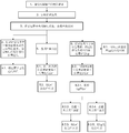
- FIG. 1 is a schematic diagram of a possible application scenario of the present invention
- FIG. 2 is a schematic structural diagram of a mobile communication terminal according to the present invention.
- FIG. 3 is a schematic diagram of a mobile terminal according to an embodiment of the present invention.
- FIG. 5 is a positioning process of a high positioning priority application according to an embodiment of the present invention.
- FIG. 6 is a process of locating an application that is not assigned a priority according to an embodiment of the present invention.
- FIG. 7 is a flowchart of performing location query in a memory according to an embodiment of the present invention.
- FIG. 8 is a process of interacting with a location server when an application that is not specified with a positioning priority or a low positioning priority is located according to an embodiment of the present invention
- FIG. 9 is a process of interacting with a location server when a high-priority priority application is located during an embodiment according to an embodiment of the present invention.
- the wireless local area network (WLAN) signal described in the present invention includes one or more of a Wi-Fi signal, a WiMax signal, a delivery service indication message (Delivery Traffic Indication Message, DTIM), and a hotspot signal.
- DTIM Delivery Traffic Indication Message
- the DTIM is used to announce that there may be a TIM in the access point to be sent to the relevant wireless client.
- base station may refer to a base station serving a cell and/or a base station serving a sector.
- base station can also generally be used to refer to similar devices in other types of wireless networks.
- a base station corresponds to a wireless access point.
- cell identity refers to a fixed cell identifier Cell ID assigned by an operator for each cell (English name: Cell Identity, usually abbreviated as Cell ID, and may also be abbreviated as Cell-ID).
- FIG. 1 shows a possible application scenario of the positioning system of the present invention.
- the positioning system 100 includes a mobile communication terminal 110, a satellite 120, an access point (AP) 130, a base station (BS) 140, a location server 150, and a database 160.
- AP access point
- BS base station
- a location server 150 location server
- database 160 database 160. 1 shows a positioning system 100 having the above components, but it should be understood that implementation of the positioning system 100 does not necessarily require all of the components illustrated, and the positioning system 100 can be implemented with more or fewer components.
- the mobile communication terminal 110 (hereinafter, also referred to as the mobile terminal 110) includes a wireless communication module for performing general voice calls and data communication.
- the mobile communication terminal 110 uses a wireless communication module to perform a general voice call and data communication in conjunction with a mobile network (not shown).
- the mobile communication terminal 110 can communicate with any number of base stations in the mobile network, such as the cellular base station 140 shown in FIG. Each base station can provide communication for each coverage area or cell.
- the term "cellular" can refer to a base station and/or its coverage area. To increase system capacity, the coverage area of the base station can be divided into individual sectors.
- the mobile communication terminal 110 transmits information of the base station 140 of the mobile network with which it interacts to the location server 150 on the network.
- the mobile communication terminal 110 includes a WLAN module.
- the mobile communication terminal 110 uses the WLAN module to access the Internet and receive various web page data through the proximity identifiable access point (AP) 130.
- AP130 It is a device that connects data communications, reads the receiver address from the sender's information, assigns the most appropriate communication path, and sends it to other networks.
- the AP 130 may extract the location of the data packet, assign an optimal communication path to the extracted location, and transmit the data packet to the next device through the assigned communication path, and may share multiple circuits in a general network environment.
- the AP 130 may include a wireless router, a repeater, a repeater, a bridge, and the like.
- the mobile communication terminal 110 collects WLAN environment information from the AP 130 with which it communicates and transmits it to the location server 150.
- the WLAN environment information is information for identifying the AP 130 that relays the WLAN signal, and may be a MAC address of the AP 130 that relays the WLAN signal, a Received Signal Strength Indication (RSSI) of each MAC address, and AP channel information. And one or more of the AP frequency information; however, the invention is not limited thereto.
- the MAC address is unique information for identifying the AP, and refers to a basic service set identifier (BSSID).
- the MAC address can be allocated 48 bits, of which 24 bits are used to input information assigned by the manufacturer.
- the Service Set Identifier (SSID) is also information for identifying an AP, and refers to a value set by a user.
- the mobile communication terminal 110 includes a Global Positioning System (GPS) module.
- GPS Global Positioning System
- the mobile communication terminal 110 extracts navigation data from GPS radio wave signals received from one or more satellites 120, and transmits the navigation data to the location server 150 through the mobile communication network.
- GPS Global Positioning System
- the mobile communication terminal 110 may be any entity that can communicate with a mobile network, such a mobile communication terminal may be a smart phone, a personal computer (PC), a notebook computer, or a personal digital assistant including the wireless communication module, the WLAN module, and the GPS module described above. (PDA), etc.
- the mobile communication terminal 110 has a memory for storing an application related to the LBS, a microprocessor for operating and controlling by executing the program, and the like.
- the mobile communication terminal 110 identifies the access point 130 and the base station 140 in the surrounding area and communicates with one or more of the access point 130 and the base station 140.
- a positioning protocol is a protocol that standardizes the application layer for positioning.
- the positioning protocol may be any positioning protocol as long as it can communicate GPS radio wave signals and/or WLAN signals between the mobile communication terminal 110 and the location server 150.
- the positioning protocol may include Temporary Standard-801 (IS-801), Radio Resource Location Service Protocol (RRLP), Radio Resource Control (RRC), Secure User Plane Location (SUPL), and the like.
- SUPL 2.0 can be used as a positioning protocol for mobile communication terminal 110 and location server 150 Both the GPS radio wave signal and the WLAN signal are transmitted/received; however, the present disclosure is not limited thereto.
- the SUPL is a scheme of eliminating communication between network nodes that originally need to perform conventional positioning processing by enabling the mobile communication terminal 110 and the location server 150 to directly communicate positioning related data through a data transmission path.
- SUPL is a protocol that reduces the cost of nodes necessary to implement location tracking and provides more accurate location services.
- the mobile communication terminal 110 can measure round trip delay (RTD).
- RTD round trip delay
- the mobile communication terminal 110 can set a location identifier (ID) and a plurality of location IDs, and measure an RTD including an RTD value, an RTD unit, and an RTD precision as a WLAN.
- ID location identifier
- AP information AP information.
- the location server 150 receives the data of the satellite 120 through the built-in satellite receiver and performs positioning using the satellite data of the mobile communication terminal 110 requesting the location. Specifically, the location server 150 receives navigation data from the mobile communication terminal 110 and calculates latitude/longitude coordinates of the mobile communication terminal 110. In addition, the location server 150 transmits assistance data to help determine the location of the mobile communication terminal 110 and calculate the distance between the satellite 120 and the mobile communication terminal 110.
- AGPS assisted GPS
- the GPS chipset or module placed in the terminal determines the location of the mobile communication terminal in a short time using the data received from the base station and the calculated pseudo distance from the GPS satellite.
- the GPS module included in the mobile communication terminal 110 of the present invention can perform positioning using at least one of the above two methods.
- the location server 150 transmits the location information to the location based service platform (LBSP).
- the location server 150 receives a location request signal (location request) from the LBSP, and the location server 150 determines the current location of the mobile communication terminal 110 by interacting with the mobile communication terminal 110, and will provide a positioning response signal including the positioning result. (Location result) is sent to LBSP.
- the location server 150 may transmit latitude/longitude data (positioning result data) and Pilot Phase Measurement (PPM) data received from the mobile communication terminal 110 to a Location Based Service Platform (LBSP) for network-based Positioning.
- LBSP Location Based Service Platform
- a location determining entity can be used in a synchronous code division multiple access (CDMA) system
- a location server can be used in an asynchronous wideband code division multiple access (W-CDMA) system
- the Service Mobile Location Center can be used in Global System for Mobile Communications (GSM) systems.
- CDMA Code Division Multiple Access
- PS location server
- W-CDMA wideband code division multiple access
- SMLC Service Mobile Location Center
- GSM Global System for Mobile Communications
- CDMA systems PDEs can perform positioning using satellites and network-based positioning using triangulation.
- the PS can perform positioning using satellites and positioning based on a base cell.
- the SMLC can perform positioning and cell-based positioning using satellites. Where cell based positioning, the location server 150 identifies which cell in the network transmits the user call and translates it into latitude and longitude to determine the user location.
- the PPM data mentioned above may include time/distance information of the neighboring base station 140 and system information measured by the mobile communication terminal 110.
- the information measured by the mobile communication terminal 110 includes information about the current serving system, pilot signals of neighboring base stations, and signal strength and the like.
- the information about the current service system includes a system ID (SID), a network ID (NID), a base station ID (BSID), a serving BS sector number (reference PN: Ref_PN), a pilot phase in Ref_PN, and a signal strength.
- the pilot signals of the neighboring base stations include the neighboring base station sector numbers (measurement PN) collected from the mobile communication terminal 110, the pilot phase in each measurement PN, the signal strength, and such distance data and time data.
- the PPM data is positioning related data in a CDMA system, and may be UE RX-TX time difference data or system frame number (SFN)-SFN observation time difference data in a W-CDMA system.
- the present invention is not limited thereto, and the PPM data may be positioning related data used in any other communication system.
- the location server 150 may perform triangulation from the base station identity received by the mobile communication terminal 110 to calculate triangulation location information.
- the location server 150 may triangulate three identifiers of information having a signal strength of a predetermined value or more, and calculate the center of the triangle. Point and identify the center point as triangulation position information.
- the location server 150 can also use the BSSID of the access point to correct the triangulation location information.
- the position range of the mobile communication terminal 110 is reduced.
- location server 150 is described as being used in CDMA and W-CDMA to provide network-based positioning, the listed items present only a technical concept of one of the different exemplary embodiments, those skilled in the art will understand that without departing In the case of the essential features of the invention, it can be modified.
- location server 150 can be used in WiBro or Wimax, Long Term Evolution (LTE), and Packet Core Evolution (EPC) to provide location.
- LTE Long Term Evolution
- EPC Packet Core Evolution
- the location server 150 may also receive WLAN environment information from the mobile communication terminal 110 and calculate WLAN location information based on the WLAN environment information.
- the location server 150 utilizes the various grid cells stored in the database 160 and the environment information that matches those grid cells to locate the mobile communication terminal 110.
- the location server 150 selects a grid unit having the best matching characteristics with the environment information received from the mobile communication terminal 110 in the database 160, and supplies it to the service request. As the final positioning result.
- the database 160 should be updated to always maintain the latest data (eg, PN, pilot phase, RSSI, MAC address, etc.) that can better reflect changes in the positioning environment, For example, the base station-based environment information, the WLAN environment information, and the positioning system status when the request is located.
- the latest data eg, PN, pilot phase, RSSI, MAC address, etc.
- each mobile communication terminal 110 can collect and report location information based on different sources (base stations, satellites, and access points). Some of the information may not be as accurate as other data, such as the accuracy of the location information determined by the base station is lower than the location information determined by the GPS, but by associating the location information data from different sources, the location for each mobile communication terminal 110 The accuracy of the information can be increased.
- the location server 150 may collect and store location information of different mobile communication terminals 110 during communication with a plurality of different mobile communication terminals 110, and the location server 150 may provide an interface for a plurality of different mobile communication terminals 110, using crowdsourcing In a manner, location information from a plurality of different mobile communication terminals 110 is stored in database 160 for the mobile communication terminal 110 to invoke at an appropriate time.
- Measures can be taken to protect the privacy of the mobile communication terminal 110 user and/or to protect the authenticity of the database 160 information.
- One such measure may include assigning an identifier to each mobile communication terminal 110 in an anonymous manner such that the identity of the terminal cannot be traced back to its users.
- the mobile communication terminal 110 reports The location information can be weighted based on their credibility.
- the credibility of the mobile communication terminal 110 refers to the past history of the terminal providing real or reliable location information. If the terminal provides a high degree or proportion of real or reliable location information, the terminal has a high degree of credibility.
- the base station-based environment information stored in the database 160 may include a country code (MCC), a network code (MNC), a system ID (SID), a network ID (NID), a base station ID (BSID), a cell ID (Cell ID), One or more of a location area code (LAC), a serving BS sector number (reference PN: Ref_PN), a pilot phase in Ref_PN, and a received signal strength indicator (RSSI).
- the WLAN environment information stored in the database 160 may include identification information (SSID), MAC address information (BSSID), received signal strength indication (RSSI), frequency information (channel), and AP for the AP that communicates with the mobile communication terminal 110.
- MCC country code
- MNC network code
- SID system ID
- NID network ID
- BSID base station ID
- Cell ID Cell ID
- LAC location area code
- RFSI received signal strength indicator
- the WLAN environment information stored in the database 160 may include identification information (SSID), MAC address information
- the location information obtained by the mobile communication terminal 110 from the aforementioned base station-based environmental information and WLAN environment information stored in the database 160 may not always be accurate or up to date. In this case, the location information extracted by the mobile communication terminal 110 will be erroneous. At this time, the aforementioned GPS module can be used to confirm, correct, and update the location information obtained by the mobile communication terminal 110 from the location server.
- the database 160 may be implemented inside or outside of the location server 150, although the location server 150 and the database 160 are illustrated as two separate components in FIG. 1, and those skilled in the art will appreciate that the database 160 may also serve as the location server 150. A part of it is included in the location server 150.
- the invention provides a mobile terminal and a positioning method thereof, which can solve the problem that the position information returned by the server is large and inaccurate from the system level; and can improve the positioning speed and reduce the positioning power consumption.
- An illustrative architecture of the mobile terminal used in the positioning method is shown in FIG.
- the architecture of the mobile terminal 110 is schematically illustrated in FIG. 2 by taking the smartphone 200 as an example.
- Smartphone 200 provides UI 220 to support user interactivity and facilitates an effective user experience, and will typically be embodied as a graphical user interface.
- Various applications are installed on the smartphone 200, and these applications can be collectively indicated by reference numeral 225.
- Some of the applications 225 may provide location based services that require the mobile terminal 110 to determine its location.
- location-based services can The location or location of the mobile terminal 110 is integrated with other information to provide added value to the user. Examples of such applications include a map application, a traffic alert application, a weather forecast application, a geotag application (eg, tagging the recorded image with the location of the recorded image), and identifying nearby places of interest for the user Other applications (for example, restaurants, stores).
- operating system 230 is particularly suited for operation on a resource-limited device, including but not limited to Android, iOS, or Windows Phone.
- the location framework layer 235 provides logic and control functions that capture location information obtained from the hardware layer 245 and make the information available to any application 225 that needs the information.
- the RIL layer 240 is a set of application programming interfaces (APIs) that provide an abstraction level between the radio on the mobile phone and the software on the mobile phone. That is, the RIL layer 240 acts as a hardware adaptation layer, ie, a layer that isolates the details of a particular mobile system/hardware from most software systems. In this way, various software solutions are available for many different mobile systems and radios.
- APIs application programming interfaces
- the hardware layer 245 provides an abstraction of the physical hardware implemented on the smartphone 200 and will typically include a processor (eg, a central processing unit (“CPU”), such as read only memory (“ROM”) and random access memory (“RAM”). System memory, bus structure, peripheral systems, drivers, display devices, user controls, and interfaces.
- the hardware may also include storage media for storing computer-executable instructions (ie, code), including either or both removable and non-removable media, such as magnetic and optical media, solid state memory, and other conventional media.
- the hardware layer 245 of the smartphone 200 includes a wireless communication module 211, a WLAN module 212, a GPS module 213, and a memory 214.
- the smartphone 200 communicates with the mobile network through the wireless communication module 211.
- the wireless communication module 211 includes conventional components such as a transmitter, a receiver, an antenna, and the like.
- the smart phone 200 uses the WLAN module 212 to access the Internet through neighboring access points, and acquires WLAN environment information such as the BSSID of the access point.
- the GPS module 213 receives signals from the GPS satellite navigation system through the GPS antenna to determine the location of the smartphone 200.
- the memory 214 is used to store the identification letter
- the location information 216 includes location information of the base station that communicates with the smartphone 200, WLAN environment information of the proximity point of the smartphone 200, and the like, and the location information 216 includes location information determined by the GPS module 213, And location information determined by network location technology.
- the information stored in the database 160 shown in FIG. 1 may be partially or completely stored in the memory 214, in such a manner that when the mobile communication base station 110 wants to acquire location information corresponding to the identification information, it is not always necessary to exchange messages with the database 160. Therefore, the positioning speed can be significantly improved.
- the memory 214 stores, in particular, invalid location information corresponding to certain identification information.
- the memory 214 can store the above information in the form of, for example, an index table.
- the identification information and its corresponding valid position information Ly are stored in the valid position table, and the identification information and the corresponding invalid position information Lw are stored in the invalid position table.
- the identification information in the valid location table may be referred to as valid identification information, and the identification information in the invalid location table may be referred to as invalid identification information.
- the valid location table is further divided into a first valid location table and a second valid location table, the Cell ID and its corresponding location information are stored in the first valid location table, and the BSSID and its corresponding are stored in the second valid location table. location information. The specific difference between the valid location information and the invalid location information will be described in detail in the subsequent content.
- the first valid location table, the second valid location table or the invalid location table described in the present invention is stored in the mobile terminal in the form of a database table, optionally, the first valid location table, the second valid location table or the invalid location
- the table is saved in the memory of the mobile terminal or an external memory card.
- the first valid location table, the second valid location table, or the invalid location table may use database file formats common in the art, including but not limited to: CSV comma separated value files, DAT data files, WrodPerfect merged data files, DB Borland's Paradox 7 tables, DBC Microsoft Visual FoxPro database container files, etc.
- the data storage solution that can be adopted is SQLite
- the data storage solutions that can be adopted are SQLite, CoreData, and NSUserDefaults.
- a personalized data storage scheme customized with basic object types is
- the memory 214 is named a memory, those skilled in the art will appreciate that modifications may be made without departing from the basic features of the invention.
- the memory 214 can also be a database Or server.
- the storage function of the memory 214 can be implemented using any type of suitable storage medium, and in particular, when the memory 214 is a cache server, it helps to further increase the positioning speed.
- FIG. 3 is a schematic diagram of a mobile terminal according to an embodiment of the present invention.
- the mobile terminal 300 in the embodiment of the present invention includes a receiving unit 302, an obtaining unit 303, a determining unit 304, a storage unit 305, a transmitting unit 306, a network positioning unit 307, a comparing unit 308, an erasing unit 309, and a write coupled to the bus 301.
- a receiving unit 302 an obtaining unit 303, a determining unit 304, a storage unit 305, a transmitting unit 306, a network positioning unit 307, a comparing unit 308, an erasing unit 309, and a write coupled to the bus 301.
- the receiving unit 302 is configured to receive an application initiated location request.
- the obtaining unit 303 is configured to acquire the identifier information of the mobile terminal 300, where the identifier information includes a cell identifier Cell ID of the cell where the mobile terminal 300 is located, and a basic service set identifier of the wireless router scanned by the mobile terminal 300. At least one of the BSSIDs, the wireless router scanned by the mobile terminal 300 includes a wireless router with the strongest signal among the wireless routers connected to the terminal or the wireless routers that are not connected.
- the determining unit 304 is configured to determine location information corresponding to the identifier information in the first valid location table, the second valid location table, or the invalid location table.
- the storage unit 305 is configured to store the first valid location table, the second valid location table, and the invalid location table, where the parameter items included in the first valid location table are a Cell ID, and a first location corresponding to the Cell ID
- the information Ln or the second location information Lg corresponding to the Cell ID, the parameter item included in the second valid location table is a BSSID, and the first location information Ln corresponding to the BSSID or the second location information Lg corresponding to the BSSID
- the parameter items included in the invalid location table are a Cell ID, a BSSID, first location information Ln corresponding to the Cell ID and the BSSID, and second location information Lg corresponding to the Cell ID and the BSSID, the first valid location table
- the second valid location table and the invalid location table each include a plurality of sets of parameter values corresponding to the parameter items, and the distance between the Ln and the Lg in the invalid location table is greater than a first threshold, and the Ln is utilized. Determined by network positioning technology, the Lg
- the sending unit 306 is configured to send the determined location information to the application that initiates the positioning request, where the sending unit 306 is further configured to send the identifier information and the location information corresponding to the identifier information to the network. At least one of the first valid location table, the second valid location table, and the invalid location table One.
- the network positioning unit 307 is configured to determine location information by using a network positioning technology.
- the comparing unit 308 is configured to compare the location information, specifically, the location information represented by the latitude and longitude information, and determine the geographical distance between the location information represented by the latitude and longitude.
- the erasing unit 309 is configured to delete the identifier information located in the first valid location table, the second valid location table, or the invalid location table and corresponding location information.
- the writing unit 310 is configured to write the identification information and the corresponding location information in the first valid location table, the second valid location table, or the invalid location table.
- the mobile terminal 300 also includes a processor that is the control center of the mobile terminal 300 and that provides sequencing and processing facilities to execute instructions, perform interrupt operations, provide timing functions, and many other functions.
- the processor includes one or more central processing units (CPUs).
- the mobile terminal 300 includes more than one processor.
- the processor can be a single core (single CPU) processor or a multi-core (multi-CPU) processor.
- processor refers to one or more devices, circuits, and/or processing cores for processing data such as computer program instructions.
- the processor can execute program code stored in the data storage device.
- program code stored in a storage medium of the data storage device may be copied to the memory unit for execution by the processor.
- the mobile terminal 300 also includes a communication interface for communicating with another device or system, either directly or through an external network.
- the mobile terminal 300 further includes a satellite positioning unit for determining location information using satellite positioning technology.
- the mobile terminal 300 further includes an output device and an input device (not shown).
- the output device is coupled to the processor and is capable of displaying information in one or more ways.
- One example of an output device is a visual display device, such as a liquid crystal display (LCD), a light emitting diode (LED) display, a cathode ray tube (CRT), or a projector.
- the input device is also coupled to the processor and is capable of receiving input from a user of the mobile terminal in one or more ways. Examples of input devices include mice, keyboards, touch screen devices, sensing devices, and the like.
- the above components of the mobile terminal 300 can pass through a data bus, an address bus, a control bus, and an extended total. Any one or any combination of lines 301 such as a line and a local bus are coupled to each other.
- the first application 2251 requests the current location or orientation of the smartphone 200, and the request is sent to the location framework layer 235 in the smartphone 200.
- the location framework layer 235 sends a message to the RIL layer 240, which issues an instruction to the wireless communication module 211 and/or the WLAN module 212 to request the identification information 215.
- the identification information 215 includes environmental information of a base station currently communicating with the smartphone 200 and/or WLAN environment information of a neighboring access point of the smartphone 200, etc., for example, the identification information 215 includes a cell identifier Cell of a cell in which the smartphone 200 is located. ID and location area code LAC.
- the identification information 215 when the smart phone 200 is capable of detecting a WLAN or Wi-Fi signal, the identification information 215 includes a basic service set identifier BSSID of the wireless router scanned by the smart phone 200, and the scanned wireless router includes the connected mobile phone 200. The most powerful wireless router among wireless routers or unconnected wireless routers.
- the identification information 215 may also include one or more pieces of information of a received signal strength indication (RSSI), a country code (MCC), a network code (MNC), and the like of the current base station.
- the identifier information 215 may include more than one cell identifier Cell ID, and the identifier information 215 further includes a received signal strength indicator RSSI of each cell identifier Cell ID.
- the location server 150 performs network-based positioning. For example, the location server 150 performs a lookup in the database 160 based on the Cell ID data contained in the identification information 215, identifying which cell in the network transmits the user call and translates it into latitude and longitude. The user first location information Ln is determined.
- the identification information 215 and its corresponding first location information Ln are stored in the valid location table. That is, the valid position information Ly in the effective position table may not be verified, and the first position information Ln determined based on the network positioning technology is directly used as the effective position information Ly.
- the location server 150 can improve the accuracy of the first location information Ln based on data such as the BSSID of the connected wireless router, the received signal strength indication (RSSI) of the current base station, and the like.
- data such as the BSSID of the connected wireless router, the received signal strength indication (RSSI) of the current base station, and the like.
- RSSI received signal strength indication
- the second application 2252 requests the current location or orientation of the smartphone 200.
- the RIL layer 240 issues an instruction to the wireless communication module 211 and/or the WLAN module 212 to request the identification information 215, while the RIL layer 240 also reports to the GPS module 213. Issue an instruction to locate.
- Smartphone 200 will The navigation data extracted by the GPS radio wave signal is transmitted to the location server 150 through the aforementioned positioning protocol.
- the location server 150 determines, by calculation, second location information Lg of the smartphone 200, the Lg including latitude coordinates and longitude coordinates of the location where the smartphone 200 is currently located.
- the identification information 215 and its corresponding second location information Lg are also stored in the valid location table.
- network-based positioning is not performed, and only satellite-based positioning technology is used (ie, positioning is performed only by the GPS module).
- the identifier information 215 is optionally the cell ID of the cell in which the cell is located.
- the identifier information 215 and Ln (or Lg) are stored in the first valid location table, where the first valid location table includes the Cell ID and the location latitude information ( Latitude), position longitude information, and location source.
- the data items that can also be saved are (not required): All Base Station ID information (All Cell Info), ID hash value (Hash), Location Area Code (LAC), Position Accuracy (Accuracy) , update or locate time, whether to preset one or more of the information.
- All the base station ID information includes all the cell IDs that are detectable by the current location, and the RSSI of each of the detectable Cell IDs.
- the RSSI is usually an integer ranging from 0 to 31. The stronger it is).
- the RSSI of all base stations that can be detected can improve the positioning accuracy.
- Table 1 is an example of the first valid location table.
- the first record indicates that the cell identifier in the identification information 215 is “18179586”, the location The area code is "4170".
- the location information determined at this time is east longitude 116.292, north latitude 40.093.
- the positioning time is 16:10:45 on March 23, 2016. It is derived from GPS and is the data preset when the smartphone is shipped from the factory.
- the second record indicates that the cell identifier in the identification information 215 is "16949249" and the location area code is "4301".
- the location information determined at this time is east longitude 116.174, north latitude 40.059. It is derived from the location server (determined based on network location technology) and is not preset at the factory.
- the above information stored in the first valid location table may be modified after being verified.
- the identification information 215 of the relocation time is the cell identifier "16949249" and the location area code "4301".
- the fourth position information Lg' determined by the GPS module 213 is east longitude 116.175, and north latitude 40.058.
- the distance between the fourth position information Lg' and the first position information Ln stored in the valid table is less than or equal to the first threshold, so the second record in Table 1 is modified, and the first valid position table is updated to Table 2 below.
- the information stored in the first valid location table is verified by the fourth location information Lg' determined by the GPS module 213.
- the network-based third location information Ln' may also be passed through the latest time.
- the first location information Ln stored in the valid location table is checked.
- the verification by the third location information Ln' is Necessary and effective.
- the identification information 215 is optionally the BSSID information of the Wi-Fi router.
- the identification information 215 and Ln are stored in the second valid location table, and the second valid location table includes the BSSID (the smartphone 200 is currently connected).
- the data items that can be saved have (non-required): ID hash value (Hash), location accuracy information (Accuracy), AP effective identification, update or positioning time, whether preset or not.
- the mobile communication terminal 110 when the mobile communication terminal 110 is shipped from the factory, some information may be preset in the second effective location table, and added, deleted, modified, and searched during use.
- the AP effective identifier is used to mark the credibility of the AP. For example, an AP that does not change position (or move a shorter distance) during multiple positioning may be marked as valid.
- a specific method of determining whether an AP is a mobile AP or an invalid AP will be described in detail in the following discussion.
- Table 3 is an example of a second valid location table.
- the first record in Table 3 indicates that the BSSID information in the identification information 215 is "00: A0: BC: D0: E1: F6".
- the location information determined at this time is east longitude 116.292, north latitude 40.093. Positioning time March 23, 2016 16:10:45, from GPS, AP is effective.
- the first position information Ln stored in the second effective position table may also be verified by the fourth position information Lg' and/or the third position information Ln', after verification,
- the first position information Ln in the second effective position table can be modified, and the specific checksum modification process and the previous description The description is similar and will not be described in detail here.
- the memory 214 further includes an invalid location table.
- the identification information in the valid location table is found to be inaccurate by the verification, the information in the valid location table is deleted and the information is stored in the invalid location table.
- the first location information Ln originating from the location server in the valid location table is checked using the fourth location information Lg' determined by the GPS module 213. Comparing Lg' and Ln, if the geographical distance represented by the two is less than or equal to the first threshold, replace Ln in the effective location table with Lg', and change the source from the location server to GPS. If the geographical distance represented by both Lg' and Ln is greater than the first threshold, the information in the valid location table is deleted, and the identification information 215 and the location information Lg' and Ln are stored in the invalid location table.
- the comparison of Lg' and Ln as described above means that the position information indicated by the latitude and longitude information is compared, and the distance between the position information Lg and Ln indicated by the latitude and longitude is determined.
- the comparison of the positional information described in the present invention refers to the process of determining the geographical distance by comparing the latitude and longitude.
- the geographical distance described in the present invention may represent a spatial linear distance between two positions determined by latitude and longitude information, or may represent a distance between two points after two positions determined by latitude and longitude information are projected onto the surface of the earth,
- the geographical distances described in the invention include, but are not limited to, the above, and those skilled in the art can modify them as needed.
- the first threshold may be set in advance by the system or the user to meet different positioning accuracy requirements.
- the first threshold ranges from 1 to 20 km.
- the first threshold is one of values of 2 km, 5 km or 10 km.
- Table 4 is an example of an invalid location table.
- the invalid location table shown in Table 4 contains Cell ID, BSSID, and all base station ID information (All Cell Info), GPS location longitude information, GPS location latitude information, location longitude information returned by the location server, location latitude information returned by the location server, location area code LAC.
- ID hash value Hash
- All the base station ID information (All Cell Info) in the invalid location table includes all cell identifiers Cell IDs that are detectable by the current location, and the RSSI of each of the detectable Cell IDs (the RSSI is usually an integer ranging from 0 to 31. A larger value indicates a stronger signal.
- All base station ID information optionally also includes a LAC of each of the Cell IDs that are detectable.
- the BSSID information in the invalid location table is the BSSID of the AP to which the smartphone 200 is currently connected, or the BSSID of the AP that detected the strongest signal when the AP is not connected. When there is no signal, the BSSID information in the invalid location table is empty.
- the first record indicates that the cell identifier in the identifier information 215 is "17928963", and the BSSID of the AP currently connected or detecting the strongest signal is "00: A0: BC: D0: E1: F6", all base stations
- the ID information includes the Cell ID of the three base stations detectable at the current location and the RSSI of each of the three base stations.
- the cell IDs of the three base stations are "17928963", "18157313", and "19952387", respectively, where the received signal strength indication of the first base station is the strongest, the RSSI is 29, and the received signal strength indications of the other two base stations are respectively 20 and 12.
- the GPS position longitude information is east longitude 116.329, and the GPS position latitude information is north latitude 39.978.
- the location longitude information returned by the location server is east longitude 116.32, and the location latitude information returned by the location server is 39.97 north latitude.
- the base station location area code is 4564.
- the memory 214 can communicate with the database 160 at fixed time intervals, download all or part of the information stored in the database 160, and use the downloaded information to update the valid location table and the invalid location table stored in the memory 214.
- the valid location table and/or invalid location table stored in memory 214 may also be uploaded to location server 150, including database 160, for query by other users.
- the user may be prompted to download the location information associated with the area in the database 160. After the user downloads all the location information related to the area into the memory 214, when the user first passes through a certain location in the area, the user can quickly locate the information reported by other users.
- This situation is particularly effective for certain mobile communication terminals 110 that do not have a GPS module, since the bits of the plurality of different mobile communication terminals 110 are stored in the database 160. Information, some of which are reported by the terminal with the GPS module, and thus have higher accuracy.
- the mobile communication terminal without the GPS module can improve the positioning accuracy by means of higher accuracy information reported by other terminals having the GPS module.
- the positioning process of the mobile communication terminal 110 taking the smartphone 200 as an example is schematically illustrated in FIGS. 4-6.
- some applications 225 can provide location-based services that can be divided into high-location priority applications (location accuracy-first applications) and low-location priority applications (location time-first applications). program).
- High positioning priority applications require higher positioning accuracy, such as map applications and navigation applications; low positioning priority applications have relatively low requirements for positioning accuracy, but it is desirable to spend relatively short positioning times, such as Photo app and weather app, etc.
- High targeting priority applications and low targeting priority applications use different positioning strategies. When the application 225 is opened by the user and initiates a positioning request, the positioning priorities of the applications 225 are first determined, and different positioning strategies are provided according to different positioning priorities.
- the low positioning priority application 225 requests the current location or orientation of the smartphone 200, and the location request is sent to the location framework layer 235 in the smartphone 200.
- the location framework layer 235 sends a message to the RIL layer 240, which issues an instruction to the wireless communication module 211 and/or the WLAN module 212 to request the identification information 215.
- the identification information 215 includes environmental information of a base station currently communicating with the smartphone 200 and/or WLAN environment information of a neighboring access point of the smartphone 200, and the like.
- the RIL layer 240 forwards the identification information 215 to the location framework layer 235.
- the location framework layer 235 generates a request to find the memory 214 of the smartphone 200, and determines whether the identification information 215 and the location information corresponding thereto are included in the memory 214.
- the valid location information Ly corresponding to the identification information 215 is sent to the location frame layer 235, and the location frame layer 235 further provides the valid location information Ly.
- the application 225, the valid location information Ly includes first location information Ln or second location information Lg. For example, when the cell ID is "18179586" and the location code is "4170"
- the location frame layer 235 transmits the latitude and longitude information in Table 1 north latitude 40.093, east longitude 116.292 to the application.
- the smart phone 200 When the identification information 215 is not stored in the memory 214, the search result is empty at this time, the smart phone 200 performs positioning by the location server 150, and the location server 150 selects the third location information Ln matching the identification information 215 from the database 160. ', and the location information Ln' is sent to the location framework layer 235, which in turn provides Ln' to the application 225.
- the identification information 215 is not stored in the memory 214, in addition to providing Ln' to the application 225 through the above process, the identification information 215 is saved as valid information to the first valid location table in the memory and/or Or a second valid location table, and save the third location information Ln' determined by the network positioning technology.
- the identification information 215 includes the cell identifier Cell ID, the Cell ID and the third location information Ln′ included in the identifier information 215 are written in the first valid location table; when the identifier information 215 includes the mobile terminal scanning When the basic service set of the wireless router identifies the BSSID, the BSSID and the third location information Ln' included in the identification information are written in the second valid location table; when the identification information 215 includes both the Cell ID and the BSSID, The Cell ID and Ln' are written in the first valid location table, and the BSSID and Ln' are written in the second valid location table.
- the second location information Lg in the invalid location table is transmitted to the application as shown in step 6.1 of FIG.
- the third location information Ln′ is determined by using a network location technology, and the second location information Lg stored in the invalid location table is as shown in step 6.2.1 in FIG. 4 .
- the third position information Ln' obtained in step 6.2 is compared.
- steps 6.2.4 and 6.2.5 of FIG. 4 if the difference between the two is greater than the second threshold, the information in the invalid location table remains unchanged, and the second location information Lg stored in the invalid location table is sent to The location framework layer 235, the location framework layer 235, in turn provides the information Lg to the application 225.
- the third position information Ln' obtained in step 6.2 is the information that has been corrected, and will be the third.
- the location information Ln' is provided to the application 225, and the invalid location table is deleted from the target
- the data related to the information 215 is stored in the first valid location table, the Cell ID and the third location information Ln′ included in the identifier information, and the BSSID and the location included in the identifier information are saved in the second valid location table.
- the third position information Ln' is described.
- the GPS module of the mobile phone is not activated during the positioning process, and only the location information in the memory 214 or the database 160 is used for positioning. As previously mentioned, some of the location information in the memory 214 or database 160 is reported by the terminal having the GPS module, or has been corrected by other users, and thus has higher accuracy.
- the GPS location information and the LAC of the multiple cell base stations are also associated with each other to improve positioning accuracy.
- the low positioning priority application can have higher positioning accuracy even if the GPS module is not activated.
- the identification information 215 can be found in the first valid position table, the second effective position table, or the invalid position table in the memory 214, since the positioning process is only operated locally, the time required for the positioning can be significantly shortened. Moreover, additional power consumption due to GPS positioning can be avoided.
- the second location information Lg stored in the invalid location table is compared with the third location information Ln' obtained in step 6.2, thereby determining whether Ln' or Lg is sent to the application.
- the first location information Ln stored in the invalid location table may be compared with the third location information Ln' obtained in step 6.2 to determine whether Lg or Ln' is transmitted to the application.
- step 6.2 The obtained position information Ln' is not corrected, and the second position information Lg stored in the invalid position table is sent to the application; if the difference between Ln' and Ln is greater than the fourth threshold, the position information obtained in step 6.2 is explained.
- Ln' is information that has been corrected, and the third location information Ln' is supplied to the application 225.
- the fourth threshold is smaller than the first threshold, and the fourth threshold may be set in advance by the system or the user to adapt to different
- the positioning accuracy requirement is that the fourth threshold has a value ranging from 1 to 10 km.
- the fourth threshold is one of values of 1 km, 2 km or 5 km. If the BSSID information corresponding to the identifier information in the invalid location table is empty, the fourth threshold value ranges from (Lg-Ln)/4 to (Lg-Ln), and preferably, the fourth threshold is (Lg-Ln). / 2, where Lg and Ln are the second position information Lg and the first position information Ln stored in the invalid position table.
- the high positioning priority application 225 requests the current location or orientation of the smartphone 200, and the request is sent to the location framework layer 235 in the smartphone 200.
- the location framework layer 235 sends a message to the RIL layer 240, which in turn issues instructions to the GPS module 213 for positioning using satellite positioning technology, and the GPS module 213 determines the fourth location information Lg' of the smartphone.
- Lg' is provided to the application 225 by the location framework layer 235 to enable positioning of the high positioning priority application.
- the GPS module 213 directly determines the fourth position information Lg' of the smartphone without using other information.
- the GPS module 213 can achieve fast positioning by means of the third position information Ln'.
- the RIL layer 240 issues an instruction to the GPS module 213 to perform positioning while also issuing an instruction to the wireless communication module 211 and/or the WLAN module 212 to request acquisition of the identification information 215.
- the smartphone 200 determines the third location information Ln' using the network location technology, and the RIL layer 240 injects the third location information Ln' as auxiliary data into the GPS module 213, shortening the location server 150 receiving the navigation data.
- the initialization time enables the GPS module 213 to determine the fourth position information Lg' of the smartphone in a short time by the AGPS method.
- the GPS module of the mobile phone is activated during the positioning process, and the position information determined by the satellite positioning technology is used for positioning.
- the high positioning priority application also verifies the valid position table and the invalid position table of the memory 214 while completing the above positioning operation.
- the verification process is as follows:
- the location framework layer 235 After receiving the identification information 215, the location framework layer 235 generates a request to find the memory 214 of the smartphone 200, and determines whether the identification information 215 and the location information corresponding thereto are included in the memory 214.
- the first position information Ln stored in the first valid position table or the second effective position table is compared with the fourth position information Lg'. If the difference between the two is less than or equal to the first threshold, the first location information Ln in the valid location table is updated to Lg', and the operation ends; if the difference between the two is greater than the first threshold, the valid location table is associated with the The information corresponding to the identification information 215 is deleted, and the identification information 215, the first location information Ln, and the fourth location information Lg' are saved in the invalid location table.
- the cell identifier in the identification information 215 is "22725377" and the location area code is "4301"
- the first location information Ln stored in the first valid location table is searched. It is east longitude 116.174, north latitude 40.053.
- the fourth position information Lg' determined by the satellite positioning technique is east longitude 116.189, north latitude 40.056. That is, the position deviation determined by Ln and Lg' is less than or equal to the first threshold.
- the corresponding position information (east longitude 116.174, north latitude 40.053) stored in the first effective position table is updated to (east longitude 116.189, north latitude 40.056), and
- the location source is modified to GPS and the operation ends.
- the fourth position information Lg' determined by the satellite positioning technique is east longitude 116.274, north latitude 40.153. That is, the positional deviation determined by Ln and Lg' is greater than the first threshold.
- the identification information 215 and the corresponding location information are deleted from the first valid location table, and the record in the following format is added to the invalid location table (Table 4). .
- the second location information Lg stored in the invalid location table is obtained in step 3.
- the third position information Ln' is compared. If the difference between the two is greater than the second threshold, the information in the invalid location table remains unchanged; if the difference between the two is less than or equal to the second threshold, the data related to the identification information 215 in the invalid location table is deleted, at the first
- the valid location table stores the Cell ID and the third location information Ln′ included in the identifier information, and the BSSID and the third location information Ln′ included in the identifier information are saved in the second valid location table.
- the selected first threshold may also be set by the system or the user in advance.
- the first threshold value ranges from 1 to 20 km.
- the first threshold value is one of values of 2 km, 5 km or 10 km.
- the selected second threshold may also be set in advance by the system or the user to adapt. Different positioning accuracy requirements, the second threshold value ranges from 1 to 20 km, preferably, the second threshold is one of values of 2 km, 5 km or 10 km.
- the second threshold is less than or equal to the first threshold. For example, when the first threshold is 10 km, the second threshold is 5 km; or when the first threshold is 5 km, the second threshold is 2 km, which is no longer an example.
- the second threshold is less than or equal to the first threshold
- the third location information Ln′ is considered to be information that has been corrected, and thus has higher reliability.
- the search result is empty at this time, as shown in step 4.3 of FIG. 5, and the third location information Ln′ determined based on the network is determined by using the satellite positioning technology.
- the fourth position information Lg' is compared. If the difference between the two is less than or equal to the first threshold, the identification information 215 is saved as valid information to the memory 214, and the corresponding fourth location information Lg' is saved; If the difference between the two is greater than the first threshold, the identification information 215 is saved as invalid information to the memory 214 while the third location information Ln' and the fourth location information Lg' corresponding to the identification information 215 are saved.
- the acquisition time of the position information Lg' and Ln' used for comparison in step 4.3 of FIG. 5 should be less than a certain time interval, so as to avoid Lg' and Ln due to the movement of the smartphone 200 during the time interval. 'The location of the location has changed.
- the time interval can also be set in advance by the system or the user, and the time interval ranges from 10 s to 5 min.
- the time interval is one of values of 30 s, 1 m or 2 m.
- the GPS module 213 can also be quickly positioned by means of the first position information Ln or the second position information Lg in the effective position table.
- the location acquired by the high positioning priority application can be stored in the memory 214 to provide convenience for other low positioning priority applications.
- the positioning process of the low positioning priority application and the high positioning priority application are respectively described above, however, the positioning priority of the application 225 in the smartphone may be somewhere in between, or in some cases, the application 225 does not.
- the positioning priority is specified, and in the following description, an application that is not assigned a positioning priority is represented by the application 2250.
- the positioning process of the application 2250 is described below in conjunction with FIG.
- the positioning may be performed by using the fourth location information Lg' determined by the satellite positioning technology, or may be located only by the location information in the memory 214 or the database 160.
- the second location information Lg corresponding to the identification information is used as the positioning result, and the positioning process is performed. It is possible to not activate the GPS module of the mobile phone, and thus it is not necessary to record the GPS location, thereby reducing unnecessary storage contents and avoiding excessive system resources.
- the application 2250 verifies the valid location table and the invalid location table of the memory 214 while positioning.
- the RIL layer 240 issues an instruction to the GPS module 213 for positioning while also to the wireless communication module 211 and/or
- the WLAN module 212 issues an instruction to request acquisition of the identification information 215.
- the RIL layer 240 Upon receiving the identification information 215, the RIL layer 240 forwards the identification information 215 to the location framework layer 235.
- the location framework layer 235 generates a request to find the memory 214 of the smartphone 200, and determines whether the identification information 215 and the location information corresponding thereto are included in the memory 214.
- the identifier information 215 When the identifier information 215 is located in the first valid location table or the second valid location table, it may be further determined whether the source of the location information corresponding to the identifier information 215 is a GPS or a location server (SERVER), and if the source of the location information is a GPS, the direct The second location information Lg is provided to the application 2250; if the source of the location information is SERVER, the first location information Ln can be compared with the fourth location information Lg' determined using the satellite positioning technique.
- the source of the location information corresponding to the identifier information 215 is a GPS or a location server (SERVER)
- the source of the location information is a GPS
- the direct The second location information Lg is provided to the application 2250; if the source of the location information is SERVER, the first location information Ln can be compared with the fourth location information Lg' determined using the satellite positioning technique.
- the first location information Ln in the valid location table is updated to the fourth location information Lg', and the fourth location information is Lg' is provided to the application 2250; if the difference between the first location information Ln and the fourth location information Lg' is greater than the first threshold, the first location information Ln corresponding to the identification information 215 in the valid location table is deleted, and The identification information 215, the first location information Ln, and the fourth location information Lg' are stored in the invalid location table, and then the fourth location information Lg' is provided to the application 2250.
- the third location information Ln′ may also be determined by using a network positioning technology, and the first valid location table (or the second valid location table) The first location information Ln or the second location information Lg stored in the ) is compared with the third location information Ln'.
- the first stored in the first valid location table (or the second valid location table) The location information Ln or the second location information Lg is provided to the application 2250; if the difference between the first location information Ln (or the second location information Lg) and the third location information Ln' is not greater than the first threshold, the third is used
- the location information Ln' replaces the first location information Ln or the second location information Lg stored in the first valid location table (or the second valid location table), and provides the third location information Ln' to the application 2250.
- the first valid location table (or the second valid location table may also be selected)
- the first location information Ln or the second location information Lg stored in the ) is provided to the application 2250 without replacing the first stored in the first valid location table (or the second valid location table) with the third location information Ln' Location information Ln or second location information Lg.
- the second location information Lg stored in the invalid location table is obtained in step 6.1.
- the third position information Ln' is compared. If the difference between the two is greater than the second threshold, the information in the invalid location table remains unchanged, and the Lg is sent to the application 2250; if the difference between the two is less than or equal to the second threshold, the invalid location table and the identification information are deleted. 215 related data, storing, in the first valid location table, the Cell ID and the third location information Ln′ included in the identifier information, and storing, in the second valid location table, the BSSID and the number included in the identifier information.
- the three-position information Ln' is then sent to the application 2250 by the third location information Ln' obtained in step 6.1.
- the smart phone 200 When the identification information 215 is not stored in the memory 214, the search result is empty at this time, the smart phone 200 performs positioning by the location server 150, and the location server 150 selects the third location information Ln matching the identification information 215 from the database 160. ', and the third location information Ln' is sent to the location frame layer 235.
- the location frame layer 235 sends a message to the RIL layer 240, and the RIL layer 240 injects the third location information Ln' as auxiliary data into the GPS module 213, shortening the initialization time at which the location server 150 receives the navigation data, so that the GPS module 213 can
- the fourth location information Lg' of the smartphone is determined in a short time, and then the fourth location information Lg' is supplied to the application 2250 through the location frame layer 235 to complete the positioning.
- the network-based determination is also performed.
- the three-position information Ln' is compared with the fourth position information Lg' determined using the satellite positioning technique. If the difference between the two is less than or equal to the first threshold, the identification information 215 is saved as valid information to the memory 214, and the corresponding fourth location information Lg' is saved; if the difference between the two is greater than the first threshold The value, the identification information 215 is saved as invalid information to the memory 214, and the third position information Ln' and the fourth position information Lg' corresponding to the identification information 215 are saved.
- the selected second threshold may be set in advance by the system or the user to adapt to different positioning accuracy requirements, and second.
- the threshold value ranges from 1 to 20 km.
- the second threshold is one of values of 2 km, 5 km or 10 km.
- the selected first threshold may also be set in advance by the system or the user to adapt to different positioning accuracy requirements, and the first threshold is taken.
- the value ranges from 1 to 20 km.
- the first threshold is one of values of 2 km, 5 km or 10 km.
- the second threshold is less than or equal to the first threshold. For example, when the first threshold is 10 km, the second threshold is 5 km; or when the first threshold is 5 km, the second threshold is 2 km, which is no longer an example.
- the second threshold is less than or equal to the first threshold
- the third location information Ln′ is considered to be information that has been corrected, and thus has higher reliability.
- the GPS module 213 achieves rapid positioning by means of the third position information Ln'.
- the GPS module 213 directly determines the position Lg of the smartphone without resorting to other information.
- the identification information 215' is obtained through the wireless communication module 211 and/or the WLAN module 212, and then it is found in the valid location table and the invalid location table whether the same exists. Identification information 215.
- the stored identification information 215 contains only Cell ID or BSSID information, when the acquired identification information 215' has the same Cell ID or BSSID information, it is determined that the identification information 215' and 215 are the same; if the stored identification information 215 contains Cell ID, BSSID information, All Cell Info information, LAC of all base stations, and signal strength RSSI received by all base stations, when the acquired identification information 215' also has the same Cell ID, BSSID information, All Cell Info information, LAC, and When RSSI is used, it is determined that the two are the same identification information.
- the following describes an example of how to compare two pieces of identification information by way of example.
- CI0 and CI1 are: a, the number of Cell IDs in All Cell Info is the same; b, the BSSID string is the same; c, each Cell ID is equal in order; d, each LAC is in the same order; e, each The mean square error of the RSSI value is less than a preset threshold.
- CI0 and CI1 both contain the above information, CI0 and CI1 are considered to be the same only if the abcde condition is satisfied.
- the formula is calculated, where the number of RSSI values can be increased or decreased according to the actual situation, and the denominator is the number of RSSI values.
- the acquired identification information 215 ′ is considered to be new identification information, and the identification information 215 ′ is inserted into the valid location table.
- the invalid location table keeps the stored identification information 215 and its corresponding location information unchanged.
- CI0 and CI1 satisfy the above ac condition, but CI0 or CI1 also includes BSSID, At least one of the LAC and the RSSI considers that CI0 and CI1 are different identification information at this time.
- the process of performing a location query in memory 214 is schematically illustrated in FIG.
- the first valid location table may be first searched for whether the Cell ID information is included. After identifying the record of the information CI1, after finding the CI1 that satisfies the condition, it may continue to search in the second valid location table for whether or not the identification information CI2 including the BSSID information is included. If CI1 that satisfies the condition is not found, the second valid location table is no longer queried, but a new lookup is made in the invalid location table.
- the CI1 can be used to assist in verifying whether the AP in the CI2 is a mobile AP or an invalid AP.
- the AP in the CI2 when the distance between the location information corresponding to the CI1 and the CI2 is less than or equal to the third threshold, the AP in the CI2 is considered to be a valid AP, and the effective location latitude and longitude information corresponding to the CI2 in the second valid location table is sent to the application;
- the AP in the CI2 is considered to be a mobile AP or an invalid AP, and the latitude and longitude information corresponding to the valid location of the CI1 in the first effective location table is sent to the application.
- the AP is marked as invalid in the second valid location table.
- the third threshold has a value ranging from 1 to 5 km.
- the third threshold is one of values such as 1 km, 2 km or 3 km, and the third threshold is smaller than the second threshold.
- CI3 is considered to be a record matching 215' when the CI3 in the invalid location table satisfies the abcde condition as compared with the currently acquired identification information 215'. If there are multiple CI3s matching 215', then the one with the smallest mean square error is selected.
- the Cell ID information and the BSSID information included in the CI3 are extracted, and the same identifier as the Cell ID information or the BSSID information in the valid location table (Table 1 and Table 2) is used. Information is deleted to ensure that all valid locations are stored in the valid location table.
- the record including the identification information CI3 is sent to the RIL layer 240.
- the hardware layer 245 of the smartphone 200 is described in the above embodiments as including a memory 214 in which a valid location table and an invalid location table are stored.
- only the valid location table may be stored in the memory 214, and the invalid location table is stored in the location server 150 on the network and its connected database 160. Since only the valid location information is stored on the mobile communication terminal 110, the storage space occupied by the mobile communication terminal 110 can be reduced, and the fast location can be realized by the effective location table stored on the mobile communication terminal 110.
- the location server 150 can be a server or a distributed server.
- the location server 150 should include a processor unit, a storage unit, a network interface, and the like.
- the processor unit is usually a high-performance CPU cluster, which is responsible for processing a large number of client query requests; the storage unit is usually a disk array, which is responsible for storing data information reported by a large number of clients; the network interface is used to connect the location server 150 and each mobile communication.
- the terminal 110 enables the location server 150 to acquire location information based on different sources (base stations, satellites, and access points) reported by each mobile communication terminal 110, and transmits related data to the mobile communication terminal 110 when the mobile communication terminal 110 requests data. .
- FIG. 8 is a diagram for explaining a process in which an application that is not assigned a priority or a low-priority priority application interacts with a location server during the positioning process to update data stored in the memory and the location server.
- the mobile communication terminal 110 when the mobile communication terminal 110 enters a certain area, it issues a request to the location server 150 requesting the location information associated with the area in the package download database 160.
- the location server 150 transmits the location information of the area having a certain distance radius centering on the approximate location of the mobile communication terminal 110 to the terminal 110 in the form of a packet.
- the terminal 110 saves the data packet in the memory 214 or updates the data stored in the memory 214 using the information in the data packet. Thereafter, when an application that is not assigned a positioning priority or a low positioning priority requests positioning, the location framework layer 235 first generates a request to search the memory 214 if found in the stored valid location table or invalid location table in the memory 214.
- the matched location information is sent to the application; if no matching location information is found in the memory 214, the terminal 110 requests the location server 150 for the location service, and the location server 150 is based on the network location mode.
- the other location records the third location information Ln' matching the identification information, and transmits Ln' to the terminal, the terminal transmits Ln' to the application, and stores Ln' and the corresponding identification information in the effective location of the memory 214. table.
- the packet is updated, and Ln' and corresponding identification information are stored in the packet.
- Figure 9 is a diagram for explaining the process of updating the data stored in the memory and the location server by interacting with the location server during the positioning process by the high positioning priority application.
- the mobile communication terminal 110 when the mobile communication terminal 110 enters a certain area, it issues a request to the location server 150 requesting the location information associated with the area in the package download database 160.
- the location server 150 transmits the location information of the area having a certain distance radius centering on the approximate location of the mobile communication terminal 110 to the terminal 110 in the form of a packet.
- the terminal 110 saves the data packet in the memory 214 or updates the data stored in the memory 214 using the information in the data packet.
- the GPS module 213 quickly determines the fourth location information Lg' by means of the location information in the effective location table, or alternatively, the GPS module 213 does not rely on other information. Next, the fourth position information Lg' is directly determined.
- the terminal 110 In addition to determining the fourth location information Lg' by the GPS module 213, the terminal 110 also requests a location service from the location server 150, and the location server 150 searches for a third location information matching the identification information in the database based on the network location mode. Ln', and transmitting the third location information Ln' to the terminal, the terminal compares Ln' and Lg', and stores the identification information and its corresponding location in the valid location table or the invalid location according to the comparison rule described above. The table updates the valid location table or invalid location table stored in the memory 214. And, the terminal uploads the updated valid location table or invalid location table to the location server 150, and the location server 150 updates the data packet according to the upload data.
- the numerical values of the above-described first, second, third, and fourth threshold values described in the specification are merely examples, and those skilled in the art can adjust and optimize as needed.
- the steps of the method described in connection with the present disclosure may be implemented in a hardware manner, or may be implemented by a processor executing software instructions.
- the software instructions may be comprised of corresponding software modules that may be stored in RAM memory, flash memory, ROM memory, EPROM memory, EEPROM memory, registers, hard disk, removable hard disk, CD-ROM, or any other form of storage well known in the art.
- An exemplary storage medium is coupled to the processor to enable the processor to read information from, and write information to, the storage medium.
- the storage medium can also be an integral part of the processor.
- the processor and the storage medium can be located in an ASIC. Additionally, the ASIC can be located in the user equipment. Of course, the processor and the storage medium may also reside as discrete components in the user equipment.
- the executable code of the program program is compiled into a binary file, which is stored in the system partition of the internal memory of the mobile phone.
- the storage location of the database is the data partition of the internal memory, and the information in the table is encrypted.
- the CPU calls the execution instruction and, when appropriate, accesses the GPS module, the wireless communication module, and the WLAN module to obtain information or connect to the network.
- the functions described herein can be implemented in hardware, software, firmware, or any combination thereof.
- the functions may be stored in a computer readable medium or transmitted as one or more instructions or code on a computer readable medium.
- Computer readable media includes both computer storage media and communication media including any medium that facilitates transfer of a computer program from one location to another.
- a storage medium may be any available media that can be accessed by a general purpose or special purpose computer.
Landscapes
- Engineering & Computer Science (AREA)
- Radar, Positioning & Navigation (AREA)
- Remote Sensing (AREA)
- Computer Networks & Wireless Communication (AREA)
- Physics & Mathematics (AREA)
- General Physics & Mathematics (AREA)
- Signal Processing (AREA)
- Mobile Radio Communication Systems (AREA)
Abstract
La présente invention concerne le domaine de la communication mobile et concerne spécifiquement un terminal mobile et son procédé de positionnement. Une première table de localisation valide, une seconde table de localisation valide et une table de localisation invalide sont stockées dans un terminal. Par la détermination des informations de localisation correspondant à des informations d'identité dans la première table de localisation valide, dans la seconde table de localisation valide ou dans la table de localisation invalide, et par la transmission des informations de localisation déterminées à une application qui a lancé une requête de positionnement, le positionnement rapide d'un terminal mobile est mis en oeuvre. La première table de localisation valide, la seconde table de localisation valide et la table de localisation invalide stockées dans le terminal peuvent être modifiées avec des données de positionnement plus précises, ce qui permet de résoudre le problème d'emplacements géographiques imprécis renvoyés par un serveur de positionnement.
Priority Applications (2)
| Application Number | Priority Date | Filing Date | Title |
|---|---|---|---|
| PCT/CN2016/086242 WO2017214979A1 (fr) | 2016-06-17 | 2016-06-17 | Terminal mobile et procédé de positionnement associé |
| CN201680036063.XA CN107771408B (zh) | 2016-06-17 | 2016-06-17 | 移动终端及其定位方法 |
Applications Claiming Priority (1)
| Application Number | Priority Date | Filing Date | Title |
|---|---|---|---|
| PCT/CN2016/086242 WO2017214979A1 (fr) | 2016-06-17 | 2016-06-17 | Terminal mobile et procédé de positionnement associé |
Publications (1)
| Publication Number | Publication Date |
|---|---|
| WO2017214979A1 true WO2017214979A1 (fr) | 2017-12-21 |
Family
ID=60663884
Family Applications (1)
| Application Number | Title | Priority Date | Filing Date |
|---|---|---|---|
| PCT/CN2016/086242 Ceased WO2017214979A1 (fr) | 2016-06-17 | 2016-06-17 | Terminal mobile et procédé de positionnement associé |
Country Status (2)
| Country | Link |
|---|---|
| CN (1) | CN107771408B (fr) |
| WO (1) | WO2017214979A1 (fr) |
Cited By (3)
| Publication number | Priority date | Publication date | Assignee | Title |
|---|---|---|---|---|
| CN111399013A (zh) * | 2020-03-20 | 2020-07-10 | Oppo广东移动通信有限公司 | 定位方法、装置、终端及存储介质 |
| CN112511985A (zh) * | 2020-12-21 | 2021-03-16 | 迪爱斯信息技术股份有限公司 | 一种警情位置定位方法、系统、计算机设备及存储介质 |
| WO2024148432A1 (fr) * | 2023-01-10 | 2024-07-18 | Absolute Software Corporation | Géolocalisation efficace |
Families Citing this family (4)
| Publication number | Priority date | Publication date | Assignee | Title |
|---|---|---|---|---|
| CN110191201B (zh) * | 2019-04-19 | 2022-01-28 | 中国移动通信集团江苏有限公司 | 小区别名的显示方法、装置、设备及计算机存储介质 |
| CN113766422A (zh) * | 2021-09-14 | 2021-12-07 | 苏州关安健信息技术科技有限公司 | 移动终端定位轨迹的优化方法、装置及计算机存储介质 |
| CN113791438A (zh) * | 2021-09-15 | 2021-12-14 | 上海探寻信息技术有限公司 | 一种提升智能穿戴设备定位感知速度的方法、装置、介质 |
| KR20250056193A (ko) * | 2022-08-30 | 2025-04-25 | 엘지전자 주식회사 | 단말 위치 예측 기반 메시지 생성 방식에서의 허용 위치 오차 설정 방법 및 장치 |
Citations (6)
| Publication number | Priority date | Publication date | Assignee | Title |
|---|---|---|---|---|
| US20070232324A1 (en) * | 2006-03-29 | 2007-10-04 | Radiant Technologies, Inc. | Mobile communication terminal capable of determining position and method of determining position in the mobile communication terminal |
| CN101115306A (zh) * | 2007-06-19 | 2008-01-30 | 中兴通讯股份有限公司 | 一种辅助全球定位过程中实现用户隐私安全的方法及系统 |
| CN101835258A (zh) * | 2010-04-21 | 2010-09-15 | 张磊 | 不依赖基站位置信息的移动终端定位方法和系统 |
| CN102695271A (zh) * | 2011-03-25 | 2012-09-26 | 中国电信股份有限公司 | 第三方定位方法与系统、移动终端 |
| CN104796980A (zh) * | 2015-03-10 | 2015-07-22 | 合肥工业大学 | 适用于不同型号智能终端的wlan室内定位校准方法 |
| CN104918323A (zh) * | 2014-03-12 | 2015-09-16 | 电信科学技术研究院 | 一种终端定位方法及设备 |
Family Cites Families (6)
| Publication number | Priority date | Publication date | Assignee | Title |
|---|---|---|---|---|
| CN103454657B (zh) * | 2012-05-30 | 2016-08-31 | 南京中兴新软件有限责任公司 | 智能终端综合定位方法及定位装置 |
| CN102946586A (zh) * | 2012-11-08 | 2013-02-27 | 中兴通讯股份有限公司 | 基于位置信息的接入网络信息通知、接入方法及装置 |
| CN104102358A (zh) * | 2014-07-18 | 2014-10-15 | 北京奇虎科技有限公司 | 隐私信息保护的方法及隐私信息保护装置 |
| US9591454B2 (en) * | 2014-09-11 | 2017-03-07 | Google Inc. | Computational complexity reduction of training wireless strength-based probabilistic models from big data |
| CN105050045B (zh) * | 2015-07-23 | 2019-05-14 | 深圳市金立通信设备有限公司 | 一种终端状态的控制方法及终端 |
| CN105606086A (zh) * | 2015-08-28 | 2016-05-25 | 宇龙计算机通信科技(深圳)有限公司 | 一种定位方法及终端 |
-
2016
- 2016-06-17 CN CN201680036063.XA patent/CN107771408B/zh active Active
- 2016-06-17 WO PCT/CN2016/086242 patent/WO2017214979A1/fr not_active Ceased
Patent Citations (6)
| Publication number | Priority date | Publication date | Assignee | Title |
|---|---|---|---|---|
| US20070232324A1 (en) * | 2006-03-29 | 2007-10-04 | Radiant Technologies, Inc. | Mobile communication terminal capable of determining position and method of determining position in the mobile communication terminal |
| CN101115306A (zh) * | 2007-06-19 | 2008-01-30 | 中兴通讯股份有限公司 | 一种辅助全球定位过程中实现用户隐私安全的方法及系统 |
| CN101835258A (zh) * | 2010-04-21 | 2010-09-15 | 张磊 | 不依赖基站位置信息的移动终端定位方法和系统 |
| CN102695271A (zh) * | 2011-03-25 | 2012-09-26 | 中国电信股份有限公司 | 第三方定位方法与系统、移动终端 |
| CN104918323A (zh) * | 2014-03-12 | 2015-09-16 | 电信科学技术研究院 | 一种终端定位方法及设备 |
| CN104796980A (zh) * | 2015-03-10 | 2015-07-22 | 合肥工业大学 | 适用于不同型号智能终端的wlan室内定位校准方法 |
Cited By (4)
| Publication number | Priority date | Publication date | Assignee | Title |
|---|---|---|---|---|
| CN111399013A (zh) * | 2020-03-20 | 2020-07-10 | Oppo广东移动通信有限公司 | 定位方法、装置、终端及存储介质 |
| CN111399013B (zh) * | 2020-03-20 | 2023-07-18 | Oppo广东移动通信有限公司 | 定位方法、装置、终端及存储介质 |
| CN112511985A (zh) * | 2020-12-21 | 2021-03-16 | 迪爱斯信息技术股份有限公司 | 一种警情位置定位方法、系统、计算机设备及存储介质 |
| WO2024148432A1 (fr) * | 2023-01-10 | 2024-07-18 | Absolute Software Corporation | Géolocalisation efficace |
Also Published As
| Publication number | Publication date |
|---|---|
| CN107771408A (zh) | 2018-03-06 |
| CN107771408B (zh) | 2020-02-21 |
Similar Documents
| Publication | Publication Date | Title |
|---|---|---|
| CN107771408B (zh) | 移动终端及其定位方法 | |
| US8446320B2 (en) | Reliable location information for a mobile station using a non-GPS location technique | |
| US8699409B2 (en) | Methods and apparatuses for providing peer-to-peer positioning in wireless networks | |
| EP2641380B1 (fr) | Procédé de découverte d'identificateur de contexte de position basé sur l'estimation de la position | |
| US8548495B2 (en) | System and method for determining a position of a mobile wireless device by accessing access points alamanacs database | |
| US8670785B2 (en) | Method and system for acquiring position of terminal | |
| US9872144B2 (en) | Assigning location information to wireless local area network access points | |
| CN103181218B (zh) | 管理外围无线lan信号的方法及针对该方法的装置、定位服务器 | |
| JP6196357B2 (ja) | 将来のナビゲーション動作への予想寄与に基づく、移動局へのワイヤレス送信機アルマナック情報の提供 | |
| KR102735681B1 (ko) | 모바일 디바이스에서 복수의 주파수들 상의 신호들을 측정하기 위한 방법 및 장치 | |
| US20170280413A1 (en) | Base station location determination | |
| KR20120005642A (ko) | 오차 범위를 이용한 위치 정보 제공 방법 및 장치 | |
| CN104081220B (zh) | 用于利用和促进大地三角测量以判定计算设备的全球定位的机制 | |
| KR101791259B1 (ko) | 계층형 측위 방법과 그를 위한 시스템 및 장치 | |
| EP3220699A1 (fr) | Procédé et système permettant de réaliser un positionnement sans fil, et dispositif de calcul d'une localisation de positionnement | |
| US11175373B2 (en) | Apparatuses, methods and computer-readable code relating to radiomap data | |
| WO2022144005A1 (fr) | Procédé et système de positionnement, terminal de communication et support de stockage lisible par ordinateur | |
| CN102438309B (zh) | 使用非gps定位技术的移动站的可靠位置信息 | |
| JP2024528470A (ja) | 隣接する送信デバイスの1つ又は複数の識別子に基づく、信頼度が増大した端末の地理的位置特定 |
Legal Events
| Date | Code | Title | Description |
|---|---|---|---|
| 121 | Ep: the epo has been informed by wipo that ep was designated in this application |
Ref document number: 16905093 Country of ref document: EP Kind code of ref document: A1 |
|
| NENP | Non-entry into the national phase |
Ref country code: DE |
|
| 122 | Ep: pct application non-entry in european phase |
Ref document number: 16905093 Country of ref document: EP Kind code of ref document: A1 |