EP1136791A1 - Méthode et dispositif pour représenter une image géographique sur un écran - Google Patents
Méthode et dispositif pour représenter une image géographique sur un écran Download PDFInfo
- Publication number
- EP1136791A1 EP1136791A1 EP01103932A EP01103932A EP1136791A1 EP 1136791 A1 EP1136791 A1 EP 1136791A1 EP 01103932 A EP01103932 A EP 01103932A EP 01103932 A EP01103932 A EP 01103932A EP 1136791 A1 EP1136791 A1 EP 1136791A1
- Authority
- EP
- European Patent Office
- Prior art keywords
- data
- screen
- computer
- bus
- image
- Prior art date
- Legal status (The legal status is an assumption and is not a legal conclusion. Google has not performed a legal analysis and makes no representation as to the accuracy of the status listed.)
- Withdrawn
Links
- 238000000034 method Methods 0.000 title claims abstract description 15
- 230000008569 process Effects 0.000 claims abstract description 5
- 238000012545 processing Methods 0.000 claims description 15
- 230000003287 optical effect Effects 0.000 claims description 4
- 238000013439 planning Methods 0.000 claims description 4
- XLYOFNOQVPJJNP-UHFFFAOYSA-N water Substances O XLYOFNOQVPJJNP-UHFFFAOYSA-N 0.000 claims description 3
- 230000005540 biological transmission Effects 0.000 description 6
- 238000013500 data storage Methods 0.000 description 4
- 238000004891 communication Methods 0.000 description 3
- 238000012546 transfer Methods 0.000 description 3
- 230000008901 benefit Effects 0.000 description 2
- 230000008859 change Effects 0.000 description 2
- 230000006870 function Effects 0.000 description 2
- 230000009467 reduction Effects 0.000 description 2
- 238000010276 construction Methods 0.000 description 1
- 238000013479 data entry Methods 0.000 description 1
- 238000013523 data management Methods 0.000 description 1
- 230000007547 defect Effects 0.000 description 1
- 238000011161 development Methods 0.000 description 1
- 230000018109 developmental process Effects 0.000 description 1
- 238000010586 diagram Methods 0.000 description 1
- 230000006872 improvement Effects 0.000 description 1
- 238000007726 management method Methods 0.000 description 1
- 230000006855 networking Effects 0.000 description 1
- 239000013589 supplement Substances 0.000 description 1
- 230000001360 synchronised effect Effects 0.000 description 1
- 230000009466 transformation Effects 0.000 description 1
- 230000000007 visual effect Effects 0.000 description 1
Images

Classifications
-
- G—PHYSICS
- G01—MEASURING; TESTING
- G01C—MEASURING DISTANCES, LEVELS OR BEARINGS; SURVEYING; NAVIGATION; GYROSCOPIC INSTRUMENTS; PHOTOGRAMMETRY OR VIDEOGRAMMETRY
- G01C21/00—Navigation; Navigational instruments not provided for in groups G01C1/00 - G01C19/00
- G01C21/26—Navigation; Navigational instruments not provided for in groups G01C1/00 - G01C19/00 specially adapted for navigation in a road network
- G01C21/34—Route searching; Route guidance
- G01C21/36—Input/output arrangements for on-board computers
- G01C21/3667—Display of a road map
Definitions
- the invention relates to a method and an apparatus for Display a geographic image on a screen a screen unit, which is connected to a first computer is connected according to the generic terms of Claims 1 and 5.
- Such methods are e.g. with the well-known navigation devices, as they are increasingly used in motor vehicles, applied.
- the main components of such a navigation device or vehicle navigation system are an operating unit for starting, intermediate destination and / or destination entry; a disk for navigation data such as B. for information on Representation of road maps; a navigation computer Implementation of route planning and route guidance; a data processing unit for processing data in image information, where the data preparation unit is usually a Contains image memory for storing the image information and a screen or a display unit for displaying Road maps, location information, destination information, etc.
- the individual components communicate via a Data bus, which in particular can also be an optical data bus can.
- Such navigation devices often also have a number of sensors for determining the vehicle position, the speed orientation etc.
- a navigation device which as Central unit has a microcontroller.
- a data memory is also connected to the information about the road network, in particular road maps, are saved.
- the microcontroller of these components supplied data are a navigation computer provided to carry out the route planning. The data calculated in this way are then also displayed on one the screen connected to the microcontroller. It should be noted that in particular road map information cannot be displayed directly, but initially converted into image information by a suitable transformation Need to become.
- Newer systems give the user the possibility to display the Image section through zoom or scroll functions free to choose. Furthermore, in such systems the Direction and movement of the vehicle in the on-screen shown road maps. Through this so-called user requirements (zoom or scroll functions) and system requirements (vehicle movement) changes the image information to be displayed constantly and must be from suitable Road map information is constantly updated.
- EP 0 306 088 A1 there is a newer generation navigation device described.
- the individual components of this navigation device are connected to each other via a data bus.
- a such networking is in so-called networked driver information systems common.
- the advantage of such networked Driver information systems is that almost any Number of individual components via a data bus line can be linked together.
- the screen not only to display navigation data, Road maps etc. are used, but serves for example also for displaying a defect or the like in the vehicle.
- the navigation device described in EP 0 306 088 A1 is based on a data bus, one connected to the data bus Data storage on which a variety of road maps and Navigation data is stored; one connected to the data bus Navigation computer for route planning; one on data processing unit connected to the data bus Processing of data in image information, the data processing unit an image memory for storing the Contains image information; one to the data processing unit connected screen on which the image information can be displayed and with a communication block an operating unit for starting, intermediate and / or destination entry.
- each image information is a road map individually loaded into the image memory.
- the transfer Such picture information always takes place via the bus line.
- a user wants the current screen display change or guide the movement of the vehicle that the image information is constantly changing, so is a transmission of the road map information from the data storage in the image storage necessary.
- a large bandwidth of the data bus necessary which in the Rule does not exist.
- the data bus almost exclusively required for the image information transfer, so that other information or data is not or only can be transferred sequentially in the remaining split times are.
- the object of the invention is to provide a method for Transmission of geographic information via a bus system to indicate on a screen which rapidly changing image content allowed to display fluently. Furthermore, one should Device for performing the method can be specified.
- the task for the device is determined by the features of claim 6 solved.
- the main idea of the invention is that on based on a geographic information on the bus geographic coordinate system transmitted data provided and the screen unit based on this geographical Data automatically supplements the image content to be displayed.
- the screen unit can e.g. yourself one Road map memory for storing road map information exhibit.
- This street map storage is used for this temporarily store information already transmitted by the navigation computer. These are available locally in the display unit Information is available for screen display if necessary ready without communication with the navigation computer is required. Only when picture information which are only to be shown in the one connected to the data bus Data storage is available is an access necessary on the navigation computer and thus the data bus, the latter with the transmission of the required information answered. This newly transmitted information may displace the outdated and no longer needed information from the road map memory of the display unit.
- Modularization generally makes it expandable or interchangeability of individual components. On maximum flexibility in this regard is inventively thereby achieved that the navigation computer and the screen unit are designed as modules, each separate Have microprocessors / computers.
- the data bus as "Media Oriented Synchronous Transfer” - (MOST) or as a “Multi Media Link” (MML) bus.
- MOST Media Oriented Synchronous Transfer
- MML Multi Media Link
- the display unit has one or more controls to enter a user request or to change the has current image information. It is irrelevant whether this information is fed directly to the navigation computer or via the data bus.
- a position sensor is for example for position data acquisition provided for detecting a current actual position and / or a direction sensor for detecting an instantaneous Orientation of the vehicle, as well as a speed sensor and / or a rotation rate sensor.
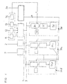
- a navigation device in a data bus structure shows an example of how a navigation device in a data bus structure according to the invention is realized.
- a data bus 3 e.g. an optical bus (such as MOST or MML bus) close among other components 7 a navigation computer 1, a data memory 2 and a screen unit 30 with controls 32.
- the screen unit 30 has an internal computer 31, a memory direction 38 and a screen 36.
- Data is supplied to the navigation device 1.
- exemplary are a speed sensor 11, a direction sensor 12, a position sensor 13 and a rotation rate sensor 14 outlined.
- the navigation computer 1 is additionally equipped with a mass storage medium, e.g. a CD drive 50, connected to it to be able to call up saved road map information.
- a mass storage medium e.g. a CD drive 50
- the road map information is in the navigation computer 1 not as a planar coordinate system, i.e. usual map, but as a geographic coordinate system.
- An example of such a geographic coordinate system is the WGS 84 coordinate system.
- the navigation computer 1 has e.g. via the mentioned mass storage device 50 Access to such a geographic coordinate system.
- a shown on the screen 36 of the screen unit 30 Map is then generated by the navigation computer only geographic data and additional necessary Information is transmitted to the screen unit 30. Based this in comparison to the known transmission methods reduced data amount, the screen unit 30 generates the final image to be displayed.
- the navigation computer 1 E.g. a driver driving from location A to location B, so must first have the necessary data in the navigation computer 1 can be entered.
- the controls are used for this 32.
- the navigation computer 1 the geographical data of these two places A and B from its memory or the aforementioned mass storage 50 Interrogate. In addition, it will be the between locations A and B determine the existing streets.
- the screen unit 30 is then from this data a to g generate an image by receiving over the data bus 3 geographic coordinates and the additional ones to the coordinates belonging information / parameters in the computer 31 of the Screen unit 30 are prepared.
- First, on Screen 36 set two points for locations A and B. On Place symbols are then displayed at these points and then the freeway between locations A and B is drawn. Finally, a vehicle symbol appears in the place of the Screen 36 is displayed, the current position of the Corresponds to the vehicle. Of course, this happens so quickly that the viewer of the picture has the impression that all Symbols appear on the image at the same time.
- the Image construction by the computer 31 in the screen unit 30 also run in the background and the display only takes place when the image is calculated in the computer of the screen unit 30 is.
- the Navigation computer 1 only shares the new geographical Coordinates of the vehicle with.
- the display of the vehicle symbol on the screen is done by the computer of the screen unit 30 itself.
- a lower bus load is that Episode.
- the screen unit 30 expediently has one Memory in which all for displaying an image necessary symbols and characters are stored.
- the computer 31 in the screen unit 30 check whether they are required to calculate the new image information Information is available in memory 38 (d). This situation can e.g. B. occur due to previous requirements B, S. If this is the case, the new image information can calculated immediately, stored in memory 38 and on the screen 36 or display are shown (i). In this case the processing of the new requirements B, S is finished (c).
- This data is stored in the computer 36 of the screen unit 30 received (f) and stored (g).
Landscapes
- Engineering & Computer Science (AREA)
- Radar, Positioning & Navigation (AREA)
- Remote Sensing (AREA)
- Automation & Control Theory (AREA)
- Physics & Mathematics (AREA)
- General Physics & Mathematics (AREA)
- Navigation (AREA)
- Traffic Control Systems (AREA)
Applications Claiming Priority (2)
| Application Number | Priority Date | Filing Date | Title |
|---|---|---|---|
| DE10010310 | 2000-03-06 | ||
| DE10010310A DE10010310B4 (de) | 2000-03-06 | 2000-03-06 | Verfahren und Vorrichtung zur Darstellung eines geografischen Bildes auf einem Bildschirm |
Publications (1)
| Publication Number | Publication Date |
|---|---|
| EP1136791A1 true EP1136791A1 (fr) | 2001-09-26 |
Family
ID=7633330
Family Applications (1)
| Application Number | Title | Priority Date | Filing Date |
|---|---|---|---|
| EP01103932A Withdrawn EP1136791A1 (fr) | 2000-03-06 | 2001-02-19 | Méthode et dispositif pour représenter une image géographique sur un écran |
Country Status (3)
| Country | Link |
|---|---|
| US (1) | US7162364B2 (fr) |
| EP (1) | EP1136791A1 (fr) |
| DE (1) | DE10010310B4 (fr) |
Families Citing this family (8)
| Publication number | Priority date | Publication date | Assignee | Title |
|---|---|---|---|---|
| US7668648B2 (en) * | 2001-03-06 | 2010-02-23 | Harman Becker Automotive Systems Gmbh | Motor vehicle navigation system |
| JP4088237B2 (ja) * | 2003-10-23 | 2008-05-21 | 株式会社ナビタイムジャパン | ナビゲーション装置、ナビゲーション方法、ナビゲーションプログラム |
| JP2006154538A (ja) * | 2004-11-30 | 2006-06-15 | Aisin Aw Co Ltd | 地図描画方法、地図描画システム、ナビゲーション装置及び入出力装置 |
| KR20060078653A (ko) * | 2004-12-30 | 2006-07-05 | 삼성전자주식회사 | 급지 제어기 자동 튜닝 방법 및 장치 |
| US7446674B2 (en) * | 2005-05-16 | 2008-11-04 | Mckenna Louis H | Emergency warning system for approach of right of way vehicle |
| US20090177382A1 (en) * | 2008-01-03 | 2009-07-09 | Commscope, Inc. Of North Carolina | Calibration of a Navigation System |
| US20090174571A1 (en) * | 2008-01-07 | 2009-07-09 | Mckenna Louis H | Navigation apparatus having emergency warning system |
| US8054200B1 (en) | 2008-12-11 | 2011-11-08 | Neva Products, Llc | Control apparatus, method, and algorithm for turning on warning in response to strobe |
Citations (2)
| Publication number | Priority date | Publication date | Assignee | Title |
|---|---|---|---|---|
| US5721684A (en) * | 1995-07-04 | 1998-02-24 | Mitsubishi Denki Kabushiki Kaisha | Navigation apparatus having two processors, the first for outputting map data and the second for drawing and scrolling the map |
| EP0836167A1 (fr) * | 1996-08-21 | 1998-04-15 | Aisin Aw Co., Ltd. | Appareil d'affichage de carte et méthode |
Family Cites Families (19)
| Publication number | Priority date | Publication date | Assignee | Title |
|---|---|---|---|---|
| JPS61216098A (ja) * | 1985-03-20 | 1986-09-25 | 日産自動車株式会社 | 車両用経路誘導装置 |
| NL8702087A (nl) | 1987-09-04 | 1989-04-03 | Philips Nv | Voertuignavigatie-inrichting met weergave van een geselekteerd kaartelement volgens een voorafbepaalde representatienorm. |
| FR2636134B1 (fr) * | 1988-09-02 | 1995-03-10 | Thomson Csf | Systeme de navigation terrestre visualisant en temps reel la position d'un vehicule |
| EP0580167B1 (fr) * | 1992-07-23 | 1999-10-20 | Aisin Aw Co., Ltd. | Dispositif de navigation pour véhicules avec recherche d'une nouvelle route quand un véhicule quitte sa route |
| EP0678731B1 (fr) * | 1994-04-15 | 1999-06-30 | Nissan Motor Co., Ltd. | Système de navigation pour véhicule |
| US5848373A (en) * | 1994-06-24 | 1998-12-08 | Delorme Publishing Company | Computer aided map location system |
| US6321158B1 (en) * | 1994-06-24 | 2001-11-20 | Delorme Publishing Company | Integrated routing/mapping information |
| US5802492A (en) * | 1994-06-24 | 1998-09-01 | Delorme Publishing Company, Inc. | Computer aided routing and positioning system |
| GB9417600D0 (en) * | 1994-09-01 | 1994-10-19 | British Telecomm | Navigation information system |
| CA2158500C (fr) | 1994-11-04 | 1999-03-30 | Ender Ayanoglu | Systeme de navigation pour vehicule automobile |
| US5774828A (en) * | 1995-04-07 | 1998-06-30 | Delco Electronics Corporation | Mapless GPS navigation system with user modifiable data base |
| US5627547A (en) * | 1995-04-07 | 1997-05-06 | Delco Electronics Corporation | Mapless GPS navigation system in vehicle entertainment system |
| US5774824A (en) * | 1995-08-24 | 1998-06-30 | The Penn State Research Foundation | Map-matching navigation system |
| KR970002795A (ko) * | 1995-10-30 | 1997-01-28 | 모리 하루오 | 네비게이션(navigation)장치 |
| US5918180A (en) * | 1995-12-22 | 1999-06-29 | Dimino; Michael | Telephone operable global tracking system for vehicles |
| US5862511A (en) * | 1995-12-28 | 1999-01-19 | Magellan Dis, Inc. | Vehicle navigation system and method |
| JP3375258B2 (ja) * | 1996-11-07 | 2003-02-10 | 株式会社日立製作所 | 地図表示方法及び装置並びにその装置を備えたナビゲーション装置 |
| DE69830631T2 (de) * | 1997-08-08 | 2006-05-11 | Alpine Electronics, Inc., Iwaki | Anzeigegerät für eine Navigationsvorrichtung |
| US6346938B1 (en) * | 1999-04-27 | 2002-02-12 | Harris Corporation | Computer-resident mechanism for manipulating, navigating through and mensurating displayed image of three-dimensional geometric model |
-
2000
- 2000-03-06 DE DE10010310A patent/DE10010310B4/de not_active Expired - Lifetime
-
2001
- 2001-02-19 EP EP01103932A patent/EP1136791A1/fr not_active Withdrawn
- 2001-03-06 US US09/801,104 patent/US7162364B2/en not_active Expired - Lifetime
Patent Citations (2)
| Publication number | Priority date | Publication date | Assignee | Title |
|---|---|---|---|---|
| US5721684A (en) * | 1995-07-04 | 1998-02-24 | Mitsubishi Denki Kabushiki Kaisha | Navigation apparatus having two processors, the first for outputting map data and the second for drawing and scrolling the map |
| EP0836167A1 (fr) * | 1996-08-21 | 1998-04-15 | Aisin Aw Co., Ltd. | Appareil d'affichage de carte et méthode |
Also Published As
| Publication number | Publication date |
|---|---|
| DE10010310A1 (de) | 2001-10-25 |
| DE10010310B4 (de) | 2009-06-10 |
| US7162364B2 (en) | 2007-01-09 |
| US20010037175A1 (en) | 2001-11-01 |
Similar Documents
| Publication | Publication Date | Title |
|---|---|---|
| DE102008052460B4 (de) | Fahrzeugnavigationssystem mit Echtzeit-Verkehrsabbildungsanzeige | |
| DE60027499T2 (de) | Informationsdarbietungssystem für mobile Einheiten | |
| EP1198696B1 (fr) | Procede et dispositif pour la transmission d'informations de navigation d'une centrale de donnees a un systeme de navigation monte dans un vehicule | |
| DE19919139B4 (de) | Fahrzeugnavigationssystem | |
| EP1272995B1 (fr) | Procede fournissant des donnees de sortie dans un vehicule et dispositif fournissant des informations destinees au conducteur | |
| EP1126244B1 (fr) | Système de navigation | |
| DE102008062012B4 (de) | Navigationsgerät | |
| EP0752692A1 (fr) | Procédé et système de mise à jour de cartes digitales routières | |
| DE112010004633T5 (de) | Fahrzeugmontierte Bildverarbeitungsvorrichtung und Reisehilfevorrichtung | |
| DE60132946T2 (de) | Navigationssystem | |
| DE10059147A1 (de) | Navigationsgerät | |
| DE19938267A1 (de) | Verfahren und Einrichtung zur elektronischen Erkennung von Verkehrszeichen in Kraftfahrzeugen | |
| DE19600700B4 (de) | Navigationsgerät | |
| DE10010310B4 (de) | Verfahren und Vorrichtung zur Darstellung eines geografischen Bildes auf einem Bildschirm | |
| DE19701370A1 (de) | Verfahren zur Erweiterung von abgespeicherten Datensätzen eines Straßennetzes | |
| EP1134551B1 (fr) | Système de navigation | |
| EP2087316B1 (fr) | Support de données géographiques, procédé de fonctionnement d'un appareil de navigation, et appareil de navigation | |
| DE602004009975T2 (de) | Fahrerassistenzsystem für Kraftfahrzeuge | |
| EP1402232B1 (fr) | Procede et dispositif pour sortir des donnees relatives a un attribut d'une carte routiere numerique | |
| DE102006013297B4 (de) | Verfahren zum Betrieb eines Navigationssystems | |
| EP0911782A2 (fr) | Procédé de fonctionnement d'un système de navigation pour un véhicule et système de navigation pour un véhicule | |
| DE102022117732B3 (de) | Verfahren zur Ausgabe einer Navigationsanweisung in einem Kraftfahrzeug zum Ansteuern einer Haltemöglichkeit sowie Kraftfahrzeug | |
| WO2012048983A1 (fr) | Procédé permettant d'améliorer la détermination de position à l'aide d'un système de navigation et système de navigation associé | |
| DE10107599A1 (de) | Verfahren zum Darstellen von Fahrgastinformationen | |
| EP3571471B1 (fr) | Procédé et système central permettant de fournir des données cartographiques haute précision à un véhicule automobile |
Legal Events
| Date | Code | Title | Description |
|---|---|---|---|
| PUAI | Public reference made under article 153(3) epc to a published international application that has entered the european phase |
Free format text: ORIGINAL CODE: 0009012 |
|
| AK | Designated contracting states |
Kind code of ref document: A1 Designated state(s): DE FR GB IT Kind code of ref document: A1 Designated state(s): AT BE CH CY DE DK ES FI FR GB GR IE IT LI LU MC NL PT SE TR |
|
| AX | Request for extension of the european patent |
Free format text: AL;LT;LV;MK;RO;SI |
|
| 17P | Request for examination filed |
Effective date: 20011030 |
|
| AKX | Designation fees paid |
Free format text: DE FR GB IT |
|
| RAP1 | Party data changed (applicant data changed or rights of an application transferred) |
Owner name: HARMAN BECKER AUTOMOTIVE SYSTEMS GMBH |
|
| 17Q | First examination report despatched |
Effective date: 20070209 |
|
| STAA | Information on the status of an ep patent application or granted ep patent |
Free format text: STATUS: THE APPLICATION IS DEEMED TO BE WITHDRAWN |
|
| 18D | Application deemed to be withdrawn |
Effective date: 20070821 |