EP1965222A2 - Procédé et dispositif destinés à suivre au moins un objet se déplaçant - Google Patents
Procédé et dispositif destinés à suivre au moins un objet se déplaçant Download PDFInfo
- Publication number
- EP1965222A2 EP1965222A2 EP08400005A EP08400005A EP1965222A2 EP 1965222 A2 EP1965222 A2 EP 1965222A2 EP 08400005 A EP08400005 A EP 08400005A EP 08400005 A EP08400005 A EP 08400005A EP 1965222 A2 EP1965222 A2 EP 1965222A2
- Authority
- EP
- European Patent Office
- Prior art keywords
- track
- route
- active
- curve
- parameters
- Prior art date
- Legal status (The legal status is an assumption and is not a legal conclusion. Google has not performed a legal analysis and makes no representation as to the accuracy of the status listed.)
- Granted
Links
Images



Classifications
-
- G—PHYSICS
- G01—MEASURING; TESTING
- G01S—RADIO DIRECTION-FINDING; RADIO NAVIGATION; DETERMINING DISTANCE OR VELOCITY BY USE OF RADIO WAVES; LOCATING OR PRESENCE-DETECTING BY USE OF THE REFLECTION OR RERADIATION OF RADIO WAVES; ANALOGOUS ARRANGEMENTS USING OTHER WAVES
- G01S7/00—Details of systems according to groups G01S13/00, G01S15/00, G01S17/00
- G01S7/003—Transmission of data between radar, sonar or lidar systems and remote stations
-
- G—PHYSICS
- G01—MEASURING; TESTING
- G01S—RADIO DIRECTION-FINDING; RADIO NAVIGATION; DETERMINING DISTANCE OR VELOCITY BY USE OF RADIO WAVES; LOCATING OR PRESENCE-DETECTING BY USE OF THE REFLECTION OR RERADIATION OF RADIO WAVES; ANALOGOUS ARRANGEMENTS USING OTHER WAVES
- G01S13/00—Systems using the reflection or reradiation of radio waves, e.g. radar systems; Analogous systems using reflection or reradiation of waves whose nature or wavelength is irrelevant or unspecified
- G01S13/66—Radar-tracking systems; Analogous systems
- G01S13/72—Radar-tracking systems; Analogous systems for two-dimensional [2D] tracking, e.g. combination of angle and range tracking, track-while-scan radar
- G01S13/723—Radar-tracking systems; Analogous systems for two-dimensional [2D] tracking, e.g. combination of angle and range tracking, track-while-scan radar by using numerical data
- G01S13/726—Multiple target tracking
-
- G—PHYSICS
- G01—MEASURING; TESTING
- G01S—RADIO DIRECTION-FINDING; RADIO NAVIGATION; DETERMINING DISTANCE OR VELOCITY BY USE OF RADIO WAVES; LOCATING OR PRESENCE-DETECTING BY USE OF THE REFLECTION OR RERADIATION OF RADIO WAVES; ANALOGOUS ARRANGEMENTS USING OTHER WAVES
- G01S13/00—Systems using the reflection or reradiation of radio waves, e.g. radar systems; Analogous systems using reflection or reradiation of waves whose nature or wavelength is irrelevant or unspecified
- G01S13/87—Combinations of radar systems, e.g. primary radar and secondary radar
-
- G—PHYSICS
- G01—MEASURING; TESTING
- G01S—RADIO DIRECTION-FINDING; RADIO NAVIGATION; DETERMINING DISTANCE OR VELOCITY BY USE OF RADIO WAVES; LOCATING OR PRESENCE-DETECTING BY USE OF THE REFLECTION OR RERADIATION OF RADIO WAVES; ANALOGOUS ARRANGEMENTS USING OTHER WAVES
- G01S13/00—Systems using the reflection or reradiation of radio waves, e.g. radar systems; Analogous systems using reflection or reradiation of waves whose nature or wavelength is irrelevant or unspecified
- G01S13/88—Radar or analogous systems specially adapted for specific applications
- G01S13/91—Radar or analogous systems specially adapted for specific applications for traffic control
- G01S13/917—Radar or analogous systems specially adapted for specific applications for traffic control for marine craft or other waterborne vessels
-
- G—PHYSICS
- G08—SIGNALLING
- G08G—TRAFFIC CONTROL SYSTEMS
- G08G3/00—Traffic control systems for marine craft
-
- G—PHYSICS
- G08—SIGNALLING
- G08G—TRAFFIC CONTROL SYSTEMS
- G08G5/00—Traffic control systems for aircraft
- G08G5/70—Arrangements for monitoring traffic-related situations or conditions
- G08G5/72—Arrangements for monitoring traffic-related situations or conditions for monitoring traffic
- G08G5/727—Arrangements for monitoring traffic-related situations or conditions for monitoring traffic from a ground station
Definitions
- the invention relates to a method and a device for tracking at least one moving object.
- Such devices are e.g. known as Tracker, Radar Extractor Tracker or Multi Sensor Tracker (MST), and others. used in coastal surveillance, river monitoring, port monitoring, airspace surveillance and tarmac monitoring to monitor ship and / or air traffic / taxiway traffic and to take necessary action if necessary.
- An MST is a device that is able to jointly evaluate measurement data from several sensors.
- Fig. 1 shows a coastline 10, a sea 12, an island 13 and three ships 12 moving on the sea 12.
- the sensor devices 20, 20 ', 21 and 21' can already perform preprocessing of the measurement data, and the possibly preprocessed measurement data "DATA" 24 are transmitted via data lines 23 or a radio network to an input interface "IN" 43 of a multi sensor tracker (MST) 32 supplied, which is located for example in a data center 34.
- MST multi sensor tracker
- the MST 32 In addition to the measurement data of the sensor devices 20, 21, the MST 32 also has what is known as a priori knowledge, map information "MAP" 40, area information "AREAS” 41 and route information "ROUTES” 42 being shown in this example.
- the MST 32 processes the measurement data arriving from the sensor devices 20, 21 with the aid of a priori knowledge and generates so-called tracks therefrom. Tracks are images in the MST 32 from the state of the real ships 14.
- the movement data of the track (from position to rotational speed) is also called the state vector, and the entirety of the track data is called the state of the track.
- object is actually the real object such as means a ship floating on a river
- track denotes an image of the object in the system
- the terms are often used interchangeably as in the following description, since the tracking of the objects in the MST 32 is usually associated with the movement of the real Objects explained.
- a further intermediate system 54 may be provided which allows data exchange between the stations 50, 50 ', 50 ", for example, a user of the workstation 50 may designate a ship 14 or its track 45, 46 as possible smugglers, and on a work station 50 'arranged on a coastal surveillance boat, this identifier is also displayed by means of the intermediate system 54.
- a user of the workstation 50 via the data line 51 data "INFO" 47 such. sends a ship's name received by radio to the MST 32.
- the MST 32 may also be assigned a recording device "REC" 56, e.g. to be able to check the shipping traffic before a misfortune arrived or to carry out statistical evaluations.
- the MST 32 is a very complex system, since it has to take into account, for example, that the areas measured by the sensor devices 20, 21 partially overlap, the measured data of the individual sensor devices 20, 21 arrive at longer intervals and partly late and not all areas through the sensor devices 20, 21 are detected. Despite these difficulties, the MST 32 should generate tracks 45 whose state, including the state vector, matches the actual state of the ships 14 as well as possible and contains as few errors as possible.
- the a priori knowledge makes it much easier for the MST 32 to track ships or objects in general.
- the area information "AREAS" 41 it can be defined in which area of the monitored area is land (so-called land areas), and accordingly the tracking of a track 45 can be terminated if it moves to such a land area since it is either not a ship or there are corresponding measurement errors. It can also be defined, for example, that in certain areas in which, for example, a large amount of noise occurs, no new tracks are generated (so-called non automatic initiation areas), or that in certain areas tracks are not removed (cancellation control areas).
- the map information "MAP" 40 gives the MST 32 more information about the area to be monitored, and the MST 32 can, for example, automatically generate area information "AREAS" 41 from the map information 40.
- the map information is also used at the workstations 50, 50 ', 50 "for control and labor convenience by superimposing thereon the objects and area information" AREAS "41.
- Fig. 2 shows an application example of the route information "ROUTES" 42 in the case of port monitoring. Shown are both the real conditions and the corresponding image in the MST 32.
- the radar sensor device 20 is arranged to monitor the channel 60. It is a rotatable directional radiator / receiver, which scans during one revolution, the region 61 indicated by concentric circles. A region 62 of the channel 60 is in the radar shadow 64 of a factory 68, ie, due to the size of the factory 68, a measurement in the region 62 by the radar sensor device 20 is not possible because the radar beams radiated by the radar sensor device through the factory 68 are completely reflected or absorbed. On the channel 60 six ships 14 'to 14 VI are shown.
- the ship 14 is just moving towards the area 62, and in this area 62 no more measurement data is being generated to the ship 14".
- Shown superposition is the MST-internal image with six tracks 45 'to 45 VI and associated speed indicators, wherein the tracks 45' to 45 VI 'correspond to the vessels 14 to 14 VI, and a route 70, which corresponds to the traveling road in the channel 60th
- the route 70 is defined and represented in the form of a polygon, and the route 70 is assigned a width (lateral extent with respect to the longitudinal route position) 71.
- the MST 32 may e.g. if, when a ship 14 enters the radar shadow area 64 for the corresponding track 45, there are no measured data left, assuming that the ship continues to travel in the same direction at the same speed. However, this may result in e.g. the track 45 "of the ship 14" in the MST 32 is moved into an area defined as land area and therefore is removed from the list of tracks 45 to the tracked ships 14, or the state of the track to the ship 14 "has been inaccurate a rectilinear movement far enough away from the true position of the ship that after leaving the area 62, no assignment of the measurements to the corresponding track 45 is possible and possibly a new track 45 is erroneously generated.
- the driveway of the ships is largely predetermined, and therefore the route 70 is defined to approximately correspond to the driveway in the radar shadow area 64.
- the MST 32 can now check if the track is on route 70 in case there is no current measurement data for a track. If so, then the MST 32 may move the track along the route 70 using the route parameters, as shown e.g. at the track 45 '' 'to the ship 14' '' is shown. For the track 45 '' 'of the ship 14' '', the route 70 is active, and the track 45 '' 'is therefore moved along the route 70, although there are no current measurement data for the ship 14' ''. Thus, with a curvature of the route 70, the track 45 will also move with a curve, i.e., the effect of the route will depend on the position of the track relative to the route.
- Route 70 significantly improves tracking of vessels 14 'through 14'''''.
- the extrapolation of the movement of the tracks becomes more precise, and their stability and possible dynamics are increased.
- the use of the routes 70 can be divided into two steps. First, it is determined based on predetermined criteria whether a route 70 is active for a track. If so, in a second step, the state of the track is influenced in dependence on the route parameters, thus assisting the tracking of the ship.
- the curve can be defined in several ways, with an open polygon requiring less computational power than simple calculations, such as a spline curve.
- the curve can also be composed of several contiguous sub-curves and have different curvatures.
- the route 70 can thus also be referred to as stationary.
- the curve defines one or two predetermined directions along the curve.
- activity criteria may have such dependencies depending on the implementation: "lateral width”, “minimum speed”, “maximum speed” and “maximum angular range”, which in turn are dependent on the activity criterion "bidirectionality”.
- One way to find the curve at the track's location is to plot the perpendicular from the track to the curve and select the resulting curve point. For this purpose, it is advantageous if the curve has no acute angle.
- a route is e.g. only active if all criteria are fulfilled (logical AND operation).
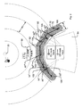
- Fig. 3 shows a route 70 with a unidirectional curve 72 and a width 71, which results from twice the lateral width 79.
- the maximum angle deviation 74 is plotted at two locations 75 and 76 respectively to the left and to the right of the direction indicated by the curve 72 locally.
- Six tracks 45 'to 45 VI are associated with speed indicator lines 15' to 15 VI shown, and they correspond to the vessels 14 'to 14 VI.
- the criterion "maximum angle deviation” is fulfilled at this time eg by the tracks 45 ", 45"'and 45 IV , since their angular deviation between the direction of movement 15 indicated by the tracks 45 and the direction of the route 70 is smaller than that Maximum angular deviation is, see eg angle deviation 77 of the track 45 ".
- the track 45 'does not fulfill this criterion since it is a unidirectional route 70 and the track 45' or the ship 14 'moves in the opposite direction. Thus, the angular deviation is too large.
- the lateral width criterion of the route is not met by Track 45 VI , because it is outside Route 70.
- the remaining tracks (ships) fulfill the criterion.
- the route becomes active for tracks 45 ", 45 '" and 45 IV , and these tracks will be correspondingly bright Circle and a bright speed indicator highlighted.
- the remaining tracks do not meet at least one of the above criteria, and they are therefore displayed dark.
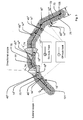
- Fig. 4 shows a route 70 and tracks (ships) 14 'to 14 VI accordingly Fig. 3 ,
- the curve 72 is defined as bidirectional.
- the maximum angular deviation 74 is applied in both directions of the curve 72.
- track 45 ' which travels substantially right-to-left on route 72, meets the criterion of maximum angular deviation, and because it also satisfies the criterion of "lateral width", the route is active for track 45'. and he is bright.
- Fig. 2 additionally shows the application of the criterion "No current measurement data available". Outside the shadow area 64, the sensor device 20 provides measurement data, and therefore the criterion "no current measurement data present" is not met for the tracks 45 ', 45 "and 45 IV to 45 VI , therefore these tracks are displayed dark and the route 70 is not active For Route 45 "'Route 70 is active and it is highlighted.
- An influencing of the movement or of the state of the track can be effected, for example, by the fact that the MST 32 generates suitable pseudo-measurement data for the desired movement and feeds the measurement data processing. It is not true measurement data of a sensor device, but artificially generated measurement data to achieve the desired movement of the track.
- the action “maintain lateral distance” can be realized, for example, by giving the system 32 a pseudo-position of the corresponding ship instead of a non-existent radar position measurement, which follows the desired path along the route, cf. Fig. 5 .
- the vectorial speed of the track can be set in the local direction of the curve, cf. Fig. 6 ,
- a route also has significant advantages in the actions, since the actions for the tracks can be carried out depending on the local property of the curve with respect to the position of the track, in particular with the actions “adjust position” and “maintain lateral distance”. The effect of the route is thus locally dependent.
- the accuracy of the lateral distance, the longitudinal movement and the compliance with the speed can also be predetermined or configured, e.g. in the form of the standard deviation.
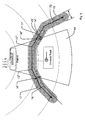
- Fig. 5 shows the temporal track course 16 of a track 45 'for a ship 14' moving through a radar shadow area 64, the activity criterion "no current measurement data present" being switched on.
- the vessel 14' travels into the radar shadow area 64, and the route 70 becomes active for the associated track 45 '(dashed portion of the track course 16).
- the "adjust position" and “maintain lateral distance” actions are on, and therefore the lateral distance 17 between the curve 72 and the track 45 'at location 16' is determined, and track 45 'is detected by the MST 32 is further moved along the curve 72, wherein the initially determined lateral distance 17 - preferably by a control - held constant (ie largely maintained), so that the track 45 'at the exit of the associated ship 14' from the Radarschatten Scheme at point 16 "a lateral distance 17 ', which substantially corresponds to the initial lateral distance 17.
- FIG. 6 Figure 16 shows the track course 16 to a track 45 'for passing through a radar shadow area 64 Fig. 5 Moving ship 14 ', with the activity criterion "No current measurement data available" is turned on. At a location 16 ', the vessel 14' travels into the radar shadow area 64 and the route 70 becomes active for the associated track 45 '(dashed portion of the lane 16).
- the lateral distance 17 of the track 45 'when entering the ship 14' into the radar shadow area 64 is not necessarily constant during the time of the activity of the route 70.
- the track pattern 16 of the track 45 'or its speed becomes according to the direction of the curve 72 adjusted, but the lateral distance changes and becomes smaller.
- the adaptation of the track 45' to the new measured values takes place there, depending on the response of the MST 32 or less clear jump of the track to the right (seen in the direction of travel).
- Routes are particularly useful when there are areas for which there is generally no radar sensor data (eg, the radar shadow area to the left of the island 13 in FIG Fig. 1 or the radar shadow area 64 in FIG Fig. 2 ) or only for certain, eg very large ships sensor data are determined (eg, below a arranged on a hill radar device).
- route parameters can be optimized, e.g. through statistical analysis of shipping traffic.
- the largely freely configurable route parameters make it possible to respond to special situations. If it is e.g. There are problems that ships 14 'on a certain route are removed too early from the tracking or from the MST 32 because of missing measurement data, this can be counteracted via the route parameters "minimum service life” or "minimum service life”.
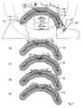
- Fig. 7a to Fig. 7e show an application for routes in close-by navigation lanes in opposite directions.
- a ship 14 ' is going through the channel 60 from left to right and a ship 14 "from right to left ..
- a ship 14"' traverses the channel 60 from left to right and is in the middle of the channel.
- route parameter "no current measurement data present" is set in the route 70, the route 70 is not active, since all ships 14 can be detected by the radar 20.
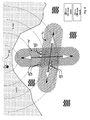
- Fig. 8 shows an application case of two intersecting waterways.
- a route 70 is defined for the first waterway (left-right) and a route 70 'for the second waterway (top-down).
- a first ship 14 ' is on route 70, a second ship 14 "on route 70', and a third ship 14"'is not on any of the routes.
- the use of the routes can here eg with the criterion "None current measurement data available "and the action" adapt position "can be used Alternatively, the routes can be selected short and used for all tracks 45 (deactivated" No current measurement data available ”) because the movement determined by the routes is over short distances usually coincide well with reality.
- the quality of the tracks and thus the quality of tracking the objects can be significantly improved, and the tracks are more reliable than tracking without routes.
- the tracks are therefore more consistent with the real objects, and this also increases the quality of the MST 32 as a whole.
- the use of routes also supports overall tracking, which can reduce the computing power required, especially in large applications.
- an established MST 32 with routes 70 well-tuned to the local conditions is much more accurate and better than an MST 32 without such routes.
- routes 70 may be required.
Landscapes
- Engineering & Computer Science (AREA)
- Radar, Positioning & Navigation (AREA)
- Remote Sensing (AREA)
- Physics & Mathematics (AREA)
- General Physics & Mathematics (AREA)
- Computer Networks & Wireless Communication (AREA)
- Ocean & Marine Engineering (AREA)
- Electromagnetism (AREA)
- Aviation & Aerospace Engineering (AREA)
- Traffic Control Systems (AREA)
- Navigation (AREA)
- Closed-Circuit Television Systems (AREA)
Applications Claiming Priority (1)
| Application Number | Priority Date | Filing Date | Title |
|---|---|---|---|
| DE102007011604 | 2007-03-02 |
Publications (3)
| Publication Number | Publication Date |
|---|---|
| EP1965222A2 true EP1965222A2 (fr) | 2008-09-03 |
| EP1965222A3 EP1965222A3 (fr) | 2013-08-14 |
| EP1965222B1 EP1965222B1 (fr) | 2017-08-30 |
Family
ID=39467179
Family Applications (1)
| Application Number | Title | Priority Date | Filing Date |
|---|---|---|---|
| EP08400005.8A Active EP1965222B1 (fr) | 2007-03-02 | 2008-02-27 | Procédé et dispositif destinés à suivre au moins un objet se déplaçant |
Country Status (4)
| Country | Link |
|---|---|
| EP (1) | EP1965222B1 (fr) |
| DE (1) | DE102008012375A1 (fr) |
| DK (1) | DK1965222T3 (fr) |
| NO (1) | NO1965222T3 (fr) |
Cited By (2)
| Publication number | Priority date | Publication date | Assignee | Title |
|---|---|---|---|---|
| DE102010008807A1 (de) | 2010-02-22 | 2011-08-25 | Engelskirchen, Jürgen, Dipl.-Ing., 22395 | Verfahren zur selbsttätigen Bahnsteuerung eines steuerbaren Objektes |
| US10769239B2 (en) | 2014-11-26 | 2020-09-08 | Maritime Radar Systems Limited | System for monitoring a maritime environment |
Families Citing this family (2)
| Publication number | Priority date | Publication date | Assignee | Title |
|---|---|---|---|---|
| US7991550B2 (en) * | 2006-02-03 | 2011-08-02 | GM Global Technology Operations LLC | Method and apparatus for on-vehicle calibration and orientation of object-tracking systems |
| US9786183B2 (en) * | 2015-06-30 | 2017-10-10 | Exactearth Ltd. | Systems and methods for vessel position reporting and monitoring |
Family Cites Families (2)
| Publication number | Priority date | Publication date | Assignee | Title |
|---|---|---|---|---|
| US6260759B1 (en) * | 1998-08-11 | 2001-07-17 | Northrop Grumman Corporation | Method for tracking a target having substantially constrained movement |
| US7940206B2 (en) * | 2005-04-20 | 2011-05-10 | Accipiter Radar Technologies Inc. | Low-cost, high-performance radar networks |
-
2008
- 2008-02-26 DE DE102008012375A patent/DE102008012375A1/de not_active Withdrawn
- 2008-02-27 DK DK08400005.8T patent/DK1965222T3/en active
- 2008-02-27 NO NO08400005A patent/NO1965222T3/no unknown
- 2008-02-27 EP EP08400005.8A patent/EP1965222B1/fr active Active
Non-Patent Citations (1)
| Title |
|---|
| FARINA ET AL.: "Constrained tracking filters for A-SMGCS", INFORMATION FUSION, 2003 AUS PROCEEDINGS OF THE SIXTH INTERNATIONAL CONFERENCE, vol. 1, 8 July 2003 (2003-07-08), pages 414 - 421 |
Cited By (3)
| Publication number | Priority date | Publication date | Assignee | Title |
|---|---|---|---|---|
| DE102010008807A1 (de) | 2010-02-22 | 2011-08-25 | Engelskirchen, Jürgen, Dipl.-Ing., 22395 | Verfahren zur selbsttätigen Bahnsteuerung eines steuerbaren Objektes |
| US10769239B2 (en) | 2014-11-26 | 2020-09-08 | Maritime Radar Systems Limited | System for monitoring a maritime environment |
| EP3026458B1 (fr) * | 2014-11-26 | 2021-09-01 | Maritime Radar Systems Limited | Système pour surveiller un environnement maritime |
Also Published As
| Publication number | Publication date |
|---|---|
| EP1965222B1 (fr) | 2017-08-30 |
| EP1965222A3 (fr) | 2013-08-14 |
| DK1965222T3 (en) | 2017-12-04 |
| NO1965222T3 (fr) | 2018-01-27 |
| DE102008012375A1 (de) | 2008-09-04 |
Similar Documents
| Publication | Publication Date | Title |
|---|---|---|
| EP3443301B1 (fr) | Procédé et système de détermination d'une position globale d'un premier repère | |
| EP3491339B1 (fr) | Procédé, dispositif et support de stockage lisible par ordinateur contenant des instructions permettant de déterminer la position latérale d'un véhicule par rapport aux voies de circulation d'une chaussée | |
| DE102016213817B4 (de) | Verfahren, Vorrichtung und computerlesbares Speichermedium mit Instruktionen zur Bestimmung der lateralen Position eines Fahrzeuges relativ zu den Fahrstreifen einer Fahrbahn | |
| EP3060942B1 (fr) | Procédé pour la détermination de la disposition d'au moins deux capteurs et réseaux de capteurs | |
| WO2020016385A1 (fr) | Procédé et système destiné à déterminer une position d'un véhicule | |
| EP3526546B1 (fr) | Procédure et système pour la localisation d'une véhicule | |
| EP3645969B1 (fr) | Procédé et dispositif de production de modèles de carte numériques | |
| DE69918677T2 (de) | Verfahren zur horizontalen leitweglenkung eines flugzeuges zwischen zwei verpflichteten punkten | |
| EP3391086B1 (fr) | Procédé amélioré de détermination de la construction de bord d'une chaussée pour la localisation de véhicules automobiles | |
| WO2020126338A1 (fr) | Procédé et système servant à déterminer une trajectoire corrigée d'un véhicule | |
| DE102016214470A1 (de) | Verfahren und System zum Erfassen eines Verkehrsumfeldes einer mobilen Einheit | |
| DE102010011982A1 (de) | Verfahren zum rechnergestützten Erstellen und/oder Aktualisieren einer Referenzkarte für eine satellitengestützte Ortung eines Objekts | |
| WO2022228738A1 (fr) | Détermination de position basée sur l'orientation pour des véhicules ferroviaires | |
| EP1965222B1 (fr) | Procédé et dispositif destinés à suivre au moins un objet se déplaçant | |
| DE102005035746A1 (de) | Verfahren zur Bestimmung einer Relativposition einer mobilen Einheit durch Vergleich von Scans einer Umgebung und mobile Einheit | |
| EP3728000B1 (fr) | Procédé d'assistance au stationnement mobile | |
| WO2019223833A1 (fr) | Commande d'un véhicule à moteur | |
| DE102021214763A1 (de) | Verfahren und Steuervorrichtung zum Steuern eines automatisierten Fahrzeugs | |
| WO2018037050A1 (fr) | Procédé pour créer un plan numérique des voies d'un ensemble voies ferrées | |
| EP3963287A1 (fr) | Procédé et dispositif pour la création d'une première carte | |
| WO2021105010A1 (fr) | Procédé et système d'attribution de coordonnées | |
| DE102015215693A1 (de) | Verfahren und Vorrichtung zum Bestimmen eines Straßenrand-Parkplatzes | |
| DE102017125332B4 (de) | Verfahren und System zur Positionsbestimmung einer mobilen Vorrichtung mittels Kartenabgleich | |
| EP4396532B1 (fr) | Procédé d'étalonnage d'un dispositif de surveillance de route et système de surveillance de route | |
| DE102019210658A1 (de) | Verfahren zur Bestimmung einer Position eines Fahrzeugs |
Legal Events
| Date | Code | Title | Description |
|---|---|---|---|
| PUAI | Public reference made under article 153(3) epc to a published international application that has entered the european phase |
Free format text: ORIGINAL CODE: 0009012 |
|
| AK | Designated contracting states |
Kind code of ref document: A2 Designated state(s): AT BE BG CH CY CZ DE DK EE ES FI FR GB GR HR HU IE IS IT LI LT LU LV MC MT NL NO PL PT RO SE SI SK TR |
|
| AX | Request for extension of the european patent |
Extension state: AL BA MK RS |
|
| PUAL | Search report despatched |
Free format text: ORIGINAL CODE: 0009013 |
|
| AK | Designated contracting states |
Kind code of ref document: A3 Designated state(s): AT BE BG CH CY CZ DE DK EE ES FI FR GB GR HR HU IE IS IT LI LT LU LV MC MT NL NO PL PT RO SE SI SK TR |
|
| AX | Request for extension of the european patent |
Extension state: AL BA MK RS |
|
| RIC1 | Information provided on ipc code assigned before grant |
Ipc: G01S 13/72 20060101AFI20130708BHEP Ipc: G08G 3/00 20060101ALI20130708BHEP Ipc: G01S 13/87 20060101ALN20130708BHEP |
|
| AKY | No designation fees paid | ||
| REG | Reference to a national code |
Ref country code: DE Ref legal event code: R108 |
|
| 17P | Request for examination filed |
Effective date: 20131221 |
|
| RBV | Designated contracting states (corrected) |
Designated state(s): AT BE BG CH CY CZ DE DK EE ES FI FR GB GR HR HU IE IS IT LI LT LU LV MC MT NL NO PL PT RO SE SI SK TR |
|
| REG | Reference to a national code |
Ref country code: DE Ref legal event code: R108 Effective date: 20140423 Ref country code: DE Ref legal event code: R108 Ref document number: 502008015571 Country of ref document: DE Effective date: 20140423 |
|
| GRAP | Despatch of communication of intention to grant a patent |
Free format text: ORIGINAL CODE: EPIDOSNIGR1 |
|
| STAA | Information on the status of an ep patent application or granted ep patent |
Free format text: STATUS: GRANT OF PATENT IS INTENDED |
|
| RIC1 | Information provided on ipc code assigned before grant |
Ipc: G01S 13/72 20060101AFI20170221BHEP Ipc: G08G 5/00 20060101ALI20170221BHEP Ipc: G01S 13/87 20060101ALN20170221BHEP Ipc: G08G 3/00 20060101ALI20170221BHEP |
|
| INTG | Intention to grant announced |
Effective date: 20170317 |
|
| GRAS | Grant fee paid |
Free format text: ORIGINAL CODE: EPIDOSNIGR3 |
|
| GRAA | (expected) grant |
Free format text: ORIGINAL CODE: 0009210 |
|
| STAA | Information on the status of an ep patent application or granted ep patent |
Free format text: STATUS: THE PATENT HAS BEEN GRANTED |
|
| AK | Designated contracting states |
Kind code of ref document: B1 Designated state(s): AT BE BG CH CY CZ DE DK EE ES FI FR GB GR HR HU IE IS IT LI LT LU LV MC MT NL NO PL PT RO SE SI SK TR |
|
| REG | Reference to a national code |
Ref country code: GB Ref legal event code: FG4D Free format text: NOT ENGLISH |
|
| REG | Reference to a national code |
Ref country code: CH Ref legal event code: EP |
|
| REG | Reference to a national code |
Ref country code: AT Ref legal event code: REF Ref document number: 924087 Country of ref document: AT Kind code of ref document: T Effective date: 20170915 |
|
| REG | Reference to a national code |
Ref country code: IE Ref legal event code: FG4D Free format text: LANGUAGE OF EP DOCUMENT: GERMAN |
|
| REG | Reference to a national code |
Ref country code: DE Ref legal event code: R096 Ref document number: 502008015571 Country of ref document: DE |
|
| REG | Reference to a national code |
Ref country code: DK Ref legal event code: T3 Effective date: 20171129 |
|
| REG | Reference to a national code |
Ref country code: SE Ref legal event code: TRGR |
|
| REG | Reference to a national code |
Ref country code: NL Ref legal event code: FP |
|
| REG | Reference to a national code |
Ref country code: LT Ref legal event code: MG4D |
|
| PG25 | Lapsed in a contracting state [announced via postgrant information from national office to epo] |
Ref country code: HR Free format text: LAPSE BECAUSE OF FAILURE TO SUBMIT A TRANSLATION OF THE DESCRIPTION OR TO PAY THE FEE WITHIN THE PRESCRIBED TIME-LIMIT Effective date: 20170830 Ref country code: LT Free format text: LAPSE BECAUSE OF FAILURE TO SUBMIT A TRANSLATION OF THE DESCRIPTION OR TO PAY THE FEE WITHIN THE PRESCRIBED TIME-LIMIT Effective date: 20170830 Ref country code: FI Free format text: LAPSE BECAUSE OF FAILURE TO SUBMIT A TRANSLATION OF THE DESCRIPTION OR TO PAY THE FEE WITHIN THE PRESCRIBED TIME-LIMIT Effective date: 20170830 |
|
| REG | Reference to a national code |
Ref country code: NO Ref legal event code: T2 Effective date: 20170830 |
|
| REG | Reference to a national code |
Ref country code: FR Ref legal event code: PLFP Year of fee payment: 11 |
|
| PG25 | Lapsed in a contracting state [announced via postgrant information from national office to epo] |
Ref country code: BG Free format text: LAPSE BECAUSE OF FAILURE TO SUBMIT A TRANSLATION OF THE DESCRIPTION OR TO PAY THE FEE WITHIN THE PRESCRIBED TIME-LIMIT Effective date: 20171130 Ref country code: IS Free format text: LAPSE BECAUSE OF FAILURE TO SUBMIT A TRANSLATION OF THE DESCRIPTION OR TO PAY THE FEE WITHIN THE PRESCRIBED TIME-LIMIT Effective date: 20171230 Ref country code: LV Free format text: LAPSE BECAUSE OF FAILURE TO SUBMIT A TRANSLATION OF THE DESCRIPTION OR TO PAY THE FEE WITHIN THE PRESCRIBED TIME-LIMIT Effective date: 20170830 Ref country code: GR Free format text: LAPSE BECAUSE OF FAILURE TO SUBMIT A TRANSLATION OF THE DESCRIPTION OR TO PAY THE FEE WITHIN THE PRESCRIBED TIME-LIMIT Effective date: 20171201 Ref country code: ES Free format text: LAPSE BECAUSE OF FAILURE TO SUBMIT A TRANSLATION OF THE DESCRIPTION OR TO PAY THE FEE WITHIN THE PRESCRIBED TIME-LIMIT Effective date: 20170830 |
|
| PG25 | Lapsed in a contracting state [announced via postgrant information from national office to epo] |
Ref country code: RO Free format text: LAPSE BECAUSE OF FAILURE TO SUBMIT A TRANSLATION OF THE DESCRIPTION OR TO PAY THE FEE WITHIN THE PRESCRIBED TIME-LIMIT Effective date: 20170830 Ref country code: PL Free format text: LAPSE BECAUSE OF FAILURE TO SUBMIT A TRANSLATION OF THE DESCRIPTION OR TO PAY THE FEE WITHIN THE PRESCRIBED TIME-LIMIT Effective date: 20170830 Ref country code: CZ Free format text: LAPSE BECAUSE OF FAILURE TO SUBMIT A TRANSLATION OF THE DESCRIPTION OR TO PAY THE FEE WITHIN THE PRESCRIBED TIME-LIMIT Effective date: 20170830 |
|
| PG25 | Lapsed in a contracting state [announced via postgrant information from national office to epo] |
Ref country code: SK Free format text: LAPSE BECAUSE OF FAILURE TO SUBMIT A TRANSLATION OF THE DESCRIPTION OR TO PAY THE FEE WITHIN THE PRESCRIBED TIME-LIMIT Effective date: 20170830 Ref country code: IT Free format text: LAPSE BECAUSE OF FAILURE TO SUBMIT A TRANSLATION OF THE DESCRIPTION OR TO PAY THE FEE WITHIN THE PRESCRIBED TIME-LIMIT Effective date: 20170830 Ref country code: EE Free format text: LAPSE BECAUSE OF FAILURE TO SUBMIT A TRANSLATION OF THE DESCRIPTION OR TO PAY THE FEE WITHIN THE PRESCRIBED TIME-LIMIT Effective date: 20170830 |
|
| REG | Reference to a national code |
Ref country code: DE Ref legal event code: R097 Ref document number: 502008015571 Country of ref document: DE |
|
| PLBE | No opposition filed within time limit |
Free format text: ORIGINAL CODE: 0009261 |
|
| STAA | Information on the status of an ep patent application or granted ep patent |
Free format text: STATUS: NO OPPOSITION FILED WITHIN TIME LIMIT |
|
| 26N | No opposition filed |
Effective date: 20180531 |
|
| PG25 | Lapsed in a contracting state [announced via postgrant information from national office to epo] |
Ref country code: SI Free format text: LAPSE BECAUSE OF FAILURE TO SUBMIT A TRANSLATION OF THE DESCRIPTION OR TO PAY THE FEE WITHIN THE PRESCRIBED TIME-LIMIT Effective date: 20170830 |
|
| REG | Reference to a national code |
Ref country code: CH Ref legal event code: PL |
|
| PG25 | Lapsed in a contracting state [announced via postgrant information from national office to epo] |
Ref country code: MT Free format text: LAPSE BECAUSE OF FAILURE TO SUBMIT A TRANSLATION OF THE DESCRIPTION OR TO PAY THE FEE WITHIN THE PRESCRIBED TIME-LIMIT Effective date: 20170830 Ref country code: MC Free format text: LAPSE BECAUSE OF FAILURE TO SUBMIT A TRANSLATION OF THE DESCRIPTION OR TO PAY THE FEE WITHIN THE PRESCRIBED TIME-LIMIT Effective date: 20170830 |
|
| REG | Reference to a national code |
Ref country code: IE Ref legal event code: MM4A |
|
| PG25 | Lapsed in a contracting state [announced via postgrant information from national office to epo] |
Ref country code: CH Free format text: LAPSE BECAUSE OF NON-PAYMENT OF DUE FEES Effective date: 20180228 Ref country code: LU Free format text: LAPSE BECAUSE OF NON-PAYMENT OF DUE FEES Effective date: 20180227 Ref country code: LI Free format text: LAPSE BECAUSE OF NON-PAYMENT OF DUE FEES Effective date: 20180228 |
|
| PG25 | Lapsed in a contracting state [announced via postgrant information from national office to epo] |
Ref country code: IE Free format text: LAPSE BECAUSE OF NON-PAYMENT OF DUE FEES Effective date: 20180227 |
|
| PGFP | Annual fee paid to national office [announced via postgrant information from national office to epo] |
Ref country code: SE Payment date: 20190308 Year of fee payment: 19 |
|
| PG25 | Lapsed in a contracting state [announced via postgrant information from national office to epo] |
Ref country code: TR Free format text: LAPSE BECAUSE OF FAILURE TO SUBMIT A TRANSLATION OF THE DESCRIPTION OR TO PAY THE FEE WITHIN THE PRESCRIBED TIME-LIMIT Effective date: 20170830 |
|
| PG25 | Lapsed in a contracting state [announced via postgrant information from national office to epo] |
Ref country code: HU Free format text: LAPSE BECAUSE OF FAILURE TO SUBMIT A TRANSLATION OF THE DESCRIPTION OR TO PAY THE FEE WITHIN THE PRESCRIBED TIME-LIMIT; INVALID AB INITIO Effective date: 20080227 Ref country code: PT Free format text: LAPSE BECAUSE OF FAILURE TO SUBMIT A TRANSLATION OF THE DESCRIPTION OR TO PAY THE FEE WITHIN THE PRESCRIBED TIME-LIMIT Effective date: 20170830 |
|
| PG25 | Lapsed in a contracting state [announced via postgrant information from national office to epo] |
Ref country code: CY Free format text: LAPSE BECAUSE OF FAILURE TO SUBMIT A TRANSLATION OF THE DESCRIPTION OR TO PAY THE FEE WITHIN THE PRESCRIBED TIME-LIMIT Effective date: 20170830 |
|
| REG | Reference to a national code |
Ref country code: AT Ref legal event code: MM01 Ref document number: 924087 Country of ref document: AT Kind code of ref document: T Effective date: 20200227 |
|
| PG25 | Lapsed in a contracting state [announced via postgrant information from national office to epo] |
Ref country code: AT Free format text: LAPSE BECAUSE OF NON-PAYMENT OF DUE FEES Effective date: 20200227 |
|
| PGFP | Annual fee paid to national office [announced via postgrant information from national office to epo] |
Ref country code: NL Payment date: 20250220 Year of fee payment: 18 |
|
| PGFP | Annual fee paid to national office [announced via postgrant information from national office to epo] |
Ref country code: DE Payment date: 20250218 Year of fee payment: 18 |
|
| PGFP | Annual fee paid to national office [announced via postgrant information from national office to epo] |
Ref country code: DK Payment date: 20250213 Year of fee payment: 18 |
|
| PGFP | Annual fee paid to national office [announced via postgrant information from national office to epo] |
Ref country code: NO Payment date: 20250214 Year of fee payment: 18 |
|
| PGFP | Annual fee paid to national office [announced via postgrant information from national office to epo] |
Ref country code: BE Payment date: 20250218 Year of fee payment: 18 |
|
| PGFP | Annual fee paid to national office [announced via postgrant information from national office to epo] |
Ref country code: FR Payment date: 20250221 Year of fee payment: 18 |
|
| PGFP | Annual fee paid to national office [announced via postgrant information from national office to epo] |
Ref country code: GB Payment date: 20250213 Year of fee payment: 18 |