EP2659231B1 - Appareil de navigation et procédé d'obtention d'informations de conditions météorologiques - Google Patents
Appareil de navigation et procédé d'obtention d'informations de conditions météorologiques Download PDFInfo
- Publication number
- EP2659231B1 EP2659231B1 EP10801588.4A EP10801588A EP2659231B1 EP 2659231 B1 EP2659231 B1 EP 2659231B1 EP 10801588 A EP10801588 A EP 10801588A EP 2659231 B1 EP2659231 B1 EP 2659231B1
- Authority
- EP
- European Patent Office
- Prior art keywords
- route
- user
- weather
- weather data
- data
- Prior art date
- Legal status (The legal status is an assumption and is not a legal conclusion. Google has not performed a legal analysis and makes no representation as to the accuracy of the status listed.)
- Active
Links
Images


Classifications
-
- G—PHYSICS
- G01—MEASURING; TESTING
- G01C—MEASURING DISTANCES, LEVELS OR BEARINGS; SURVEYING; NAVIGATION; GYROSCOPIC INSTRUMENTS; PHOTOGRAMMETRY OR VIDEOGRAMMETRY
- G01C21/00—Navigation; Navigational instruments not provided for in groups G01C1/00 - G01C19/00
- G01C21/26—Navigation; Navigational instruments not provided for in groups G01C1/00 - G01C19/00 specially adapted for navigation in a road network
- G01C21/34—Route searching; Route guidance
- G01C21/36—Input/output arrangements for on-board computers
- G01C21/3667—Display of a road map
-
- G—PHYSICS
- G01—MEASURING; TESTING
- G01C—MEASURING DISTANCES, LEVELS OR BEARINGS; SURVEYING; NAVIGATION; GYROSCOPIC INSTRUMENTS; PHOTOGRAMMETRY OR VIDEOGRAMMETRY
- G01C21/00—Navigation; Navigational instruments not provided for in groups G01C1/00 - G01C19/00
- G01C21/26—Navigation; Navigational instruments not provided for in groups G01C1/00 - G01C19/00 specially adapted for navigation in a road network
- G01C21/34—Route searching; Route guidance
- G01C21/3453—Special cost functions, i.e. other than distance or default speed limit of road segments
-
- G—PHYSICS
- G01—MEASURING; TESTING
- G01C—MEASURING DISTANCES, LEVELS OR BEARINGS; SURVEYING; NAVIGATION; GYROSCOPIC INSTRUMENTS; PHOTOGRAMMETRY OR VIDEOGRAMMETRY
- G01C21/00—Navigation; Navigational instruments not provided for in groups G01C1/00 - G01C19/00
- G01C21/26—Navigation; Navigational instruments not provided for in groups G01C1/00 - G01C19/00 specially adapted for navigation in a road network
- G01C21/34—Route searching; Route guidance
- G01C21/36—Input/output arrangements for on-board computers
- G01C21/3667—Display of a road map
- G01C21/3676—Overview of the route on the road map
-
- G—PHYSICS
- G01—MEASURING; TESTING
- G01C—MEASURING DISTANCES, LEVELS OR BEARINGS; SURVEYING; NAVIGATION; GYROSCOPIC INSTRUMENTS; PHOTOGRAMMETRY OR VIDEOGRAMMETRY
- G01C21/00—Navigation; Navigational instruments not provided for in groups G01C1/00 - G01C19/00
- G01C21/26—Navigation; Navigational instruments not provided for in groups G01C1/00 - G01C19/00 specially adapted for navigation in a road network
- G01C21/34—Route searching; Route guidance
- G01C21/36—Input/output arrangements for on-board computers
- G01C21/3691—Retrieval, searching and output of information related to real-time traffic, weather, or environmental conditions
- G01C21/3694—Output thereof on a road map
-
- G—PHYSICS
- G01—MEASURING; TESTING
- G01W—METEOROLOGY
- G01W1/00—Meteorology
- G01W1/02—Instruments for indicating weather conditions by measuring two or more variables, e.g. humidity, pressure, temperature, cloud cover or wind speed
- G01W1/04—Instruments for indicating weather conditions by measuring two or more variables, e.g. humidity, pressure, temperature, cloud cover or wind speed giving only separate indications of the variables measured
Definitions
- Portable computing devices for example Portable Navigation Devices (PNDs) that include GPS (Global Positioning System) signal reception and processing functionality are well known and are widely employed as in-car or other vehicle navigation systems.
- GPS Global Positioning System
- a modern PND comprises a processor, memory and map data stored within said memory.
- the processor and memory cooperate to provide an execution environment in which a software operating system is typically established, and additionally it is commonplace for one or more additional software programs to be provided to enable the functionality of the PND to be controlled, and to provide various other functions.
- these devices further comprise one or more input interfaces that allow a user to interact with and control the device, and one or more output interfaces by means of which information may be relayed to the user.
- output interfaces include a visual display and a speaker for audible output.
- input interfaces include one or more physical buttons to control on/off operation or other features of the device (which buttons need not necessarily be on the device itself but can be on a steering wheel if the device is built into a vehicle), and a microphone for detecting user speech.
- the output interface display may be configured as a touch sensitive display (by means of a touch sensitive overlay or otherwise) additionally to provide an input interface by means of which a user can operate the device by touch.
- PNDs of this type also include a GPS antenna by means of which satellite-broadcast signals, including location data, can be received and subsequently processed to determine a current location of the device.
- PNDs The utility of such PNDs is manifested primarily in their ability to determine a route between a first location (typically a start or current location) and a second location (typically a destination). These locations can be input by a user of the device, by any of a wide variety of different methods, for example by postcode, street name and house number, previously stored "well known" destinations (such as famous locations, municipal locations (such as sports grounds or swimming baths) or other points of interest), and favourite or recently visited destinations.
- PNDs of this type may typically be mounted on the dashboard or windscreen of a vehicle, but may also be formed as part of an on-board computer of the vehicle radio or indeed as part of the control system of the vehicle itself.
- the navigation device may also be part of a hand-held system, such as a PDA (Portable Digital Assistant), a media player, a mobile telephone or the like, and in these cases, the normal functionality of the hand-held system is extended by means of the installation of software on the device to perform both route calculation and navigation along a calculated route.
- PDA Portable Digital Assistant
- the user interacts with the navigation device to select the desired calculated route, optionally from a list of proposed routes.
- the user may intervene in, or guide the route selection process, for example by specifying that certain routes, roads, locations or criteria are to be avoided or are mandatory for a particular journey.
- the route calculation aspect of the PND forms one primary function, and navigation along such a route is another primary function.
- a further important function provided by the device is automatic route re-calculation in the event that: a user deviates from the previously calculated route during navigation (either by accident or intentionally); real-time traffic conditions dictate that an alternative route would be more expedient and the device is suitably enabled to recognize such conditions automatically, or if a user actively causes the device to perform route re-calculation for any reason.
- route calculation and navigation functions are fundamental to the overall utility of PNDs, it is possible to use the device purely for information display, or "free-driving", in which only map information relevant to the current device location is displayed, and in which no route has been calculated and no navigation is currently being performed by the device. Such a mode of operation is often applicable when the user already knows the route along which it is desired to travel and does not require navigation assistance.
- PNDs During navigation along a calculated route, it is usual for such PNDs to provide visual and/or audible instructions to guide the user along a chosen route to the end of that route, i.e. the desired destination. It is also usual for PNDs to display map information on-screen during the navigation, such information regularly being updated on-screen so that the map information displayed is representative of the current location of the device, and thus of the user or user's vehicle if the device is being used for in-vehicle navigation.
- An icon displayed on-screen typically denotes the current device location, and is centred with the map information of current and surrounding roads in the vicinity of the current device location and other map features also being displayed. Additionally, navigation information may be displayed, optionally in a status bar above, below or to one side of the displayed map information, examples of navigation information include a distance to the next deviation from the current road required to be taken by the user, the nature of that deviation possibly being represented by a further icon suggestive of the particular type of deviation, for example a left or right turn.
- the navigation function also determines the content, duration and timing of audible instructions by means of which the user can be guided along the route. As can be appreciated, a simple instruction such as "turn left in 100 m" requires significant processing and analysis.
- user interaction with the device may be by a touch screen, or additionally or alternately by steering column mounted remote control, by voice activation or by any other suitable method.
- Another known technique comprises showing a map of a route and providing either a snapshot of a weather condition, i.e. at a single moment in time, displayed on top of the route and/or the map, or displaying an animation showing progression of the global weather conditions over time.
- US 2009/248289 A1 discloses a navigation apparatus for providing a guidance route.
- Information about a typhoon relevant to the route is displayed, wherein the weather information is displayed per map slice.
- the route may be recalculated from a particular start time in order to avoid the typhoon.
- JP 2000 258174 A discloses a method of displaying map information and weather data on a navigation device. Weather information per a plurality of points on the route are displayed together with associated times on a map display or as a list. It also discloses the determination of a current weather map for an area based on a current position of the user and conveying it via a display.
- the user interface is arranged to receive an instruction to re-calculate the route after communicating the weather data.
- the instruction to recalculate the route is an instruction to change the journey start time.
- the user interface may be arranged to receive an instruction to re-calculate the route so as to avoid a weather condition is a user-specified route part of the plurality of route parts.
- the weather data processing engine may be arranged to obtain the weather data from a source of weather data remote from the navigation apparatus.
- the route calculator may be arranged to receive weather preference data provided by the user and to cooperate with the weather data processing engine in order to calculate the route so as to attempt to satisfy a weather preference represented by the weather preference data.
- the route calculated is performed with respect to a journey start time.
- the journey start time may be a current time when the journey start time is unspecified.
- the route segmentation module may be arranged to divide the route into the plurality of route parts in which to the division of the route is based on a length of the route calculated and/or an estimated travel time for each route part.
- the plurality of route parts may be of equal length.
- the plurality of route parts may be of the same temporal length.
- the temporal length may be an estimated transit time.
- a predefined time threshold may be provided and the plurality of route parts may comprise a first route part having a time period associated therewith.
- the weather data processor may be arranged to recalculate the weather data in respect of the first route part at which the user is to arrive when the user is estimated to arrive at the first route part after the time period and/or the predetermine time threshold after the time period.
- the method comprises communicating to the user the weather data in respect of a number of the plurality of route parts and at respective times of presence associated with the number of the plurality of route parts.
- the weather data is communicated graphically in combination with a map.
- the method further comprises receiving an instruction to re-calculate the route when communicating the weather data.
- the method may further comprise: obtaining the weather data from a source of weather data remote from the navigation apparatus.
- the method may further comprise: receiving weather preference data provided by the user; and calculating the route so as to attempt to satisfy a weather preference represented by the weather preference data.
- Example embodiments of the present disclosure may be described with particular reference to a navigation device (ND) or personal navigation device (PND). It should be remembered, however, that the teachings of the present disclosure are not limited to dedicated NDs or PNDs, but are instead universally applicable to any type of processing device that is configured to execute navigation software so as to provide route planning and navigation functionality. It follows, therefore, that in the context of the present application, a navigation device is intended to include (without limitation) any type of route planning and navigation device, irrespective of whether that device is embodied as a PND, a navigation device built into a vehicle, or a computing resource (such as a desktop or portable personal computer (PC), mobile telephone or portable digital assistant (PDA)) executing route planning and navigation software.
- example embodiments can be implemented in pedestrian navigation networks and/or any other type of transportation network, for example a metro train.
- GPS measurements probe trace points
- latitude and longitude coordinates location measurements
- location measurements may be obtained from any source and are not limited to GPS.
- indoor positioning technology can be employed, for example using Wi-Fi access points.
- embodiments described herein can be employed by pedestrians, for example in a shopping mall, using navigation apparatus or other electronic apparatus capable of location determination using, for example, wi-fi as mentioned above and/or cellular communications technology
- GPS Global Positioning System
- the GPS is a satellite-radio based navigation system capable of determining continuous position, velocity, time, and in some instances direction information for an unlimited number of users.
- NAVSTAR the GPS incorporates a plurality of satellites which orbit the earth in extremely precise orbits. Based on these precise orbits, GPS satellites can relay their location to any number of receiving units.
- the GPS system is implemented when a device, specially equipped to receive GPS data, begins scanning radio frequencies for GPS satellite signals. Upon receiving a radio signal from a GPS satellite, the device determines the precise location of that satellite via one of a plurality of different conventional methods. The device will continue scanning, in most instances, for signals until it has acquired at least three different satellite signals (noting that position is not normally, but can be, determined with only two signals using other triangulation techniques). Implementing geometric triangulation, the receiver uses the three known positions to determine its own two-dimensional position relative to the satellites. This can be done in a known manner. Additionally, acquiring a fourth satellite signal allows the receiving device to calculate its three dimensional position by the same geometrical calculation in a known manner. The position and velocity data can be updated in real time on a continuous basis by an unlimited number of users.
- the GPS system 100 comprises a plurality of satellites 102 orbiting the earth 104.
- a GPS receiver 106 receives spread spectrum GPS satellite data signals 108 from a number of the plurality of satellites 102.
- the spread spectrum data signals 108 are continuously transmitted from each satellite 102, the spread spectrum data signals 108 transmitted each comprise a data stream including information identifying a particular satellite 102 from which the data stream originates.
- the GPS receiver 106 generally requires spread spectrum data signals 108 from at least three satellites 102 in order to be able to calculate a two-dimensional position. Receipt of a fourth spread spectrum data signal enables the GPS receiver 106 to calculate, using a known technique, a three-dimensional position.
- one aspect of the input device 204, the touch panel, and the display screen 206 are integrated so as to provide an integrated input and display device, including a touchpad or touchscreen input 230 ( Figure 3 ) to enable both input of information (via direct input, menu selection, etc.) and display of information through the touch panel screen so that a user need only touch a portion of the display screen 206 to select one of a plurality of display choices or to activate one of a plurality of virtual or "soft" buttons.
- the processor 202 supports a Graphical User Interface (GUI) that operates in conjunction with the touchscreen.
- GUI Graphical User Interface
- the processor 202 is operatively connected to and capable of receiving input information from input device 204 via a connection 210, and operatively connected to at least one of the display screen 206 and an output device 208, via respective output connections 212, to output information thereto.
- the output device 208 is, for example, an audible output device (e.g. including a loudspeaker).
- input device 204 can include a microphone and software for receiving input voice commands as well.
- the navigation apparatus 200 can also include any additional input device 204 and/or any additional output device, such as audio input/output devices.
- the processor 202 is operably coupled to a memory resource 214 via connection 216 and is further adapted to receive/send information from/to input/output (I/O) ports 218 via connection 220, wherein the I/O port 218 is connectible to an I/O device 222 external to the navigation apparatus 200.
- the external I/O device 222 may include, but is not limited to an external listening device, such as an earpiece for example.
- the connection to I/O device 222 can further be a wired or wireless connection to any other external device such as a car stereo unit for hands-free operation and/or for voice activated operation for example, for connection to an earpiece or headphones.
- the memory resource 214 comprises, for example, a volatile memory, such as a Random Access Memory (RAM) and a non-volatile memory, for example a digital memory, such as a flash memory.
- RAM Random Access Memory
- non-volatile memory for example a digital memory, such as a flash memory.
- Figure 2 further illustrates an operative connection between the processor 202 and an antenna/receiver 224 via connection 226, wherein the antenna/receiver 224 can be a GPS antenna/receiver for example.
- the antenna and receiver designated by reference numeral 224 are combined schematically for illustration, but that the antenna and receiver may be separately located components, and that the antenna can be a GPS patch antenna or helical antenna for example.
- the cellular communications module 228 supports a bidirectional data communications service, for example a packet switched data service, such as a General Packet Radio Service (GPRS) supported by the GSM communications network and/or a High Speed Downlink Packet Access (HSDPA) service supported by the UMTS network.
- GPRS General Packet Radio Service
- HSDPA High Speed Downlink Packet Access
- the communications interface 229 is therefore compatible with the bidirectional data communications service.
- the bidirectional data communications service supports an Internet Protocol (IP) for data communications although use of other protocols, additionally or alternatively, is contemplated.
- IP Internet Protocol
- the navigation apparatus 200 can sit on an arm 232, which itself can be secured to a vehicle dashboard/window/etc. using a suction cup 234.
- This arm 232 is one example of a docking station to which the navigation apparatus 200 can be docked.
- the navigation apparatus 200 can be docked or otherwise connected to the arm 232 of the docking station by snap connecting the navigation apparatus 200 to the arm 232 for example.
- the navigation apparatus 200 may then be rotatable on the arm 232.
- a button (not shown) on the navigation apparatus 200 may be pressed, for example.
- Other equally suitable arrangements for coupling and decoupling the navigation apparatus 200 to a docking station are well known to persons of ordinary skill in the art.
- the memory resource 214 of the navigation apparatus 200 stores a boot loader program (not shown) that is executed by the processor 202 in order to load an operating system 238 from the memory resource 214 for execution by functional hardware components 236, which provides an environment in which application software 240 can run.
- the operating system 238 serves to control the functional hardware components 236 and resides between the application software 240 and the functional hardware components 236.
- the application software 240 provides an operational environment including the GUI that supports core functions of the navigation apparatus 200, for example map viewing, route planning, navigation functions and any other functions associated therewith.
- the application software 240 supports a route calculator 241, a time estimation module 242, a route segmentation module 243 and a weather data processing engine 244.
- the route calculator 241 having an input 252 for receiving route calculation parameters from a navigation input module (not shown), for example a start location and a destination location constituting, in this example, the first and second locations mentioned above.
- the route calculator 241 has access to a map database 254 comprising geospatial data.
- the route calculator 250 is also operably coupled to the route segmentation module 243, the route segmentation module 243 being operably coupled to the weather data processing engine 244.
- the weather data processing engine 244 is operably coupled to the time estimation module 242 and a user interface module 245.
- the cellular communications network 280 is operably coupled to the Internet 284.
- a remote server 286 is "attached" to the Internet 284 via an Internet Service Provider (ISP) and constitutes an example of an external resource.
- the remote server 286 comprises or is coupled to a further database of weather data 288.
- the navigation apparatus 200 in combination with the remote server 286 and the functional relationship therebetween constitutes a content delivery system.
- the establishment of the network connection between the navigation apparatus 200 (via a service provider) and another device, for example the remote server 286, using the Internet 284, can be done in any suitable known manner.
- any number of appropriate data communications protocols can be employed.
- the communications module 228 can utilize any number of communication standards such as CDMA2000, GSM, IEEE 802.11 a/b/c/g/n, etc.
- the user configures a route for calculation as follows.
- the user undertakes an illustrative destination location input process described hereinbelow using a location browser function supported by the user interface.
- the user uses a settings menu option supported by the application software 240 in order to select view generation in a three-dimensional mode.
- the GPS module 658 of the apparatus 200 acquires GPS data and performs a self-location determination by calculating (in a known manner) the current location of the navigation apparatus 200.
- the user is then presented, as shown in Figure 7 , with a display 300 showing in pseudo three-dimensions: a local environment 302 in which the navigation apparatus 200 is determined to be located and, in a region 304 of the display 300 below the local environment 302, a set of control and status messages.
- the navigation apparatus 200 By touching the display at the local environment 302, the navigation apparatus 200, through the user interface, updates the display 300 by displaying (as shown in Figure 8 ) a series of virtual or soft buttons 306 by means of which the user can, inter alia, input a destination to which the user wishes to navigate.
- the navigation apparatus 200 By touching the "Navigate to" virtual button 308, the navigation apparatus 200 initiates a route calculation procedure, a part of which comprises a route creation procedure.
- the navigation apparatus 200 displays (as shown in Figure 9 ) a plurality of virtual buttons that are each associated with a different category of selectable destinations.
- the display shows a "home” button that if pressed would set the destination to a stored home location.
- the "favourite” button if pressed, reveals a list of destinations that the user has previously stored in the navigation apparatus 200 and if one of these destinations is then selected the destination for the route to be calculated is set to the selected previously stored destination.
- a triangular arrow-like virtual button provides access to additional sub-menu options relating to the "Navigate to " menu option, and an "address” button 310 commences a process by which the user can input the street address of the destination to which the user wishes to navigate.
- the "address" button 310 is operated (by touching the virtual button displayed on the touchscreen) in order to select a location as the destination, whereupon (as shown in Figure 10 ) the user is presented with a series of address input options: address input by "city centre”, by "postcode”, by "crossing or intersection” (for example a junction of two roads) and by "street and house number”.
- the user knows the street address and house number of the destination and hence selects a "street and house number" virtual button 312 whereupon the user is then presented, as shown in Figure 11 , with: a prompt 314 to enter the name of the city to which they wish to navigate, a flag button 316 by means of which the user can select the country in which the desired city is located, and a virtual keyboard 318 that may be operated by the user, if necessary, to input the name of the destination city.
- the user begins to type the word "Amsterdam" and the navigation apparatus 200 therefore responds by providing the user with a list 320 of selectable cites.
- the user wishes to travel to the street “Rembrandtplein” and so the user selects "Rembrandtplein” from the displayed list 324.
- the navigation apparatus 200 displays ( Figure 13 ) a restricted, largely numeric, virtual keypad 326 and prompts the user, by means of prompt 328, to enter the street number in the selected street and city to which the user wishes to navigate. If the user has previously navigated to a building number in this street, then that number is initially shown. If, as in this instance, the user wishes to navigate to No. 35, Rembrandtplein, then the user simply needs to type the street number ("35") using the virtual keypad 326 and then touch a "done" virtual button 330 displayed at the bottom right hand corner of the display 300. If the user should wish to navigate to a different building number in Rembrandtplein, then all the user needs do is operate the virtual keypad 326 to input an appropriate building or street number.
- the user touches the "Done" virtual button 330.
- the application software 240 then causes the user interface to present an interrogation message 346 ( Figure 14 ) asking the user whether a particular arrival time is required. If the user should touch a "yes" virtual button, then functionality is invoked that estimates the time required to travel to the destination (after provision by the user of the desired arrival time) and advises the user when they should leave (or if they are running late, should have left) their current location in order to arrive at their destination on time. In this instance, the user is not concerned about arriving at a particular time and hence selects a "no" virtual button 348.
- the weather data processor engine 244 then interrogates (Step 408) the time estimation module 243, providing the mid-point information for each of the route parts to the time estimation module 243 and obtains estimated times associated with each route part, based upon a start time provided by the user.
- the weather data processor engine 244 then accesses the weather data 288 stored by the remote server 286 and obtains (Step 410) weather information in respect of a geographic region corresponding to each route part and the time at which the user is estimated respectively to be travelling along the route part, i.e. present in the route part.
- the weather data processor engine 244 then communicates (Step 412) the weather data obtained for each route part to the user interface 245 for communication to the user.
- the weather information can be communicated (Step 414) graphically in combination with map data showing the route calculated.
- the weather data can be communicated to the user as a list identifying route parts and associated weather conditions at the time the user is estimated to be present in each route part.
- the route summary can be divided into "slices" that conform to the division of the calculated route and then the weather data obtained corresponds to the "slices" defined for the respective times at which the user will attend the route part for the slice. are as described weather data can be displayed as segments. Hence, a slice or weather is shown as it is predicted for the part of the route and at the associated time.
- the number of segments in which to divide the calculated route can be based upon the length of route calculated and/or an estimated travel time for each segment. Consequently, each segment cay be of equal length.
- route segments can correspond to the same time period, namly the estimated time to travel each route segment would be the same.
- the slicing of the map for superimposion of weather data can be achieved in a number of ways, for example the slicing can be in the shape of radius or radii from an origin point, for example a start location. Alternatively, the slicing can be implemented by using the shape of a radius or radii from multiple locations along the calculated route. Another technique employs the use of parallel bars of map area, the bars being perpendicular to the calculated route or parallel to a direction in which a given weather pattern is heading so that weather conditions just missed and still to be expect can be seen.
- the slicing can be in bands having a radius or curve such that it is optimized to show the direction the weather is heading.
- the slicing of the map can be in bands perpendicular to any curve representing a weather front.
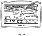
- the weather according to progress along the calculated route can be shown as a side progress bar ( Figure 18 ).
- the weather conditions are shown as portions of the side bar and the progress of the user through the weather conditions, depending upon location along the calculated route is shown by an icon depicting the user's progress.
- the user may not be content with the weather conditions to be encountered along the route calculated.
- the user interface can allow the user an opportunity to re-calculate the route by changing a start time.
- the user can be permitted to specify the weather conditions preferred en-route and so the route calculator 241 can cooperate with the weather data processor engine 244 in order calculate a route that obviates or minimises certain specified undesirable weather conditions.
- weather data may be obtained from an independent source of weather data and recalculation of the weather data presented may be necessary as a result of the weather data being provided in respect of predefined time intervals, for example 30 minute periods of time, but the independent source of weather data.
- a user following the calculated route may be delayed in which case the time of arrival of the user in a subsequent route part may be at a time that is outside the time interval for the weather data previously retrieved.
- a time threshold can be set to, for example, a value between 15 and 30 minutes and if the user arrives at a subsequent route part at a time in excess of the time period of the weather data already provided and in excess by the time threshold defined, the weather data processor engine 244 recalculates the weather data in respect of the subsequent route part. In another example, the weather data can be recalculated in respect of all subsequent route parts.
- the user is also provided with a "done” virtual button 352 ( Figure 15 ), which the user can press to indicate the calculated route is acceptable, a "find alternative” virtual button 354 that the user can press to cause the navigation apparatus 200 to calculate another route to the selected destination, and a “details” virtual button 356 that a user can press to reveal selectable options for the display of more detailed information concerning the currently displayed route 350.
- a "done” virtual button 352 Figure 15
- a “find alternative” virtual button 354 that the user can press to cause the navigation apparatus 200 to calculate another route to the selected destination
- a “details” virtual button 356 that a user can press to reveal selectable options for the display of more detailed information concerning the currently displayed route 350.
- the navigation apparatus can be arranged to provide alerts based upon the weather data obtained, for example an advice when improved weather conditions are likely to be encountered.
- the navigation apparatus can be arranged to show weather conditions and progression along the calculated route in an animated manner.
- the progression of the weather conditions can therefore be combined with an indicator of the location along the calculated route.
- the weather data can be supplemented with or replaced by other types of data, for example ambient light level data, such as data indicative of the existence of sunlight or moonlight. This can allow users to be informed as to whether they will be driving, for example in the rain and in the dark.
- ambient light level data such as data indicative of the existence of sunlight or moonlight.
- the navigation apparatus may utilise any kind of position sensing technology as an alternative to (or indeed in addition to) the GPS.
- the navigation apparatus may utilise other global navigation satellite systems (GNSS) such as the proposed European Galileo system when available.
- GNSS global navigation satellite systems
- LORAN long range navigation
- Alternative embodiments can be implemented as a computer program product for use with a computer system, the computer program product being, for example, a series of computer instructions stored on a tangible data recording medium, such as a diskette, CD-ROM, ROM, or fixed disk, or embodied in a computer data signal, the signal being transmitted over a tangible medium or a wireless medium, for example, microwave or infrared.
- the series of computer instructions can constitute all or part of the functionality described above, and can also be stored in any memory device, volatile or non-volatile, such as semiconductor, magnetic, optical or other memory device.
Landscapes
- Engineering & Computer Science (AREA)
- Radar, Positioning & Navigation (AREA)
- Remote Sensing (AREA)
- General Physics & Mathematics (AREA)
- Physics & Mathematics (AREA)
- Automation & Control Theory (AREA)
- Environmental & Geological Engineering (AREA)
- Atmospheric Sciences (AREA)
- Environmental Sciences (AREA)
- Ecology (AREA)
- Biodiversity & Conservation Biology (AREA)
- Life Sciences & Earth Sciences (AREA)
- Navigation (AREA)
Claims (8)
- Appareil de navigation comprenant :une ressource de traitement agencée de façon à prendre en charge, lorsqu'elle est en utilisation, un environnement opérationnel, l'environnement opérationnel prenant en charge un calculateur d'itinéraires (241), un module d'estimation de temps (242), un module de segmentation d'itinéraires (243), et un moteur de traitement de données météorologiques (244) ;un module interface d'utilisateur (245) ;une base de données cartographiques (254) comprenant des données géospatiales ;le calculateur d'itinéraires (241) étant agencé de façon à calculer, lorsqu'il est en utilisation, un itinéraire entre une première localisation et une deuxième localisation à un moment de démarrage particulier du déplacement ;le module d'estimation de temps (242) étant agencé de façon à estimer un moment auquel un utilisateur va être présent à une localisation le long de l'itinéraire ;le module de segmentation d'itinéraire (243) étant agencé de façon à diviser l'itinéraire en une pluralité de parties d'itinéraire et à obtenir, à partir du module d'estimation de temps, au moins un temps de présence associé à au moins une partie parmi la pluralité de parties d'itinéraire ;le moteur de traitement de données météorologiques (244) étant agencé de façon à fournir des données météorologiques associées à une partie d'itinéraire de la pluralité de parties d'itinéraire par rapport au temps de présence associé à la partie d'itinéraire ; etle module interface d'utilisateur (245) étant agencé de façon à communiquer à l'utilisateur les données météorologiques relatives à un certain nombre de la pluralité de parties d'itinéraire et à des moments de présence respectifs associés au nombre de la pluralité de parties d'itinéraire, les données météorologiques étant communiquées de manière graphique en combinaison avec une carte qui est divisée en tranches concordant avec les parties d'itinéraire afin de montrer, pour chaque tranche, les conditions météorologiques à l'extérieur de l'itinéraire qui ont été ou seront manquées aux moments de présence respectifs associés à la partie d'itinéraire respective, et le module interface d'utilisateur étant agencé en outre de façon à recevoir une instruction pour re-calculer l'itinéraire après la communication des données météorologiques en changeant le temps de démarrage du déplacement, et le calculateur d'itinéraires (241) étant agencé de façon à re-calculer l'itinéraire en réaction à l'instruction pour re-calculer l'itinéraire.
- Appareil tel que revendiqué dans l'une quelconque des revendications précédentes, dans lequel le module interface d'utilisateur (245) est agencé de façon à communiquer à l'utilisateur des données météorologiques relatives à une, quelques-unes ou toutes les parties d'itinéraire de l'itinéraire re-calculé.
- Appareil tel que revendiqué dans l'une quelconque des revendications précédentes, dans lequel le moteur de traitement de données météorologiques (244) est agencé de façon à obtenir les données météorologiques à partir d'une source de données météorologiques distante de l'appareil de navigation.
- Appareil tel que revendiqué dans l'une quelconque des revendications précédentes, dans lequel le calculateur d'itinéraires (241) est agencé de manière à recevoir des données de préférence météorologiques fournies par l'utilisateur et à coopérer avec le moteur de traitement de données météorologiques (244) afin de calculer l'itinéraire de sorte à tenter de satisfaire à une préférence météorologique représentée par les données de préférence météorologiques.
- Procédé de fourniture d'informations de conditions météorologiques sur un appareil de navigation, le procédé comprenant :le fait de calculer un itinéraire entre une première localisation et une deuxième localisation à un moment de démarrage particulier du déplacement (402) ;le fait de diviser l'itinéraire en une pluralité de parties d'itinéraire (406) ;le fait d'estimer un moment auquel un utilisateur va être présent à une localisation le long de l'itinéraire associé à au moins une partie parmi la pluralité de parties d'itinéraire (408) ;le fait de fournir des données météorologiques associées à une partie d'itinéraire de la pluralité de parties d'itinéraire par rapport au temps de présence associé à la partie d'itinéraire (410) ;le fait de communiquer à l'utilisateur les données météorologiques relatives à un certain nombre de la pluralité de parties d'itinéraire et à des moments de présence respectifs associés au nombre de la pluralité de parties d'itinéraire (412, 414), les données météorologiques étant communiquées de manière graphique en combinaison avec une carte qui est divisée en tranches concordant avec les parties d'itinéraire afin de montrer, pour chaque tranche, les conditions météorologiques à l'extérieur de l'itinéraire qui ont été ou seront manquées aux moments de présence respectifs associés à la partie d'itinéraire respective ; etle fait de recevoir une instruction pour re-calculer l'itinéraire après la communication des données météorologiques en changeant le temps de démarrage du déplacement, comprenant en outre le fait de re-calculer l'itinéraire en réaction à l'instruction pour re-calculer l'itinéraire.
- Procédé tel que revendiqué dans la revendication 5, comprenant en outre :
l'obtention des données météorologiques (410) à partir d'une source de données météorologiques distante de l'appareil de navigation. - Procédé tel que revendiqué dans la revendication 5 ou 6, comprenant en outre :la réception de données de préférence météorologiques fournies par l'utilisateur ; etle calcul de l'itinéraire (402) de sorte à tenter de satisfaire à une préférence météorologique représentée par les données de préférence météorologiques.
- Logiciel informatique comprenant des instructions lisibles par ordinateur qui, lorsqu'elles sont exécutées par un processeur d'un appareil de navigation, obligent le processeur à réaliser le procédé de l'une quelconque des revendications 5 à 7.
Applications Claiming Priority (1)
| Application Number | Priority Date | Filing Date | Title |
|---|---|---|---|
| PCT/EP2010/070968 WO2012089280A1 (fr) | 2010-12-31 | 2010-12-31 | Appareil de navigation et procédé d'obtention d'informations de conditions météorologiques |
Publications (2)
| Publication Number | Publication Date |
|---|---|
| EP2659231A1 EP2659231A1 (fr) | 2013-11-06 |
| EP2659231B1 true EP2659231B1 (fr) | 2019-04-24 |
Family
ID=44546129
Family Applications (1)
| Application Number | Title | Priority Date | Filing Date |
|---|---|---|---|
| EP10801588.4A Active EP2659231B1 (fr) | 2010-12-31 | 2010-12-31 | Appareil de navigation et procédé d'obtention d'informations de conditions météorologiques |
Country Status (3)
| Country | Link |
|---|---|
| US (2) | US9395201B2 (fr) |
| EP (1) | EP2659231B1 (fr) |
| WO (1) | WO2012089280A1 (fr) |
Families Citing this family (30)
| Publication number | Priority date | Publication date | Assignee | Title |
|---|---|---|---|---|
| CN102795250A (zh) * | 2012-08-27 | 2012-11-28 | 白维 | 轨道车辆基于电子区间的组网运行调度系统 |
| CA2877453A1 (fr) | 2012-06-21 | 2013-12-27 | Cellepathy Ltd. | Determination de contexte de dispositif |
| US20150177010A1 (en) * | 2013-08-23 | 2015-06-25 | Cellepathy Ltd. | Suppressed navigation instructions |
| US9638537B2 (en) | 2012-06-21 | 2017-05-02 | Cellepathy Inc. | Interface selection in navigation guidance systems |
| US8996312B1 (en) * | 2012-06-27 | 2015-03-31 | Google Inc. | Systems, methods, and computer-readable media for providing alternative trips for a computer-implemented trip search |
| US10324231B2 (en) | 2013-04-04 | 2019-06-18 | Sky Motion Research, Ulc | Method and system for combining localized weather forecasting and itinerary planning |
| US10330827B2 (en) | 2013-04-04 | 2019-06-25 | Sky Motion Research, Ulc | Method and system for displaying weather information on a timeline |
| US10203219B2 (en) | 2013-04-04 | 2019-02-12 | Sky Motion Research Ulc | Method and system for displaying nowcasts along a route on a map |
| US10495785B2 (en) | 2013-04-04 | 2019-12-03 | Sky Motion Research, Ulc | Method and system for refining weather forecasts using point observations |
| US20140372038A1 (en) * | 2013-04-04 | 2014-12-18 | Sky Motion Research, Ulc | Method for generating and displaying a nowcast in selectable time increments |
| TWI631361B (zh) | 2013-06-26 | 2018-08-01 | 加拿大商天勢研究無限公司 | 用於在時間軸上顯示氣象資訊之方法及系統 |
| ES2712167T3 (es) * | 2013-07-31 | 2019-05-09 | Navpos Systems Gmbh | Procedimiento para transmitir información meteorológica y/o información de predicción meteorológica |
| CN104457767B (zh) | 2013-09-18 | 2019-03-01 | 腾讯科技(深圳)有限公司 | 实现位置服务的方法和装置 |
| US9459117B2 (en) | 2013-12-20 | 2016-10-04 | Google Inc. | Interactive user interface providing weather information and available trips |
| US10388169B2 (en) * | 2014-07-17 | 2019-08-20 | Airbus Group India Private Limited | System and method for providing in-flight weather information to compute an optimized vertical flight profile |
| US9691288B2 (en) * | 2014-07-17 | 2017-06-27 | Airbus Group India Private Limited | System and method for sending in-flight weather alerts |
| US10371536B2 (en) * | 2014-10-20 | 2019-08-06 | Tomtom Navigation B.V. | Alternative routes |
| US10371543B1 (en) * | 2016-01-05 | 2019-08-06 | Open Invention Network Llc | Navigation application providing supplemental navigation information |
| US10101170B2 (en) * | 2017-01-09 | 2018-10-16 | International Business Machines Corporation | Predicting an impact of a moving phenomenon on a travelling vehicle |
| JP2018119842A (ja) * | 2017-01-24 | 2018-08-02 | トヨタ自動車株式会社 | 車両用情報出力システム |
| US11294096B2 (en) | 2017-11-03 | 2022-04-05 | The Tomorrow Companies Inc. | Real-time data pipeline techniques for improving a fast weather forecasting system |
| FR3088716B1 (fr) * | 2018-11-16 | 2020-10-30 | Ifp Energies Now | Procede de determination d’un cumul d’intemperies sur un trajet |
| USD926097S1 (en) * | 2019-10-04 | 2021-07-27 | Volkswagen Aktiengesellschaft | Instrument panel for media and navigation system |
| USD926096S1 (en) * | 2019-11-08 | 2021-07-27 | Volkswagen Aktiengesellschaft | Instrument panel for media and navigation system |
| CN110941776B (zh) * | 2020-01-03 | 2023-05-12 | 成都中科大旗软件股份有限公司 | 基于移动智能端的景区导览系统 |
| JP6937856B2 (ja) * | 2020-02-13 | 2021-09-22 | 本田技研工業株式会社 | 運転支援装置および車両 |
| USD937165S1 (en) * | 2020-08-26 | 2021-11-30 | Atieva Inc. | Retractable, vehicular, center console display screen |
| CN113715845A (zh) * | 2021-09-07 | 2021-11-30 | 北京百度网讯科技有限公司 | 一种自动驾驶方法、装置及电子设备 |
| US20230194276A1 (en) * | 2021-12-22 | 2023-06-22 | Red Hat, Inc. | Determining navigation route based on environmental factors |
| CN116612666A (zh) * | 2023-06-05 | 2023-08-18 | 中国银行股份有限公司 | 船舶航行的告警方法、装置及设备 |
Family Cites Families (22)
| Publication number | Priority date | Publication date | Assignee | Title |
|---|---|---|---|---|
| US5911775A (en) * | 1996-10-08 | 1999-06-15 | Alpine Electronics, Inc. | Return point route searching for vehicle navigation |
| JP3606736B2 (ja) | 1998-04-30 | 2005-01-05 | 松下電器産業株式会社 | 気象衛星データ受信機能付カーナビゲーション装置 |
| JPH11344349A (ja) | 1998-06-03 | 1999-12-14 | Toyota Motor Corp | 車両用経路案内装置および車両用経路案内装置用プログラムを記憶した媒体 |
| JP3915290B2 (ja) | 1998-12-24 | 2007-05-16 | 株式会社デンソー | 経路設定装置及びナビゲーション装置 |
| JP4197790B2 (ja) * | 1999-03-12 | 2008-12-17 | ウェザー・サービス株式会社 | ナビゲーション装置,ナビゲーションシステム,および気象情報提供サーバ |
| US6795823B1 (en) * | 2000-08-31 | 2004-09-21 | Neoris Logistics, Inc. | Centralized system and method for optimally routing and tracking articles |
| EP1355130B1 (fr) | 2002-04-17 | 2013-12-04 | Hitachi, Ltd. | Système de navigation utilisant des télécommunications |
| US6839628B1 (en) * | 2003-06-13 | 2005-01-04 | Alpine Electronics, Inc | Display method and apparatus for arranging order of listing points of interest for navigation system |
| US7155339B2 (en) * | 2003-06-13 | 2006-12-26 | Alpine Electronics, Inc. | Display method and apparatus for navigation system for searching POI and arranging listing order of POI |
| JP4896613B2 (ja) * | 2006-07-20 | 2012-03-14 | ヤマハ発動機株式会社 | 車両 |
| US8036822B2 (en) * | 2006-09-12 | 2011-10-11 | Dds Wireless International Inc. | Travel time determination |
| WO2008091574A1 (fr) * | 2007-01-22 | 2008-07-31 | Truenorth Global Inc. | Système intégré d'affichage de conditions météorologiques et de décision facilitant les déplacements et la navigation |
| US8543628B2 (en) * | 2007-04-17 | 2013-09-24 | Cypress Semiconductor Corporation | Method and system of digital signal processing |
| JP4555321B2 (ja) * | 2007-07-25 | 2010-09-29 | クラリオン株式会社 | 経路探索装置、およびその経路探索方法 |
| DE102007037938A1 (de) | 2007-08-11 | 2009-02-12 | Bayerische Motoren Werke Aktiengesellschaft | Kraftfahrzeug-Navigationssystem |
| US8140335B2 (en) * | 2007-12-11 | 2012-03-20 | Voicebox Technologies, Inc. | System and method for providing a natural language voice user interface in an integrated voice navigation services environment |
| JP4513881B2 (ja) * | 2008-03-07 | 2010-07-28 | 株式会社デンソー | カーナビゲーション装置 |
| JP2009244068A (ja) | 2008-03-31 | 2009-10-22 | Xanavi Informatics Corp | ナビゲーション装置 |
| US8493408B2 (en) * | 2008-11-19 | 2013-07-23 | Apple Inc. | Techniques for manipulating panoramas |
| US9037397B2 (en) * | 2009-12-07 | 2015-05-19 | Intel Corporation | System and method for generating alternative routes |
| US8924142B2 (en) * | 2009-12-29 | 2014-12-30 | Blackberry Limited | System and method of representing route information |
| US20110166777A1 (en) * | 2010-01-07 | 2011-07-07 | Anand Kumar Chavakula | Navigation Application |
-
2010
- 2010-12-31 EP EP10801588.4A patent/EP2659231B1/fr active Active
- 2010-12-31 US US13/977,795 patent/US9395201B2/en not_active Expired - Fee Related
- 2010-12-31 WO PCT/EP2010/070968 patent/WO2012089280A1/fr not_active Ceased
-
2016
- 2016-07-18 US US15/212,368 patent/US10393538B2/en active Active
Non-Patent Citations (1)
| Title |
|---|
| None * |
Also Published As
| Publication number | Publication date |
|---|---|
| US10393538B2 (en) | 2019-08-27 |
| US20130345979A1 (en) | 2013-12-26 |
| US20160327406A1 (en) | 2016-11-10 |
| EP2659231A1 (fr) | 2013-11-06 |
| US9395201B2 (en) | 2016-07-19 |
| WO2012089280A1 (fr) | 2012-07-05 |
Similar Documents
| Publication | Publication Date | Title |
|---|---|---|
| US10393538B2 (en) | Navigation apparatus and method of providing weather condition information | |
| US8756000B2 (en) | Navigation apparatus and method of detection that a parking facility is sought | |
| US8914224B2 (en) | Navigation device and method | |
| US8244454B2 (en) | Navigation device and method | |
| US8793033B2 (en) | Satellite signal acquisition apparatus, navigation apparatus and method of acquiring a satellite signal | |
| US20110125398A1 (en) | Navigation apparatus, server apparatus and method of providing point of interest data | |
| US20160054137A1 (en) | Navigation device with enhanced widgets and applications | |
| TW201232486A (en) | Navigation apparatus and method of providing weather condition information | |
| CN101903747A (zh) | 导航装置及方法 | |
| WO2010040386A1 (fr) | Appareil de navigation et procédé de détermination d’un trajet pour celui-ci | |
| US8886455B2 (en) | Navigation apparatus, audible instruction generation system and method of generating audible instructions | |
| WO2012089284A2 (fr) | Procédé de communication d'un contenu à un utilisateur, appareil informatique mobile et système de livraison de contenu | |
| WO2012089283A1 (fr) | Procédé de communication d'un contenu à un utilisateur, dispositif de calcul mobile, et système de diffusion de contenu | |
| WO2010081542A1 (fr) | Système et procédé de navigation | |
| WO2010012295A1 (fr) | Appareil et procédé de navigation et logiciel d'ordinateur destiné à être utilisé dans ceux-ci | |
| HK1150657A (en) | Navigation device & method |
Legal Events
| Date | Code | Title | Description |
|---|---|---|---|
| PUAI | Public reference made under article 153(3) epc to a published international application that has entered the european phase |
Free format text: ORIGINAL CODE: 0009012 |
|
| 17P | Request for examination filed |
Effective date: 20130731 |
|
| AK | Designated contracting states |
Kind code of ref document: A1 Designated state(s): AL AT BE BG CH CY CZ DE DK EE ES FI FR GB GR HR HU IE IS IT LI LT LU LV MC MK MT NL NO PL PT RO RS SE SI SK SM TR |
|
| DAX | Request for extension of the european patent (deleted) | ||
| RAP1 | Party data changed (applicant data changed or rights of an application transferred) |
Owner name: TOMTOM INTERNATIONAL B.V. |
|
| 17Q | First examination report despatched |
Effective date: 20140930 |
|
| RIC1 | Information provided on ipc code assigned before grant |
Ipc: G01C 21/36 20060101AFI20180830BHEP |
|
| GRAP | Despatch of communication of intention to grant a patent |
Free format text: ORIGINAL CODE: EPIDOSNIGR1 |
|
| STAA | Information on the status of an ep patent application or granted ep patent |
Free format text: STATUS: GRANT OF PATENT IS INTENDED |
|
| RAP1 | Party data changed (applicant data changed or rights of an application transferred) |
Owner name: TOMTOM NAVIGATION B.V. |
|
| INTG | Intention to grant announced |
Effective date: 20181113 |
|
| GRAS | Grant fee paid |
Free format text: ORIGINAL CODE: EPIDOSNIGR3 |
|
| GRAA | (expected) grant |
Free format text: ORIGINAL CODE: 0009210 |
|
| STAA | Information on the status of an ep patent application or granted ep patent |
Free format text: STATUS: THE PATENT HAS BEEN GRANTED |
|
| AK | Designated contracting states |
Kind code of ref document: B1 Designated state(s): AL AT BE BG CH CY CZ DE DK EE ES FI FR GB GR HR HU IE IS IT LI LT LU LV MC MK MT NL NO PL PT RO RS SE SI SK SM TR |
|
| REG | Reference to a national code |
Ref country code: GB Ref legal event code: FG4D |
|
| REG | Reference to a national code |
Ref country code: CH Ref legal event code: EP |
|
| REG | Reference to a national code |
Ref country code: AT Ref legal event code: REF Ref document number: 1124671 Country of ref document: AT Kind code of ref document: T Effective date: 20190515 Ref country code: IE Ref legal event code: FG4D |
|
| REG | Reference to a national code |
Ref country code: DE Ref legal event code: R096 Ref document number: 602010058448 Country of ref document: DE |
|
| REG | Reference to a national code |
Ref country code: NL Ref legal event code: FP |
|
| REG | Reference to a national code |
Ref country code: LT Ref legal event code: MG4D |
|
| PG25 | Lapsed in a contracting state [announced via postgrant information from national office to epo] |
Ref country code: NO Free format text: LAPSE BECAUSE OF FAILURE TO SUBMIT A TRANSLATION OF THE DESCRIPTION OR TO PAY THE FEE WITHIN THE PRESCRIBED TIME-LIMIT Effective date: 20190724 Ref country code: ES Free format text: LAPSE BECAUSE OF FAILURE TO SUBMIT A TRANSLATION OF THE DESCRIPTION OR TO PAY THE FEE WITHIN THE PRESCRIBED TIME-LIMIT Effective date: 20190424 Ref country code: LT Free format text: LAPSE BECAUSE OF FAILURE TO SUBMIT A TRANSLATION OF THE DESCRIPTION OR TO PAY THE FEE WITHIN THE PRESCRIBED TIME-LIMIT Effective date: 20190424 Ref country code: HR Free format text: LAPSE BECAUSE OF FAILURE TO SUBMIT A TRANSLATION OF THE DESCRIPTION OR TO PAY THE FEE WITHIN THE PRESCRIBED TIME-LIMIT Effective date: 20190424 Ref country code: PT Free format text: LAPSE BECAUSE OF FAILURE TO SUBMIT A TRANSLATION OF THE DESCRIPTION OR TO PAY THE FEE WITHIN THE PRESCRIBED TIME-LIMIT Effective date: 20190824 Ref country code: SE Free format text: LAPSE BECAUSE OF FAILURE TO SUBMIT A TRANSLATION OF THE DESCRIPTION OR TO PAY THE FEE WITHIN THE PRESCRIBED TIME-LIMIT Effective date: 20190424 Ref country code: AL Free format text: LAPSE BECAUSE OF FAILURE TO SUBMIT A TRANSLATION OF THE DESCRIPTION OR TO PAY THE FEE WITHIN THE PRESCRIBED TIME-LIMIT Effective date: 20190424 Ref country code: FI Free format text: LAPSE BECAUSE OF FAILURE TO SUBMIT A TRANSLATION OF THE DESCRIPTION OR TO PAY THE FEE WITHIN THE PRESCRIBED TIME-LIMIT Effective date: 20190424 |
|
| PG25 | Lapsed in a contracting state [announced via postgrant information from national office to epo] |
Ref country code: RS Free format text: LAPSE BECAUSE OF FAILURE TO SUBMIT A TRANSLATION OF THE DESCRIPTION OR TO PAY THE FEE WITHIN THE PRESCRIBED TIME-LIMIT Effective date: 20190424 Ref country code: LV Free format text: LAPSE BECAUSE OF FAILURE TO SUBMIT A TRANSLATION OF THE DESCRIPTION OR TO PAY THE FEE WITHIN THE PRESCRIBED TIME-LIMIT Effective date: 20190424 Ref country code: GR Free format text: LAPSE BECAUSE OF FAILURE TO SUBMIT A TRANSLATION OF THE DESCRIPTION OR TO PAY THE FEE WITHIN THE PRESCRIBED TIME-LIMIT Effective date: 20190725 Ref country code: BG Free format text: LAPSE BECAUSE OF FAILURE TO SUBMIT A TRANSLATION OF THE DESCRIPTION OR TO PAY THE FEE WITHIN THE PRESCRIBED TIME-LIMIT Effective date: 20190724 Ref country code: PL Free format text: LAPSE BECAUSE OF FAILURE TO SUBMIT A TRANSLATION OF THE DESCRIPTION OR TO PAY THE FEE WITHIN THE PRESCRIBED TIME-LIMIT Effective date: 20190424 |
|
| REG | Reference to a national code |
Ref country code: AT Ref legal event code: MK05 Ref document number: 1124671 Country of ref document: AT Kind code of ref document: T Effective date: 20190424 |
|
| PG25 | Lapsed in a contracting state [announced via postgrant information from national office to epo] |
Ref country code: IS Free format text: LAPSE BECAUSE OF FAILURE TO SUBMIT A TRANSLATION OF THE DESCRIPTION OR TO PAY THE FEE WITHIN THE PRESCRIBED TIME-LIMIT Effective date: 20190824 |
|
| REG | Reference to a national code |
Ref country code: DE Ref legal event code: R097 Ref document number: 602010058448 Country of ref document: DE |
|
| PG25 | Lapsed in a contracting state [announced via postgrant information from national office to epo] |
Ref country code: CZ Free format text: LAPSE BECAUSE OF FAILURE TO SUBMIT A TRANSLATION OF THE DESCRIPTION OR TO PAY THE FEE WITHIN THE PRESCRIBED TIME-LIMIT Effective date: 20190424 Ref country code: SK Free format text: LAPSE BECAUSE OF FAILURE TO SUBMIT A TRANSLATION OF THE DESCRIPTION OR TO PAY THE FEE WITHIN THE PRESCRIBED TIME-LIMIT Effective date: 20190424 Ref country code: EE Free format text: LAPSE BECAUSE OF FAILURE TO SUBMIT A TRANSLATION OF THE DESCRIPTION OR TO PAY THE FEE WITHIN THE PRESCRIBED TIME-LIMIT Effective date: 20190424 Ref country code: AT Free format text: LAPSE BECAUSE OF FAILURE TO SUBMIT A TRANSLATION OF THE DESCRIPTION OR TO PAY THE FEE WITHIN THE PRESCRIBED TIME-LIMIT Effective date: 20190424 Ref country code: DK Free format text: LAPSE BECAUSE OF FAILURE TO SUBMIT A TRANSLATION OF THE DESCRIPTION OR TO PAY THE FEE WITHIN THE PRESCRIBED TIME-LIMIT Effective date: 20190424 Ref country code: RO Free format text: LAPSE BECAUSE OF FAILURE TO SUBMIT A TRANSLATION OF THE DESCRIPTION OR TO PAY THE FEE WITHIN THE PRESCRIBED TIME-LIMIT Effective date: 20190424 |
|
| PG25 | Lapsed in a contracting state [announced via postgrant information from national office to epo] |
Ref country code: SM Free format text: LAPSE BECAUSE OF FAILURE TO SUBMIT A TRANSLATION OF THE DESCRIPTION OR TO PAY THE FEE WITHIN THE PRESCRIBED TIME-LIMIT Effective date: 20190424 Ref country code: IT Free format text: LAPSE BECAUSE OF FAILURE TO SUBMIT A TRANSLATION OF THE DESCRIPTION OR TO PAY THE FEE WITHIN THE PRESCRIBED TIME-LIMIT Effective date: 20190424 |
|
| PLBE | No opposition filed within time limit |
Free format text: ORIGINAL CODE: 0009261 |
|
| STAA | Information on the status of an ep patent application or granted ep patent |
Free format text: STATUS: NO OPPOSITION FILED WITHIN TIME LIMIT |
|
| PG25 | Lapsed in a contracting state [announced via postgrant information from national office to epo] |
Ref country code: TR Free format text: LAPSE BECAUSE OF FAILURE TO SUBMIT A TRANSLATION OF THE DESCRIPTION OR TO PAY THE FEE WITHIN THE PRESCRIBED TIME-LIMIT Effective date: 20190424 |
|
| 26N | No opposition filed |
Effective date: 20200127 |
|
| PG25 | Lapsed in a contracting state [announced via postgrant information from national office to epo] |
Ref country code: SI Free format text: LAPSE BECAUSE OF FAILURE TO SUBMIT A TRANSLATION OF THE DESCRIPTION OR TO PAY THE FEE WITHIN THE PRESCRIBED TIME-LIMIT Effective date: 20190424 |
|
| REG | Reference to a national code |
Ref country code: CH Ref legal event code: PL |
|
| REG | Reference to a national code |
Ref country code: BE Ref legal event code: MM Effective date: 20191231 |
|
| PG25 | Lapsed in a contracting state [announced via postgrant information from national office to epo] |
Ref country code: MC Free format text: LAPSE BECAUSE OF FAILURE TO SUBMIT A TRANSLATION OF THE DESCRIPTION OR TO PAY THE FEE WITHIN THE PRESCRIBED TIME-LIMIT Effective date: 20190424 |
|
| PG25 | Lapsed in a contracting state [announced via postgrant information from national office to epo] |
Ref country code: LU Free format text: LAPSE BECAUSE OF NON-PAYMENT OF DUE FEES Effective date: 20191231 Ref country code: IE Free format text: LAPSE BECAUSE OF NON-PAYMENT OF DUE FEES Effective date: 20191231 |
|
| PG25 | Lapsed in a contracting state [announced via postgrant information from national office to epo] |
Ref country code: BE Free format text: LAPSE BECAUSE OF NON-PAYMENT OF DUE FEES Effective date: 20191231 Ref country code: LI Free format text: LAPSE BECAUSE OF NON-PAYMENT OF DUE FEES Effective date: 20191231 Ref country code: CH Free format text: LAPSE BECAUSE OF NON-PAYMENT OF DUE FEES Effective date: 20191231 |
|
| PG25 | Lapsed in a contracting state [announced via postgrant information from national office to epo] |
Ref country code: CY Free format text: LAPSE BECAUSE OF FAILURE TO SUBMIT A TRANSLATION OF THE DESCRIPTION OR TO PAY THE FEE WITHIN THE PRESCRIBED TIME-LIMIT Effective date: 20190424 |
|
| PG25 | Lapsed in a contracting state [announced via postgrant information from national office to epo] |
Ref country code: MT Free format text: LAPSE BECAUSE OF FAILURE TO SUBMIT A TRANSLATION OF THE DESCRIPTION OR TO PAY THE FEE WITHIN THE PRESCRIBED TIME-LIMIT Effective date: 20190424 Ref country code: HU Free format text: LAPSE BECAUSE OF FAILURE TO SUBMIT A TRANSLATION OF THE DESCRIPTION OR TO PAY THE FEE WITHIN THE PRESCRIBED TIME-LIMIT; INVALID AB INITIO Effective date: 20101231 |
|
| PG25 | Lapsed in a contracting state [announced via postgrant information from national office to epo] |
Ref country code: MK Free format text: LAPSE BECAUSE OF FAILURE TO SUBMIT A TRANSLATION OF THE DESCRIPTION OR TO PAY THE FEE WITHIN THE PRESCRIBED TIME-LIMIT Effective date: 20190424 |
|
| P01 | Opt-out of the competence of the unified patent court (upc) registered |
Effective date: 20230520 |
|
| PGFP | Annual fee paid to national office [announced via postgrant information from national office to epo] |
Ref country code: NL Payment date: 20241120 Year of fee payment: 15 |
|
| PGFP | Annual fee paid to national office [announced via postgrant information from national office to epo] |
Ref country code: GB Payment date: 20241107 Year of fee payment: 15 |
|
| PGFP | Annual fee paid to national office [announced via postgrant information from national office to epo] |
Ref country code: FR Payment date: 20241121 Year of fee payment: 15 |
|
| PGFP | Annual fee paid to national office [announced via postgrant information from national office to epo] |
Ref country code: DE Payment date: 20251104 Year of fee payment: 16 |