EP2690404B1 - Erstellen eines Geofences - Google Patents
Erstellen eines Geofences Download PDFInfo
- Publication number
- EP2690404B1 EP2690404B1 EP12177524.1A EP12177524A EP2690404B1 EP 2690404 B1 EP2690404 B1 EP 2690404B1 EP 12177524 A EP12177524 A EP 12177524A EP 2690404 B1 EP2690404 B1 EP 2690404B1
- Authority
- EP
- European Patent Office
- Prior art keywords
- map
- geofence
- area object
- starting position
- detecting
- Prior art date
- Legal status (The legal status is an assumption and is not a legal conclusion. Google has not performed a legal analysis and makes no representation as to the accuracy of the status listed.)
- Active
Links
Images

Classifications
-
- H—ELECTRICITY
- H04—ELECTRIC COMMUNICATION TECHNIQUE
- H04W—WIRELESS COMMUNICATION NETWORKS
- H04W4/00—Services specially adapted for wireless communication networks; Facilities therefor
- H04W4/02—Services making use of location information
- H04W4/021—Services related to particular areas, e.g. point of interest [POI] services, venue services or geofences
-
- G—PHYSICS
- G01—MEASURING; TESTING
- G01C—MEASURING DISTANCES, LEVELS OR BEARINGS; SURVEYING; NAVIGATION; GYROSCOPIC INSTRUMENTS; PHOTOGRAMMETRY OR VIDEOGRAMMETRY
- G01C21/00—Navigation; Navigational instruments not provided for in groups G01C1/00 - G01C19/00
- G01C21/26—Navigation; Navigational instruments not provided for in groups G01C1/00 - G01C19/00 specially adapted for navigation in a road network
- G01C21/34—Route searching; Route guidance
- G01C21/36—Input/output arrangements for on-board computers
- G01C21/3679—Retrieval, searching and output of POI information, e.g. hotels, restaurants, shops, filling stations, parking facilities
- G01C21/3685—Retrieval, searching and output of POI information, e.g. hotels, restaurants, shops, filling stations, parking facilities the POI's being parking facilities
-
- G—PHYSICS
- G01—MEASURING; TESTING
- G01C—MEASURING DISTANCES, LEVELS OR BEARINGS; SURVEYING; NAVIGATION; GYROSCOPIC INSTRUMENTS; PHOTOGRAMMETRY OR VIDEOGRAMMETRY
- G01C21/00—Navigation; Navigational instruments not provided for in groups G01C1/00 - G01C19/00
- G01C21/38—Electronic maps specially adapted for navigation; Updating thereof
- G01C21/3863—Structures of map data
- G01C21/3867—Geometry of map features, e.g. shape points, polygons or for simplified maps
-
- G—PHYSICS
- G06—COMPUTING OR CALCULATING; COUNTING
- G06Q—INFORMATION AND COMMUNICATION TECHNOLOGY [ICT] SPECIALLY ADAPTED FOR ADMINISTRATIVE, COMMERCIAL, FINANCIAL, MANAGERIAL OR SUPERVISORY PURPOSES; SYSTEMS OR METHODS SPECIALLY ADAPTED FOR ADMINISTRATIVE, COMMERCIAL, FINANCIAL, MANAGERIAL OR SUPERVISORY PURPOSES, NOT OTHERWISE PROVIDED FOR
- G06Q10/00—Administration; Management
- G06Q10/08—Logistics, e.g. warehousing, loading or distribution; Inventory or stock management
-
- H—ELECTRICITY
- H04—ELECTRIC COMMUNICATION TECHNIQUE
- H04W—WIRELESS COMMUNICATION NETWORKS
- H04W4/00—Services specially adapted for wireless communication networks; Facilities therefor
- H04W4/02—Services making use of location information
- H04W4/021—Services related to particular areas, e.g. point of interest [POI] services, venue services or geofences
- H04W4/022—Services related to particular areas, e.g. point of interest [POI] services, venue services or geofences with dynamic range variability
-
- H—ELECTRICITY
- H04—ELECTRIC COMMUNICATION TECHNIQUE
- H04W—WIRELESS COMMUNICATION NETWORKS
- H04W4/00—Services specially adapted for wireless communication networks; Facilities therefor
- H04W4/02—Services making use of location information
- H04W4/025—Services making use of location information using location based information parameters
- H04W4/027—Services making use of location information using location based information parameters using movement velocity, acceleration information
-
- H—ELECTRICITY
- H04—ELECTRIC COMMUNICATION TECHNIQUE
- H04W—WIRELESS COMMUNICATION NETWORKS
- H04W4/00—Services specially adapted for wireless communication networks; Facilities therefor
- H04W4/30—Services specially adapted for particular environments, situations or purposes
- H04W4/40—Services specially adapted for particular environments, situations or purposes for vehicles, e.g. vehicle-to-pedestrians [V2P]
Definitions
- the present invention relates to a method for automatically creating a geofence. Furthermore, the invention relates to a digital storage medium with electronically readable control signals, wherein the control signals can cooperate with a data processing device, that the above method is carried out. In addition, the invention relates to a computer program product having program code stored on a machine-readable medium for carrying out the above method when the program code is executed on a data processing device. Furthermore, the invention relates to a computer program with program code for carrying out the above method, when the program runs on a data processing device.
- a geofence can be understood as any closed geographic area.
- the area may be both a two-dimensional area on a map, for example a gas station area or a parking lot on a logistics yard, or even a three-dimensional area, for example an airport with an entry lane or a flight corridor.
- a geofence can also cover a whole country or a continent.
- geofences have a major impact on logistics, where they can influence the planning of routes as well as the support of critical processes and operations.
- geofences support the tracking of any objects.
- geofences are used to mark areas that are of great importance to dispatchers or the tracking of means of transport (assets) or shipments in them Enable areas.
- notifications may include messages such as "a truck has entered a critical area" or "a ship has left the port”.
- geofences are manually defined. For this purpose, for example, borders are drawn manually on a map, which define the geofence, which entails a very high outlay and thus costs.
- the definition and storage of geofences takes place using position data, such as longitude and latitude. The geofences are then stored digitally for the application.
- the manual method of creating geofences is unsuitable because of the high cost. All identified geopositions must be searched for on the map and adjusted manually.
- the starting positions may be defined, for example, by gas stations, airports, ports, distribution centers or the like, as well as by countries or cities.
- a geofence engineer needs to go to a map's home position, then visually recognize geofence boundaries on the map, and manually create geofence boundaries.
- An additional problem can in that the starting position may be incomplete or erroneous, whereby an inappropriate geofence may be generated from the map. Because the geofence creation is based on the map, the geofence can be dependent on a selected map. So the geofence can vary depending on different cards used.
- a geofence can be defined which is based on current geographical positions of mobile devices.
- a boundary of a common coverage area is formed that includes the current locations, with the boundary of the common coverage area defining the geofence.
- the WO 2011/057273 A1 concerns location-based tracking based on geofences. To adjust a geofence, a section can be truncated based on position information from it.
- WO 2012/019628 A1 It is known that parking lot locations and geometries are distinguished from probe data and integrated with a digital map for use in navigation and other map related activities.
- the steps of this method include identifying the locations in the probe data where cars are likely to be parked, detecting the locations of parking lots, determining the extent and shape of the parking lots recognized parking and parking in the road network.
- the parking lot can be classified and additional attributes calculated.
- a topological connection of the parking lot with the road network is established, in which the inputs and outputs are identified.
- a geofence service that enables various remote control and automatic operations based on the current geographic location of a user as determined by a current geographic location of the user's mobile device.
- the geofence service allows the user to define one or more geofences based on specific geographic locations. Such geofences can be applied against various geofence applications for remote control and automatic device control.
- the volume or power control settings of the mobile device are adjusted based on the user's location inside or outside a geofence.
- the temperature setting of a building or home is controlled to a geofence based on the proximity of the user.
- electrical devices in a home are automatically activated and controlled based on the user's current geographic location.
- the invention is therefore based on the object, a method for Create a geofence that enables automatic creation of geofences, is easy to use, provides geofences with high accuracy, and has fault tolerance over faulty home positions.
- the invention thus provides a method for automatically creating a geofence, comprising the steps of detecting a starting position, transferring the starting position to a digital map, automatically creating a surface object on the digital map, the area object comprising the starting position, acquiring movement data of at least one mobile object in the region of the surface object, wherein the motion data comprises a velocity and / or a moving direction of the moving object, and automatically reducing the surface object to the geofence based on the motion data, wherein the step of detecting a starting position comprises selecting a point of interest.
- a digital storage medium with electronically readable control signals is specified, wherein the control signals can interact with a data processing device such that the above method is carried out.
- According to the invention is also a computer program product stored on a machine-readable carrier Program code for performing the above method indicated when the program code is executed on a data processing device.
- the invention also provides a computer program with program code for carrying out the above method when the program runs on a data processing device.
- the basic idea of the present invention is thus to enable automatic generation of the geofence by detecting movement data of at least one mobile object.
- this method is well suited. Due to the movement data, the geofence can be generated with high accuracy. Also, this method has a high tolerance to an inaccurate and even an incorrect starting position, since at least within the surface object by the motion data, an accurate creation of the geofences can be done independently and without further consideration of the initial position. By using motion data from multiple moving objects or a moving object that has moved multiple times in the area of the surface object, the geofence can be created in great detail.
- the "points of interest” usually comprise a geographical indication that can be simply used as a starting position or converted into a starting position, and usually a position type, for example "gas station".
- a position type for example "gas station”.
- POIs Various types of POIs are available so that geofences can be created with little effort using such available information.
- a moving object can be any object whose motion can be detected.
- the moving objects may be any means of transport having a GPS receiver and configured to transmit their position during operation.
- the means of transport may include cars, trucks, buses, ships and the like.
- the moving objects can also be independent of the means of transport and can only be carried along with them, for example a mobile telephone with a GPS receiver.
- the acquisition of the movement data can also be done by external monitoring of the moving objects.
- the aforementioned mobile phones can be monitored by the network operator, for example, so that their position can be determined via GSM triangulation, via radio cell location and / or via WLAN localization.
- vehicles can over Mobile telephones can be monitored by the network operator, for example, so that their position can be determined via GSM triangulation, via radio cell location and / or via WLAN localization.
- Vehicles can also be recognized by a unique identifier, eg their license plate, which is read out at predefined positions, wherein, for example, a speed of the vehicle can be detected at the same time.
- the capture of movement data of the at least one movable object in the region of the surface object can, in principle, take place at any desired time.
- the detection can be done globally by permanently monitoring the moving objects. Then, to create the geofence, a selection of movement data relating to the area object takes place.
- the digital map can be embodied as an abstract representation in the manner of a road map, a terrain map or the like or as a realistic representation in the manner of a satellite photo or a combination thereof.
- the surface object can in principle have any shape.
- the surface object preferably has a geometric standard form, for example a circle, a triangle, a quadrangle or the like. Particularly preferably, the starting position is the center of the surface object.
- the movement data includes a position and a speed and / or a direction of movement of the respective moving object.
- the speed and direction of the respective mobile object can alternatively be determined from a chronological sequence of position data.
- the method is a digital method, which is usually performed with a data processing device, such as a computer.
- the method is developed in such a way that the step of automatically reducing the area object to the geofence includes recognizing areas covered by the geofence. In other words, there is a positive recognition of areas of the area object belonging to the geofence. Various methods for positive detection are possible. Preferably, areas in which the at least one movable object has been included are added to the geofence.
- areas in which the at least one movable object has moved with at least one predetermined limit speed are added to the geofence.
- a speed limit of more than 60 km / h may indicate a highway, so that the areas where the at least one moving object has moved at a typical truck speed of 80 km / h are added to the geofence when geofence, for example, affects the highway.
- limit speeds may be selected, for example 0 km / h for a movement, 7 km / h for a walking speed, 30 km / h or 50 km / h for speeds in a locality, 60 km / h for a country road, 80 km / h for a motorway or 90 km / h for exceeding the allowed speed in a truck. More preferably, a corridor having an upper and a lower limit speed is formed.
- the method is developed in such a way that the step of automatically reducing the area object to the geofence includes recognizing areas outside the geofence.
- the step of automatically reducing the area object to the geofence includes recognizing areas outside the geofence.
- Various methods for negative detection are possible.
- areas in which the at least one movable object has not been stopped are not covered by the geofence.
- areas in which the at least one movable object has moved with at least one predetermined limit speed are not covered by the geofence.
- a speed limit of more than 60 km / h may indicate a highway, so that the areas where the at least one moving object has moved at a typical truck speed of 80 km / h are not covered by the geofence, For example, if the geofence concerns a motorway service station.
- other limit speeds may be selected, for example 0 km / h for one movement, 7 km / h for a walking speed, 30 km / h or 50 km / h for speeds in a locality, 60 km / h for a country road, 80 km / h. h for a highway or 90 km / h for exceeding the allowed speed in a truck.
- a corridor having an upper and a lower limit speed is formed.
- the method is developed such that the step of acquiring movement data of at least one mobile object in the area of the area object includes generating a motion profile of the at least one mobile object, and the step of automatically reducing the area object to the geofence based on the motion data includes analyzing the motion profile of the at least one mobile object.
- the motion profiles may include local areas such as distances or areas, speeds and / or time sequences.
- a more sophisticated motion profile for the gas station may include slowly reducing the speed to zero, then stopping for a predetermined duration, and finally accelerating. Thus, the gas station can be safely separated from a rest area, where the length of stay is usually longer than the predetermined duration.
- the method is developed in such a way that the method comprises the step of detecting a position type to the starting position, and the step of automatically reducing the surface object to the geofence based on the movement data comprises the evaluation of the movement data depending on the position type.
- various types of geofences can be created, which can be determined in different ways by the movement data.
- a highway may be detected by a speed of the at least one moving object greater than 60 km / h while in an urban area the speed is limited to 50 km / h.
- various types of moving objects can move differently. In a port, ships usually move with only a few, slow changes in direction, while land vehicles have a higher speed with rapid changes in direction. Accordingly, for example, a harbor basin can be easily identified by means of a corresponding movement profile for creating a geofence.
- the method is developed such that the method comprises the step of detecting a position type to the starting position, and the step of automatically creating a surface object on the digital map comprises creating the surface object depending on the position type.
- the surface object can be adapted to accelerate the generation of geofences, on the one hand by eliminating irrelevant areas and avoiding the exclusion of relevant areas.
- a geofence for a gas station is usually smaller than one for a container port.
- a uniform area object is used, the size of which is selected depending on the position type.
- the shape of the surface object may be selected depending on the position type.
- the method is developed such that the step of detecting a starting position comprises receiving a geographical indication.
- the geographical indication can be designed differently, for example as a coordinate pair for direct assignment on the map.
- a location of a moving object can be detected at a certain time as a starting position.
- the method is developed in such a way that the step of receiving a geographical indication comprises receiving an abstract map information and converting the abstract map information into the starting position.
- the abstract map information may be, for example, an address or a landmark.
- An address can be converted, for example, by a "Reverse Address Service" into position data for the starting position.
- the starting position is initially determined without using the card.
- a plurality of geofences may be based on an automatic read in of a plurality Addresses are easily created, since a manual capture of the starting position is eliminated.
- the method is developed such that the step of automatically creating a surface object on the digital map comprises automatically generating the area object on the map based on map contents.
- the area object can already be created with good accuracy, and the cost of reduction to the geofence is low.
- the map contents may be different contents depending on the card used.
- the map contents can be distinguished by different color schemes, such as blue for a lake or river.
- a street or a building can each have a different color, whereby these areas can be automatically distinguished.
- the method is developed in such a way that the step of automatically generating the area object on the card based on card contents comprises the following steps: Detecting a map color at the home position, detecting a first boundary point of the area object by detecting the change of the color of the map relative to the map color at the home position, detecting at least one further boundary point of the area object by detecting the change of the color of the map relative to the map color at the starting position at a predetermined distance from the respective previous boundary point, generating the surface object by connecting the boundary points.
- This method defines the surface object by the color change on the map based on the color of the home position. The method may be performed depending on a desired accuracy of the geofence for a different number of boundary points. Alternatively, other methods may be used.
- the method is developed in such a way that the step of automatically generating the area object on the map based on map contents includes automatically creating a boundary object on the digital map, wherein the boundary object comprises the home position, and the step of determining a boundary of the area object is limited by circumferentially detecting the change of the color of the map on the boundary object.
- the boundary object may be a geometric object, for example a circle or a quadrangle, in which the starting position is located, so that the automatic generation of the area object on the map can be limited to the geometric object. In principle, however, an extension of the geometric object to the surface object is possible.
- FIG. 4 shows a sequence of the inventive method for automatically creating a geofence 1.
- Various geofences 1 are in the FIGS. 1 to 3 shown.
- step S100 The process starts in step S100 with the detection of a home position. Accordingly, a geographical indication is received, which is an address in this embodiment as abstract map information. The address is converted by a "Reverse Address Service” into position data in the form of a coordinate pair for the starting position.
- step S200 the detection of a position type to the home position is performed.
- the entry of the item category includes a user input.
- the home position is in this embodiment as a Defined so that the item type is "motorway service station".
- steps S100 and S200 are summarized. Accordingly, a "point of interest" (POI) is selected with a geographic indication corresponding to the home position and a location type.
- POI point of interest
- step S300 the home position is transferred to a digital map.
- the coordinate pair defining the starting position is assigned directly to the map.
- the digital map in this embodiment includes an abstract representation in the form of a road map.
- Step S400 includes automatically creating an area object on the digital map, the area object comprising the home position.
- the surface object has the shape of a circle, the starting position being the center of the circle.
- the procedure captures motion data by constantly monitoring the moving objects.
- Movable objects in this embodiment are land vehicles having a GPS receiver and configured to transmit their motion data in operation to a data processing device for collection.
- the movement data comprises a chronological sequence of positions of the moving objects from which the Speed of the respective moving objects is determined.
- step S500 motion data is acquired from a plurality of moving objects in the area of the surface object. From the previously acquired movement data, a selection of the movement data relating to the area object takes place. From the motion data of the moving objects motion profiles are generated, which include time sequences of deceleration, stopping and accelerating.
- step S600 the area object is automatically reduced to the geofence based on the movement data. This includes detecting areas covered by the geofence and areas outside the geofence. For example, areas in which no moving object was located are marked as not belonging to the geofence. Furthermore, depending on the object type "motorway service station" selected here, areas in which the moving objects have moved at more than a limit speed of 60 km / h are marked as not belonging to the geofence. In this case, a spatial distance to the starting position within the surface object is irrelevant.
- the limit speed may be selected differently for other types of objects, for example, 0 km / h for a movement, 7 km / h for a walking speed, 30 km / h or 50 km / h for speeds in a village, 60 km / h for a country road , 80 km / h for a highway or 90 km / h for exceeding the allowed speed in a truck.
- a corridor is formed with upper and lower limit speeds.
- the movement profile in this embodiment comprises the slow reduction of the speed to zero, a subsequent standstill with a duration of one to five minutes and a final acceleration. This is the stay at the gas station by the visit of a motorway restaurants, in which the length of stay is higher to distinguish clearly. Thus, regions according to the motion profile are marked as belonging to the geofence. Finally, the geofence is created by reducing the area object to areas belonging to the geofence.
- the procedure ends with saving the geofence.
- Step S400 according to the alternative embodiment includes automatically generating the area object on the map based on map contents.
- the boundary of the area object is determined limited to the boundary object.
- the boundary object is, in accordance with the area object, a geometric object, which in this embodiment is a circle.
- the radius of the circle depends on the object type as stated above.
- a map color is detected at the home position.
- the card is moved in one direction until a first boundary point, at which a change in the color of the card relative to the card color at the starting position, is reached.
- a first boundary point at which a change in the color of the card relative to the card color at the starting position.
- a slight change for example from a middle hue to the same, darkened hue, is not considered as a change.
- further boundary points of the surface object are detected by detecting the change of the color of the map relative to the map color at the starting position, in each case starting from the last reached boundary point.
- a further boundary point is detected at a predetermined distance from the respective previous boundary point.
- the area object is created by merging the boundary points.
- the methods described above are digital methods, each executed as a computer program on a data processing device. Accordingly, the data processing program is on a digital Storage medium, here a hard drive, stored.
- the data processing program includes electronically readable control signals that cooperate with the data processing device to execute the above method.
- the data processing program is embodied as a computer program product with program code stored on a machine-readable carrier for execution on the data processing device.
Landscapes
- Engineering & Computer Science (AREA)
- Radar, Positioning & Navigation (AREA)
- Remote Sensing (AREA)
- Physics & Mathematics (AREA)
- Signal Processing (AREA)
- Business, Economics & Management (AREA)
- Computer Networks & Wireless Communication (AREA)
- General Physics & Mathematics (AREA)
- Economics (AREA)
- Automation & Control Theory (AREA)
- Entrepreneurship & Innovation (AREA)
- Human Resources & Organizations (AREA)
- Marketing (AREA)
- Operations Research (AREA)
- Quality & Reliability (AREA)
- Strategic Management (AREA)
- Tourism & Hospitality (AREA)
- General Business, Economics & Management (AREA)
- Theoretical Computer Science (AREA)
- Development Economics (AREA)
- Geometry (AREA)
- Processing Or Creating Images (AREA)
- Instructional Devices (AREA)
Description
- Die vorliegende Erfindung betrifft ein Verfahren zum automatischen Erstellen eines Geofences. Weiterhin betrifft die Erfindung ein digitales Speichermedium mit elektronisch auslesbaren Steuersignalen, wobei die Steuersignale so mit einer Datenverarbeitungsvorrichtung zusammenwirken können, dass das obige Verfahren ausgeführt wird. Zusätzlich betrifft die Erfindung ein Computer-Programm-Produkt mit auf einem maschinenlesbaren Träger gespeichertem Programmcode zur Durchführung des obigen Verfahrens, wenn der Programmcode auf einer Datenverarbeitungsvorrichtung ausgeführt wird. Ferner betrifft die Erfindung ein Computer-Programm mit Programmcode zur Durchführung des obigen Verfahrens, wenn das Programm auf einer Datenverarbeitungsvorrichtung abläuft.
- Ein Geofence kann verstanden werden als ein beliebiger, geschlossener, geographischer Bereich. Der Bereich kann sowohl ein zwei-dimensionaler Bereich auf einer Karte sein, beispielsweise ein Tankstellengelände oder ein Parkplatz auf einem Logistikhof, oder auch ein drei-dimensionaler Bereich, beispielsweise ein Flughafen mit einer Einflugschneise oder ein Flugkorridor. Prinzipiell kann ein Geofence auch ein ganzes Land oder einen Kontinent umfassen. Geofences haben beispielsweise große Auswirkungen im Bereich der Logistik, wo sie die Planung von Routen als auch die Unterstützung von kritischen Prozessen und Abläufen beeinflussen können. Prinzipiell unterstützen Geofences die Verfolgung aller beliebigen Objekte. In der Logistik werden Geofences beispielsweise für die Markierung von Bereichen verwendet, welche für Disponenten von großer Wichtigkeit sind bzw. die Verfolgung von Transportmitteln (Assets) oder Transportgütern (Shipments) in diesen Bereichen ermöglichen. Dazu lassen sich durch digitale Geofences basierend auf unterschiedlichen Ereignissen, die beispielsweise die Einfahrt oder die nicht Einfahrt in den Geofence, die Ausfahrt oder die nicht Ausfahrt aus dem Geofence, eine Aufenthaltsdauer in dem Geofence oder das Erreichen/Nichterreichen eines Geofences in einem bestimmten Zeitfenster umfassen, jeweils unterschiedliche Benachrichtigungen definieren und an einen beliebigen Empfängerkreis versenden. Diese Benachrichtigungen können Nachrichten umfassen wie "ein LKW ist in ein kritisches Gebiet eingefahren" oder "ein Schiff hat den Hafen verlassen".
- Bis heute werden Geofences manuell definiert. Dazu werden beispielsweise auf einer Karte manuell Grenzen gezogen, die den Geofence definieren, was einen sehr hohen Aufwand und damit Kosten mit sich bringt. Die Definition und Speicherung von Geofences findet mithilfe von Positionsdaten, beispielsweise Längengrad und Breitengrad, statt. Die Geofences werden dann für die Anwendung digital gespeichert.
- Insbesondere wenn viele Geofences erstellt werden sollen, ist das manuelle Verfahren für die Erstellung von Geofences wegen des hohen Aufwands ungeeignet. Es müssen alle identifizierten Geopositionen auf der Karte gesucht werden und manuell angepasst werden. Die Ausgangspositionen können beispielsweise durch Tankstellen, Flughäfen, Häfen, Distributionszentren oder ähnliches definiert sein, genauso wie durch Länder oder Städte. Ein Bearbeiter zur Erstellung eines Geofences muss dazu die Ausgangsposition auf einer Karte aufrufen, anschließend auf der Karte visuell die Grenzen für den Geofence erkennen und manuell die Grenzen des Geofences erstellen. Ein zusätzliches Problem kann darin bestehen, dass die Ausgangsposition unvollständig oder fehlerbehaftet sein kann, wodurch ausgehend von der Karte ein ungeeigneter Geofence erzeugt werden kann. Da die Erstellung des Geofences basierend auf der Karte erfolgt, kann der Geofence abhängig von einer ausgewählten Karte sein. So kann der Geofence abhängig von verschiedenen verwendeten Karten variieren.
- Aus der
US 2012/008 526 A1 ist die Bildung und Überwachung einer gemeinsamen Ortsgruppe bekannt. Dazu kann ein Geofence definiert werden, welcher auf aktuellen geographischen Positionen von Mobilgeräten basiert. Es wird eine Grenze eines gemeinsamen Abdeckungsbereichs gebildet, der die aktuellen Positionen umfasst, wobei die Grenze des gemeinsamen Abdeckungsbereichs den Geofence definiert. - Aus der
WO 2011/000 060 A1 ist ein funkaktiviertes Gefahrenwarnsystem bekannt, bei dem ein codiertes Signal an eine Mehrzahl geographischer Zonen, die als Geofences definiert sind, übertragen wird. - Die
WO 2011/057273 A1 betrifft Location-based tracking basierend auf Geofences. Zur Anpassung eines Geofences kann basierend auf Positionsinformationen von diesem ein Abschnitt abgeschnitten werden kann. - Außerdem ist aus der
WO 2012/019628 A1 bekannt, dass Parkplatzpositionen und -geometrien von Sondendaten unterschieden und mit einer digitalen Karte zur Verwendung in der Navigation und anderen kartenbezogenen Aktivitäten integriert werden. Die Schritte dieses Verfahrens umfassen das Identifizieren der Positionen in den Sondendaten, wo Autos wahrscheinlich geparkt sind, Erfassen der Positionen von Parkplätzen, Bestimmen der Ausdehnung und Form der erkannten Parkplätze und Einstellen der Parkplätze in das Straßennetz. Der Parkplatz kann klassifiziert und zusätzliche Attribute berechnet werden. Schließlich wird eine topologische Verbindung des Parkplatzes mit dem Straßennetz hergestellt, in dem die Ein- und Ausgänge identifiziert werden. - Weiterhin ist aus der
EP 1 557 807 A2 ein allgemeines Verfahren und System zur Ortung eines überwachteten Geräts und zur Überwachung der Befolgung einer Route mittels Geofencing bekannt. - Auch ist aus der
US 2012/172027 A1 ein Geofence-Dienst bekannt, der verschiedene Fernsteuerungs- und automatische Operationen auf der Grundlage der aktuellen geografischen Position eines Benutzers ermöglicht, die durch einen aktuellen geographischen Standort des mobilen Geräts des Benutzers bestimmt wird. Der Geofence-Dienst ermöglicht dem Benutzer, einen oder mehrere Geofences basierend auf bestimmten geografischen Standorten zu definieren. Solche Geofences können gegen verschiedene Geofence-Anwendungen zur Fernsteuerung und automatischen Steuerung von Geräten angewendet werden. Die die Lautstärke- oder Leistungssteuerungseinstellungen des mobilen Geräts werden basierend auf dem Standort des Benutzers innerhalb oder außerhalb eines Geofence angepasst. Auch wird die Temperatureinstellung eines Gebäudes oder Hauses basierend auf der Nähe des Benutzers zu einem Geofence gesteuert. Ebenfalls werden elektrische Geräte in einem Heim basierend auf dem aktuellen geographischen Standort des Benutzers automatisch aktiviert und gesteuert. - Ausgehend von dem oben genannten Stand der Technik liegt der Erfindung somit die Aufgabe zugrunde, ein Verfahren zur Erstellung eines Geofences anzugeben, das eine automatische Erstellung von Geofences ermöglicht, einfach anzuwenden ist, Geofences mit einer hohen Genauigkeit liefert und eine Fehlertoleranz gegenüber fehlerhaften Ausgangspositionen aufweist.
- Die Lösung der Aufgabe erfolgt erfindungsgemäß durch die Merkmale der unabhängigen Ansprüche. Vorteilhafte Ausgestaltungen der Erfindung sind in den Unteransprüchen angegeben.
- Erfindungsgemäß ist somit ein Verfahren zum automatischen Erstellen eines Geofences vorgesehen, umfassend die Schritte Erfassen einer Ausgangsposition, Übertragen der Ausgangsposition auf eine digitale Karte, automatisches Erstellen eines Flächenobjekts auf der digitalen Karte, wobei das Flächenobjekt die Ausgangsposition umfasst, Erfassen von Bewegungsdaten wenigstens eines beweglichen Objekts im Bereich des Flächenobjekts, wobei die Bewegungsdaten eine Geschwindigkeit und/der eine Bewegungsrichtung des beweglichen Objekts umfassen, und automatisches Reduzieren des Flächenobjekts zu dem Geofence basierend auf den Bewegungsdaten, wobei der Schritt des Erfassens einer Ausgangsposition das Auswählen eines point of interest umfasst.
- Erfindungsgemäß ist weiterhin ein digitales Speichermedium mit elektronisch auslesbaren Steuersignalen angegeben, wobei die Steuersignale so mit einer Datenverarbeitungsvorrichtung zusammenwirken können, dass das obige Verfahren ausgeführt wird.
- Erfindungsgemäß ist ebenfalls ein Computer-Programm-Produkt mit auf einem maschinenlesbaren Träger gespeichertem Programmcode zur Durchführung des obigen Verfahrens angegeben, wenn der Programmcode auf einer Datenverarbeitungsvorrichtung ausgeführt wird.
- Erfindungsgemäß ist auch ein Computer-Programm mit Programmcode zur Durchführung des obigen Verfahrens angegeben, wenn das Programm auf einer Datenverarbeitungsvorrichtung abläuft.
- Grundidee der vorliegenden Erfindung ist es also, durch das Erfassen von Bewegungsdaten wenigstens eines beweglichen Objekts ein automatisches Erzeugen des Geofences zu ermöglichen. Insbesondere für die Erzeugung von einer Vielzahl Geofences ist dieses Verfahren damit gut geeignet. Durch die Bewegungsdaten kann der Geofence zusätzlich mit einer hohen Genauigkeit erzeugt werden. Auch weist dieses Verfahren eine hohe Toleranz gegenüber einer ungenauen und sogar einer unkorrekten Ausgangsposition auf, da zumindest innerhalb des Flächenobjekts durch die Bewegungsdaten eine exakte Erstellung des Geofences unabhängig und ohne weitere Berücksichtigung der Ausgangspostion erfolgen kann. Durch die Verwendung von Bewegungsdaten von mehreren beweglichen Objekten oder eines beweglichen Objekts, welche sich mehrfach im Bereich des Flächenobjekts bewegt hat, kann der Geofence sehr detailliert erstellt werden. Die "points of interest" (POI) umfassen üblicherweise eine geographische Angabe, die einfach als Ausgangsposition verwendet oder in eine Ausgangsposition umgewandelt werden kann, und üblicherweise einen Positionstyp, beispielsweise "Tankstelle". Verschiedenste Arten von POIs sind verfügbar, so dass mit geringem Aufwand unter Verwendung solcher verfügbaren Informationen Geofences erstellt werden können. Ein bewegliches Objekt kann ein beliebiges Objekt sein, dessen Bewegung erfasst werden kann. Beispielsweise können die beweglichen Objekte beliebige Verkehrsmittel sein, die einen GPS-Empfänger aufweisen und ausgeführt sind, ihre Position im Betrieb zu übertragen. Die Verkehrsmittel können PKW, LKW, Busse, Schiffe und ähnliches umfassen. Prinzipiell können die beweglichen Objekte aber auch unabhängig von den Verkehrsmitteln sein und lediglich mit ihnen mitgeführt werden, beispielsweise ein Mobiltelefon mit einem GPS-Empfänger. Die Erfassung der Bewegungsdaten kann aber auch durch eine externe Überwachung der beweglichen Objekte erfolgen. Die zuvor genannten Mobiltelefone können beispielsweise durch den Netzbetreiber überwacht werden, so dass ihre Position über GSM Triangulation, über Funkzellenortung und/oder über WLAN-Ortung ermittelt werden kann. Auch können Fahrzeuge über Mobiltelefone können beispielsweise durch den Netzbetreiber überwacht werden, so dass ihre Position über GSM Triangulation, über Funkzellenortung und/oder über WLAN-Ortung ermittelt werden kann. Auch können Fahrzeuge über ein eindeutiges Kennzeichen, z.B. ihr Nummernschild, erkannt werden, welches an vorgegebenen Positionen ausgelesen wird, wobei gleichzeitig beispielsweise eine Geschwindigkeit des Fahrzeugs erfasst werden kann. Das Erfassen von Bewegungsdaten des wenigstens eines beweglichen Objekts im Bereich des Flächenobjekts kann prinzipiell zu einem beliebigen Zeitpunkt erfolgen. Die Erfassung kann global erfolgen, indem die beweglichen Objekte permanent überwacht werden. Es erfolgt dann zur Erstellung des Geofences eine Auswahl von Bewegungsdaten, die das Flächenobjekt betreffen.
- Die digitale Karte kann dabei als abstrakte Darstellung nach der Art einer Strassenkarte, einer Geländekarte oder Ähnlichem oder als realistische Darstellung nach der Art eines Satellitenfotos oder eine Kombination davon ausgeführt sein. Das Flächenobjekt kann prinzipiell eine beliebige Form haben. Bevorzugt weist das Flächenobjekt eine geometrische Standardform auf, beispielsweise einen Kreis, ein Dreieck, ein Viereck oder ähnliches. Besonders bevorzugt ist die Ausgangsposition das Zentrum des Flächenobjekts. Die Bewegungsdaten umfassen eine Position sowie eine Geschwindigkeit und/der eine Bewegungsrichtung des jeweiligen beweglichen Objekts. Geschwindigkeit und Richtung des jeweiligen beweglichen Objekts können alternativ aus einer zeitlichen Abfolge von Positionsdaten ermittelt werden.
- Das Verfahren ist ein digitales Verfahren, welches üblicherweise mit einer Datenverarbeitungsvorrichtung, beispielsweise einem Computer, durchgeführt wird.
- In vorteilhafter Ausgestaltung der Erfindung ist das Verfahren derart weitergebildet, dass der Schritt des automatischen Reduzierens des Flächenobjekts zu dem Geofence das Erkennen von Bereichen, die von dem Geofence umfasst werden, beinhaltet. Es erfolgt in anderen Worten eine positive Erkennung von Bereichen des Flächenobjekts, die zu dem Geofence gehören. Verschiedene Verfahren zur positiven Erkennung sind dabei möglich. Vorzugsweise werden Bereiche, in denen sich das wenigstens eine bewegliche Objekt aufgehalten hat, zu dem Geofence hinzugerechnet.
- Besonders bevorzugt werden Bereiche, in denen sich das wenigstens eine bewegliche Objekt mit mindestens einer vorgegebenen Grenzgeschwindigkeit bewegt hat, zu dem Geofence hinzugerechnet. Beispielsweise kann eine Grenzgeschwindigkeit von mehr als 60 km/h auf eine Autobahn hinweisen, so dass die Bereiche, in denen sich das wenigstens eine bewegliche Objekt mit einer für LKW typischen Geschwindigkeit von 80 km/h bewegt hat, zu dem Geofence hinzugerechnet werden, wenn der Geofence beispielsweise die Autobahn betrifft. Alternativ können andere Grenzgeschwindigkeiten gewählt sein, beispielsweise 0 km/h für eine Bewegung, 7 km/h für eine Schrittgeschwindigkeit, 30 km/h oder 50 Km/h für Geschwindigkeiten in einer Ortschaft, 60 km/h für eine Landstraße, 80 km/h für eine Autobahn oder 90 km/h für ein überschreiten der erlaubten Geschwindigkeit bei einem LKW. Weiter bevorzugt ist ein Korridor mit einer oberen und einer unteren Grenzgeschwindigkeit gebildet.
- In vorteilhafter Ausgestaltung der Erfindung ist das Verfahren derart weitergebildet, dass der Schritt des automatischen Reduzierens des Flächenobjekts zu dem Geofence das Erkennen von Bereichen außerhalb des Geofences beinhaltet. Es erfolgt in anderen Worten eine negative Erkennung von Bereichen des Flächenobjekts, die nicht zu dem Geofence gehören. Verschiedene Verfahren zur negativen Erkennung sind dabei möglich. Vorzugsweise werden Bereiche, in denen sich das wenigstens eine bewegliche Objekt nicht aufgehalten hat, von dem Geofence nicht umfasst. Besonders bevorzugt werden Bereiche, in denen sich das wenigstens eine bewegliche Objekt mit mindestens einer vorgegebenen Grenzgeschwindigkeit bewegt hat, von dem Geofence nicht umfasst. Beispielsweise kann eine Grenzgeschwindigkeit von mehr als 60 km/h auf eine Autobahn hinweisen, so dass die Bereiche, in denen sich das wenigstens eine bewegliche Objekt mit einer für LKW typischen Geschwindigkeit von 80 km/h bewegt hat, von dem Geofence nicht umfasst werden, wenn der Geofence beispielsweise eine Autobahntankstelle betrifft. Alternativ können andere Grenzgeschwindigkeiten gewählt sein, beispielsweise 0 km/h für eine Bewegung, 7 km/h für eine Schrittgeschwindigkeit, 30 km/h oder 50 Km/h für Geschwindigkeiten in einer Ortschaft, 60 km/h für eine Landstraße, 80 km/h für eine Autobahn oder 90 km/h für ein überschreiten der erlaubten Geschwindigkeit bei einem LKW. Weiter bevorzugt ist ein Korridor mit einer oberen und einer unteren Grenzgeschwindigkeit gebildet.
- In vorteilhafter Ausgestaltung der Erfindung ist das Verfahren derart weitergebildet, dass der Schritt des Erfassens von Bewegungsdaten wenigstens eines beweglichen Objekts im Bereich des Flächenobjekts das Erzeugen eines Bewegungsprofils des wenigstens eines beweglichen Objekts beinhaltet, und der Schritt des automatischen Reduzierens des Flächenobjekts zu dem Geofence basierend auf den Bewegungsdaten das Analysieren des Bewegungsprofils des wenigstens eines beweglichen Objekts beinhaltet. Die Bewegungsprofile können lokale Bereiche wie Wegstrecken oder Flächen, Geschwindigkeiten und/oder zeitliche Abfolgen umfassen. Durch die Analyse von Bewegungsdaten kann beispielsweise eine Tankstelle neben einer Autobahn identifiziert werden, um einen Geofence zu bilden. Der Geofence umfasst dann den Bereich, welcher sowohl im zuvor erstellten Geofence liegt plus die Bereiche in dem Flächenobjekt, in denen die beweglichen Objekte eine Geschwindigkeitsreduktion auf Null erfahren und für mindestens 60 Sekunden anhalten. Dies ist entsprechend der Bereich der Autobahntankstelle selbst. Bereiche, in welchen die Geschwindigkeit um den Haltepunkt kleiner als 7 km/h war, werden als An- und Abfahrt zu dem Geofence hinzugefügt. Ein weiter entwickeltes Bewegungsprofil für die Tankstelle kann das langsame Reduzieren der Geschwindigkeit bis auf Null, einen anschließenden Stillstand mit einer vorgegebenen Dauer und ein abschließendes Beschleunigen beinhalten. Damit kann die Tankstelle sicher von einem Rastplatz abgegrenzt werden, an dem die Aufenthaltsdauer üblicherweise länger als die vorgegebene Dauer ist. Somit ist die Zuordnung eines beweglichen Objekts zu einem Geofence mit einer hohen Zuverlässigkeit möglich.
- In vorteilhafter Ausgestaltung der Erfindung ist das Verfahren derart weitergebildet, dass das Verfahren den Schritt des Erfassens eines Positionstyps zu der Ausgangsposition umfasst, und der Schritt des automatischen Reduzierens des Flächenobjekts zu dem Geofence basierend auf den Bewegungsdaten das Auswerten der Bewegungsdaten abhängig von dem Positionstyp umfasst. Für Ausgangspositionen können verschiedenartige Geofences angelegt werden, die durch die Bewegungsdaten auf unterschiedliche Weise ermittelt werden können. Wie zuvor ausgeführt kann eine Autobahn durch eine Geschwindigkeit des wenigstens einen beweglichen Objekts größer als 60 km/h erfasst werden, während in einen städtischen Bereich die Geschwindigkeit auf 50 km/h begrenzt ist. Auch können sich verschiedenartige bewegliche Objekte unterschiedlich bewegen. In einem Hafen bewegen sich Schiffe üblicherweise mit nur wenigen, langsamen Richtungsänderungen, während Landfahrzeuge eine höhere Geschwindigkeit mit schnellen Richtungsänderungen aufweisen. Entsprechend kann beispielsweise ein Hafenbecken anhand eines entsprechenden Bewegungsprofils leicht zum Erstellen eines Geofences identifiziert werden.
- In vorteilhafter Ausgestaltung der Erfindung ist das Verfahren derart weitergebildet, dass das Verfahren den Schritt des Erfassens eines Positionstyps zu der Ausgangsposition umfasst, und der Schritt des automatischen Erstellens eines Flächenobjekts auf der digitalen Karte das Erstellen des Flächenobjekts abhängig von dem Positionstyp umfasst. Somit kann das Flächenobjekt angepasst werden, um einerseits die Erzeugung des Geofences zu beschleunigen, indem keine irrelevanten Bereiche bearbeitet werden, und andererseits das Aussparen von relevanten Bereichen vermieden wird. Beispielsweise ist ein Geofence für eine Tankstelle üblicherweise kleiner als einer für einen Containerhafen. Vorzugsweise wird jeweils ein gleichförmiges Flächenobjekt verwendet, dessen Größe abhängig von dem Positionstyp ausgewählt wird. Alternativ oder zusätzlich kann die Form des Flächenobjekts abhängig von dem Positionstyp gewählt werden.
- In vorteilhafter Ausgestaltung der Erfindung ist das Verfahren derart weitergebildet, dass der Schritt des Erfassens einer Ausgangsposition das Empfangen einer geographischen Angabe umfasst. Die geographische Angabe kann unterschiedlich ausgebildet sein, beispielsweise als Koordinatenpaar zur direkten Zuordnung auf der Karte. In einer alternativen Ausführungsform, die nicht unter den vorliegenden Hauptanspruch fällt, kann ein Standort eines beweglichen Objekts zu einem bestimmten Zeitpunkt als Ausgangsposition erfasst werden.
- In vorteilhafter Ausgestaltung der Erfindung ist das Verfahren derart weitergebildet, dass der Schritt des Empfangens einer geographischen Angabe das Empfangen einer abstrakten Kartenangabe und das Umwandeln der abstrakten Kartenangabe in die Ausgangsposition umfasst. Die abstrakte Kartenangabe kann beispielsweise eine Adresse oder eine Landmarke sein. Eine Adresse kann beispielsweise durch einen "Reverse Address Service" in Positionsdaten für die Ausgangsposition umgerechnet werden. Vorzugsweise wird somit die Ausgangsposition zunächst ohne Verwendung der Karte festgelegt. Eine Mehrzahl Geofences kann ausgehend auf einem automatischen Einlesen von einer Mehrzahl Adressen einfach erstellt werden, da ein manuelles Erfassen der Ausgangsposition entfällt.
- In vorteilhafter Ausgestaltung der Erfindung ist das Verfahren derart weitergebildet, dass der Schritt des automatischen Erstellens eines Flächenobjekts auf der digitalen Karte das automatische Erzeugen des Flächenobjekts auf der Karte basierend auf Karteninhalten umfasst. Somit kann das Flächenobjekt bereits mit einer guten Genauigkeit erstellt werden, und der Aufwand für die Reduktion zu dem Geofence ist gering. Die Karteninhalte können unterschiedliche Inhalte abhängig von der verwendeten Karte sein. Im Allgemeinen können die Karteninhalte über unterschiedliche farbliche Ausgestaltungen unterschieden werden, beispielsweise blau für einen See oder Fluss. Auch eine Straße bzw. ein Gebäude können jeweils eine unterschiedliche Farbe aufweisen, wodurch diese Bereiche automatisch unterschieden werden können.
- In vorteilhafter Ausgestaltung der Erfindung ist das Verfahren derart weitergebildet, dass der Schritt des automatischen Erzeugens des Flächenobjekts auf der Karte basierend auf Karteninhalten folgende Schritte umfasst: Erfassen einer Kartenfarbe an der Ausgangsposition, Erfassen eines ersten Begrenzungspunktes des Flächenobjekts durch das Erfassen der Änderung der Farbe der Karte bezogen auf die Kartenfarbe an der Ausgangsposition, Erfassen wenigstens eines weiteren Begrenzungspunktes des Flächenobjekts durch das Erfassen der Änderung der Farbe der Karte bezogen auf die Kartenfarbe an der Ausgangsposition in einem vorgegebenen Abstand von dem jeweils vorherigen Begrenzungspunkt, Erzeugen des Flächenobjekts durch Verbinden der Begrenzungspunkte. Durch dieses Verfahren wird das Flächenobjekt durch die Farbänderung auf der Karte ausgehend von der Farbe der Ausgangsposition definiert. Das Verfahren kann abhängig von einer gewünschten Genauigkeit des Geofence für eine unterschiedliche Anzahl Begrenzungspunkte durchgeführt werden. Alternativ können auch andere Verfahren angewendet werden.
- In vorteilhafter Ausgestaltung der Erfindung ist das Verfahren derart weitergebildet, dass der Schritt des automatischen Erzeugens des Flächenobjekts auf der Karte basierend auf Karteninhalten das automatisches Erstellen eines Begrenzungsobjekts auf der digitalen Karte beinhaltet, wobei das Begrenzungsobjekt die Ausgangsposition umfasst, und der Schritt des Bestimmens einer Grenze des Flächenobjekts durch umfängliches Erfassen der Änderung der Farbe der Karte auf das Begrenzungsobjekt begrenzt ist. Das Begrenzungsobjekt kann ein geometrisches Objekt sein, beispielsweise ein Kreis oder ein Viereck, in dem sich die Ausgangsposition befindet, so dass das automatische Erzeugen des Flächenobjekts auf der Karte auf das geometrische Objekt begrenzt werden kann. Prinzipiell ist jedoch auch eine Erweiterung des geometrischen Objekts zu dem Flächenobjekt möglich.
- Nachfolgend wird die Erfindung unter Bezugnahme auf die anliegende Zeichnung anhand bevorzugter Ausführungsformen näher erläutert.
- Es zeigen
- Fig. 1
- eine Ansicht eines Geofence als Kreis,
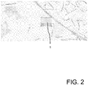
- Fig. 2
- eine Ansicht eines Geofence als Viereck,
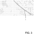
- Fig. 3
- eine Ansicht eines Geofence als Straße, und
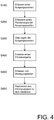
- Fig. 4
- ein Ablaufdiagram zur Durchführung des erfindungsgemäßen Verfahrens.
- Die
Figur 4 zeigt einen Ablauf des erfindungsgemäßen Verfahrens zum automatischen Erstellen eines Geofences 1. Verschiedene Geofences 1 sind in denFiguren 1 bis 3 gezeigt. - Das Verfahren beginnt in Schritt S100 mit dem Erfassen einer Ausgangsposition. Entsprechend wird eine geographische Angabe empfangen, die in diesem Ausführungsbeispiel als abstrakte Kartenangabe eine Adresse ist. Die Adresse wird durch einen "Reverse Address Service" in Positionsdaten in der Form eines Koordinatenpaares für die Ausgangsposition umgerechnet.
- In Schritt S200 erfolgt das Erfassen eines Positionstyps zu der Ausgangsposition. Das Erfassen des Positionstyps beinhaltet eine Benutzereingabe. Die Ausgangsposition wird in diesem Ausführungsbeispiels als zu einer Autobahntankstelle gehörend definiert, so dass der Positionstyp "Autobahntankstelle" ist.
- In einem alternativen Ausführungsbeispiel sind die Schritte S100 und S200 zusammengefasst. Entsprechend wird ein "point of interest" (POI) mit einer geographischen Angabe, die der Ausgangsposition entspricht, und einem Positionstyp ausgewählt.
- In Schritt S300 wird die Ausgangsposition auf eine digitale Karte übertragen. Das die Ausgangsposition definierende Koordinatenpaar wird dabei direkt auf der Karte zugeordnet. Die digitale Karte beinhaltet in diesem Ausführungsbeispiel ein abstrakte Darstellung in der Form einer Straßenkarte.
- Schritt S400 umfasst das automatische Erstellen eines Flächenobjekts auf der digitalen Karte, wobei das Flächenobjekt die Ausgangsposition umfasst. In diesem Ausführungsbeispiel hat das Flächenobjekt die Form eines Kreises, wobei die Ausgangsposition das Zentrum des Kreises ist. Abhängig von dem Objekttyp hat der Kreis einen unterschiedlichen Radius r, z.B. für einen Parkplatz r = 5m, für eine Tankstelle r = 50m, für ein Depot r = 700m oder für einen Flughafen r = 3000m.
- Für das Verfahren werden Bewegungsdaten erfasst, indem die beweglichen Objekte permanent überwacht werden. Bewegliche Objekte sind in diesem Ausführungsbeispiel Landfahrzeuge, die einen GPS-Empfänger aufweisen und ausgeführt sind, ihre Bewegungsdaten im Betrieb zur Sammlung an eine Datenverarbeitungsvorrichtung zu übertragen. Die Bewegungsdaten umfassen eine zeitliche Abfolge von Positionen der beweglichen Objekte, aus der die Geschwindigkeit der jeweiligen beweglichen Objekte ermittelt wird.
- In Schritt S500 werden Bewegungsdaten von einer Mehrzahl beweglicher Objekte im Bereich des Flächenobjekts erfasst. Es erfolgt aus den zuvor erfassten Bewegungsdaten eine Auswahl der Bewegungsdaten, die das Flächenobjekt betreffen. Aus den Bewegungsdaten der beweglichen Objekte werden Bewegungsprofile erzeugt, die zeitliche Abfolgen aus Abbremsen, Anhalten und Beschleunigen umfassen.
- In Schritt S600 erfolgt ein automatisches Reduzieren des Flächenobjekts zu dem Geofence basierend auf den Bewegungsdaten. Dazu werden Bereiche, die von dem Geofence umfasst werden, und Bereiche außerhalb des Geofences erkannt. So werden zunächst Bereiche, in denen sich kein bewegliches Objekt aufgehalten hat, als nicht zu dem Geofence gehörend markiert. Weiterhin werden abhängig von dem hier ausgewählten Objekttyp "Autobahntankstelle" Bereiche, in denen sich die beweglichen Objekte mit mehr als einer Grenzgeschwindigkeit von 60 km/h bewegt haben, als nicht zu dem Geofence gehörend markiert. Dabei ist ein räumlicher Abstand zu der Ausgangsposition innerhalb des Flächenobjekts unerheblich. Alternativ kann die Grenzgeschwindigkeit für andere Objekttypen unterschiedlich gewählt sein, beispielsweise 0 km/h für eine Bewegung, 7 km/h für eine Schrittgeschwindigkeit, 30 km/h oder 50 Km/h für Geschwindigkeiten in einer Ortschaft, 60 km/h für eine Landstraße, 80 km/h für eine Autobahn oder 90 km/h für ein überschreiten der erlaubten Geschwindigkeit bei einem LKW. In einer weiter alternativen Ausführungsform ist ein Korridor mit einer oberen und einer unteren Grenzgeschwindigkeit gebildet.
- Zusätzlich werden Bewegungsprofile der beweglichen Objekte erzeugt und analysiert. Für den hier verwendeten Objekttyp "Autobahntankstelle" umfasst das Bewegungsprofil in diesem Ausführungsbeispiel das langsame Reduzieren der Geschwindigkeit bis auf Null, einen anschließenden Stillstand mit einer Dauer von einer bis fünf Minuten und ein abschließendes Beschleunigen. Damit ist der Aufenthalt an der Tankstelle von dem Besuch eines Autobahnrestaurants, in dem die Aufenthaltsdauer höher ist, klar zu unterscheiden. Somit werden Bereiche gemäß des Bewegungsprofils als zu dem Geofence gehörend markiert. Abschließend wird der Geofence durch die Reduktion des Flächenobjekts auf zu dem Geofence gehörende Bereiche erstellt.
- Das Verfahren endet mit dem Speichern des Geofences.
- Ein Verfahren gemäß einer alternativen Ausführungsform unterscheidet sich von dem zuvor beschrieben Verfahren lediglich in dem Schritt S400. Schritt S400 gemäß der alternativen Ausführungsform umfasst das automatische Erzeugen des Flächenobjekts auf der Karte basierend auf Karteninhalten.
- Entsprechend wir zunächst eine Begrenzungsobjekt auf der digitalen Karte erstellt, wobei das Begrenzungsobjekt um die Ausgangsposition zentriert ist. Im Weiteren wird die Grenze des Flächenobjekts begrenzt auf das Begrenzungsobjekt bestimmt. Das Begrenzungsobjekt ist in Übereinstimmung mit dem Flächenobjekt ein geometrisches Objekt, das in diesem Ausführungsbeispiel ein Kreis ist. Der Radius des Kreises hängt wie oben ausgeführt von dem Objekttyp ab.
- Weiter wird eine Kartenfarbe an der Ausgangsposition erfasst. Ausgehend von der Ausgangsposition wird in eine Richtung auf der Karte verfahren, bis ein erster Begrenzungspunkt, an dem eine Änderung der Farbe der Karte bezogen auf die Kartenfarbe an der Ausgangsposition erfolgt, erreicht wird. Dabei wird als Änderung der Farbe nur eine signifikante Änderung betrachtet, so dass lediglich eine geringfügige Änderung, beispielsweise von einem mittleren Farbton zu demselben, abgedunkelten Farbton, nicht als Änderung betrachtet wird. Anschließend werden jeweils ausgehend von dem zuletzt erreichten Begrenzungspunkt weitere Begrenzungspunktes des Flächenobjekts durch das Erfassen der Änderung der Farbe der Karte bezogen auf die Kartenfarbe an der Ausgangsposition erfasst. Dabei wird jeweils ein weiterer Begrenzungspunkt in einem vorgegebenen Abstand von dem jeweils vorherigen Begrenzungspunkt erfasst.
- Diese Prozedur wird insgesamt so oft wiederholt, bis ein Abbruchkritierium, bzw. Gütekriterium erreicht wird. Bei einem Geofence mit 100 Metern Durchmesser (R = 50m) werden hier insgesamt 8 Iterationen durchgeführt, bzw. es wird weitergerechnet, bis die Distanz des zuletzt ermittelten Begrenzungspunktes zum ersten Begrenzungspunkt kleiner 12 Metern ist.
- Sobald genügend Begrenzungspunkte erfasst worden, wird das Flächenobjekts durch Verbinden der Begrenzungspunkte erzeugt.
- Die oben beschriebenen Verfahren sind digitales Verfahren, die jeweils als Computer-Programm auf einer Datenverarbeitungsvorrichtung ausgeführt wird. Entsprechend ist das Datenverarbeitungsprogramm auf einem digitalen Speichermedium, hier einer Festplatte, gespeichert. Das Datenverarbeitungsprogramm umfasst elektronisch auslesbaren Steuersignale, die so mit der Datenverarbeitungsvorrichtung zusammenwirken, dass das obige Verfahren ausgeführt wird.
- Das Datenverarbeitungsprogramm ist als Computer-Programm-Produkt mit auf einem maschinenlesbaren Träger gespeichertem Programmcode zur Ausführung auf der Datenverarbeitungsvorrichtung ausgeführt.
Claims (13)
- Verfahren zum automatischen Erstellen eines Geofences (1), umfassend die Schritte
Erfassen einer Ausgangsposition,
Übertragen der Ausgangsposition auf eine digitale Karte,
automatisches Erstellen eines Flächenobjekts auf der digitalen Karte, wobei das Flächenobjekt die Ausgangsposition umfasst,
Erfassen von Bewegungsdaten wenigstens eines beweglichen Objekts im Bereich des Flächenobjekts, wobei die Bewegungsdaten eine Position des beweglichen Objekts und zusätzlich eine Geschwindigkeit und/oder eine Bewegungsrichtung des beweglichen Objekts umfassen, und
automatisches Reduzieren des Flächenobjekts zu dem Geofence (1) basierend auf den Bewegungsdaten, wobei
der Schritt des Erfassens einer Ausgangsposition das Auswählen eines point of interest umfasst. - Verfahren nach Anspruch 1, wobei
der Schritt des automatischen Reduzierens des Flächenobjekts zu dem Geofence (1) das Erkennen von Bereichen, die von dem Geofence (1) umfasst werden, beinhaltet. - Verfahren nach einem der Ansprüche 1 oder 2, wobei
der Schritt des automatischen Reduzierens des Flächenobjekts zu dem Geofence (1) das Erkennen von Bereichen außerhalb des Geofences (1) beinhaltet. - Verfahren nach einem der vorhergehenden Ansprüche, wobei
der Schritt des Erfassens von Bewegungsdaten wenigstens eines beweglichen Objekts im Bereich des Flächenobjekts das Erzeugen eines Bewegungsprofils des wenigstens eines beweglichen Objekts beinhaltet, und
der Schritt des automatischen Reduzierens des Flächenobjekts zu dem Geofence (1) basierend auf den Bewegungsdaten das Analysieren des Bewegungsprofils des wenigstens eines beweglichen Objekts beinhaltet. - Verfahren nach einem der vorhergehenden Ansprüche, wobei
das Verfahren den Schritt des Erfassens eines Positionstyps zu der Ausgangsposition umfasst, und
der Schritt des automatischen Reduzierens des Flächenobjekts zu dem Geofence (1) basierend auf den Bewegungsdaten das Auswerten der Bewegungsdaten abhängig von dem Positionstyp umfasst. - Verfahren nach einem der vorhergehenden Ansprüche, wobei
das Verfahren den Schritt des Erfassens eines Positionstyps zu der Ausgangsposition umfasst, und
der Schritt des automatischen Erstellens eines Flächenobjekts auf der digitalen Karte das Erstellen des Flächenobjekts abhängig von dem Positionstyp umfasst. - Verfahren nach einem der vorhergehenden Ansprüche, wobei
der Schritt des Erfassens einer Ausgangsposition das Empfangen einer geographischen Angabe umfasst. - Verfahren nach Anspruch 7, wobei
der Schritt des Empfangens einer geographischen Angabe das Empfangen einer abstrakten Kartenangabe und das Umwandeln der abstrakten Kartenangabe in die Ausgangsposition umfasst. - Verfahren nach einem der vorhergehenden Ansprüche, wobei
der Schritt des automatischen Erstellens eines Flächenobjekts auf der digitalen Karte das automatische Erzeugen des Flächenobjekts auf der Karte basierend auf Karteninhalten umfasst. - Verfahren nach Anspruch 9, wobei
der Schritt des automatischen Erzeugens des Flächenobjekts auf der Karte basierend auf Karteninhalten folgende Schritte umfasst:Erfassen einer Kartenfarbe an der Ausgangsposition,Erfassen eines ersten Begrenzungspunktes des Flächenobjekts durch das Erfassen der Änderung der Farbe der Karte bezogen auf die Kartenfarbe an der Ausgangsposition,Erfassen wenigstens eines weiteren Begrenzungspunktes des Flächenobjekts durch das Erfassen der Änderung der Farbe der Karte bezogen auf die Kartenfarbe an der Ausgangsposition in einem vorgegebenen Abstand von dem jeweils vorherigen Begrenzungspunkt,Erzeugen des Flächenobjekts durch Verbinden der Begrenzungspunkte. - Verfahren nach Anspruch 10, wobei
der Schritt des automatischen Erzeugens des Flächenobjekts auf der Karte basierend auf Karteninhalten das automatisches Erstellen eines Begrenzungsobjekts auf der digitalen Karte beinhaltet, wobei das Begrenzungsobjekt die Ausgangsposition umfasst, und
der Schritt des Bestimmens einer Grenze des Flächenobjekts durch umfängliches Erfassen der Änderung der Farbe der Karte auf das Begrenzungsobjekt begrenzt ist. - Digitales Speichermedium mit elektronisch auslesbaren Steuersignalen, die so mit einem programmierbaren Computersystem zusammenwirken können, dass ein Verfahren nach einem der Ansprüche 1 bis 11 ausgeführt wird.
- Computer-Programm-Produkt mit auf einem maschinenlesbaren Träger gespeichertem Programmcode zur Durchführung des Verfahrens nach einem der Ansprüche 1 bis 11, wenn der Programmcode auf einer Datenverarbeitungsvorrichtung ausgeführt wird.
Priority Applications (4)
| Application Number | Priority Date | Filing Date | Title |
|---|---|---|---|
| EP12177524.1A EP2690404B1 (de) | 2012-07-23 | 2012-07-23 | Erstellen eines Geofences |
| US14/417,121 US9319837B2 (en) | 2012-07-23 | 2013-07-04 | Creation of a geofence based on movement data and a digital map |
| CN201380039342.8A CN104487805B (zh) | 2012-07-23 | 2013-07-04 | 创建地理围栏的方法 |
| PCT/EP2013/064115 WO2014016096A1 (de) | 2012-07-23 | 2013-07-04 | Erstellen eines geofences |
Applications Claiming Priority (1)
| Application Number | Priority Date | Filing Date | Title |
|---|---|---|---|
| EP12177524.1A EP2690404B1 (de) | 2012-07-23 | 2012-07-23 | Erstellen eines Geofences |
Publications (2)
| Publication Number | Publication Date |
|---|---|
| EP2690404A1 EP2690404A1 (de) | 2014-01-29 |
| EP2690404B1 true EP2690404B1 (de) | 2019-01-09 |
Family
ID=46800010
Family Applications (1)
| Application Number | Title | Priority Date | Filing Date |
|---|---|---|---|
| EP12177524.1A Active EP2690404B1 (de) | 2012-07-23 | 2012-07-23 | Erstellen eines Geofences |
Country Status (4)
| Country | Link |
|---|---|
| US (1) | US9319837B2 (de) |
| EP (1) | EP2690404B1 (de) |
| CN (1) | CN104487805B (de) |
| WO (1) | WO2014016096A1 (de) |
Cited By (1)
| Publication number | Priority date | Publication date | Assignee | Title |
|---|---|---|---|---|
| DE102024127863A1 (de) | 2024-09-26 | 2026-03-26 | Deutsche Post Ag | Verfahren und vorrichtung zur positionsbasierten bestimmung von möglichkeiten zur übergabe einer sendung |
Families Citing this family (23)
| Publication number | Priority date | Publication date | Assignee | Title |
|---|---|---|---|---|
| CN103984556B (zh) * | 2014-05-30 | 2017-03-15 | 云朵网络有限公司 | 一种地图区域构造设备、方法和监控终端 |
| WO2016183841A1 (zh) * | 2015-05-21 | 2016-11-24 | 华为技术有限公司 | 一种触发操作的方法及便携式电子设备 |
| CN106568429B (zh) * | 2015-10-09 | 2019-12-06 | 阿里巴巴集团控股有限公司 | 一种建立兴趣点的方法及装置 |
| US9648581B1 (en) | 2015-11-09 | 2017-05-09 | Radiumone, Inc. | Robust geolocation system implementation for serving targeted advertisement and personalized content |
| US10732005B2 (en) * | 2016-01-06 | 2020-08-04 | Robert Bosch Gmbh | System and method for providing multimodal visual time aware graphical displays |
| EP3402226B1 (de) * | 2016-01-28 | 2020-09-16 | Huawei Technologies Co., Ltd. | Verfahren und vorrichtung zur ausgabe von benachrichtigungen |
| US10593074B1 (en) * | 2016-03-16 | 2020-03-17 | Liberty Mutual Insurance Company | Interactive user interface for displaying geographic boundaries |
| GB2559159A (en) * | 2017-01-27 | 2018-08-01 | Kbd Tech Limited | System and methods for data correlation between a telematics system and a fleet management system |
| US10231167B2 (en) | 2017-06-30 | 2019-03-12 | Otis Elevator Company | Building access zone specification for mobile applications |
| US10771617B1 (en) * | 2017-12-22 | 2020-09-08 | Charles Isgar | Mobile computing intervening system using geofencing |
| CN108322890B (zh) * | 2018-05-15 | 2021-01-08 | 北京万兔思睿科技有限公司 | 一种电子围栏范围生成方法及装置 |
| CN109557942B (zh) * | 2019-01-21 | 2021-10-26 | 梁晓龙 | 一种自主飞行的无人机地理围栏算法 |
| CN109819403B (zh) * | 2019-01-28 | 2021-07-23 | 汉海信息技术(上海)有限公司 | 生成电子围栏的方法、装置及电子设备 |
| US12185178B2 (en) * | 2020-04-27 | 2024-12-31 | Trueblue, Inc. | Dynamic geofencing for temporary work time validation |
| CN111637915B (zh) * | 2020-05-14 | 2022-12-27 | 深圳市航通北斗信息技术有限公司 | 检测非法卸料方法、终端以及可读存储介质 |
| CN111787485B (zh) * | 2020-06-02 | 2022-10-21 | Oppo广东移动通信有限公司 | 一种电子围栏创建方法及装置、存储介质 |
| CN112070271B (zh) * | 2020-08-07 | 2024-05-31 | 北京电子工程总体研究所 | 动态变化条件下互联资源的容错栅栏覆盖配置方法和系统 |
| CN112087708B (zh) * | 2020-08-14 | 2022-09-16 | 江苏省电力试验研究院有限公司 | 一种电子围栏的布设方法及其布设装置、存储介质 |
| GB2604130A (en) * | 2021-02-25 | 2022-08-31 | Pci Tech Investments Ltd | Systems and methods for smart farming |
| US11915585B2 (en) * | 2021-07-01 | 2024-02-27 | Purdue Research Foundation | Method of identifying vehicle turning movements at intersections from trajectory data and reallocating green time therefor |
| CN115080876A (zh) * | 2022-07-04 | 2022-09-20 | 合众新能源汽车有限公司 | 一种服务推荐方法、终端及计算机存储介质 |
| US12150012B2 (en) | 2022-08-05 | 2024-11-19 | Honda Motor Co., Ltd. | Enabling location-based services based on geofence data and privacy settings |
| CN116448093A (zh) * | 2023-04-10 | 2023-07-18 | 深圳市正浩创新科技股份有限公司 | 作业地图处理方法、自移动设备及存储介质 |
Citations (1)
| Publication number | Priority date | Publication date | Assignee | Title |
|---|---|---|---|---|
| WO2012019628A1 (en) * | 2010-08-12 | 2012-02-16 | Tomtom Germany Gmbh & Co. Kg | Parking lot detection using probe data |
Family Cites Families (6)
| Publication number | Priority date | Publication date | Assignee | Title |
|---|---|---|---|---|
| US7164986B2 (en) * | 2004-01-16 | 2007-01-16 | Mci, Llc | Method and system for tracked device location and route adherence via geofencing |
| EP2449537A4 (de) * | 2009-07-03 | 2012-12-05 | Rabwa Pty Ltd | Funkaktiviertes gefahrenwarnsystem |
| US8577590B2 (en) * | 2009-11-09 | 2013-11-05 | Qualcomm Incorporated | Scalable geofences |
| US8284748B2 (en) * | 2010-07-07 | 2012-10-09 | Apple Inc. | Ad hoc formation and tracking of location-sharing groups |
| US20120172027A1 (en) * | 2011-01-03 | 2012-07-05 | Mani Partheesh | Use of geofences for location-based activation and control of services |
| US9210545B2 (en) * | 2012-06-05 | 2015-12-08 | Apple Inc. | Managing alerts based on context |
-
2012
- 2012-07-23 EP EP12177524.1A patent/EP2690404B1/de active Active
-
2013
- 2013-07-04 WO PCT/EP2013/064115 patent/WO2014016096A1/de not_active Ceased
- 2013-07-04 US US14/417,121 patent/US9319837B2/en active Active
- 2013-07-04 CN CN201380039342.8A patent/CN104487805B/zh active Active
Patent Citations (1)
| Publication number | Priority date | Publication date | Assignee | Title |
|---|---|---|---|---|
| WO2012019628A1 (en) * | 2010-08-12 | 2012-02-16 | Tomtom Germany Gmbh & Co. Kg | Parking lot detection using probe data |
Cited By (1)
| Publication number | Priority date | Publication date | Assignee | Title |
|---|---|---|---|---|
| DE102024127863A1 (de) | 2024-09-26 | 2026-03-26 | Deutsche Post Ag | Verfahren und vorrichtung zur positionsbasierten bestimmung von möglichkeiten zur übergabe einer sendung |
Also Published As
| Publication number | Publication date |
|---|---|
| CN104487805B (zh) | 2017-08-22 |
| CN104487805A (zh) | 2015-04-01 |
| US20150215736A1 (en) | 2015-07-30 |
| US9319837B2 (en) | 2016-04-19 |
| EP2690404A1 (de) | 2014-01-29 |
| WO2014016096A1 (de) | 2014-01-30 |
Similar Documents
| Publication | Publication Date | Title |
|---|---|---|
| EP2690404B1 (de) | Erstellen eines Geofences | |
| DE102015207804B4 (de) | Verfahren zum Erkennen von Parkflächen und/oder Freiflächen | |
| DE102014002150B3 (de) | Verfahren zur Ermittlung der absoluten Position einer mobilen Einheit und mobile Einheit | |
| EP3432108B1 (de) | Verfahren und steuervorrichtung für ein autonomes und/oder teilautonomes transportfahrzeug | |
| WO2018210468A1 (de) | Verfahren, vorrichtung und system zum ermitteln einer strassenbaustelle | |
| DE102016205434A1 (de) | Verfahren und System zum Erstellen einer spurgenauen Belegungskarte für Fahrspuren | |
| DE102018218436A1 (de) | Fahrzeugparkassistenz | |
| EP3881032B1 (de) | Erstellung und aktualisierung von karten im off-street bereich | |
| DE102014008429A1 (de) | Verfahren und Vorrichtung zur Ermittlung freier Abstellplätze auf LKW-Parkplätzen und Mitteilung an LKW-Fahrer | |
| EP1191500A1 (de) | Verfahren und Vorrichtungen zum Orten eines Fahrzeuges | |
| WO2017137046A1 (de) | Verfahren zur assistenz für einen parkvorgang und parkassistenzvorrichtung | |
| DE102014106048A1 (de) | Verfahren zur Bestimmung der Position eines Verkehrsteilnehmers, Infrastruktureinrichtung, Fahrzeug und Computerprogramm | |
| EP3688659A1 (de) | Verfahren zum automatisierten identifizieren von parkflächen und/oder nicht-parkflächen | |
| EP3980724A1 (de) | Verfahren zum erstellen einer universell einsetzbaren merkmalskarte | |
| DE102011051100A1 (de) | Verfahren und Referenzgerät zur Bereitstellung von Korrektursignalen für ein Satelliten gestütztes Positionsbestimmungssystem | |
| DE102017118078A1 (de) | Lokalisationseinrichtung für ein Kraftfahrzeug, Fahrerassistenzeinrichtung, Kraftfahrzeug sowie Verfahren zum Lokalisieren eines Kraftfahrzeugs | |
| DE102014216276A1 (de) | Positionsbestimmung von Kraftfahrzeugen mittels Radarbaken | |
| EP3781906A1 (de) | Verfahren und vorrichtung zum bestimmen einer hochgenauen position eines fahrzeugs | |
| EP3809228B1 (de) | Verfahren zum navigieren eines flurförderzeugs | |
| WO2018210487A1 (de) | Verfahren, vorrichtung und system zum ermitteln eines wettergebiets | |
| DE102018004671A1 (de) | Verfahren und Steueranordnung für eine Fahrzeugroutenplanung | |
| DE102010055371A1 (de) | Verfahren zur Ermittlung einer Position eines Fahrzeugs | |
| DE19751741C2 (de) | Flottendispositionsverfahren | |
| EP3271746A1 (de) | Konfigurieren eines verwaltungssystems für einen parkplatz | |
| DE102019204260A1 (de) | Steuern eines Kraftfahrzeugs |
Legal Events
| Date | Code | Title | Description |
|---|---|---|---|
| PUAI | Public reference made under article 153(3) epc to a published international application that has entered the european phase |
Free format text: ORIGINAL CODE: 0009012 |
|
| AK | Designated contracting states |
Kind code of ref document: A1 Designated state(s): AL AT BE BG CH CY CZ DE DK EE ES FI FR GB GR HR HU IE IS IT LI LT LU LV MC MK MT NL NO PL PT RO RS SE SI SK SM TR |
|
| AX | Request for extension of the european patent |
Extension state: BA ME |
|
| 17P | Request for examination filed |
Effective date: 20140729 |
|
| RBV | Designated contracting states (corrected) |
Designated state(s): AL AT BE BG CH CY CZ DE DK EE ES FI FR GB GR HR HU IE IS IT LI LT LU LV MC MK MT NL NO PL PT RO RS SE SI SK SM TR |
|
| 17Q | First examination report despatched |
Effective date: 20160506 |
|
| REG | Reference to a national code |
Ref country code: DE Ref legal event code: R079 Ref document number: 502012014126 Country of ref document: DE Free format text: PREVIOUS MAIN CLASS: G01C0021320000 Ipc: G01C0021360000 |
|
| RIC1 | Information provided on ipc code assigned before grant |
Ipc: G01C 21/36 20060101AFI20180528BHEP |
|
| GRAP | Despatch of communication of intention to grant a patent |
Free format text: ORIGINAL CODE: EPIDOSNIGR1 |
|
| STAA | Information on the status of an ep patent application or granted ep patent |
Free format text: STATUS: GRANT OF PATENT IS INTENDED |
|
| INTG | Intention to grant announced |
Effective date: 20180730 |
|
| GRAS | Grant fee paid |
Free format text: ORIGINAL CODE: EPIDOSNIGR3 |
|
| GRAA | (expected) grant |
Free format text: ORIGINAL CODE: 0009210 |
|
| STAA | Information on the status of an ep patent application or granted ep patent |
Free format text: STATUS: THE PATENT HAS BEEN GRANTED |
|
| AK | Designated contracting states |
Kind code of ref document: B1 Designated state(s): AL AT BE BG CH CY CZ DE DK EE ES FI FR GB GR HR HU IE IS IT LI LT LU LV MC MK MT NL NO PL PT RO RS SE SI SK SM TR |
|
| REG | Reference to a national code |
Ref country code: GB Ref legal event code: FG4D Free format text: NOT ENGLISH |
|
| REG | Reference to a national code |
Ref country code: CH Ref legal event code: EP Ref country code: AT Ref legal event code: REF Ref document number: 1087873 Country of ref document: AT Kind code of ref document: T Effective date: 20190115 |
|
| REG | Reference to a national code |
Ref country code: IE Ref legal event code: FG4D Free format text: LANGUAGE OF EP DOCUMENT: GERMAN |
|
| REG | Reference to a national code |
Ref country code: DE Ref legal event code: R096 Ref document number: 502012014126 Country of ref document: DE |
|
| REG | Reference to a national code |
Ref country code: DE Ref legal event code: R082 Ref document number: 502012014126 Country of ref document: DE Representative=s name: MICHALSKI HUETTERMANN & PARTNER PATENTANWAELTE, DE |
|
| REG | Reference to a national code |
Ref country code: NL Ref legal event code: MP Effective date: 20190109 |
|
| REG | Reference to a national code |
Ref country code: LT Ref legal event code: MG4D |
|
| PG25 | Lapsed in a contracting state [announced via postgrant information from national office to epo] |
Ref country code: NL Free format text: LAPSE BECAUSE OF FAILURE TO SUBMIT A TRANSLATION OF THE DESCRIPTION OR TO PAY THE FEE WITHIN THE PRESCRIBED TIME-LIMIT Effective date: 20190109 |
|
| PG25 | Lapsed in a contracting state [announced via postgrant information from national office to epo] |
Ref country code: ES Free format text: LAPSE BECAUSE OF FAILURE TO SUBMIT A TRANSLATION OF THE DESCRIPTION OR TO PAY THE FEE WITHIN THE PRESCRIBED TIME-LIMIT Effective date: 20190109 Ref country code: PT Free format text: LAPSE BECAUSE OF FAILURE TO SUBMIT A TRANSLATION OF THE DESCRIPTION OR TO PAY THE FEE WITHIN THE PRESCRIBED TIME-LIMIT Effective date: 20190509 Ref country code: SE Free format text: LAPSE BECAUSE OF FAILURE TO SUBMIT A TRANSLATION OF THE DESCRIPTION OR TO PAY THE FEE WITHIN THE PRESCRIBED TIME-LIMIT Effective date: 20190109 Ref country code: FI Free format text: LAPSE BECAUSE OF FAILURE TO SUBMIT A TRANSLATION OF THE DESCRIPTION OR TO PAY THE FEE WITHIN THE PRESCRIBED TIME-LIMIT Effective date: 20190109 Ref country code: NO Free format text: LAPSE BECAUSE OF FAILURE TO SUBMIT A TRANSLATION OF THE DESCRIPTION OR TO PAY THE FEE WITHIN THE PRESCRIBED TIME-LIMIT Effective date: 20190409 Ref country code: PL Free format text: LAPSE BECAUSE OF FAILURE TO SUBMIT A TRANSLATION OF THE DESCRIPTION OR TO PAY THE FEE WITHIN THE PRESCRIBED TIME-LIMIT Effective date: 20190109 Ref country code: LT Free format text: LAPSE BECAUSE OF FAILURE TO SUBMIT A TRANSLATION OF THE DESCRIPTION OR TO PAY THE FEE WITHIN THE PRESCRIBED TIME-LIMIT Effective date: 20190109 |
|
| PG25 | Lapsed in a contracting state [announced via postgrant information from national office to epo] |
Ref country code: BG Free format text: LAPSE BECAUSE OF FAILURE TO SUBMIT A TRANSLATION OF THE DESCRIPTION OR TO PAY THE FEE WITHIN THE PRESCRIBED TIME-LIMIT Effective date: 20190409 Ref country code: IS Free format text: LAPSE BECAUSE OF FAILURE TO SUBMIT A TRANSLATION OF THE DESCRIPTION OR TO PAY THE FEE WITHIN THE PRESCRIBED TIME-LIMIT Effective date: 20190509 Ref country code: LV Free format text: LAPSE BECAUSE OF FAILURE TO SUBMIT A TRANSLATION OF THE DESCRIPTION OR TO PAY THE FEE WITHIN THE PRESCRIBED TIME-LIMIT Effective date: 20190109 Ref country code: HR Free format text: LAPSE BECAUSE OF FAILURE TO SUBMIT A TRANSLATION OF THE DESCRIPTION OR TO PAY THE FEE WITHIN THE PRESCRIBED TIME-LIMIT Effective date: 20190109 Ref country code: GR Free format text: LAPSE BECAUSE OF FAILURE TO SUBMIT A TRANSLATION OF THE DESCRIPTION OR TO PAY THE FEE WITHIN THE PRESCRIBED TIME-LIMIT Effective date: 20190410 Ref country code: RS Free format text: LAPSE BECAUSE OF FAILURE TO SUBMIT A TRANSLATION OF THE DESCRIPTION OR TO PAY THE FEE WITHIN THE PRESCRIBED TIME-LIMIT Effective date: 20190109 |
|
| REG | Reference to a national code |
Ref country code: DE Ref legal event code: R097 Ref document number: 502012014126 Country of ref document: DE |
|
| PG25 | Lapsed in a contracting state [announced via postgrant information from national office to epo] |
Ref country code: IT Free format text: LAPSE BECAUSE OF FAILURE TO SUBMIT A TRANSLATION OF THE DESCRIPTION OR TO PAY THE FEE WITHIN THE PRESCRIBED TIME-LIMIT Effective date: 20190109 Ref country code: CZ Free format text: LAPSE BECAUSE OF FAILURE TO SUBMIT A TRANSLATION OF THE DESCRIPTION OR TO PAY THE FEE WITHIN THE PRESCRIBED TIME-LIMIT Effective date: 20190109 Ref country code: RO Free format text: LAPSE BECAUSE OF FAILURE TO SUBMIT A TRANSLATION OF THE DESCRIPTION OR TO PAY THE FEE WITHIN THE PRESCRIBED TIME-LIMIT Effective date: 20190109 Ref country code: SK Free format text: LAPSE BECAUSE OF FAILURE TO SUBMIT A TRANSLATION OF THE DESCRIPTION OR TO PAY THE FEE WITHIN THE PRESCRIBED TIME-LIMIT Effective date: 20190109 Ref country code: EE Free format text: LAPSE BECAUSE OF FAILURE TO SUBMIT A TRANSLATION OF THE DESCRIPTION OR TO PAY THE FEE WITHIN THE PRESCRIBED TIME-LIMIT Effective date: 20190109 Ref country code: DK Free format text: LAPSE BECAUSE OF FAILURE TO SUBMIT A TRANSLATION OF THE DESCRIPTION OR TO PAY THE FEE WITHIN THE PRESCRIBED TIME-LIMIT Effective date: 20190109 Ref country code: AL Free format text: LAPSE BECAUSE OF FAILURE TO SUBMIT A TRANSLATION OF THE DESCRIPTION OR TO PAY THE FEE WITHIN THE PRESCRIBED TIME-LIMIT Effective date: 20190109 |
|
| PLBE | No opposition filed within time limit |
Free format text: ORIGINAL CODE: 0009261 |
|
| STAA | Information on the status of an ep patent application or granted ep patent |
Free format text: STATUS: NO OPPOSITION FILED WITHIN TIME LIMIT |
|
| PG25 | Lapsed in a contracting state [announced via postgrant information from national office to epo] |
Ref country code: SM Free format text: LAPSE BECAUSE OF FAILURE TO SUBMIT A TRANSLATION OF THE DESCRIPTION OR TO PAY THE FEE WITHIN THE PRESCRIBED TIME-LIMIT Effective date: 20190109 |
|
| 26N | No opposition filed |
Effective date: 20191010 |
|
| PG25 | Lapsed in a contracting state [announced via postgrant information from national office to epo] |
Ref country code: SI Free format text: LAPSE BECAUSE OF FAILURE TO SUBMIT A TRANSLATION OF THE DESCRIPTION OR TO PAY THE FEE WITHIN THE PRESCRIBED TIME-LIMIT Effective date: 20190109 Ref country code: MC Free format text: LAPSE BECAUSE OF FAILURE TO SUBMIT A TRANSLATION OF THE DESCRIPTION OR TO PAY THE FEE WITHIN THE PRESCRIBED TIME-LIMIT Effective date: 20190109 |
|
| REG | Reference to a national code |
Ref country code: CH Ref legal event code: PL |
|
| PG25 | Lapsed in a contracting state [announced via postgrant information from national office to epo] |
Ref country code: TR Free format text: LAPSE BECAUSE OF FAILURE TO SUBMIT A TRANSLATION OF THE DESCRIPTION OR TO PAY THE FEE WITHIN THE PRESCRIBED TIME-LIMIT Effective date: 20190109 |
|
| REG | Reference to a national code |
Ref country code: BE Ref legal event code: MM Effective date: 20190731 |
|
| PG25 | Lapsed in a contracting state [announced via postgrant information from national office to epo] |
Ref country code: LU Free format text: LAPSE BECAUSE OF NON-PAYMENT OF DUE FEES Effective date: 20190723 Ref country code: BE Free format text: LAPSE BECAUSE OF NON-PAYMENT OF DUE FEES Effective date: 20190731 Ref country code: CH Free format text: LAPSE BECAUSE OF NON-PAYMENT OF DUE FEES Effective date: 20190731 Ref country code: LI Free format text: LAPSE BECAUSE OF NON-PAYMENT OF DUE FEES Effective date: 20190731 |
|
| PG25 | Lapsed in a contracting state [announced via postgrant information from national office to epo] |
Ref country code: IE Free format text: LAPSE BECAUSE OF NON-PAYMENT OF DUE FEES Effective date: 20190723 |
|
| REG | Reference to a national code |
Ref country code: AT Ref legal event code: MM01 Ref document number: 1087873 Country of ref document: AT Kind code of ref document: T Effective date: 20190723 |
|
| PG25 | Lapsed in a contracting state [announced via postgrant information from national office to epo] |
Ref country code: AT Free format text: LAPSE BECAUSE OF NON-PAYMENT OF DUE FEES Effective date: 20190723 |
|
| PG25 | Lapsed in a contracting state [announced via postgrant information from national office to epo] |
Ref country code: CY Free format text: LAPSE BECAUSE OF FAILURE TO SUBMIT A TRANSLATION OF THE DESCRIPTION OR TO PAY THE FEE WITHIN THE PRESCRIBED TIME-LIMIT Effective date: 20190109 |
|
| PG25 | Lapsed in a contracting state [announced via postgrant information from national office to epo] |
Ref country code: MT Free format text: LAPSE BECAUSE OF FAILURE TO SUBMIT A TRANSLATION OF THE DESCRIPTION OR TO PAY THE FEE WITHIN THE PRESCRIBED TIME-LIMIT Effective date: 20190109 Ref country code: HU Free format text: LAPSE BECAUSE OF FAILURE TO SUBMIT A TRANSLATION OF THE DESCRIPTION OR TO PAY THE FEE WITHIN THE PRESCRIBED TIME-LIMIT; INVALID AB INITIO Effective date: 20120723 |
|
| PG25 | Lapsed in a contracting state [announced via postgrant information from national office to epo] |
Ref country code: MK Free format text: LAPSE BECAUSE OF FAILURE TO SUBMIT A TRANSLATION OF THE DESCRIPTION OR TO PAY THE FEE WITHIN THE PRESCRIBED TIME-LIMIT Effective date: 20190109 |
|
| P01 | Opt-out of the competence of the unified patent court (upc) registered |
Effective date: 20230526 |
|
| PGFP | Annual fee paid to national office [announced via postgrant information from national office to epo] |
Ref country code: DE Payment date: 20250728 Year of fee payment: 14 |
|
| PGFP | Annual fee paid to national office [announced via postgrant information from national office to epo] |
Ref country code: GB Payment date: 20250722 Year of fee payment: 14 |
|
| PGFP | Annual fee paid to national office [announced via postgrant information from national office to epo] |
Ref country code: FR Payment date: 20250725 Year of fee payment: 14 |