EP2775261A1 - Guidage routier au niveau d'intersections - Google Patents
Guidage routier au niveau d'intersections Download PDFInfo
- Publication number
- EP2775261A1 EP2775261A1 EP13157563.1A EP13157563A EP2775261A1 EP 2775261 A1 EP2775261 A1 EP 2775261A1 EP 13157563 A EP13157563 A EP 13157563A EP 2775261 A1 EP2775261 A1 EP 2775261A1
- Authority
- EP
- European Patent Office
- Prior art keywords
- intersection
- curved path
- route
- intersections
- transition
- Prior art date
- Legal status (The legal status is an assumption and is not a legal conclusion. Google has not performed a legal analysis and makes no representation as to the accuracy of the status listed.)
- Granted
Links
Images




Classifications
-
- G—PHYSICS
- G01—MEASURING; TESTING
- G01C—MEASURING DISTANCES, LEVELS OR BEARINGS; SURVEYING; NAVIGATION; GYROSCOPIC INSTRUMENTS; PHOTOGRAMMETRY OR VIDEOGRAMMETRY
- G01C21/00—Navigation; Navigational instruments not provided for in groups G01C1/00 - G01C19/00
- G01C21/26—Navigation; Navigational instruments not provided for in groups G01C1/00 - G01C19/00 specially adapted for navigation in a road network
- G01C21/34—Route searching; Route guidance
- G01C21/36—Input/output arrangements for on-board computers
- G01C21/3626—Details of the output of route guidance instructions
- G01C21/3658—Lane guidance
-
- G—PHYSICS
- G01—MEASURING; TESTING
- G01C—MEASURING DISTANCES, LEVELS OR BEARINGS; SURVEYING; NAVIGATION; GYROSCOPIC INSTRUMENTS; PHOTOGRAMMETRY OR VIDEOGRAMMETRY
- G01C21/00—Navigation; Navigational instruments not provided for in groups G01C1/00 - G01C19/00
- G01C21/26—Navigation; Navigational instruments not provided for in groups G01C1/00 - G01C19/00 specially adapted for navigation in a road network
- G01C21/34—Route searching; Route guidance
- G01C21/36—Input/output arrangements for on-board computers
- G01C21/3626—Details of the output of route guidance instructions
Definitions
- Various embodiments relate to a method of providing route guidance along a planned route and to a navigation system.
- various embodiments relate to techniques which provide the route guidance by displaying in a map view a curved path modelling a geometrical form of a transition leading along a planned route through an intersection.
- a planned route is obtained by performing route finding; once the planned route is obtained, route guidance along the planned route is provided in order to guide a driver of the vehicle from a current position to the destination of the planned route.
- the route guidance in other words, is provided to assist the driver in following the planned route by taking appropriate driving actions.
- turning events i.e., positions along the planned route where the driver can chose between a plurality of paths to continue.
- it is particularly relevant to provide the route guidance at such turning events. This enables the driver to take the particular driving action which allows to follow the planned route.
- a typical turning event is an intersection.
- An intersection is generally defined as a road junction where two or more roads meet or cross.
- the driver of the vehicle has a plurality of driving choices and the route guidance along the planned route supports the driver in taking the particular driving action which follows along the planned route.
- a database typically stores map data of a road network which comprises a plurality of road segments. The end points of neighbouring road segments are connected by nodes. A series of road segments may form a road.
- the road network is formally described by means of a road network graph comprising the road segments and the nodes connecting the road segments as edges and vertices. In such a scenario, an intersection may be described as a node associated with more than two road segments.
- route finding algorithms e.g., the Dijkstra alogorithm and variations thereof, as part of the route finding.
- the road network graph is employed not only for the route finding, but additionally for the route guidance: the route guidance along the planned route at an intersection typically includes displaying turning indicators in a map view.
- a turning indicator may include one or more arrows which are arranged along the participating road segments.
- a representation of the intersection in the road network graph may be simplified to a smaller or larger degree.
- the representation of the intersection in the road network graph may merely consist of four road segments and a connecting node
- the real-world appearance of the intersection may be more sophisticated.
- a plurality of driving lanes may exist which might have associated turning restrictions.
- the real-world appearance of the intersection may have considerable extensions, i.e., the intersection may cover a significant area.
- the intersection when modelling an intersection merely by using road segments and nodes of the road network graph, the intersection may be a point feature. In such a scenario it is not possible, or possible only to a limited degree, to provide route guidance while the vehicle moves through the intersection.
- the route guidance may be of limited use to the driver of the vehicle. A considerable likelihood of not successfully following the planned route may result.
- a method of providing route guidance along a planned route comprises, if the planned route comprises at least one intersection: retrieving from a database predetermined attributes for a transition between an incoming road segment, which leads towards the at least one intersection, and an outgoing road segment, which leads away from the at least one intersection.
- the attributes specify at least a curved path modelling a geometrical form of the transition.
- the method further comprises displaying the curved path in a map view for route guidance along the planned route.
- the intersection may correspond to a road junction where two or more roads meet or cross.
- the transition may correspond to a way through the intersection, i.e., represent a topological connection through the at least one intersection, i.e., represent a spatial arrangement of the connection through the intersection.
- the incoming road segment may in other words be referred to as the entry road segment being positioned on the planned route - e.g., directly - before the at least one intersection.
- the outgoing road segment may be referred to as the exit road segment being positioned along the planned route - e.g., directly - behind the at least one intersection.
- the curved path may connect the incoming road segment with the outgoing road segment.
- the data format or structure used to describe the curved path may not be particularly limited, e.g., may be selected from the group comprising: spline, vector curve, Bezier curve, clothoid.
- a plurality of curved paths are associated with each intersection, such that, depending on the particular planned route, the corresponding attribute may be retrieved which describes the particular transition for the given planned route.
- the corresponding attribute may be retrieved which describes the particular transition for the given planned route.
- a respective attribute including a curved path may be stored in the database.
- a particular one may be retrieved, i.e., loaded from the database.
- the at least one intersection comprises a plurality of driving lanes, wherein it is necessary for the driver to pick a particular driving lane in order to follow the planned route, it may be possible to model such a driving-lane specific navigation using techniques as described above.
- the curved path may correspond to a particular driving lane of the at least one intersection.
- a more detailed and precise route guidance for the planned route through the intersection may be provided.
- the curved path may model the geometrical form of the transition taking into account a given one of a plurality of driving lanes of the at least one intersection.
- the curved path is defined with respect to a first point on the incoming road segment and a second point on the outgoing segment, and at least one further point in-between the incoming road segment and the outgoing road segment.
- the points may respectively be at a given geolocation and have associated tangents.
- the geolocation may be described with respect to latitude and longitude, possibly taking into account an elevation and / or height profile.
- a well-defined curvature of the curved path may be obtained.
- a data structure comprising points and tangents in order to describe the curvature is sometimes referred to as a clothoid.
- the curved path may be described with a high spatial resolution; while, at the same time, the amount of data which needs to be stored on the database may be comparably limited.
- the displaying of the curved path in the map view may be comparably feasible using the data structure comprising the points and the tangents. For example, rendering algorithms may readily access and interpret such a data structure.
- the at least one further point which may be in-between the first and second points, may model the real-world appearance of the transition.
- the at least one intersection may be merely an assembly of one or more zero-dimensional point features, e.g., nodes connecting various road segments in a road network graph, by using the first point, the second point, and the at least one further point it may be possible to model more complex geometrical forms of the transition having at least one-dimensional extensions, or, preferably, at least two-dimensional extensions. It is also possible to consider the elevation and thereby model three-dimensional extensions of the intersection.
- the at least one intersection connects a plurality of road segments which are stored in the database.
- the curved path may deviate at least partially from the road segments of the at least one intersection.
- the curved path merely models the geometrical form already provided by the plurality of road segments in the map data stored in the database, e.g., at a higher spatial resolution.
- distinct geometrical forms are modelled by the curved path - but not, or only to a limited degree, by the plurality of road segments. This is motivated by the provisioning of additional data in the database in form of the attributes including the curved path - in particular, in addition to road network data.
- route finding for obtaining the planned route accesses the map data including, e.g., a road network graph which comprises a plurality of road segments - while said route guidance relies additionally on the attributes.
- the route guidance may be possible to limit the amount of data which has to be considered by said route finding, while - at the same time - it is possible to provide the route guidance at a high spatial resolution and in a detailed manner. This may enable to, on the one hand side, limit the computational resources which are necessary for performing said route finding; while, nonetheless and at the same time, a detailed route guidance is possible.
- the type of attributes retrieved from the database may not be limited to the curved path.
- the attributes for the transition may further specify intersection features of the at least one intersection with respect to at least one point at a given geolocation along the curved path.
- the intersection features may be selected from the group comprising: stop line, traffic lights, pedestrian crossing, bicycle crossing, turning restrictions, driving lanes with usage restrictions, e.g., high-occupancy lanes and/or taxi lanes and/or bus lanes and/or restricted operation hours, driving lane markings.
- the method may further comprise displaying a graphical representation of the intersection features in the map view for route guidance along the planned route.
- intersection features By retrieving attributes for the transition which further specify the intersection features as discussed above, various effects may be obtained. For example, an ease of recognition of the route guidance may be increased. In other words, it may be easier for the driver to translate the provided route guidance into the real-world situation. For example, by providing the graphical representation of intersection features such as traffic lights, lane markings or pedestrians crossing, it may be easily possible for the driver to identify the real-world counterparts of these graphical representations. Furthermore, by means of the intersection features, it may be possible to create an awareness at the driver for certain potentially dangerous situations. For example, it may be possible to highlight stop lines, traffic lights, and pedestrians crossing such that the driver becomes aware of the particular driving action which needs to be taken at such intersection features.
- the planned route may comprise at least two intersections, wherein the incoming road segment leads towards a first one of the at least two intersections and wherein the outgoing road segments leads away from a last one of the at least two intersections.
- the at least two intersections may form an assembly of intersections where a choice of a given driving lane at the first one of the at least two intersections determines an exit point from the assembly of intersections.
- the assembly of intersections may be perceived by a driver of the vehicle as a single, continuous intersection - a formal description of the assembly of intersections consisting of a plurality of individual intersections, e.g., due to the road network graph comprising multiple nodes and road segments, may not be suited well to describe the real-world appearance of the intersection assembly. Therefore, by means of the techniques as discussed above, it may be possible to provide the route guidance mostly independent of the number of successive intersections encountered by the planned route.
- the curved path may in other words model the geometrical form of the transition independently or largely independently of the respective at least one intersection as defined by the road network graph. This enables to more flexibly handle complex situations as the assembly of intersections as described above.
- the method may further comprise performing route finding in order to obtain a planned route.
- the route finding may consider weights for road segments and/or nodes of a road network graph. For such road segments and/or nodes which correspond to the at least one intersection, the method may further comprise determining weights depending on the attributes of the transition.
- the route finding is performed taking into account these attributes.
- the weights used for said performing of the route finding consider the curved path, e.g., a curvature thereof, a length thereof, an elevation difference thereof, etc. It would also be possible that the weights are determined in dependence of a number of traffic lights and/or stop lines. For example, if the number of traffic lights and/or stop lines is smaller (larger), it may be assumed that the time of travel through the at least one intersection is smaller (larger). Likewise, if the length or curvature of the curved path is larger (smaller) it can be assumed that the time of travel through the at least one intersection is larger (smaller).
- the method may further comprise retrieving a current position of a vehicle for which the route guidance is executed.
- the displaying may be selectively executed if the retrieved current position is within a predefined distance to the at least one intersection.
- a graphical representation of the current position may be displayed in the map view.
- the route guidance is provided primarily taking into account the retrieved attributes for the particular planned route. For example, curved paths relating to other transitions through the at least one intersection - which might be as well stored in the database - may be not visible in the map view. This may facilitate an ease of recognition of the route guidance.
- Further criteria that determine if said displaying is selectively executed may be selected from the group comprising: a magnification scale of the map view being within a predefined range, a velocity of the vehicle being lower than a maximum velocity, a user input.
- the current position may be specified with a spatial resolution which is high enough in order to determine a particular driving lane of the at least one intersection on which the vehicle is currently located, e.g., lie in the range of approximately 1 meter or below.
- the curved path in the map view may correspond to various driving lanes of the at least one intersection.
- the method may further comprise: issuing a warning to a driver of the vehicle when the turning position approaches the at least one point.
- issuing a warning to a driver of the vehicle when the turning position approaches the at least one point.
- the attributes of the transition may be associated with entries of the database which are selected from the group comprising: a given one of the at least one intersection, the incoming road segment, and the outgoing road segment.
- entries of the database which are selected from the group comprising: a given one of the at least one intersection, the incoming road segment, and the outgoing road segment.
- pointers at respective entries of the database which are associated with the planned route.
- these elements may be the at least one intersection or the participating road segments. Therefore, the particular entry of the database with which the attributes are associated are not particularly limited.
- a navigation system for providing route guidance along a planned route.
- the navigation system comprises a database which is configured for storing map data comprising road segments of a road network.
- the database is further configured for storing predetermined attributes for transitions of intersections of the road segments.
- the navigation system further comprises at least one processor which is configured for, if the planned route comprises at least one intersection, retrieving from the database predetermined attributes for a transition between an incoming road segment leading towards the at least one intersection and an outgoing road segment leading away from the at least one intersection.
- the attributes specify at least the curved path modelling a geometrical form of the transition.
- the navigation system further comprises a display which is configured for selectively displaying the curved path in a map view for route guidance along the planned route.
- the navigation system may be configured to execute the method of providing route guidance along a planned route according to a further aspect of the present invention.
- Predetermined attributes are retrieved from a database for a transition through the intersection, the attributes including a curved path.
- the curved path models a geometrical form or shape of the transition, i.e. models the real-world appearance of the transition.
- the curved path can correspond to a particular driving lane which a driver of the vehicle for which the route guidance is provided needs to take in order to follow the planned route.
- a navigation system 500 is schematically illustrated.
- the navigation system 500 comprises a processor 501, e.g., a multi-core processor.
- the processor 501 is configured for executing a wide variety of tasks, including, but not limited to: providing the route guidance, performing route finding to obtain the planned route, retrieving data from a database 504 of the navigation system 500, and controlling displaying of a map view on a display 502 of the navigation system 500.
- the display 502 can be mounted in a center console of the vehicle. It is also possible that display 502 is a head-up display providing the route guidance by projecting onto a windshield of the vehicle.
- the navigation system 500 comprises a positioning unit 503.
- the positioning unit 503 is configured for determining a current position of the vehicle.
- the positioning unit 503 can determine the current position such that it indicates or enables to determine a particular driving lane on which the current position is currently located.
- the positioning unit 503 can comprise a Global Positioning System (GPS) unit.
- GPS Global Positioning System
- Such a GPS unit may be configured to determine the current position at such a high spatial resolution which enables to deduce the particular driving lane on which the current position of the vehicle is currently located.
- the positioning unit 503 comprises further entities, e.g., an optical camera which monitors a surrounding of the vehicle and, based on said monitoring, determines the particular driving lane on which the current position of the vehicle is currently located.
- the techniques described hereinafter do not necessarily rely on the positioning unit 503 determining the particular driving lane on which the vehicle is currently located. Rather, it may be sufficient to determine the current position at a comparably lower spatial resolution.
- the positioning unit 503 is part of the navigation system 500.
- the positioning unit 503 is a separate entity which provides the position data specifying the current location to the navigation system 500, e.g., via a vehicle bus system.
- the navigation system 500 may comprise a respective interface (not shown in Fig. 1 ).
- the navigation system 500 comprises the database 504.
- the database 504 stores various data, including, but not limited to: the attributes for the transition through the at least one intersection and map data comprising road segments of a road network graph.
- the map data can be accessed and used by the processor 501 in order to perform the route finding.
- the attributes for the transition through the at least one intersection as stored on the database 504 can be used, e.g., together with the map data, by the processor 501 in order to perform the route guidance.
- the map data stored on the database 504 can comprise pointers or links to the attributes specifying the transition to enable the processor 501 to retrieve the particular attributes which are suited to provide the route guidance for the planned route.
- Respective techniques of a layered database hierarchy including references between different levels of the database are known to the skilled person, e.g., as part of the Navigation Data Standard (NDS), Version 2.2.1 (2012) of the NDS e.V. consortium. From the NDS, it is also known to separately store in the database 504 such features which are used for said route finding, said route guidance, and said displaying of the map view on the display 502.
- NDS Navigation Data Standard
- From the NDS it is also known to separately store in the database 504 such features which are used for said route finding, said route guidance, and said displaying of the map view on the display 502.
- FIG. 2A a road network graph 100, e.g., as stored on the database 504 as part of the map data, is illustrated.
- the road network graph 100 of FIG. 2A comprises four road segments 101-1, 101-2, 101-6, 101-7. These road segments 101-1, 101-2, 101-6, 101-7 share a node 102.
- the node 102 connects the road segments 101-1, 101-2, 101-6, 101-7 and therefore forms an intersection 105.
- the intersection 105 is a zero-dimensional point feature. It does not comprise inherently any one-dimensional or two-dimensional or three-dimensional extensions.
- the road network graph 100 of the scenario of FIG. 2A is correspondingly depicted, where the participating road segments 101-1, 101-2, 101-6, 101-7 include two driving lanes 215-1, 215-2, respectively.
- the two driving lanes 215-1, 215-2 may correspond to the different driving directions.
- intersection 105 is formed from four nodes 102 and therefore comprises two-dimensional extensions.
- FIG. 2C a scenario is considered where the planned route (not shown in FIG. 2C ) leads along the road segments 101-2, 101-1, i.e. includes a left turn at the intersection 105.
- the planned route leads along the road segments 101-2, 101-1, i.e. includes a left turn at the intersection 105.
- FIG. 2C a reference implementation of providing route guidance along a planned route is illustrated. This includes displaying a graphical representation of the road network graph 100 of FIG. 2C as part of a map view; and further includes displaying a turn indicator 205, e.g., in the form of the full arrow as illustrated in FIG. 2C in the map view at the position of the intersection 105.
- the turn indicator 205 is calculated based on the features as included in the map data stored in the database 504.
- the amount of information graphically represented by the turn indicator 205 is therefore limited to the amount of information included in the road network graph 100. This may be in particular relevant in scenarios where the real-world appearance of the intersection 105 is more complex as its representation in the road network graph 100.
- attributes are retrieved from database 504, which include a curved path 210 modelling a geometrical form of a transition between the incoming road segment 101-2 and the outgoing road segment 101-1.
- the curved path 210 is defined with respect to a first point 211-1 on the incoming road segment 101-2 and furthermore with respect to a second point 211-2 on the outgoing road segment 101-1.
- the first and second points 211-1, 211-2 form an entry point and exit point, respectively, to the curved path 210 for the left turn transition as previously discussed with respect to FIG. 2C .
- curved path 210 for various other transitions leading through the intersection 105 are also depicted.
- one of these various curved paths 210 may be retrieved as part of the attributes stored on the database 504 for performing the route guidance. Only this particular curved path 210 may be selectively displayed in the map view on the display 502 at one time.
- the curved path 210 partially deviates from the road segments 101-1, 101-2, 101-6, 101-7 forming the intersection 105.
- the level of detail of the curved path 210 is not limited by the level of detail of the road network graph 100.
- FIG. 4 a more complex assembly of two intersections 105-1, 105-2 is illustrated.
- the two intersections 105-1, 105-2 are formed by two nodes 102.
- the planned route 110 is illustrated using a double line.
- the planned route 110 enters via the road segment 101-1, follows road segment 101-2 and exits via road segment 101-3.
- FIG. 5 a real-world appearance of the two intersections 105-1, 105-2 of FIG. 4 is illustrated.
- a real-world appearance of the intersections 105-1, 105-2 could be part of the map view 250, e.g., by using respectively textured faces for a rendering of the map view 250.
- using respective texturing for said displaying of the map view 250 does not necessarily affect the level of detail included in the road network graph 100 of FIG. 4 . It may be furthermore not possible or only possible to a limited degree to use such texturing for said route guidance.
- both intersections 105-1, 105-2 comprise multiple driving lanes.
- the choice of a given driving lane at the first intersection 105-1 determines an exit point from the second intersection 105-2.
- the driver needs to take one of the left driving lanes of the road segment 101-1 leading towards the first intersection 105-1.
- the choice of the respective driving lane at the first intersection 105-1 determines whether the driver will be able to successfully follow the planned route 110 at the second intersection 105-2.
- the curved path 210 can be retrieved from the database 504, see FIG. 6 .
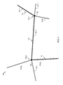
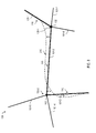
- the curved path 210 (illustrated in FIG. 6 as a dashed line) is defined with respect to a plurality of points 211-1 - 211-9, which are respectively at a given geolocation and have associated tangents 212.
- the tangents 212 define the curvature of the curved path 210.
- Such a data structure comprising points 211-1 - 211-9 associated with tangents 212 is sometimes referred to as a clothoid.
- a clothoid Such a data structure comprising points 211-1 - 211-9 associated with tangents 212 is sometimes referred to as a clothoid.
- other formal data structures which enable to describe the curved path 210 exist and may be employed in various scenarios.
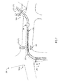
- the map view 250 including the curved path 210 for route guidance along the planned route 110 is illustrated.
- the curved path 210 models the geometrical form of the transition along the planned route 110, taking into account a given one of the plurality of driving lanes through the intersections 105-1, 105-2.
- the route guidance includes continuously highlighting this given one of the plurality of driving lanes along the curved path 210 throughout the two intersections 105-1, 105-2 (illustrated in FIG. 7 by the dashed full line).
- various techniques of highlighting are conceivable, including, but not limited to: using certain colors, using borders, using certain line styles, using certain textures, animation.
- the current position 260 is graphically indicated in the map view 250. As the current position 260 is determined at a spatial resolution high enough to distinguish between adjacent driving lanes, it is immediately possible for the driver of the vehicle to check whether the vehicle correctly follows the particular driving lane indicated by the curved path 210 and illustrated in the map view 250.
- intersection features such as bicycle and pedestrians crossing 270, traffic lights 271, lane markings 272, and stop lines 273 are provided in the map view 250.
- warnings 280 which create attention of the driver to potentially dangerous situations of the intersection.
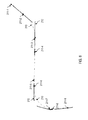
- the curved path 210 is illustrated with respect to the road network graph 100 of FIG. 5 . As can be seen, the curved path 210 does not exactly follow the road segments 101-1-101-7 which form the two intersections 105-1, 105-2. Instead, a distance between the various road segments 101-1 - 101-7 of the road network graph 100 and the curved path 210 may exist (illustrated in FIG. 8 by the arrow).
- FIG. 9 a flowchart of a method for providing route guidance along a planned route according to various embodiments of the present invention is illustrated.
- step S2 the route finding is performed to obtain the planned route 110.
- step S2 is an optional step.
- the route finding is executed based on map data comprising a road network graph 100 as stored in the database 504. Alternatively, it is possible to obtain the planned route 110 from other entities.
- step S3 it is checked whether the planned route comprises ant least one intersection 105, 105-1, 105-2. If this is not the case, the method ends in step S6.
- attributes for a transition through the at least one intersection 105, 105-1, 105-2 along the planned route 110 are retrieved from the database 504.
- the attributes include at least the curved path 210 through the at least one intersection 105, 105-1, 105-2.
- the attributes may include the intersection features, e.g., geographical position of stop lines, traffic lights, etc.
- step S5 the curved path 210 is displayed in the map view 250.
- the current position 260 can be displayed in the map view such that the driver may easily determine whether the vehicle follows the curved path 210.
- step S6 The method ends in step S6.
- map view For example, various embodiments of the map view have been discussed making reference to two-dimensional map views. Yet it is possible to apply techniques described herein to three-dimensional map views.
Landscapes
- Engineering & Computer Science (AREA)
- Radar, Positioning & Navigation (AREA)
- Remote Sensing (AREA)
- Automation & Control Theory (AREA)
- Physics & Mathematics (AREA)
- General Physics & Mathematics (AREA)
- Navigation (AREA)
Priority Applications (2)
| Application Number | Priority Date | Filing Date | Title |
|---|---|---|---|
| EP13157563.1A EP2775261B1 (fr) | 2013-03-04 | 2013-03-04 | Guidage routier au niveau d'intersections |
| US14/196,838 US10295357B2 (en) | 2013-03-04 | 2014-03-04 | Route guidance at intersections |
Applications Claiming Priority (1)
| Application Number | Priority Date | Filing Date | Title |
|---|---|---|---|
| EP13157563.1A EP2775261B1 (fr) | 2013-03-04 | 2013-03-04 | Guidage routier au niveau d'intersections |
Publications (2)
| Publication Number | Publication Date |
|---|---|
| EP2775261A1 true EP2775261A1 (fr) | 2014-09-10 |
| EP2775261B1 EP2775261B1 (fr) | 2019-06-12 |
Family
ID=47779958
Family Applications (1)
| Application Number | Title | Priority Date | Filing Date |
|---|---|---|---|
| EP13157563.1A Active EP2775261B1 (fr) | 2013-03-04 | 2013-03-04 | Guidage routier au niveau d'intersections |
Country Status (2)
| Country | Link |
|---|---|
| US (1) | US10295357B2 (fr) |
| EP (1) | EP2775261B1 (fr) |
Cited By (1)
| Publication number | Priority date | Publication date | Assignee | Title |
|---|---|---|---|---|
| CN112798003A (zh) * | 2020-12-30 | 2021-05-14 | 腾讯科技(深圳)有限公司 | 导航提示信息的生成方法、提醒方法、装置及设备 |
Families Citing this family (14)
| Publication number | Priority date | Publication date | Assignee | Title |
|---|---|---|---|---|
| US10533863B2 (en) * | 2014-10-10 | 2020-01-14 | Here Global B.V. | Apparatus and associated methods for use in lane-level mapping of road intersections |
| US9915540B2 (en) | 2015-08-06 | 2018-03-13 | International Business Machines Corporation | Generating routing information for a target location |
| US20170277392A1 (en) * | 2016-03-24 | 2017-09-28 | The Boeing Company | Vehicle map icon |
| US9978161B2 (en) * | 2016-04-11 | 2018-05-22 | Here Global B.V. | Supporting a creation of a representation of road geometry |
| JP6727985B2 (ja) * | 2016-08-18 | 2020-07-22 | 株式会社東芝 | 情報処理装置、情報処理方法、および移動体 |
| KR102695518B1 (ko) | 2017-01-26 | 2024-08-14 | 삼성전자주식회사 | 차량 경로 가이드 방법 및 장치 |
| JP6787627B2 (ja) * | 2017-02-06 | 2020-11-18 | アルパイン株式会社 | ナビゲーション装置 |
| CN110196056B (zh) * | 2018-03-29 | 2023-12-05 | 文远知行有限公司 | 用于生成用于自动驾驶车辆导航和决策的道路地图的方法和导航装置 |
| CN110411470B (zh) * | 2018-04-27 | 2021-11-23 | 北京嘀嘀无限科技发展有限公司 | 一种基于车道的播报系统、方法、装置和存储介质 |
| CN112774197B (zh) * | 2019-11-06 | 2024-05-28 | 网易(杭州)网络有限公司 | 道路过渡段的生成方法、装置、电子设备及存储介质 |
| CN114179805B (zh) * | 2021-12-10 | 2023-12-19 | 北京百度网讯科技有限公司 | 一种行驶方向确定方法、装置、设备以及存储介质 |
| CN114812597A (zh) * | 2022-02-08 | 2022-07-29 | 阿里巴巴(中国)有限公司 | 道路引导图示生成方法、装置、导航方法及可读存储介质 |
| US12536914B2 (en) * | 2023-08-23 | 2026-01-27 | Honeywell International Inc. | Method and system for taxi assist path generation based on guidance lines of an airport |
| CN117392875A (zh) * | 2023-09-15 | 2024-01-12 | 上汽通用五菱汽车股份有限公司 | 基于几何模型的线路权限的分配方法 |
Citations (5)
| Publication number | Priority date | Publication date | Assignee | Title |
|---|---|---|---|---|
| EP1122626A1 (fr) * | 2000-02-02 | 2001-08-08 | Matsushita Electric Industrial Co., Ltd. | Méthode de visualisation d'une intersection, unité de visualisation d'une carte et support d'enregistrement pour réaliser la méthode |
| EP1471329A2 (fr) * | 2003-04-25 | 2004-10-27 | Pioneer Corporation | Système de recherche de route, procédé de recherche de route, système de navigation et produit logiciel |
| EP1536394A2 (fr) * | 2003-11-28 | 2005-06-01 | Samsung Electronics Co., Ltd. | Système télématique utilisant des données d'image, et méthode pour le guidage d'un vehicule suivant une route, uitlisant ce système |
| US20080208450A1 (en) * | 2007-02-28 | 2008-08-28 | Navigon Ag | Navigation device and method for the graphic output of navigaton instructions |
| EP2192554A1 (fr) * | 2008-01-28 | 2010-06-02 | Geo Technical Laboratory Co., Ltd. | Structure de données d'une base de données de guidage de route |
Family Cites Families (5)
| Publication number | Priority date | Publication date | Assignee | Title |
|---|---|---|---|---|
| JP4663620B2 (ja) * | 2006-12-07 | 2011-04-06 | 日立オートモティブシステムズ株式会社 | 車載情報端末、地図サーバ、および車載システム |
| JP5234691B2 (ja) * | 2009-01-28 | 2013-07-10 | アイシン・エィ・ダブリュ株式会社 | ナビゲーション装置、プローブ情報送信方法、プログラム及び交通情報作成装置 |
| WO2012129424A2 (fr) * | 2011-03-23 | 2012-09-27 | Tk Holdings Inc. | Système d'aide à la conduite |
| US9146125B2 (en) * | 2012-06-05 | 2015-09-29 | Apple Inc. | Navigation application with adaptive display of graphical directional indicators |
| US9026356B2 (en) * | 2013-02-22 | 2015-05-05 | Nissan North America, Inc. | Vehicle navigation system and method |
-
2013
- 2013-03-04 EP EP13157563.1A patent/EP2775261B1/fr active Active
-
2014
- 2014-03-04 US US14/196,838 patent/US10295357B2/en active Active
Patent Citations (5)
| Publication number | Priority date | Publication date | Assignee | Title |
|---|---|---|---|---|
| EP1122626A1 (fr) * | 2000-02-02 | 2001-08-08 | Matsushita Electric Industrial Co., Ltd. | Méthode de visualisation d'une intersection, unité de visualisation d'une carte et support d'enregistrement pour réaliser la méthode |
| EP1471329A2 (fr) * | 2003-04-25 | 2004-10-27 | Pioneer Corporation | Système de recherche de route, procédé de recherche de route, système de navigation et produit logiciel |
| EP1536394A2 (fr) * | 2003-11-28 | 2005-06-01 | Samsung Electronics Co., Ltd. | Système télématique utilisant des données d'image, et méthode pour le guidage d'un vehicule suivant une route, uitlisant ce système |
| US20080208450A1 (en) * | 2007-02-28 | 2008-08-28 | Navigon Ag | Navigation device and method for the graphic output of navigaton instructions |
| EP2192554A1 (fr) * | 2008-01-28 | 2010-06-02 | Geo Technical Laboratory Co., Ltd. | Structure de données d'une base de données de guidage de route |
Cited By (1)
| Publication number | Priority date | Publication date | Assignee | Title |
|---|---|---|---|---|
| CN112798003A (zh) * | 2020-12-30 | 2021-05-14 | 腾讯科技(深圳)有限公司 | 导航提示信息的生成方法、提醒方法、装置及设备 |
Also Published As
| Publication number | Publication date |
|---|---|
| EP2775261B1 (fr) | 2019-06-12 |
| US20140249748A1 (en) | 2014-09-04 |
| US10295357B2 (en) | 2019-05-21 |
Similar Documents
| Publication | Publication Date | Title |
|---|---|---|
| EP2775261B1 (fr) | Guidage routier au niveau d'intersections | |
| US11933627B2 (en) | High-definition map building method and apparatus | |
| KR20220018594A (ko) | 지도 생성 방법, 포지셔닝 방법, 장치, 디바이스, 저장 매체 및 컴퓨터 프로그램 | |
| EP2960884B1 (fr) | Système de visualisation de disponibilité de stationnement directionnel | |
| CN112325896B (zh) | 导航方法、装置、智能行驶设备及存储介质 | |
| US11255692B2 (en) | System and method for identification of a roadwork zone | |
| US20200372012A1 (en) | System and method for updating map data in a map database | |
| US20160178383A1 (en) | User Interface for Displaying Navigation Information in a Small Display | |
| US11333505B2 (en) | Method and system to generate updated map data for parallel roads | |
| EP3009798B1 (fr) | Fourniture d'instructions de navigation routière alternatives pour les automobilistes sur des routes non familières | |
| US10168176B2 (en) | Visualizing unidirectional traffic information | |
| US11602974B2 (en) | System and method for generating map data associated with road objects | |
| EP3432287A1 (fr) | Métrique de commande de navigation | |
| CN111307167A (zh) | 用于通过区域的路线生成的方法和系统 | |
| US20120191344A1 (en) | Method and apparatus for displaying lane complexity information for navigation system | |
| US9243926B2 (en) | Electronic map system | |
| US10488214B2 (en) | Method, apparatus, and computer program product for dynamic lane guidance | |
| EP2775262A1 (fr) | Guidage routier | |
| US10876841B2 (en) | Moving body management system and method | |
| WO2019016931A1 (fr) | Dispositif de commande d'affichage et procédé de commande d'affichage | |
| CN108168566B (zh) | 道路确定方法、装置及电子设备 | |
| CN110081892A (zh) | 一种高精度电子地图导航方法及装置 | |
| JP6633372B2 (ja) | 経路探索装置及び経路探索方法 | |
| EP3339808B1 (fr) | Positionnement d'objets dans un affichage de réalité augmentée | |
| CN110514216B (zh) | 一种确定导航路线的方法、装置、设备及存储介质 |
Legal Events
| Date | Code | Title | Description |
|---|---|---|---|
| PUAI | Public reference made under article 153(3) epc to a published international application that has entered the european phase |
Free format text: ORIGINAL CODE: 0009012 |
|
| 17P | Request for examination filed |
Effective date: 20130304 |
|
| AK | Designated contracting states |
Kind code of ref document: A1 Designated state(s): AL AT BE BG CH CY CZ DE DK EE ES FI FR GB GR HR HU IE IS IT LI LT LU LV MC MK MT NL NO PL PT RO RS SE SI SK SM TR |
|
| AX | Request for extension of the european patent |
Extension state: BA ME |
|
| R17P | Request for examination filed (corrected) |
Effective date: 20150224 |
|
| 17Q | First examination report despatched |
Effective date: 20160819 |
|
| STAA | Information on the status of an ep patent application or granted ep patent |
Free format text: STATUS: EXAMINATION IS IN PROGRESS |
|
| GRAP | Despatch of communication of intention to grant a patent |
Free format text: ORIGINAL CODE: EPIDOSNIGR1 |
|
| STAA | Information on the status of an ep patent application or granted ep patent |
Free format text: STATUS: GRANT OF PATENT IS INTENDED |
|
| INTG | Intention to grant announced |
Effective date: 20190115 |
|
| GRAS | Grant fee paid |
Free format text: ORIGINAL CODE: EPIDOSNIGR3 |
|
| GRAA | (expected) grant |
Free format text: ORIGINAL CODE: 0009210 |
|
| STAA | Information on the status of an ep patent application or granted ep patent |
Free format text: STATUS: THE PATENT HAS BEEN GRANTED |
|
| AK | Designated contracting states |
Kind code of ref document: B1 Designated state(s): AL AT BE BG CH CY CZ DE DK EE ES FI FR GB GR HR HU IE IS IT LI LT LU LV MC MK MT NL NO PL PT RO RS SE SI SK SM TR |
|
| REG | Reference to a national code |
Ref country code: GB Ref legal event code: FG4D |
|
| REG | Reference to a national code |
Ref country code: CH Ref legal event code: EP |
|
| REG | Reference to a national code |
Ref country code: AT Ref legal event code: REF Ref document number: 1143145 Country of ref document: AT Kind code of ref document: T Effective date: 20190615 |
|
| REG | Reference to a national code |
Ref country code: DE Ref legal event code: R096 Ref document number: 602013056401 Country of ref document: DE |
|
| REG | Reference to a national code |
Ref country code: IE Ref legal event code: FG4D |
|
| REG | Reference to a national code |
Ref country code: NL Ref legal event code: MP Effective date: 20190612 |
|
| REG | Reference to a national code |
Ref country code: LT Ref legal event code: MG4D |
|
| PG25 | Lapsed in a contracting state [announced via postgrant information from national office to epo] |
Ref country code: LT Free format text: LAPSE BECAUSE OF FAILURE TO SUBMIT A TRANSLATION OF THE DESCRIPTION OR TO PAY THE FEE WITHIN THE PRESCRIBED TIME-LIMIT Effective date: 20190612 Ref country code: HR Free format text: LAPSE BECAUSE OF FAILURE TO SUBMIT A TRANSLATION OF THE DESCRIPTION OR TO PAY THE FEE WITHIN THE PRESCRIBED TIME-LIMIT Effective date: 20190612 Ref country code: FI Free format text: LAPSE BECAUSE OF FAILURE TO SUBMIT A TRANSLATION OF THE DESCRIPTION OR TO PAY THE FEE WITHIN THE PRESCRIBED TIME-LIMIT Effective date: 20190612 Ref country code: NO Free format text: LAPSE BECAUSE OF FAILURE TO SUBMIT A TRANSLATION OF THE DESCRIPTION OR TO PAY THE FEE WITHIN THE PRESCRIBED TIME-LIMIT Effective date: 20190912 Ref country code: AL Free format text: LAPSE BECAUSE OF FAILURE TO SUBMIT A TRANSLATION OF THE DESCRIPTION OR TO PAY THE FEE WITHIN THE PRESCRIBED TIME-LIMIT Effective date: 20190612 Ref country code: SE Free format text: LAPSE BECAUSE OF FAILURE TO SUBMIT A TRANSLATION OF THE DESCRIPTION OR TO PAY THE FEE WITHIN THE PRESCRIBED TIME-LIMIT Effective date: 20190612 |
|
| PG25 | Lapsed in a contracting state [announced via postgrant information from national office to epo] |
Ref country code: GR Free format text: LAPSE BECAUSE OF FAILURE TO SUBMIT A TRANSLATION OF THE DESCRIPTION OR TO PAY THE FEE WITHIN THE PRESCRIBED TIME-LIMIT Effective date: 20190913 Ref country code: LV Free format text: LAPSE BECAUSE OF FAILURE TO SUBMIT A TRANSLATION OF THE DESCRIPTION OR TO PAY THE FEE WITHIN THE PRESCRIBED TIME-LIMIT Effective date: 20190612 Ref country code: RS Free format text: LAPSE BECAUSE OF FAILURE TO SUBMIT A TRANSLATION OF THE DESCRIPTION OR TO PAY THE FEE WITHIN THE PRESCRIBED TIME-LIMIT Effective date: 20190612 Ref country code: BG Free format text: LAPSE BECAUSE OF FAILURE TO SUBMIT A TRANSLATION OF THE DESCRIPTION OR TO PAY THE FEE WITHIN THE PRESCRIBED TIME-LIMIT Effective date: 20190912 |
|
| REG | Reference to a national code |
Ref country code: AT Ref legal event code: MK05 Ref document number: 1143145 Country of ref document: AT Kind code of ref document: T Effective date: 20190612 |
|
| PG25 | Lapsed in a contracting state [announced via postgrant information from national office to epo] |
Ref country code: SK Free format text: LAPSE BECAUSE OF FAILURE TO SUBMIT A TRANSLATION OF THE DESCRIPTION OR TO PAY THE FEE WITHIN THE PRESCRIBED TIME-LIMIT Effective date: 20190612 Ref country code: EE Free format text: LAPSE BECAUSE OF FAILURE TO SUBMIT A TRANSLATION OF THE DESCRIPTION OR TO PAY THE FEE WITHIN THE PRESCRIBED TIME-LIMIT Effective date: 20190612 Ref country code: RO Free format text: LAPSE BECAUSE OF FAILURE TO SUBMIT A TRANSLATION OF THE DESCRIPTION OR TO PAY THE FEE WITHIN THE PRESCRIBED TIME-LIMIT Effective date: 20190612 Ref country code: NL Free format text: LAPSE BECAUSE OF FAILURE TO SUBMIT A TRANSLATION OF THE DESCRIPTION OR TO PAY THE FEE WITHIN THE PRESCRIBED TIME-LIMIT Effective date: 20190612 Ref country code: CZ Free format text: LAPSE BECAUSE OF FAILURE TO SUBMIT A TRANSLATION OF THE DESCRIPTION OR TO PAY THE FEE WITHIN THE PRESCRIBED TIME-LIMIT Effective date: 20190612 Ref country code: PT Free format text: LAPSE BECAUSE OF FAILURE TO SUBMIT A TRANSLATION OF THE DESCRIPTION OR TO PAY THE FEE WITHIN THE PRESCRIBED TIME-LIMIT Effective date: 20191014 Ref country code: AT Free format text: LAPSE BECAUSE OF FAILURE TO SUBMIT A TRANSLATION OF THE DESCRIPTION OR TO PAY THE FEE WITHIN THE PRESCRIBED TIME-LIMIT Effective date: 20190612 |
|
| PG25 | Lapsed in a contracting state [announced via postgrant information from national office to epo] |
Ref country code: SM Free format text: LAPSE BECAUSE OF FAILURE TO SUBMIT A TRANSLATION OF THE DESCRIPTION OR TO PAY THE FEE WITHIN THE PRESCRIBED TIME-LIMIT Effective date: 20190612 Ref country code: IS Free format text: LAPSE BECAUSE OF FAILURE TO SUBMIT A TRANSLATION OF THE DESCRIPTION OR TO PAY THE FEE WITHIN THE PRESCRIBED TIME-LIMIT Effective date: 20191012 Ref country code: IT Free format text: LAPSE BECAUSE OF FAILURE TO SUBMIT A TRANSLATION OF THE DESCRIPTION OR TO PAY THE FEE WITHIN THE PRESCRIBED TIME-LIMIT Effective date: 20190612 Ref country code: ES Free format text: LAPSE BECAUSE OF FAILURE TO SUBMIT A TRANSLATION OF THE DESCRIPTION OR TO PAY THE FEE WITHIN THE PRESCRIBED TIME-LIMIT Effective date: 20190612 |
|
| REG | Reference to a national code |
Ref country code: DE Ref legal event code: R097 Ref document number: 602013056401 Country of ref document: DE |
|
| PG25 | Lapsed in a contracting state [announced via postgrant information from national office to epo] |
Ref country code: TR Free format text: LAPSE BECAUSE OF FAILURE TO SUBMIT A TRANSLATION OF THE DESCRIPTION OR TO PAY THE FEE WITHIN THE PRESCRIBED TIME-LIMIT Effective date: 20190612 |
|
| PLBE | No opposition filed within time limit |
Free format text: ORIGINAL CODE: 0009261 |
|
| STAA | Information on the status of an ep patent application or granted ep patent |
Free format text: STATUS: NO OPPOSITION FILED WITHIN TIME LIMIT |
|
| PG25 | Lapsed in a contracting state [announced via postgrant information from national office to epo] |
Ref country code: PL Free format text: LAPSE BECAUSE OF FAILURE TO SUBMIT A TRANSLATION OF THE DESCRIPTION OR TO PAY THE FEE WITHIN THE PRESCRIBED TIME-LIMIT Effective date: 20190612 Ref country code: DK Free format text: LAPSE BECAUSE OF FAILURE TO SUBMIT A TRANSLATION OF THE DESCRIPTION OR TO PAY THE FEE WITHIN THE PRESCRIBED TIME-LIMIT Effective date: 20190612 |
|
| 26N | No opposition filed |
Effective date: 20200313 |
|
| PG25 | Lapsed in a contracting state [announced via postgrant information from national office to epo] |
Ref country code: SI Free format text: LAPSE BECAUSE OF FAILURE TO SUBMIT A TRANSLATION OF THE DESCRIPTION OR TO PAY THE FEE WITHIN THE PRESCRIBED TIME-LIMIT Effective date: 20190612 Ref country code: IS Free format text: LAPSE BECAUSE OF FAILURE TO SUBMIT A TRANSLATION OF THE DESCRIPTION OR TO PAY THE FEE WITHIN THE PRESCRIBED TIME-LIMIT Effective date: 20200224 |
|
| PG2D | Information on lapse in contracting state deleted |
Ref country code: IS |
|
| PG25 | Lapsed in a contracting state [announced via postgrant information from national office to epo] |
Ref country code: MC Free format text: LAPSE BECAUSE OF FAILURE TO SUBMIT A TRANSLATION OF THE DESCRIPTION OR TO PAY THE FEE WITHIN THE PRESCRIBED TIME-LIMIT Effective date: 20190612 |
|
| REG | Reference to a national code |
Ref country code: CH Ref legal event code: PL |
|
| REG | Reference to a national code |
Ref country code: BE Ref legal event code: MM Effective date: 20200331 |
|
| PG25 | Lapsed in a contracting state [announced via postgrant information from national office to epo] |
Ref country code: LU Free format text: LAPSE BECAUSE OF NON-PAYMENT OF DUE FEES Effective date: 20200304 |
|
| PG25 | Lapsed in a contracting state [announced via postgrant information from national office to epo] |
Ref country code: CH Free format text: LAPSE BECAUSE OF NON-PAYMENT OF DUE FEES Effective date: 20200331 Ref country code: LI Free format text: LAPSE BECAUSE OF NON-PAYMENT OF DUE FEES Effective date: 20200331 Ref country code: IE Free format text: LAPSE BECAUSE OF NON-PAYMENT OF DUE FEES Effective date: 20200304 Ref country code: FR Free format text: LAPSE BECAUSE OF NON-PAYMENT OF DUE FEES Effective date: 20200331 |
|
| PG25 | Lapsed in a contracting state [announced via postgrant information from national office to epo] |
Ref country code: BE Free format text: LAPSE BECAUSE OF NON-PAYMENT OF DUE FEES Effective date: 20200331 |
|
| PG25 | Lapsed in a contracting state [announced via postgrant information from national office to epo] |
Ref country code: MT Free format text: LAPSE BECAUSE OF FAILURE TO SUBMIT A TRANSLATION OF THE DESCRIPTION OR TO PAY THE FEE WITHIN THE PRESCRIBED TIME-LIMIT Effective date: 20190612 Ref country code: CY Free format text: LAPSE BECAUSE OF FAILURE TO SUBMIT A TRANSLATION OF THE DESCRIPTION OR TO PAY THE FEE WITHIN THE PRESCRIBED TIME-LIMIT Effective date: 20190612 |
|
| PG25 | Lapsed in a contracting state [announced via postgrant information from national office to epo] |
Ref country code: MK Free format text: LAPSE BECAUSE OF FAILURE TO SUBMIT A TRANSLATION OF THE DESCRIPTION OR TO PAY THE FEE WITHIN THE PRESCRIBED TIME-LIMIT Effective date: 20190612 |
|
| P01 | Opt-out of the competence of the unified patent court (upc) registered |
Effective date: 20230526 |
|
| PGFP | Annual fee paid to national office [announced via postgrant information from national office to epo] |
Ref country code: GB Payment date: 20260220 Year of fee payment: 14 |
|
| PGFP | Annual fee paid to national office [announced via postgrant information from national office to epo] |
Ref country code: DE Payment date: 20260219 Year of fee payment: 14 |