EP2879089A1 - Dispositif de traitement d'informations, système de traitement d'informations, et programme de traitement d'informations - Google Patents
Dispositif de traitement d'informations, système de traitement d'informations, et programme de traitement d'informations Download PDFInfo
- Publication number
- EP2879089A1 EP2879089A1 EP13871790.5A EP13871790A EP2879089A1 EP 2879089 A1 EP2879089 A1 EP 2879089A1 EP 13871790 A EP13871790 A EP 13871790A EP 2879089 A1 EP2879089 A1 EP 2879089A1
- Authority
- EP
- European Patent Office
- Prior art keywords
- mobile body
- aerial photograph
- scene
- trajectory
- information processing
- Prior art date
- Legal status (The legal status is an assumption and is not a legal conclusion. Google has not performed a legal analysis and makes no representation as to the accuracy of the status listed.)
- Withdrawn
Links
Images


Classifications
-
- G—PHYSICS
- G06—COMPUTING OR CALCULATING; COUNTING
- G06F—ELECTRIC DIGITAL DATA PROCESSING
- G06F16/00—Information retrieval; Database structures therefor; File system structures therefor
- G06F16/50—Information retrieval; Database structures therefor; File system structures therefor of still image data
- G06F16/58—Retrieval characterised by using metadata, e.g. metadata not derived from the content or metadata generated manually
-
- G—PHYSICS
- G01—MEASURING; TESTING
- G01C—MEASURING DISTANCES, LEVELS OR BEARINGS; SURVEYING; NAVIGATION; GYROSCOPIC INSTRUMENTS; PHOTOGRAMMETRY OR VIDEOGRAMMETRY
- G01C21/00—Navigation; Navigational instruments not provided for in groups G01C1/00 - G01C19/00
- G01C21/005—Navigation; Navigational instruments not provided for in groups G01C1/00 - G01C19/00 with correlation of navigation data from several sources, e.g. map or contour matching
-
- G—PHYSICS
- G01—MEASURING; TESTING
- G01C—MEASURING DISTANCES, LEVELS OR BEARINGS; SURVEYING; NAVIGATION; GYROSCOPIC INSTRUMENTS; PHOTOGRAMMETRY OR VIDEOGRAMMETRY
- G01C21/00—Navigation; Navigational instruments not provided for in groups G01C1/00 - G01C19/00
- G01C21/20—Instruments for performing navigational calculations
- G01C21/203—Instruments for performing navigational calculations specially adapted for water-borne vessels
-
- G—PHYSICS
- G06—COMPUTING OR CALCULATING; COUNTING
- G06F—ELECTRIC DIGITAL DATA PROCESSING
- G06F16/00—Information retrieval; Database structures therefor; File system structures therefor
- G06F16/50—Information retrieval; Database structures therefor; File system structures therefor of still image data
- G06F16/58—Retrieval characterised by using metadata, e.g. metadata not derived from the content or metadata generated manually
- G06F16/5866—Retrieval characterised by using metadata, e.g. metadata not derived from the content or metadata generated manually using information manually generated, e.g. tags, keywords, comments, manually generated location and time information
-
- G—PHYSICS
- G06—COMPUTING OR CALCULATING; COUNTING
- G06T—IMAGE DATA PROCESSING OR GENERATION, IN GENERAL
- G06T7/00—Image analysis
- G06T7/20—Analysis of motion
- G06T7/223—Analysis of motion using block-matching
-
- G—PHYSICS
- G08—SIGNALLING
- G08G—TRAFFIC CONTROL SYSTEMS
- G08G1/00—Traffic control systems for road vehicles
- G08G1/01—Detecting movement of traffic to be counted or controlled
- G08G1/0104—Measuring and analyzing of parameters relative to traffic conditions
- G08G1/0108—Measuring and analyzing of parameters relative to traffic conditions based on the source of data
- G08G1/012—Measuring and analyzing of parameters relative to traffic conditions based on the source of data from other sources than vehicle or roadside beacons, e.g. mobile networks
-
- G—PHYSICS
- G08—SIGNALLING
- G08G—TRAFFIC CONTROL SYSTEMS
- G08G1/00—Traffic control systems for road vehicles
- G08G1/01—Detecting movement of traffic to be counted or controlled
- G08G1/0104—Measuring and analyzing of parameters relative to traffic conditions
- G08G1/0125—Traffic data processing
- G08G1/0129—Traffic data processing for creating historical data or processing based on historical data
-
- G—PHYSICS
- G08—SIGNALLING
- G08G—TRAFFIC CONTROL SYSTEMS
- G08G1/00—Traffic control systems for road vehicles
- G08G1/01—Detecting movement of traffic to be counted or controlled
- G08G1/017—Detecting movement of traffic to be counted or controlled identifying vehicles
- G08G1/0175—Detecting movement of traffic to be counted or controlled identifying vehicles by photographing vehicles, e.g. when violating traffic rules
-
- G—PHYSICS
- G08—SIGNALLING
- G08G—TRAFFIC CONTROL SYSTEMS
- G08G3/00—Traffic control systems for marine craft
- G08G3/02—Anti-collision systems
-
- G—PHYSICS
- G08—SIGNALLING
- G08G—TRAFFIC CONTROL SYSTEMS
- G08G9/00—Traffic control systems for craft where the kind of craft is irrelevant or unspecified
- G08G9/02—Anti-collision systems
-
- G—PHYSICS
- G06—COMPUTING OR CALCULATING; COUNTING
- G06T—IMAGE DATA PROCESSING OR GENERATION, IN GENERAL
- G06T2207/00—Indexing scheme for image analysis or image enhancement
- G06T2207/10—Image acquisition modality
- G06T2207/10032—Satellite or aerial image; Remote sensing
-
- G—PHYSICS
- G06—COMPUTING OR CALCULATING; COUNTING
- G06T—IMAGE DATA PROCESSING OR GENERATION, IN GENERAL
- G06T2207/00—Indexing scheme for image analysis or image enhancement
- G06T2207/20—Special algorithmic details
- G06T2207/20021—Dividing image into blocks, subimages or windows
-
- G—PHYSICS
- G06—COMPUTING OR CALCULATING; COUNTING
- G06T—IMAGE DATA PROCESSING OR GENERATION, IN GENERAL
- G06T2207/00—Indexing scheme for image analysis or image enhancement
- G06T2207/30—Subject of image; Context of image processing
- G06T2207/30241—Trajectory
-
- G—PHYSICS
- G08—SIGNALLING
- G08G—TRAFFIC CONTROL SYSTEMS
- G08G5/00—Traffic control systems for aircraft
- G08G5/70—Arrangements for monitoring traffic-related situations or conditions
- G08G5/72—Arrangements for monitoring traffic-related situations or conditions for monitoring traffic
- G08G5/727—Arrangements for monitoring traffic-related situations or conditions for monitoring traffic from a ground station
Definitions
- the present invention relates to an information processing technology and to an information processing technology for assisting mutual information reference by combining an aerial photograph, such as a satellite image or a photograph taken by aircraft, with trajectory data of a mobile body, such as a person, a vehicle, a ship, or aircraft.
- an aerial photograph such as a satellite image or a photograph taken by aircraft
- trajectory data of a mobile body such as a person, a vehicle, a ship, or aircraft.
- the aerial photograph such as a satellite image, is an image of a scene of an area of interest taken on a specific date.
- trajectory data of a mobile body such as a person, a vehicle, a ship, or aircraft
- GPS Global Positioning System
- Examples of the trajectory data include automobile probe data and the Automatic Identification System (AIS) data of ships.
- AIS Automatic Identification System
- GIS geographic information system
- An object of the present invention is to facilitate referencing the position or attribute information of a mobile body shown in an aerial photograph, or identify of an aerial photograph of a point showing the mobile body, for example.
- an information processing device is associated with a mobile body trajectory database storing mobile body trajectory data including a mobile body ID and trajectory data for each mobile body ID, and with an aerial photograph database storing aerial photograph data including an aerial photograph scene ID, a photography date/time, and a photography object range.
- the information processing device includes a mobile body identifying process unit that searches the mobile body trajectory database and identifies the mobile body ID positioned in or around the photography object range of the aerial photograph scene around the photography date/time of the aerial photograph scene; a mobile body trajectory cut-out processing unit that, with respect to the mobile body ID identified by the mobile body identifying process unit, searches the mobile body trajectory database, and cuts out, from the mobile body trajectory data around the photography date/time, a mobile body trajectory data range to be linked to the aerial photograph scene to generate in-scene trajectory data; and a scene corresponding mobile body database storing the in-scene trajectory data linked to a set of the mobile body ID and the aerial photograph scene ID identifying the aerial photograph scene of each scene in the aerial photograph.
- the mobile body shown in the aerial photograph can be identified easily, for example.
- the information processing device may include a mobile body attribute providing process unit that provides the set of the mobile body ID and the aerial photograph scene ID of each scene of the aerial photograph with attribute information of the mobile body.
- the aerial photograph database may include the aerial photograph scene ID and attribute information of the aerial photograph, and the attribute information provided by the mobile body attribute providing process unit may be attribute information derived from at least one of the mobile body trajectory database and the aerial photograph database at the time of linking.
- the aerial photograph can be identified easily and at high speed.
- the mobile body trajectory cut-out processing unit may further cut out the data stored in the scene corresponding mobile body database by narrowing the trajectory data of the mobile body to around the date/time of photography of the aerial photograph and the photography object range for each aerial photograph scene ID.
- the amount of data in the scene corresponding mobile body database can be decreased.
- the information processing device may include an interpolation processing unit that subjects the mobile body trajectory data to an interpolation process in a time interval. While the mobile body trajectory data normally include an arrangement of point data consisting of time and position, the trajectory data may be subjected to an interpolation process in a time interval.
- a smooth trajectory shape can be obtained. Further, a position at a specific date/time can also be more accurately estimated.
- the information processing device may include a chip image cut-out processing unit that cuts out the aerial photograph scene image from the aerial image around an estimated position of the mobile body, and stores the aerial photograph scene image in the scene corresponding mobile body database as a chip image file.
- the image of the mobile body as the object of interest can be easily referenced and utilized for identifying a change in the mobile body over time or deciphering the mobile body in another aerial photograph.
- the information processing device may include a mobile body trajectory superposition unit that generates a superposed file superposing the trajectory data extracted from the scene corresponding mobile body database on an image of an aerial photograph extracted from the aerial photograph database.
- the present invention also provides an information processing system including the information processing device and a superposed file display terminal including a display unit that performs a display based on the superposed file.
- Display control is performed whereby, with the display unit performing the display based on the superposed file superposed by the mobile body trajectory superposition unit, upon detection of a pointing operation with respect to the mobile body or its trajectory displayed on the display unit on the superposed file display terminal, the superposed file is accessed, and attribute information of the mobile body identified based on the pointing-operated position is displayed in association with the mobile body or trajectory.
- the present invention also provides an information processing system including the information processing device and a superposed file display terminal including a display unit that performs a display based on the superposed file. Display control is performed whereby, with the display unit performing the display based on the superposed file superposed by the mobile body trajectory superposition unit, the superposed file is accessed in accordance with a search key that is input, and obtained attribute information is displayed in association with the mobile body or trajectory.
- the present invention also provides an information processing system including the information processing device and a superposed file display terminal including a display unit that performs a display based on the superposed file.
- Display control is performed whereby, with the display unit performing the display based on the superposed file superposed by the mobile body trajectory superposition unit, the superposed file is accessed in accordance with a search key that is input, and the display of the mobile body or trajectory corresponding to a portion obtained in accordance with a process of acquiring or returning the obtained mobile body or trajectory data is modified.
- the scene corresponding mobile body database may be accessed on-line.
- a user interface may be formed such that the mobile body attribute information can be referenced by mouse-clicking or tapping the mobile body or trajectory, the display of the mobile body can be emphasized by conducting an attribute information search by inputting a text, or display divisions, such as color coding, can be switched depending on the attribute information.
- the present invention also provides an information processing system including the information processing device and an aerial photograph search terminal that conducts a search for an aerial photograph.
- an information processing system including the information processing device and an aerial photograph search terminal that conducts a search for an aerial photograph.
- the data in the scene corresponding mobile body database are narrowed according to the search conditions, and an aerial photograph obtained in accordance with a process of acquiring or returning an aerial photograph showing a mobile body having the designated mobile body ID is displayed.
- all of the aerial photographs showing the mobile body can be identified, for example.
- the scene corresponding mobile body database may include orientation or speed of the trajectory data of the mobile body as the object of interest, and the search for the aerial photograph may be performed based on the orientation or speed of the trajectory data of the mobile body as the object of interest.
- the present invention also provides an information processing system including the information processing device and an aerial photograph search terminal that conducts a search for an aerial photograph.
- the scene corresponding mobile body database may include cloud coverage probability data of a possibility of the mobile body as the object of interest being clouded, and may narrow the aerial photograph for which the search is conducted, based on the cloud coverage probability data.
- the present invention also provides an information processing system including the information processing device and an aerial photograph search terminal that conducts a search for an aerial photograph.
- the aerial photograph search terminal may include a means that identifies an aerial photograph showing the mobile body as the object of interest with another specific mobile body or a specific location in the same scene.
- a photograph around the mobile body may be cut out from the aerial photograph showing the mobile body, and then stored as a chip image in association with the mobile body.
- the image of the mobile body as the object of interest can be referenced easily and may be utilized for identifying a change in the mobile body over time or deciphering the mobile body in another aerial photograph.
- the present invention provides an information processing program associated with a mobile body trajectory database storing mobile body trajectory data including a mobile body ID and trajectory data for each mobile body ID, and with an aerial photograph database storing aerial photograph data including an aerial photograph scene ID, a photography date/time, and a photography object range.
- the program causes a computer to execute: a mobile body identifying process of searching the mobile body trajectory database and identifying the mobile body ID positioned in or around the photography object range of the aerial photograph scene around the photography date/time of the aerial photograph scene; a mobile body cut-out process of, with respect to the mobile body ID identified by the mobile body identifying process unit, searching the mobile body trajectory database and cutting out, from the trajectory data of the mobile body around the photography date/time, a mobile body trajectory data range to be linked to the aerial photograph scene to generate in-scene trajectory data; and a process of linking, with respect to a set of the mobile body ID and the aerial photograph scene ID identifying the aerial photograph scene of each scene in the aerial photograph, the in-scene trajectory data, and storing the in-scene trajectory data in the scene corresponding mobile body database.
- a mobile body shown in an aerial photograph can be simply identified.
- an aerial photograph of a point showing a mobile body, or mobile body attribute information can be referenced easily.
- an aerial photograph scene having a high possibility of showing a specific mobile body can be easily identified.
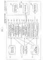
- FIG. 1 is a functional block diagram of a configuration example of an information processing system according to the present embodiment.
- an information processing system A is a system that is normally not connected with an information processing device B via a network, and that includes a superposed file display terminal 107 that displays a superposed file 108 having a data configuration for superposing trajectory data of a mobile body, attributes and the like on an aerial photograph.
- the information processing device B includes a mobile body trajectory database (DB) 101 that stores mobile body track information; an aerial photograph database (DB) 102 that stores aerial photographs; a scene corresponding mobile body database (DB) 103 that stores scene corresponding mobile body information; a preparation processing device (processing unit) 104 that performs a preparation process; a mobile body trajectory superposition device (superposition unit) 105 that superposes a mobile body trajectory on an aerial photograph; an aerial photograph search device (search unit) 106 that conducts aerial photograph search; and an aerial photograph search terminal 109 that conducts aerial photograph search.
- DB mobile body trajectory database
- the superposed file display terminal 107 performs an information process using the superposed file 108 output or delivered by the information processing device B.
- the superposed file display terminal 107 is not connected with the information processing device B via a network (utilized off-line).
- the superposed file display terminal 107 may be connected with the information processing device B and used in on-line mode.
- the information processing device B as a whole may be constructed of a single device, such as a PC, or may be constructed as a system including other devices and the like.
- the DBs may include a conventional memory or an HDD in a PC, or a server and the like via a network.
- the entirety of FIG. 1 may constitute an information processing system.
- the preparation processing device 104 includes a mobile body identifying process unit 104-1; a mobile body trajectory cut-out processing unit 104-2; a mobile body attribute providing process unit 104-3; and a chip image cut-out processing unit 104-4.
- the mobile body trajectory superposition device 105 includes a mobile body trajectory cut-out processing unit 105-1 and a file format conversion unit 105-2.
- the aerial photograph search device 106 includes a search parameter generation unit 106-1 and a search result output unit 106-2.
- the preparation processing device 104 extracts, from the mobile body trajectory DB 101, mobile body trajectory information to be linked to an aerial photograph with respect to each aerial photograph scene stored in the aerial photograph DB 102, and stores the information in the scene corresponding mobile body DB 103.
- a concrete method for the preparation process will be described later.
- the mobile body trajectory superposition device 105 cuts the trajectory data extracted from the scene corresponding mobile body DB 103 in accordance with a range (which is often a part of the scene) of an aerial photograph as the object of delivery, and outputs the cut-out data, together with an image and attribute (meta) data of the aerial photograph extracted from the aerial photograph DB 102, as the superposed file 108 to be delivered.
- the data of the superposed file 108 can be displayed on a display unit of the superposed file display terminal 107 based on a display request from the superposed file display terminal 107, for example.
- a link to the scene corresponding mobile body DB or the aerial photograph DB may be embedded in the file instead of embedding the image data, trajectory data, and attribute data, whereby the image data, trajectory data, and attribute data can be acquired on-line when the superposed file display terminal displays the information.
- the aerial photograph search terminal 109 based on the input of an mobile body as the object of interest, an object period, and an additional search condition, searches for an aerial photograph in which the mobile body as the object of interest is shown.
- an aerial photograph attribute such as a photography condition or cloud coverage probability as scene attribute data
- a mobile body attribute such as the speed of the mobile body at the time of photography, destination of the mobile body, or the point of departure as mobile body attribute data
- a complex condition such as that a plurality of the mobile bodies as the object of interest are shown at the same time in a single aerial photograph.
- the object of search can be narrowed so that, for example, the search is conducted for aerial photographs showing a plurality of mobile bodies.
- the aerial photograph search device 106 can generate a search parameter (such as a SQL statement) that satisfies the designated search conditions, search the aerial photograph DB 102 or the scene corresponding mobile body DB 103 using the parameter, modify the result, and output data to be displayed on the aerial photograph search terminal 109, for example.
- a search parameter such as a SQL statement
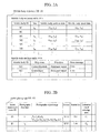
- FIG. 2A illustrates a configuration example of the mobile body trajectory DB 101.
- the mobile body trajectory DB 101 includes a mobile body trajectory table 101a and a mobile body attribute table 101b.
- the mobile body trajectory table 101a includes, e.g., a mobile body ID uniquely identifying the mobile body and, for each mobile body ID, time t, mobile body position data (x, y) at the time, and orientation/speed data (u, v) of the mobile body as an arbitrary attribute.
- x and y are positions on a two-dimensional surface, such as the latitude and the longitude, and t is the time at which the mobile body is positioned at the point.
- the mobile body attribute table 101b holds the attribute data of each mobile body, and includes, for each mobile body ID, the name of the mobile body (or a ship name in the case of a ship), mobile body type (or a ship type in the case of a ship), and other mobile body characteristics (such as the gross tonnage in the case of a ship), for example.
- the mobile body trajectory table 101a and the mobile body attribute table 101b are related by the mobile body ID. While herein the mobile body trajectory DB 101 includes the two types of tables 101a and 101b, the type or number of the tables is not limited to the above.
- FIG. 2B illustrates a configuration example of the aerial photograph DB 102.
- the aerial photograph DB 102 includes, for each aerial photograph, the aerial photograph scene ID uniquely identifying the aerial photograph; the photography date/time of the aerial photograph scene; the photography object range of the aerial photograph scene; and scene attribute data.
- the scene attribute data include, for example, a sensor (satellite) that took the aerial photograph; the resolution of the sensor; and a cloud coverage estimated area in the aerial photograph.
- the trajectory data of the mobile body are generally given not as temporally continuous line data but as point data. If the time interval between point data is long, for example, it may become necessary to perform an interpolation process.
- FIG. 2C illustrates an example in which, with respect to an aerial photograph (a area having vertexes P 1 -P 2 -P 3 -P 4 ), the trajectory of a mobile body has been superposed.
- the position P 11 (x, y) of the mobile body shown in the aerial photograph taken at the time of photography t 1 is indicated on a trajectory connecting four points (x 11 , y 11 , t 11 ), (x 12 , y 12 , t 12 ), (x 13 , y 13 , t 13 ), (x 14 , y 14 , t 14 ) existing as trajectory data.
- the mobile body data may be interpolated.
- a technique may be selected from a simple polygonal line and a spline curve, for example, depending on the positional accuracy or the smoothness of shape required for the particular purpose.
- the Hermitian curve may be an alternative.
- a trajectory data interpolation process may be performed in the mobile body trajectory superposition device 105 or the superposed file display terminal 107.
- the position P 11 (x, y) of the mobile body at the photography time t 1 can be determined by the interpolation process.
- FIG. 6A is a flowchart of the preparation process for creating the data of the scene corresponding mobile body DB 103 illustrated in FIG. 3 in the preparation processing device 104 of FIG. 1 .
- the flowchart will be described with reference to FIG. 1 , FIG. 2A, and FIG. 2B as needed.
- the mobile body identifying process unit 104-1 searches the mobile body trajectory DB 101 of FIG. 2A for a mobile body positioned in or around the photography object range (such as P 1 -P 2 -P 3 -P 4 ) of the aerial photograph scene around the photography date/time t 1 of the aerial photograph scene (step 201).
- the "around the photography date/time” refers to the period of t 1 - ⁇ t max /2 and t 1 + ⁇ t max /2, for example, where t 1 is the photography date/time of the scene, and ⁇ t max is the maximum value of the interval of the trajectory data of the mobile body.
- t 1 is the photography date/time of the scene
- ⁇ t max is the maximum value of the interval of the trajectory data of the mobile body.
- the trajectory data of the mobile body is interpolated by the above-described method as illustrated in FIG. 2C , estimating the position of the mobile body at the photography date/time t 1 of the scene (step 202).
- the subsequent process is performed only for those of the mobile bodies of which estimated positions are within the photography object area of the scene after eliminating the mobile bodies of which the estimated positions are outside the photography object area of the scene (step 203).
- the mobile body trajectory cut-out processing unit 104-2 first cuts out, from the trajectory data of the mobile body around the photography date/time, a data range included in the photography object range of the scene, and stores the cut-out data range in the scene corresponding mobile body DB 103, as illustrated in FIG. 3 (step 204).
- the scene corresponding mobile body DB 103 there are stored the items described below with respect to the set of the mobile body ID of the searched mobile body ( FIG. 2A ) and the aerial photograph ID (aerial photograph scene ID).
- attribute data unique to the date/time or position of photography are extracted. For example, by estimating the orientation (orientation at the time of photography) or speed (speed at the time of photography) of the mobile body at the photography date/time from the trajectory data, or by tracking the trajectory data temporally forward and backward, it becomes possible to estimate the point of departure of the mobile body (the point of departure) or the date/time of departure, or the point of arrival (destination) or the date/time of arrival.
- the point of departure or destination may be estimated based on the trajectory data of the mobile body illustrated in FIG. 2A .
- the amount of data of the stored trajectory data can be decreased.
- the mobile body attribute providing process unit 104-3 stores these attribute information (provided attributes) in the scene corresponding mobile body DB 103 (step 205).
- the chip image cut-out processing unit 104-4 cuts out an aerial photograph scene image around the estimated position of the mobile body from the aerial image, and stores the cut-out image in the scene corresponding mobile body DB 103 as a chip image file 302 (step 206). This completes the preparation process of storing data in the scene corresponding mobile body DB 103.
- the past data in the mobile body trajectory DB 101 may be deleted.
- the mobile body trajectory data if held in their entirety, often result in vast amounts of data.
- the data storage medium can be saved.
- a scene corresponding mobile body table 301 is a table having a pair of mobile body ID and aerial photograph scene ID as a primary key.
- In-scene trajectory data may be stored as blob (binary large object) data, a separate table, or a file in the table in the scene corresponding mobile body DB.
- the chip image is held as the image file 302 according to JPEG and the like, the chip image may be stored in the table as blob data.
- the scene corresponding mobile body DB 103 is constructed in advance.
- the aerial photograph identified by the aerial photograph scene ID by associating the mobile body (such as the mobile body ID) positioned in the object photography range of the aerial photograph and related attributes (such as the mobile body departure time and the probability of cloud coverage in the aerial photograph) with the time of photography of the aerial photograph (see FIG. 2B ) in advance, it becomes possible to easily reference the trajectory of the mobile body shown in the aerial photograph or attribute information of the mobile body such as the cloud coverage probability, or to identify the aerial photograph that includes such attributes easily and at high speed.
- the mobile body such as the mobile body ID
- related attributes such as the mobile body departure time and the probability of cloud coverage in the aerial photograph
- FIG. 4 illustrates a display screen example 401 in which the superposed file 108 is displayed on the superposed file display terminal 107.
- the mobile body trajectory superposition device 105 that outputs and delivers the superposed file in which the mobile body trajectory is superposed on the aerial photograph includes the mobile body trajectory cut-out processing unit 105-1 and the file format conversion unit 105-2.
- the mobile body trajectory cut-out processing unit 105-1 by referring to the aerial photograph DB 102 and the scene corresponding mobile body DB 103, generates the superposed file 108 in which the in-scene trajectory data obtained from the data in the scene corresponding mobile body DB 103 of FIG. 3 are superposed on the aerial photograph obtained from the aerial photograph DB 102 of FIG. 2B based on the aerial photograph scene ID.
- the superposed file 108 may be converted by the file format conversion unit 105-2 in advance into a format in which raster and vector are superposed, such as GeoPDF, KML, or HTML 5, enabling the user to refer to information by a simple and charge-free means, such as Adobe Reader, Google Earth (both trademarks), or a browser, without using expensive software or difficult procedures.
- a format in which raster and vector are superposed such as GeoPDF, KML, or HTML 5
- a simple and charge-free means such as Adobe Reader, Google Earth (both trademarks), or a browser, without using expensive software or difficult procedures.
- the aerial photograph of a point showing the mobile body can be easily referenced.
- an attribute can be known from the color or shape of a corresponding icon, or a movement orientation can be known from the direction of the icon.
- the attribute information may be referenced.
- a process may be performed whereby attribute information such as a text is input as search data so as to identify the mobile body matching a search condition and display the mobile body with emphasis on the aerial photograph, for example.
- the user When the user searches for the aerial photograph showing a mobile body as the object of interest, the user inputs the mobile body as the object of interest, the object period, and an additional search condition, using the aerial photograph search device 109.
- an aerial photograph attribute such as a photography condition
- a mobile body attribute such as the speed at the time of photography, destination, or cloud coverage probability
- the aerial photograph search device 106 generates a search parameter (such as a SQL statement) that satisfies the designated search conditions, and searches the aerial photograph database or the scene corresponding mobile body database using the search parameter. The result may be modified and presented to the user via the aerial photograph search terminal 109.
- FIG. 6B is a flow chart of an example of an attribute information referencing process.
- step S1 when the process is started (step S1) and a pointing operation on a mobile body or trajectory in a scene using the mouse or cursor is detected in step S2 (Yes), a search for a mobile body or trajectory closest to the pointed position detected in step S2 is conducted in step S, and the mobile body ID corresponding to the pointing operation is identified.
- step S4 based on the mobile body ID identified in step S3, attribute information is extracted.
- step S5 with respect to the pointed position detected in step S2, the attribute information extracted in step S4 is displayed on the display screen.
- a ship name based on the mobile body ID such as "Queen Elizabeth", or the destination ("Sydney") and the like obtained based on the trajectory data may be pop-up displayed on the image of FIG. 4 .
- display control is executed such that, with the aerial photograph being displayed on the display unit of the superposed file display terminal 107 based on the superposed file superposed by the mobile body trajectory superposition device 105, the superposed file and the like is accessed in accordance with an input search key, and the display of the mobile body or trajectory is modified in a part obtained in accordance with a process of acquiring or returning the obtained mobile body or trajectory data. This may be helpful in a process of determining the trajectory data of the same mobile body at different times and superposing the data on the aerial photograph, for example.
- the superposed file display terminal 107 may be connected to the information processing device B on-line via a network to access the scene corresponding mobile body DB 103 of the information processing device B and acquire the attribute information and the like.
- an attribute may be known from the color or shape of the corresponding icon, or a movement orientation may be known from the direction of the icon.
- attribute information may be referenced by mouse-clicking or tapping the mobile body or trajectory.
- a text may be input to search for attribute information and display the corresponding mobile body with emphasis.
- FIG. 6C is a flow chart of an example of a process of identifying the mobile body or trajectory based on attributes.
- step S 11 Start
- step S 12 an attribute information search is conducted in step S13.
- step S 14 the superposed file display terminal 107 or the scene corresponding mobile body data 301 of FIG. 3 is searched to identify the matching mobile body ID.
- step S 15 a mobile body position or trajectory corresponding to the mobile body ID is displayed with emphasis (such as by providing hatching in the mark of ship).
- one of the two mobile bodies for example, may be clearly indicated by the display with emphasis and the like. This completes the process (step S16: End).
- a mobile body matching the search condition can be shown to the user. Thereafter, a pop-up display may be made by the process of FIG. 6B .
- FIG. 7 shows the flow of an information process in the aerial photograph search device 106 according to a second embodiment of the present invention.
- FIG. 5 shows a search screen example.
- search conditions such as the ID of a mobile body as the object of interest, an additional search object period and the like, entered in the search area 502 (step S22: YES)
- the geographical positions of the searched aerial photograph scenes are displayed while being superposed on the trajectory of the mobile body during the object period (step S23).
- step S24 area 501 in FIG. 5 ).
- step S25 there is displayed more detailed information about each of the aerial photograph scenes acquired in step S25. For example, by displaying a plurality of chip images matching the search conditions (area 503 in FIG. 5 : step S26), image selection by the user can be further assisted. Then, the process ends (end: step S27).
- the aerial photograph scene ID may be identified based on a plurality of mobile body IDs, and the corresponding aerial photograph may be extracted.
- the orientation at the time of photography, the photography dates, and the cloud coverage probability (%) in the image can be displayed on a scene by scene basis for each mobile body scene ID in the display area 501 and for each scene ID indicated as a search result in the display area 503.
- the desired aerial photograph can be displayed in the area 501.
- the process of selecting an aerial photograph image matching a search condition, the process of referencing detailed information, and the like can be assisted.
- the present invention includes a method invention, a program invention, and an invention of a storage medium for storing the program.
- the constituent elements of the present invention may be selectively adopted as desired, and an invention provided with the selectively adopted elements is also included in the present invention.
- the present invention may be utilized as an information processing device.
Landscapes
- Engineering & Computer Science (AREA)
- Physics & Mathematics (AREA)
- General Physics & Mathematics (AREA)
- Remote Sensing (AREA)
- Radar, Positioning & Navigation (AREA)
- Theoretical Computer Science (AREA)
- Analytical Chemistry (AREA)
- Chemical & Material Sciences (AREA)
- Automation & Control Theory (AREA)
- General Engineering & Computer Science (AREA)
- Databases & Information Systems (AREA)
- Data Mining & Analysis (AREA)
- Library & Information Science (AREA)
- Ocean & Marine Engineering (AREA)
- Multimedia (AREA)
- Computer Vision & Pattern Recognition (AREA)
- Information Retrieval, Db Structures And Fs Structures Therefor (AREA)
- Processing Or Creating Images (AREA)
- Image Processing (AREA)
- Image Analysis (AREA)
Applications Claiming Priority (2)
| Application Number | Priority Date | Filing Date | Title |
|---|---|---|---|
| JP2013006691A JP2014137750A (ja) | 2013-01-17 | 2013-01-17 | 情報処理装置、情報処理システム及び情報処理プログラム |
| PCT/JP2013/068091 WO2014112138A1 (fr) | 2013-01-17 | 2013-07-02 | Dispositif de traitement d'informations, système de traitement d'informations, et programme de traitement d'informations |
Publications (2)
| Publication Number | Publication Date |
|---|---|
| EP2879089A1 true EP2879089A1 (fr) | 2015-06-03 |
| EP2879089A4 EP2879089A4 (fr) | 2016-03-23 |
Family
ID=51209254
Family Applications (1)
| Application Number | Title | Priority Date | Filing Date |
|---|---|---|---|
| EP13871790.5A Withdrawn EP2879089A4 (fr) | 2013-01-17 | 2013-07-02 | Dispositif de traitement d'informations, système de traitement d'informations, et programme de traitement d'informations |
Country Status (4)
| Country | Link |
|---|---|
| US (1) | US20150220568A1 (fr) |
| EP (1) | EP2879089A4 (fr) |
| JP (1) | JP2014137750A (fr) |
| WO (1) | WO2014112138A1 (fr) |
Cited By (1)
| Publication number | Priority date | Publication date | Assignee | Title |
|---|---|---|---|---|
| EP3196595A4 (fr) * | 2014-09-16 | 2018-06-20 | Furuno Electric Co., Ltd. | Dispositif d'affichage d'informations environnant son propre navire et procédé d'affichage d'informations environnant son propre navire |
Families Citing this family (10)
| Publication number | Priority date | Publication date | Assignee | Title |
|---|---|---|---|---|
| JP6159179B2 (ja) * | 2013-07-09 | 2017-07-05 | キヤノン株式会社 | 画像処理装置、画像処理方法 |
| US9383210B2 (en) * | 2014-01-30 | 2016-07-05 | James L. Carr | Image navigation and registration (INR) transfer from exquisite systems to hosted space payloads |
| JP6702598B2 (ja) * | 2015-11-26 | 2020-06-03 | Necソリューションイノベータ株式会社 | 航跡描画装置、航跡描画方法、及びプログラム |
| US11119722B2 (en) * | 2016-11-08 | 2021-09-14 | Sharp Kabushiki Kaisha | Movable body control apparatus and recording medium |
| JP6430086B1 (ja) | 2017-10-05 | 2018-11-28 | 三菱電機株式会社 | 画像提供装置、画像提供方法および画像提供プログラム |
| US12219293B2 (en) * | 2019-08-08 | 2025-02-04 | Nippon Telegraph And Telephone Corporation | Image data collecting apparatus, method, and program |
| JP6801802B1 (ja) * | 2020-03-11 | 2020-12-16 | オムロン株式会社 | コントローラシステムおよびその制御方法 |
| JP6863497B1 (ja) * | 2020-03-11 | 2021-04-21 | オムロン株式会社 | コントローラシステムおよびその制御方法 |
| JP6800453B1 (ja) * | 2020-05-07 | 2020-12-16 | 株式会社 情報システムエンジニアリング | 情報処理装置及び情報処理方法 |
| CN117455958B (zh) * | 2023-12-22 | 2024-03-08 | 武汉以彼古罗咨询服务有限公司 | 一种面向精子识别的轨迹追踪方法和装置 |
Family Cites Families (14)
| Publication number | Priority date | Publication date | Assignee | Title |
|---|---|---|---|---|
| JPH10300503A (ja) * | 1997-04-24 | 1998-11-13 | Asia Kosoku Kk | 画像収集機能付きナビゲーションシステム |
| JP4236767B2 (ja) * | 1999-06-25 | 2009-03-11 | 三菱スペース・ソフトウエア株式会社 | 衛星sar画像に基づく移動体の移動情報検出方法 |
| JP3436235B2 (ja) * | 1999-11-05 | 2003-08-11 | 株式会社日立製作所 | 移動物体画像検索方法、及び、装置 |
| US8172702B2 (en) * | 2000-06-16 | 2012-05-08 | Skyhawke Technologies, Llc. | Personal golfing assistant and method and system for graphically displaying golf related information and for collection, processing and distribution of golf related data |
| US8850011B2 (en) * | 2005-04-21 | 2014-09-30 | Microsoft Corporation | Obtaining and displaying virtual earth images |
| JP4788447B2 (ja) * | 2006-04-05 | 2011-10-05 | 株式会社日立製作所 | 画像処理プログラム、画像処理装置 |
| JP5603663B2 (ja) | 2010-06-02 | 2014-10-08 | Toa株式会社 | 移動体軌跡表示装置および移動体軌跡表示プログラム |
| FR2962867B1 (fr) * | 2010-07-13 | 2012-08-17 | Thales Sa | Systeme permettant d'augmenter la couverture, l'information et la robustesse des dispositifs d'identification automatique de navires. |
| JP5920760B2 (ja) * | 2011-05-17 | 2016-05-18 | 国立大学法人東京海洋大学 | 移動体運行情報システム |
| JP5789137B2 (ja) | 2011-06-27 | 2015-10-07 | グローリー株式会社 | 紙幣収納繰出装置 |
| US9146125B2 (en) * | 2012-06-05 | 2015-09-29 | Apple Inc. | Navigation application with adaptive display of graphical directional indicators |
| US8880336B2 (en) * | 2012-06-05 | 2014-11-04 | Apple Inc. | 3D navigation |
| US9269178B2 (en) * | 2012-06-05 | 2016-02-23 | Apple Inc. | Virtual camera for 3D maps |
| US20130321400A1 (en) * | 2012-06-05 | 2013-12-05 | Apple Inc. | 3D Map Views for 3D Maps |
-
2013
- 2013-01-17 JP JP2013006691A patent/JP2014137750A/ja active Pending
- 2013-07-02 US US14/424,218 patent/US20150220568A1/en not_active Abandoned
- 2013-07-02 EP EP13871790.5A patent/EP2879089A4/fr not_active Withdrawn
- 2013-07-02 WO PCT/JP2013/068091 patent/WO2014112138A1/fr not_active Ceased
Cited By (1)
| Publication number | Priority date | Publication date | Assignee | Title |
|---|---|---|---|---|
| EP3196595A4 (fr) * | 2014-09-16 | 2018-06-20 | Furuno Electric Co., Ltd. | Dispositif d'affichage d'informations environnant son propre navire et procédé d'affichage d'informations environnant son propre navire |
Also Published As
| Publication number | Publication date |
|---|---|
| JP2014137750A (ja) | 2014-07-28 |
| US20150220568A1 (en) | 2015-08-06 |
| WO2014112138A1 (fr) | 2014-07-24 |
| EP2879089A4 (fr) | 2016-03-23 |
Similar Documents
| Publication | Publication Date | Title |
|---|---|---|
| EP2879089A1 (fr) | Dispositif de traitement d'informations, système de traitement d'informations, et programme de traitement d'informations | |
| EP2583254B1 (fr) | Mappage de contenu à base de dispositif mobile pour environnement de réalité augmentée | |
| US11060880B2 (en) | Route planning method and apparatus, computer storage medium, terminal | |
| US8321395B2 (en) | Associating digital images with waypoints | |
| US20150062114A1 (en) | Displaying textual information related to geolocated images | |
| US20120113145A1 (en) | Augmented reality surveillance and rescue system | |
| US20050216193A1 (en) | System and method for automatically collecting images of objects at geographic locations and displaying same in online directories | |
| JP6950832B2 (ja) | 位置座標推定装置、位置座標推定方法およびプログラム | |
| US10810466B2 (en) | Method for location inference from map images | |
| KR20140130499A (ko) | 포지셔닝을 위한 시각적 ocr | |
| US20160035094A1 (en) | Image-based object location system and process | |
| CN113916244A (zh) | 巡检位置设置的方法、装置、电子设备和可读存储介质 | |
| US10451431B2 (en) | Route search system, route search device, route search method, program, and information storage medium | |
| US10148772B2 (en) | System and method for automatically pushing location-specific content to users | |
| JP2013109624A (ja) | 画像処理装置、画像処理方法 | |
| CN113986094A (zh) | 一种地图标记方法、装置、终端及存储介质 | |
| US20150379040A1 (en) | Generating automated tours of geographic-location related features | |
| US10108882B1 (en) | Method to post and access information onto a map through pictures | |
| WO2023053485A1 (fr) | Dispositif, procédé et programme de traitement d'informations | |
| CN110795586B (zh) | 一种图像显示方法、系统及装置 | |
| JP5467829B2 (ja) | 空中写真検索システム | |
| Nkambu Ngoma et al. | Geographical Information System: Application to the Geolocation of the Nearest Health Facilities in the Town of Kananga | |
| US20120202516A1 (en) | Apparatus and method for providing location-based data | |
| JP6575221B2 (ja) | 表示制御方法、情報処理装置及び表示制御プログラム | |
| KR20160059693A (ko) | 이동 단말에서의 지리적 위치 정보 서비스 제공 방법 |
Legal Events
| Date | Code | Title | Description |
|---|---|---|---|
| PUAI | Public reference made under article 153(3) epc to a published international application that has entered the european phase |
Free format text: ORIGINAL CODE: 0009012 |
|
| 17P | Request for examination filed |
Effective date: 20150227 |
|
| AK | Designated contracting states |
Kind code of ref document: A1 Designated state(s): AL AT BE BG CH CY CZ DE DK EE ES FI FR GB GR HR HU IE IS IT LI LT LU LV MC MK MT NL NO PL PT RO RS SE SI SK SM TR |
|
| AX | Request for extension of the european patent |
Extension state: BA ME |
|
| RA4 | Supplementary search report drawn up and despatched (corrected) |
Effective date: 20160219 |
|
| RIC1 | Information provided on ipc code assigned before grant |
Ipc: G01S 13/91 20060101ALI20160215BHEP Ipc: G06F 17/30 20060101ALI20160215BHEP Ipc: G06T 1/00 20060101AFI20160215BHEP |
|
| DAX | Request for extension of the european patent (deleted) | ||
| STAA | Information on the status of an ep patent application or granted ep patent |
Free format text: STATUS: THE APPLICATION IS DEEMED TO BE WITHDRAWN |
|
| 18D | Application deemed to be withdrawn |
Effective date: 20160920 |