EP2940428A2 - Vues de route au niveau des voies - Google Patents
Vues de route au niveau des voies Download PDFInfo
- Publication number
- EP2940428A2 EP2940428A2 EP15161806.3A EP15161806A EP2940428A2 EP 2940428 A2 EP2940428 A2 EP 2940428A2 EP 15161806 A EP15161806 A EP 15161806A EP 2940428 A2 EP2940428 A2 EP 2940428A2
- Authority
- EP
- European Patent Office
- Prior art keywords
- lane
- speed
- data
- information
- road
- Prior art date
- Legal status (The legal status is an assumption and is not a legal conclusion. Google has not performed a legal analysis and makes no representation as to the accuracy of the status listed.)
- Withdrawn
Links
Images




Classifications
-
- H—ELECTRICITY
- H04—ELECTRIC COMMUNICATION TECHNIQUE
- H04L—TRANSMISSION OF DIGITAL INFORMATION, e.g. TELEGRAPHIC COMMUNICATION
- H04L67/00—Network arrangements or protocols for supporting network services or applications
- H04L67/01—Protocols
- H04L67/10—Protocols in which an application is distributed across nodes in the network
-
- B—PERFORMING OPERATIONS; TRANSPORTING
- B60—VEHICLES IN GENERAL
- B60K—ARRANGEMENT OR MOUNTING OF PROPULSION UNITS OR OF TRANSMISSIONS IN VEHICLES; ARRANGEMENT OR MOUNTING OF PLURAL DIVERSE PRIME-MOVERS IN VEHICLES; AUXILIARY DRIVES FOR VEHICLES; INSTRUMENTATION OR DASHBOARDS FOR VEHICLES; ARRANGEMENTS IN CONNECTION WITH COOLING, AIR INTAKE, GAS EXHAUST OR FUEL SUPPLY OF PROPULSION UNITS IN VEHICLES
- B60K35/00—Instruments specially adapted for vehicles; Arrangement of instruments in or on vehicles
- B60K35/20—Output arrangements, i.e. from vehicle to user, associated with vehicle functions or specially adapted therefor
- B60K35/21—Output arrangements, i.e. from vehicle to user, associated with vehicle functions or specially adapted therefor using visual output, e.g. blinking lights or matrix displays
- B60K35/22—Display screens
-
- B—PERFORMING OPERATIONS; TRANSPORTING
- B60—VEHICLES IN GENERAL
- B60K—ARRANGEMENT OR MOUNTING OF PROPULSION UNITS OR OF TRANSMISSIONS IN VEHICLES; ARRANGEMENT OR MOUNTING OF PLURAL DIVERSE PRIME-MOVERS IN VEHICLES; AUXILIARY DRIVES FOR VEHICLES; INSTRUMENTATION OR DASHBOARDS FOR VEHICLES; ARRANGEMENTS IN CONNECTION WITH COOLING, AIR INTAKE, GAS EXHAUST OR FUEL SUPPLY OF PROPULSION UNITS IN VEHICLES
- B60K35/00—Instruments specially adapted for vehicles; Arrangement of instruments in or on vehicles
- B60K35/20—Output arrangements, i.e. from vehicle to user, associated with vehicle functions or specially adapted therefor
- B60K35/28—Output arrangements, i.e. from vehicle to user, associated with vehicle functions or specially adapted therefor characterised by the type of the output information, e.g. video entertainment or vehicle dynamics information; characterised by the purpose of the output information, e.g. for attracting the attention of the driver
-
- B—PERFORMING OPERATIONS; TRANSPORTING
- B60—VEHICLES IN GENERAL
- B60K—ARRANGEMENT OR MOUNTING OF PROPULSION UNITS OR OF TRANSMISSIONS IN VEHICLES; ARRANGEMENT OR MOUNTING OF PLURAL DIVERSE PRIME-MOVERS IN VEHICLES; AUXILIARY DRIVES FOR VEHICLES; INSTRUMENTATION OR DASHBOARDS FOR VEHICLES; ARRANGEMENTS IN CONNECTION WITH COOLING, AIR INTAKE, GAS EXHAUST OR FUEL SUPPLY OF PROPULSION UNITS IN VEHICLES
- B60K35/00—Instruments specially adapted for vehicles; Arrangement of instruments in or on vehicles
- B60K35/80—Arrangements for controlling instruments
-
- B—PERFORMING OPERATIONS; TRANSPORTING
- B60—VEHICLES IN GENERAL
- B60K—ARRANGEMENT OR MOUNTING OF PROPULSION UNITS OR OF TRANSMISSIONS IN VEHICLES; ARRANGEMENT OR MOUNTING OF PLURAL DIVERSE PRIME-MOVERS IN VEHICLES; AUXILIARY DRIVES FOR VEHICLES; INSTRUMENTATION OR DASHBOARDS FOR VEHICLES; ARRANGEMENTS IN CONNECTION WITH COOLING, AIR INTAKE, GAS EXHAUST OR FUEL SUPPLY OF PROPULSION UNITS IN VEHICLES
- B60K35/00—Instruments specially adapted for vehicles; Arrangement of instruments in or on vehicles
- B60K35/85—Arrangements for transferring vehicle- or driver-related data
-
- G—PHYSICS
- G01—MEASURING; TESTING
- G01C—MEASURING DISTANCES, LEVELS OR BEARINGS; SURVEYING; NAVIGATION; GYROSCOPIC INSTRUMENTS; PHOTOGRAMMETRY OR VIDEOGRAMMETRY
- G01C21/00—Navigation; Navigational instruments not provided for in groups G01C1/00 - G01C19/00
- G01C21/26—Navigation; Navigational instruments not provided for in groups G01C1/00 - G01C19/00 specially adapted for navigation in a road network
-
- G—PHYSICS
- G01—MEASURING; TESTING
- G01C—MEASURING DISTANCES, LEVELS OR BEARINGS; SURVEYING; NAVIGATION; GYROSCOPIC INSTRUMENTS; PHOTOGRAMMETRY OR VIDEOGRAMMETRY
- G01C21/00—Navigation; Navigational instruments not provided for in groups G01C1/00 - G01C19/00
- G01C21/26—Navigation; Navigational instruments not provided for in groups G01C1/00 - G01C19/00 specially adapted for navigation in a road network
- G01C21/34—Route searching; Route guidance
-
- G—PHYSICS
- G01—MEASURING; TESTING
- G01C—MEASURING DISTANCES, LEVELS OR BEARINGS; SURVEYING; NAVIGATION; GYROSCOPIC INSTRUMENTS; PHOTOGRAMMETRY OR VIDEOGRAMMETRY
- G01C21/00—Navigation; Navigational instruments not provided for in groups G01C1/00 - G01C19/00
- G01C21/26—Navigation; Navigational instruments not provided for in groups G01C1/00 - G01C19/00 specially adapted for navigation in a road network
- G01C21/34—Route searching; Route guidance
- G01C21/36—Input/output arrangements for on-board computers
- G01C21/3626—Details of the output of route guidance instructions
- G01C21/3658—Lane guidance
-
- G—PHYSICS
- G01—MEASURING; TESTING
- G01C—MEASURING DISTANCES, LEVELS OR BEARINGS; SURVEYING; NAVIGATION; GYROSCOPIC INSTRUMENTS; PHOTOGRAMMETRY OR VIDEOGRAMMETRY
- G01C21/00—Navigation; Navigational instruments not provided for in groups G01C1/00 - G01C19/00
- G01C21/26—Navigation; Navigational instruments not provided for in groups G01C1/00 - G01C19/00 specially adapted for navigation in a road network
- G01C21/34—Route searching; Route guidance
- G01C21/36—Input/output arrangements for on-board computers
- G01C21/3691—Retrieval, searching and output of information related to real-time traffic, weather, or environmental conditions
-
- G—PHYSICS
- G01—MEASURING; TESTING
- G01S—RADIO DIRECTION-FINDING; RADIO NAVIGATION; DETERMINING DISTANCE OR VELOCITY BY USE OF RADIO WAVES; LOCATING OR PRESENCE-DETECTING BY USE OF THE REFLECTION OR RERADIATION OF RADIO WAVES; ANALOGOUS ARRANGEMENTS USING OTHER WAVES
- G01S17/00—Systems using the reflection or reradiation of electromagnetic waves other than radio waves, e.g. lidar systems
- G01S17/86—Combinations of lidar systems with systems other than lidar, radar or sonar, e.g. with direction finders
-
- G—PHYSICS
- G01—MEASURING; TESTING
- G01S—RADIO DIRECTION-FINDING; RADIO NAVIGATION; DETERMINING DISTANCE OR VELOCITY BY USE OF RADIO WAVES; LOCATING OR PRESENCE-DETECTING BY USE OF THE REFLECTION OR RERADIATION OF RADIO WAVES; ANALOGOUS ARRANGEMENTS USING OTHER WAVES
- G01S17/00—Systems using the reflection or reradiation of electromagnetic waves other than radio waves, e.g. lidar systems
- G01S17/88—Lidar systems specially adapted for specific applications
- G01S17/89—Lidar systems specially adapted for specific applications for mapping or imaging
-
- G—PHYSICS
- G01—MEASURING; TESTING
- G01S—RADIO DIRECTION-FINDING; RADIO NAVIGATION; DETERMINING DISTANCE OR VELOCITY BY USE OF RADIO WAVES; LOCATING OR PRESENCE-DETECTING BY USE OF THE REFLECTION OR RERADIATION OF RADIO WAVES; ANALOGOUS ARRANGEMENTS USING OTHER WAVES
- G01S17/00—Systems using the reflection or reradiation of electromagnetic waves other than radio waves, e.g. lidar systems
- G01S17/88—Lidar systems specially adapted for specific applications
- G01S17/93—Lidar systems specially adapted for specific applications for anti-collision purposes
- G01S17/931—Lidar systems specially adapted for specific applications for anti-collision purposes of land vehicles
-
- G—PHYSICS
- G01—MEASURING; TESTING
- G01S—RADIO DIRECTION-FINDING; RADIO NAVIGATION; DETERMINING DISTANCE OR VELOCITY BY USE OF RADIO WAVES; LOCATING OR PRESENCE-DETECTING BY USE OF THE REFLECTION OR RERADIATION OF RADIO WAVES; ANALOGOUS ARRANGEMENTS USING OTHER WAVES
- G01S19/00—Satellite radio beacon positioning systems; Determining position, velocity or attitude using signals transmitted by such systems
- G01S19/01—Satellite radio beacon positioning systems transmitting time-stamped messages, e.g. GPS [Global Positioning System], GLONASS [Global Orbiting Navigation Satellite System] or GALILEO
- G01S19/03—Cooperating elements; Interaction or communication between different cooperating elements or between cooperating elements and receivers
- G01S19/07—Cooperating elements; Interaction or communication between different cooperating elements or between cooperating elements and receivers providing data for correcting measured positioning data, e.g. DGPS [differential GPS] or ionosphere corrections
- G01S19/071—DGPS corrections
-
- G—PHYSICS
- G01—MEASURING; TESTING
- G01S—RADIO DIRECTION-FINDING; RADIO NAVIGATION; DETERMINING DISTANCE OR VELOCITY BY USE OF RADIO WAVES; LOCATING OR PRESENCE-DETECTING BY USE OF THE REFLECTION OR RERADIATION OF RADIO WAVES; ANALOGOUS ARRANGEMENTS USING OTHER WAVES
- G01S19/00—Satellite radio beacon positioning systems; Determining position, velocity or attitude using signals transmitted by such systems
- G01S19/38—Determining a navigation solution using signals transmitted by a satellite radio beacon positioning system
- G01S19/39—Determining a navigation solution using signals transmitted by a satellite radio beacon positioning system the satellite radio beacon positioning system transmitting time-stamped messages, e.g. GPS [Global Positioning System], GLONASS [Global Orbiting Navigation Satellite System] or GALILEO
- G01S19/40—Correcting position, velocity or attitude
- G01S19/41—Differential correction, e.g. DGPS [differential GPS]
-
- G—PHYSICS
- G01—MEASURING; TESTING
- G01S—RADIO DIRECTION-FINDING; RADIO NAVIGATION; DETERMINING DISTANCE OR VELOCITY BY USE OF RADIO WAVES; LOCATING OR PRESENCE-DETECTING BY USE OF THE REFLECTION OR RERADIATION OF RADIO WAVES; ANALOGOUS ARRANGEMENTS USING OTHER WAVES
- G01S7/00—Details of systems according to groups G01S13/00, G01S15/00, G01S17/00
- G01S7/48—Details of systems according to groups G01S13/00, G01S15/00, G01S17/00 of systems according to group G01S17/00
- G01S7/51—Display arrangements
-
- G—PHYSICS
- G06—COMPUTING OR CALCULATING; COUNTING
- G06V—IMAGE OR VIDEO RECOGNITION OR UNDERSTANDING
- G06V20/00—Scenes; Scene-specific elements
- G06V20/50—Context or environment of the image
- G06V20/52—Surveillance or monitoring of activities, e.g. for recognising suspicious objects
- G06V20/54—Surveillance or monitoring of activities, e.g. for recognising suspicious objects of traffic, e.g. cars on the road, trains or boats
-
- G—PHYSICS
- G08—SIGNALLING
- G08G—TRAFFIC CONTROL SYSTEMS
- G08G1/00—Traffic control systems for road vehicles
- G08G1/09—Arrangements for giving variable traffic instructions
- G08G1/0962—Arrangements for giving variable traffic instructions having an indicator mounted inside the vehicle, e.g. giving voice messages
- G08G1/0967—Systems involving transmission of highway information, e.g. weather, speed limits
- G08G1/096708—Systems involving transmission of highway information, e.g. weather, speed limits where the received information might be used to generate an automatic action on the vehicle control
- G08G1/096716—Systems involving transmission of highway information, e.g. weather, speed limits where the received information might be used to generate an automatic action on the vehicle control where the received information does not generate an automatic action on the vehicle control
-
- G—PHYSICS
- G08—SIGNALLING
- G08G—TRAFFIC CONTROL SYSTEMS
- G08G1/00—Traffic control systems for road vehicles
- G08G1/09—Arrangements for giving variable traffic instructions
- G08G1/0962—Arrangements for giving variable traffic instructions having an indicator mounted inside the vehicle, e.g. giving voice messages
- G08G1/0967—Systems involving transmission of highway information, e.g. weather, speed limits
- G08G1/096733—Systems involving transmission of highway information, e.g. weather, speed limits where a selection of the information might take place
- G08G1/096741—Systems involving transmission of highway information, e.g. weather, speed limits where a selection of the information might take place where the source of the transmitted information selects which information to transmit to each vehicle
-
- G—PHYSICS
- G08—SIGNALLING
- G08G—TRAFFIC CONTROL SYSTEMS
- G08G1/00—Traffic control systems for road vehicles
- G08G1/09—Arrangements for giving variable traffic instructions
- G08G1/0962—Arrangements for giving variable traffic instructions having an indicator mounted inside the vehicle, e.g. giving voice messages
- G08G1/0967—Systems involving transmission of highway information, e.g. weather, speed limits
- G08G1/096766—Systems involving transmission of highway information, e.g. weather, speed limits where the system is characterised by the origin of the information transmission
- G08G1/096775—Systems involving transmission of highway information, e.g. weather, speed limits where the system is characterised by the origin of the information transmission where the origin of the information is a central station
-
- H—ELECTRICITY
- H04—ELECTRIC COMMUNICATION TECHNIQUE
- H04L—TRANSMISSION OF DIGITAL INFORMATION, e.g. TELEGRAPHIC COMMUNICATION
- H04L67/00—Network arrangements or protocols for supporting network services or applications
- H04L67/01—Protocols
- H04L67/12—Protocols specially adapted for proprietary or special-purpose networking environments, e.g. medical networks, sensor networks, networks in vehicles or remote metering networks
-
- B—PERFORMING OPERATIONS; TRANSPORTING
- B60—VEHICLES IN GENERAL
- B60K—ARRANGEMENT OR MOUNTING OF PROPULSION UNITS OR OF TRANSMISSIONS IN VEHICLES; ARRANGEMENT OR MOUNTING OF PLURAL DIVERSE PRIME-MOVERS IN VEHICLES; AUXILIARY DRIVES FOR VEHICLES; INSTRUMENTATION OR DASHBOARDS FOR VEHICLES; ARRANGEMENTS IN CONNECTION WITH COOLING, AIR INTAKE, GAS EXHAUST OR FUEL SUPPLY OF PROPULSION UNITS IN VEHICLES
- B60K2360/00—Indexing scheme associated with groups B60K35/00 or B60K37/00 relating to details of instruments or dashboards
- B60K2360/16—Type of output information
- B60K2360/167—Vehicle dynamics information
-
- B—PERFORMING OPERATIONS; TRANSPORTING
- B60—VEHICLES IN GENERAL
- B60K—ARRANGEMENT OR MOUNTING OF PROPULSION UNITS OR OF TRANSMISSIONS IN VEHICLES; ARRANGEMENT OR MOUNTING OF PLURAL DIVERSE PRIME-MOVERS IN VEHICLES; AUXILIARY DRIVES FOR VEHICLES; INSTRUMENTATION OR DASHBOARDS FOR VEHICLES; ARRANGEMENTS IN CONNECTION WITH COOLING, AIR INTAKE, GAS EXHAUST OR FUEL SUPPLY OF PROPULSION UNITS IN VEHICLES
- B60K2360/00—Indexing scheme associated with groups B60K35/00 or B60K37/00 relating to details of instruments or dashboards
- B60K2360/16—Type of output information
- B60K2360/172—Driving mode indication
-
- B—PERFORMING OPERATIONS; TRANSPORTING
- B60—VEHICLES IN GENERAL
- B60K—ARRANGEMENT OR MOUNTING OF PROPULSION UNITS OR OF TRANSMISSIONS IN VEHICLES; ARRANGEMENT OR MOUNTING OF PLURAL DIVERSE PRIME-MOVERS IN VEHICLES; AUXILIARY DRIVES FOR VEHICLES; INSTRUMENTATION OR DASHBOARDS FOR VEHICLES; ARRANGEMENTS IN CONNECTION WITH COOLING, AIR INTAKE, GAS EXHAUST OR FUEL SUPPLY OF PROPULSION UNITS IN VEHICLES
- B60K2360/00—Indexing scheme associated with groups B60K35/00 or B60K37/00 relating to details of instruments or dashboards
- B60K2360/55—Remote control arrangements
- B60K2360/56—Remote control arrangements using mobile devices
- B60K2360/566—Mobile devices displaying vehicle information
-
- B—PERFORMING OPERATIONS; TRANSPORTING
- B60—VEHICLES IN GENERAL
- B60R—VEHICLES, VEHICLE FITTINGS, OR VEHICLE PARTS, NOT OTHERWISE PROVIDED FOR
- B60R2300/00—Details of viewing arrangements using cameras and displays, specially adapted for use in a vehicle
- B60R2300/30—Details of viewing arrangements using cameras and displays, specially adapted for use in a vehicle characterised by the type of image processing
- B60R2300/301—Details of viewing arrangements using cameras and displays, specially adapted for use in a vehicle characterised by the type of image processing combining image information with other obstacle sensor information, e.g. using RADAR/LIDAR/SONAR sensors for estimating risk of collision
-
- B—PERFORMING OPERATIONS; TRANSPORTING
- B60—VEHICLES IN GENERAL
- B60R—VEHICLES, VEHICLE FITTINGS, OR VEHICLE PARTS, NOT OTHERWISE PROVIDED FOR
- B60R2300/00—Details of viewing arrangements using cameras and displays, specially adapted for use in a vehicle
- B60R2300/80—Details of viewing arrangements using cameras and displays, specially adapted for use in a vehicle characterised by the intended use of the viewing arrangement
- B60R2300/804—Details of viewing arrangements using cameras and displays, specially adapted for use in a vehicle characterised by the intended use of the viewing arrangement for lane monitoring
-
- B—PERFORMING OPERATIONS; TRANSPORTING
- B60—VEHICLES IN GENERAL
- B60W—CONJOINT CONTROL OF VEHICLE SUB-UNITS OF DIFFERENT TYPE OR DIFFERENT FUNCTION; CONTROL SYSTEMS SPECIALLY ADAPTED FOR HYBRID VEHICLES; ROAD VEHICLE DRIVE CONTROL SYSTEMS FOR PURPOSES NOT RELATED TO THE CONTROL OF A PARTICULAR SUB-UNIT
- B60W30/00—Purposes of road vehicle drive control systems not related to the control of a particular sub-unit, e.g. of systems using conjoint control of vehicle sub-units
- B60W30/14—Adaptive cruise control
- B60W30/143—Speed control
- B60W30/146—Speed limiting
-
- G—PHYSICS
- G01—MEASURING; TESTING
- G01C—MEASURING DISTANCES, LEVELS OR BEARINGS; SURVEYING; NAVIGATION; GYROSCOPIC INSTRUMENTS; PHOTOGRAMMETRY OR VIDEOGRAMMETRY
- G01C21/00—Navigation; Navigational instruments not provided for in groups G01C1/00 - G01C19/00
- G01C21/26—Navigation; Navigational instruments not provided for in groups G01C1/00 - G01C19/00 specially adapted for navigation in a road network
- G01C21/34—Route searching; Route guidance
- G01C21/36—Input/output arrangements for on-board computers
-
- G—PHYSICS
- G08—SIGNALLING
- G08G—TRAFFIC CONTROL SYSTEMS
- G08G1/00—Traffic control systems for road vehicles
- G08G1/01—Detecting movement of traffic to be counted or controlled
-
- G—PHYSICS
- G08—SIGNALLING
- G08G—TRAFFIC CONTROL SYSTEMS
- G08G1/00—Traffic control systems for road vehicles
- G08G1/01—Detecting movement of traffic to be counted or controlled
- G08G1/0104—Measuring and analyzing of parameters relative to traffic conditions
Definitions
- the present teachings relate generally to navigation, maps, Advanced Traveler Information Systems (ATIS), Advanced Driver Assistance Systems (ADAS), Highly Assisted Driving (HAD), and the like.
- ATIS Advanced Traveler Information Systems
- ADAS Advanced Driver Assistance Systems
- HAD Highly Assisted Driving
- GPS global positioning system
- GPS data is affected by a variety of factors (e.g., satellite position, atmospheric effects, type of connection, etc.), and positioning error on the order of several meters is not uncommon. Indeed, the positioning error inherent in GPS data may even exceed the typical width of a lane on a roadway. As a result, the use of GPS to convey lane level traffic information from a probe vehicle traveling on the roadway may not be feasible. Moreover, if a roadway contains a plurality of adjacent lanes, the probe vehicle and/or the vehicular traffic system to which the probe vehicle reports may be unable to distinguish from which lane the probe report was submitted.
- factors e.g., satellite position, atmospheric effects, type of connection, etc.
- Frequent lane changes are a commonplace observance on many roadways. Oftentimes, the drivers changing lanes do so with the intention of expediting their travel times and reaching their destinations more quickly. However, the decision to change lanes is typically made without knowledge of the latent speed constraints or other limitations that may be present in the adjacent lane further up the road in the direction of travel. Thus, without knowing the looming traffic conditions in the new lane, a driver may find that the new lane-after an initial period and/or distance of improved traffic flow-may actually prove to be slower than the original lane.
- a method in accordance with the present teachings includes: (a) accessing, by a computer processor, lane-specific data comprising information characterizing a first segment of a first lane of a road in a direction of travel; and (b) communicating, by the computer processor, at least a portion of the lane-specific data to a client.
- An apparatus in accordance with the present teachings includes at least one processor and at least one memory including computer program code for one or more programs.
- the at least one memory and the computer program code are configured to, with the at least one processor, cause the apparatus to perform at least the following: (a) access lane-specific data comprising information characterizing one or a plurality of segments of a first lane of a road in a direction of travel; and (b) communicate at least a portion of the lane-specific data to a client.
- a non-transitory computer readable storage medium in accordance with the present teachings has stored therein data representing instructions executable by a programmed processor.
- the storage medium includes instructions for (a) accessing lane-specific data comprising information characterizing one or a plurality of segments of a first lane of a road in a direction of travel; and (b) communicating at least a portion of the lane-specific data to a client.
- lane level information may be displayed and/or the content of the lane level information.
- a content provider e.g., a vehicular traffic system.
- a simple linear view of speed-related information may be presented to a user (e.g., the driver of a vehicle) as a plurality of contiguous speed buckets. When taken together, these buckets may provide the user with a lane level view of a contiguous stretch of a road.
- the speed-related information includes map-based information (e.g., maximum and/or minimum speed limits prescribed for a specific lane of a roadway) and/or real-time speed information (e.g., current maximum speed possible in a given lane based on current traffic conditions) that may or may not be related to the current location of the user's vehicle.
- map-based information e.g., maximum and/or minimum speed limits prescribed for a specific lane of a roadway
- real-time speed information e.g., current maximum speed possible in a given lane based on current traffic conditions
- lane level distance information e.g., the distance in the lane that the vehicle may travel at and/or near the current speed
- lane level miscellaneous information e.g., exits in the lane, turn-by-turn directions for reaching a pre-defined destination from the current location, points-of-interest en route to the destination, and/or the like
- speed-related information e.g., the speed in the lane that the vehicle may travel at and/or near the current speed
- lane level miscellaneous information e.g., exits in the lane, turn-by-turn directions for reaching a pre-defined destination from the current location, points-of-interest en route to the destination, and/or the like
- the present teachings may be used in conjunction with ATIS (Advanced Traveler Information System) technology.
- ATIS Advanced Traveler Information System
- ATIS and in-car navigation systems may not provide information for satisfactorily predicting future traffic patterns or conditions.
- real-time traffic information at the lane level may be harnessed to improve the overall user experience (UX) for a driver using ATIS and/or related technologies.
- an ATIS feature in accordance with the present teachings is configured to provide a real-time display of sequential buckets of lane level information (e.g., maximum speed limit, minimum speed limit, and/or current average speed; respective distance stretch in km for each speed bucket; exits along each bucket, and/or the like) en route to a driver's destination.
- lane level information e.g., maximum speed limit, minimum speed limit, and/or current average speed; respective distance stretch in km for each speed bucket; exits along each bucket, and/or the like
- methods and systems in accordance with the present teachings may be used to provide a lane-specific electronic horizon analogous to an electronic horizon as provided by the ADAS architecture described in U.S. Patent No. 6,405,128 B1 . The entire contents of U.S. Patent No.
- a lane-specific electronic horizon in accordance with the present teachings displays only the current lane of travel.
- a lane-specific electronic horizon in accordance with the present teachings displays a plurality of lanes that include the current lane of travel as well as one or more additional adjacent lanes.
- methods and systems in accordance with the present teachings may be used to continuously provide an ADAS installed in a motor vehicle with updated lane-specific data about the current lane of travel and/or about one or more adjacent lanes accessible by the vehicle from its current lane.
- a driver may be provided with a virtual view of lane level traffic conditions on the road ahead of the driver's current location through the communication (e.g., via some form of display) of projected data buckets (e.g., speed buckets) in the direction of travel for the driver's current lane and/or for one or more adjacent lanes.
- projected data buckets e.g., speed buckets
- a virtual view of lane level traffic conditions could not be achieved due to lane level information extraction limitations (e.g., the error inherent in GPS data).
- lane level positioning information and lane level sensing information from a vehicle in transit may be reported (e.g., to a vehicular traffic system or the like) using, for example, recent advances in positioning technologies and/or sensing technologies, as further described below.
- speed of the vehicle at the lane level may also be provided.
- DGPS Differential Global Positioning System
- GPS which is characterized by a positional accuracy on the order of meters
- DGPS provides positional accuracy on the order of centimeters.
- the improved accuracy of DGPS is typically sufficient to capture the exact lane in which a vehicle is travelling.
- onboard vehicular camera systems may be used in some embodiments-either alternatively to or in addition to positioning information (e.g., DGPS)-to detect the lane markings annotated on a given road and, thereby, to identify the lane in which a vehicle is traveling.
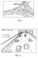
- FIG. 1 shows an example of representative lane level information that may be obtained through sensors (e.g., laser or LIDAR) on a vehicle.
- sensors e.g., laser or LIDAR
- vehicular camera systems may clearly identify the different lane markings, such that lane level information may be reported from the vehicle (e.g., a probe vehicle).
- a vehicle may be able to report its current lane of travel even without using DGPS.
- lane level variable speed sign (VSS) detection-may be performed in accordance with the present teachings.
- positioning and camera advancements may be used in accordance with the present teachings to improve highly assisted driving (HAD) systems through the provision of lane level traffic information in an easy-to-visualize format.
- HAD highly assisted driving
- FIG. 2 lane level variable speed signs identified using vehicular camera sensors may be displayed to a driver using a three-dimensional map.
- lane level information obtained in accordance with the present teachings may be communicated to human drivers, as described above.
- lane level information may likewise be communicated to autonomously operated vehicles.
- a driving instruction derived from analysis of lane-specific data may be transmitted to the autonomously operated vehicle (e.g., to an onboard computer processor thereof).
- the driving instruction e.g., an instruction to remain in a certain lane, an instruction to switch to a different lane after a predefined time and/or distance, and/or the like
- the driving instruction may be the result of an analysis designed to identify optimum lane level routing decisions (e.g., based on speed) in view of the speed buckets on the road ahead.
- the driving instruction may simply be transmitted directly to a computer processor (e.g., a processor that is physically aboard the vehicle and/or a processor that is electronically coupled to the vehicle through a wireless connection) without displaying information on a user interface.
- a computer processor e.g., a processor that is physically aboard the vehicle and/or a processor that is electronically coupled to the vehicle through a wireless connection
- a user interface may be provided for situations in which the vehicle is being at least partially manually operated.
- a first method in accordance with the present teachings for providing a lane-level road view includes: (a) accessing lane-specific data comprising information characterizing a first segment of a first lane of a road in a direction of travel; and (b) communicating at least a portion of the lane-specific data to a client.
- the lane-specific data may further include one or more of the following: information characterizing one or a plurality of additional segments of the first lane of the road in the direction of travel; one or a plurality of segments of an adjacent second lane of the road in the direction of travel; one or a plurality of segments of an adjacent third lane of the road in the direction of travel; one or a plurality of segments of an adjacent fourth or higher (e.g., fifth, sixth, etc.) lane of the road in the direction of travel; and/or the like.
- a plurality of segments within a specific lane of the road may together define a contiguous (e.g., uninterrupted) stretch of that particular lane.
- a second method in accordance with the present teachings for providing a lane-level road view includes: (a) forming a first-lane data bucket; and (b) communicating the first-lane data bucket to a client.
- the first-lane data bucket characterizes a segment of a first lane of a road in a direction of travel.
- the information comprised by the data bucket may include information obtained directly from its original source (e.g., one or a plurality of probe vehicles, map databases, roadway sensors, traffic helicopters, traffic cameras, emergency vehicles, and/or the like) and/or information derived from the original information (e.g., via subsequent processing and/or analysis, etc.).
- processing and/or analysis of information obtained from a probe vehicle, map database, and/or the like may be at least partially executed on an external server (e.g., in a vehicular traffic system) and transmitted to a vehicle or group of vehicles.
- at least a portion of the processing and/or analysis is performed onboard an individual vehicle.
- bucket refers broadly to an assemblage of raw and/or processed data that pertain to at least a section of a designated lane of a roadway.
- the manner in which a bucket may be communicated to a user is not restricted and, in some embodiments, includes but is not limited to graphical depictions (e.g., linear elements as shown, for example, in FIG. 3 below), numeric values (e.g., speed limits, distances, and/or the like), tabulated information (e.g., such as in Table 1 below), and/or the like.
- adjacent refers to lanes that are close in proximity to one another but not necessarily immediately adjoining one another.
- the leftmost lane may be described herein as being adjacent to the rightmost lane even though an intermediate lane-which is likewise adjacent to the leftmost lane-is interposed therebetween.
- adjacent lanes share a common boundary and are not separated by any other lane. In other embodiments, adjacent lanes do not share a common boundary and may be separated by one or more additional lanes.
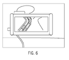
- adjacent as used in reference to lanes of a roadway does not imply that the lanes are parallel to each other along all or even a portion of their respective lengths. Indeed, adjacent lanes may diverge (e.g., as shown in FIG. 6 below), run at non-parallel angles to one another, intersect, and/or the like.
- client refers to one or a plurality of human users (e.g., a human driver operating a vehicle) and/or to one or a plurality of autonomously driven vehicles.
- client may be used interchangeably with the term “user” unless context dictates otherwise.
- lane-specific data in accordance with the present teachings may be derived from positioning data (e.g., GPS data, DGPS data, and/or the like), sensor data (e.g., LIDAR data and/or the like), or a combination thereof.
- GPS data may be sufficiently accurate to be used in accordance with the present teachings-particularly though not exclusively in combination with DGPS data and/or camera sensor data.
- positioning data comprises DGPS data without GPS data.
- lane-specific data in accordance with the present teachings may include information obtained from one or more probe vehicles.
- the lane-specific data in accordance with the present teachings may comprise a plurality of different speeds.
- a speed associated with a data bucket may correspond to a range of speeds.
- a speed associated with a data bucket may correspond to an aggregate (e.g., an average) of substantially similar speeds that lie within a pre-defined range.
- the phrase "substantially similar" as used in reference to two different speeds may refer, in some embodiments, to speeds that are less than about 30% different, in some embodiments less than about 25% different, in some embodiments less than about 20% different, in some embodiments less than about 15% different, in some embodiments less than about 10% different, and in some embodiments less than about 5% different.
- an average speed comprises a weighted average.
- an aggregation algorithm may be used to assign substantially similar speeds into the same data bucket.
- Data buckets in accordance with the present teachings may comprise map-based speed information, real-time speed information, distance information, miscellaneous information, or the like, and combinations thereof.
- Map-based speed information in accordance with the present teachings may include, for example, a maximum speed limit, a minimum speed limit, or the like, and combinations thereof.
- Distance information in accordance with the present teachings may include, for example, a distance of a segment of a lane and/or a road, a distance over which a particular speed is applicable, a distance remaining before an upcoming turn and/or a change in road, or the like, and combinations thereof.
- Miscellaneous information in accordance with the present teachings may include, for example, turn-by-turn directions for reaching a pre-defined destination from a current location, map-based location information (e.g., a road name, an exit number, a mile marker number, a range of mile marker numbers, etc.), point-of-interest information (e.g., restaurants, shops, rest areas, service stations, oases, historic sites, scenic overlooks, advertising content, etc.), or the like, and combinations thereof.
- map-based location information e.g., a road name, an exit number, a mile marker number, a range of mile marker numbers, etc.
- point-of-interest information e.g., restaurants, shops, rest areas, service stations, oases, historic sites, scenic overlooks, advertising content, etc.
- Some drivers may be interested in the minimum lane level speed limit (e.g., a driver in an unfamiliar city who wants to exercise proper care while driving), whereas other drivers may be interested in only the maximum lane level speed limit (e.g., a driver who wants to exploit the driving potential of roads within a city). Other drivers may only be interested in current real-time estimates of lane level speed to assist with planning an optimum route for reaching a destination in the shortest amount of time.
- the minimum lane level speed limit e.g., a driver in an unfamiliar city who wants to exercise proper care while driving
- maximum lane level speed limit e.g., a driver who wants to exploit the driving potential of roads within a city.
- Other drivers may only be interested in current real-time estimates of lane level speed to assist with planning an optimum route for reaching a destination in the shortest amount of time.
- one or a plurality of different speed modes may be selected for display.
- a user may select to display (1) the current maximum possible speed from a current location to a destination; (2) the current minimum possible speed from the current location to the destination; and/or (3) the current real-time speed (e.g., "ground truth" speed) from the current location to the destination.
- the current real-time speed e.g., "ground truth" speed
- the lane level view of traffic when the current maximum speed is selected for display, the lane level view of traffic may show the contiguous upper speed limit values for the respective lanes. In some embodiments, when the current minimum speed is selected for display, the lane level view of traffic may show the contiguous lower speed limit values for the respective lanes. By way of example, some highways have a minimum speed limit at or above which vehicles are expected to travel. In some embodiments, when the current observed real-time speed is selected for display, the lane level view of traffic may show the contiguous lower current travel speed, upper current travel speed, and/or average travel speed (e.g., a speed derived at the lane level in real time from, for example, probe vehicles utilizing DGPS and/or advanced camera technology).
- average travel speed e.g., a speed derived at the lane level in real time from, for example, probe vehicles utilizing DGPS and/or advanced camera technology.
- FIG. 3 shows an example of a representative display format 300 for reporting color-coded speed-related information pertaining to an exemplary three-lane road to a user.
- the color assigned to a data bucket may be based on whether the speed associated with the speed bucket (e.g., as determined by an aggregation algorithm, as described above) is at, below, or above a predefined threshold.
- Each of the color-coded linear bands in FIG. 3 represents a data bucket with exemplary data buckets being identified at 302, 304, and 306.
- the exemplary view depicted in FIG. 3 may change in relation to the location of a user's vehicle (e.g., the data buckets may update in real time after predefined time thresholds and/or distance thresholds, or based on instantaneous road conditions and/or vehicle location, etc.).
- the current lane in which the user is traveling may blink so that the driver may readily identify the current lane in which the vehicle is traveling with a glance.
- the current lane may be distinguished from the adjacent lanes via one or more alternative visual mechanisms, including but not limited to, for example, increased size, increased line thickness, prominence of position on display, use of boldfaced fonts, or the like, and combinations thereof.
- color may be used to communicate the current observed real-time speeds across each of the three lanes.
- a driver may see and evaluate upcoming speed buckets in the current and adjacent lanes in the direction of travel prior to deciding to move to a different lane.
- the information comprised in a data bucket may be communicated to a user in other formats-including but not limited to in a tabular format as shown in Table 1 below.
- the data in Table 1 corresponds to the data depicted in FIG. 3 .
- Table 1 Table 1.
- Tabular driver speed view Display current observed real-time speed.
- speed-related information displayed in FIG. 3 and Table 1 corresponds to current observed real-time speeds
- other lane level views of speeds may likewise be reported.
- other views include but are not limited to current maximum speed limits and/or current minimum speed limits.
- the speed-related information provided by the data buckets include each of current observed real-time speed, current maximum speed limit, and current minimum speed limit.
- different user interface sub view modes of speed-related information may be displayed.
- Representative types of sub view modes include but are not limited to (i) a complete list view of all traffic speed-limit buckets between the current location and the destination, (ii) a view of only a subset of the total number of speed-limit buckets (e.g., only two or three) ahead of the current location, (iii) a view of only those speed limit buckets that satisfy (e.g., are at or above, are at or below, etc.) a predefined speed threshold set by the user, or the like, and combinations thereof.
- one or more data buckets communicated to the client in accordance with the present teachings is related to a current location of the client.
- the data buckets are updated automatically to reflect changes in the current location of the client.
- data buckets in accordance with the present teachings may comprise color-coded speed-related information. Solely by way of example, green (a color traditionally associated with "go") may be used to indicate little or no traffic congestion or obstruction and/or the possibility of travel at speeds at or above a predefined threshold (e.g., a posted maximum speed limit, a user-selected desired speed, etc.).
- a predefined threshold e.g., a posted maximum speed limit, a user-selected desired speed, etc.
- red (a color traditionally associated with "stop") may be used to indicate very heavy traffic congestion or roadway obstruction, and/or travel speeds at or below a predefined threshold (e.g., a posted minimum speed limit, a user-selected desired speed, etc.).
- a predefined threshold e.g., a posted minimum speed limit, a user-selected desired speed, etc.
- yellow and/or orange may be used to indicate traffic flow that is intermediate between the extremes represented by green and red.
- a user interface analogous to an interface implemented by the data horizon program described in U.S. Patent No. 6,405,128 B1 may be used.
- the communicating of one or more data buckets to a client may comprise visually displaying the data buckets.
- the data buckets may be displayed via a navigation system, a mobile phone, a tablet, a projection (e.g., onto a windshield, dashboard, console, and/or other interior surface of a vehicle, etc.), or the like, and combinations thereof.
- FIG. 5 shows a simplified view of speed buckets on a four-lane road as displayed on a representative mobile device. In the example shown in FIG. 5 , contrary to the depiction shown in FIG. 3 , the distance and exit information are not included. Rather, only color-coded lane level speeds, as determined from lane level information received from probe vehicles, are shown.
- FIG. 5 shows a simplified speed view of speed buckets as displayed on a representative vehicular navigation system.
- the communicating of one or more data buckets to a client may comprise aurally communicating information comprised by the data buckets to the user (e.g., through a user interface).
- the user may interact with an artificial intelligence (e.g., an intelligent personal assistant or the like) to request that certain information be repeated, to request alternate information, and/or the like using, for example, a voice command device and/or the like.
- an artificial intelligence e.g., an intelligent personal assistant or the like
- a method in accordance with the present teachings further comprises one or a plurality of the following additional acts: (c) forming a second-lane data bucket that characterizes a segment of an adjacent lane of the road in the direction of travel; (d) communicating the second-lane data bucket to the client; (e) forming a plurality of first-lane data buckets, each of which characterizes and corresponds to a different segment of the first lane in the direction of travel; (f) communicating at least a portion of the plurality of first-lane data buckets to the client; (g) forming a plurality of second-lane data buckets, each of which characterizes and corresponds to a different segment of an adjacent lane of the road in the direction of travel; (h) communicating at least a portion of the plurality of second-lane data buckets to the client; (i) forming a plurality of third-lane data buckets, each of which characterizes and corresponds to a different segment of a different adjacent lane in the direction of travel
- a method in accordance with the present teachings may further comprise forming one or a plurality of fourth-lane data buckets and, in some embodiments, one or a plurality of even higher-lane (e.g., fifth, sixth, etc.) data buckets. It is to be understood that the number of lanes on a road is not restricted, and that methods in accordance with the present teachings may be applied to both single-lane roads and multi-lane roads.
- a data bucket in accordance with the present teachings may include information obtained from one or a plurality of second-lane probe vehicles, map databases, roadway sensors, traffic helicopters, traffic cameras, emergency vehicles, and/or the like, and/or information derived therefrom (e.g., via subsequent processing and/or analysis, etc.).
- a method in accordance with the present teachings for providing a lane-level road view is implemented using a computer and, in some embodiments, one or a plurality of the above-described acts are performed by one or a plurality of processors.
- one or more of the one or the plurality of processors include graphics processing units (GPUs).
- one or more of the one or the plurality of processors include central processing units (CPUs).
- methods in accordance with the present teachings are implemented entirely on GPUs. In some embodiments, GPUs provide improved and/or faster performance.
- a plurality of same-lane data buckets e.g., a plurality of first-lane data buckets, a plurality of second-lane data buckets, a plurality of third-lane data buckets, and/or a plurality of fourth- or higher-lane data buckets
- sequentially- may characterize a contiguous (e.g., uninterrupted) stretch of lane along the road.
- FIG. 4 shows an exemplary flow chart of a representative method 400 for providing a lane-level road view.
- a user may optionally request directions from a current location to a target destination and, in some embodiments, may select the desired route for reaching a destination from among a plurality of available options.
- the user may select the desired display format and/or content of information to be communicated (e.g., in some embodiments, in the form of data buckets). In some embodiments, the selection at block 404 may be made by a vehicular traffic system on behalf of the user.
- one or more lane-specific data buckets may be formed that comprise information obtained and/or derived from one or a plurality of probe vehicles, map databases (e.g., speed limits obtained directly from a map), roadway sensors, traffic helicopters, traffic cameras, emergency vehicles, and/or the like.
- map databases e.g., speed limits obtained directly from a map
- the information to be communicated to the user is displayed according to the selected format and with the selected content as determined at block 404.
- the present teachings provide methods for providing a lane-level road view. In other embodiments, as further described below, the present teachings also provide apparatuses for providing lane-level road view.
- FIG. 7 shows a block diagram of a representative apparatus 700 in accordance with the present teachings for providing a lane-level road view.
- an apparatus 700 in accordance with the present teachings is implemented as part of a GPU in a computer system.
- the apparatus 700 may be implemented as part of a CPU in a computer system.
- the apparatus 700 may include: a processor 702; a non-transitory memory 704 coupled with the processor 702; first logic 706 stored in the non-transitory memory 704 and executable by the processor 702 to cause the apparatus 700 to form a first-lane data bucket (DB) that characterizes a segment of a first lane of a road in a direction of travel; and second logic 708 stored in the non-transitory memory 704 and executable by the processor 702 to cause the apparatus 700 to communicate the first-lane data bucket to a client.
- DB first-lane data bucket
- the apparatus 700 may further include one or more of the following: third logic 710 stored in the non-transitory memory 704 and executable by the processor 702 to cause the apparatus 700 to form a plurality of first-lane data buckets each of which characterizes and corresponds to a different segment of the first lane of the road in the direction of travel; fourth logic 712 stored in the non-transitory memory 704 and executable by the processor 702 to cause the apparatus 700 to form a plurality of second-lane data buckets, each of which characterizes and corresponds to a different segment of an adjacent lane of the road in the direction of travel; fifth logic 714 stored in the non-transitory memory 704 and executable by the processor 702 to cause the apparatus 700 to form a plurality of third-lane data buckets, each of which characterizes and corresponds to a different segment of a further adjacent lane of the road in the direction of travel; sixth logic 716 stored in the non-transitory memory 704 and executable by the processor 702 to cause the
- the apparatus 700 is configured as a device selected from the group consisting of navigation systems, mobile phones, personal computers, game consoles, laptops, notebooks, tablets, portable media players, personal digital assistants, pagers, and the like, and combinations thereof.
- the apparatus 700 is configured as a navigation system and/or a mobile phone and further includes: (a) user interface circuitry and user interface software configured to (i) facilitate user control of at least some functions of the navigation system and/or mobile phone though use of a display and (ii) respond to user inputs; and (b) a display and display circuitry configured to display at least a portion of a user interface of the navigation system and/or mobile phone, the display and the display circuitry configured to facilitate user control of at least some of the functions of the navigation system and/or mobile phone.
- a non-transitory computer-readable storage medium in accordance with the present teachings has stored therein data representing instructions executable by a programmed processor for providing a lane level road view.
- the storage medium includes instructions for: (a) accessing lane-specific data comprising information characterizing one or a plurality of segments of a first lane of a road in a direction of travel; and (b) communicating at least a portion of the lane-specific data to a client.
- modules or logic described herein may be implemented using, among other things, a tangible computer-readable medium comprising computer-executable instructions (e.g., executable software code).
- modules may be implemented as software code, firmware code, hardware, and/or a combination of the aforementioned.
- FIG. 8 depicts an illustrative embodiment of a general computer system 800.
- the computer system 800 can include a set of instructions that can be executed to cause the computer system 800 to perform any one or more of the methods or computer based functions disclosed herein.
- the computer system 800 may operate as a standalone device or may be connected (e.g., using a network) to other computer systems or peripheral devices. Any of the components discussed above, such as the processor, may be a computer system 800 or a component in the computer system 800.
- the computer system 800 may implement a navigation module for providing a lane level road view, of which the disclosed embodiments are a component thereof.
- the computer system 800 may operate in the capacity of a server or as a client user computer in a client-server user network environment, or as a peer computer system in a peer-to-peer (or distributed) network environment.
- the computer system 800 can also be implemented as or incorporated into various devices, such as a personal computer (PC), a tablet PC, a set-top box (STB), a personal digital assistant (PDA), a mobile device, a palmtop computer, a laptop computer, a desktop computer, a communications device, a wireless telephone, a landline telephone, a control system, a camera, a scanner, a facsimile machine, a printer, a pager, a personal trusted device, a web appliance, a network router, switch or bridge, or any other machine capable of executing a set of instructions (sequential or otherwise) that specify actions to be taken by that machine.
- the computer system 800 can be implemented using electronic devices that provide voice, video or data communication. Further, while a single computer system 800 is illustrated, the term "system” shall also be taken to include any collection of systems or sub-systems that individually or jointly execute a set, or multiple sets, of instructions to perform one or more computer functions.
- the computer system 800 may include a processor 802, for example a central processing unit (CPU), a graphics-processing unit (GPU), or both.
- the processor 802 may be a component in a variety of systems.
- the processor 802 may be part of a standard personal computer or a workstation.
- the processor 802 may be one or more general processors, digital signal processors, application specific integrated circuits, field programmable gate arrays, servers, networks, digital circuits, analog circuits, combinations thereof, or other now known or later developed devices for analyzing and processing data.
- the processor 802 may implement a software program, such as code generated manually (i.e., programmed).
- the computer system 800 may include a memory 804 that can communicate via a bus 808.
- the memory 804 may be a main memory, a static memory, or a dynamic memory.
- the memory 804 may include, but is not limited to, computer-readable storage media such as various types of volatile and non-volatile storage media, including but not limited to random access memory, read-only memory, programmable read-only memory, electrically programmable read-only memory, electrically erasable read-only memory, flash memory, magnetic tape or disk, optical media and the like.
- the memory 804 includes a cache or random access memory for the processor 802.
- the memory 804 is separate from the processor 802, such as a cache memory of a processor, the system memory, or other memory.
- the memory 804 may be an external storage device or database for storing data. Examples include a hard drive, compact disc (CD), digital video disc (DVD), memory card, memory stick, floppy disc, universal serial bus (USB) memory device, or any other device operative to store data.
- the memory 804 is operable to store instructions executable by the processor 802.
- the functions, acts or tasks illustrated in the figures or described herein may be performed by the programmed processor 802 executing the instructions 812 stored in the memory 804.
- the functions, acts or tasks are independent of the particular type of instructions set, storage media, processor or processing strategy and may be performed by software, hardware, integrated circuits, firm-ware, micro-code and the like, operating alone or in combination.
- processing strategies may include multiprocessing, multitasking, parallel processing and the like.
- the computer system 800 may further include a display unit 814, such as a liquid crystal display (LCD), an organic light emitting diode (OLED), a flat panel display, a solid state display, a cathode ray tube (CRT), a projector, a printer or other now known or later developed display device for outputting determined information.
- a display unit 814 such as a liquid crystal display (LCD), an organic light emitting diode (OLED), a flat panel display, a solid state display, a cathode ray tube (CRT), a projector, a printer or other now known or later developed display device for outputting determined information.
- the display 814 may act as an interface for the user to see the functioning of the processor 802, or specifically as an interface with the software stored in the memory 804 or in the drive unit 806.
- the computer system 800 may include an input device 816 configured to allow a user to interact with any of the components of system 800.
- the input device 816 may be a number pad, a keyboard, or a cursor control device, such as a mouse, or a joystick, touch screen display, remote control or any other device operative to interact with the system 800.
- the computer system 800 may also include a disk or optical drive unit 806.
- the disk drive unit 806 may include a computer-readable medium 810 in which one or more sets of instructions 812 (e.g., software) can be embedded.
- the instructions 812 may embody one or more of the methods or logic as described herein.
- the instructions 812 may reside completely, or at least partially, within the memory 804 and/or within the processor 802 during execution by the computer system 800.
- the memory 804 and the processor 802 also may include computer-readable media as described above.
- the present teachings contemplate a computer-readable medium that includes instructions 812 or receives and executes instructions 812 responsive to a propagated signal, so that a device connected to a network 820 can communicate voice, video, audio, images or any other data over the network 820. Further, the instructions 812 may be transmitted or received over the network 820 via a communication interface 818.
- the communication interface 818 may be a part of the processor 802 or may be a separate component.
- the communication interface 818 may be created in software or may be a physical connection in hardware.
- the communication interface 818 is configured to connect with a network 820, external media, the display 814, or any other components in system 800, or combinations thereof.
- the connection with the network 820 may be a physical connection, such as a wired Ethernet connection or may be established wirelessly as discussed below.
- the additional connections with other components of the system 800 may be physical connections or may be established wirelessly.
- the network 820 may include wired networks, wireless networks, or combinations thereof.
- the wireless network may be a cellular telephone network, an 802.11, 802.16, 802.20, or WiMax network.
- the network 820 may be a public network, such as the Internet, a private network, such as an intranet, or combinations thereof, and may utilize a variety of networking protocols now available or later developed including, but not limited to TCP/IP based networking protocols.
- Embodiments of the subject matter and the functional operations described in this specification can be implemented in digital electronic circuitry, or in computer software, firmware, or hardware, including the structures disclosed in this specification and their structural equivalents, or in combinations of one or more of them.
- Embodiments of subject matter described in this specification can be implemented as one or more computer program products, for example, one or more modules of computer program instructions encoded on a computer-readable medium for execution by, or to control the operation of, data processing apparatus. While the computer-readable medium is shown to be a single medium, the term "computer-readable medium" includes a single medium or multiple media, such as a centralized or distributed database, and/or associated caches and servers that store one or more sets of instructions.
- the term "computer-readable medium” shall also include any medium that is capable of storing, encoding or carrying a set of instructions for execution by a processor or that cause a computer system to perform any one or more of the methods or operations disclosed herein.
- the computer-readable medium can be a machine-readable storage device, a machine-readable storage substrate, a memory device, or a combination of one or more of them.
- data processing apparatus encompasses all apparatuses, devices, and machines for processing data, including but not limited to, by way of example, a programmable processor, a computer, or multiple processors or computers.
- the apparatus can include, in addition to hardware, code that creates an execution environment for the computer program in question (e.g., code that constitutes processor firmware, a protocol stack, a database management system, an operating system, or a combination thereof).
- the computer-readable medium can include a solid-state memory such as a memory card or other package that houses one or more non-volatile read-only memories. Further, the computer-readable medium can be a random access memory or other volatile re-writable memory. Additionally, the computer-readable medium can include a magneto-optical or optical medium, such as a disk or tapes or other storage device to capture carrier wave signals such as a signal communicated over a transmission medium. A digital file attachment to an e-mail or other self-contained information archive or set of archives may be considered a distribution medium that is a tangible storage medium. Accordingly, the present teachings are considered to include any one or more of a computer-readable medium or a distribution medium and other equivalents and successor media, in which data or instructions may be stored.
- dedicated hardware implementations such as application specific integrated circuits, programmable logic arrays, and other hardware devices, can be constructed to implement one or more of the methods described herein.
- Applications that may include the apparatus and systems of various embodiments can broadly include a variety of electronic and computer systems.
- One or more embodiments described herein may implement functions using two or more specific interconnected hardware modules or devices with related control and data signals that can be communicated between and through the modules, or as portions of an application-specific integrated circuit. Accordingly, the present system encompasses software, firmware, and hardware implementations.
- the methods described herein may be implemented by software programs executable by a computer system. Further, in some embodiments, implementations can include distributed processing, component/object distributed processing, and parallel processing. Alternatively, virtual computer system processing can be constructed to implement one or more of the methods or functionality as described herein.
- a computer program (also known as a program, software, software application, script, or code) can be written in any form of programming language, including compiled or interpreted languages, and it can be deployed in any form, including as a standalone program or as a module, component, subroutine, or other unit suitable for use in a computing environment.
- a computer program does not necessarily correspond to a file in a file system.
- a program can be stored in a portion of a file that holds other programs or data (e.g., one or more scripts stored in a markup language document), in a single file dedicated to the program in question, or in multiple coordinated files (e.g., files that store one or more modules, sub programs, or portions of code).
- a computer program can be deployed to be executed on one computer or on multiple computers that are located at one site or distributed across multiple sites and interconnected by a communication network.
- the processes and logic flows described herein can be performed by one or more programmable processors executing one or more computer programs to perform functions by operating on input data and generating output.
- the processes and logic flows can also be performed by, and apparatus can also be implemented as, special purpose logic circuitry, for example, an FPGA (field programmable gate array) or an ASIC (application specific integrated circuit).
- FPGA field programmable gate array
- ASIC application specific integrated circuit
- processors suitable for the execution of a computer program include, by way of example, both general and special purpose microprocessors, and any one or more processors of any kind of digital computer.
- a processor will receive instructions and data from a read-only memory or a random access memory or both.
- the main elements of a computer are a processor for performing instructions and one or more memory devices for storing instructions and data.
- a computer will also include, or be operatively coupled to receive data from or transfer data to, or both, one or more mass storage devices for storing data, for example, magnetic, magneto optical disks, or optical disks.
- mass storage devices for storing data, for example, magnetic, magneto optical disks, or optical disks.
- a computer need not have such devices.
- a computer can be embedded in another device, for example, a mobile telephone, a personal digital assistant (PDA), a mobile audio player, a Global Positioning System (GPS) receiver, to name just a few.
- Computer-readable media suitable for storing computer program instructions and data include all forms of non volatile memory, media and memory devices, including but not limited to, by way of example, semiconductor memory devices (e.g., EPROM, EEPROM, and flash memory devices); magnetic disks (e.g., internal hard disks or removable disks); magneto optical disks; and CD ROM and DVD-ROM disks.
- semiconductor memory devices e.g., EPROM, EEPROM, and flash memory devices
- magnetic disks e.g., internal hard disks or removable disks
- magneto optical disks e.g., CD ROM and DVD-ROM disks.
- the processor and the memory can be supplemented by, or incorporated in, special purpose logic circuitry.
- some embodiments of subject matter described herein can be implemented on a device having a display, for example a CRT (cathode ray tube) or LCD (liquid crystal display) monitor, for displaying information to the user and a keyboard and a pointing device, for example a mouse or a trackball, by which the user can provide input to the computer.
- a display for example a CRT (cathode ray tube) or LCD (liquid crystal display) monitor
- a keyboard and a pointing device for example a mouse or a trackball
- Other kinds of devices can be used to provide for interaction with a user as well.
- feedback provided to the user can be any form of sensory feedback (e.g., visual feedback, auditory feedback, or tactile feedback); and input from the user can be received in any form, including but not limited to acoustic, speech, or tactile input.
- Embodiments of subject matter described herein can be implemented in a computing system that includes a back-end component, for example, as a data server, or that includes a middleware component, for example, an application server, or that includes a front end component, for example, a client computer having a graphical user interface or a Web browser through which a user can interact with an implementation of the subject matter described in this specification, or any combination of one or more such back end, middleware, or front end components.
- the components of the system can be interconnected by any form or medium of digital data communication, for example, a communication network. Examples of communication networks include but are not limited to a local area network (LAN) and a wide area network (WAN), for example, the Internet.
- LAN local area network
- WAN wide area network
- the computing system can include clients and servers.
- a client and server are generally remote from each other and typically interact through a communication network.
- the relationship of client and server arises by virtue of computer programs running on the respective computers and having a client-server relationship to each other.
- inventions of the disclosure may be referred to herein, individually and/or collectively, by the term "invention" merely for convenience and without intending to voluntarily limit the scope of this application to any particular invention or inventive concept.
- inventions may be referred to herein, individually and/or collectively, by the term "invention" merely for convenience and without intending to voluntarily limit the scope of this application to any particular invention or inventive concept.
- specific embodiments have been illustrated and described herein, it should be appreciated that any subsequent arrangement designed to achieve the same or similar purpose may be substituted for the specific embodiments shown.
- This disclosure is intended to cover any and all subsequent adaptations or variations of various embodiments. Combinations of the above embodiments, and other embodiments not specifically described herein, will be apparent to those of skill in the art upon reviewing the description.
Landscapes
- Engineering & Computer Science (AREA)
- Radar, Positioning & Navigation (AREA)
- Remote Sensing (AREA)
- Physics & Mathematics (AREA)
- General Physics & Mathematics (AREA)
- Computer Networks & Wireless Communication (AREA)
- Automation & Control Theory (AREA)
- Life Sciences & Earth Sciences (AREA)
- Atmospheric Sciences (AREA)
- Mechanical Engineering (AREA)
- Transportation (AREA)
- Chemical & Material Sciences (AREA)
- Combustion & Propulsion (AREA)
- Electromagnetism (AREA)
- Signal Processing (AREA)
- Health & Medical Sciences (AREA)
- Computing Systems (AREA)
- General Health & Medical Sciences (AREA)
- Medical Informatics (AREA)
- Ecology (AREA)
- Biodiversity & Conservation Biology (AREA)
- Environmental Sciences (AREA)
- Environmental & Geological Engineering (AREA)
- Multimedia (AREA)
- Theoretical Computer Science (AREA)
- Navigation (AREA)
- Traffic Control Systems (AREA)
- Devices For Checking Fares Or Tickets At Control Points (AREA)
Applications Claiming Priority (1)
| Application Number | Priority Date | Filing Date | Title |
|---|---|---|---|
| US14/264,578 US9609046B2 (en) | 2014-04-29 | 2014-04-29 | Lane level road views |
Publications (2)
| Publication Number | Publication Date |
|---|---|
| EP2940428A2 true EP2940428A2 (fr) | 2015-11-04 |
| EP2940428A3 EP2940428A3 (fr) | 2015-12-16 |
Family
ID=52807663
Family Applications (1)
| Application Number | Title | Priority Date | Filing Date |
|---|---|---|---|
| EP15161806.3A Withdrawn EP2940428A3 (fr) | 2014-04-29 | 2015-03-31 | Vues de route au niveau des voies |
Country Status (2)
| Country | Link |
|---|---|
| US (1) | US9609046B2 (fr) |
| EP (1) | EP2940428A3 (fr) |
Families Citing this family (27)
| Publication number | Priority date | Publication date | Assignee | Title |
|---|---|---|---|---|
| CN105335597B (zh) * | 2014-07-30 | 2019-04-16 | 国际商业机器公司 | 用于获取路线的轨迹模式的方法和系统 |
| EP3045867B1 (fr) * | 2015-01-16 | 2018-05-30 | Volvo Car Corporation | Unité de navigation et procédé permettant de fournir des instructions de navigation d'un véhicule autonome |
| JP6536064B2 (ja) * | 2015-02-10 | 2019-07-03 | 株式会社デンソー | 走行軌跡選定装置、走行軌跡選定方法 |
| JP6319192B2 (ja) * | 2015-05-29 | 2018-05-09 | トヨタ自動車株式会社 | 車速制限装置 |
| US10691958B1 (en) * | 2015-07-30 | 2020-06-23 | Ambarella International Lp | Per-lane traffic data collection and/or navigation |
| DE102015224442A1 (de) * | 2015-11-05 | 2017-05-11 | Continental Teves Ag & Co. Ohg | Situationsabhängiges Teilen von MAP-Botschaften zur Verbesserung digitaler Karten |
| US9937923B2 (en) * | 2016-01-30 | 2018-04-10 | Bendix Commercial Vehicle Systems Llc | System and method for providing a speed warning and speed control |
| USD842331S1 (en) * | 2016-11-14 | 2019-03-05 | Lyft, Inc. | Display screen or portion thereof with animated graphical user interface |
| CN108305477B (zh) * | 2017-04-20 | 2019-08-13 | 腾讯科技(深圳)有限公司 | 一种车道选择方法及终端 |
| US20180315314A1 (en) * | 2017-04-28 | 2018-11-01 | GM Global Technology Operations LLC | Automated vehicle route traversal |
| US10553110B2 (en) | 2017-06-23 | 2020-02-04 | Here Global B.V. | Detection and estimation of variable speed signs |
| CN107909837A (zh) * | 2017-10-24 | 2018-04-13 | 华为技术有限公司 | 一种车辆借道通行的方法和控制中心 |
| USD858549S1 (en) | 2017-10-27 | 2019-09-03 | Waymo Llc | Display screen portion with graphical user interface |
| USD858550S1 (en) | 2017-10-27 | 2019-09-03 | Waymo Llc | Display screen portion with graphical user interface |
| KR102306790B1 (ko) * | 2017-11-08 | 2021-09-30 | 삼성전자주식회사 | 컨텐츠 시각화 장치 및 방법 |
| GB201802366D0 (en) * | 2018-02-14 | 2018-03-28 | Tom Tom Traffic B V | Methods and systems for generating taffic volumn or traffic density data |
| US10895468B2 (en) * | 2018-04-10 | 2021-01-19 | Toyota Jidosha Kabushiki Kaisha | Dynamic lane-level vehicle navigation with lane group identification |
| US10982969B2 (en) | 2018-10-23 | 2021-04-20 | Here Global B.V. | Method, apparatus, and computer program product for lane-level route guidance |
| US11022457B2 (en) * | 2018-10-23 | 2021-06-01 | Here Global B.V. | Method, apparatus, and computer program product for lane-level route guidance |
| JP7155975B2 (ja) * | 2018-12-10 | 2022-10-19 | トヨタ自動車株式会社 | 車両制御装置 |
| US11348453B2 (en) * | 2018-12-21 | 2022-05-31 | Here Global B.V. | Method and apparatus for dynamic speed aggregation of probe data for high-occupancy vehicle lanes |
| KR102869072B1 (ko) * | 2019-07-08 | 2025-10-13 | 현대자동차주식회사 | 교통 정보 제공 시스템 및 방법 |
| EP3786918B1 (fr) * | 2019-08-30 | 2023-11-08 | Zenuity AB | Procédé et agencement permettant de déterminer la limitation de vitesse d'un véhicule routier à l'emplacement actuel |
| TWI701533B (zh) * | 2019-11-14 | 2020-08-11 | 緯創資通股份有限公司 | 控制方法以及電動助行器 |
| US20220340160A1 (en) * | 2021-04-21 | 2022-10-27 | Argo AI, LLC | Systems and methods for simulation supported map quality assurance in an autonomous vehicle context |
| US12259255B2 (en) * | 2021-12-29 | 2025-03-25 | Here Global B.V. | Detecting and obtaining lane level insight in unplanned incidents |
| JP7816125B2 (ja) * | 2022-12-21 | 2026-02-18 | トヨタ自動車株式会社 | 情報配信装置及びナビゲーションシステム |
Citations (1)
| Publication number | Priority date | Publication date | Assignee | Title |
|---|---|---|---|---|
| US6405128B1 (en) | 1999-12-20 | 2002-06-11 | Navigation Technologies Corp. | Method and system for providing an electronic horizon in an advanced driver assistance system architecture |
Family Cites Families (19)
| Publication number | Priority date | Publication date | Assignee | Title |
|---|---|---|---|---|
| US4286846A (en) | 1977-03-07 | 1981-09-01 | Bollenbacher Dale E | Signal viewer for automobile |
| US6466862B1 (en) | 1999-04-19 | 2002-10-15 | Bruce DeKock | System for providing traffic information |
| US7221287B2 (en) * | 2002-03-05 | 2007-05-22 | Triangle Software Llc | Three-dimensional traffic report |
| US7835858B2 (en) | 2002-11-22 | 2010-11-16 | Traffic.Com, Inc. | Method of creating a virtual traffic network |
| US6911918B2 (en) * | 2002-12-19 | 2005-06-28 | Shawfu Chen | Traffic flow and route selection display system for routing vehicles |
| US7526103B2 (en) * | 2004-04-15 | 2009-04-28 | Donnelly Corporation | Imaging system for vehicle |
| JP2007200274A (ja) | 2005-09-14 | 2007-08-09 | Denso Corp | 合流支援装置及び合流支援システム |
| US8279763B2 (en) | 2006-10-12 | 2012-10-02 | Garmin Switzerland Gmbh | System and method for grouping traffic events |
| JP5157304B2 (ja) * | 2007-08-03 | 2013-03-06 | 日産自動車株式会社 | 車両用走行制御装置 |
| US20090140887A1 (en) * | 2007-11-29 | 2009-06-04 | Breed David S | Mapping Techniques Using Probe Vehicles |
| JP4816670B2 (ja) | 2008-03-31 | 2011-11-16 | アイシン・エィ・ダブリュ株式会社 | ナビゲーション装置、ナビゲーション方法およびナビゲーションプログラム |
| US8405520B2 (en) | 2008-10-20 | 2013-03-26 | Navteq B.V. | Traffic display depicting view of traffic from within a vehicle |
| US8350845B2 (en) | 2009-01-12 | 2013-01-08 | Navteq North America, Llc | Transit view for a traffic report |
| US20100225644A1 (en) | 2009-03-05 | 2010-09-09 | Navteq North America, Llc | Method and System for Transitioning Between Views in a Traffic Report |
| WO2011066850A1 (fr) | 2009-11-12 | 2011-06-09 | Tomtom Belgium N.V. | Système de navigation avec alerte de vitesse en direct pour un courant de circulation convergent |
| US8346426B1 (en) | 2010-04-28 | 2013-01-01 | Google Inc. | User interface for displaying internal state of autonomous driving system |
| US9709406B2 (en) * | 2010-12-31 | 2017-07-18 | Tomtom Navigation B.V. | Navigation methods and systems |
| US20130278441A1 (en) | 2012-04-24 | 2013-10-24 | Zetta Research and Development, LLC - ForC Series | Vehicle proxying |
| US9008961B2 (en) * | 2012-11-30 | 2015-04-14 | Google Inc. | Determining and displaying auto drive lanes in an autonomous vehicle |
-
2014
- 2014-04-29 US US14/264,578 patent/US9609046B2/en active Active
-
2015
- 2015-03-31 EP EP15161806.3A patent/EP2940428A3/fr not_active Withdrawn
Patent Citations (1)
| Publication number | Priority date | Publication date | Assignee | Title |
|---|---|---|---|---|
| US6405128B1 (en) | 1999-12-20 | 2002-06-11 | Navigation Technologies Corp. | Method and system for providing an electronic horizon in an advanced driver assistance system architecture |
Also Published As
| Publication number | Publication date |
|---|---|
| US9609046B2 (en) | 2017-03-28 |
| EP2940428A3 (fr) | 2015-12-16 |
| US20150312327A1 (en) | 2015-10-29 |
Similar Documents
| Publication | Publication Date | Title |
|---|---|---|
| US9609046B2 (en) | Lane level road views | |
| US11636760B2 (en) | Detection and estimation of variable speed signs | |
| US11192558B2 (en) | Method, apparatus, and system for providing road curvature data | |
| US11681294B2 (en) | Method and system for prediction of roadwork zone | |
| US10197404B2 (en) | Path curve confidence factors | |
| US11249984B2 (en) | System and method for updating map data in a map database | |
| AU2016264974B2 (en) | Navigation lane guidance | |
| US10175059B2 (en) | Method, apparatus and computer program product for a navigation system user interface | |
| US11255692B2 (en) | System and method for identification of a roadwork zone | |
| US11322025B2 (en) | Method and system for validating existence of roadwork | |
| CN110832417A (zh) | 使用高清地图为自主车辆生成路线 | |
| US11243085B2 (en) | Systems, methods, and a computer program product for updating map data | |
| US10801844B2 (en) | Remediating dissimilarities between digital maps and ground truth data via dissimilarity threshold tuning | |
| US11537944B2 (en) | Method and system to generate machine learning model for evaluating quality of data | |
| US12055409B2 (en) | Uncontrolled intersection detection and warning system | |
| CN111051818B (zh) | 提供导航方向 | |
| US10401187B2 (en) | Method, apparatus and computer program product for a navigation system user interface | |
| US11989805B2 (en) | Dynamic geometry using virtual spline for making maps | |
| US20240192018A1 (en) | System and method for virtual lane generation | |
| US20240191999A1 (en) | System and method for generating navigation instructions | |
| US20240410714A1 (en) | Generating improved user interfaces for provider computing devices with compass, dynamic halo, and contextual information shapes | |
| HK1246391B (zh) | 以节点为中心的导航优化 |
Legal Events
| Date | Code | Title | Description |
|---|---|---|---|
| PUAI | Public reference made under article 153(3) epc to a published international application that has entered the european phase |
Free format text: ORIGINAL CODE: 0009012 |
|
| AK | Designated contracting states |
Kind code of ref document: A2 Designated state(s): AL AT BE BG CH CY CZ DE DK EE ES FI FR GB GR HR HU IE IS IT LI LT LU LV MC MK MT NL NO PL PT RO RS SE SI SK SM TR |
|
| AX | Request for extension of the european patent |
Extension state: BA ME |
|
| PUAL | Search report despatched |
Free format text: ORIGINAL CODE: 0009013 |
|
| AK | Designated contracting states |
Kind code of ref document: A3 Designated state(s): AL AT BE BG CH CY CZ DE DK EE ES FI FR GB GR HR HU IE IS IT LI LT LU LV MC MK MT NL NO PL PT RO RS SE SI SK SM TR |
|
| AX | Request for extension of the european patent |
Extension state: BA ME |
|
| RIC1 | Information provided on ipc code assigned before grant |
Ipc: G01C 21/36 20060101AFI20151111BHEP |
|
| RAP1 | Party data changed (applicant data changed or rights of an application transferred) |
Owner name: HERE GLOBAL B.V. |
|
| STAA | Information on the status of an ep patent application or granted ep patent |
Free format text: STATUS: THE APPLICATION IS DEEMED TO BE WITHDRAWN |
|
| 18D | Application deemed to be withdrawn |
Effective date: 20160617 |