EP2940624A1 - Procédé de fabrication d'un modèle virtuel tridimensionnel d'un environnement pour applications destinées à la détermination de position - Google Patents
Procédé de fabrication d'un modèle virtuel tridimensionnel d'un environnement pour applications destinées à la détermination de position Download PDFInfo
- Publication number
- EP2940624A1 EP2940624A1 EP14450018.8A EP14450018A EP2940624A1 EP 2940624 A1 EP2940624 A1 EP 2940624A1 EP 14450018 A EP14450018 A EP 14450018A EP 2940624 A1 EP2940624 A1 EP 2940624A1
- Authority
- EP
- European Patent Office
- Prior art keywords
- dimensional
- algorithm
- model
- environment
- feature extraction
- Prior art date
- Legal status (The legal status is an assumption and is not a legal conclusion. Google has not performed a legal analysis and makes no representation as to the accuracy of the status listed.)
- Granted
Links
Images


Classifications
-
- G—PHYSICS
- G06—COMPUTING OR CALCULATING; COUNTING
- G06T—IMAGE DATA PROCESSING OR GENERATION, IN GENERAL
- G06T7/00—Image analysis
- G06T7/50—Depth or shape recovery
- G06T7/55—Depth or shape recovery from multiple images
-
- G—PHYSICS
- G06—COMPUTING OR CALCULATING; COUNTING
- G06T—IMAGE DATA PROCESSING OR GENERATION, IN GENERAL
- G06T7/00—Image analysis
- G06T7/20—Analysis of motion
- G06T7/246—Analysis of motion using feature-based methods, e.g. the tracking of corners or segments
-
- G—PHYSICS
- G06—COMPUTING OR CALCULATING; COUNTING
- G06T—IMAGE DATA PROCESSING OR GENERATION, IN GENERAL
- G06T7/00—Image analysis
- G06T7/20—Analysis of motion
- G06T7/246—Analysis of motion using feature-based methods, e.g. the tracking of corners or segments
- G06T7/251—Analysis of motion using feature-based methods, e.g. the tracking of corners or segments involving models
-
- G—PHYSICS
- G06—COMPUTING OR CALCULATING; COUNTING
- G06V—IMAGE OR VIDEO RECOGNITION OR UNDERSTANDING
- G06V20/00—Scenes; Scene-specific elements
- G06V20/20—Scenes; Scene-specific elements in augmented reality scenes
-
- G—PHYSICS
- G06—COMPUTING OR CALCULATING; COUNTING
- G06V—IMAGE OR VIDEO RECOGNITION OR UNDERSTANDING
- G06V20/00—Scenes; Scene-specific elements
- G06V20/60—Type of objects
- G06V20/64—Three-dimensional [3D] objects
- G06V20/653—Three-dimensional [3D] objects by matching three-dimensional models, e.g. conformal mapping of Riemann surfaces
-
- G—PHYSICS
- G06—COMPUTING OR CALCULATING; COUNTING
- G06T—IMAGE DATA PROCESSING OR GENERATION, IN GENERAL
- G06T2207/00—Indexing scheme for image analysis or image enhancement
- G06T2207/10—Image acquisition modality
- G06T2207/10016—Video; Image sequence
-
- G—PHYSICS
- G06—COMPUTING OR CALCULATING; COUNTING
- G06T—IMAGE DATA PROCESSING OR GENERATION, IN GENERAL
- G06T2207/00—Indexing scheme for image analysis or image enhancement
- G06T2207/30—Subject of image; Context of image processing
- G06T2207/30244—Camera pose
Definitions
- the invention relates to a method for creating a three-dimensional virtual model of an environment for positioning applications.
- the invention further relates to a method for determining the position of a user in a real environment by means of a user-carried mobile terminal using a stored virtual model of the environment.
- the invention further relates to a device for determining the position of a user in a real environment and to a corresponding computer program product.
- GPS Global Positioning System
- Modern electronic systems also enable localization inside buildings.
- the hardware or computational effort required for a sufficiently accurate position determination is significant and exceeds current capacities of smartphones.
- Conventional methods for determining the position in a closed space are usually designed as optical systems with which the position and / or orientation of objects in the environment can be determined.
- optical systems By matching the optically detected object with a previously acquired three-dimensional model of the relevant environment, the position of the detected object in three-dimensional space can be determined, and subsequently the position of the user relative to it Object to be determined.
- To detect objects in the environment systems with different physical principles of action are used.
- Commonly used are so-called optical tracking systems, which determine the position of objects located in the detection range of a camera and / or the position of the camera via the detection of the objects by various methods of computer-aided image processing.
- markers In order to increase the processing speed and reduce the computational requirements, it is known to provide the tracking space with high-contrast, easily recognizable markings (so-called markers). However, this approach has the disadvantage that the tracking room must be equipped and the tracking is possible only in the equipped area. Optical tracking methods using this method are generally referred to as marker-based tracking methods.
- markerless tracking systems have also become known, in which a simplification of the complexity is usually achieved by using additional sensors, for example acceleration sensors, which restrict the search space of the image processing algorithms.
- the input information of the system in the case of optical tracking systems is a two-dimensional camera image on the basis of which the position and orientation of one or more objects relative to the camera are determined.
- Position and orientation may, for example, be described by a transformation matrix.
- Various methods are known for determining the transformation matrix. Some methods recognize features, such as edges or corners, of real objects and compare them with previously stored digital models of reality.
- the present invention aims to provide a system that allows people to determine their position to the nearest centimeter with the help of a mobile terminal indoors.
- the required computing power of the terminal and the requirement for the sensor equipment should be so low that the position determination is readily possible with the help of commercially available smartphones and tablet computers.
- Positioning should be for navigation or orientation applications, e.g. at airports, shopping centers, hospitals, public buildings, etc.
- the position and orientation in the room should also be usable for augmented reality applications in order to display virtual contents in the real correct places, e.g. virtual advertising posters about real shops, vouchers in front of shops, navigation arrows to the destination, etc.
- the invention also aims to provide a method with which a three-dimensional virtual model of the relevant environment which is suitable for determining the position can be created in a simple manner.
- the invention provides a method for creating a three-dimensional virtual model environment for positioning applications, comprising generating one or more two-dimensional images of a real environment using an optical capture device, transforming the two-dimensional image into a three-dimensional one Model the real environment by means of a first algorithm for feature extraction, generating a two-dimensional map of at least a portion of the real environment using an optical capture device, transforming the two-dimensional map into a two-dimensional model of the subregion of the real environment by means of a second feature extraction algorithm, the first and second feature extraction algorithms being different, and the two-dimensional model of the at least one subregion being a 3D position within the three-dimensional model of the environment is assigned.
- the invention provides a method for determining the position of a user in a real environment by means of a mobile terminal carried by the user using a stored virtual model of the environment, in particular one according to the method of one of claims 1 to 9 model, characterized in that the stored model comprises a three-dimensional model of the environment and at least one two-dimensional model of at least a portion of the environment to which a 3D position within the three-dimensional model of the environment is associated with an optical sensor of the environment Terminal is taken a portion of the real environment to obtain at least a two-dimensional image of the area that is subjected to the at least one two-dimensional image of electronic image processing in the terminal, which is a first algorithm for Fe Atur extraction and a second feature extraction algorithm to obtain a two-dimensional and / or a three-dimensional virtual model of the area, that the two- or three-dimensional virtual model is compared with the stored two- or three-dimensional model and when detected a match the position of the user within
- the invention thus proposes a hybrid method in which two different optical tracking methods are combined with one another.
- the first tracking method relies on a first feature extraction algorithm applied to the images of the entire environment
- the second tracking method relies on a second feature extraction algorithm applied only to selected portions of the environment.
- the subregions are preferably manually defined when creating the three-dimensional virtual model of the environment and are preferably spatially finite objects or inscriptions, such as e.g. Signs, company logos, etc., which have good recognizability with regard to the feature extraction algorithm used.
- those subareas of the environment can be selected which have clear or characteristic differences in contrast, so that recognition even under the influence of disturbances, such as, for example, is possible. changing light conditions, is guaranteed.
- the tracking method according to the invention not only the absolute position of the user or the terminal in 3D space can be determined, but also the orientation of the user in space, so yaw, pitch and roll angle. As a result, in addition to the exact position of the user, his direction of sight can also be recognized.
- the first and second feature extraction algorithms may preferably be different in that the computational effort, quality, and / or resolution of feature extraction of the first algorithm and the second algorithm is different from each other, preferably the computational effort, the quality and / or the resolution of the feature extraction of the first algorithm is lower than the second algorithm.
- the hardware and / or software costs for the implementation of the first algorithm can be kept low, which can result in certain inaccuracies in the recognition of the environment and in comparison with the three-dimensional virtual model of the environment.
- this is compensated within the scope of the invention by the second algorithm, which ensures better and more robust recognition of the environment.
- the second algorithm By limiting the application of the second algorithm to the mapping of selected subregions of the environment, the overall computational effort remains within an acceptable range for mobile terminals.
- the hybrid character of the tracking system according to the invention is also expressed in that the first feature extraction algorithm is performed in such a way that the two-dimensional images of the environment are transformed into a three-dimensional model, whereas the second algorithm for feature extraction transforms the two-dimensional image into a two-dimensional image Model transformed.
- the second algorithm For the implementation of the second algorithm, a single two-dimensional image is sufficient, whereas for the generation of a three-dimensional model with the aid of the first algorithm, a plurality of images or a moving image is required in order to calculate the third dimension.
- a feature extraction or feature extraction is generally understood to mean a method for image processing digital images in which a certain number of features are automatically extracted from the images. By means of an algorithm, distinctive features are sought in the pictures. The chosen features should be distributed over the entire image as far as possible and should not concentrate on specific regions.
- the first and / or the second algorithm for feature extraction within the scope of the invention may preferably comprise a corner point detection and / or an edge detection.
- Algorithms for corner point detection are known in the art. Very often we use the FAST vertex detector (FAST - Features from accelerated segment test).
- Algorithms for edge detection are also known to those skilled in the art. Lines or edges may be present in the image as contours of regions or as lines themselves. They can be represented by the pairs of their endpoints or their midpoints and extracted by means of edge detection. Points in the image can be given as intersections of lines or corners of contours. They can be extracted by corner detectors.
- SLAM Simultaneous Localization and Mapping
- the first algorithm for feature extraction is in this case such that, in addition to the actual feature extraction, it is able to assign a third dimension to the features extracted from the two-dimensional mappings, ie to position the features in three-dimensional space in order to produce a three-dimensional image create a virtual model of the environment.
- the third dimension may be preferred here by comparing the position of extracted features in one A plurality of successively recorded images are determined, with the skilled person corresponding calculation methods are known. Particularly preferred are all monoscopic algorithms (ie only those requiring a camera), in particular SLAM algorithms, which extract 3D information from a set of 2D images.
- the calculation of the third dimension can be facilitated here by additional sensor data, eg data representing the direction of movement of the optical recording device during image acquisition.
- the inventive method according to the first aspect of the invention is preferably performed in this context such that the generation of two-dimensional images of a real environment comprises creating at least one video sequence of the real environment.
- a plurality of video sequences are created, which are each transformed separately into a three-dimensional model by means of the first algorithm, the three-dimensional models being combined to form an overall model of the environment.
- the transformation of the two-dimensional mapping of the real environment and / or of the subarea of the environment into a two- or three-dimensional model comprises the creation of a point cloud.
- a point cloud is here understood to mean a list of points whose position in three-dimensional space is specified, for example, by Cartesian 3D coordinates.
- each of the points represents a feature extracted from the two-dimensional map as part of the feature extraction, such as a line, an edge, or a corner.
- the point cloud can represent the three-dimensional virtual model of the environment.
- the three-dimensional model When creating the three-dimensional model, it is possible to proceed in a preferred manner in such a way that the three-dimensional model of the environment is edited, wherein preferably points of the cloud of points are deleted. In this way, certain areas of the three-dimensional model can be changed later, for example, to completely or partially eliminate mutable objects that would interfere with the position detection. These are, for example, objects whose local position or appearance is variable, such as baggage carts in an airport hall, display panels with variable display, seasonal business ornaments and the like.
- the positioning method according to the second aspect of the invention is preferably performed on the basis of a stored virtual three-dimensional model of the environment as obtained with the method according to the first aspect of the invention.
- the stored virtual three-dimensional model therefore includes model areas in spatial subareas that were determined using a different feature extraction algorithm than the rest of the model.
- the stored model comprises a three-dimensional model of the environment and at least one two-dimensional model of at least a portion of the environment to which a 3D position within the three-dimensional model is assigned to the environment.
- positioning is also performed using a hybrid tracking method using two different feature extraction algorithms.
- the user takes with his mobile device to a digital two-dimensional image or a sequence of images of the environment, which or which image processing by means of the first and the second algorithm for Feature extraction to be subjected.
- the electronic image processing is carried out by means of the first feature extraction algorithm in order to obtain a three-dimensional virtual model of the recorded area, and the electronic image processing is performed by the second feature extraction algorithm to produce a two-dimensional obtain virtual model of the area, comparing the three-dimensional virtual model with the stored three-dimensional model and comparing the two-dimensional virtual model with the stored two-dimensional model.
- the images of the detected region of the real environment taken by the user by means of the terminal are transformed by means of the corresponding algorithm into a point cloud in the sequence is aligned with the stored three-dimensional model of the environment representing point cloud to determine the position within the three-dimensional model or the real environment in a match.
- each of the captured images of the environment is subjected to both the first algorithm and the second algorithm for feature extraction. This can be done either in two parallel computing processes or consecutively. In the latter case, the computation constantly switches back and forth between feature extraction using the first algorithm and the second algorithm.
- the method is preferably carried out such that the recording of the area of the real environment is carried out in order to to obtain at least one video sequence, wherein each of the consecutive frames of the video sequence is consecutively subjected to image processing by the first algorithm and image processing by the second algorithm.
- the position is preferably determined such that primarily the result of the image processing by means of the second algorithm for feature extraction is used to determine the position by comparing the thus obtained two-dimensional model with the stored two-dimensional model. Only if this comparison yields no result is the result of the image processing by means of the first algorithm used for the feature extraction for position determination.
- a two-step process is used.
- two-dimensional, planar visual descriptors such as existing logos or signs, are used to determine the position and orientation of the mobile terminal.
- These can be tracked robustly and with low latency using existing technology optimized for mobile platforms (eg Qualcomm Vuforia, Metaio Mobile SDK) (second feature extraction algorithm).
- a 3D tracking algorithm is used (first feature extraction algorithm) that evaluates and stores distinctive visual 3D features (corners and edges on ceilings and walls, columns, protrusions). If no prominent planar marker is detected in the current camera image, the hybrid tracking algorithm uses only the 3D tracking algorithm. If a planar marker is visible, the position is determined by both methods and a final position is calculated. By combining both methods create redundancies that enable a more robust position determination.
- the base features stored in the stored three-dimensional model can be supplemented with new features from the current camera image of the mobile terminal with poor tracking quality in order to improve the robustness of the algorithm.
- the determined position and position data can be merged with the inertial measurement units integrated in the mobile terminal (measured values of acceleration sensors, gyro sensors, compass, etc.) become.
- the hybrid tracking algorithm provides tracking as the optional last stage based on the inertial measurement units. This safeguard against tracking failure is intended for a short period of time until visual descriptors can be used for tracking.
- the position determination according to the invention in interiors can be used advantageously for augmented reality applications.
- virtual contents on the electronic image can be displayed in the correct places, eg virtual advertising posters about real shops, vouchers in front of entrances to shops, navigation arrows to the destination, etc.
- the invention is preferably further developed in such a way that the recorded area of the real environment on an electronic display unit of the terminal in real time is displayed and depending on the determined position of the user at least one virtual object is displayed in the display of the real environment.
- the invention relates to a device for determining the position of a user in a real environment, in particular for carrying out the above-described position determination, comprising a user-portable mobile terminal with an optical sensor for generating a two-dimensional image of a region of the real environment, with a A data store for storing a virtual model of the environment, wherein the stored model comprises a three-dimensional model of the environment and at least one two-dimensional model of at least a portion of the environment associated with a 3D position within the three-dimensional model of the environment and a data processing system in the data processing system, a method is implemented which is suitable for subjecting the at least one two-dimensional image to electronic image processing, which comprises a first algorithm for feature extraction and a second algorithm for feature extraction to obtain a two-dimensional and / or a three-dimensional virtual model of the region, to compare the two-dimensional or three-dimensional virtual model with the stored two-dimensional or three-dimensional model and to detect a Match the position of the user within the stored three-dimensional
- the invention relates to a computer program product comprising software code sections which are suitable in a method according to the second aspect of the invention for subjecting the at least one two-dimensional image of electronic image processing in the terminal, which comprises a first feature extraction algorithm and comprises a second algorithm for feature extraction to obtain a two-dimensional and / or a three-dimensional virtual model of the captured area, to compare the two-dimensional or three-dimensional virtual model with the stored two- or three-dimensional model and to recognize a Match the position of the user within the stored three-dimensional model.
- FIG. 1 a flow chart of a software implementation of the invention
- Fig. 2 the spatial representation of an exemplary point cloud
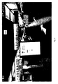
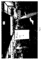
- Fig. 3 and 4 an augmented reality application of the invention, namely the display of a navigation arrow in the representation of the environment on a display device of the terminal.
- the workflow diagram according to Fig. 1 includes four modules in the present embodiment.
- the modules 1 to 3 symbolize the creation of a three-dimensional model of an environment and the module 4 symbolizes the position determination (tracking) of a user by means of an application on a mobile terminal.
- Module 1 several recorded video clips (video input) of an interior space become the first algorithm (3D Map Generator) supplied, wherein the first algorithm comprises a feature extraction and may be designed as a SLAM algorithm or may include this.
- the first algorithm creates a 3D point cloud as a virtual model of the interior.
- sections of individual video sequences are used to generate several, each localized submodels as 3D point clouds (Reference Sub-Maps).
- two-dimensional images (2D logos), eg signs, logos, etc. can be automatically extracted from the video or existing image data can be used.
- the individual 3D submodels are automatically assembled into an overall model by means of an Iterative Closest Point (ICP) algorithm.
- ICP Iterative Closest Point
- the existing 2D images (2D logos) are located, i. inserted at the correct position in the 3D point cloud (3D / 2D Fusion).
- the recorded video (Image Stream 1..n) can be used by using both the first and second algorithms (Tracking Thread 3D, Tracking Thread 2D) and matching with the respective previously generated model simultaneously both the 3D point cloud and 2D Images can be recognized and thereby spatially assigned.
- module 3 content to be displayed in a graphical editor (3D content) is prepared for an augmented reality application. These contents are inserted into the previously constructed 3D model, which has been extended by 2D images, and this determines their position and orientation in space.
- the model enhanced by 3D content preferably comprises the following data groups: 2D logos, 3D submodels (Reference Sub-Maps) and the assignment (2D / 3D Fusion Map) of the 3D position of the 2D logos within the 3D submodels, whereby the merger Map may be formed as a mapping matrix. Together, the data groups make up the Global Map Information Package.
- Module 4 uses the previously created overall model (Global Map Information Package) together with registered content. This information packet is now transferred to a mobile terminal on which runs for the purpose of determining the position of the user of the hybrid tracking algorithm.
- the first algorithm uses the sub-maps stored in the package to locate the user; the second algorithm uses the 2D images contained in the Global Map Information Package for robust positioning.
- the position and orientation can be estimated by means of inertial sensors of the terminal (fallback heuristic), if in the short term no camera data is available at the terminal. Once position and orientation have been determined, the augmented reality content included in the package can be displayed in the correct position on the display of the terminal. A very accurate indoor navigation solution is thereby realized.
- Fig. 2 shows a point cloud as generated by the first feature extraction algorithm.
- Fig. 3 shows an application of the invention in tracking with an augmented reality function.
- the camera of a mobile device smart phone
- the environment of an interior eg airport
- the application has detected the position and orientation (yaw, pitch and roll angles) of the device within the 3D model
- additional information is displayed on the screen and inserted into the live image of the camera, depending on the application.
- it is is a navigation function in which the additional information navigation arrows to a desired destination.
- Fig. 4 shows the same display view as Fig. 3 , wherein for better illustration, the image features recognized by the first and / or second algorithm for feature extraction in the context of corner point or edge detection are marked.
Landscapes
- Engineering & Computer Science (AREA)
- Physics & Mathematics (AREA)
- General Physics & Mathematics (AREA)
- Theoretical Computer Science (AREA)
- Multimedia (AREA)
- Computer Vision & Pattern Recognition (AREA)
- Software Systems (AREA)
- Processing Or Creating Images (AREA)
Priority Applications (1)
| Application Number | Priority Date | Filing Date | Title |
|---|---|---|---|
| EP14450018.8A EP2940624B8 (fr) | 2014-04-30 | 2014-04-30 | Modèle virtuel tridimensionnel d'un environnement pour applications destinées à la détermination de position |
Applications Claiming Priority (1)
| Application Number | Priority Date | Filing Date | Title |
|---|---|---|---|
| EP14450018.8A EP2940624B8 (fr) | 2014-04-30 | 2014-04-30 | Modèle virtuel tridimensionnel d'un environnement pour applications destinées à la détermination de position |
Publications (3)
| Publication Number | Publication Date |
|---|---|
| EP2940624A1 true EP2940624A1 (fr) | 2015-11-04 |
| EP2940624B1 EP2940624B1 (fr) | 2021-04-28 |
| EP2940624B8 EP2940624B8 (fr) | 2021-06-02 |
Family
ID=50841721
Family Applications (1)
| Application Number | Title | Priority Date | Filing Date |
|---|---|---|---|
| EP14450018.8A Active EP2940624B8 (fr) | 2014-04-30 | 2014-04-30 | Modèle virtuel tridimensionnel d'un environnement pour applications destinées à la détermination de position |
Country Status (1)
| Country | Link |
|---|---|
| EP (1) | EP2940624B8 (fr) |
Cited By (3)
| Publication number | Priority date | Publication date | Assignee | Title |
|---|---|---|---|---|
| US10681183B2 (en) | 2014-05-28 | 2020-06-09 | Alexander Hertel | Platform for constructing and consuming realm and object featured clouds |
| CN116057572A (zh) * | 2020-07-30 | 2023-05-02 | 利沃科斯有限公司 | 用于确定多个照明设备的三维位置的方法 |
| CN117132507A (zh) * | 2023-10-23 | 2023-11-28 | 光轮智能(北京)科技有限公司 | 图像增强方法、图像处理方法、计算机设备及存储介质 |
-
2014
- 2014-04-30 EP EP14450018.8A patent/EP2940624B8/fr active Active
Non-Patent Citations (2)
| Title |
|---|
| CARD CEM: "insider navigation - Destination tomorrow. Today!", 22 April 2014 (2014-04-22), XP054975558, Retrieved from the Internet <URL:http://youtu.be/aMBVLUMxmiQ> [retrieved on 20141020] * |
| CARD CEM: "insider navigation app - first live demo", 22 April 2014 (2014-04-22), XP054975559, Retrieved from the Internet <URL:http://youtu.be/WG0pVSia1js> [retrieved on 20141020] * |
Cited By (7)
| Publication number | Priority date | Publication date | Assignee | Title |
|---|---|---|---|---|
| US10681183B2 (en) | 2014-05-28 | 2020-06-09 | Alexander Hertel | Platform for constructing and consuming realm and object featured clouds |
| US11368557B2 (en) | 2014-05-28 | 2022-06-21 | Alexander Hertel | Platform for constructing and consuming realm and object feature clouds |
| US11729245B2 (en) | 2014-05-28 | 2023-08-15 | Alexander Hertel | Platform for constructing and consuming realm and object feature clouds |
| US12101371B2 (en) | 2014-05-28 | 2024-09-24 | Alexander Hertel | Platform for constructing and consuming realm and object feature clouds |
| CN116057572A (zh) * | 2020-07-30 | 2023-05-02 | 利沃科斯有限公司 | 用于确定多个照明设备的三维位置的方法 |
| CN117132507A (zh) * | 2023-10-23 | 2023-11-28 | 光轮智能(北京)科技有限公司 | 图像增强方法、图像处理方法、计算机设备及存储介质 |
| CN117132507B (zh) * | 2023-10-23 | 2023-12-22 | 光轮智能(北京)科技有限公司 | 图像增强方法、图像处理方法、计算机设备及存储介质 |
Also Published As
| Publication number | Publication date |
|---|---|
| EP2940624B8 (fr) | 2021-06-02 |
| EP2940624B1 (fr) | 2021-04-28 |
Similar Documents
| Publication | Publication Date | Title |
|---|---|---|
| EP3539086B1 (fr) | Procédé et dispositif pour superposer des données image et audio virtuelles à une représentation optique et sonore d'une scène réelle et appareil mobile | |
| EP3347878B1 (fr) | Procédé et dispositif pour superposer une image virtuelle à une représentation d'un cadre réel, et appareil mobile | |
| EP2297701B1 (fr) | Analyse vidéo | |
| EP2491530B1 (fr) | Déterminer la pose d'une caméra | |
| DE112017005059T5 (de) | System und verfahren zum projizieren graphischer objekte | |
| WO2013053438A2 (fr) | Procédé d'intégration d'objets virtuels dans des affichages de véhicule | |
| DE102019216548A1 (de) | Verfahren und mobile Erfassungsvorrichtung zur Erfassung von Infrastrukturelementen eines unterirdischen Leitungsnetzwerks | |
| DE112019006107B4 (de) | Authoring-Vorrichtung, Authoring-Verfahren und Authoring-Programm | |
| EP2381207A1 (fr) | Mesure de cible 3D et orientation de cible à partir de données IR | |
| EP2940624B1 (fr) | Modèle virtuel tridimensionnel d'un environnement pour applications destinées à la détermination de position | |
| EP2859531B1 (fr) | Procédé permettant de détecter des modifications à partir d'images | |
| DE102017122554A1 (de) | Informationenverarbeitungsvorrichtung, informationenverarbeitungsverfahren und speichermedium | |
| DE19746639A1 (de) | Verfahren zur digitalen Erfassung räumlicher Objekte und Szenen für eine 3D-Bildkarte sowie 3D-Bildkarte | |
| WO2021165129A1 (fr) | Procédé et dispositif pour générer des scénarios combinés | |
| EP3711392B1 (fr) | Procédé et dispositif de détermination de position | |
| EP4172729B1 (fr) | Méthode d'affichage d'un objet virtuel | |
| DE102023204603A1 (de) | Verfahren zum Erstellen einer Referenzkartendarstellung | |
| DE102018118422A1 (de) | Verfahren und system zur darstellung von daten von einer videokamera | |
| DE102019207888A1 (de) | Verfahren und Systeme für die Ausnutzung von Bewegungskonflikten pro Pixel zum Extrahieren primärer und sekundärer Bewegungen in Augmented-Reality-Systemen | |
| WO2009068336A2 (fr) | Module de traitement d'images pour l'estimation d'une position d'un objet à surveiller, procédé de détermination de la position d'un objet à surveiller et programme informatique | |
| DE102005039703A1 (de) | Verfahren zum Aufbau einer Merkmalsdatenbank | |
| EP3446289A1 (fr) | Procédé et système pour représenter un environnement de simulation | |
| DE102023119511A1 (de) | Verfahren zur Erzeugung von Sensordaten einer Bewegung eines Lebewesens | |
| EP3384469A2 (fr) | Procédé de représentation d'un environnement de simulation | |
| DE102006027120A1 (de) | Bildverarbeitungsverfahren, Videoüberwachungssystem sowie Computerprogramm |
Legal Events
| Date | Code | Title | Description |
|---|---|---|---|
| PUAI | Public reference made under article 153(3) epc to a published international application that has entered the european phase |
Free format text: ORIGINAL CODE: 0009012 |
|
| AK | Designated contracting states |
Kind code of ref document: A1 Designated state(s): AL AT BE BG CH CY CZ DE DK EE ES FI FR GB GR HR HU IE IS IT LI LT LU LV MC MK MT NL NO PL PT RO RS SE SI SK SM TR |
|
| AX | Request for extension of the european patent |
Extension state: BA ME |
|
| 17P | Request for examination filed |
Effective date: 20160420 |
|
| RBV | Designated contracting states (corrected) |
Designated state(s): AL AT BE BG CH CY CZ DE DK EE ES FI FR GB GR HR HU IE IS IT LI LT LU LV MC MK MT NL NO PL PT RO RS SE SI SK SM TR |
|
| STAA | Information on the status of an ep patent application or granted ep patent |
Free format text: STATUS: EXAMINATION IS IN PROGRESS |
|
| 17Q | First examination report despatched |
Effective date: 20170829 |
|
| GRAP | Despatch of communication of intention to grant a patent |
Free format text: ORIGINAL CODE: EPIDOSNIGR1 |
|
| STAA | Information on the status of an ep patent application or granted ep patent |
Free format text: STATUS: GRANT OF PATENT IS INTENDED |
|
| RIC1 | Information provided on ipc code assigned before grant |
Ipc: G06T 7/246 20170101ALI20201111BHEP Ipc: G06T 7/55 20170101ALI20201111BHEP Ipc: G06K 9/00 20060101AFI20201111BHEP |
|
| INTG | Intention to grant announced |
Effective date: 20201126 |
|
| GRAS | Grant fee paid |
Free format text: ORIGINAL CODE: EPIDOSNIGR3 |
|
| GRAA | (expected) grant |
Free format text: ORIGINAL CODE: 0009210 |
|
| STAA | Information on the status of an ep patent application or granted ep patent |
Free format text: STATUS: THE PATENT HAS BEEN GRANTED |
|
| AK | Designated contracting states |
Kind code of ref document: B1 Designated state(s): AL AT BE BG CH CY CZ DE DK EE ES FI FR GB GR HR HU IE IS IT LI LT LU LV MC MK MT NL NO PL PT RO RS SE SI SK SM TR |
|
| REG | Reference to a national code |
Ref country code: GB Ref legal event code: FG4D Free format text: NOT ENGLISH |
|
| REG | Reference to a national code |
Ref country code: CH Ref legal event code: EP |
|
| REG | Reference to a national code |
Ref country code: DE Ref legal event code: R096 Ref document number: 502014015519 Country of ref document: DE |
|
| REG | Reference to a national code |
Ref country code: CH Ref legal event code: PK Free format text: BERICHTIGUNG B8 |
|
| REG | Reference to a national code |
Ref country code: AT Ref legal event code: REF Ref document number: 1387923 Country of ref document: AT Kind code of ref document: T Effective date: 20210515 |
|
| RAP4 | Party data changed (patent owner data changed or rights of a patent transferred) |
Owner name: INS INSIDER NAVIGATION SYSTEMS GMBH |
|
| REG | Reference to a national code |
Ref country code: IE Ref legal event code: FG4D Free format text: LANGUAGE OF EP DOCUMENT: GERMAN |
|
| REG | Reference to a national code |
Ref country code: LT Ref legal event code: MG9D |
|
| PG25 | Lapsed in a contracting state [announced via postgrant information from national office to epo] |
Ref country code: BG Free format text: LAPSE BECAUSE OF FAILURE TO SUBMIT A TRANSLATION OF THE DESCRIPTION OR TO PAY THE FEE WITHIN THE PRESCRIBED TIME-LIMIT Effective date: 20210728 Ref country code: NL Free format text: LAPSE BECAUSE OF FAILURE TO SUBMIT A TRANSLATION OF THE DESCRIPTION OR TO PAY THE FEE WITHIN THE PRESCRIBED TIME-LIMIT Effective date: 20210428 Ref country code: LT Free format text: LAPSE BECAUSE OF FAILURE TO SUBMIT A TRANSLATION OF THE DESCRIPTION OR TO PAY THE FEE WITHIN THE PRESCRIBED TIME-LIMIT Effective date: 20210428 Ref country code: FI Free format text: LAPSE BECAUSE OF FAILURE TO SUBMIT A TRANSLATION OF THE DESCRIPTION OR TO PAY THE FEE WITHIN THE PRESCRIBED TIME-LIMIT Effective date: 20210428 Ref country code: HR Free format text: LAPSE BECAUSE OF FAILURE TO SUBMIT A TRANSLATION OF THE DESCRIPTION OR TO PAY THE FEE WITHIN THE PRESCRIBED TIME-LIMIT Effective date: 20210428 |
|
| REG | Reference to a national code |
Ref country code: DE Ref legal event code: R119 Ref document number: 502014015519 Country of ref document: DE |
|
| REG | Reference to a national code |
Ref country code: DE Ref legal event code: R079 Ref document number: 502014015519 Country of ref document: DE Free format text: PREVIOUS MAIN CLASS: G06K0009000000 Ipc: G06V0010000000 |
|
| PG25 | Lapsed in a contracting state [announced via postgrant information from national office to epo] |
Ref country code: GR Free format text: LAPSE BECAUSE OF FAILURE TO SUBMIT A TRANSLATION OF THE DESCRIPTION OR TO PAY THE FEE WITHIN THE PRESCRIBED TIME-LIMIT Effective date: 20210729 Ref country code: IS Free format text: LAPSE BECAUSE OF FAILURE TO SUBMIT A TRANSLATION OF THE DESCRIPTION OR TO PAY THE FEE WITHIN THE PRESCRIBED TIME-LIMIT Effective date: 20210828 Ref country code: LV Free format text: LAPSE BECAUSE OF FAILURE TO SUBMIT A TRANSLATION OF THE DESCRIPTION OR TO PAY THE FEE WITHIN THE PRESCRIBED TIME-LIMIT Effective date: 20210428 Ref country code: RS Free format text: LAPSE BECAUSE OF FAILURE TO SUBMIT A TRANSLATION OF THE DESCRIPTION OR TO PAY THE FEE WITHIN THE PRESCRIBED TIME-LIMIT Effective date: 20210428 Ref country code: SE Free format text: LAPSE BECAUSE OF FAILURE TO SUBMIT A TRANSLATION OF THE DESCRIPTION OR TO PAY THE FEE WITHIN THE PRESCRIBED TIME-LIMIT Effective date: 20210428 Ref country code: ES Free format text: LAPSE BECAUSE OF FAILURE TO SUBMIT A TRANSLATION OF THE DESCRIPTION OR TO PAY THE FEE WITHIN THE PRESCRIBED TIME-LIMIT Effective date: 20210428 Ref country code: NO Free format text: LAPSE BECAUSE OF FAILURE TO SUBMIT A TRANSLATION OF THE DESCRIPTION OR TO PAY THE FEE WITHIN THE PRESCRIBED TIME-LIMIT Effective date: 20210728 Ref country code: PL Free format text: LAPSE BECAUSE OF FAILURE TO SUBMIT A TRANSLATION OF THE DESCRIPTION OR TO PAY THE FEE WITHIN THE PRESCRIBED TIME-LIMIT Effective date: 20210428 Ref country code: PT Free format text: LAPSE BECAUSE OF FAILURE TO SUBMIT A TRANSLATION OF THE DESCRIPTION OR TO PAY THE FEE WITHIN THE PRESCRIBED TIME-LIMIT Effective date: 20210830 |
|
| REG | Reference to a national code |
Ref country code: NL Ref legal event code: MP Effective date: 20210428 |
|
| PG25 | Lapsed in a contracting state [announced via postgrant information from national office to epo] |
Ref country code: LU Free format text: LAPSE BECAUSE OF NON-PAYMENT OF DUE FEES Effective date: 20210430 |
|
| REG | Reference to a national code |
Ref country code: BE Ref legal event code: MM Effective date: 20210430 |
|
| PG25 | Lapsed in a contracting state [announced via postgrant information from national office to epo] |
Ref country code: MC Free format text: LAPSE BECAUSE OF FAILURE TO SUBMIT A TRANSLATION OF THE DESCRIPTION OR TO PAY THE FEE WITHIN THE PRESCRIBED TIME-LIMIT Effective date: 20210428 Ref country code: LI Free format text: LAPSE BECAUSE OF NON-PAYMENT OF DUE FEES Effective date: 20210430 Ref country code: CH Free format text: LAPSE BECAUSE OF NON-PAYMENT OF DUE FEES Effective date: 20210430 Ref country code: RO Free format text: LAPSE BECAUSE OF FAILURE TO SUBMIT A TRANSLATION OF THE DESCRIPTION OR TO PAY THE FEE WITHIN THE PRESCRIBED TIME-LIMIT Effective date: 20210428 Ref country code: SK Free format text: LAPSE BECAUSE OF FAILURE TO SUBMIT A TRANSLATION OF THE DESCRIPTION OR TO PAY THE FEE WITHIN THE PRESCRIBED TIME-LIMIT Effective date: 20210428 Ref country code: SM Free format text: LAPSE BECAUSE OF FAILURE TO SUBMIT A TRANSLATION OF THE DESCRIPTION OR TO PAY THE FEE WITHIN THE PRESCRIBED TIME-LIMIT Effective date: 20210428 Ref country code: CZ Free format text: LAPSE BECAUSE OF FAILURE TO SUBMIT A TRANSLATION OF THE DESCRIPTION OR TO PAY THE FEE WITHIN THE PRESCRIBED TIME-LIMIT Effective date: 20210428 Ref country code: DE Free format text: LAPSE BECAUSE OF NON-PAYMENT OF DUE FEES Effective date: 20211103 Ref country code: EE Free format text: LAPSE BECAUSE OF FAILURE TO SUBMIT A TRANSLATION OF THE DESCRIPTION OR TO PAY THE FEE WITHIN THE PRESCRIBED TIME-LIMIT Effective date: 20210428 Ref country code: DK Free format text: LAPSE BECAUSE OF FAILURE TO SUBMIT A TRANSLATION OF THE DESCRIPTION OR TO PAY THE FEE WITHIN THE PRESCRIBED TIME-LIMIT Effective date: 20210428 |
|
| PLBE | No opposition filed within time limit |
Free format text: ORIGINAL CODE: 0009261 |
|
| STAA | Information on the status of an ep patent application or granted ep patent |
Free format text: STATUS: NO OPPOSITION FILED WITHIN TIME LIMIT |
|
| GBPC | Gb: european patent ceased through non-payment of renewal fee |
Effective date: 20210728 |
|
| 26N | No opposition filed |
Effective date: 20220131 |
|
| PG25 | Lapsed in a contracting state [announced via postgrant information from national office to epo] |
Ref country code: IE Free format text: LAPSE BECAUSE OF NON-PAYMENT OF DUE FEES Effective date: 20210430 Ref country code: GB Free format text: LAPSE BECAUSE OF NON-PAYMENT OF DUE FEES Effective date: 20210728 |
|
| PG25 | Lapsed in a contracting state [announced via postgrant information from national office to epo] |
Ref country code: IS Free format text: LAPSE BECAUSE OF FAILURE TO SUBMIT A TRANSLATION OF THE DESCRIPTION OR TO PAY THE FEE WITHIN THE PRESCRIBED TIME-LIMIT Effective date: 20210828 Ref country code: FR Free format text: LAPSE BECAUSE OF NON-PAYMENT OF DUE FEES Effective date: 20210628 Ref country code: AL Free format text: LAPSE BECAUSE OF FAILURE TO SUBMIT A TRANSLATION OF THE DESCRIPTION OR TO PAY THE FEE WITHIN THE PRESCRIBED TIME-LIMIT Effective date: 20210428 |
|
| PG25 | Lapsed in a contracting state [announced via postgrant information from national office to epo] |
Ref country code: IT Free format text: LAPSE BECAUSE OF FAILURE TO SUBMIT A TRANSLATION OF THE DESCRIPTION OR TO PAY THE FEE WITHIN THE PRESCRIBED TIME-LIMIT Effective date: 20210428 Ref country code: BE Free format text: LAPSE BECAUSE OF NON-PAYMENT OF DUE FEES Effective date: 20210430 |
|
| PG25 | Lapsed in a contracting state [announced via postgrant information from national office to epo] |
Ref country code: HU Free format text: LAPSE BECAUSE OF FAILURE TO SUBMIT A TRANSLATION OF THE DESCRIPTION OR TO PAY THE FEE WITHIN THE PRESCRIBED TIME-LIMIT; INVALID AB INITIO Effective date: 20140430 |
|
| PG25 | Lapsed in a contracting state [announced via postgrant information from national office to epo] |
Ref country code: CY Free format text: LAPSE BECAUSE OF FAILURE TO SUBMIT A TRANSLATION OF THE DESCRIPTION OR TO PAY THE FEE WITHIN THE PRESCRIBED TIME-LIMIT Effective date: 20210428 |
|
| REG | Reference to a national code |
Ref country code: AT Ref legal event code: PC Ref document number: 1387923 Country of ref document: AT Kind code of ref document: T Owner name: INSIDER NAVIGATION INC., US Effective date: 20231018 |
|
| PG25 | Lapsed in a contracting state [announced via postgrant information from national office to epo] |
Ref country code: MK Free format text: LAPSE BECAUSE OF FAILURE TO SUBMIT A TRANSLATION OF THE DESCRIPTION OR TO PAY THE FEE WITHIN THE PRESCRIBED TIME-LIMIT Effective date: 20210428 |
|
| PG25 | Lapsed in a contracting state [announced via postgrant information from national office to epo] |
Ref country code: MT Free format text: LAPSE BECAUSE OF FAILURE TO SUBMIT A TRANSLATION OF THE DESCRIPTION OR TO PAY THE FEE WITHIN THE PRESCRIBED TIME-LIMIT Effective date: 20210428 |
|
| PGFP | Annual fee paid to national office [announced via postgrant information from national office to epo] |
Ref country code: AT Payment date: 20241030 Year of fee payment: 11 |
|
| PG25 | Lapsed in a contracting state [announced via postgrant information from national office to epo] |
Ref country code: TR Free format text: LAPSE BECAUSE OF FAILURE TO SUBMIT A TRANSLATION OF THE DESCRIPTION OR TO PAY THE FEE WITHIN THE PRESCRIBED TIME-LIMIT Effective date: 20210428 |
|
| REG | Reference to a national code |
Ref country code: AT Ref legal event code: MM01 Ref document number: 1387923 Country of ref document: AT Kind code of ref document: T Effective date: 20250430 |
|
| PG25 | Lapsed in a contracting state [announced via postgrant information from national office to epo] |
Ref country code: AT Free format text: LAPSE BECAUSE OF NON-PAYMENT OF DUE FEES Effective date: 20250430 |