EP3010255A1 - Procédé, système, terminal utilisateur et programmes informatiques pour l'estimation de voies mobiles de terminal d'utilisateur via un réseau cellulaire et d'informations cartographiques - Google Patents
Procédé, système, terminal utilisateur et programmes informatiques pour l'estimation de voies mobiles de terminal d'utilisateur via un réseau cellulaire et d'informations cartographiques Download PDFInfo
- Publication number
- EP3010255A1 EP3010255A1 EP14382398.7A EP14382398A EP3010255A1 EP 3010255 A1 EP3010255 A1 EP 3010255A1 EP 14382398 A EP14382398 A EP 14382398A EP 3010255 A1 EP3010255 A1 EP 3010255A1
- Authority
- EP
- European Patent Office
- Prior art keywords
- user terminal
- map
- cell
- street
- locations
- Prior art date
- Legal status (The legal status is an assumption and is not a legal conclusion. Google has not performed a legal analysis and makes no representation as to the accuracy of the status listed.)
- Withdrawn
Links
Images




Classifications
-
- H—ELECTRICITY
- H04—ELECTRIC COMMUNICATION TECHNIQUE
- H04W—WIRELESS COMMUNICATION NETWORKS
- H04W4/00—Services specially adapted for wireless communication networks; Facilities therefor
- H04W4/02—Services making use of location information
- H04W4/029—Location-based management or tracking services
Definitions
- the present invention generally relates to cellular networks methods and systems.
- the invention relates to a computer implemented method, a system, a user terminal and computer programs for estimating user terminal mobile paths through cellular network and map information.
- cellular networks are a repository of continuous location information from its subscribed terminal devices. Such information, however, comes at a coarse granularity both in terms of space, as well as time. For otherwise inactive devices, location information can be obtained at the granularity of the associated cellular sector, and at infrequent points in time, that are sensitive to the structure of the network itself, and the level of mobility of the device/terminal.
- Mobility management is a fundamental function of the cellular infrastructure. However, unlike recent public belief, in normal operation a cellular network is not in a position to accurately localize every single subscriber in space. In most cellular infrastructures today, mobile subscribers leave a trace of their associated tower, only when making/receiving calls, sending/receiving SMS, crossing Location Area Codes (LACs) or are routinely polled by the network due to stale information that exceeds a preconfigured duration (on the order of a few hours). These traces are referred as Network Events (NE). Full handover information (all the sectors crossed by a mobile device) is further accessible through RNC-level monitoring.
- LACs Location Area Codes
- the spatial granularity of the location information in cellular NEs is at best that of a sector (BTS), which is often quite large. Frequently the location is even less accurate as the BSC/RNCs associate mobiles to nearby cell sectors but not the nearest one, in order to balance load.
- the temporal granularity of the location information heavily depends on subscriber activity in terms of either movement or use of the network. Arguably mobile subscribers use the network more or less continuously because of data services, but cell boundaries are carefully chosen to minimize the number of signaling messages for handovers, and inactive mobiles are paged only on the timescale of hours.
- a mobile is associated with only a single cell sector at a time. There is no information on the set of cell sectors that are within range of a subscriber, and there is no measurement of the signal strength (i.e. RSSI) with which a mobile can hear its associated cell sector or vice versa. While some of this information does reach the BSC/RNC, logging it would be a major departure from current operational practices such that present invention does not consider that possibility.
- RSSI signal strength
- Embodiments of the present invention address these and/or other needs by providing a computer implemented method for estimating user terminal mobile paths through cellular network and map information.
- the method is able to parse the continuous sector observations and identify the segments corresponding to a stationary position, and the segments corresponding to actual mobility.
- Stationary segments are used, that typically feature multiple sector observations, to derive more accurate estimations for the stationary position.
- an algorithm is developed able to extract mobility paths between stationary points.
- the path estimation algorithm characteristically uses cellular topology information to identify the areas on a map that are consistent with the observed sector associations, and weighs them according to the likelihood for a mobile subscriber to have connected, via a user terminal through 2G/3G or 4G, with a cell tower from different locations within the respective sector coverage area. It then biases the route selection to pass through high probability areas while respecting the underlying road network.
- the method provides a time sequence of mapped associations between a user terminal and a plurality of cell sectors on a first map including geographical cell sector locations. Then the provided time sequences are split into user terminal stationary state sub-sequences and user terminal mobile state sub-sequences. Once those two different time sequences are split, user terminal locations from the user terminal stationary sub-sequences are calculated marking the user terminal locations as endpoints locations in the first map. Following that and for at least one of the user terminal mobile sub-sequence, geographical locations on the first map are identified in which a probability of the user terminal having travelled through during the mapped association has a high probability value. Finally, the weights of the high probability values of said identified geographical locations are adjusted based on streets and/or passageways included in a second map and a street routing algorithm is applied over the weighted high probability values of the second map.
- the weights of the high probability values of the identified geographical locations are adjusted depending on the length of the street, type of the street, mode of transportation in the street and/or speed limits of the street.
- the street routing algorithm chooses the street and/or passageway of the second map having at least the shortest adjusted weight.
- the method further models the probability of the given position being associated with a specific sector of the plurality of cell sectors.
- each one of the plurality of cell sectors is defined by, the location of the cell, the orientation of the cell, the beam width of the cell and/or an intended spatial extent of the cell.
- the user terminal stationary state sub-sequences involve the user terminal being in a same logical location (e.g. a building, a campus, a square, etc.) for more than a threshold time ⁇ .
- Embodiments of the present invention also provide a user terminal, such as a Smartphone or a tablet, among others, comprising a computer readable medium and a software program having program code instructions embedded in the computer readable medium for receiving a signal corresponding to the estimated user terminal mobile paths, and for presenting information relating to the estimated user terminal mobile paths to at least one user.
- a user terminal such as a Smartphone or a tablet, among others, comprising a computer readable medium and a software program having program code instructions embedded in the computer readable medium for receiving a signal corresponding to the estimated user terminal mobile paths, and for presenting information relating to the estimated user terminal mobile paths to at least one user.
- a computer program product is one embodiment that has a computer-readable medium including computer program instructions encoded thereon that when executed on at least one processor in a computer system causes the processor to perform the operations indicated herein as embodiments of the invention.
- Present invention enables the extraction of mobility paths from sparse spatial-temporal cellular location information. Using more than 3,000 mobility trajectories, it has been estimated that present invention is able to estimate the stationary locations with a median accuracy of 230 meters. When the terminal is mobile, present invention can estimate its mobility path with a median error of 70 meters. To achieve such accuracy, present invention takes into account the cellular network topology, as well as geographic information. Mobility path accuracy improves with its length and speed, and counter to the inventor's intuition, accuracy appears to improve in rural areas. Present invention allows location services for the new generation of connected mobile terminals that may feature neither GPS nor WiFi due to cost, size, or energy constraints.
- Fig. 1 illustrates the overall method steps executed by a processor of a computer system for estimating user terminal mobile paths through cellular network and map information.
- Components of the computer system are illustrated in Fig. 2 .
- the computer system 110 at least includes a processor 111 having various hardware components including a central processing unit (CPU), among other components, and a memory 112.
- the memory 112 stores computer program code instructions that control the processes for executing the proposed method.
- a first map/cell coverage map where a user/subscriber is likely to be while associated first needs to be modeled. That is, the coverage of the cell sectors needs to be known. Therefore, for each sector, a model for the expected coverage is built based on the information that is available to the network operator. Preferably, this information is stored in a first database (not illustrated) accessible by the processor 111 and at least includes the sector location, orientation, beam width, and the intended spatial extent of the installation (i.e., macro, micro, or femto cell). Moreover, the coverage models may be combined to identify the overlap between two sectors S i and S j to understand likely handover locations.
- the mobile associations are any indications that the subscriber was "connected" to a cell tower at some point in time. More specifically they are in the form of (time, tower_ID).
- the associating is logged when certain events occur i ) every time the subscriber makes/receives a call or SMS; ii ) every time the subscriber is switching from one cell tower to another (handovers); iii ) periodically (to notify the network that the terminal is still there); iv) when requested by the network and/or v) whenever any packet (e.g., data to update e-mail) are exchanged with the cell tower.
- step 101 stationary and mobile segments are identified.
- Present invention models mobile subscribers as alternating between stationary and mobile states. Since different estimation procedures are appropriate for the different states, present invention splits the cellular observations into stationary and mobile state sub-sequences.
- a stationary sequence is defined as the sequence of cell sectors S a mobile terminal sees while in the same logical location (e.g. a building, a square, a campus, etc.) for more than a threshold time ⁇ , preferably 15 minutes but it could be an hour, or even a few hours.
- a mobile sequence is defined as the sequence between two stationary sequences.
- step 102 user terminal locations are calculated from the user terminal stationary sub-sequences.
- To generate a path present invention needs to identify the two end-point locations. During each stationary sequence, a number of sectors may be observed. Therefore, the whole set of observed sectors can be used over time to derive a more accurate estimate of the terminal's fixed location than using the whole coverage area of a single sector.
- the proposed method preferably uses the coverage area of each cell tower plus the duration the terminal was associated with each sector.
- Step 103 For each mobile sub-sequence, a number of intermediate sectors are observed between the stationary sub-sequences that serve as endpoints. (Step 103) The coverage of the observed sectors indicates the areas that the terminal traveled through with high probability. These areas typically constrain the path of the mobile subscriber.
- present invention uses the identified high-probability areas to bias route search over a second map/Geographic Information System (GIS) map. More specifically, present invention (step 105) applies a street-routing algorithm over the GIS map where the streets, passageways and/or public transport routes have adjusted weights based on the inferred coverage.
- GIS Geographic Information System
- the street-routing algorithm an A* algorithm (but any routing algorithm can be used such as Dijstra, two-direction Dijstra, hierarchical routing, etc.), captures the idiosyncratic deviations the subscriber makes from shortest paths.
- the coverage map is built to estimate the likelihood that a mobile subscriber m at a particular position relative to sector S is associated with the sector. It is convenient to use a polar coordinate model for positions.
- the likelihood is then a function of three parameters: the power P of the sector; the distance d between the terminal and the cell tower; and the angle factor ⁇ of the terminal relative to the sector.
- the angle factor is defined as the ratio of the polar angle of the mobile relative to the major axis of the sector and the beam width of the sector.
- present invention preferably uses ground truth data of associations at different locations to approximate it empirically.
- the result is the coverage probabilities as a PDF that is denoted by W P (d, ⁇ ), using the same notation for parameters as explained above.
- Q(g, S) are the probability grids. In the steps that follow, these grids are used as the most convenient form of the coverage map. It should be recalled that present invention has as input a discrete trajectory in the form of a sequence of time-stamped cell sector associations. This sequence has to be split into stationary and mobile segments, therefore to do so, present invention builds on the coverage PDF in the form of the probability grid Q(g, S).
- Two sectors S 1 and S 2 are called adjacent sectors if there is a square g in the grid such that Q(g,S1) > 0 and Q(g,S2) > 0. That is, a mobile terminal can connect to both sectors without moving.
- a sequence of sectors S 1 ...S n it is said to be stationary if every two sectors are adjacent and the duration of the sequence as determined by its timestamps is greater than a threshold time ⁇ . That is, the mobile terminal can connect to all sectors without moving and this situation persists for long enough that non-adjacent handovers would likely have occurred if it was actually moving.
- the stationary periods are extended as far along the sequence as possible. Then present invention defines the sequence of sectors between two stationary periods (which cannot itself be stationary) to be a mobile period.
- a stationary segment consists of only one sector S
- the most likely position is simply the square grid g that maximizes Q(g, S).
- this procedure gives an estimated user terminal location for the start and end points. It has to be noted that the end point for one path forms the start period for the next path with no discontinuities because they share the same stationary period.
- the mobile sub-sequences are mined for locations that the subscriber passes through with high-probability.
- present invention will bias the estimated path to follow the high-probability locations.
- Q(g, S ) is the probability that a subscriber in g is connected to S.
- present invention uses the road network to constrain the path between the stationary end-points.
- Present invention approach is to use the values of the squares p(g) to bias routing on the road network.
- present invention preferentially searches for a route in the "corridor" formed by the coverage areas of all sectors in the mobile segment. High values close to the shortest path represent likely deviations.
- present invention implementation uses OpenStreetMaps (OSM), which is not limitative, as any map representation can be used.
- OSM OpenStreetMaps
- OSM is a community-driven repository that contains data about roads, POIs, railway connections, etc. and is designed to be used for navigation purposes as it includes information for routing by many modes including car, foot and bicycle.
- Nodes V represent the geographical locations of intersections or points along curved road segments, which each edge represents a directional road-segment between two nodes.
- W(e) ⁇ R For each edge e ⁇ E an initial weight, W(e) ⁇ R is assigned that represents the expected time that is required to traverse it. This weight may depend on: i ) the length of the road segment; ii ) the type of the road segment (e.g., motorway, primary, secondary, footpath); and/or iii ) the mode of transport (e.g., walking, driving). The required information and the default values of these weights for each mode of transport are therefore calculated based on the OSM recommendations. It has to be noted that for some means of transport certain roads might be restricted (e.g., motorways cannot be used for walking routes).
- Each road segment e crosses several square grids g 1 ... g l .
- ⁇ allows the route to gracefully handle gaps in coverage due to low (zero) scores rather than require a major diversion. It basically allows balancing the tradeoff between the short/best routes and the routes that are close to the observed sectors.
- the inventors had experiment with various ⁇ values and observed that as long as ⁇ ⁇ 0.1 the expected errors are insensitive of the choice of ⁇ .
- any other form of weighting streets based on observed sectors can be applied. This includes time-evolving probabilities based on when a cell tower was observed.
- the A* algorithm in an embodiment, is used to search the graph for a shortest weighted path between the start and end points.
- the A* algorithm is used for path-finding because running Dijkstra on the entire network graph is computationally expensive.
- A* algorithm is much faster and performs well in the invention setting.
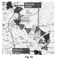
- the resulting path in the graph is the final estimate for the path taken by the mobile subscriber. An example of such a path is given in Fig. 4c .
- NEs Network Events
- CDRs Call Detail Records
- RSSI Session Information
- location-based service data such as geo-tagged posts on Facebook®/Twitter® or check-ins Foursquare® can be used.
- the proposed method uses a data-driven model
- other alternative methods such as simulation (with or without a GIS model), fingerprinting or a mathematical model can also be used.
- information such as the historical and active transmission power can be added to the model to improve the real-time estimation of coverage.
- the type of the route, the speed limit, the type and/or the length of the street is used to calculate the initial weight that represents the time that is required to traverse a road/street/passageway segment.
- any other method such as historical data about average speed on certain road segments (per time-of the day and time-of-the-week) can be also used.
- real-time information coming from sensor e.g., traffic cameras, induction loops
- All these previous data that can be used for representing the required time to traverse the road/street/passageway preferably is stored in a second database (not illustrated either) accessible by the processor 111.
- the proposed method produces an optimal route between two locations by influencing the street-routing algorithm to prefer streets that are within the coverage. Although this is usually the case, it may not work well when the route is a loop or when a subscriber is having large deviations/detours. Therefore, present invention can force the route to pass through the coverage area of each sector.
- the proposed method uses fixed means of transport to estimate the path. However, based on the location and the time taken to move between two locations it has been detected whether a subscriber was walking, driving or taking public transport. Present invention can then use the appropriate path-planning algorithm (walking/driving/public transport) to estimate the best possible route.
- path-planning algorithm walking/driving/public transport
- the software programs included as part of the invention may be embodied in a computer program product that includes a computer useable medium.
- a computer usable medium can include a readable memory device, such as a hard drive device, a flash memory device, a CD-ROM, a DVD/ROM, or a computer diskette, having computer readable program code segments stored thereon.
- the computer readable medium can also include a communications link, either optical, wired, or wireless, having program code segments carried thereon as digital or analog signals.
Landscapes
- Engineering & Computer Science (AREA)
- Computer Networks & Wireless Communication (AREA)
- Signal Processing (AREA)
- Mobile Radio Communication Systems (AREA)
Priority Applications (1)
| Application Number | Priority Date | Filing Date | Title |
|---|---|---|---|
| EP14382398.7A EP3010255A1 (fr) | 2014-10-17 | 2014-10-17 | Procédé, système, terminal utilisateur et programmes informatiques pour l'estimation de voies mobiles de terminal d'utilisateur via un réseau cellulaire et d'informations cartographiques |
Applications Claiming Priority (1)
| Application Number | Priority Date | Filing Date | Title |
|---|---|---|---|
| EP14382398.7A EP3010255A1 (fr) | 2014-10-17 | 2014-10-17 | Procédé, système, terminal utilisateur et programmes informatiques pour l'estimation de voies mobiles de terminal d'utilisateur via un réseau cellulaire et d'informations cartographiques |
Publications (1)
| Publication Number | Publication Date |
|---|---|
| EP3010255A1 true EP3010255A1 (fr) | 2016-04-20 |
Family
ID=51799067
Family Applications (1)
| Application Number | Title | Priority Date | Filing Date |
|---|---|---|---|
| EP14382398.7A Withdrawn EP3010255A1 (fr) | 2014-10-17 | 2014-10-17 | Procédé, système, terminal utilisateur et programmes informatiques pour l'estimation de voies mobiles de terminal d'utilisateur via un réseau cellulaire et d'informations cartographiques |
Country Status (1)
| Country | Link |
|---|---|
| EP (1) | EP3010255A1 (fr) |
Cited By (5)
| Publication number | Priority date | Publication date | Assignee | Title |
|---|---|---|---|---|
| US20160123728A1 (en) * | 2014-11-04 | 2016-05-05 | Ha Yoon Song | Method for classifying human mobility state using particle filter |
| CN108574933A (zh) * | 2017-03-07 | 2018-09-25 | 华为技术有限公司 | 用户轨迹恢复方法及装置 |
| CN109565700A (zh) * | 2016-08-16 | 2019-04-02 | 瑞典爱立信有限公司 | 控制定向通信设备 |
| BE1027036B1 (nl) * | 2019-08-07 | 2020-08-31 | Retailsonar Nv | Werkwijze, computersysteem en computerprogrammaproduct voor verplaatsingspatroon en demografische heat map creatie |
| CN118139001A (zh) * | 2024-03-12 | 2024-06-04 | 河北凯阳科技有限公司 | 基于手机基站数据挖掘移动模式的方法 |
Citations (2)
| Publication number | Priority date | Publication date | Assignee | Title |
|---|---|---|---|---|
| US20120115475A1 (en) * | 2010-11-09 | 2012-05-10 | Motoharu Miyake | System and method for population tracking, counting, and movement estimation using mobile operational data and/or geographic information in mobile network |
| US20130102334A1 (en) * | 2011-10-21 | 2013-04-25 | Qualcomm Incorporated | Egress based map region classification |
-
2014
- 2014-10-17 EP EP14382398.7A patent/EP3010255A1/fr not_active Withdrawn
Patent Citations (2)
| Publication number | Priority date | Publication date | Assignee | Title |
|---|---|---|---|---|
| US20120115475A1 (en) * | 2010-11-09 | 2012-05-10 | Motoharu Miyake | System and method for population tracking, counting, and movement estimation using mobile operational data and/or geographic information in mobile network |
| US20130102334A1 (en) * | 2011-10-21 | 2013-04-25 | Qualcomm Incorporated | Egress based map region classification |
Cited By (6)
| Publication number | Priority date | Publication date | Assignee | Title |
|---|---|---|---|---|
| US20160123728A1 (en) * | 2014-11-04 | 2016-05-05 | Ha Yoon Song | Method for classifying human mobility state using particle filter |
| CN109565700A (zh) * | 2016-08-16 | 2019-04-02 | 瑞典爱立信有限公司 | 控制定向通信设备 |
| CN108574933A (zh) * | 2017-03-07 | 2018-09-25 | 华为技术有限公司 | 用户轨迹恢复方法及装置 |
| EP3592000A4 (fr) * | 2017-03-07 | 2020-01-08 | Huawei Technologies Co., Ltd. | Procédé et dispositif de récupération de chemin d'utilisateur |
| BE1027036B1 (nl) * | 2019-08-07 | 2020-08-31 | Retailsonar Nv | Werkwijze, computersysteem en computerprogrammaproduct voor verplaatsingspatroon en demografische heat map creatie |
| CN118139001A (zh) * | 2024-03-12 | 2024-06-04 | 河北凯阳科技有限公司 | 基于手机基站数据挖掘移动模式的方法 |
Similar Documents
| Publication | Publication Date | Title |
|---|---|---|
| Leontiadis et al. | From cells to streets: Estimating mobile paths with cellular-side data | |
| US8930123B2 (en) | Systems and methods for determining traffic intensity using information obtained through crowdsourcing | |
| US8504034B2 (en) | System and method for population tracking, counting, and movement estimation using mobile operational data and/or geographic information in mobile network | |
| Kaiwartya et al. | Geometry-based localization for GPS outage in vehicular cyber physical systems | |
| US9672735B2 (en) | Traffic classification based on spatial neighbor model | |
| Yue et al. | Evolution of road traffic congestion control: A survey from perspective of sensing, communication, and computation | |
| US8271188B2 (en) | Systems and methods for determining location using cellular transition patterns | |
| Golestan et al. | Vehicle localization in vanets using data fusion and v2v communication | |
| Liu et al. | Location awareness through trajectory prediction | |
| EP3101446B1 (fr) | Techniques de géolocalisation de réseau mobile | |
| US20060200303A1 (en) | The static or dynamic roadway travel time system to determine the path with least travel time between two places | |
| JP2018538627A (ja) | 交通道路の経路ヒートを取得する方法および装置 | |
| EP3839917A1 (fr) | Procédé, système et programmes informatiques d'estimation de trafic à l'aide de données de réseau passif | |
| JP6803205B2 (ja) | 対象経路を含む移動位置範囲群に基づき通行量を推定する装置、プログラム及び方法 | |
| Hashemi | Reusability of the output of map-matching algorithms across space and time through machine learning | |
| US20150012213A1 (en) | Method, system and computer-readable storage mediums for estimating a route | |
| EP3073460A1 (fr) | Prédiction de la trajectoire d'utilisateurs mobiles | |
| Yilmaz et al. | Cloud-assisted mobile crowd sensing for route and congestion monitoring | |
| Garzon et al. | Geofence index: A performance estimator for the reliability of proactive location-based services | |
| Costanzo | An arduino based system provided with GPS/GPRS shield for real time monitoring of traffic flows | |
| Hadachi et al. | A survey on the advancement of travel time estimation using mobile phone network data | |
| Chaturvedi et al. | Real time vehicular traffic estimation using cellular infrastructure | |
| CN114584928B (zh) | 基于电子围栏的路径推测方法、装置、计算机设备和介质 | |
| Scholler et al. | In-stream mobility and speed estimation of mobile devices from mobile network data | |
| Zorić et al. | Predicting public transport arrival time and congestion based on BLE beacon crowdsourced data |
Legal Events
| Date | Code | Title | Description |
|---|---|---|---|
| PUAI | Public reference made under article 153(3) epc to a published international application that has entered the european phase |
Free format text: ORIGINAL CODE: 0009012 |
|
| AK | Designated contracting states |
Kind code of ref document: A1 Designated state(s): AL AT BE BG CH CY CZ DE DK EE ES FI FR GB GR HR HU IE IS IT LI LT LU LV MC MK MT NL NO PL PT RO RS SE SI SK SM TR |
|
| AX | Request for extension of the european patent |
Extension state: BA ME |
|
| 17P | Request for examination filed |
Effective date: 20161019 |
|
| RBV | Designated contracting states (corrected) |
Designated state(s): AL AT BE BG CH CY CZ DE DK EE ES FI FR GB GR HR HU IE IS IT LI LT LU LV MC MK MT NL NO PL PT RO RS SE SI SK SM TR |
|
| STAA | Information on the status of an ep patent application or granted ep patent |
Free format text: STATUS: REQUEST FOR EXAMINATION WAS MADE |
|
| STAA | Information on the status of an ep patent application or granted ep patent |
Free format text: STATUS: THE APPLICATION IS DEEMED TO BE WITHDRAWN |
|
| 18D | Application deemed to be withdrawn |
Effective date: 20180501 |