EP3124841A1 - Procédé de contrôle de la position de conduits posés en surface dans des conditions de gel permanent - Google Patents
Procédé de contrôle de la position de conduits posés en surface dans des conditions de gel permanent Download PDFInfo
- Publication number
- EP3124841A1 EP3124841A1 EP14887017.3A EP14887017A EP3124841A1 EP 3124841 A1 EP3124841 A1 EP 3124841A1 EP 14887017 A EP14887017 A EP 14887017A EP 3124841 A1 EP3124841 A1 EP 3124841A1
- Authority
- EP
- European Patent Office
- Prior art keywords
- pipeline
- benchmarks
- coordinates
- control
- benchmark
- Prior art date
- Legal status (The legal status is an assumption and is not a legal conclusion. Google has not performed a legal analysis and makes no representation as to the accuracy of the status listed.)
- Granted
Links
Images



Classifications
-
- F—MECHANICAL ENGINEERING; LIGHTING; HEATING; WEAPONS; BLASTING
- F17—STORING OR DISTRIBUTING GASES OR LIQUIDS
- F17D—PIPE-LINE SYSTEMS; PIPE-LINES
- F17D5/00—Protection or supervision of installations
-
- F—MECHANICAL ENGINEERING; LIGHTING; HEATING; WEAPONS; BLASTING
- F16—ENGINEERING ELEMENTS AND UNITS; GENERAL MEASURES FOR PRODUCING AND MAINTAINING EFFECTIVE FUNCTIONING OF MACHINES OR INSTALLATIONS; THERMAL INSULATION IN GENERAL
- F16L—PIPES; JOINTS OR FITTINGS FOR PIPES; SUPPORTS FOR PIPES, CABLES OR PROTECTIVE TUBING; MEANS FOR THERMAL INSULATION IN GENERAL
- F16L1/00—Laying or reclaiming pipes; Repairing or joining pipes on or under water
- F16L1/024—Laying or reclaiming pipes on land, e.g. above the ground
- F16L1/026—Laying or reclaiming pipes on land, e.g. above the ground in or on a frozen surface
-
- F—MECHANICAL ENGINEERING; LIGHTING; HEATING; WEAPONS; BLASTING
- F17—STORING OR DISTRIBUTING GASES OR LIQUIDS
- F17D—PIPE-LINE SYSTEMS; PIPE-LINES
- F17D5/00—Protection or supervision of installations
- F17D5/02—Preventing, monitoring, or locating loss
- F17D5/06—Preventing, monitoring, or locating loss using electric or acoustic means
-
- G—PHYSICS
- G01—MEASURING; TESTING
- G01S—RADIO DIRECTION-FINDING; RADIO NAVIGATION; DETERMINING DISTANCE OR VELOCITY BY USE OF RADIO WAVES; LOCATING OR PRESENCE-DETECTING BY USE OF THE REFLECTION OR RERADIATION OF RADIO WAVES; ANALOGOUS ARRANGEMENTS USING OTHER WAVES
- G01S19/00—Satellite radio beacon positioning systems; Determining position, velocity or attitude using signals transmitted by such systems
- G01S19/01—Satellite radio beacon positioning systems transmitting time-stamped messages, e.g. GPS [Global Positioning System], GLONASS [Global Orbiting Navigation Satellite System] or GALILEO
- G01S19/13—Receivers
- G01S19/14—Receivers specially adapted for specific applications
-
- G—PHYSICS
- G01—MEASURING; TESTING
- G01S—RADIO DIRECTION-FINDING; RADIO NAVIGATION; DETERMINING DISTANCE OR VELOCITY BY USE OF RADIO WAVES; LOCATING OR PRESENCE-DETECTING BY USE OF THE REFLECTION OR RERADIATION OF RADIO WAVES; ANALOGOUS ARRANGEMENTS USING OTHER WAVES
- G01S19/00—Satellite radio beacon positioning systems; Determining position, velocity or attitude using signals transmitted by such systems
- G01S19/38—Determining a navigation solution using signals transmitted by a satellite radio beacon positioning system
- G01S19/39—Determining a navigation solution using signals transmitted by a satellite radio beacon positioning system the satellite radio beacon positioning system transmitting time-stamped messages, e.g. GPS [Global Positioning System], GLONASS [Global Orbiting Navigation Satellite System] or GALILEO
- G01S19/42—Determining position
-
- G—PHYSICS
- G01—MEASURING; TESTING
- G01S—RADIO DIRECTION-FINDING; RADIO NAVIGATION; DETERMINING DISTANCE OR VELOCITY BY USE OF RADIO WAVES; LOCATING OR PRESENCE-DETECTING BY USE OF THE REFLECTION OR RERADIATION OF RADIO WAVES; ANALOGOUS ARRANGEMENTS USING OTHER WAVES
- G01S19/00—Satellite radio beacon positioning systems; Determining position, velocity or attitude using signals transmitted by such systems
- G01S19/38—Determining a navigation solution using signals transmitted by a satellite radio beacon positioning system
- G01S19/39—Determining a navigation solution using signals transmitted by a satellite radio beacon positioning system the satellite radio beacon positioning system transmitting time-stamped messages, e.g. GPS [Global Positioning System], GLONASS [Global Orbiting Navigation Satellite System] or GALILEO
- G01S19/42—Determining position
- G01S19/48—Determining position by combining or switching between position solutions derived from the satellite radio beacon positioning system and position solutions derived from a further system
-
- G—PHYSICS
- G01—MEASURING; TESTING
- G01S—RADIO DIRECTION-FINDING; RADIO NAVIGATION; DETERMINING DISTANCE OR VELOCITY BY USE OF RADIO WAVES; LOCATING OR PRESENCE-DETECTING BY USE OF THE REFLECTION OR RERADIATION OF RADIO WAVES; ANALOGOUS ARRANGEMENTS USING OTHER WAVES
- G01S19/00—Satellite radio beacon positioning systems; Determining position, velocity or attitude using signals transmitted by such systems
- G01S19/38—Determining a navigation solution using signals transmitted by a satellite radio beacon positioning system
- G01S19/39—Determining a navigation solution using signals transmitted by a satellite radio beacon positioning system the satellite radio beacon positioning system transmitting time-stamped messages, e.g. GPS [Global Positioning System], GLONASS [Global Orbiting Navigation Satellite System] or GALILEO
- G01S19/42—Determining position
- G01S19/421—Determining position by combining or switching between position solutions or signals derived from different satellite radio beacon positioning systems; by combining or switching between position solutions or signals derived from different modes of operation in a single system
-
- G—PHYSICS
- G01—MEASURING; TESTING
- G01S—RADIO DIRECTION-FINDING; RADIO NAVIGATION; DETERMINING DISTANCE OR VELOCITY BY USE OF RADIO WAVES; LOCATING OR PRESENCE-DETECTING BY USE OF THE REFLECTION OR RERADIATION OF RADIO WAVES; ANALOGOUS ARRANGEMENTS USING OTHER WAVES
- G01S19/00—Satellite radio beacon positioning systems; Determining position, velocity or attitude using signals transmitted by such systems
- G01S19/38—Determining a navigation solution using signals transmitted by a satellite radio beacon positioning system
- G01S19/39—Determining a navigation solution using signals transmitted by a satellite radio beacon positioning system the satellite radio beacon positioning system transmitting time-stamped messages, e.g. GPS [Global Positioning System], GLONASS [Global Orbiting Navigation Satellite System] or GALILEO
- G01S19/42—Determining position
- G01S19/421—Determining position by combining or switching between position solutions or signals derived from different satellite radio beacon positioning systems; by combining or switching between position solutions or signals derived from different modes of operation in a single system
- G01S19/423—Determining position by combining or switching between position solutions or signals derived from different satellite radio beacon positioning systems; by combining or switching between position solutions or signals derived from different modes of operation in a single system by combining or switching between position solutions derived from different satellite radio beacon positioning systems
-
- G—PHYSICS
- G01—MEASURING; TESTING
- G01S—RADIO DIRECTION-FINDING; RADIO NAVIGATION; DETERMINING DISTANCE OR VELOCITY BY USE OF RADIO WAVES; LOCATING OR PRESENCE-DETECTING BY USE OF THE REFLECTION OR RERADIATION OF RADIO WAVES; ANALOGOUS ARRANGEMENTS USING OTHER WAVES
- G01S19/00—Satellite radio beacon positioning systems; Determining position, velocity or attitude using signals transmitted by such systems
- G01S19/38—Determining a navigation solution using signals transmitted by a satellite radio beacon positioning system
- G01S19/39—Determining a navigation solution using signals transmitted by a satellite radio beacon positioning system the satellite radio beacon positioning system transmitting time-stamped messages, e.g. GPS [Global Positioning System], GLONASS [Global Orbiting Navigation Satellite System] or GALILEO
- G01S19/42—Determining position
- G01S19/421—Determining position by combining or switching between position solutions or signals derived from different satellite radio beacon positioning systems; by combining or switching between position solutions or signals derived from different modes of operation in a single system
- G01S19/425—Determining position by combining or switching between position solutions or signals derived from different satellite radio beacon positioning systems; by combining or switching between position solutions or signals derived from different modes of operation in a single system by combining or switching between signals derived from different satellite radio beacon positioning systems
Definitions
- the invention relates to the field of engineering geodesy and can be used for monitoring of the condition including the position and the deformation of pipelines.
- the claimed invention relates to the monitoring of above-ground major pipelines - extended objects which routes are laid under different topographic, geological, hydrogeological and weather conditions including in permafrost soil areas.
- PHAP planned high-altitude position
- the claim KR20110057066 (IPC G08B 21/18, published on 24.12.2012) discloses the method of control under condition of the oil pipeline that consists of collection of the information about the condition of the pipeline upon different channels, including the video channel, infrared rays etc. and based on the combination of treated results of the stream data from all information channels that allows to draw the conclusion about the condition of the pipeline.
- the method has the high precision of measurement, however, the use of the claimed method in high latitudes and distant regions is not possible because it is impossible to provide for the electrical supply, stability of operation and reliability of the precision instrument set due to extremely low temperature and remoteness from settlements.
- the parameters are used that describe the geometrical form of deformed portions such as the slope of the straight-line portion of the pipeline, the change of deflection compared with the basic measurement. These data are also obtained upon indices of deformation control benchmarks.
- the prior art also discloses the invention upon the RF patent No. 2357205 (IPC G01B11/16, published on 27.05.2009) that is related to the system for determination of deformations in construction structures and buildings.
- the known device consists of the motorized electronic tachometer with the glass protective cap installed inside the building with the foundation block, the support contour and the cover.
- the tachometer is linked by the cable with the computer and has the option of the optical contact with deformation control benchmarks as triple prismatic reflectors installed on controlled construction structures.
- the benchmarks installed on the cover are fixed by clamps on outputs of the cover.
- One of these benchmarks is the control one and equipped by the additional reflector.
- the distance between reflectors is attested in a metrological method upon measured coordinates.
- the drawback of the system is that the electronic tachometer cannot be provided by the constant electrical feeding under conditions of the remoteness of the pipeline and permafrost. Moreover, precise positioning and workability may be interrupted if the tachometer is installed in the remote location with no security and under conditions of atmospheric and natural impacts.
- the drawback of the method is the absence of the option to switch on feeding of sensor taking into account the big number of them on the major pipeline. Moreover, the application of the known measurement method is quite narrow and it is not available for the use as the means for monitoring of major pipelines because there are no means for accumulation and treatment of the date.
- the objective of the claimed technical solution is the increase of the operational reliability and the environmental safety of high-pressure pipeline systems that enable transportation of hazardous liquids and gases on the oil and gas complex objects due to introduction of the modern monitoring and diagnostic methods for pipeline systems that suggest the overall evaluation of their technical condition and correspondence of the current parameters to technical values, in particular, to the planned high-altitude position.
- the technical result achieved by the use of the claimed invention is the use of the complex of interrelated monitoring measures that include the control under the position of deformation control benchmarks with the help of optical geodetic devices and with the help of mobile satellite geodetic transmitters, the use of the state coordinate system only at the initial stage to attach sites of the network to the local coordinate system, the decrease of time and labor for works aimed to determine coordinates of the oil pipeline for operational needs, simplification of procedures for communication, storage and transmission of the data about the planned high-altitude position of oil pipelines during measurements upon the increase of authenticity (precision) and the rate of formation of the result for the obtained data about the current condition of pipelines and support.
- the method for control of the above-ground pipeline position under the permafrost conditions includes installation of deformation control benchmarks on the piles of the support foundation on the distance of no less than 0.5 m from the ground surface during the assemblage of the pipeline, the installation of ground deep benchmarks that are placed on the distance of no more than 1.5 km to each other and no more than 50 meters from supports, the installation of reference stations on the distance of 20-40 km from each other that provide their precise positioning and data transmission to the server that uses this data to calculate necessary adjustments in order to transmit them to movable GPS/GLONASS transmitters (rovers) as a result of which precise coordinates of its location are displayed on the controller to the rover in the real-time mode.
- deformation control benchmarks on the piles of the support foundation on the distance of no less than 0.5 m from the ground surface during the assemblage of the pipeline
- the installation of ground deep benchmarks that are placed on the distance of no more than 1.5 km to each other and no more than 50 meters from supports
- the data of the deformation control and deep benchmarks about the current planned high-altitude position is taken with the help of a rover, then the data is transmitted to the server where the current digital model of the pipeline is built and compared with the design digital model of the pipeline and parts of the pipeline are detected on which deflection of its current position from the design one is higher than acceptable values and, thus, the part of the pipeline with deflected position of supports is detected.
- the data of the current planned high-altitude position on the zero cycle is taken by the optical control devices, during the first year of the pipeline service the PHAP data are taken by the rover no less than once a month and then, during service, no less than twice a year.
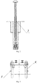
- Deformation control benchmarks used for implementation of the claimed method are made of the rolled steel, for instance, the angle steel, pipe or bar, with formation of the sharp angle, at this benchmarks are fixed to the metal pilework or to the head of the support pile in such way that the top of the sharp angle is the top point of the deformation control benchmark the position of which is the point of taking the data of the pipeline support foundation.
- Deep benchmarks used for implementation of the claimed method are the metal pipe with diameter of 57 mm, 11.6 m long, the benchmark head made of the stainless steel with the polished spherical surface and the concrete "anchor" installed to the bore with the diameter of 500 mm, at this the benchmark is equipped with the protective case made of the metal pipe with the diameter of 426 mm filled by the sand nonfrost-susceptible soil.
- Each benchmark is installed to the depth that is no less than the depth of the border of the maximum seasonal soil thawing increased to 1 m, in particular, to the depth of no less than 11 m.
- Sensors of the planned high-altitude position may be installed on pipeline compensators, at this, the sensor data is sent to the server with the help of the fiber-optic communication link or with the help of the radio modem via the reference station. If the rover is removed from reference stations to the distance of no more than 8-10 m, the PHAP measurement error is no more than ⁇ 25 mm, and if the rover is removed from reference stations to the distance of 15-20 km, the PHAP measurement error is no more than ⁇ 40 mm.
- Each reference station contains the receiver with the aerial global navigation satellite system (GNSS) with multi-path and re-reflected signal suppression systems, the device for fixation to an immovable object; the interface to switch the computer with the controller function to set up the equipment of the permanent reference station; the software to perform main functions of the reference station; the standby power unit (if necessary).
- GNSS aerial global navigation satellite system
- the claimed method is implemented during service of the pipeline at the geodetic network device. However, first necessary measures are taken as early as at the stage of the pipeline assemblage and installation of supports.
- the geodetic network on the major pipeline fixes the single system of coordinates (or several interrelated systems of coordinates). Precision of the network building provides for evaluation of the safety margin and the residual resource of the pipeline in the condition monitoring mode.
- the geodetic network is built along the pipeline as reference stations (above-ground geodetic sites) linked with the data processing center and placed in its units and as many special deformation control benchmarks fixed on the pipeline support. Special geodetic transmitters of the navigation signal from global navigation satellite systems (GNSS) are used as reference stations.
- GNSS global navigation satellite systems
- the equipment of permanent reference stations includes:
- the customer equipment includes mobile stations (rovers) equipped by multi-frequency navigation units of the GLONASS or GLONASS/GPS consumer with the phase use mode and communication means.
- the customer equipment includes the following equipment:
- the geodetic data storage and protection center (GDSPC) is installed in the administrative building for administration of the oil pipeline that includes one or several servers with the special network software.
- the computer center performs:
- the software of the administration center helps to organize the control under the online user interaction with identification of users and accounting of RTK measurement sessions, the automatic processing of user measurements together with the basic station data, calculation of the coordinates of the user objects and creation of reports.
- GDSPC must provide:
- the equipment of the GPS/GLONASS receiver must include:
- GPS/GLONASS transmitters must be specially developed for the use in reference station networks.
- the satellite equipment of GLONASS or GLONASS/GPS systems is used for geodetic works on permanent reference stations.
- the high-altitude position of the pipeline is set up by spatial coordinates of its axis in control points.
- Figure 5 outlines the first stage of implementation of the claimed method - creation of the local support geodetic network consisting of deep benchmarks 1, which coordinates are determined upon benchmarks of the state geodetic network 9 by detection of coordinates and high-altitude marks and then with the help of the key are translated to coordinates of the local geodetic network.
- the local geodetic network is installed along the pipeline.
- the number of sites that determine the PHAP must be no less than the number provided by the documents that regulate the location survey at the life-size offset of the pipeline route.
- control points are detected no less than at every 100 m, and at every 10 m on individual sites and additionally at sites where the direction of the pipeline axis is changed including profile bending points.
- Figure 6 outlines the second stage of implementation of the claimed method - installation of deformation control benchmarks 3 on supports 6 of the above-ground pipeline.
- Figure 7 outlines the third stage of implementation of the claimed method - carrying out of the zero cycle for measurement of deformation control benchmarks, receipt of their coordinates and high-altitude marks in relation to coordinates of benchmarks in the local support geodetic network. Coordinates of marks are measured with the help of measurement means 8, i.e. optic geodetic devices (the level, the transit, the tachometer).
- measurement means 8 i.e. optic geodetic devices (the level, the transit, the tachometer).
- the database of the zero measurement cycle is formed that characterizes the design position of the pipeline.
- the database and the digital pipeline model that contains values of the pipeline PHAP are stored on the server 7.
- Figure 8 outlines the fourth state of implementation of the claimed method - receipt and processing of the data of the zero measurement cycle and building of the digital pipeline model upon taken indices.
- the data is transferred to the server 7 that performs the said procedures and stores the processed data for the further use.
- Figure 9 represents the location of reference stations 2 and detection of their coordinates upon benchmarks of the state geodetic network 9 with the further translation to local geodetic coordinates by the key.
- Reference stations give the adjusting data for the highly precise detection of the coordinate data on the site with the help of rovers.
- the material implementation of the local system of coordinates is provided by the network of geodetic sites located at the site and built as a complex of interrelated reference stations.
- Figure 10 outlines the process of local measures for control under the pipeline position.
- the operator using the rover that receives the adjusting data from reference stations, collects the coordinate data and high-altitude marks from deformation control benchmarks and deep benchmarks. This data is transferred to the server for analysis and processing.
- Figure 11 represents the final stage of implementation of the claimed method that is comparison of the data received and processed by the server at formation of the zero measurement cycle with the data of the current measurement cycle received from rovers.
- the server detects identity of the zero and the current position of measurement points or records deflection. If during processing the server detects deflection of this or that measurement point from the zero cycle value, this point is identified upon coordinates related to it, the troubled part of the pipeline is localized and measures for recovery of the pipeline design position and, consequently, of the measurement point are taken.
- the server must be provided by the continuous connection with reference stations and receive the data with the preset frequency of updates. Different methods may be used for the data transfer from reference stations to the server (to the administration center):
- Oil and gas complex objects are complex, dynamic and open geotechnical systems (GTS) that interact with the environment (external).
- GTS geotechnical systems
- the negative effect of such objects change features and condition of the environment.
- the environment and its change affect the objects.
- Such interaction is clearly seen under permafrost conditions.
- Permafrost formations (PFF) used as foundations of engineering objects may be in both hard frozen and plastic frozen conditions. Due to that, the load-bearing capacity of PFF is changed that leads to deformations of engineering objects. When critical parameters are achieved, deformation may cause emergency situations on the oil and gas complex objects as well as urgent repair works that require additional financial and economic expenses.
- the information about the technical and spatial-temporal condition of the GTS may be obtained with the help of the correctly organized geodetic monitoring.
- the geodetic monitoring of such objects is made at all stages of the life cycle of structures: research, construction, operation or their elimination.
Landscapes
- Engineering & Computer Science (AREA)
- Radar, Positioning & Navigation (AREA)
- Remote Sensing (AREA)
- General Engineering & Computer Science (AREA)
- Physics & Mathematics (AREA)
- Mechanical Engineering (AREA)
- Computer Networks & Wireless Communication (AREA)
- General Physics & Mathematics (AREA)
- Acoustics & Sound (AREA)
- Position Fixing By Use Of Radio Waves (AREA)
Applications Claiming Priority (1)
| Application Number | Priority Date | Filing Date | Title |
|---|---|---|---|
| PCT/RU2014/000221 WO2015147686A1 (fr) | 2014-03-28 | 2014-03-28 | Procédé de contrôle de la position de conduits posés en surface dans des conditions de gel permanent |
Publications (3)
| Publication Number | Publication Date |
|---|---|
| EP3124841A1 true EP3124841A1 (fr) | 2017-02-01 |
| EP3124841A4 EP3124841A4 (fr) | 2018-02-07 |
| EP3124841B1 EP3124841B1 (fr) | 2023-10-18 |
Family
ID=54196056
Family Applications (1)
| Application Number | Title | Priority Date | Filing Date |
|---|---|---|---|
| EP14887017.3A Active EP3124841B1 (fr) | 2014-03-28 | 2014-03-28 | Procédé et système de contrôle de la position de conduits posés en surface dans des conditions de gel permanent |
Country Status (4)
| Country | Link |
|---|---|
| US (1) | US10578253B2 (fr) |
| EP (1) | EP3124841B1 (fr) |
| CA (1) | CA2942860C (fr) |
| WO (1) | WO2015147686A1 (fr) |
Cited By (1)
| Publication number | Priority date | Publication date | Assignee | Title |
|---|---|---|---|---|
| RU2821670C1 (ru) * | 2023-12-19 | 2024-06-26 | Акционерное общество "Мессояханефтегаз" | Способ определения деформаций свайных опор трубопровода с использованием навигационных спутниковых систем |
Families Citing this family (10)
| Publication number | Priority date | Publication date | Assignee | Title |
|---|---|---|---|---|
| WO2015147682A1 (fr) * | 2014-03-28 | 2015-10-01 | Открытое акционерное общество "Акционерная компания по транспорту нефти "Транснефть" (ОАО "АК "Транснефть") | Support de conduit immobile |
| CN106772508A (zh) * | 2017-01-19 | 2017-05-31 | 广州南方无人机技术有限公司 | 无人机后差分航测模块 |
| CN107966717B (zh) * | 2017-11-23 | 2021-05-28 | 千寻位置网络有限公司 | 低成本终端的Multi-GNSS形变监测数据处理方法 |
| CN110715175A (zh) * | 2019-10-25 | 2020-01-21 | 兰州交通大学 | 一种用于冻土区的智能监测输油气管道 |
| CN113338255B (zh) * | 2021-05-18 | 2022-10-18 | 中国铁道科学研究院集团有限公司铁道建筑研究所 | 一种寒区铁路路桥过渡段服役性能智能预警系统 |
| CN114016393B (zh) * | 2021-08-26 | 2023-08-22 | 中国科学院西北生态环境资源研究院 | 一种桥墩固位系统 |
| CN116822949B (zh) * | 2023-06-14 | 2025-02-11 | 国网吉林省电力有限公司辽源供电公司 | 季节性冻土地区输配电线路接地状态评估方法 |
| CN117574493B (zh) * | 2023-11-13 | 2024-05-28 | 中国公路工程咨询集团有限公司 | 一种多年冻土地区高速公路冻土范围形变识别方法及系统 |
| CN117948549A (zh) * | 2023-12-08 | 2024-04-30 | 中国科学院西北生态环境资源研究院 | 一种多年冻土区埋地暖油管线移动距离监测装置的安装方法 |
| CN119394253B (zh) * | 2024-11-12 | 2025-07-11 | 中铁资源集团勘察设计有限公司 | 寒区边坡冻胀变形及表面位移协同监测装置及方法 |
Family Cites Families (40)
| Publication number | Priority date | Publication date | Assignee | Title |
|---|---|---|---|---|
| US4452087A (en) | 1982-04-05 | 1984-06-05 | Antonio Nicholas F D | Pipeline monitoring system |
| US5450765A (en) * | 1994-03-01 | 1995-09-19 | Tdw Delaware, Inc. | Apparatus for providing signal communication between the interior and exterior of a pipeline |
| NO308630B1 (no) * | 1996-09-19 | 2000-10-02 | Norske Stats Oljeselskap | System for inspeksjon av rørledninger |
| US6084989A (en) | 1996-11-15 | 2000-07-04 | Lockheed Martin Corporation | System and method for automatically determining the position of landmarks in digitized images derived from a satellite-based imaging system |
| US6243657B1 (en) * | 1997-12-23 | 2001-06-05 | Pii North America, Inc. | Method and apparatus for determining location of characteristics of a pipeline |
| US6243483B1 (en) | 1998-09-23 | 2001-06-05 | Pii North America, Inc. | Mapping system for the integration and graphical display of pipeline information that enables automated pipeline surveillance |
| US6170344B1 (en) | 1999-09-29 | 2001-01-09 | Honeywell Inc. | Pipeline distortion monitoring system |
| US6553322B1 (en) | 1999-09-29 | 2003-04-22 | Honeywell International Inc. | Apparatus and method for accurate pipeline surveying |
| US20010029989A1 (en) * | 2000-02-17 | 2001-10-18 | Paz German N. | Pipeline identification and positioning system |
| CA2416171A1 (fr) | 2003-01-13 | 2004-07-13 | Pure Technologies Ltd. | Systeme de surveillance de pipeline |
| US8076928B2 (en) * | 2005-05-13 | 2011-12-13 | Nunally Patrick O'neal | System and method for in-situ integrity and performance monitoring of operating metallic and non-metallic natural gas transmission and delivery pipelines using ultra wideband point-to point and point-to point and point-to-multipoint communication |
| RU49251U1 (ru) * | 2005-07-18 | 2005-11-10 | Красноярская государственная архитектурно-строительная академия КрасГАСА | Устройство слежения и управления напряженно-деформируемым состоянием надземных магистральных трубопроводов, проложенных в сложных грунтовых условиях |
| US7680625B2 (en) * | 2005-11-14 | 2010-03-16 | Macsema, Inc. | Systems and methods for monitoring system performance |
| RU2317466C1 (ru) * | 2006-03-31 | 2008-02-20 | Александр Владимирович Конюхов | Способ прокладки надземных трубопроводов по трассам дорог в северных регионах |
| CA2566933C (fr) * | 2006-10-17 | 2013-09-24 | Athena Industrial Technologies Inc. | Appareil et methode d'inspection |
| US8001858B2 (en) | 2007-01-19 | 2011-08-23 | Cogen William | Pipeline inspection apparatus and method using radio frequency identification and inertial navigation |
| RU2334162C1 (ru) | 2007-01-26 | 2008-09-20 | Общество С Ограниченной Ответственностью "Газпромэнергодиагностика" | Аппаратура для измерения линейных деформаций магистрального трубопровода |
| US8261623B2 (en) * | 2007-07-09 | 2012-09-11 | Microline Technology Corporation | Communication system for pipeline inspection |
| GB0722534D0 (en) * | 2007-11-16 | 2007-12-27 | Advanced Eng Solutions Ltd | Pipeline condition detecting method and apparatus |
| RU2357205C1 (ru) | 2007-12-18 | 2009-05-27 | Федеральное государственное унитарное предприятие "Государственный специализированный проектный институт" (ФГУП "ГСПИ") | Система для определения деформаций строительных конструкций сооружения |
| WO2010014581A2 (fr) * | 2008-07-28 | 2010-02-04 | Geospatial Holdings, Inc. | Procédé, appareil et système permettant de surveiller de façon non invasive des installations souterraines |
| RU2413055C1 (ru) | 2009-10-28 | 2011-02-27 | Открытое акционерное общество "Авангард" | Способ измерения осадок фундаментов и устройство для его реализации |
| ATE554508T1 (de) | 2009-11-23 | 2012-05-15 | Research In Motion Ltd | Akku mit verringertem magnetischem schwund |
| US20110161038A1 (en) | 2009-12-29 | 2011-06-30 | Jeff Sutherland | System and Method for Calibration of Mounted Acoustic Monitoring System with Mapping Unit |
| CN102135235A (zh) * | 2010-01-27 | 2011-07-27 | 捷达世软件(深圳)有限公司 | 空压管道监测系统及方法 |
| CN101886743B (zh) | 2010-06-30 | 2012-10-17 | 东北大学 | 一种定位海底管道机器人方法及装置 |
| DE102010062191B4 (de) | 2010-11-30 | 2012-06-28 | Siemens Aktiengesellschaft | Pipelinesystem und Verfahren zum Betreiben eines Pipelinesystems |
| RU2451874C1 (ru) * | 2011-03-29 | 2012-05-27 | Открытое акционерное общество "Гипрогазцентр" | Способ мониторинга и оценки технического состояния магистрального трубопровода и система для его реализации |
| US9000778B2 (en) * | 2011-08-15 | 2015-04-07 | Gas Technology Institute | Communication method for monitoring pipelines |
| US9746444B2 (en) * | 2012-10-27 | 2017-08-29 | Valerian Goroshevskiy | Autonomous pipeline inspection using magnetic tomography |
| RU2527902C2 (ru) | 2012-11-23 | 2014-09-10 | Открытое акционерное общество "Акционерная компания по транспорту нефти "Транснефть" (ОАО "АК "Транснефть") | Способ определения планово-высотного положения подземного магистрального трубопровода |
| US20140313321A1 (en) * | 2013-02-13 | 2014-10-23 | SeeScan, Inc. | Optical ground tracking apparatus, systems, and methods |
| US8961071B2 (en) * | 2013-03-15 | 2015-02-24 | Chevron U.S.A. Inc. | Systems and methods for protecting subsea pipeline from excessive stress or fatigue loading |
| DE102014003554A1 (de) | 2013-10-09 | 2015-04-09 | Seba-Dynatronic Mess- Und Ortungstechnik Gmbh | Verfahren zur Synchronisation der Datenaufzeichnung in Rohrleitungsnetzen |
| RU2558724C2 (ru) | 2013-12-17 | 2015-08-10 | Открытое акционерное общество "Акционерная компания по транспорту нефти "Транснефть" (ОАО "АК "Транснефть") | Устройство диагностического комплекса для определения положения трубопровода и способ определения относительного перемещения трубопровода по результатам двух и более инспекционных пропусков диагностического комплекса для определения положения трубопровода |
| CA2839467A1 (fr) | 2014-01-16 | 2015-07-16 | Msp Resourcing Canada Inc | Systeme de gestion de donnees et procede dans une installation de tuyauterie |
| RU2582428C2 (ru) | 2014-03-20 | 2016-04-27 | Открытое акционерное общество "Акционерная компания по транспорту нефти "Транснефть" (ОАО "АК "Транснефть") | Способ контроля положения трубопроводов надземной прокладки в условиях вечной мерзлоты |
| EP3124842B1 (fr) * | 2014-03-28 | 2023-02-22 | Public Joint Stock Company "Transneft" | Support de conduit mobile et unité de support |
| CO6940075A1 (es) | 2014-04-29 | 2014-05-09 | Technical Qualified Personnel S A S | Estación de monitoreo remoto para evaluación de riesgos geotécnicos e integridad en tuberías de transporte de hidrocarburos |
| US20190212131A1 (en) * | 2018-01-10 | 2019-07-11 | Quanta Associates, L.P. | Pipeline depth of cover determination method and apparatus |
-
2014
- 2014-03-28 WO PCT/RU2014/000221 patent/WO2015147686A1/fr not_active Ceased
- 2014-03-28 CA CA2942860A patent/CA2942860C/fr active Active
- 2014-03-28 EP EP14887017.3A patent/EP3124841B1/fr active Active
-
2016
- 2016-08-02 US US15/226,897 patent/US10578253B2/en not_active Expired - Fee Related
Cited By (2)
| Publication number | Priority date | Publication date | Assignee | Title |
|---|---|---|---|---|
| RU2821670C1 (ru) * | 2023-12-19 | 2024-06-26 | Акционерное общество "Мессояханефтегаз" | Способ определения деформаций свайных опор трубопровода с использованием навигационных спутниковых систем |
| RU2853559C1 (ru) * | 2024-10-22 | 2025-12-24 | Наталья Александровна Демина | Способ мониторинга свайного поля |
Also Published As
| Publication number | Publication date |
|---|---|
| CA2942860C (fr) | 2020-11-24 |
| US10578253B2 (en) | 2020-03-03 |
| EP3124841B1 (fr) | 2023-10-18 |
| US20170030527A1 (en) | 2017-02-02 |
| CA2942860A1 (fr) | 2015-10-01 |
| WO2015147686A1 (fr) | 2015-10-01 |
| EP3124841A4 (fr) | 2018-02-07 |
Similar Documents
| Publication | Publication Date | Title |
|---|---|---|
| EP3124841B1 (fr) | Procédé et système de contrôle de la position de conduits posés en surface dans des conditions de gel permanent | |
| RU2582428C2 (ru) | Способ контроля положения трубопроводов надземной прокладки в условиях вечной мерзлоты | |
| Ghorbani et al. | Geotechnical, structural and geodetic measurements for conventional tunnelling hazards in urban areas–The case of Niayesh road tunnel project | |
| Kuzina et al. | Deformation monitoring of road transport structures and facilities using engineering and geodetic techniques | |
| CN107402043A (zh) | 半盖挖顺作法城市隧道施工监测方法及监测系统 | |
| CN108999612A (zh) | 一种基于互联网的地铁隧道施工安全监测系统 | |
| CN106703086A (zh) | 基坑在线安全监测系统 | |
| US20240045063A1 (en) | Iot-based groundwater monitoring system using lidar sensor technology | |
| CN118187169A (zh) | 一种紧邻地下构筑物的深基坑施工过程监测系统及监测方法 | |
| CN107940099A (zh) | 环保分割长距离机械顶管施工方法 | |
| Kuzin et al. | Satellite-based techniques for monitoring of bridge deformations | |
| Chai et al. | 3D Monitoring Model for Real‐Time Displacement of Metro Tunnel under “Dual Carbon” Background | |
| García et al. | Integrity management program for geo-hazards in the OCENSA pipeline system | |
| Bragallini et al. | Geotechnical monitoring at Forrestfield Airport Link Project in Perth (WA) | |
| CN218405354U (zh) | 基坑明暗挖施工的地面沉降及支护应力监测系统 | |
| Gill et al. | NOAA guidance document for determination of vertical land motion at water level stations using GPS technology | |
| Turner | Continuous GPS: Pilot Applications–Phase II | |
| Berkelaar et al. | Deformation Monitoring of the Underground Metro Station Rotterdam CS: A Case Study | |
| Marino et al. | Tackling the Illegal Tapping problem in Brazil with the Deployment of Vibroacoustic Technology: presentation of a success case | |
| Shi et al. | High precision GPS aided in-pipe distance calibration for satellite image-based pipeline mapping | |
| SĂLĂGEAN et al. | ASPECTS REGARDING THE ANALYSIS OF HORIZONTAL DISPLACEMENTS AT CUMPĂNA DAM, ARGEŞ COUNTY | |
| Son et al. | Validation of the method of height transmission by laser tape measure in construction | |
| Xin et al. | Implementation of Settlement Monitoring for Foundation Pit Constructionat Qingliangsi Station of Changzhou Rail Transit | |
| Satoh et al. | Monitoring the stability of a large-scale colluvium deposited by slope failures due to heavy rainfall using a GPS automatic monitoring system | |
| Young | Management of Geohazard Loading During Pipeline Operation |
Legal Events
| Date | Code | Title | Description |
|---|---|---|---|
| STAA | Information on the status of an ep patent application or granted ep patent |
Free format text: STATUS: THE INTERNATIONAL PUBLICATION HAS BEEN MADE |
|
| PUAI | Public reference made under article 153(3) epc to a published international application that has entered the european phase |
Free format text: ORIGINAL CODE: 0009012 |
|
| STAA | Information on the status of an ep patent application or granted ep patent |
Free format text: STATUS: REQUEST FOR EXAMINATION WAS MADE |
|
| 17P | Request for examination filed |
Effective date: 20161005 |
|
| AK | Designated contracting states |
Kind code of ref document: A1 Designated state(s): AL AT BE BG CH CY CZ DE DK EE ES FI FR GB GR HR HU IE IS IT LI LT LU LV MC MK MT NL NO PL PT RO RS SE SI SK SM TR |
|
| AX | Request for extension of the european patent |
Extension state: BA ME |
|
| DAX | Request for extension of the european patent (deleted) | ||
| A4 | Supplementary search report drawn up and despatched |
Effective date: 20180108 |
|
| RIC1 | Information provided on ipc code assigned before grant |
Ipc: F16L 1/026 20060101AFI20180102BHEP Ipc: G01S 19/14 20100101ALI20180102BHEP Ipc: F17D 5/00 20060101ALI20180102BHEP |
|
| STAA | Information on the status of an ep patent application or granted ep patent |
Free format text: STATUS: EXAMINATION IS IN PROGRESS |
|
| 17Q | First examination report despatched |
Effective date: 20200526 |
|
| GRAP | Despatch of communication of intention to grant a patent |
Free format text: ORIGINAL CODE: EPIDOSNIGR1 |
|
| STAA | Information on the status of an ep patent application or granted ep patent |
Free format text: STATUS: GRANT OF PATENT IS INTENDED |
|
| INTG | Intention to grant announced |
Effective date: 20230707 |
|
| GRAS | Grant fee paid |
Free format text: ORIGINAL CODE: EPIDOSNIGR3 |
|
| GRAA | (expected) grant |
Free format text: ORIGINAL CODE: 0009210 |
|
| STAA | Information on the status of an ep patent application or granted ep patent |
Free format text: STATUS: THE PATENT HAS BEEN GRANTED |
|
| AK | Designated contracting states |
Kind code of ref document: B1 Designated state(s): AL AT BE BG CH CY CZ DE DK EE ES FI FR GB GR HR HU IE IS IT LI LT LU LV MC MK MT NL NO PL PT RO RS SE SI SK SM TR |
|
| REG | Reference to a national code |
Ref country code: GB Ref legal event code: FG4D |
|
| REG | Reference to a national code |
Ref country code: CH Ref legal event code: EP |
|
| REG | Reference to a national code |
Ref country code: DE Ref legal event code: R096 Ref document number: 602014088639 Country of ref document: DE |
|
| REG | Reference to a national code |
Ref country code: IE Ref legal event code: FG4D |
|
| REG | Reference to a national code |
Ref country code: LT Ref legal event code: MG9D |
|
| REG | Reference to a national code |
Ref country code: NL Ref legal event code: MP Effective date: 20231018 |
|
| REG | Reference to a national code |
Ref country code: AT Ref legal event code: MK05 Ref document number: 1622741 Country of ref document: AT Kind code of ref document: T Effective date: 20231018 |
|
| PG25 | Lapsed in a contracting state [announced via postgrant information from national office to epo] |
Ref country code: NL Free format text: LAPSE BECAUSE OF FAILURE TO SUBMIT A TRANSLATION OF THE DESCRIPTION OR TO PAY THE FEE WITHIN THE PRESCRIBED TIME-LIMIT Effective date: 20231018 |
|
| PG25 | Lapsed in a contracting state [announced via postgrant information from national office to epo] |
Ref country code: GR Free format text: LAPSE BECAUSE OF FAILURE TO SUBMIT A TRANSLATION OF THE DESCRIPTION OR TO PAY THE FEE WITHIN THE PRESCRIBED TIME-LIMIT Effective date: 20240119 |
|
| PG25 | Lapsed in a contracting state [announced via postgrant information from national office to epo] |
Ref country code: IS Free format text: LAPSE BECAUSE OF FAILURE TO SUBMIT A TRANSLATION OF THE DESCRIPTION OR TO PAY THE FEE WITHIN THE PRESCRIBED TIME-LIMIT Effective date: 20240218 |
|
| PG25 | Lapsed in a contracting state [announced via postgrant information from national office to epo] |
Ref country code: LT Free format text: LAPSE BECAUSE OF FAILURE TO SUBMIT A TRANSLATION OF THE DESCRIPTION OR TO PAY THE FEE WITHIN THE PRESCRIBED TIME-LIMIT Effective date: 20231018 |
|
| PG25 | Lapsed in a contracting state [announced via postgrant information from national office to epo] |
Ref country code: AT Free format text: LAPSE BECAUSE OF FAILURE TO SUBMIT A TRANSLATION OF THE DESCRIPTION OR TO PAY THE FEE WITHIN THE PRESCRIBED TIME-LIMIT Effective date: 20231018 |
|
| PG25 | Lapsed in a contracting state [announced via postgrant information from national office to epo] |
Ref country code: ES Free format text: LAPSE BECAUSE OF FAILURE TO SUBMIT A TRANSLATION OF THE DESCRIPTION OR TO PAY THE FEE WITHIN THE PRESCRIBED TIME-LIMIT Effective date: 20231018 |
|
| PG25 | Lapsed in a contracting state [announced via postgrant information from national office to epo] |
Ref country code: LT Free format text: LAPSE BECAUSE OF FAILURE TO SUBMIT A TRANSLATION OF THE DESCRIPTION OR TO PAY THE FEE WITHIN THE PRESCRIBED TIME-LIMIT Effective date: 20231018 Ref country code: IS Free format text: LAPSE BECAUSE OF FAILURE TO SUBMIT A TRANSLATION OF THE DESCRIPTION OR TO PAY THE FEE WITHIN THE PRESCRIBED TIME-LIMIT Effective date: 20240218 Ref country code: GR Free format text: LAPSE BECAUSE OF FAILURE TO SUBMIT A TRANSLATION OF THE DESCRIPTION OR TO PAY THE FEE WITHIN THE PRESCRIBED TIME-LIMIT Effective date: 20240119 Ref country code: ES Free format text: LAPSE BECAUSE OF FAILURE TO SUBMIT A TRANSLATION OF THE DESCRIPTION OR TO PAY THE FEE WITHIN THE PRESCRIBED TIME-LIMIT Effective date: 20231018 Ref country code: BG Free format text: LAPSE BECAUSE OF FAILURE TO SUBMIT A TRANSLATION OF THE DESCRIPTION OR TO PAY THE FEE WITHIN THE PRESCRIBED TIME-LIMIT Effective date: 20240118 Ref country code: AT Free format text: LAPSE BECAUSE OF FAILURE TO SUBMIT A TRANSLATION OF THE DESCRIPTION OR TO PAY THE FEE WITHIN THE PRESCRIBED TIME-LIMIT Effective date: 20231018 Ref country code: PT Free format text: LAPSE BECAUSE OF FAILURE TO SUBMIT A TRANSLATION OF THE DESCRIPTION OR TO PAY THE FEE WITHIN THE PRESCRIBED TIME-LIMIT Effective date: 20240219 |
|
| PG25 | Lapsed in a contracting state [announced via postgrant information from national office to epo] |
Ref country code: SE Free format text: LAPSE BECAUSE OF FAILURE TO SUBMIT A TRANSLATION OF THE DESCRIPTION OR TO PAY THE FEE WITHIN THE PRESCRIBED TIME-LIMIT Effective date: 20231018 Ref country code: RS Free format text: LAPSE BECAUSE OF FAILURE TO SUBMIT A TRANSLATION OF THE DESCRIPTION OR TO PAY THE FEE WITHIN THE PRESCRIBED TIME-LIMIT Effective date: 20231018 Ref country code: PL Free format text: LAPSE BECAUSE OF FAILURE TO SUBMIT A TRANSLATION OF THE DESCRIPTION OR TO PAY THE FEE WITHIN THE PRESCRIBED TIME-LIMIT Effective date: 20231018 Ref country code: NO Free format text: LAPSE BECAUSE OF FAILURE TO SUBMIT A TRANSLATION OF THE DESCRIPTION OR TO PAY THE FEE WITHIN THE PRESCRIBED TIME-LIMIT Effective date: 20240118 Ref country code: LV Free format text: LAPSE BECAUSE OF FAILURE TO SUBMIT A TRANSLATION OF THE DESCRIPTION OR TO PAY THE FEE WITHIN THE PRESCRIBED TIME-LIMIT Effective date: 20231018 Ref country code: HR Free format text: LAPSE BECAUSE OF FAILURE TO SUBMIT A TRANSLATION OF THE DESCRIPTION OR TO PAY THE FEE WITHIN THE PRESCRIBED TIME-LIMIT Effective date: 20231018 |
|
| PG25 | Lapsed in a contracting state [announced via postgrant information from national office to epo] |
Ref country code: DK Free format text: LAPSE BECAUSE OF FAILURE TO SUBMIT A TRANSLATION OF THE DESCRIPTION OR TO PAY THE FEE WITHIN THE PRESCRIBED TIME-LIMIT Effective date: 20231018 |
|
| REG | Reference to a national code |
Ref country code: DE Ref legal event code: R097 Ref document number: 602014088639 Country of ref document: DE |
|
| PG25 | Lapsed in a contracting state [announced via postgrant information from national office to epo] |
Ref country code: CZ Free format text: LAPSE BECAUSE OF FAILURE TO SUBMIT A TRANSLATION OF THE DESCRIPTION OR TO PAY THE FEE WITHIN THE PRESCRIBED TIME-LIMIT Effective date: 20231018 |
|
| PG25 | Lapsed in a contracting state [announced via postgrant information from national office to epo] |
Ref country code: SK Free format text: LAPSE BECAUSE OF FAILURE TO SUBMIT A TRANSLATION OF THE DESCRIPTION OR TO PAY THE FEE WITHIN THE PRESCRIBED TIME-LIMIT Effective date: 20231018 |
|
| PG25 | Lapsed in a contracting state [announced via postgrant information from national office to epo] |
Ref country code: SM Free format text: LAPSE BECAUSE OF FAILURE TO SUBMIT A TRANSLATION OF THE DESCRIPTION OR TO PAY THE FEE WITHIN THE PRESCRIBED TIME-LIMIT Effective date: 20231018 Ref country code: SK Free format text: LAPSE BECAUSE OF FAILURE TO SUBMIT A TRANSLATION OF THE DESCRIPTION OR TO PAY THE FEE WITHIN THE PRESCRIBED TIME-LIMIT Effective date: 20231018 Ref country code: RO Free format text: LAPSE BECAUSE OF FAILURE TO SUBMIT A TRANSLATION OF THE DESCRIPTION OR TO PAY THE FEE WITHIN THE PRESCRIBED TIME-LIMIT Effective date: 20231018 Ref country code: IT Free format text: LAPSE BECAUSE OF FAILURE TO SUBMIT A TRANSLATION OF THE DESCRIPTION OR TO PAY THE FEE WITHIN THE PRESCRIBED TIME-LIMIT Effective date: 20231018 Ref country code: EE Free format text: LAPSE BECAUSE OF FAILURE TO SUBMIT A TRANSLATION OF THE DESCRIPTION OR TO PAY THE FEE WITHIN THE PRESCRIBED TIME-LIMIT Effective date: 20231018 Ref country code: DK Free format text: LAPSE BECAUSE OF FAILURE TO SUBMIT A TRANSLATION OF THE DESCRIPTION OR TO PAY THE FEE WITHIN THE PRESCRIBED TIME-LIMIT Effective date: 20231018 Ref country code: CZ Free format text: LAPSE BECAUSE OF FAILURE TO SUBMIT A TRANSLATION OF THE DESCRIPTION OR TO PAY THE FEE WITHIN THE PRESCRIBED TIME-LIMIT Effective date: 20231018 |
|
| PLBE | No opposition filed within time limit |
Free format text: ORIGINAL CODE: 0009261 |
|
| STAA | Information on the status of an ep patent application or granted ep patent |
Free format text: STATUS: NO OPPOSITION FILED WITHIN TIME LIMIT |
|
| 26N | No opposition filed |
Effective date: 20240719 |
|
| REG | Reference to a national code |
Ref country code: DE Ref legal event code: R119 Ref document number: 602014088639 Country of ref document: DE |
|
| PG25 | Lapsed in a contracting state [announced via postgrant information from national office to epo] |
Ref country code: SI Free format text: LAPSE BECAUSE OF FAILURE TO SUBMIT A TRANSLATION OF THE DESCRIPTION OR TO PAY THE FEE WITHIN THE PRESCRIBED TIME-LIMIT Effective date: 20231018 |
|
| PG25 | Lapsed in a contracting state [announced via postgrant information from national office to epo] |
Ref country code: SI Free format text: LAPSE BECAUSE OF FAILURE TO SUBMIT A TRANSLATION OF THE DESCRIPTION OR TO PAY THE FEE WITHIN THE PRESCRIBED TIME-LIMIT Effective date: 20231018 |
|
| REG | Reference to a national code |
Ref country code: CH Ref legal event code: PL |
|
| PG25 | Lapsed in a contracting state [announced via postgrant information from national office to epo] |
Ref country code: LU Free format text: LAPSE BECAUSE OF NON-PAYMENT OF DUE FEES Effective date: 20240328 |
|
| PG25 | Lapsed in a contracting state [announced via postgrant information from national office to epo] |
Ref country code: MC Free format text: LAPSE BECAUSE OF FAILURE TO SUBMIT A TRANSLATION OF THE DESCRIPTION OR TO PAY THE FEE WITHIN THE PRESCRIBED TIME-LIMIT Effective date: 20231018 |
|
| GBPC | Gb: european patent ceased through non-payment of renewal fee |
Effective date: 20240328 |
|
| PG25 | Lapsed in a contracting state [announced via postgrant information from national office to epo] |
Ref country code: MC Free format text: LAPSE BECAUSE OF FAILURE TO SUBMIT A TRANSLATION OF THE DESCRIPTION OR TO PAY THE FEE WITHIN THE PRESCRIBED TIME-LIMIT Effective date: 20231018 Ref country code: LU Free format text: LAPSE BECAUSE OF NON-PAYMENT OF DUE FEES Effective date: 20240328 |
|
| REG | Reference to a national code |
Ref country code: BE Ref legal event code: MM Effective date: 20240331 |
|
| PG25 | Lapsed in a contracting state [announced via postgrant information from national office to epo] |
Ref country code: DE Free format text: LAPSE BECAUSE OF NON-PAYMENT OF DUE FEES Effective date: 20241001 |
|
| PG25 | Lapsed in a contracting state [announced via postgrant information from national office to epo] |
Ref country code: BE Free format text: LAPSE BECAUSE OF NON-PAYMENT OF DUE FEES Effective date: 20240331 |
|
| PG25 | Lapsed in a contracting state [announced via postgrant information from national office to epo] |
Ref country code: GB Free format text: LAPSE BECAUSE OF NON-PAYMENT OF DUE FEES Effective date: 20240328 |
|
| PG25 | Lapsed in a contracting state [announced via postgrant information from national office to epo] |
Ref country code: FR Free format text: LAPSE BECAUSE OF NON-PAYMENT OF DUE FEES Effective date: 20240331 |
|
| PG25 | Lapsed in a contracting state [announced via postgrant information from national office to epo] |
Ref country code: IE Free format text: LAPSE BECAUSE OF NON-PAYMENT OF DUE FEES Effective date: 20240328 |
|
| PG25 | Lapsed in a contracting state [announced via postgrant information from national office to epo] |
Ref country code: IE Free format text: LAPSE BECAUSE OF NON-PAYMENT OF DUE FEES Effective date: 20240328 Ref country code: GB Free format text: LAPSE BECAUSE OF NON-PAYMENT OF DUE FEES Effective date: 20240328 Ref country code: FR Free format text: LAPSE BECAUSE OF NON-PAYMENT OF DUE FEES Effective date: 20240331 Ref country code: DE Free format text: LAPSE BECAUSE OF NON-PAYMENT OF DUE FEES Effective date: 20241001 Ref country code: BE Free format text: LAPSE BECAUSE OF NON-PAYMENT OF DUE FEES Effective date: 20240331 Ref country code: CH Free format text: LAPSE BECAUSE OF NON-PAYMENT OF DUE FEES Effective date: 20240331 |
|
| PG25 | Lapsed in a contracting state [announced via postgrant information from national office to epo] |
Ref country code: CY Free format text: LAPSE BECAUSE OF FAILURE TO SUBMIT A TRANSLATION OF THE DESCRIPTION OR TO PAY THE FEE WITHIN THE PRESCRIBED TIME-LIMIT; INVALID AB INITIO Effective date: 20140328 |
|
| PG25 | Lapsed in a contracting state [announced via postgrant information from national office to epo] |
Ref country code: HU Free format text: LAPSE BECAUSE OF FAILURE TO SUBMIT A TRANSLATION OF THE DESCRIPTION OR TO PAY THE FEE WITHIN THE PRESCRIBED TIME-LIMIT; INVALID AB INITIO Effective date: 20140328 |
|
| PG25 | Lapsed in a contracting state [announced via postgrant information from national office to epo] |
Ref country code: FI Free format text: LAPSE BECAUSE OF FAILURE TO SUBMIT A TRANSLATION OF THE DESCRIPTION OR TO PAY THE FEE WITHIN THE PRESCRIBED TIME-LIMIT Effective date: 20231019 |
|
| PG25 | Lapsed in a contracting state [announced via postgrant information from national office to epo] |
Ref country code: TR Free format text: LAPSE BECAUSE OF FAILURE TO SUBMIT A TRANSLATION OF THE DESCRIPTION OR TO PAY THE FEE WITHIN THE PRESCRIBED TIME-LIMIT Effective date: 20231018 |