EP3155451B1 - Procédé et dispositif pour l'évaluation d'un signal satellite dans un système mondial de navigation par satellites, au sujet d'une erreur de multitrajets - Google Patents
Procédé et dispositif pour l'évaluation d'un signal satellite dans un système mondial de navigation par satellites, au sujet d'une erreur de multitrajets Download PDFInfo
- Publication number
- EP3155451B1 EP3155451B1 EP15750640.3A EP15750640A EP3155451B1 EP 3155451 B1 EP3155451 B1 EP 3155451B1 EP 15750640 A EP15750640 A EP 15750640A EP 3155451 B1 EP3155451 B1 EP 3155451B1
- Authority
- EP
- European Patent Office
- Prior art keywords
- satellite
- receiver
- multipath
- evaluation
- satellite signal
- Prior art date
- Legal status (The legal status is an assumption and is not a legal conclusion. Google has not performed a legal analysis and makes no representation as to the accuracy of the status listed.)
- Active
Links
Images

Classifications
-
- G—PHYSICS
- G01—MEASURING; TESTING
- G01S—RADIO DIRECTION-FINDING; RADIO NAVIGATION; DETERMINING DISTANCE OR VELOCITY BY USE OF RADIO WAVES; LOCATING OR PRESENCE-DETECTING BY USE OF THE REFLECTION OR RERADIATION OF RADIO WAVES; ANALOGOUS ARRANGEMENTS USING OTHER WAVES
- G01S19/00—Satellite radio beacon positioning systems; Determining position, velocity or attitude using signals transmitted by such systems
- G01S19/01—Satellite radio beacon positioning systems transmitting time-stamped messages, e.g. GPS [Global Positioning System], GLONASS [Global Orbiting Navigation Satellite System] or GALILEO
- G01S19/13—Receivers
- G01S19/22—Multipath-related issues
Definitions
- the invention relates to a method for evaluating a satellite signal in a global navigation satellite system with respect to a Mehrwegegren, wherein a particular moving receiver in a position determination from the satellite signals of several satellites based on a transit time measurement delay distance between the receiver and the satellite and one on a Determines carrier phase measurement based carrier phase separation between the receiver and the satellite or a reference point, a receiver for a global navigation satellite system and a motor vehicle.
- GNSS Global Navigation Satellite Systems
- the position is determined over the transit time of the satellite signal from the satellite to the receiver, which gives the distance between the satellite and the receiver. This resulting distance, together with the receiver clock error, is often referred to as “pseudo-orange”; Runtime measurement is often referred to as “code measurement” or “code phase measurement” because it evaluates the code modulated onto the carrier frequency of the satellite signal.
- GNSS receivers With a clear view of the sky, simple GNSS receivers today already achieve an accuracy of less than 5 m in 95% of cases. Due to the high speed of light, inaccuracies in the transit time measurement still occur in most cases. Many modern GPS receivers therefore use yet another variant for measurements of distances, namely the so-called Doppler measurement using carrier phase measurement, in which the phase of the carrier frequency and its change is analyzed. While phase measurements are useful in determining distances for other applications, such as time-of-flight cameras, GNSS receivers have the problem that it is unknown how many full wave trains are between the satellite and the GNSS receiver. Thus, there is always an ambiguity in a phase measurement, since it is not known how many full wavelengths have already been covered.
- the Doppler measurement usually refers to a reference point, from which the phase is observed as continuously as possible and consequently the number of wavelengths is known at least for this reference.
- Methods have also been proposed in which the number of whole wavelengths up to the satellite is estimated in order to determine also by the carrier phase measurement a distance between the receiver and the satellite.
- a problem can occur during the temporary loss of a satellite signal, since then optionally a passage of at least one wavelength is missed, so that a loss of the phase relationship occurs. This can be caused, for example, signal obstruction by obstacles, but also multipath effects and the like.
- Such a loss of phase relationship is referred to as a "loss of lock” and usually results in a jump in measurements of the carrier phase ("cycle slip").
- the transit time measurement is not affected by this.
- a first approach relates to the adaptation of parameters of the correlator provided on the input side of the receiver, wherein high bandwidths of the precorrelator and narrow correlator distances increase the robustness compared to multi-channel satellite signals, cf.
- RAIM Receiveiver Autonomous Integrity Monitoring
- the multi-path error has different effects on the carrier phase measurement and the transit time measurement.
- the code-minus-carrier (CMC) size can be formed and the amount of the multipath error can be estimated as in the article for example by MS Braasch, "Multipath Effects", in: Global Positioning System Theory and Applications, Vol. 1, pp. 547-568, 1996 , is described.
- the CMC size or similar quantities can also be analyzed in the frequency domain and a multipath frequency characteristic of the geometry can be attenuated.
- the multipath error is a locally restricted phenomenon. Therefore, no correction can be made using a reference infrastructure (for example, differential GPS). Consequently, a receiver-autonomous detection method must be used.
- a reference infrastructure for example, differential GPS. Consequently, a receiver-autonomous detection method must be used.
- the previously known in the prior art methods have some disadvantages.
- the widespread snapshot RAIM error detection and identification techniques require a minimum number of visible satellites.
- a detection of a multipath error is there only with five satellite signals possible, wherein the identification of a faulty observation can be made only in the presence of six satellite signals.
- Variations of the traditional RAIM are able to identify from n observations, the n-5 flawed, cf. this too G. Schrott, M. Rippl, A. Ene, J. Blanch, B. Belabbas, T. Walter, P. Enge and M. Meurer, "Enhancements of the Range Consensus Algorithm (RANCO)", in: Proceedings of the ION GNSS Conference, 2008 ,
- the invention is therefore based on the object of specifying an improved possibility, particularly in the case of a moving GNSS receiver, for the detection of satellite signals loaded with multipath errors.
- CMCD code minus carrier delta tag
- Delta Rate or “Range Rate” refers to a quantity which can be derived both from the transit time measurement and from the carrier phase measurement, namely by temporal derivation of the respective distances.
- the invention utilizes that a multipath error has a different effect on the measured variables of the transit time measurement, the carrier phase measurement and the Doppler measurement on which the carrier phase measurement is based.
- an existing error can be detected by mutual plausibility
- the multipath error caused by multipath reception in the propagation time measurement and the carrier phase measurement differs by two orders of magnitude, cf. for example P. 178 of the paper by P. Misra and P. Enge, “Global Positioning System: Signals, Measurements, and Performance," Ganga-Jamuna Press, 2011 ,
- CMCD code minus carrier delta length
- phase ambiguity that is, the carrier phase ambiguity
- cycle slips no longer pose a problem.
- the evaluation variable is determined from distances derived from the same satellite signal, not in accordance with the invention.
- this means that k 1, because the detection for each satellite signal can be made independently and it is unnecessary to compare the observations among the individual satellite signals, and therefore, no minimum number of observations must be given.
- the evaluation variable is determined from a time interval derived from the satellite signal of a first satellite and a carrier phase distance derived from the satellite signal from another, second satellite, one of the satellites being a reference satellite with a small multipath error.
- multipath criteria can be formulated as a hypothesis test, which is the additional noise process detect and thus allow to classify the transit time measurement or the satellite signal in itself as Herwebeehlerbehaftet or Merwegeconshari.
- the multipath criterion may allow to estimate the quantity ⁇ in equations (1) to (3) as zero or one.
- a satellite signal in a simple and reliable manner as Herwegeconsbelasted classifiable.
- a further advantage of the detection of multipath errors in satellite signals described here is that the evaluation variable can also be used in the dynamic case, ie in a receiver moved in a motor vehicle, for example, since the multipath process is mapped as broadband noise in the evaluation variable and thus In particular cycle slips can be regarded as a negligible disruptive process.
- the checked satellite signal is classified as multi-path error-free or multi-path error-prone by the multipath criterion.
- a characteristic value is determined, which is compared with a threshold value for distinguishing between a multi-path error-free and a multi-path error-prone satellite signal.
- the presence of multipath errors results in the evaluation variable not only containing the amplified fundamental noise, but also an additional wideband noise, which also has significantly greater excursions, so that statistical evaluations in a sliding window offer to multipath errors to detect quickly and reliably.
- a maximum amount of the evaluation variable in the sliding window is considered as the characteristic value and / or the standard deviation of the evaluation variables in the sliding window is considered as the characteristic value, wherein in particular the threshold value is set as at least a multiple of a variance in a reliable multi-path error-free course becomes.
- the concrete multiplier can be selected depending on the expected statistical errors of the first and second type. Both variants take advantage of the fact that the broadband additional noise due to the Mehrwegehou has larger deflections, as they can occur through the Gaussian distributed amplified receiver noise. Of course, other ways of formulating the multipath criterion are also conceivable in principle in order to describe the changes in the statistical behavior that occur due to the additional noise.
- the method according to the invention can also be used particularly advantageously with a moving receiver, in particular when using a receiver installed and / or arranged in a motor vehicle.
- the method according to the invention can also be used for global navigation satellite systems (GNSS) with which transit time measurement and carrier phase measurement is possible, so that, for example, GPS and / or Galileo and / or GLONASS and / or Beidou (Compass) can be used as the global navigation satellite system.
- GNSS global navigation satellite systems
- Galileo and / or GLONASS and / or Beidou (Compass) can be used as the global navigation satellite system.
- the invention also relates to a receiver for a global navigation satellite system, one for carrying out the invention Having trained method computing device.
- the method according to the invention as a whole can be integrated especially expediently into the usual algorithms for determining the current position of the receiver, in which certain satellite signals which were detected as multi-path error-related are withdrawn from further consideration, or the like. All statements relating to the method according to the invention can be analogously transferred to the receiver according to the invention, with which therefore the same advantages can be obtained.
- the invention also relates to a motor vehicle having a receiver according to the invention.
- Motor vehicles are often moved even at higher speeds, so that just here used methods for the detection of multipath errors could not be used sufficiently robust and reliable. This changes when using the method according to the invention, which offers just this robustness and reliability in the detection of multipath errors due to the facts already described.
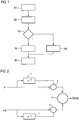
- Fig. 1 shows a flowchart of the method according to the invention, which integrates into the general position determination within a GNSS receiver is.
- a step S1 within the GNSS receiver, as usual, the transit time distance between the receiver and the satellite determined from a transit time measurement by evaluating the code modulated onto the carrier frequency of the satellite signal and the carrier phase distance based on a carrier phase measurement with underlying Doppler measurement between the receiver and determined and provided to the satellite or a reference point.
- a step S2 these distances (and their time course) are used to determine the evaluation quantity CMCD, as described by the equation (3).
- the time derivation is determined by forming the difference between the respective actual distance and the previously determined distance stored in a register, as shown in the block diagram of FIG Fig. 2 can be seen. There, in turn, is denoted by ⁇ the delay time, with ⁇ the carrier phase distance. Register 1 records the previously determined values.
- Adder 2 is used for subtraction to determine the respective delta ranges.
- Another adder 3 subtracts the two delta lengths as defined in equation (3) from each other to obtain the evaluation quantity CMCD.
- the block diagram in Fig. 2 only a simple realization possibility; Timing derivatives can also be determined by taking into account several historical values and the like, or in some other way; In particular, the determination of the CMCD can also be performed by software components.
- Fig. 3 shows an exemplary course of the evaluation variable CMDC plotted against the time t in a period of about 100 seconds. If the underlying satellite signal, in which case the delay distance and the carrier phase separation of the same satellite signal are evaluated here, is free of multiple errors, then in regions 4 only the amplified receiver noise with small fluctuations, that is, small maximum amounts of the evaluation variable, is shown. In the areas 5, however, there are multipath effects, so that a clearly changed behavior results, according to which a broadband noise with strong excursions, that is high amplitudes, is given.
- a step S3 cf. in turn Fig. 1 , are now to be used for classification classification criteria, whether the satellite signal is loaded with a Mehrwebeehler.
- a statistical evaluation of the course of the evaluation is made, in the present case a multipath criterion is used, which compares the maximum amount of the evaluation size within a sliding window over the course, which always ends at the current value of the evaluation size, with a threshold, in this case purely by way of example 5 m per second. If this threshold value is exceeded, in a step S4 the satellite signal is classified as multiwavefaulty and marked. However, if the threshold value is not exceeded, the satellite signal from which the evaluation variable was determined is classified and marked as multi-path error-free in a step S5.
- this classification is constantly updated via the hypothesis test carried out in step S3 and the classification is carried out for all received satellite signals.
- a step S6 the position can then be determined, with satellite signals marked as multipath errors and the distances determined therefrom not being taken into account.
- step S3 additionally or alternatively, other evaluation criteria can be used, for example, those that assess the standard deviation of the evaluation variable in the sliding window.
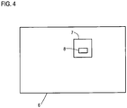
- Fig. 4 finally shows a schematic diagram of a motor vehicle 6 according to the invention, which has a GNSS receiver 7 according to the invention, here a GPS receiver.
Landscapes
- Engineering & Computer Science (AREA)
- Radar, Positioning & Navigation (AREA)
- Remote Sensing (AREA)
- Computer Networks & Wireless Communication (AREA)
- Physics & Mathematics (AREA)
- General Physics & Mathematics (AREA)
- Position Fixing By Use Of Radio Waves (AREA)
- Navigation (AREA)
Claims (9)
- Procédé d'évaluation d'un signal de satellite dans un système de navigation par satellite du point de vue d'une erreur de trajets multiples, dans lequel un récepteur (7) détermine dans le cadre d'une détermination de position, à partir des signaux de satellites de plusieurs satellites, une distance mesurée par temps de propagation, basée sur une mesure de temps de propagation, entre le récepteur (7) et le satellite et une distance mesurée par phase porteuse, basée sur une mesure de phase porteuse, entre le récepteur (7) et le satellite ou un point de référence,
dans lequel une différence des dérivées temporelles de la distance mesurée par temps de propagation et de la distance mesurée par phase porteuse est formée comme grandeur d'évaluation dans le récepteur (7), laquelle différence est évaluée via au moins un critère de trajets multiples quant à la présence d'une erreur de trajets multiples,
caractérisé en ce que la grandeur d'évaluation est déterminée à partir d'une distance mesurée par temps de propagation déduite du signal de satellite d'un premier satellite et d'un signal de phase porteuse déduit du signal de satellite d'un deuxième satellite, l'un des satellites étant un satellite de référence avec une petite erreur de trajets multiples. - Procédé selon la revendication 1, caractérisé en ce que la grandeur d'évaluation est corrigée d'un terme supplémentaire issu des vitesses relatives différentes entre récepteur (7) et satellite en tenant compte d'informations de vitesse au moins des satellites, en particulier des satellites et du récepteur (7).
- Procédé selon l'une des revendications précédentes, caractérisé en ce que le signal de satellite vérifié est classé par le critère de trajets multiples comme étant exempt d'erreur de trajets multiples ou affecté d'une erreur de trajets multiples.
- Procédé selon la revendication 3, caractérisé en ce que, pour le critère de trajets multiples, on détermine par une évaluation statistique des dernières grandeurs d'évaluation déterminées, dans une fenêtre glissante, une valeur caractéristique qui est comparée à une valeur de seuil afin de distinguer entre signal de satellite exempt d'erreur de trajets multiples et signal de satellite affecté d'une erreur de trajets multiples.
- Procédé selon la revendication 4, caractérisé en ce que, comme valeur caractéristique, on considère une valeur maximale de la grandeur d'évaluation dans la fenêtre glissante et/ou l'écart type des grandeurs d'évaluation dans la fenêtre glissante, la valeur de seuil étant définie en particulier comme un multiple d'un écart type dans une courbe certainement exempte d'erreur de trajets multiples.
- Procédé selon l'une des revendications précédentes, caractérisé en ce qu'on déplace le récepteur (7), en particulier on utilise un récepteur (7) placé et/ou intégré dans un véhicule automobile (6).
- Procédé selon l'une des revendications précédentes, caractérisé en ce que, comme système de navigation par satellite, on utilise GPS et/ou Galileo et/ou GLONASS et/ou Beidou.
- Récepteur (7) destiné à un système de navigation par satellite, comportant une unité de calcul (8) conçue pour la mise en oeuvre d'un procédé selon l'une des revendications précédentes.
- Véhicule automobile (6), comportant un récepteur (7) selon la revendication 8.
Applications Claiming Priority (2)
| Application Number | Priority Date | Filing Date | Title |
|---|---|---|---|
| DE102014013209.9A DE102014013209B4 (de) | 2014-09-06 | 2014-09-06 | Verfahren zur Bewertung eines Satellitensignals in einem globalen Navigationssatellitensystem im Hinblick auf einen Mehrwegefehler, Empfänger für ein globales Navigationssatellitensystem und Kraftfahrzeug |
| PCT/EP2015/001694 WO2016034267A1 (fr) | 2014-09-06 | 2015-08-18 | Procédé et dispositif pour l'évaluation d'un signal satellite dans un système mondial de navigation par satellites, au sujet d'une erreur de multitrajets |
Publications (2)
| Publication Number | Publication Date |
|---|---|
| EP3155451A1 EP3155451A1 (fr) | 2017-04-19 |
| EP3155451B1 true EP3155451B1 (fr) | 2017-06-28 |
Family
ID=53872004
Family Applications (1)
| Application Number | Title | Priority Date | Filing Date |
|---|---|---|---|
| EP15750640.3A Active EP3155451B1 (fr) | 2014-09-06 | 2015-08-18 | Procédé et dispositif pour l'évaluation d'un signal satellite dans un système mondial de navigation par satellites, au sujet d'une erreur de multitrajets |
Country Status (5)
| Country | Link |
|---|---|
| US (1) | US9810790B2 (fr) |
| EP (1) | EP3155451B1 (fr) |
| CN (1) | CN106796295B (fr) |
| DE (1) | DE102014013209B4 (fr) |
| WO (1) | WO2016034267A1 (fr) |
Families Citing this family (13)
| Publication number | Priority date | Publication date | Assignee | Title |
|---|---|---|---|---|
| EP3505964B1 (fr) * | 2017-12-28 | 2022-03-23 | Centre National d'Etudes Spatiales | Gestion de trajets multiples dans des systèmes globaux de navigation par satellite |
| CN108279425A (zh) * | 2018-01-29 | 2018-07-13 | 鄢名扬 | 一种多频观测过程中多径误差的修正方法 |
| CN109507696B (zh) * | 2018-05-25 | 2023-08-25 | 武汉大学 | 一种基于自适应滤波的gnss伪距多路径消除方法 |
| CN109101902A (zh) * | 2018-07-24 | 2018-12-28 | 东南大学 | 一种基于无监督学习的卫星nlos信号检测方法 |
| KR102292187B1 (ko) * | 2018-12-14 | 2021-08-24 | 주식회사 피피솔 | Gnss 수신기의 데이터 신호 처리 방법, 기록매체 및 gnss 수신기 시스템, |
| CN111487659B (zh) * | 2019-01-28 | 2022-07-05 | 广州市中海达测绘仪器有限公司 | 状态识别方法、装置、计算机设备和存储介质 |
| CN113840321B (zh) * | 2020-06-24 | 2024-01-30 | 大唐移动通信设备有限公司 | 一种信息指示方法、装置及通信设备 |
| CN112230247B (zh) * | 2020-09-25 | 2021-07-27 | 南京航空航天大学 | 一种用于城市复杂环境下gnss完好性监测方法 |
| CN112230254B (zh) * | 2020-10-29 | 2024-05-14 | 新乡医学院三全学院 | 一种gps载波相位多径误差的校正方法及装置 |
| CN115718316B (zh) * | 2022-11-07 | 2026-03-24 | 中山大学 | 考虑时间相关性的伪距确定方法、定位方法及相关设备 |
| CN116736345B (zh) * | 2023-05-25 | 2026-02-03 | 武汉大学 | 用于mhgm多路径误差建模的半天球自适应格网划分方法 |
| CN116582174B (zh) * | 2023-07-13 | 2023-11-21 | 武汉能钠智能装备技术股份有限公司四川省成都市分公司 | 一种卫星信号态势可视化方法及系统 |
| CN117687995A (zh) * | 2023-10-30 | 2024-03-12 | 中铁大桥勘测设计院集团有限公司 | 基于cnn神经网络的多终端北斗数据质量评估方法及系统 |
Family Cites Families (10)
| Publication number | Priority date | Publication date | Assignee | Title |
|---|---|---|---|---|
| US6329945B1 (en) | 2000-04-20 | 2001-12-11 | Novatel, Inc. | System for improved GPS accuracy using a sky map |
| US20050216210A1 (en) * | 2004-03-25 | 2005-09-29 | Bartone Chris G | Real-time code multipath mitigation in the frequency domain using FDsmooth™ for Global Navigation Satellite Systems |
| US20050212696A1 (en) * | 2004-03-25 | 2005-09-29 | Bartone Chris G | Reat-time WaveSmooth™ error mitigation for Global Navigation Satellite Systems |
| US8757548B2 (en) | 2007-04-30 | 2014-06-24 | The Boeing Company | Apparatus for an automated aerial refueling boom using multiple types of sensors |
| DE102008004068A1 (de) * | 2008-01-12 | 2009-07-23 | Thales Atm Gmbh | Überwachungseinrichtung für ein augmentiertes satellitenbasiertes Positionsbestimmungsystem und augmentiertes satellitenbasiertes Positionsbestimmungssystem |
| US7898472B2 (en) | 2009-03-27 | 2011-03-01 | GM Global Technology Operations LLC | Method and apparatus for precise relative positioning in multiple vehicles |
| KR101437346B1 (ko) * | 2011-05-24 | 2014-09-04 | 이흥수 | Gps 수신기의 위치 계산 방법, 그 방법을 구현하기 위한 프로그램이 기록된 기록매체 및 gps 수신기 |
| KR20140057662A (ko) | 2011-09-12 | 2014-05-13 | 콘티넨탈 테베스 아게 운트 코. 오하게 | 위성을 선택하기 위한 방법 |
| US9329274B2 (en) * | 2013-07-09 | 2016-05-03 | Honeywell International Inc. | Code minus carrier multipath observation for satellite exclusion |
| CN103901442B (zh) * | 2014-03-14 | 2016-05-11 | 中国测绘科学研究院 | 一种单频多路径效应探测与缓解方法 |
-
2014
- 2014-09-06 DE DE102014013209.9A patent/DE102014013209B4/de not_active Expired - Fee Related
-
2015
- 2015-08-18 WO PCT/EP2015/001694 patent/WO2016034267A1/fr not_active Ceased
- 2015-08-18 EP EP15750640.3A patent/EP3155451B1/fr active Active
- 2015-08-18 US US15/508,840 patent/US9810790B2/en active Active
- 2015-08-18 CN CN201580047624.1A patent/CN106796295B/zh active Active
Non-Patent Citations (1)
| Title |
|---|
| None * |
Also Published As
| Publication number | Publication date |
|---|---|
| EP3155451A1 (fr) | 2017-04-19 |
| US20170276794A1 (en) | 2017-09-28 |
| US9810790B2 (en) | 2017-11-07 |
| DE102014013209A1 (de) | 2016-03-10 |
| WO2016034267A1 (fr) | 2016-03-10 |
| CN106796295A (zh) | 2017-05-31 |
| DE102014013209B4 (de) | 2016-06-09 |
| CN106796295B (zh) | 2019-08-23 |
Similar Documents
| Publication | Publication Date | Title |
|---|---|---|
| EP3155451B1 (fr) | Procédé et dispositif pour l'évaluation d'un signal satellite dans un système mondial de navigation par satellites, au sujet d'une erreur de multitrajets | |
| DE69505145T2 (de) | Differentielles gps bodenstationsystem | |
| DE602004009590T2 (de) | Verfahren zur empfängerautonomen integritätsüberwachung und fehlerdetektion und -beseitigung | |
| DE69904187T2 (de) | Überwachungsgerät zur isolierung von gps-fehlern | |
| DE102013206544A1 (de) | Fortschrittliche Positionierung mit globalen Navigationssatellitensystemen (GNSS) unter Verwendung von präziser Satelliteninformation | |
| DE112007003538T5 (de) | Positionsverfolgungsgerät und Verfahren | |
| DE102004032261A1 (de) | Verfahren zur Verbesserung der GPS-Integrität und Erkennung von Mehrwegestörung unter Verwendung von Trägheitsnavigationssensoren und eines Netzes von mobilen Empfängern | |
| DE102009043882A1 (de) | Vorrichtung und Verfahren zum Abschwächen von Mehrwegsignalen | |
| DE102010011982A1 (de) | Verfahren zum rechnergestützten Erstellen und/oder Aktualisieren einer Referenzkarte für eine satellitengestützte Ortung eines Objekts | |
| DE102014211176A1 (de) | Verfahren und System zur Korrektur von Messdaten und/oder Navigationsdaten eines Sensorbasissystems | |
| DE102016119626A1 (de) | Automatische dreidimensionale Geolokation von SAR-Targets und gleichzeitige Schätzung troposphärischer Ausbreitungsverzögerungen mittels zweier SAR-Bilder mit langer Apertur | |
| DE102017110994A1 (de) | Verfahren zur Bestimmung von Schneeparametern | |
| EP3019887B1 (fr) | Détermination d'une position d'un récepteur mobile | |
| EP2348334B1 (fr) | Amélioration de la communication d'intégrité dans un système de navigation par satellite | |
| WO2016135205A2 (fr) | Identification multi-chemins au moyen d'une comparaison de deux signaux gnss différents | |
| WO2021008971A1 (fr) | Procédé de génération d'un modèle d'environnement tridimensionnel à l'aide de mesures gnss | |
| EP2216657B1 (fr) | Procédé et installation de détermination de la position | |
| DE102011054379B4 (de) | Verfahren und Vorrichtung zur Ermittlung einer Positionsinformation | |
| EP2573583B1 (fr) | Procédé et appareil de recherche pour la recherche d'un appareil d'émission | |
| DE102019209119A1 (de) | Verfahren zum Klassifizieren eines Positionssignals | |
| EP3987310B1 (fr) | L'évaluation des erreurs et de l'intégrité par la prédiction des mouvements | |
| DE102020213150A1 (de) | Verfahren zur GNSS-basierten Lokalisierung eines Fahrzeugs mittels einer Lokalisierungseinrichtung des Fahrzeugs unter Berücksichtigung von GNSS-Messdaten anderer Fahrzeuge | |
| DE102006001794B4 (de) | Verfahren zum Reduzieren von durch Mehrwegeempfang verursachten Störungen in Satellitennavigationsempfängern | |
| WO2016087087A1 (fr) | Procédé et dispositif de détermination de propriétés statistiques de valeurs de mesure brutes | |
| DE102011108138B4 (de) | Verfahren zur Anpassung der Parameter eines Kanalmodells für einen Signalübertragungsweg |
Legal Events
| Date | Code | Title | Description |
|---|---|---|---|
| PUAI | Public reference made under article 153(3) epc to a published international application that has entered the european phase |
Free format text: ORIGINAL CODE: 0009012 |
|
| 17P | Request for examination filed |
Effective date: 20170116 |
|
| AK | Designated contracting states |
Kind code of ref document: A1 Designated state(s): AL AT BE BG CH CY CZ DE DK EE ES FI FR GB GR HR HU IE IS IT LI LT LU LV MC MK MT NL NO PL PT RO RS SE SI SK SM TR |
|
| AX | Request for extension of the european patent |
Extension state: BA ME |
|
| GRAP | Despatch of communication of intention to grant a patent |
Free format text: ORIGINAL CODE: EPIDOSNIGR1 |
|
| INTG | Intention to grant announced |
Effective date: 20170425 |
|
| GRAS | Grant fee paid |
Free format text: ORIGINAL CODE: EPIDOSNIGR3 |
|
| GRAA | (expected) grant |
Free format text: ORIGINAL CODE: 0009210 |
|
| AK | Designated contracting states |
Kind code of ref document: B1 Designated state(s): AL AT BE BG CH CY CZ DE DK EE ES FI FR GB GR HR HU IE IS IT LI LT LU LV MC MK MT NL NO PL PT RO RS SE SI SK SM TR |
|
| DAV | Request for validation of the european patent (deleted) | ||
| DAX | Request for extension of the european patent (deleted) | ||
| REG | Reference to a national code |
Ref country code: GB Ref legal event code: FG4D Free format text: NOT ENGLISH |
|
| REG | Reference to a national code |
Ref country code: CH Ref legal event code: EP |
|
| REG | Reference to a national code |
Ref country code: AT Ref legal event code: REF Ref document number: 905361 Country of ref document: AT Kind code of ref document: T Effective date: 20170715 |
|
| REG | Reference to a national code |
Ref country code: IE Ref legal event code: FG4D Free format text: LANGUAGE OF EP DOCUMENT: GERMAN |
|
| REG | Reference to a national code |
Ref country code: DE Ref legal event code: R096 Ref document number: 502015001353 Country of ref document: DE |
|
| REG | Reference to a national code |
Ref country code: FR Ref legal event code: PLFP Year of fee payment: 3 |
|
| PG25 | Lapsed in a contracting state [announced via postgrant information from national office to epo] |
Ref country code: HR Free format text: LAPSE BECAUSE OF FAILURE TO SUBMIT A TRANSLATION OF THE DESCRIPTION OR TO PAY THE FEE WITHIN THE PRESCRIBED TIME-LIMIT Effective date: 20170628 Ref country code: LT Free format text: LAPSE BECAUSE OF FAILURE TO SUBMIT A TRANSLATION OF THE DESCRIPTION OR TO PAY THE FEE WITHIN THE PRESCRIBED TIME-LIMIT Effective date: 20170628 Ref country code: FI Free format text: LAPSE BECAUSE OF FAILURE TO SUBMIT A TRANSLATION OF THE DESCRIPTION OR TO PAY THE FEE WITHIN THE PRESCRIBED TIME-LIMIT Effective date: 20170628 Ref country code: GR Free format text: LAPSE BECAUSE OF FAILURE TO SUBMIT A TRANSLATION OF THE DESCRIPTION OR TO PAY THE FEE WITHIN THE PRESCRIBED TIME-LIMIT Effective date: 20170929 Ref country code: NO Free format text: LAPSE BECAUSE OF FAILURE TO SUBMIT A TRANSLATION OF THE DESCRIPTION OR TO PAY THE FEE WITHIN THE PRESCRIBED TIME-LIMIT Effective date: 20170928 |
|
| REG | Reference to a national code |
Ref country code: NL Ref legal event code: MP Effective date: 20170628 |
|
| REG | Reference to a national code |
Ref country code: LT Ref legal event code: MG4D |
|
| PG25 | Lapsed in a contracting state [announced via postgrant information from national office to epo] |
Ref country code: BG Free format text: LAPSE BECAUSE OF FAILURE TO SUBMIT A TRANSLATION OF THE DESCRIPTION OR TO PAY THE FEE WITHIN THE PRESCRIBED TIME-LIMIT Effective date: 20170928 Ref country code: NL Free format text: LAPSE BECAUSE OF FAILURE TO SUBMIT A TRANSLATION OF THE DESCRIPTION OR TO PAY THE FEE WITHIN THE PRESCRIBED TIME-LIMIT Effective date: 20170628 Ref country code: RS Free format text: LAPSE BECAUSE OF FAILURE TO SUBMIT A TRANSLATION OF THE DESCRIPTION OR TO PAY THE FEE WITHIN THE PRESCRIBED TIME-LIMIT Effective date: 20170628 Ref country code: LV Free format text: LAPSE BECAUSE OF FAILURE TO SUBMIT A TRANSLATION OF THE DESCRIPTION OR TO PAY THE FEE WITHIN THE PRESCRIBED TIME-LIMIT Effective date: 20170628 Ref country code: SE Free format text: LAPSE BECAUSE OF FAILURE TO SUBMIT A TRANSLATION OF THE DESCRIPTION OR TO PAY THE FEE WITHIN THE PRESCRIBED TIME-LIMIT Effective date: 20170628 |
|
| PG25 | Lapsed in a contracting state [announced via postgrant information from national office to epo] |
Ref country code: SK Free format text: LAPSE BECAUSE OF FAILURE TO SUBMIT A TRANSLATION OF THE DESCRIPTION OR TO PAY THE FEE WITHIN THE PRESCRIBED TIME-LIMIT Effective date: 20170628 Ref country code: EE Free format text: LAPSE BECAUSE OF FAILURE TO SUBMIT A TRANSLATION OF THE DESCRIPTION OR TO PAY THE FEE WITHIN THE PRESCRIBED TIME-LIMIT Effective date: 20170628 Ref country code: CZ Free format text: LAPSE BECAUSE OF FAILURE TO SUBMIT A TRANSLATION OF THE DESCRIPTION OR TO PAY THE FEE WITHIN THE PRESCRIBED TIME-LIMIT Effective date: 20170628 |
|
| PG25 | Lapsed in a contracting state [announced via postgrant information from national office to epo] |
Ref country code: IT Free format text: LAPSE BECAUSE OF FAILURE TO SUBMIT A TRANSLATION OF THE DESCRIPTION OR TO PAY THE FEE WITHIN THE PRESCRIBED TIME-LIMIT Effective date: 20170628 Ref country code: PL Free format text: LAPSE BECAUSE OF FAILURE TO SUBMIT A TRANSLATION OF THE DESCRIPTION OR TO PAY THE FEE WITHIN THE PRESCRIBED TIME-LIMIT Effective date: 20170628 Ref country code: ES Free format text: LAPSE BECAUSE OF FAILURE TO SUBMIT A TRANSLATION OF THE DESCRIPTION OR TO PAY THE FEE WITHIN THE PRESCRIBED TIME-LIMIT Effective date: 20170628 Ref country code: SM Free format text: LAPSE BECAUSE OF FAILURE TO SUBMIT A TRANSLATION OF THE DESCRIPTION OR TO PAY THE FEE WITHIN THE PRESCRIBED TIME-LIMIT Effective date: 20170628 Ref country code: IS Free format text: LAPSE BECAUSE OF FAILURE TO SUBMIT A TRANSLATION OF THE DESCRIPTION OR TO PAY THE FEE WITHIN THE PRESCRIBED TIME-LIMIT Effective date: 20171028 |
|
| REG | Reference to a national code |
Ref country code: DE Ref legal event code: R097 Ref document number: 502015001353 Country of ref document: DE |
|
| PG25 | Lapsed in a contracting state [announced via postgrant information from national office to epo] |
Ref country code: MC Free format text: LAPSE BECAUSE OF FAILURE TO SUBMIT A TRANSLATION OF THE DESCRIPTION OR TO PAY THE FEE WITHIN THE PRESCRIBED TIME-LIMIT Effective date: 20170628 |
|
| PG25 | Lapsed in a contracting state [announced via postgrant information from national office to epo] |
Ref country code: DK Free format text: LAPSE BECAUSE OF FAILURE TO SUBMIT A TRANSLATION OF THE DESCRIPTION OR TO PAY THE FEE WITHIN THE PRESCRIBED TIME-LIMIT Effective date: 20170628 |
|
| REG | Reference to a national code |
Ref country code: BE Ref legal event code: MM Effective date: 20170831 |
|
| PLBE | No opposition filed within time limit |
Free format text: ORIGINAL CODE: 0009261 |
|
| STAA | Information on the status of an ep patent application or granted ep patent |
Free format text: STATUS: NO OPPOSITION FILED WITHIN TIME LIMIT |
|
| REG | Reference to a national code |
Ref country code: IE Ref legal event code: MM4A |
|
| 26N | No opposition filed |
Effective date: 20180329 |
|
| PG25 | Lapsed in a contracting state [announced via postgrant information from national office to epo] |
Ref country code: LU Free format text: LAPSE BECAUSE OF NON-PAYMENT OF DUE FEES Effective date: 20170818 |
|
| PG25 | Lapsed in a contracting state [announced via postgrant information from national office to epo] |
Ref country code: IE Free format text: LAPSE BECAUSE OF NON-PAYMENT OF DUE FEES Effective date: 20170818 |
|
| REG | Reference to a national code |
Ref country code: FR Ref legal event code: PLFP Year of fee payment: 4 |
|
| PG25 | Lapsed in a contracting state [announced via postgrant information from national office to epo] |
Ref country code: BE Free format text: LAPSE BECAUSE OF NON-PAYMENT OF DUE FEES Effective date: 20170831 Ref country code: SI Free format text: LAPSE BECAUSE OF FAILURE TO SUBMIT A TRANSLATION OF THE DESCRIPTION OR TO PAY THE FEE WITHIN THE PRESCRIBED TIME-LIMIT Effective date: 20170628 |
|
| PG25 | Lapsed in a contracting state [announced via postgrant information from national office to epo] |
Ref country code: MT Free format text: LAPSE BECAUSE OF FAILURE TO SUBMIT A TRANSLATION OF THE DESCRIPTION OR TO PAY THE FEE WITHIN THE PRESCRIBED TIME-LIMIT Effective date: 20170628 |
|
| REG | Reference to a national code |
Ref country code: CH Ref legal event code: PL |
|
| PG25 | Lapsed in a contracting state [announced via postgrant information from national office to epo] |
Ref country code: LI Free format text: LAPSE BECAUSE OF NON-PAYMENT OF DUE FEES Effective date: 20180831 Ref country code: CH Free format text: LAPSE BECAUSE OF NON-PAYMENT OF DUE FEES Effective date: 20180831 |
|
| PG25 | Lapsed in a contracting state [announced via postgrant information from national office to epo] |
Ref country code: HU Free format text: LAPSE BECAUSE OF FAILURE TO SUBMIT A TRANSLATION OF THE DESCRIPTION OR TO PAY THE FEE WITHIN THE PRESCRIBED TIME-LIMIT; INVALID AB INITIO Effective date: 20150818 |
|
| PG25 | Lapsed in a contracting state [announced via postgrant information from national office to epo] |
Ref country code: RO Free format text: LAPSE BECAUSE OF FAILURE TO SUBMIT A TRANSLATION OF THE DESCRIPTION OR TO PAY THE FEE WITHIN THE PRESCRIBED TIME-LIMIT Effective date: 20170628 |
|
| PG25 | Lapsed in a contracting state [announced via postgrant information from national office to epo] |
Ref country code: CY Free format text: LAPSE BECAUSE OF FAILURE TO SUBMIT A TRANSLATION OF THE DESCRIPTION OR TO PAY THE FEE WITHIN THE PRESCRIBED TIME-LIMIT Effective date: 20170628 |
|
| PG25 | Lapsed in a contracting state [announced via postgrant information from national office to epo] |
Ref country code: MK Free format text: LAPSE BECAUSE OF FAILURE TO SUBMIT A TRANSLATION OF THE DESCRIPTION OR TO PAY THE FEE WITHIN THE PRESCRIBED TIME-LIMIT Effective date: 20170628 |
|
| PG25 | Lapsed in a contracting state [announced via postgrant information from national office to epo] |
Ref country code: TR Free format text: LAPSE BECAUSE OF FAILURE TO SUBMIT A TRANSLATION OF THE DESCRIPTION OR TO PAY THE FEE WITHIN THE PRESCRIBED TIME-LIMIT Effective date: 20170628 |
|
| PG25 | Lapsed in a contracting state [announced via postgrant information from national office to epo] |
Ref country code: PT Free format text: LAPSE BECAUSE OF FAILURE TO SUBMIT A TRANSLATION OF THE DESCRIPTION OR TO PAY THE FEE WITHIN THE PRESCRIBED TIME-LIMIT Effective date: 20170628 |
|
| PG25 | Lapsed in a contracting state [announced via postgrant information from national office to epo] |
Ref country code: AL Free format text: LAPSE BECAUSE OF FAILURE TO SUBMIT A TRANSLATION OF THE DESCRIPTION OR TO PAY THE FEE WITHIN THE PRESCRIBED TIME-LIMIT Effective date: 20170628 |
|
| REG | Reference to a national code |
Ref country code: AT Ref legal event code: MM01 Ref document number: 905361 Country of ref document: AT Kind code of ref document: T Effective date: 20200818 |
|
| PG25 | Lapsed in a contracting state [announced via postgrant information from national office to epo] |
Ref country code: AT Free format text: LAPSE BECAUSE OF NON-PAYMENT OF DUE FEES Effective date: 20200818 |
|
| P01 | Opt-out of the competence of the unified patent court (upc) registered |
Effective date: 20230530 |
|
| PGFP | Annual fee paid to national office [announced via postgrant information from national office to epo] |
Ref country code: DE Payment date: 20250831 Year of fee payment: 11 |
|
| PGFP | Annual fee paid to national office [announced via postgrant information from national office to epo] |
Ref country code: GB Payment date: 20250822 Year of fee payment: 11 |
|
| PGFP | Annual fee paid to national office [announced via postgrant information from national office to epo] |
Ref country code: FR Payment date: 20250821 Year of fee payment: 11 |