EP3189349B1 - Methode zur kollaborativen bestimmung von positionierungsfehlern eines satellitengestützten navigationssystems - Google Patents
Methode zur kollaborativen bestimmung von positionierungsfehlern eines satellitengestützten navigationssystems Download PDFInfo
- Publication number
- EP3189349B1 EP3189349B1 EP15763847.9A EP15763847A EP3189349B1 EP 3189349 B1 EP3189349 B1 EP 3189349B1 EP 15763847 A EP15763847 A EP 15763847A EP 3189349 B1 EP3189349 B1 EP 3189349B1
- Authority
- EP
- European Patent Office
- Prior art keywords
- receivers
- contributing
- data
- receiver
- error
- Prior art date
- Legal status (The legal status is an assumption and is not a legal conclusion. Google has not performed a legal analysis and makes no representation as to the accuracy of the status listed.)
- Active
Links
Images


Classifications
-
- G—PHYSICS
- G01—MEASURING; TESTING
- G01S—RADIO DIRECTION-FINDING; RADIO NAVIGATION; DETERMINING DISTANCE OR VELOCITY BY USE OF RADIO WAVES; LOCATING OR PRESENCE-DETECTING BY USE OF THE REFLECTION OR RERADIATION OF RADIO WAVES; ANALOGOUS ARRANGEMENTS USING OTHER WAVES
- G01S19/00—Satellite radio beacon positioning systems; Determining position, velocity or attitude using signals transmitted by such systems
- G01S19/01—Satellite radio beacon positioning systems transmitting time-stamped messages, e.g. GPS [Global Positioning System], GLONASS [Global Orbiting Navigation Satellite System] or GALILEO
- G01S19/03—Cooperating elements; Interaction or communication between different cooperating elements or between cooperating elements and receivers
- G01S19/07—Cooperating elements; Interaction or communication between different cooperating elements or between cooperating elements and receivers providing data for correcting measured positioning data, e.g. DGPS [differential GPS] or ionosphere corrections
-
- G—PHYSICS
- G01—MEASURING; TESTING
- G01S—RADIO DIRECTION-FINDING; RADIO NAVIGATION; DETERMINING DISTANCE OR VELOCITY BY USE OF RADIO WAVES; LOCATING OR PRESENCE-DETECTING BY USE OF THE REFLECTION OR RERADIATION OF RADIO WAVES; ANALOGOUS ARRANGEMENTS USING OTHER WAVES
- G01S19/00—Satellite radio beacon positioning systems; Determining position, velocity or attitude using signals transmitted by such systems
- G01S19/01—Satellite radio beacon positioning systems transmitting time-stamped messages, e.g. GPS [Global Positioning System], GLONASS [Global Orbiting Navigation Satellite System] or GALILEO
- G01S19/13—Receivers
- G01S19/24—Acquisition or tracking or demodulation of signals transmitted by the system
- G01S19/25—Acquisition or tracking or demodulation of signals transmitted by the system involving aiding data received from a cooperating element, e.g. assisted GPS
-
- G—PHYSICS
- G01—MEASURING; TESTING
- G01S—RADIO DIRECTION-FINDING; RADIO NAVIGATION; DETERMINING DISTANCE OR VELOCITY BY USE OF RADIO WAVES; LOCATING OR PRESENCE-DETECTING BY USE OF THE REFLECTION OR RERADIATION OF RADIO WAVES; ANALOGOUS ARRANGEMENTS USING OTHER WAVES
- G01S19/00—Satellite radio beacon positioning systems; Determining position, velocity or attitude using signals transmitted by such systems
- G01S19/38—Determining a navigation solution using signals transmitted by a satellite radio beacon positioning system
- G01S19/39—Determining a navigation solution using signals transmitted by a satellite radio beacon positioning system the satellite radio beacon positioning system transmitting time-stamped messages, e.g. GPS [Global Positioning System], GLONASS [Global Orbiting Navigation Satellite System] or GALILEO
- G01S19/40—Correcting position, velocity or attitude
Definitions
- the present invention applies to systems for aiding satellite-based navigation. More precisely, the aim of the invention is to produce information making it possible to determine the positioning errors resulting from the use of a satellite-based navigation signal.
- the first constellation of satellites transmitting positioning signals was put in place for military applications by the American State (Global Positioning System or GPS) at the start of the 1980s. Since then, GPS signals have been used by professional civil applications (management of fleets of lorries, aids to aerial navigation, geodesic surveys, etc.), and henceforth for general-public applications (automobile navigation with onboard terminals and pedestrian navigation with terminals of smartphone type). Other constellations were put in place by the Russian State (GLONASS) and the Chinese State (Ba ⁇ idou). A constellation of European satellites (Galileo) is undergoing deployment. Generally, these navigation systems are designated by the acronym GNSS (Global Navigation Satellite Systems).
- the basic principle of aiding satellite-based positioning and navigation is the calculation by a receiver furnished with electronic processing circuits of position, velocity and time (PVT) data on the basis of electromagnetic signals of centimetric wavelength transmitted by satellites in orbit.
- PVT position, velocity and time
- the calculation of the PVT data by a receiver on the basis of the signals of the satellites is affected by numerous errors of various types: impact of the crossing by the electromagnetic signals of the various layers of the atmosphere (troposphere, ionosphere), errors due to the reflections of the signals on objects in the neighbourhood of the receiver (multipaths), clock errors, errors of the electronic processing circuits, etc.
- P(Y) code of GPS reserved carriers
- Specific means of multi-sensor processing and fusion are furthermore generally envisaged in order to guarantee precision and integrity of measurements intended for critical uses. But these solutions are restricted and expensive.
- the errors due to the crossing of the ionosphere by the signals transmitted by the radionavigation satellites weigh heavily in the global toll of the positioning errors (4 standard deviations, according to the publication by A Angrisano et al., "Ionospheric models comparison for single-frequency GNSS positionning", ENC 2011, 12/2011, http://panq.uniparthenope.it/node/64 ).
- Several types of techniques for correcting these ionospheric errors may be employed in the state of the art.
- a dual-frequency receiver can thus use a linear combination of the pseudo-distances calculated on the basis of the signals of each of the frequencies.
- the ionospheric error being strongly correlated with the frequencies, it will be able to be eliminated by said combination.
- dual-frequency receivers are not yet widespread among the general public. Furthermore, the convergence time to a stabilized measurement is relatively long (possibly reaching as much as half an hour).
- a method making it possible to guarantee at one and the same time fast convergence, precision and integrity is the acquisition of specialized signals containing corrections calculated on the basis of the differences between the known positions of fixed stations belonging to a network and the positions calculated on the basis of the navigation signals of a GNSS constellation.
- augmentation systems Small Based Augmentation Systems or SBAS
- SBAS Stelite Based Augmentation Systems
- the operational systems comprise notably EGNOS in Europe (European Geostationary Navigation Overlay Service), and WAAS in the United States (Wide Area Augmentation System).
- RTK Real Time Kinematics
- a limitation which is common to the differential approaches of SBAS and RTK type is that of requiring the use of reference stations whose position is known very precisely and of calculation algorithms which process the entirety or the major part of the errors with equivalent precision. This limitation restricts the access of users of general-public terminals furnished with standard GNSS signal acquisition capabilities to greater positioning precision.
- the invention affords a solution to this problem by generating a map of the ionospheric errors of sufficient precision on the basis of terminals for receiving GNSS signals whose position may not be known precisely, and optionally whose onboard processing capability may be limited.
- the solution to the problem is provided by the apended independent claims.
- Another advantage of the invention is that of providing a calculation of position corrected of the ionospheric errors, making it possible to obtain, under most conditions of use, a global precision of positioning of the same order of magnitude as that provided by SBAS systems, when the number of terminals in a given geographical zone is sufficient (without however the same integrity guarantees).
- Another advantage of the invention is that of authorizing the recombination of the corrections of ionospheric errors obtained of the invention with positioning data of variable precision obtained moreover so as to obtain a global precision level which will be able to depend, on the one hand, on the configuration of the receiver possibly allowing it to acquire and process the data of this or that precise positioning service, and on the other hand on the reception conditions just where said receiver is located.
- the position data used to initialize the position calculation in a GNSS receiver can for example be data calculated by another means provided either by a radiocommunication, cellular or WiFi-terminal-based network, or by a cartographic means.
- Another advantage of the invention, coupled with these initialization means, is then that of allowing faster acquisition of the GNSS signals by a receiver entering a given geographical zone or exiting a masking zone.
- the invention is sufficiently versatile for its implementation to cope with several types of architectures making it possible to obtain a contribution of correction data according to different modalities of receivers having variable onboard calculation capabilities.
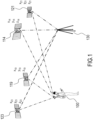
- Figure 1 represents a basic view of an RTK system according to the prior art.
- a user 100 receives positioning signals for at least one constellation of satellites, 114, 119, 121, 123.
- the positioning signals for said satellites are also received by a reference station 130.
- the user 100 can be mobile.
- the reference station 130 must be fixed, of precisely known position and situated in a radius of about 10 to 20 km from the user (see http://www.navipedia.ne/index.php/RTK Fundamentals).
- An algorithm of RTK type can be implemented by using the code, the phase or a combination of the two, if appropriate with variable weightings.
- the precision is better when the phase is used, since its measurement is less noisy than that of the code, at the price of greater complexity, notably in order to remove the cycle ambiguity.
- ⁇ x Sat ⁇ x Rx 2 + y Sat ⁇ y Rx 2 + z Sat ⁇ z Rx 2 1 / 2
- the ionospheric and tropospheric errors have already been commented on.
- the clock biases do not call for any particular comment.
- the cycle ambiguity in the phase measurement is to within N cycles, N being an integer.
- N is an integer.
- an ambiguity of one cycle represents a disparity of 20 cm. To obtain centimetric precision, it is therefore necessary to resolve the cycle ambiguity or integer ambiguity.
- ⁇ 100 121,123 ⁇ ⁇ 130 121,123 ⁇ 100 121,123 ⁇ ⁇ 130 121,123 ⁇ I 100 121,123 + I 130 121,123 + Tr 100 121,123 ⁇ Tr 130 121,123 + ⁇ N 100 121,123 ⁇ N 130 121,123 + ⁇ 100 121,123 ⁇ ⁇ 130 121,123 + ⁇ 100 121,123 ⁇ ⁇ 130 121,123
- the precision of the position measurement of the receiver of the user 100 will be of the same order of magnitude as the precision of the various terms of equation (3), or of the equivalent equations for the code and code/phase combination variants, with a precision equivalent to the precision of the positioning which must be provided.
- To obtain metric precision it is thus necessary to ascertain the position of the reference station with identical precision, thereby in practice excluding the possibility of it being mobile. It is also necessary to calculate the various error terms with the same precision, this being very difficult for the ionospheric error, having regard to the multiple factors which affect it.
- Figure 2 represents an architecture diagram for implementing the invention, in several of its embodiments.
- the invention can be implemented with the satellites of the constellation of the prior art, 114,119,121,123.
- Geographical zones 210, 220 are defined within which the measurements of receivers 2111, 2112, 2113, 2211, 2212, 2213, notably, which are active in said geographical zones, contribute to a global calculation of ionospheric errors.
- the geographical zones 210, 220 have a mesh which may be of the order of a few kilometres (for example between 1 and 10 km).
- a server 230 managed by a provider of positioning data 240 can receive data from the receivers and transmit same thereto.
- the receivers can be of all types, mono-frequency or multifrequency, able to pick up the signals of a single GNSS constellation or of several, furnished or not with antennas suitable for attenuating the effects of the multipaths, and aided or not by an inertial hybridization or a mapping. They are also coupled to a module allowing them to transmit and receive data by RF pathway.
- simple smartphones comprising a standard GPS microchip, can be integrated into the measures.
- the receivers 2111, 2112, 2211, 2212) may be solely contributors, that is to say may provide the server 230, and/or other receivers, with raw or summarized data making it possible to calculate the map of the ionospheric error in the zones 210, 220, without being users thereof. This may in particular be the case for vehicles of commercial or administrative fleets (public transport, taxis, ambulances, postal vehicles, lorries, etc.) equipped with means of precise positioning and receiving precision data.
- the receivers 2113, 2213 may be solely users, that is to say may receive positioning data without contributing their own position data.
- the receivers may also be contributors and users simultaneously or successively.
- the receivers must be able to provide as a minimum the code and the phase of the raw navigation signals. If the position of the receiver must be determined on the basis of the GNSS signal, the minimum number of satellite axes must be four. If the position of the receiver is determined by another means, as indicated hereinbelow, this is not necessary. A selection of the best signals will nonetheless be carried out. It is also possible to generate a summary signal, according to the modalities described hereinbelow as commentary to Figure 3 . The raw signals or the summary signal are thereafter transmitted by RF pathway to the server 230.
- the zones 210 and 220 differ from one another in that the second comprises base stations 2221, 2222, 2223 of a cellular radiocommunications network which are equipped with transmit relay antennas. These antennas may belong to different operators, or optionally be rented by operators that do not have their own network of base stations.
- the operator of a radiocommunications network is able to ascertain at any instant the base station to which an active terminal of one of its subscribers is attached. The precision of the position of the subscriber therefore varies as a function of the density of the cells, therefore from a hundred or so metres to a few kilometres.
- the provider of positioning data 240 is therefore able to ascertain the receivers that are active in the geographical zone 220, thereby making it possible to initialize the method of the invention, without the precise position of the receiver being known, as indicated hereinbelow. In this case, the transmission or the calculation of a GNSS position is therefore not necessary. It must on the other hand be possible to identify receivers that are located in the geographical zone 210, not covered by cells of a radiocommunications network of an operator with whom the positioning operator has negotiated an agreement to share data. It is on the other hand necessary either to calculate a position on the basis of the raw code and phase data used moreover to calculate the ionospheric error, or the data, or to acquire the PVT (Point Velocity Time) data at the output of the receiver.
- PVT Point Velocity Time
- Figure 3 represents a general flowchart of the processing actions for determining the ionospheric errors according to several embodiments of the invenfion.
- the contributors to the cooperative production of the positioning data according to the invention by the provider 240 are furnished with communicating positioning receivers, 2111, etc., designated in Figure 3 by Ri, having the characteristics indicated hereinabove.
- the contributors are registered by the provider 240, which also registers the identifiers of their GNSS receiver and of their radiocommunication receiver, as well as, optionally, the configuration characteristics of said receivers.
- the contributors must give, at the moment of their registration, their consent to the permanent collection of their location data for the needs of the service. In return for this consent, the data provider 240 will make the necessary legal and contractual undertakings in compliance with the provisions of the countries in which he operates regarding the protection of personal data. Optionally, the data provider will be able to collect the geo-location coordinates of the cellular network base stations onto which the receiver Ri is successively locked.
- processing actions for carrying out the invention are, on the one hand, implemented for each of the receivers Ri of the contributors located in a zone Zj (processing actions 310), and on the other hand are implemented by the entirety of the zones Zj served by the provider of positioning data (processing action 320).
- the positioning data produced by the processing actions 320, and optionally by external processing actions, are thereafter made available to the users and contributors/users of the service (processing action 330).
- each receiver Ri can be carried out according to variants of the invention, either in the receiver itself, or in the server 230. Likewise certain processing actions applicable in a concomitant manner to all the receivers Ri of a zone Zi can also be carried out either on each of the receivers, or on the server.
- a reasonable frequency of the processing actions for updating the data of the server 230, and therefore for extracting and/or calculating the data required at the level of the receivers and/cr of the server, is of the order of a few minutes (between 1 and 5 min, for example, for the information relating to the ionosphere, and probably 1 min for the information about the troposphere).
- the integer ambiguity N ⁇ can be neglected (it is of the order of 10 to 50 cm) in the case of a mono-frequency receiver.
- the residual value of the ambiguity N ⁇ will be processed by the positioning filter of the receiver.
- the integer ambiguity is resolved by the standard processing of the receiver.
- the estimator for the measurement noise in the code and the phase is Gaussian noise of zero mean, thereby making it possible, according to the invention, to delete said noise from the calculations without loss of precision in the calculation of an ionospheric correction applicable in the zone Zj, on condition that it is possible to use a sufficient number of measurements of receivers in the zone Zj.
- the measurements aggregated during step 3240 can be weighted by their quality indicator.
- a second weighting can be performed as a function of an indicator calculated on the server, for each receiver featuring in the database of the provider, on the basis of the configuration parameters of said receiver. It is for example possible to use the characteristics of the antennas, of the microchip, notably the code noise indicated by the provider of the receiver.
- the data I(Z) are thereafter placed at the disposal of the users and users/contributors according to modalities which will be explained further on as commentary to Figure 4 .
- a filtering for example Kalman filtering
- the atmospheric error is normally the sum of the ionospheric and tropospheric errors.
- the tropospheric error is customarily decomposed into two terms: the wet delay or SWD, for Slant Wet Delay which represents the contribution of water vapour and corresponds to about 10% of the total tropospheric delay and the hydrostatic delay (SHD, for Slant Hydrostatic Delay) which represents the remaining contribution and can be calculated on the basis of the equation of hydrostatic equilibrium.
- SWD wet delay
- SHD Slant Hydrostatic Delay
- the description of the invention given for the ionospheric error is adapted in the following manner to determine at least one of the contributions (wet delay, hydrostatic delay) of the tropospheric error.
- the main requirement which differs with respect to the determination of the ionospheric contribution is the need for the precise knowledge, preferably submetric or less, of the position of the receiver in order to perform the calculation.
- the person skilled in the art will have no difficulty in implementing the mathematical steps either gleaned from the foregoing description or from the literature.
- the tropospheric component is determined by an external means such as that of the IGN network in France.
- the atmospheric error is then the sum of this tropospheric error with the ionospheric error determined according to the invention.
- the tropospheric error alone is determined according to the invention.
- the tropospheric and ionospheric error is determined, simultaneously or successively by the same receivers.
- a combination of the previous variants is implemented so as to exploit the environment and peculiarities and capability of the various receivers.
- the presence of at least one receiver having capabilities for precise positioning (PPP) in a geographical zone about 1 km in diameter can allow the system to acquire the tropospheric errors applicable in said geographical zone and to retransmit them to the other subscribers after integration of the ionospheric error.
- PPP precise positioning
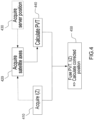
- Figure 4 represents a general flowchart of the processing actions for a use of the data of a server of positioning data, according to several embodiments of the invenfion.
- the data made available on the server 230 can be transmitted to the receivers of the users in multicast mode, or withdrawn on the server, either by an automatic procedure, or by a request procedure of said receivers addressed to said server.
- the distribution of the data of the server can be performed either by message or in http or https mode. A combination of the various modes of distribution is possible, according to the invention.
- Step 410 consists of this broadcasting in multicast mode or the request addressed to the server.
- the receiver acquires the satellite axis or axes in sight.
- the receiver position determined by the server according to a variant of the invention on the basis of data of the mobile radiocommunications operator to which the user of the receiver is subscribed.
- This step makes it possible, combined with the ionospheric error data I(Z) applicable to the receiver, to shorten the delay in acquiring the satellite axes and the convergence delay of the following step of calculating the PVT on the basis of the satellite axes.
- the uncorrected PVT positioning data are calculated by the receiver.
- the PVT data are corrected by fusion with the data I(Z) transmitted by the server.
- the precision of the position measurement provided by the GNSS system is improved by fusion with the data relating to the ionospheric errors transmitted by the server 230.
- the time for acquisition and the time for convergence of the calculations are also improved.
Landscapes
- Engineering & Computer Science (AREA)
- Radar, Positioning & Navigation (AREA)
- Remote Sensing (AREA)
- Computer Networks & Wireless Communication (AREA)
- Physics & Mathematics (AREA)
- General Physics & Mathematics (AREA)
- Position Fixing By Use Of Radio Waves (AREA)
Claims (19)
- Verfahren zum Bestimmen von Fehlern durch einen Computerserver (230) beim Berechnen einer Position, die von Benutzerempfängern (2113, 2223) von Positionierungssignalen berechnet wird, die von mindestens einer Konstellation von Satelliten (114, 119, 121, 123) in einer bestimmten geografischen Zone (210, 220) empfangen werden, wobei das Verfahren Folgendes umfasst:Bestimmen (3110) einer Liste der beitragenden Empfänger Ri (2111, 2112, 2221, 2222) von Positionierungssignalen, die sich in der geografischen Zone Zj (210, 220) befinden, wobei eine genaue Position der beitragenden Empfänger nicht von vornherein bekannt ist;Empfangen (3120) von Daten aus Code Ci und Phase Φi von mindestens einem Kanal des beitragenden Empfängers für jeden der beitragenden Empfänger Ri;Berechnen (3130) eines ersten ionosphärischen Fehlers li, der auf jeden beitragenden Empfänger Ri anwendbar ist, auf der Grundlage der Daten aus Code Ci und Phase Φi;Berechnen (3230, 3240) eines zweiten ionosphärischen Fehlers I(Zj), der in der geografischen Zone Zj anwendbar ist, auf der Grundlage der ersten ionosphärischen Fehler li, die auf die beitragenden Empfänger Ri anwendbar sind; undBereitstellen (330) von Werten der berechneten zweiten ionosphärischen Fehler für die Benutzerempfänger.
- Verfahren nach Anspruch 1, das ferner das Berechnen eines troposphärischen Fehlers für mindestens einen beitragenden Empfänger Ri und das Hinzufügen des troposphärischen Fehlers zu dem ionosphärischen Fehler des mindestens einen beitragenden Empfängers umfasst.
- Verfahren nach Anspruch 2, wobei der troposphärische Fehler für den mindestens einen beitragenden Empfänger Ri als Summe einer ersten Verzögerung, die als "Nassverzögerung" (SWD) bezeichnet wird, und einer zweiten Verzögerung, die als "hydrostatische Verzögerung" (SHD) bezeichnet wird, berechnet wird.
- Verfahren nach einem der Ansprüche 1 bis 3, wobei das Berechnen eines atmosphärischen Fehlers als Eingabe die ionosphärischen Fehler li der beitragenden Empfänger Ri und einen troposphärischen Fehler, der in der geografischen Zone Zj anwendbar ist und von einer externen Quelle von Bereitstellungsinformationen stammt, empfängt.
- Verfahren nach einem der Ansprüche 1 bis 4, wobei das Bestimmen mindestens eines Teils der Liste der beitragenden Empfänger Ri (2221, 2222), die sich in der geografischen Zone befinden, Daten zur Lokalisierung der Empfänger in Bezug auf mindestens eine Basisstation eines zellulären Funkkommunikationsnetzes verwendet.
- Verfahren nach einem der Ansprüche 1 bis 5, das ferner das Klassifizieren von Datenpaaren aus Code Ci und Phase Φi von Kanälen eines beitragenden Empfängers Ri umfasst, wobei das Klassifizieren eine gewichtete Kombination von Kriterien verwendet, die Kriterien umfasst, die für eines oder mehrere von einem Signal-Rausch-Verhältnis des Kanals oder einer Höhe der Satellitenachse des Kanals repräsentativ sind.
- Verfahren nach einem der Ansprüche 1 bis 6, wobei das Berechnen des ersten ionosphärischen Fehlers, der auf einen der beitragenden Empfänger Ri anwendbar ist, das Subtrahieren von Daten der Phase Φi von Codedaten der Daten aus Code Ci und Phase Φi umfasst.
- Verfahren nach einem der Ansprüche 1 bis 7, das ferner das Berechnen (3140, 3150) eines Qualitätsindex IQ(li) des ersten ionosphärischen Fehlers li umfasst, der auf einen der beitragenden Empfänger Ri anwendbar ist, wobei der Qualitätsindex durch eine gewichtete Kombination von Kriterien berechnet wird, die Kriterien umfasst, die für eines oder mehrere von einem Signal-Rausch-Verhältnis eines Kanals des beitragenden Empfängers, einer Höhe einer Satellitenachse, die vom beitragenden Empfänger erfasst wurde, und eine Anzahl erfasster Satellitenachsen repräsentativ sind.
- Verfahren nach Anspruch 8, wobei der Qualitätsindex IQ(li) ferner von Parametern abhängt, die eine oder mehrere einer Hardware- oder einer Softwarekonfiguration des beitragenden Empfängers charakterisieren.
- Verfahren nach einem der Ansprüche 8 bis 9, wobei der zweite ionosphärische Fehler I(Zj), der in der geografischen Zone Zj anwendbar ist, eine lineare Kombination des ersten ionosphärischen Fehlers li der beitragenden Empfänger Ri ist, wobei jeder erster ionosphärische Fehler durch Faktoren gewichtet wird, die den Qualitätsindizes IQ(li) des ersten ionosphärischen Fehlers zugeordnet sind, wobei die Faktoren einem Qualitätsindex entsprechen, der weniger als ein erster Schwellenwert Tresh1, der Null ist, beträgt.
- Verfahren nach einem der Ansprüche 8 bis 10, das ferner das Filtern von Werten des zweiten ionosphärischen Fehlers I(Zj) durch ein Model von ionosphärischen Fehlern umfasst.
- Verfahren nach einem der Ansprüche 8 bis 11, das ferner das Bestimmen eines Vertrauensindikators des zweiten ionosphärischen Fehlers I(Zj) umfasst, wobei der Vertrauensindikator des zweiten ionosphärischen Fehlers von einer Anzahl Nj der beitragenden Empfänger Ri abhängt, deren Qualitätsindex IQ(li) größer als der erste Schwellenwert Thresh1 ist.
- Verfahren nach Anspruch 12, wobei der zweite ionosphärische Fehler I(Zj), wenn sein Vertrauensindikator kleiner als ein zweiter Schwellenwert Thresh2 ist, durch einen Wert ersetzt wird, der von einer oder mehreren einer räumlichen oder einer zeitlichen Interpolation innerhalb einer Reihe von Werten ionosphärischer Fehler, die für benachbarte geografische Zonen oder Zeiträume berechnet wurden, berechnet wird.
- Verfahren, das das Verfahren nach einem der Ansprüche 1 bis 13 umfasst und ferner das Erfassen (430) einer vom Server (230) bestimmten Position der Benutzerempfänger durch jeden der Benutzerempfänger und das Berechnen einer korrigierten Position durch jeden der Benutzerempfänger durch Fusion der PVT-Daten aus Position, Geschwindigkeit und Zeit des Benutzerempfängers und der Werte des zweiten ionosphärischen Fehlers umfasst.
- Server (230) zum Positionieren von Daten, der dazu konfiguriert ist, das Verfahren nach einem der Ansprüche 1 bis 14 durchzuführen.
- Server nach Anspruch 15, der Folgendes umfasst:eine Schaltungslogik, die für das Bestimmen der Liste der beitragenden Empfänger Ri (2111, 2112, 2221, 2222) konfiguriert ist;eine Verarbeitungslogik, die dazu konfiguriert ist, mit einer bestimmten Frequenz zeitliche Datensequenzen von Daten zu erfassen, die von den beitragenden Empfängern Ri der Liste übertragen werden,wobei die zeitlichen Datensequenzen eine oder mehrere von Folgendem umfassen:• der Daten aus Code und Phase mindestens eines Kanals jedes der beitragenden Empfänger Ri, und• ein aus dem Code und der Phase berechnetes Datum,eine Datenlogik, die dazu konfiguriert ist, eine zeitliche Fehlersequenz des zweiten ionosphärischen Fehlers I(Zj) zu berechnen, der in der geografischen Zone Zj anwendbar ist; undeinen Kommunikationslink, um den Benutzerempfängern (2113, 2223) die zeitliche Fehlersequenz bereitzustellen.
- Kollaboratives System zur Unterstützung des Positionierens von Benutzerempfängern (2113, 2223) von Positionierungssignalen, die von mindestens einer Konstellation von Satelliten (114, 119, 121, 123) durch beitragende Empfänger Ri in mindestens einer geografischen Zone Zj (210, 220) empfangen wird, wobei das System einen Server (230) nach Anspruch 15 oder 16 und eine Vielzahl von Empfängern Ri (2111, 2112, 2221, 2222, 2113, 2223) von Positionierungssignalen umfasst.
- System nach Anspruch 17, wobei ein Prozessor mindestens eines der beitragenden Empfänger Ri dazu konfiguriert ist, das Berechnen des ersten ionosphärischen Fehlers li, der in der geografischen Zone auf den beitragenden Empfänger anwendbar ist, anhand der Daten aus Code Ci und Phase Φi durchzuführen, wobei das Ergebnis der Berechnung über einen Kommunikationslink an einen Server (230) übertragen wird.
- System nach Anspruch 18, wobei die Daten aus Code Ci und Phase Φi mindestens eines Kanals mindestens eines beitragenden Empfängers Ri über einen Kommunikationslink an den Server (230) übertragen werden, wobei ein Prozessor des Servers dazu konfiguriert ist, das Berechnen des ersten ionosphärischen Fehlers li, der in der geografischen Zone auf den beitragenden Empfänger Ri anwendbar ist, anhand der Daten aus Code Ci und Phase Φi durchzuführen.
Applications Claiming Priority (2)
| Application Number | Priority Date | Filing Date | Title |
|---|---|---|---|
| FR1458336A FR3025610B1 (fr) | 2014-09-05 | 2014-09-05 | Procede de determination collaborative d'erreurs de positionnement d'un systeme de navigation par satellites |
| PCT/EP2015/070047 WO2016034622A1 (en) | 2014-09-05 | 2015-09-02 | Method of collaborative determination of positioning errors of a satellite-based navigation system |
Publications (2)
| Publication Number | Publication Date |
|---|---|
| EP3189349A1 EP3189349A1 (de) | 2017-07-12 |
| EP3189349B1 true EP3189349B1 (de) | 2024-03-20 |
Family
ID=53008569
Family Applications (1)
| Application Number | Title | Priority Date | Filing Date |
|---|---|---|---|
| EP15763847.9A Active EP3189349B1 (de) | 2014-09-05 | 2015-09-02 | Methode zur kollaborativen bestimmung von positionierungsfehlern eines satellitengestützten navigationssystems |
Country Status (6)
| Country | Link |
|---|---|
| US (1) | US10641902B2 (de) |
| EP (1) | EP3189349B1 (de) |
| KR (1) | KR20170039718A (de) |
| CN (1) | CN107076856A (de) |
| FR (1) | FR3025610B1 (de) |
| WO (1) | WO2016034622A1 (de) |
Families Citing this family (9)
| Publication number | Priority date | Publication date | Assignee | Title |
|---|---|---|---|---|
| US10012738B2 (en) * | 2016-03-24 | 2018-07-03 | Hitachi Zosen Corporation | Positioning method and positioning apparatus using satellite positioning system |
| EP3226034B1 (de) | 2016-04-01 | 2025-03-26 | Centre National d'Etudes Spatiales | Verbesserter gnss-empfänger mit geschwindigkeitsintegration |
| EP3316001B1 (de) | 2016-10-25 | 2024-06-12 | Centre National d'Etudes Spatiales | Gemeinschaftliche verbesserung der positionierung eines fahrzeugs |
| US10304342B2 (en) | 2016-11-08 | 2019-05-28 | Ge Aviation Systems Llc | Ground-based data acquisition system |
| DE102017206275A1 (de) * | 2017-04-12 | 2018-10-18 | Robert Bosch Gmbh | Verfahren zum Betreiben eines Korrekturdienstsystems und Korrekturdienstsystem |
| FR3085082B1 (fr) * | 2018-08-17 | 2020-07-17 | Continental Automotive France | Estimation de la position geographique d'un vehicule routier pour la production participative de base de donnees routieres |
| IL269263B (en) * | 2019-09-10 | 2021-09-30 | Veeride Geo Ltd | A navigation method based on a cell phone |
| CN111045042B (zh) * | 2019-12-20 | 2022-03-04 | 西安空间无线电技术研究所 | 一种基于“云-端”架构的ppp-rtk增强方法与系统 |
| CN120195699B (zh) * | 2025-04-02 | 2026-02-03 | 武汉大学 | 一种基于ppp-rtk的桥梁多模态频率识别方法与系统 |
Citations (1)
| Publication number | Priority date | Publication date | Assignee | Title |
|---|---|---|---|---|
| US20130127658A1 (en) * | 2011-11-22 | 2013-05-23 | Radio Systems Corporation | Method and Apparatus to Determine Actionable Position and Speed in GNSS Applications |
Family Cites Families (21)
| Publication number | Priority date | Publication date | Assignee | Title |
|---|---|---|---|---|
| US5867411A (en) * | 1996-12-19 | 1999-02-02 | The Aerospace Corporation | Kalman filter ionospheric delay estimator |
| US6397147B1 (en) * | 2000-06-06 | 2002-05-28 | Csi Wireless Inc. | Relative GPS positioning using a single GPS receiver with internally generated differential correction terms |
| WO2003069366A1 (en) * | 2002-02-13 | 2003-08-21 | Sirf Technology, Inc. | Ionospheric error prediction and correction in satellite positioning systems |
| US6701253B2 (en) * | 2002-02-19 | 2004-03-02 | Eride, Inc. | Total correction strategy |
| WO2004095055A1 (en) * | 2003-04-17 | 2004-11-04 | Secretary Of State For Defence | Correction of troposphere induced errors in global positioning systems |
| US7289061B2 (en) * | 2004-07-23 | 2007-10-30 | California Institute Of Technology | Generating high precision ionospheric ground-truth measurements |
| US7656352B2 (en) * | 2005-09-20 | 2010-02-02 | Novariant, Inc. | Troposphere corrections for ground based positioning systems |
| FR2929015B1 (fr) * | 2008-03-21 | 2010-04-23 | Thales Sa | Reseau et procede de calcul de corrections ionospheriques |
| US20120119944A1 (en) * | 2010-05-30 | 2012-05-17 | Trimble Navigation Limited | Gnss atmospheric estimation with ambiguity fixing |
| US8803735B2 (en) * | 2010-11-19 | 2014-08-12 | Agjunction Llc | Portable base station network for local differential GNSS corrections |
| DE102011051100A1 (de) * | 2011-06-16 | 2012-12-20 | Universität Kassel | Verfahren und Referenzgerät zur Bereitstellung von Korrektursignalen für ein Satelliten gestütztes Positionsbestimmungssystem |
| CN102426374A (zh) * | 2011-09-02 | 2012-04-25 | 东南大学 | Gps移动基站快速定位与解算方法 |
| CN103018758A (zh) * | 2012-12-03 | 2013-04-03 | 东南大学 | 基于gps/ins/agps的移动差分基站方法 |
| GB2532626B (en) * | 2013-08-07 | 2017-02-22 | Topcon Positioning Systems Llc | Mitigation of scintillations in signals of global navigation satellite systems caused by ionospheric irregularities |
| CN103592653B (zh) * | 2013-10-17 | 2016-08-17 | 中国科学院光电研究院 | 用于局部地区单频卫星导航用户的电离层延迟修正方法 |
| CN103645482A (zh) * | 2013-12-25 | 2014-03-19 | 上海华测导航技术有限公司 | 基于任意点设置的基准站实现gps实时动态测量的方法 |
| EP3106897A1 (de) * | 2015-06-19 | 2016-12-21 | Centre National d'Etudes Spatiales | Gnss-empfänger mit eingebauter fähigkeit zur durchführung eines optimalen fehlerkorrekturverfahrens |
| EP3226034B1 (de) * | 2016-04-01 | 2025-03-26 | Centre National d'Etudes Spatiales | Verbesserter gnss-empfänger mit geschwindigkeitsintegration |
| WO2018034580A1 (en) * | 2016-08-15 | 2018-02-22 | Limited Liability Company "Topcon Positioning Systems" | Adaptive gnss positioning method capable of adjusting to ionospheric delay |
| US10690775B2 (en) * | 2017-06-29 | 2020-06-23 | Novatel Inc. | Crowdsourcing atmospheric correction data |
| DK201870263A1 (en) * | 2018-05-02 | 2019-12-03 | Intelligent Marking Aps | Method for marking a ground surface using a robot unit and a local base station, the system therefore and use thereof |
-
2014
- 2014-09-05 FR FR1458336A patent/FR3025610B1/fr active Active
-
2015
- 2015-09-02 WO PCT/EP2015/070047 patent/WO2016034622A1/en not_active Ceased
- 2015-09-02 CN CN201580047618.6A patent/CN107076856A/zh active Pending
- 2015-09-02 KR KR1020177006063A patent/KR20170039718A/ko not_active Withdrawn
- 2015-09-02 EP EP15763847.9A patent/EP3189349B1/de active Active
- 2015-09-02 US US15/508,296 patent/US10641902B2/en active Active
Patent Citations (1)
| Publication number | Priority date | Publication date | Assignee | Title |
|---|---|---|---|---|
| US20130127658A1 (en) * | 2011-11-22 | 2013-05-23 | Radio Systems Corporation | Method and Apparatus to Determine Actionable Position and Speed in GNSS Applications |
Also Published As
| Publication number | Publication date |
|---|---|
| WO2016034622A1 (en) | 2016-03-10 |
| KR20170039718A (ko) | 2017-04-11 |
| FR3025610A1 (fr) | 2016-03-11 |
| FR3025610B1 (fr) | 2022-01-14 |
| US10641902B2 (en) | 2020-05-05 |
| US20170307761A1 (en) | 2017-10-26 |
| CN107076856A (zh) | 2017-08-18 |
| EP3189349A1 (de) | 2017-07-12 |
Similar Documents
| Publication | Publication Date | Title |
|---|---|---|
| EP3189349B1 (de) | Methode zur kollaborativen bestimmung von positionierungsfehlern eines satellitengestützten navigationssystems | |
| CN115398273B (zh) | 在存在gnss欺骗的情况下确定正确位置 | |
| Odolinski et al. | An assessment of smartphone and low-cost multi-GNSS single-frequency RTK positioning for low, medium and high ionospheric disturbance periods: R. Odolinski, PJG Teunissen | |
| EP3115807B1 (de) | Gnss-empfänger mit eingebauter fähigkeit zur durchführung eines optimalen fehlerkorrekturverfahrens | |
| US6243648B1 (en) | Fast acquisition position reporting system | |
| Marques et al. | Accuracy assessment of Precise Point Positioning with multi-constellation GNSS data under ionospheric scintillation effects | |
| US7800530B2 (en) | Method and system for providing assistance data for A-GPS location of handsets in wireless networks | |
| US11460583B2 (en) | Method and apparatus for providing correction data for satellite navigation | |
| US20040203853A1 (en) | Position determination for a wireless terminal in a hybrid position determination system | |
| CN111045034A (zh) | 基于广播星历的gnss多系统实时精密时间传递方法及系统 | |
| US11686850B2 (en) | Ionosphere grid history and compression for GNSS positioning | |
| US6970785B2 (en) | Device for a mobile terminal for determining position by filtering integrity data from an augmentation device | |
| Chen et al. | Signal‐in‐Space and Positioning Performance of BDS Open Augmentation Service | |
| US20240402349A1 (en) | Delta-ionosphere compensated differential carrier phase (dcp) update | |
| EP4099061A1 (de) | Verfahren zur erzeugung und bereitstellung einer genauen positionierungslösung eines mobilen empfängers in einem gnss-system durch eine zentrale recheneinheit und ein software-produkt und dessen verteilung | |
| CN117368951A (zh) | 一种载波相位模糊度快速固定系统与方法 | |
| CN118818544A (zh) | 数据处理方法及装置、电子设备及存储介质 | |
| Skournetou | Mitigation of dominant channel propagation effects in GNSS-based positioning | |
| HK1232606A1 (en) | Gnss receiver with an on-board capability to implement an optimal error correction mode |
Legal Events
| Date | Code | Title | Description |
|---|---|---|---|
| STAA | Information on the status of an ep patent application or granted ep patent |
Free format text: STATUS: THE INTERNATIONAL PUBLICATION HAS BEEN MADE |
|
| PUAI | Public reference made under article 153(3) epc to a published international application that has entered the european phase |
Free format text: ORIGINAL CODE: 0009012 |
|
| STAA | Information on the status of an ep patent application or granted ep patent |
Free format text: STATUS: REQUEST FOR EXAMINATION WAS MADE |
|
| 17P | Request for examination filed |
Effective date: 20170404 |
|
| AK | Designated contracting states |
Kind code of ref document: A1 Designated state(s): AL AT BE BG CH CY CZ DE DK EE ES FI FR GB GR HR HU IE IS IT LI LT LU LV MC MK MT NL NO PL PT RO RS SE SI SK SM TR |
|
| AX | Request for extension of the european patent |
Extension state: BA ME |
|
| DAV | Request for validation of the european patent (deleted) | ||
| DAX | Request for extension of the european patent (deleted) | ||
| REG | Reference to a national code |
Ref country code: HK Ref legal event code: DE Ref document number: 1240652 Country of ref document: HK |
|
| STAA | Information on the status of an ep patent application or granted ep patent |
Free format text: STATUS: EXAMINATION IS IN PROGRESS |
|
| 17Q | First examination report despatched |
Effective date: 20200417 |
|
| P01 | Opt-out of the competence of the unified patent court (upc) registered |
Effective date: 20230526 |
|
| GRAP | Despatch of communication of intention to grant a patent |
Free format text: ORIGINAL CODE: EPIDOSNIGR1 |
|
| STAA | Information on the status of an ep patent application or granted ep patent |
Free format text: STATUS: GRANT OF PATENT IS INTENDED |
|
| INTG | Intention to grant announced |
Effective date: 20231025 |
|
| GRAS | Grant fee paid |
Free format text: ORIGINAL CODE: EPIDOSNIGR3 |
|
| GRAA | (expected) grant |
Free format text: ORIGINAL CODE: 0009210 |
|
| STAA | Information on the status of an ep patent application or granted ep patent |
Free format text: STATUS: THE PATENT HAS BEEN GRANTED |
|
| AK | Designated contracting states |
Kind code of ref document: B1 Designated state(s): AL AT BE BG CH CY CZ DE DK EE ES FI FR GB GR HR HU IE IS IT LI LT LU LV MC MK MT NL NO PL PT RO RS SE SI SK SM TR |
|
| REG | Reference to a national code |
Ref country code: GB Ref legal event code: FG4D |
|
| REG | Reference to a national code |
Ref country code: CH Ref legal event code: EP Ref country code: HK Ref legal event code: WD Ref document number: 1240652 Country of ref document: HK |
|
| REG | Reference to a national code |
Ref country code: IE Ref legal event code: FG4D |
|
| REG | Reference to a national code |
Ref country code: DE Ref legal event code: R096 Ref document number: 602015087989 Country of ref document: DE |
|
| PG25 | Lapsed in a contracting state [announced via postgrant information from national office to epo] |
Ref country code: LT Free format text: LAPSE BECAUSE OF FAILURE TO SUBMIT A TRANSLATION OF THE DESCRIPTION OR TO PAY THE FEE WITHIN THE PRESCRIBED TIME-LIMIT Effective date: 20240320 |
|
| REG | Reference to a national code |
Ref country code: LT Ref legal event code: MG9D |
|
| PG25 | Lapsed in a contracting state [announced via postgrant information from national office to epo] |
Ref country code: GR Free format text: LAPSE BECAUSE OF FAILURE TO SUBMIT A TRANSLATION OF THE DESCRIPTION OR TO PAY THE FEE WITHIN THE PRESCRIBED TIME-LIMIT Effective date: 20240621 |
|
| PG25 | Lapsed in a contracting state [announced via postgrant information from national office to epo] |
Ref country code: RS Free format text: LAPSE BECAUSE OF FAILURE TO SUBMIT A TRANSLATION OF THE DESCRIPTION OR TO PAY THE FEE WITHIN THE PRESCRIBED TIME-LIMIT Effective date: 20240620 Ref country code: HR Free format text: LAPSE BECAUSE OF FAILURE TO SUBMIT A TRANSLATION OF THE DESCRIPTION OR TO PAY THE FEE WITHIN THE PRESCRIBED TIME-LIMIT Effective date: 20240320 |
|
| REG | Reference to a national code |
Ref country code: NL Ref legal event code: MP Effective date: 20240320 |
|
| PG25 | Lapsed in a contracting state [announced via postgrant information from national office to epo] |
Ref country code: RS Free format text: LAPSE BECAUSE OF FAILURE TO SUBMIT A TRANSLATION OF THE DESCRIPTION OR TO PAY THE FEE WITHIN THE PRESCRIBED TIME-LIMIT Effective date: 20240620 Ref country code: NO Free format text: LAPSE BECAUSE OF FAILURE TO SUBMIT A TRANSLATION OF THE DESCRIPTION OR TO PAY THE FEE WITHIN THE PRESCRIBED TIME-LIMIT Effective date: 20240620 Ref country code: LT Free format text: LAPSE BECAUSE OF FAILURE TO SUBMIT A TRANSLATION OF THE DESCRIPTION OR TO PAY THE FEE WITHIN THE PRESCRIBED TIME-LIMIT Effective date: 20240320 Ref country code: HR Free format text: LAPSE BECAUSE OF FAILURE TO SUBMIT A TRANSLATION OF THE DESCRIPTION OR TO PAY THE FEE WITHIN THE PRESCRIBED TIME-LIMIT Effective date: 20240320 Ref country code: GR Free format text: LAPSE BECAUSE OF FAILURE TO SUBMIT A TRANSLATION OF THE DESCRIPTION OR TO PAY THE FEE WITHIN THE PRESCRIBED TIME-LIMIT Effective date: 20240621 Ref country code: FI Free format text: LAPSE BECAUSE OF FAILURE TO SUBMIT A TRANSLATION OF THE DESCRIPTION OR TO PAY THE FEE WITHIN THE PRESCRIBED TIME-LIMIT Effective date: 20240320 Ref country code: BG Free format text: LAPSE BECAUSE OF FAILURE TO SUBMIT A TRANSLATION OF THE DESCRIPTION OR TO PAY THE FEE WITHIN THE PRESCRIBED TIME-LIMIT Effective date: 20240320 |
|
| REG | Reference to a national code |
Ref country code: AT Ref legal event code: MK05 Ref document number: 1668317 Country of ref document: AT Kind code of ref document: T Effective date: 20240320 |
|
| PG25 | Lapsed in a contracting state [announced via postgrant information from national office to epo] |
Ref country code: SE Free format text: LAPSE BECAUSE OF FAILURE TO SUBMIT A TRANSLATION OF THE DESCRIPTION OR TO PAY THE FEE WITHIN THE PRESCRIBED TIME-LIMIT Effective date: 20240320 Ref country code: LV Free format text: LAPSE BECAUSE OF FAILURE TO SUBMIT A TRANSLATION OF THE DESCRIPTION OR TO PAY THE FEE WITHIN THE PRESCRIBED TIME-LIMIT Effective date: 20240320 |
|
| PG25 | Lapsed in a contracting state [announced via postgrant information from national office to epo] |
Ref country code: NL Free format text: LAPSE BECAUSE OF FAILURE TO SUBMIT A TRANSLATION OF THE DESCRIPTION OR TO PAY THE FEE WITHIN THE PRESCRIBED TIME-LIMIT Effective date: 20240320 |
|
| PG25 | Lapsed in a contracting state [announced via postgrant information from national office to epo] |
Ref country code: NL Free format text: LAPSE BECAUSE OF FAILURE TO SUBMIT A TRANSLATION OF THE DESCRIPTION OR TO PAY THE FEE WITHIN THE PRESCRIBED TIME-LIMIT Effective date: 20240320 |
|
| PG25 | Lapsed in a contracting state [announced via postgrant information from national office to epo] |
Ref country code: IS Free format text: LAPSE BECAUSE OF FAILURE TO SUBMIT A TRANSLATION OF THE DESCRIPTION OR TO PAY THE FEE WITHIN THE PRESCRIBED TIME-LIMIT Effective date: 20240720 |
|
| PG25 | Lapsed in a contracting state [announced via postgrant information from national office to epo] |
Ref country code: SM Free format text: LAPSE BECAUSE OF FAILURE TO SUBMIT A TRANSLATION OF THE DESCRIPTION OR TO PAY THE FEE WITHIN THE PRESCRIBED TIME-LIMIT Effective date: 20240320 Ref country code: PT Free format text: LAPSE BECAUSE OF FAILURE TO SUBMIT A TRANSLATION OF THE DESCRIPTION OR TO PAY THE FEE WITHIN THE PRESCRIBED TIME-LIMIT Effective date: 20240722 |
|
| PG25 | Lapsed in a contracting state [announced via postgrant information from national office to epo] |
Ref country code: ES Free format text: LAPSE BECAUSE OF FAILURE TO SUBMIT A TRANSLATION OF THE DESCRIPTION OR TO PAY THE FEE WITHIN THE PRESCRIBED TIME-LIMIT Effective date: 20240320 |
|
| PG25 | Lapsed in a contracting state [announced via postgrant information from national office to epo] |
Ref country code: CZ Free format text: LAPSE BECAUSE OF FAILURE TO SUBMIT A TRANSLATION OF THE DESCRIPTION OR TO PAY THE FEE WITHIN THE PRESCRIBED TIME-LIMIT Effective date: 20240320 Ref country code: EE Free format text: LAPSE BECAUSE OF FAILURE TO SUBMIT A TRANSLATION OF THE DESCRIPTION OR TO PAY THE FEE WITHIN THE PRESCRIBED TIME-LIMIT Effective date: 20240320 |
|
| PG25 | Lapsed in a contracting state [announced via postgrant information from national office to epo] |
Ref country code: AT Free format text: LAPSE BECAUSE OF FAILURE TO SUBMIT A TRANSLATION OF THE DESCRIPTION OR TO PAY THE FEE WITHIN THE PRESCRIBED TIME-LIMIT Effective date: 20240320 |
|
| PG25 | Lapsed in a contracting state [announced via postgrant information from national office to epo] |
Ref country code: PL Free format text: LAPSE BECAUSE OF FAILURE TO SUBMIT A TRANSLATION OF THE DESCRIPTION OR TO PAY THE FEE WITHIN THE PRESCRIBED TIME-LIMIT Effective date: 20240320 |
|
| PG25 | Lapsed in a contracting state [announced via postgrant information from national office to epo] |
Ref country code: SK Free format text: LAPSE BECAUSE OF FAILURE TO SUBMIT A TRANSLATION OF THE DESCRIPTION OR TO PAY THE FEE WITHIN THE PRESCRIBED TIME-LIMIT Effective date: 20240320 |
|
| PG25 | Lapsed in a contracting state [announced via postgrant information from national office to epo] |
Ref country code: SM Free format text: LAPSE BECAUSE OF FAILURE TO SUBMIT A TRANSLATION OF THE DESCRIPTION OR TO PAY THE FEE WITHIN THE PRESCRIBED TIME-LIMIT Effective date: 20240320 Ref country code: SK Free format text: LAPSE BECAUSE OF FAILURE TO SUBMIT A TRANSLATION OF THE DESCRIPTION OR TO PAY THE FEE WITHIN THE PRESCRIBED TIME-LIMIT Effective date: 20240320 Ref country code: RO Free format text: LAPSE BECAUSE OF FAILURE TO SUBMIT A TRANSLATION OF THE DESCRIPTION OR TO PAY THE FEE WITHIN THE PRESCRIBED TIME-LIMIT Effective date: 20240320 Ref country code: PT Free format text: LAPSE BECAUSE OF FAILURE TO SUBMIT A TRANSLATION OF THE DESCRIPTION OR TO PAY THE FEE WITHIN THE PRESCRIBED TIME-LIMIT Effective date: 20240722 Ref country code: PL Free format text: LAPSE BECAUSE OF FAILURE TO SUBMIT A TRANSLATION OF THE DESCRIPTION OR TO PAY THE FEE WITHIN THE PRESCRIBED TIME-LIMIT Effective date: 20240320 Ref country code: IS Free format text: LAPSE BECAUSE OF FAILURE TO SUBMIT A TRANSLATION OF THE DESCRIPTION OR TO PAY THE FEE WITHIN THE PRESCRIBED TIME-LIMIT Effective date: 20240720 Ref country code: ES Free format text: LAPSE BECAUSE OF FAILURE TO SUBMIT A TRANSLATION OF THE DESCRIPTION OR TO PAY THE FEE WITHIN THE PRESCRIBED TIME-LIMIT Effective date: 20240320 Ref country code: EE Free format text: LAPSE BECAUSE OF FAILURE TO SUBMIT A TRANSLATION OF THE DESCRIPTION OR TO PAY THE FEE WITHIN THE PRESCRIBED TIME-LIMIT Effective date: 20240320 Ref country code: CZ Free format text: LAPSE BECAUSE OF FAILURE TO SUBMIT A TRANSLATION OF THE DESCRIPTION OR TO PAY THE FEE WITHIN THE PRESCRIBED TIME-LIMIT Effective date: 20240320 Ref country code: AT Free format text: LAPSE BECAUSE OF FAILURE TO SUBMIT A TRANSLATION OF THE DESCRIPTION OR TO PAY THE FEE WITHIN THE PRESCRIBED TIME-LIMIT Effective date: 20240320 |
|
| PG25 | Lapsed in a contracting state [announced via postgrant information from national office to epo] |
Ref country code: IT Free format text: LAPSE BECAUSE OF FAILURE TO SUBMIT A TRANSLATION OF THE DESCRIPTION OR TO PAY THE FEE WITHIN THE PRESCRIBED TIME-LIMIT Effective date: 20240320 |
|
| REG | Reference to a national code |
Ref country code: DE Ref legal event code: R097 Ref document number: 602015087989 Country of ref document: DE |
|
| PG25 | Lapsed in a contracting state [announced via postgrant information from national office to epo] |
Ref country code: IT Free format text: LAPSE BECAUSE OF FAILURE TO SUBMIT A TRANSLATION OF THE DESCRIPTION OR TO PAY THE FEE WITHIN THE PRESCRIBED TIME-LIMIT Effective date: 20240320 |
|
| PG25 | Lapsed in a contracting state [announced via postgrant information from national office to epo] |
Ref country code: DK Free format text: LAPSE BECAUSE OF FAILURE TO SUBMIT A TRANSLATION OF THE DESCRIPTION OR TO PAY THE FEE WITHIN THE PRESCRIBED TIME-LIMIT Effective date: 20240320 |
|
| PLBE | No opposition filed within time limit |
Free format text: ORIGINAL CODE: 0009261 |
|
| STAA | Information on the status of an ep patent application or granted ep patent |
Free format text: STATUS: NO OPPOSITION FILED WITHIN TIME LIMIT |
|
| PG25 | Lapsed in a contracting state [announced via postgrant information from national office to epo] |
Ref country code: DK Free format text: LAPSE BECAUSE OF FAILURE TO SUBMIT A TRANSLATION OF THE DESCRIPTION OR TO PAY THE FEE WITHIN THE PRESCRIBED TIME-LIMIT Effective date: 20240320 |
|
| 26N | No opposition filed |
Effective date: 20241223 |
|
| PG25 | Lapsed in a contracting state [announced via postgrant information from national office to epo] |
Ref country code: MC Free format text: LAPSE BECAUSE OF FAILURE TO SUBMIT A TRANSLATION OF THE DESCRIPTION OR TO PAY THE FEE WITHIN THE PRESCRIBED TIME-LIMIT Effective date: 20240320 Ref country code: SI Free format text: LAPSE BECAUSE OF FAILURE TO SUBMIT A TRANSLATION OF THE DESCRIPTION OR TO PAY THE FEE WITHIN THE PRESCRIBED TIME-LIMIT Effective date: 20240320 |
|
| REG | Reference to a national code |
Ref country code: CH Ref legal event code: PL |
|
| PG25 | Lapsed in a contracting state [announced via postgrant information from national office to epo] |
Ref country code: LU Free format text: LAPSE BECAUSE OF NON-PAYMENT OF DUE FEES Effective date: 20240902 |
|
| REG | Reference to a national code |
Ref country code: BE Ref legal event code: MM Effective date: 20240930 |
|
| PG25 | Lapsed in a contracting state [announced via postgrant information from national office to epo] |
Ref country code: BE Free format text: LAPSE BECAUSE OF NON-PAYMENT OF DUE FEES Effective date: 20240930 |
|
| PG25 | Lapsed in a contracting state [announced via postgrant information from national office to epo] |
Ref country code: CH Free format text: LAPSE BECAUSE OF NON-PAYMENT OF DUE FEES Effective date: 20240930 |
|
| PG25 | Lapsed in a contracting state [announced via postgrant information from national office to epo] |
Ref country code: IE Free format text: LAPSE BECAUSE OF NON-PAYMENT OF DUE FEES Effective date: 20240902 |
|
| PGFP | Annual fee paid to national office [announced via postgrant information from national office to epo] |
Ref country code: DE Payment date: 20250829 Year of fee payment: 11 |
|
| PGFP | Annual fee paid to national office [announced via postgrant information from national office to epo] |
Ref country code: GB Payment date: 20250829 Year of fee payment: 11 |
|
| PGFP | Annual fee paid to national office [announced via postgrant information from national office to epo] |
Ref country code: FR Payment date: 20250829 Year of fee payment: 11 |
|
| PG25 | Lapsed in a contracting state [announced via postgrant information from national office to epo] |
Ref country code: CY Free format text: LAPSE BECAUSE OF FAILURE TO SUBMIT A TRANSLATION OF THE DESCRIPTION OR TO PAY THE FEE WITHIN THE PRESCRIBED TIME-LIMIT; INVALID AB INITIO Effective date: 20150902 |
|
| PG25 | Lapsed in a contracting state [announced via postgrant information from national office to epo] |
Ref country code: HU Free format text: LAPSE BECAUSE OF FAILURE TO SUBMIT A TRANSLATION OF THE DESCRIPTION OR TO PAY THE FEE WITHIN THE PRESCRIBED TIME-LIMIT; INVALID AB INITIO Effective date: 20150902 |