EP3220165A2 - Support d'une estimation d'emplacements de satellite - Google Patents
Support d'une estimation d'emplacements de satellite Download PDFInfo
- Publication number
- EP3220165A2 EP3220165A2 EP17159123.3A EP17159123A EP3220165A2 EP 3220165 A2 EP3220165 A2 EP 3220165A2 EP 17159123 A EP17159123 A EP 17159123A EP 3220165 A2 EP3220165 A2 EP 3220165A2
- Authority
- EP
- European Patent Office
- Prior art keywords
- satellite
- time
- error component
- values
- locations
- Prior art date
- Legal status (The legal status is an assumption and is not a legal conclusion. Google has not performed a legal analysis and makes no representation as to the accuracy of the status listed.)
- Granted
Links
Images



Classifications
-
- G—PHYSICS
- G01—MEASURING; TESTING
- G01S—RADIO DIRECTION-FINDING; RADIO NAVIGATION; DETERMINING DISTANCE OR VELOCITY BY USE OF RADIO WAVES; LOCATING OR PRESENCE-DETECTING BY USE OF THE REFLECTION OR RERADIATION OF RADIO WAVES; ANALOGOUS ARRANGEMENTS USING OTHER WAVES
- G01S19/00—Satellite radio beacon positioning systems; Determining position, velocity or attitude using signals transmitted by such systems
- G01S19/01—Satellite radio beacon positioning systems transmitting time-stamped messages, e.g. GPS [Global Positioning System], GLONASS [Global Orbiting Navigation Satellite System] or GALILEO
- G01S19/13—Receivers
- G01S19/24—Acquisition or tracking or demodulation of signals transmitted by the system
- G01S19/27—Acquisition or tracking or demodulation of signals transmitted by the system creating, predicting or correcting ephemeris or almanac data within the receiver
-
- G—PHYSICS
- G01—MEASURING; TESTING
- G01S—RADIO DIRECTION-FINDING; RADIO NAVIGATION; DETERMINING DISTANCE OR VELOCITY BY USE OF RADIO WAVES; LOCATING OR PRESENCE-DETECTING BY USE OF THE REFLECTION OR RERADIATION OF RADIO WAVES; ANALOGOUS ARRANGEMENTS USING OTHER WAVES
- G01S19/00—Satellite radio beacon positioning systems; Determining position, velocity or attitude using signals transmitted by such systems
- G01S19/38—Determining a navigation solution using signals transmitted by a satellite radio beacon positioning system
- G01S19/39—Determining a navigation solution using signals transmitted by a satellite radio beacon positioning system the satellite radio beacon positioning system transmitting time-stamped messages, e.g. GPS [Global Positioning System], GLONASS [Global Orbiting Navigation Satellite System] or GALILEO
- G01S19/40—Correcting position, velocity or attitude
Definitions
- the invention relates to the field of satellite signal based positioning and more specifically to supporting an estimation of satellite locations.
- Satellite locations may have to be estimated in the scope of a satellite signal based positioning.
- a satellite signal based positioning may be based for example on any kind of present and/or future Global Navigation Satellite System (GNSS), such as the Global Positioning System (GPS), GLONASS, Galileo, the BeiDou Navigation Satellite System (BDS), etc., or any combination thereof.
- GNSS Global Navigation Satellite System
- GPS Global Positioning System
- GLONASS Global Positioning System
- Galileo Galileo
- BDS BeiDou Navigation Satellite System
- satellites orbiting the Earth transmit signals that a receiver may use to calculate its own position.
- the signals transmitted by a satellite convey a message, and a part of the message comprises a set of parameter values of an orbit model defining an orbit of the satellite for a limited period of time.
- Such parameter values are referred to in some of the GNSSs as the broadcast ephemeris (BE). They can be used by the receiver to compute the location of the satellite, for example in an Earth-Centered-Earth-Fixed (ECEF) coordinate system. Based on the estimated locations of a plurality of satellites and the propagation time of the signals, the receiver may compute its own position.
- ECEF Earth-Centered-Earth-Fixed
- the propagation time may be estimated from a time of transmission of the satellite signal indicated in the message and a measured time of arrival of the satellite signal at the receiver.
- the parameter values of the orbit model have a certain, limited validity time, during which the satellite's location can be estimated with a desired accuracy. Positioning accuracy decreases as the age of the parameter values for a satellite increases, and eventually the receiver must receive a new set of parameter values of the orbit model before it can continue with positioning.
- Ephemeris extension service EES It is usually performed on-device at the receiver, with or without the usage of external assistance data.
- the orbit of a satellite is predicted by integrating output values of an equation of motion defined for the satellite.
- the last reliable satellite location that can be determined with broadcast ephemeris data may be used as an initial state of the orbit for the integration.
- the equation of motion is also called force model, as it is based on forces acting on the satellite. Ideally the equation of motion includes all the forces affecting the satellite. However, in practice it may not feasible to model all the forces and typically the equation of motion includes only the four major forces: gravitational forces of the Earth, the Sun and the Moon and solar radiation pressure.
- a method comprises computing a first plurality of locations of a satellite of a satellite navigation system for a plurality of points in time based on a first set of parameters values of an orbit model, the first set of parameters values broadcast by the satellite for a first validity period.
- the method further comprises computing a second plurality of locations of the satellite for the plurality of points in time based on at least one second set of parameter values of an orbit model, the at least one second set of parameter values broadcast by the satellite earlier than the first set of parameter values for at least one second validity period, wherein for computing the first plurality of locations and the second plurality of locations of the satellite, the first validity period or the at least one second validity period is extended by an equation of motion for the satellite, which includes at least one force acting on the satellite.
- the method further comprises computing a value of at least one error component for each of the plurality of points in time by comparing the computed first plurality of locations of the satellite with the computed second plurality of locations of the satellite.
- the method further comprises fitting parameter values of a model having at least one periodic component to the computed values of the at least one error component to obtain a model of a time-evolution of values of the at least one error component.
- the method further comprises providing the model of the time-evolution of the values of the at least one error component as a basis for a correction of locations of the satellite that are computed based on the first set of parameter values for points in time outside of the first validity period.
- the actions of the method may be performed by an apparatus.
- a first apparatus which comprises means for performing the actions of any one embodiment of the described method.
- the means of this apparatus can be implemented in hardware and/or software. They may comprise for instance a processor for executing computer program code for realizing the required functions, a memory storing the program code, or both. Alternatively, they could comprise for instance circuitry that is designed to realize the required functions, for instance implemented in a chipset or a chip, like an integrated circuit.
- the apparatus may comprise a single means for all functions, a common plurality of means for all functions, or a plurality of different means for different functions.
- a second apparatus which comprises at least one processor and at least one memory including computer program code, the at least one memory and the computer program code with the at least one processor configured to cause the apparatus at least to perform the actions of any one embodiment of the presented method.
- non-transitory computer readable storage medium in which computer program code is stored.
- the computer program code causes an apparatus to perform the actions of any one embodiment of the presented method when executed by the processor.
- the computer readable storage medium could be for example a disk or a memory or the like.
- the computer program code could be stored in the computer readable storage medium in the form of instructions encoding the computer-readable storage medium.
- the computer readable storage medium may be intended for taking part in the operation of a device, like an internal or external hard disk of a computer, or be intended for distribution of the program code, like an optical disc.
- Any of the described apparatuses may comprise only the indicated components or one or more additional components.
- the described method is an information providing method
- the described first apparatus is an information providing apparatus
- the means of the described first apparatus are processing means.
- the methods are methods for supporting and estimation of satellite locations.
- the apparatuses are apparatuses for supporting an estimation of satellite locations.
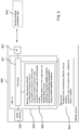
- Figure 1 is a schematic block diagram of an example embodiment of any apparatus according to the invention.
- Apparatus 100 comprises a processor 101 and, linked to processor 101, a memory 102.
- Memory 102 stores computer program code for supporting an estimation of satellite locations.
- Processor 101 is configured to execute computer program code stored in memory 102 in order to cause an apparatus to perform desired actions.
- Memory 102 is thus an example embodiment of a non-transitory computer readable storage medium, in which computer program code according to the invention is stored.
- Apparatus 100 could be any kind of mobile device that is configured to be operable as well when in motion.
- An example of a mobile device may be a mobile communication device, a smartphone, a navigation device, a camera, a device comprising a camera, a mobile computing device, or a laptop, etc. It could be a handheld device or a device that is meant to be integrated into a larger mobile entity, for instance a navigation device that is integrated into a vehicle.
- Apparatus 100 could also be a stationary device, which is configured to operate only when stationary.
- An example of a stationary device may be a server.
- Apparatus 100 could equally be a component, like a chip, circuitry on a chip or a plug-in board, for any mobile or stationary device.
- apparatus 100 could comprise various other components, like a camera, a data interface configured to enable an exchange of data with a server or any other device, a satellite signal receiver, a user interface like a touchscreen, a further memory, a further processor,
- Processor 101 and the program code stored in memory 102 cause an apparatus to perform the operation when the program code is retrieved from memory 102 and executed by processor 101.
- the apparatus that is caused to perform the operation can be apparatus 100 or some other apparatus, for example but not necessarily a device comprising apparatus 100.
- the apparatus computes a first plurality of locations of a satellite of a satellite navigation system for a plurality of points in time based on a first set of parameters values of an orbit model, the first set of parameters values broadcast by the satellite for a first validity period.
- the satellite navigation system may be a GNSS, but it may equally be for instance an autonomous regional satellite navigation system, or a global or regional satellite-based augmentation system (SBAS).
- SBAS global or regional satellite-based augmentation system
- An example for a regional satellite-based augmentation system is the Quasi-Zenith Satellite System (QZSS).
- the apparatus moreover computes a second plurality of locations of the satellite for the plurality of points in time based on at least one second set of parameter values of an orbit model, the at least one second set of parameter values broadcast by the satellite earlier than the first set of parameter values for at least one second validity period.
- the first validity period or the at least one second validity period is extended by an equation of motion for the satellite, which includes at least one force acting on the satellite.
- Each set of parameter values may contain values of parameters of an orbit model defining the orbit of a particular satellite for a certain validity period.
- the validity period may be a period of predetermined length, for example a period in which a location of the satellite computed based on the set of parameter values is expected to have a desired accuracy.
- the at least one second validity period may differ entirely or partially from the first validity period.
- the at least one second set of parameter values may comprise one or more sets of parameter values, each having its own validity period. Several second sets of parameter values may thus cover several spaced apart, adjacent and/or overlapping validity periods.
- the location of the satellite is thus computed twice for several points in time using different sets of parameter values as a basis in each case.
- One of the computations for each point in time may be performed using as a basis a set of parameter values having a validity period which comprises the respective point in time so that it may be assumed that the computed location is quite accurate.
- the other one of the computations for each point in time may be performed using as a basis a set of parameter values having a validity period which does not comprise the respective point in time.
- a force model may be used in addition to the respective set of parameter values for predicting the satellite location at the required point in time.
- the apparatus moreover computes a value of at least one error component for each of the plurality of points in time by comparing the computed first plurality of locations of the satellite with the computed second plurality of locations of the satellite.
- the values of the error components may be determined for each point in time for instance based on a discrepancy between a respective location that has been computed for this point in time based on the currently received first set of parameter values and a location that has been computed for this point in time based on one of the at least one stored second set of parameter values.
- a model of a time-evolution may thus be a general model that has a frequency component and that is adapted to a particular satellite for a certain span of time by setting parameter values of the general model accordingly.
- the model of the time-evolution may allow estimating a value of an error component for any point in time.
- the apparatus moreover provides the model of the time-evolution of values of the at least one error component as a basis for a correction of locations of the satellite that are computed based on the first set of parameter values for points in time outside of the first validity period. (action 205) It is to be understood that if the model of the time-evolution is provided for use at a separate device, only parameter values specifying a general model may be provided.
- the invention is based on the consideration that while conventional orbit model extension methods can be used to extend the life span of orbit model data taking account of the four major forces, the forces left out from the equation of motion, also called unmodeled forces, are relatively small, but still give a significant contribution to the orbital error in long orbit predictions ranging from several days to weeks. Moreover, there are further sources of orbital errors, including inaccuracies in the models, inaccuracies in the initial state of the satellite and inaccuracies in the model parameters. Such inaccuracies in the model parameters may relate, for example, to Earth orientation parameters used in coordinate transformations. Improving the force model and the initial state estimation increases the complexity of the force model and thus the computational load with relatively small reduction in the orbital errors.
- the orbital errors in long predictions are mainly caused by inaccuracies in the prediction model and by leaving out some of the smaller forces, the orbit errors may not be completely random in nature. Rather, most predictions may contain systematic features.
- the orbital errors may contain systematic features in that they may comprise a certain periodicity and in that they may increase in a manner that may be reflected by a model.
- a prediction model for a time-evolution of values of at least one error component is determined based on at least two sets of parameter values broadcast by a satellite of a satellite navigation system by exploiting systematic characteristics of the values of the at least one error component.
- Each set of parameter values broadcast by the satellite enables a computation of a location of the satellite at different points in time and is provided for a respective validity period.
- the at least one error component is an error component that is expected to occur when computing locations of the satellite based on one of the sets of parameter values outside of the respectively associated validity period, even if using some extension measures.
- the prediction model for the time-evolution may thus be provided as a basis for correcting locations of the satellite that are computed based on the first set of parameter values when the locations are computed outside of the validity period of the first set of parameters.
- the value of one or more error components may be predicted based on the prediction model as a function of time separately for each satellite location that is to be corrected.
- Certain embodiments of the invention may thus have the effect that the value of one or more error components occurring in orbit predictions can be reduced without introducing additional terms to an equation of motion for the satellite.
- the approach may be computationally light, that is, it may require little additional processor time. Nevertheless, the quality of satellite locations that are estimated outside of the validity time of the used set of parameters may be increased significantly. Also the time during which a set of parameters can be used may be extended.
- Apparatus 100 illustrated in Figure 1 and the method illustrated in Figure 2 may be implemented and refined in various ways.
- the apparatus may receive the first and second sets of parameter values for example directly from the satellite by means of a satellite signal receiver of the apparatus, or via a satellite signal receiver of a device comprising the apparatus.
- the apparatus may receive the sets of parameter values from a separate entity, for instance from a positioning assistance server.
- At least some of the sets of parameter values may be stored before being processed, for example in the apparatus or in a device comprising the apparatus or in any memory that is accessible to the apparatus.
- the points in time for which two sets of satellite locations are computed may be selected for instance depending on the availability of sets of parameter values and associated validity periods.
- the plurality of points in time for which the first plurality of locations of the satellite are computed lie outside of the first validity period.
- Computing the first plurality of locations of the satellite for the plurality of points in time may then comprise extending the first validity period by an equation of motion for the satellite, which models at least one force acting on the satellite.
- the equation of motion may be used in this case for instance for a backward prediction of the satellite locations.
- the plurality of points in time for which the second plurality of locations of the satellite are computed lie outside of the at least one second validity period.
- Computing the second plurality of locations of the satellite for the plurality of points in time may then comprise extending the at least one second validity period by an equation of motion for the satellite, which models at least one force acting on the satellite.
- the equation of motion may be used in this case for instance for a forward prediction of the satellite locations.
- the at least one force may comprise in both embodiments for instance the gravitational forces of the Earth, the Sun and the Moon and solar radiation pressure, as the four major forces. Still, it is to be understood that one or more of these major forces may be omitted and/or that one or more minor forces may be added.
- Computing a location of the satellite based on a particular set of parameter values at a particular point in time outside of the validity period of the particular set of parameter values may comprise computing a location of the satellite based on the particular set of parameter values for a point in time within the validity period as an initial state for an integration of output values of the equation of motion for the satellite.
- each of the first set of parameter values and the at least one second set of parameter values comprises a respective set of ephemeris data.
- the ephemeris data may be ephemeris data broadcast by any satellite navigation system satellite, for example a GPS satellite, a BeiDou satellite, a GLONASS satellite or a Galileo satellite.
- Ephemeris data can be used to accurately calculate the location of a satellite at a particular point in time, as long as the point in time lies within the prescribed validity period.
- the prescribed validity period may depend on the type of satellite navigation system. It may be, for example, approximately four hours.
- Prior information about the parameter values of the model having at least one periodic component can be utilized by using regularized optimization.
- the first plurality of locations of the satellite and the second plurality of locations of the satellite are computed as coordinates in an Earth centered, Earth fixed coordinate system.
- Computing a value of at least one error component for each of the plurality of points in time by comparing the computed first plurality of locations of the satellite with the computed second plurality of locations of the satellite may then comprise transforming deviations between the computed first plurality of locations of the satellite and the computed second plurality of locations of the satellite into values of at least one error component in a Radial-Tangential-Normal coordinate system.
- the Radial-Tangential-Normal coordinate system may be a system in which a radial coordinate R points from the center of the Earth to the satellite, in which a normal coordinate N points to the direction of the cross product of the position and the velocity of the satellite, and in which a tangential coordinate T points to the direction of the cross product of vectors pointing in N and R directions.
- the cross product may be used so that components are perpendicular to each other.
- the error components may have a clearly characteristic behavior, in particular a systematic periodical behavior.
- Modeling the time-evolution of error components in a Radial-Tangential-Normal coordinate system may therefore have the effect that the errors may be modeled particularly well and using simple error curves. It is to be understood, however, that other coordinate systems may be used just the same, and that a transformation between coordinate systems is not essential to the presented approach.
- the at least one error component comprises a radial error component and/or a tangential error component and/or a normal error component of a Radial-Tangential-Normal satellite centered coordinate system. Any combination of these error components may be considered. Radial and tangential errors may have the largest contribution to the error of a computed location of a satellite. In order to achieve a satisfactory effect of the achievable error reduction with limited effort, thus a radial error component and a tangential error component may be considered, while a normal error component may be neglected. It is to be understood that additional components may be considered as well. Furthermore, it is to be understood that other error components may be considered in case any other coordinate system is used.
- the at least one error component comprises at least two error components and the model of a time-evolution of the values of the at least one error component comprises a separate error function for each of the at least two error components. This may have the effect that the influence of each component may be reflected individually and thus more precisely.
- the at least one error component comprises at least a radial error component and a tangential error component of a Radial-Tangential-Normal satellite centered coordinate system.
- the phases of a radial error component and the phase of a tangential error component may have a strong correlation. Therefore, a phase of an error function for the radial error component obtained by fitting parameter values of the model having at least one periodic component to the computed values of the radial error component may be used in fitting parameter values of the model having at least one periodic component to the computed values of the tangential error component to obtain an error function for the tangential error component. This may have the effect that the number of parameters that have to be considered can be reduced and that a more accurate estimate may be obtained.
- fitting parameter values of a model having at least one periodic component to the computed values of the at least one error component comprises applying a non-linear optimization algorithm, for example a non-linear least square fitting algorithm.
- a non-linear optimization algorithm for example a non-linear least square fitting algorithm.
- Such an algorithm may be for instance a Levenberg-Marquardt algorithm, which may converge with a particularly high probability.
- Any other optimization algorithm like a Gauß-Newton algorithm or a Gradient-Decent algorithm, may be used as well, though.
- a quality of the obtained model of a time-evolution of the values of the at least one error component is monitored. Based on the monitored quality, a repetition rate of obtaining a model of a time-evolution of the values of the at least one error component may be adjusted. This may have the effect that poor optimization results may be detected and that their effect be minimized.
- a location of the satellite at a particular point in time may furthermore be computed based on the first set of parameter values.
- a value of the at least one error component for the particular point in time may then be estimated using the provided model of the time-evolution of the values of the at least one error component.
- the computed location of the satellite may be corrected based on the estimated value of the at least one error component.
- a position of the apparatus at the particular point in time may then be computed using the corrected location of the satellite. It is to be understood that in this latter computation, the location or corrected location of other satellites will be considered in addition.
- an accurate position of a satellite may be determined with long intervals between the receipt or extraction or decoding of respectively new broadcast parameter values.
- an initial location may be computed based on the first set of parameter values, which may then be used as a starting point for predicting the location at the particular point in time using an equation of motion or force model.
- Figure 3 is a schematic block diagram of an example embodiment of a system according to the invention.
- the system supports the estimation of satellite locations at a mobile device.
- the system comprises a mobile device 300 and, optionally, a server 310.
- Mobile device 300 may be for instance a mobile communication device, like a smartphone, or a navigation device that is integrated in a vehicle, or any other mobile device that may have to be positioned.
- Mobile device 300 comprises a processor 301 that is linked to a first memory 302, to a second memory 304, to a GNSS receiver 306 and to a communication interface 307.
- Processor 301 is configured to execute computer program code, including computer program code stored in memory 302, in order to cause mobile device 300 to perform desired actions.
- Memory 302 stores computer program code for modeling a time-evolution of error components of satellite orbit models which are to be extended beyond their respective validity period; computer program code for computing satellite locations based on orbit models that may or may not be extended; computer program code for estimating values of error components for various satellites for a particular point in time based on a modeled time evolution of the error components; computer program code for correcting computed locations of satellites based on computed values of error components; and computer program code for performing positioning computations using the corrected locations of satellites.
- the computer program code may comprise for example similar program code as memory 102.
- memory 302 could store computer program code configured to realize other functions, for instance program code for application making use of computed positions of mobile device 300.
- memory 302 could also store other kind of data.
- Processor 301 and memory 302 may optionally belong to a chip or an integrated circuit 303, which may comprise in addition various other components, for instance a further processor or memory. It may comprise for instance a working memory for processor 301.
- Memory 304 is configured to store data, for example, sets of ephemeris data that have been broadcast by various satellites of one or more GNSS.
- Each set of ephemeris data constitutes a set of parameter values specifying an orbit model for a particular satellite for a particular validity period.
- determined parameter values for a model of a time-evolution of error components may be stored for various satellites.
- GNSS receiver 306 is configured to receive signals from satellites of one or more GNSS.
- it could be a receiver for BeiDou and/or GPS satellite signals, but it could be a receiver for any other GNSS satellite signals as well. It is configured to perform measurements on these satellite signals, to extract navigation messages including ephemeris data and to decode the navigation messages.
- Communication interface 307 may be for instance a data interface. It may enable a communication via a cellular communication network or via a wireless local area network or via Bluetooth, etc. It is to be understood that mobile device 300 may comprise several types of communication interfaces. Communication interface 307 may be for instance a comprehensive communication component, like a cellular engine and an associated transceiver. Alternatively, it may comprise only a transceiver, which may be controlled by processor 301 when executing corresponding program code from memory 302.
- Component 303 or mobile device 300 could be an example embodiment of an apparatus according to the invention.
- Server 310 may be a positioning assistance server or any other kind of server that is configured to provide assistance data to mobile devices via any suitable communication network. It may be configured, for instance, to provide data to mobile devices via the Internet and further via any kind of wireless link. Alternatively, it could be for instance a part of a cellular network, via which the data may be transmitted.
- the assistance data provided by the server 310 may be of different kinds. It may include for example a reference location, ionosphere corrections, or entire sets of ephemeris data for various satellites, etc.
- Figures 4 and 9 are flow charts illustrating operations at mobile device 300.
- Processor 301 and some of the program code stored in memory 302 cause mobile device 300 to perform the presented operations when the program code is retrieved from memory 302 and executed by processor 301.
- Figures 5 to 8 are diagrams illustrating an example error compensation that may be achieved with the operations in Figures 4 and 9 .
- Figure 4 illustrates an example modeling of the time-evolution of error components.
- the operation is performed for a plurality of satellites.
- the processing for different satellites may be performed in parallel, as far as the satellites are visible at the same time, or subsequently over time.
- Mobile device 300 regularly receives signals transmitted by visible GNSS satellites via GNSS receiver 306.
- GNSS receiver 306 performs measurements on the signals to obtain a satellite ID of a respective satellite and to determine a time of arrival of navigation messages.
- the content of navigation messages including the current set of ephemeris data of the satellite may only be decoded from time to time.
- one set of ephemeris data may be obtained each day during four consecutive days once every second week.
- the operations of GNSS receiver 306 may optionally be supported by any kind of assistance data that may be provided by server 310.
- Processor 301 receives the sets of ephemeris data from GNSS receiver 306 and causes storage of the sets of ephemeris data in memory 304.
- four sets of ephemeris data with four different validity periods of e.g. 4 hours are available.
- the operation illustrated in Figure 4 starts with receipt of the latest set of ephemeris data, which has a first validity period.
- This set of ephemeris data may be received at processor 301 directly from GNSS receiver 306; or the data may be stored first in memory 304 and received at processor 301 from memory 304 for action 401.
- the latest set of ephemeris data is to be used for the next two weeks as a basis for determining the location of the satellite.
- the error in the determined satellite location increases significantly over time, even if using a force model for predicting the location.
- SISRE Signal In Space Range Error
- GPS ⁇ ⁇ R ⁇ c ⁇ t 2 + 1 49 ⁇ ⁇ T 2 + ⁇ ⁇ N 2
- ⁇ ⁇ R ⁇ c ⁇ t 2 , ⁇ ⁇ T 2 and ⁇ ⁇ N 2 describe errors in the radial (R), tangential (T) and normal (N) directions respectively.
- the radial error component ⁇ ⁇ R ⁇ c ⁇ t 2 includes the effects of satellite's clock offset and radial orbital error.
- the radial error is the most significant component in the SISRE.
- the tangential error usually grows very fast compared to the radial and normal errors and becomes significant in very long predictions.
- the scale of the normal error is usually comparable to the radial error and gives therefore a very small contribution to the overall SISRE.
- the SISRE is required to stay within a predefined threshold. Therefore, reducing the radial and tangential orbital error components may result in longer validity and better quality of the ephemeris extension.
- the error components contain systematic features. For illustration, a typical evolution of the radial error component in meters [m] over a prediction length in days [d] when using a conventional force model based ephemeris extension is illustrated in Figure 5 for a selected GPS satellite.
- the time-evolution of the radial and tangential error components can be modeled by means of separate error functions for each component.
- f R ( t, p R ) and f T ( t, p T ) be example functions of a general model describing the error components in radial (R) and tangential (T) directions at time t.
- the vectors p R and p T contain parameters of unknown values.
- Unmodeled forces usually behave in frequencies of one-cycle-per-orbital-revolution (1 CPR) and therefore Tis given by the orbital period of the satellite. Most of the errors are in frequencies of 1 CPR, but other significant frequencies may also be identified, such as the frequency of orbiting of the Moon. Sinusoidal components in other frequencies may also be added to equation (2) to take into account such forces.
- the function for the tangential error component may be defined in a similar manner.
- the functions f R ( t , p R ) and f T ( t, p T ) thus comprise parameters that have to be specified for each satellite and the current time. This may be achieved by fitting the functions and thus the general model as a whole to a number of values of the respective error component that are determined for different points in time.
- mobile device 300 retrieves the latest sets of ephemeris data having a respective earlier validity period than the first validity period from memory 304. (action 402)
- the points in time may lie in the past and precede the associated validity period, meaning that a backward prediction is performed using a force model.
- the points in time may be selected such that each point in time lies within one of the mentioned earlier validity periods.
- the locations may be estimated in an ECEF coordinate system.
- the final term a SRP is the acceleration caused by the solar radiation pressure.
- r ⁇ sat denotes the second derivative of the position of the satellite. Note that positions, velocities and accelerations are 3-dimensional vectors.
- the models for the acceleration terms may be defined as described in the following:
- the Sun and the Moon are considered as point masses and the accelerations caused by them are calculated in a similar way.
- a SRP ⁇ ⁇ 1 1 r Sun e Sun + ⁇ 2 e y , where ⁇ 1 and ⁇ 2 are parameters which are estimated for each satellite individually.
- Parameter ⁇ determines if the satellite is fully or partially in Earth's shadow.
- the length of time for which a set of ephemeris data is valid varies between different satellite systems, so that at least for some systems, more than one retrieved set of ephemeris data may be needed to obtain a sufficient number and time span of observations.
- the satellite locations may be computed again in an ECEF coordinate system.
- Mobile device 300 may now compute for each point in time a deviation of the first satellite location computed in action 403 compared to the second satellite location computed in action 404.
- the deviation may be transformed into an RTN coordinate system.
- Figure 6 is a diagram presenting an example of a true radial error in meters in the orbit of a particular satellite that is predicted based on a single set of ephemeris data with force model based forward prediction over two weeks and force model based backward prediction over four days.
- the true radial error is indicated with a dotted line (labeled "Radial error”).
- Figure 6 furthermore presents example values of a radial error component that may be computed in action 405, indicated by a number of crosses (labeled "Fitting data”) in a period preceding the validity period of the set of ephemeris data.
- L-M Levenberg-Marquardt
- Details for the L-M algorithm can be taken for example from: " An algorithm for least-squares estimation of nonlinear parameters.” by Marquardt, D., in Journal of the Society for Industrial and Applied Mathematics, 11(2):431 - 441, 1963 .
- the initial guess for the L-M algorithm can be obtained from priors formed using historical data.
- mobile device 300 may use at first the values of the radial error component for estimating the unknown parameter values of the function f R ( t, p R ) and thus to fit the function to the current situation for a particular satellite by minimizing the above equation.
- the resulting specified function is a model of the time-evolution of the values of the radial error component.
- mobile device 300 may use the values of the tangential error component for estimating the unknown parameter values of a function f T ( t, p T ) and thus to fit the function to the current situation for the particular satellite by minimizing the above equation.
- the phase of the radial fit resulting in action 406 is used in the tangential fitting to reduce the number of parameters and to obtain a more accurate estimate.
- the resulting specified function is a model of the time-evolution of the values of the tangential error component.
- the determined parameter values of the error functions for radial and tangential error component may be stored in memory 304 for later use.
- the error from the radial and tangential error components in satellite location predictions can be reduced significantly based on the specified error functions.
- Figure 7 is a diagram illustrating an example of a possible error correction in the case of a successful modeling of the time evolution of a radial error in meters.
- a dotted line shows again the evolution of a true radial error (labeled "Radial error”) for a particular satellite when extending the use of a set of ephemeris data to two weeks.
- a bold dashed line (labeled "Fit”) shows again a modeled time-evolution of the radial error component over the two weeks.
- a solid bold line (labeled "Corrected") shows the remaining values of the radial error over time for the two weeks when subtracting the modeled radial error from the true radial error. As can be seen, the remaining error is reduced significantly.
- Actions 401 to 407 may be repeated at regular intervals in order to update the ephemeris data from time to time.
- the repetition rate may be fixed or variable.
- Mobile device 300 may monitor the accuracy of satellite locations that have been predicted based on the set of received values and corrected using the determined error functions. Mobile device 300 may adjust the update rate and thus the prediction length accordingly. (action 408) This may take account of the risk that the optimization result may not be satisfactory in some cases.
- a monitoring may be achieved for instance - starting from the second iteration of operations 401 to 407 - by computing a location of the considered satellite with the set of ephemeris data received in action 401 for a point in time within the associated first validity period; predicting a location of the satellite for the same point in time with the set of ephemeris data received in the preceding iteration in action 401 and corrected with expected values of the radial and tangential error components using a time-evolution for both error components modeled in actions 406 and 407 of the preceding iteration; and comparing both locations. If the discrepancy exceeds a first threshold value, the repetition rate of the iteration may be increased. If the discrepancy falls short of a second threshold value, the repetition rate of the iteration may be decreased.
- Figure 8 is a diagram illustrating an example evolution of a SISRE error in meters of a satellite location that is predicted using a force model taking account of the four major forces but without correction (labeled "Old model”) and with a correction using the modeled time-evolution of the radial and tangential error components (labeled "Corrected fit") over seven days. It can be seen that rise of the SISRE error is much flatter when using corrected satellite locations. The performance of the presented approach may differ with different satellites systems and types, but the improvement may be vast in each case.
- the example of Figure 8 is based on a computation performed for a BeiDou Medium Earth Orbit (MEO) satellite. With BeiDou MEO satellites tracked during a one-week prediction, the SISRE 68% quantile dropped from 16 to 6 meters.
- MEO BeiDou Medium Earth Orbit
- the repetition rate of the process may also be set for instance such that the corrected SISRE error can be expected to remain below a predetermined threshold value, for instance below 6 meters or any other value.
- Figure 9 illustrates the application of the modeled time-evolution of the radial and tangential error components in positioning computations.
- mobile device 300 When mobile device 300 has to determine its own position at a particular point in time, it performs measurements on satellite signals received via GNSS receiver 306 to detect currently visible satellites and to determine the time of arrival of navigation messages. (action 901) Decoding the navigation messages is not required.
- Mobile device 300 moreover estimates the respective location of a plurality of visible satellites. The estimation is based on the latest set of ephemeris data that is stored in memory 304 for the respective satellite. As far as the validity period for the set of ephemeris data has expired for any of the satellites, mobile device 300 uses in addition a force model based forward prediction for estimating the satellite location. (action 902)
- mobile device 300 may now determine for each satellite for which the validity period of the latest stored set of ephemeris data has expired, expected values of the error components at the desired point in time by using the general error functions, by specifying them with the previously determined and stored values for the unknown parameters and by using the desired point in time as input value of the error functions.
- the output of the radial error function will then be an expected value of the radial error and the output of the tangential error function will be an expected value of the tangential error of the predicted satellite location. (action 903)
- the satellite locations estimated in action 902 may be converted into RTN coordinates and corrected individually with the error values determined in action 903 for the respective satellite, as far as the validity period of the latest stored set of ephemeris data for this satellite has expired. (action 904)
- Mobile device 300 may then use the corrected satellite locations of a plurality of visible satellites along with the measurement results of action 901 for determining the position of mobile device 300. (action 505) The determined position may then be used in any application requiring the position of mobile device 300.
- the process of actions 901 to 905 may be repeated in a loop, if the position of mobile device 300 is to be tracked, for instance for use in a navigation application.
- the order of actions could be modified.
- the first satellite locations could also be computed in line with action 403 of Figure 4 before the stored sets of ephemeris data are retrieved in action 402.
- the second satellite locations could also be computed in line with 404 before the first satellite locations are computed in action 403.
- the first and second satellite locations could also be computed in parallel.
- action 408 could be performed any time after action 401, starting from the second iteration.
- the approach presented with reference to Figure 2 or with reference to Figure 4 could also be implemented in a stationary device, like server 306, which performs the computations for various mobile devices and provides the respective current set of ephemeris data and associated time-evolution model data for each satellite for use by mobile devices.
- a stationary device like server 306, which performs the computations for various mobile devices and provides the respective current set of ephemeris data and associated time-evolution model data for each satellite for use by mobile devices.
- Figures 2 , 4 and 9 may also be understood to represent exemplary functional blocks of a computer program code for supporting an estimation of satellite locations.
- certain embodiments of the invention may model of a time-evolution of the values of individual error components based on previously observed values of the error components.
- certain embodiments of the invention may have the effect that they enable a reduction of the values or error components (like RTN error components) in satellite navigation system orbit prediction without introducing additional terms to the satellites' equation of motion.
- the approach may be computationally light and give a significant reduction in the SISRE, and thus increase the quality of an extended use of a set of ephemeris data and the time during which a set of ephemeris data can be used.
- connection in the described embodiments is to be understood in a way that the involved components are operationally coupled.
- connections can be direct or indirect with any number or combination of intervening elements, and there may be merely a functional relationship between the components.
- circuitry refers to any of the following:
- circuitry also covers an implementation of merely a processor (or multiple processors) or portion of a processor and its (or their) accompanying software and/or firmware.
- circuitry also covers, for example and if applicable to the particular claim element, a baseband integrated circuit or applications processor integrated circuit for a mobile phone or a similar integrated circuit in server, a cellular network device, or other network device.
- Any of the processors mentioned in this text could be a processor of any suitable type.
- Any processor and memory may comprise but is not limited to one or more single-core processor(s), one or more dual-core processor(s), one or more multi-core processor(s), one or more microprocessor(s), one or more digital signal processor(s), one or more processor(s) with accompanying digital signal processor(s), one or more processor(s) without accompanying digital signal processor(s), one or more special-purpose computer chips, one or more field-programmable gate arrays (FPGAS), one or more controllers, one or more application-specific integrated circuits (ASICS), or one or more computer(s).
- FPGAS field-programmable gate arrays
- ASICS application-specific integrated circuits
- the relevant structure/hardware has been programmed in such a way to carry out the described function.
- any of the memories mentioned in this text could be implemented as a single memory or as a combination of a plurality of distinct memories, and may comprise for example a read-only memory, a random access memory, a flash memory or a hard disc drive memory etc.
- any of the actions described or illustrated herein may be implemented using executable instructions in a general-purpose or special-purpose processor and stored on a computer-readable storage medium (e.g., disk, memory, or the like) to be executed by such a processor.
- a computer-readable storage medium e.g., disk, memory, or the like
- References to 'computer-readable storage medium' should be understood to encompass specialized circuits such as FPGAs, ASICs, signal processing devices, and other devices.
- processor 101 in combination with memory 102, or by processor 301 in combination with memory 302 or by the component 303 can be viewed as means for computing a first plurality of locations of a satellite of a satellite navigation system for a plurality of points in time based on a first set of parameters values of an orbit model, the first set of parameters values broadcast by the satellite for a first validity period; means for computing a second plurality of locations of the satellite for the plurality of points in time based on at least one second set of parameter values of an orbit model, the at least one second set of parameter values broadcast by the satellite earlier than the first set of parameter values for at least one second validity period, wherein for computing the first plurality of locations and the second plurality of locations of the satellite, the first validity period or the at least one second validity period is extended by an equation of motion for the satellite, which includes at least one force acting on the satellite; means for computing a value of at least one error component for each of the plurality of points in time by comparing the computed first plurality of locations of the satellite with the
- the program codes in memory 102 or memory 302 can also be viewed as comprising such means in the form of functional modules.
Landscapes
- Engineering & Computer Science (AREA)
- Radar, Positioning & Navigation (AREA)
- Remote Sensing (AREA)
- Computer Networks & Wireless Communication (AREA)
- Physics & Mathematics (AREA)
- General Physics & Mathematics (AREA)
- Power Engineering (AREA)
- Position Fixing By Use Of Radio Waves (AREA)
- Navigation (AREA)
- Control Of Position, Course, Altitude, Or Attitude Of Moving Bodies (AREA)
Applications Claiming Priority (1)
| Application Number | Priority Date | Filing Date | Title |
|---|---|---|---|
| GB1604405.9A GB2548367A (en) | 2016-03-15 | 2016-03-15 | Supporting an estimation of satellite locations |
Publications (3)
| Publication Number | Publication Date |
|---|---|
| EP3220165A2 true EP3220165A2 (fr) | 2017-09-20 |
| EP3220165A3 EP3220165A3 (fr) | 2017-10-25 |
| EP3220165B1 EP3220165B1 (fr) | 2022-10-19 |
Family
ID=55952351
Family Applications (1)
| Application Number | Title | Priority Date | Filing Date |
|---|---|---|---|
| EP17159123.3A Active EP3220165B1 (fr) | 2016-03-15 | 2017-03-03 | Support d'une estimation d'emplacements de satellite |
Country Status (3)
| Country | Link |
|---|---|
| US (1) | US10564292B2 (fr) |
| EP (1) | EP3220165B1 (fr) |
| GB (1) | GB2548367A (fr) |
Cited By (2)
| Publication number | Priority date | Publication date | Assignee | Title |
|---|---|---|---|---|
| EP3499270A1 (fr) * | 2017-12-13 | 2019-06-19 | Airbus Defence and Space GmbH | Utilisation d'un modèle d'indicateur de qualité de signal dynamique de préservation de batterie |
| CN109917436A (zh) * | 2019-04-28 | 2019-06-21 | 中国人民解放军国防科技大学 | 一种卫星/惯性组合实时精密相对动基准定位方法 |
Families Citing this family (14)
| Publication number | Priority date | Publication date | Assignee | Title |
|---|---|---|---|---|
| US10795028B2 (en) * | 2016-12-20 | 2020-10-06 | Here Global B.V. | Supporting an extension of a validity period of parameter values defining an orbit |
| KR102026115B1 (ko) * | 2017-06-27 | 2019-11-04 | 한국항공우주연구원 | 위성 영상 획득 시각 보정 장치 및 방법 |
| CN108769928B (zh) * | 2018-06-08 | 2020-09-25 | 清华大学 | 基于船舶位置的海域通信波束协同控制方法和系统 |
| CN110794432A (zh) * | 2019-11-22 | 2020-02-14 | 武汉云图智信科技有限公司 | 一种用于gps软件接收机的初始定位方法 |
| CN115603792A (zh) * | 2020-04-10 | 2023-01-13 | 华为技术有限公司(Cn) | 一种通信方法和装置 |
| US12429335B2 (en) * | 2020-12-02 | 2025-09-30 | The Boeing Company | Personal navigation device operable in GNSS-denied environment |
| US12061273B2 (en) | 2021-05-24 | 2024-08-13 | Here Global B.V. | Methods and systems for correcting a predicted position and/or a clock offset of a navigation satellite |
| JP7348344B1 (ja) * | 2022-03-28 | 2023-09-20 | ソフトバンク株式会社 | 車両およびサーバ |
| US12395237B2 (en) * | 2022-07-18 | 2025-08-19 | Qualcomm Incorporated | Assistance data for orienting a mobile device for satellite-based communications |
| US12493124B2 (en) | 2022-08-08 | 2025-12-09 | Qualcomm Incorporated | Satellite positioning for satellite-based communications |
| US12445192B2 (en) | 2022-08-19 | 2025-10-14 | Qualcomm Incorporated | Mobile device orientation guidance for satellite-based communications |
| US12591069B2 (en) * | 2022-12-05 | 2026-03-31 | Qualcomm Incorporated | Real time GNSS space vehicle broadcast data quality monitoring using crowd-sourced data from road side units |
| CN116299586B (zh) * | 2022-12-07 | 2023-11-03 | 中国科学院上海天文台 | 基于广播星历的精密单点定位方法、接收机、设备和介质 |
| CN121934115B (zh) * | 2026-03-30 | 2026-08-04 | 长沙金维集成电路股份有限公司 | 用于卫星定位接收机的定位方法、装置及其接收机 |
Family Cites Families (22)
| Publication number | Priority date | Publication date | Assignee | Title |
|---|---|---|---|---|
| KR100685780B1 (ko) * | 2004-11-04 | 2007-02-22 | 한국전자통신연구원 | 이온층 오차 보정 방법과 그를 이용한 정밀 궤도 결정시스템 및 그 방법 |
| US7679550B2 (en) * | 2006-02-21 | 2010-03-16 | Garrison James L | System and method for model-base compression of GPS ephemeris |
| US7548200B2 (en) | 2006-04-24 | 2009-06-16 | Nemerix Sa | Ephemeris extension method for GNSS applications |
| EP1876467B1 (fr) | 2006-07-07 | 2011-11-16 | STMicroelectronics (Research & Development) Limited | Localisation de satellites |
| JP2010060489A (ja) * | 2008-09-05 | 2010-03-18 | Seiko Epson Corp | 衛星軌道モデル化適否判定方法、長期予測軌道データ提供方法及び衛星軌道モデル化適否判定装置 |
| JP2010066099A (ja) * | 2008-09-10 | 2010-03-25 | Seiko Epson Corp | パラメータ値算出方法、長期予測軌道データの提供方法、情報提供装置及び測位システム |
| US8120529B2 (en) | 2008-09-11 | 2012-02-21 | California Institute Of Technology | Method and apparatus for autonomous, in-receiver prediction of GNSS ephemerides |
| US8823587B2 (en) * | 2008-11-13 | 2014-09-02 | Broadcom Corporation | Method of keeping a GPS receiver in a state that enables rapid signal acquisition |
| US8538682B1 (en) * | 2009-04-24 | 2013-09-17 | Qualcomm Incorporated | Systems and methods for satellite navigation using locally generated ephemeris data |
| US8174437B2 (en) * | 2009-07-29 | 2012-05-08 | Hemisphere Gps Llc | System and method for augmenting DGNSS with internally-generated differential correction |
| US8847820B2 (en) | 2009-09-19 | 2014-09-30 | Trimble Navigation Limited | GNSS signal processing to estimate orbits |
| US9075140B2 (en) * | 2009-09-23 | 2015-07-07 | Purdue Research Foundation | GNSS ephemeris with graceful degradation and measurement fusion |
| US8441398B2 (en) * | 2010-02-03 | 2013-05-14 | Texas Instruments Incorporated | Receivers, circuits, and methods to improve GNSS time-to-fix and other performances |
| WO2012064568A2 (fr) * | 2010-11-09 | 2012-05-18 | Sorce4 Llc. | Procédés permettant de coder et de récupérer une éphéméride gnss pour une transmission radio |
| US20140132447A1 (en) * | 2011-03-11 | 2014-05-15 | Sorce4 Llc | Offline Ephemeris Prediction |
| US9612341B2 (en) | 2012-12-28 | 2017-04-04 | Trimble Inc. | GNSS receiver positioning system |
| US20150362597A1 (en) * | 2013-01-14 | 2015-12-17 | Nokia Technologies Oy | Ephemeris Extension |
| US9739888B2 (en) | 2013-09-12 | 2017-08-22 | Marvell World Trade Ltd. | Method, system and device for position determination with predicted ephemeris |
| CN103675861B (zh) | 2013-11-18 | 2015-07-08 | 航天恒星科技有限公司 | 一种基于星载gnss多天线的卫星自主定轨方法 |
| NL2013473B1 (en) * | 2014-09-15 | 2016-09-28 | Fugro N V | Precise GNSS positioning system with improved ambiguity estimation. |
| JP6380284B2 (ja) * | 2015-08-05 | 2018-08-29 | 株式会社Soken | 位置検出装置、及び位置検出システム |
| WO2017046914A1 (fr) * | 2015-09-17 | 2017-03-23 | 三菱電機株式会社 | Dispositif de sélection de satellite de positionnement, dispositif de positionnement, système de positionnement, dispositif de transmission d'informations de positionnement et terminal de positionnement |
-
2016
- 2016-03-15 GB GB1604405.9A patent/GB2548367A/en not_active Withdrawn
-
2017
- 2017-03-03 EP EP17159123.3A patent/EP3220165B1/fr active Active
- 2017-03-14 US US15/458,469 patent/US10564292B2/en active Active
Cited By (3)
| Publication number | Priority date | Publication date | Assignee | Title |
|---|---|---|---|---|
| EP3499270A1 (fr) * | 2017-12-13 | 2019-06-19 | Airbus Defence and Space GmbH | Utilisation d'un modèle d'indicateur de qualité de signal dynamique de préservation de batterie |
| WO2019115293A1 (fr) * | 2017-12-13 | 2019-06-20 | Airbus Defence and Space GmbH | Utilisation d'un modèle d'indicateur de qualité de signal dynamique permettant une économie de batterie |
| CN109917436A (zh) * | 2019-04-28 | 2019-06-21 | 中国人民解放军国防科技大学 | 一种卫星/惯性组合实时精密相对动基准定位方法 |
Also Published As
| Publication number | Publication date |
|---|---|
| EP3220165A3 (fr) | 2017-10-25 |
| GB201604405D0 (en) | 2016-04-27 |
| EP3220165B1 (fr) | 2022-10-19 |
| US20170269221A1 (en) | 2017-09-21 |
| US10564292B2 (en) | 2020-02-18 |
| GB2548367A (en) | 2017-09-20 |
Similar Documents
| Publication | Publication Date | Title |
|---|---|---|
| EP3220165B1 (fr) | Support d'une estimation d'emplacements de satellite | |
| EP3559702B1 (fr) | Système et procédé servant à générer des données d'éphémérides de satellites du type étendu | |
| US8538682B1 (en) | Systems and methods for satellite navigation using locally generated ephemeris data | |
| EP3805801A1 (fr) | Identification de données de navigation gnss comme potentiellement manipulées ou dignes de confiance, basée au moins en partie, sur une déviation estimée d'une seconde estimation d'un état de satellite par rapport à une première estimation de l'état de satellite | |
| US8164518B2 (en) | Method and system for a GNSS receiver with self-assisted ephemeris extensions | |
| US12061273B2 (en) | Methods and systems for correcting a predicted position and/or a clock offset of a navigation satellite | |
| EP2426510B1 (fr) | Récepteur de navigation par satellite doté de données d'horloge et d'éphémérides futures propres | |
| US20240345256A1 (en) | Dynamic augmentation of ionospheric correction data | |
| EP3559701B1 (fr) | Prise en charge de prolongement de période de validité de valeurs de paramètres définissant une orbite | |
| US10197680B2 (en) | GNSS receiver | |
| CN108513623A (zh) | 一种伪距计算方法和终端 | |
| US20200363536A1 (en) | Methods for enhancing non-global navigation satellite system location and timing pseudorange positioning calculations and systems thereof | |
| TW202246803A (zh) | 超寬巷即時動態定位 | |
| US20130135144A1 (en) | Synchronized measurement sampling in a navigation device | |
| EP3581967A1 (fr) | Procédé, dispositif et serveur d'estimation d'une valeur d'étalonnage ifb | |
| US20230168384A1 (en) | Methods and apparatus for monitoring the quality of correcton data associated with a navigation satellite or the propagation of signals transmitted thereby | |
| US20140320341A1 (en) | Position calculating method and position calculating device | |
| US9316741B2 (en) | System and method for determining GPS receiver position | |
| US20230125115A1 (en) | Methods and apparatus for efficient correction of a parameter associated with a navigation satellite or the propagation of signals transmitted thereby | |
| US20220179101A1 (en) | Determining transmission characteristics for transmitting correction data | |
| US10185035B2 (en) | Satellite-based positioning method and associated apparatus | |
| JP2012013505A (ja) | 測位支援装置 | |
| US20230126539A1 (en) | Method and apparatus for providing predicted navigation-data parameters with embedded correction data | |
| Tang et al. | Improving GNSS ultra-rapid orbit accuracy via multi-session normal equation stacking | |
| EP3923029A1 (fr) | Dispositif de traitement d'informations et procédé de transmission d'informations d'augmentation de positionnement |
Legal Events
| Date | Code | Title | Description |
|---|---|---|---|
| PUAI | Public reference made under article 153(3) epc to a published international application that has entered the european phase |
Free format text: ORIGINAL CODE: 0009012 |
|
| STAA | Information on the status of an ep patent application or granted ep patent |
Free format text: STATUS: THE APPLICATION HAS BEEN PUBLISHED |
|
| AK | Designated contracting states |
Kind code of ref document: A2 Designated state(s): AL AT BE BG CH CY CZ DE DK EE ES FI FR GB GR HR HU IE IS IT LI LT LU LV MC MK MT NL NO PL PT RO RS SE SI SK SM TR |
|
| AX | Request for extension of the european patent |
Extension state: BA ME |
|
| PUAL | Search report despatched |
Free format text: ORIGINAL CODE: 0009013 |
|
| AK | Designated contracting states |
Kind code of ref document: A3 Designated state(s): AL AT BE BG CH CY CZ DE DK EE ES FI FR GB GR HR HU IE IS IT LI LT LU LV MC MK MT NL NO PL PT RO RS SE SI SK SM TR |
|
| AX | Request for extension of the european patent |
Extension state: BA ME |
|
| RIC1 | Information provided on ipc code assigned before grant |
Ipc: G01S 19/27 20100101AFI20170915BHEP |
|
| STAA | Information on the status of an ep patent application or granted ep patent |
Free format text: STATUS: REQUEST FOR EXAMINATION WAS MADE |
|
| 17P | Request for examination filed |
Effective date: 20180413 |
|
| RBV | Designated contracting states (corrected) |
Designated state(s): AL AT BE BG CH CY CZ DE DK EE ES FI FR GB GR HR HU IE IS IT LI LT LU LV MC MK MT NL NO PL PT RO RS SE SI SK SM TR |
|
| STAA | Information on the status of an ep patent application or granted ep patent |
Free format text: STATUS: EXAMINATION IS IN PROGRESS |
|
| 17Q | First examination report despatched |
Effective date: 20210317 |
|
| GRAP | Despatch of communication of intention to grant a patent |
Free format text: ORIGINAL CODE: EPIDOSNIGR1 |
|
| STAA | Information on the status of an ep patent application or granted ep patent |
Free format text: STATUS: GRANT OF PATENT IS INTENDED |
|
| INTG | Intention to grant announced |
Effective date: 20220511 |
|
| GRAS | Grant fee paid |
Free format text: ORIGINAL CODE: EPIDOSNIGR3 |
|
| GRAA | (expected) grant |
Free format text: ORIGINAL CODE: 0009210 |
|
| STAA | Information on the status of an ep patent application or granted ep patent |
Free format text: STATUS: THE PATENT HAS BEEN GRANTED |
|
| AK | Designated contracting states |
Kind code of ref document: B1 Designated state(s): AL AT BE BG CH CY CZ DE DK EE ES FI FR GB GR HR HU IE IS IT LI LT LU LV MC MK MT NL NO PL PT RO RS SE SI SK SM TR |
|
| RAP3 | Party data changed (applicant data changed or rights of an application transferred) |
Owner name: HERE GLOBAL B.V. |
|
| REG | Reference to a national code |
Ref country code: GB Ref legal event code: FG4D |
|
| REG | Reference to a national code |
Ref country code: CH Ref legal event code: EP |
|
| REG | Reference to a national code |
Ref country code: DE Ref legal event code: R096 Ref document number: 602017062718 Country of ref document: DE |
|
| REG | Reference to a national code |
Ref country code: IE Ref legal event code: FG4D |
|
| REG | Reference to a national code |
Ref country code: AT Ref legal event code: REF Ref document number: 1525891 Country of ref document: AT Kind code of ref document: T Effective date: 20221115 |
|
| REG | Reference to a national code |
Ref country code: NL Ref legal event code: FP |
|
| REG | Reference to a national code |
Ref country code: LT Ref legal event code: MG9D |
|
| REG | Reference to a national code |
Ref country code: AT Ref legal event code: MK05 Ref document number: 1525891 Country of ref document: AT Kind code of ref document: T Effective date: 20221019 |
|
| PG25 | Lapsed in a contracting state [announced via postgrant information from national office to epo] |
Ref country code: SE Free format text: LAPSE BECAUSE OF FAILURE TO SUBMIT A TRANSLATION OF THE DESCRIPTION OR TO PAY THE FEE WITHIN THE PRESCRIBED TIME-LIMIT Effective date: 20221019 Ref country code: PT Free format text: LAPSE BECAUSE OF FAILURE TO SUBMIT A TRANSLATION OF THE DESCRIPTION OR TO PAY THE FEE WITHIN THE PRESCRIBED TIME-LIMIT Effective date: 20230220 Ref country code: NO Free format text: LAPSE BECAUSE OF FAILURE TO SUBMIT A TRANSLATION OF THE DESCRIPTION OR TO PAY THE FEE WITHIN THE PRESCRIBED TIME-LIMIT Effective date: 20230119 Ref country code: LT Free format text: LAPSE BECAUSE OF FAILURE TO SUBMIT A TRANSLATION OF THE DESCRIPTION OR TO PAY THE FEE WITHIN THE PRESCRIBED TIME-LIMIT Effective date: 20221019 Ref country code: FI Free format text: LAPSE BECAUSE OF FAILURE TO SUBMIT A TRANSLATION OF THE DESCRIPTION OR TO PAY THE FEE WITHIN THE PRESCRIBED TIME-LIMIT Effective date: 20221019 Ref country code: ES Free format text: LAPSE BECAUSE OF FAILURE TO SUBMIT A TRANSLATION OF THE DESCRIPTION OR TO PAY THE FEE WITHIN THE PRESCRIBED TIME-LIMIT Effective date: 20221019 Ref country code: AT Free format text: LAPSE BECAUSE OF FAILURE TO SUBMIT A TRANSLATION OF THE DESCRIPTION OR TO PAY THE FEE WITHIN THE PRESCRIBED TIME-LIMIT Effective date: 20221019 |
|
| PG25 | Lapsed in a contracting state [announced via postgrant information from national office to epo] |
Ref country code: RS Free format text: LAPSE BECAUSE OF FAILURE TO SUBMIT A TRANSLATION OF THE DESCRIPTION OR TO PAY THE FEE WITHIN THE PRESCRIBED TIME-LIMIT Effective date: 20221019 Ref country code: PL Free format text: LAPSE BECAUSE OF FAILURE TO SUBMIT A TRANSLATION OF THE DESCRIPTION OR TO PAY THE FEE WITHIN THE PRESCRIBED TIME-LIMIT Effective date: 20221019 Ref country code: LV Free format text: LAPSE BECAUSE OF FAILURE TO SUBMIT A TRANSLATION OF THE DESCRIPTION OR TO PAY THE FEE WITHIN THE PRESCRIBED TIME-LIMIT Effective date: 20221019 Ref country code: IS Free format text: LAPSE BECAUSE OF FAILURE TO SUBMIT A TRANSLATION OF THE DESCRIPTION OR TO PAY THE FEE WITHIN THE PRESCRIBED TIME-LIMIT Effective date: 20230219 Ref country code: HR Free format text: LAPSE BECAUSE OF FAILURE TO SUBMIT A TRANSLATION OF THE DESCRIPTION OR TO PAY THE FEE WITHIN THE PRESCRIBED TIME-LIMIT Effective date: 20221019 Ref country code: GR Free format text: LAPSE BECAUSE OF FAILURE TO SUBMIT A TRANSLATION OF THE DESCRIPTION OR TO PAY THE FEE WITHIN THE PRESCRIBED TIME-LIMIT Effective date: 20230120 |
|
| REG | Reference to a national code |
Ref country code: DE Ref legal event code: R097 Ref document number: 602017062718 Country of ref document: DE |
|
| PG25 | Lapsed in a contracting state [announced via postgrant information from national office to epo] |
Ref country code: SM Free format text: LAPSE BECAUSE OF FAILURE TO SUBMIT A TRANSLATION OF THE DESCRIPTION OR TO PAY THE FEE WITHIN THE PRESCRIBED TIME-LIMIT Effective date: 20221019 Ref country code: RO Free format text: LAPSE BECAUSE OF FAILURE TO SUBMIT A TRANSLATION OF THE DESCRIPTION OR TO PAY THE FEE WITHIN THE PRESCRIBED TIME-LIMIT Effective date: 20221019 Ref country code: EE Free format text: LAPSE BECAUSE OF FAILURE TO SUBMIT A TRANSLATION OF THE DESCRIPTION OR TO PAY THE FEE WITHIN THE PRESCRIBED TIME-LIMIT Effective date: 20221019 Ref country code: DK Free format text: LAPSE BECAUSE OF FAILURE TO SUBMIT A TRANSLATION OF THE DESCRIPTION OR TO PAY THE FEE WITHIN THE PRESCRIBED TIME-LIMIT Effective date: 20221019 Ref country code: CZ Free format text: LAPSE BECAUSE OF FAILURE TO SUBMIT A TRANSLATION OF THE DESCRIPTION OR TO PAY THE FEE WITHIN THE PRESCRIBED TIME-LIMIT Effective date: 20221019 |
|
| PLBE | No opposition filed within time limit |
Free format text: ORIGINAL CODE: 0009261 |
|
| STAA | Information on the status of an ep patent application or granted ep patent |
Free format text: STATUS: NO OPPOSITION FILED WITHIN TIME LIMIT |
|
| PG25 | Lapsed in a contracting state [announced via postgrant information from national office to epo] |
Ref country code: SK Free format text: LAPSE BECAUSE OF FAILURE TO SUBMIT A TRANSLATION OF THE DESCRIPTION OR TO PAY THE FEE WITHIN THE PRESCRIBED TIME-LIMIT Effective date: 20221019 Ref country code: AL Free format text: LAPSE BECAUSE OF FAILURE TO SUBMIT A TRANSLATION OF THE DESCRIPTION OR TO PAY THE FEE WITHIN THE PRESCRIBED TIME-LIMIT Effective date: 20221019 |
|
| 26N | No opposition filed |
Effective date: 20230720 |
|
| PG25 | Lapsed in a contracting state [announced via postgrant information from national office to epo] |
Ref country code: MC Free format text: LAPSE BECAUSE OF FAILURE TO SUBMIT A TRANSLATION OF THE DESCRIPTION OR TO PAY THE FEE WITHIN THE PRESCRIBED TIME-LIMIT Effective date: 20221019 |
|
| REG | Reference to a national code |
Ref country code: CH Ref legal event code: PL |
|
| PG25 | Lapsed in a contracting state [announced via postgrant information from national office to epo] |
Ref country code: SI Free format text: LAPSE BECAUSE OF FAILURE TO SUBMIT A TRANSLATION OF THE DESCRIPTION OR TO PAY THE FEE WITHIN THE PRESCRIBED TIME-LIMIT Effective date: 20221019 |
|
| REG | Reference to a national code |
Ref country code: BE Ref legal event code: MM Effective date: 20230331 |
|
| PG25 | Lapsed in a contracting state [announced via postgrant information from national office to epo] |
Ref country code: LU Free format text: LAPSE BECAUSE OF NON-PAYMENT OF DUE FEES Effective date: 20230303 |
|
| REG | Reference to a national code |
Ref country code: IE Ref legal event code: MM4A |
|
| PG25 | Lapsed in a contracting state [announced via postgrant information from national office to epo] |
Ref country code: LI Free format text: LAPSE BECAUSE OF NON-PAYMENT OF DUE FEES Effective date: 20230331 Ref country code: IE Free format text: LAPSE BECAUSE OF NON-PAYMENT OF DUE FEES Effective date: 20230303 Ref country code: CH Free format text: LAPSE BECAUSE OF NON-PAYMENT OF DUE FEES Effective date: 20230331 |
|
| PG25 | Lapsed in a contracting state [announced via postgrant information from national office to epo] |
Ref country code: BE Free format text: LAPSE BECAUSE OF NON-PAYMENT OF DUE FEES Effective date: 20230331 |
|
| PGFP | Annual fee paid to national office [announced via postgrant information from national office to epo] |
Ref country code: NL Payment date: 20240108 Year of fee payment: 8 |
|
| PGFP | Annual fee paid to national office [announced via postgrant information from national office to epo] |
Ref country code: GB Payment date: 20240109 Year of fee payment: 8 |
|
| PG25 | Lapsed in a contracting state [announced via postgrant information from national office to epo] |
Ref country code: IT Free format text: LAPSE BECAUSE OF FAILURE TO SUBMIT A TRANSLATION OF THE DESCRIPTION OR TO PAY THE FEE WITHIN THE PRESCRIBED TIME-LIMIT Effective date: 20221019 |
|
| PG25 | Lapsed in a contracting state [announced via postgrant information from national office to epo] |
Ref country code: BG Free format text: LAPSE BECAUSE OF FAILURE TO SUBMIT A TRANSLATION OF THE DESCRIPTION OR TO PAY THE FEE WITHIN THE PRESCRIBED TIME-LIMIT Effective date: 20221019 |
|
| PG25 | Lapsed in a contracting state [announced via postgrant information from national office to epo] |
Ref country code: BG Free format text: LAPSE BECAUSE OF FAILURE TO SUBMIT A TRANSLATION OF THE DESCRIPTION OR TO PAY THE FEE WITHIN THE PRESCRIBED TIME-LIMIT Effective date: 20221019 |
|
| PG25 | Lapsed in a contracting state [announced via postgrant information from national office to epo] |
Ref country code: CY Free format text: LAPSE BECAUSE OF FAILURE TO SUBMIT A TRANSLATION OF THE DESCRIPTION OR TO PAY THE FEE WITHIN THE PRESCRIBED TIME-LIMIT; INVALID AB INITIO Effective date: 20170303 |
|
| PG25 | Lapsed in a contracting state [announced via postgrant information from national office to epo] |
Ref country code: HU Free format text: LAPSE BECAUSE OF FAILURE TO SUBMIT A TRANSLATION OF THE DESCRIPTION OR TO PAY THE FEE WITHIN THE PRESCRIBED TIME-LIMIT; INVALID AB INITIO Effective date: 20170303 |
|
| REG | Reference to a national code |
Ref country code: NL Ref legal event code: MM Effective date: 20250401 |
|
| GBPC | Gb: european patent ceased through non-payment of renewal fee |
Effective date: 20250303 |
|
| PG25 | Lapsed in a contracting state [announced via postgrant information from national office to epo] |
Ref country code: TR Free format text: LAPSE BECAUSE OF FAILURE TO SUBMIT A TRANSLATION OF THE DESCRIPTION OR TO PAY THE FEE WITHIN THE PRESCRIBED TIME-LIMIT Effective date: 20221019 |
|
| PG25 | Lapsed in a contracting state [announced via postgrant information from national office to epo] |
Ref country code: NL Free format text: LAPSE BECAUSE OF NON-PAYMENT OF DUE FEES Effective date: 20250401 |
|
| PG25 | Lapsed in a contracting state [announced via postgrant information from national office to epo] |
Ref country code: GB Free format text: LAPSE BECAUSE OF NON-PAYMENT OF DUE FEES Effective date: 20250303 |
|
| PGFP | Annual fee paid to national office [announced via postgrant information from national office to epo] |
Ref country code: FR Payment date: 20251231 Year of fee payment: 10 |
|
| PGFP | Annual fee paid to national office [announced via postgrant information from national office to epo] |
Ref country code: DE Payment date: 20260102 Year of fee payment: 10 |