EP3761191A1 - Procédé de traitement de données géospatiales - Google Patents
Procédé de traitement de données géospatiales Download PDFInfo
- Publication number
- EP3761191A1 EP3761191A1 EP19183720.2A EP19183720A EP3761191A1 EP 3761191 A1 EP3761191 A1 EP 3761191A1 EP 19183720 A EP19183720 A EP 19183720A EP 3761191 A1 EP3761191 A1 EP 3761191A1
- Authority
- EP
- European Patent Office
- Prior art keywords
- enclosure
- data objects
- boundary
- partition
- linear features
- Prior art date
- Legal status (The legal status is an assumption and is not a legal conclusion. Google has not performed a legal analysis and makes no representation as to the accuracy of the status listed.)
- Granted
Links
Images




Classifications
-
- G—PHYSICS
- G06—COMPUTING OR CALCULATING; COUNTING
- G06F—ELECTRIC DIGITAL DATA PROCESSING
- G06F16/00—Information retrieval; Database structures therefor; File system structures therefor
- G06F16/90—Details of database functions independent of the retrieved data types
- G06F16/95—Retrieval from the web
- G06F16/953—Querying, e.g. by the use of web search engines
- G06F16/9537—Spatial or temporal dependent retrieval, e.g. spatiotemporal queries
-
- G—PHYSICS
- G06—COMPUTING OR CALCULATING; COUNTING
- G06F—ELECTRIC DIGITAL DATA PROCESSING
- G06F16/00—Information retrieval; Database structures therefor; File system structures therefor
- G06F16/20—Information retrieval; Database structures therefor; File system structures therefor of structured data, e.g. relational data
- G06F16/24—Querying
- G06F16/245—Query processing
- G06F16/2455—Query execution
- G06F16/24564—Applying rules; Deductive queries
- G06F16/24566—Recursive queries
-
- G—PHYSICS
- G06—COMPUTING OR CALCULATING; COUNTING
- G06F—ELECTRIC DIGITAL DATA PROCESSING
- G06F16/00—Information retrieval; Database structures therefor; File system structures therefor
- G06F16/20—Information retrieval; Database structures therefor; File system structures therefor of structured data, e.g. relational data
- G06F16/29—Geographical information databases
Definitions
- Embodiments of the present invention related to a computer-implemented method and system for processing geospatial data.
- the present invention relates to a computer-implemented method of generating a partition scheme for the processing of large geospatial datasets.
- Spatial databases are used as a means for storing and querying data representative of objects defined in geographic space, and is used to store and analyse information about different geographic areas.
- objects of the geographic area may be represented as point features, linear features and areal features.
- individual landmarks may be represented as data points, road networks, rail lines, coastlines and waterways may be represented as linear features, and building outlines and geographic regions such as towns, cities and counties or states may be represented as areal features.
- a partition scheme is often required to divide the source data into manageable chunks, each of which may be fit into a single cluster node, central processing unit (CPU), CPU core or the like, and ideally processed independent of other chunks.
- Such schemes are data and application dependent, but in general they should ensure that a spatial data object to be processed is contained in one and only one partition. That is to say, the boundary of a partition polygon should not intersect with the interior of spatial data objects in that partition, otherwise complicated deduplication and/or merge procedures are required to process those data objects.
- the generated partition polygons should have a high "square-ness", defined as the ratio of the area of the polygon to the area of its axis-aligned minimum bounding rectangle, to facilitate efficient spatial queries.
- FIGS 1A-B show an example of such partition schemes.
- the partition scheme 106 shown in Figure 1B is generated from a road network 100 and coastline 102 for the purpose of generalising individual buildings 104 into building blocks, as shown in Figure 1A .
- the coastline 102 serves as the boundary geometry enclosing the total area occupied by the spatial data objects 104 to be processed, whilst the road network 100 serves as the reference network that divides the bounding geometry 102 into multiple partitions.
- partitions 110 of thin and long shape, and in some cases circular, are often generated at the coastal area. Consequently, processing inside these partitions 110 will be very inefficient, and sometime impossible, due to the high cost of spatial operations required in such cases.
- Embodiments of the present invention address the above noted problem by providing a computer-implemented method and system for generating partition polygons across a geographic area, wherein a concave hull of the reference network, usually a network of linear features such as roads, and the spatial data objects to be processed is first generated, the resulting concave hull thereby providing the boundary geometry for the final partition scheme.
- a concave hull of the reference network usually a network of linear features such as roads
- the spatial data objects to be processed is first generated, the resulting concave hull thereby providing the boundary geometry for the final partition scheme.
- the boundary lines of the concave hull intersect with more of the linear features of the reference network, particularly compared with the natural boundary geometry typically used such as coastlines, which helps to ensure that the partition polygons at the edges of the geographic area being processed are of a size and configuration that are easier and quicker to process.
- a first aspect of the present invention provides a computer-implemented method for generating partition polygons for a first geospatial dataset, the first geospatial dataset comprising a set of spatial data objects to be processed, the method comprising identifying a set of linear features in a second geospatial data set, generating a first enclosure representative of an area comprising the set of spatial data objects and the set of linear features, and generating a set of partition polygons for the set of geospatial data objects in dependence on a boundary of the first enclosure and the set of linear features, wherein a boundary of the first enclosure and the set of linear features define the vertices of the partition polygons.
- the edges of the partition polygons are generated based on (1) a reference network provided by linear features, such as a road network, the linear features corresponding to the same geographic area as the spatial data objects to be processed, and (2) the boundary edge of an area in which all of the spatial data objects and the linear features are contained, where the vertices of the boundary edge are either vertices of the spatial data objects to be processed or end points of the linear features from the reference network.
- the boundary of the area enclosing all of the data objects and the linear features is such that it intersects with the end points of the linear features and/or the spatial data objects, which helps to ensure that the polygons produced at the periphery of the geographic area being processed are of a size and configuration that is easy to process.
- the partition polygons may need to be generated such that each spatial data object is contained within one polygon. That is to say, the edges of the partition polygons do not intersect a spatial data object except at the boundary of the enclosing area. It is for this reason that linear features such as road networks are particularly suitable for generating partition polygons since they do not tend to intersect the real-world objects that the spatial data objects represent, such as buildings or landmarks.
- the partition polygons may be output to the user via a display and/or output to a computer node for processing the spatial data objects within the polygons, for example, by performing spatial queries.
- the first enclosure may be a concave hull, as is known in the art.
- the boundary of the first enclosure may comprise a plurality of edge lengths connecting one or more of: a plurality of end points of the linear features and a portion of the spatial data objects. That is to say, the boundary is formed by connecting at least a portion of the spatial data objects and the end points of the linear features that are located at the periphery of the geographic area that they cover.
- the vertices of the partition polygons may then be determined based on a plurality of intersections between the boundary of the first enclosure and the set of linear features. As such, by generating an enclosure having a boundary edge that intersects more of the reference network of linear features, this helps to ensure that the partition polygons generated at the edges of the geographic area are of a size and configuration that is easier to process.
- generating the first enclosure may further comprise generating an initial enclosure using a first subset of data points, wherein the first subset of data points may be a set of vertices of the set of linear features.
- the first enclosure may then be generated from the initial enclosure based on a second subset of data points.
- the second subset of data points may comprise spatial data objects located outside of the initial enclosure.
- Generating the first enclosure may then comprise recursively searching the set of spatial data objects in dependence on the initial enclosure to identify the second subset of data points, wherein generating the first enclosure may then comprise adding the second subset of data points to the initial enclosure That is to say, given the initial enclosure, the spatial data objects may be processed one by one to determine whether they should be used to adjust the boundary of the initial enclosure.
- the initial enclosure may also be a concave hull.
- the first step may be to produce an initial concave hull based on the vertices of the linear features being used as the reference network.
- the spatial data objects may then be recursively searched to find any sitting outside of the initial concave hull, with those spatial data objects being added to the initial concave hull until the boundary of the concave hull encloses all of the spatial data objects and the linear features.
- Generating the first enclosure may I be generated in dependence on a criterion.
- the criterion may define a maximum edge length of a boundary of the first enclosure. That is to say, each edge length of the boundary may be analysed to determine whether it exceeds a predetermined length, for example, 200 meters. If it exceeds the predetermined length, that segment of the first enclosure will be removed. This may then be repeated until none of the segments around the boundary exceed the maximum length.
- a further aspect of the present invention provides a system comprising a processor, and a computer readable medium storing one or more instruction(s) arranged such that when executed the processor is caused to perform the method described above.
- the present invention provides a method of generating partition schemes for geospatial datasets by generating a concave hull of the reference network and the spatial data objects to be processed, wherein the resulting concave hull provides the boundary geometry for the partition generation.
- the concave hull is much simpler in terms of the number of vertices in the geometry, which will result in partition polygons that are much easier to process, particularly those around the edges. Furthermore, the concave hull is adaptive to the spatial data objects and the reference network geometry, which will ultimately result in an improved enclosure of the spatial dataset.
- the concave hull is more likely to include the end points of the reference network in the hull, which in this example would be the end of a road, to thereby make a complete enclosure of the data objects to be processed and prevent ringshaped partitions from being generated. Consequently, smaller and more compact partitions will be generated, which will help to improve the performance and efficiency of any subsequent processing.
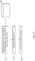
- geospatial data is received from a spatial database 200. More specifically, a plurality of linear features and spatial data objects are received, wherein the linear features are to form the reference network for the partition generation, and the data objects are those that are to be subsequently processed.
- the next step 2.4 is to generate a concave hull, wherein the vertices of the boundary of the concave hull are defined by the end points of the linear features that form the reference network and the spatial data objects to be processed.
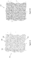
- construction of the concave hull typically starts with the generation of a convex hull 300 from the linear features 302 of the reference network and the data objects 304 to be processed, as illustrated by Figure 3A .
- the linear features 302 and the data objects 304 are triangulated together, for example, using constrained Delaunay triangulation, as is well known in the field of geospatial data.
- the convex hull 300 encloses the linear features 302 and data objects 304, such that the convex hull 300 is the minimum convex set comprising all of the linear features 302 and data objects 304. More specifically, the convex hull 300 represents the area containing all of the triangle edges 306 connecting each pair of points in a dataset, which in this case will be the data objects 304 and the end points of the linear features 302.
- This convex hull 300 can then be used to generate the concave hull, as illustrated by Figure 3B .
- the concave hull of a point set is effectively a subset of the convex hull of the dataset.
- the configuration of the concave hull 300, specifically, the outer vertices and edges will depend on the parameters of the concave hull generation, as will be described in more detail below.
- the concave hull 308 is generated such that that the boundary of the concave hull 308 is formed by connecting end points of the linear features 302 and peripheral data objects 304 as efficiently as possible, to thereby provide smaller partition polygons at the edges of the geographic area to be processed.
- the concave hull 308 is generated by a process of "digging", wherein triangles from the triangulation of the convex hull 300 and data objects 304 are repeatedly removed according to a concave hull criterion so as to "dig” inwards.
- a concave hull criterion so as to "dig” inwards.
- One particularly suitable method is the use of the "Chi criterion” proposed by Duckham et al 1 , which is effectively the maximum edge segment length of the concave hull boundary.
- the triangles are analysed and removed if the length of their outer edge exceeds a predefined threshold.
- the concave hull criterion may be set such that triangles having an outer edge length more than 200m will be removed.
- the predefined threshold may be set at any suitable length according to the application and context in which the method is being applied, which may involve the processing of geospatial data at varying scales. 1 Duckham et al. (2008). Efficient generation of simple polygons for characterizing the shape of a set of points in the plane. Pattern Recognition. 41. 3224-3236. 10.1016/j.patcog.2008.03.023 .
- concave hull criterion Another example of a concave hull criterion that could be applied is the "alpha-shape criterion" proposed in Edelsbrunner et al 2 , which is effectively the maximum radius of the circumscribed circle of a triangle at the boundary of the concave hull. If the radius is larger than the given threshold, the triangle will be removed from the concave hull. 2 Edelsbrunner H, Kirkpatrick DG and Seidel R (1983). On the shape of a set of points in the plane", IEEE Transactions on Information Theory, 29 (4), 551-559
- a set of partition polygons 310 can be generated (s.2.6), as illustrated by Figure 3C .
- the concave hull 308 provides the boundary geometry, from which the outer edges 314 of the polygons 316 at the periphery of the geographic area are generated.
- the linear features 302 provide the reference network, from which the remaining edges 318 of the partition polygons 310 are generated.
- the vertices 320 of the partition polygons 310 are derived based on the points at which the linear features 302 of the reference network and the boundary of the concave hull 308 intersect with each other. If the set of partition polygons 310 comprise any particularly small polygons, that will therefore require very minimal processing, these may be merged together to provide the final partition scheme.
- the resulting boundary geometry has more connection points with the reference network compared to boundary geometry provided by natural enclosures such as coastlines and the like.
- the concave hull 308 provides an improved enclosure of the reference network and data objects, resulting in smaller polygons at the edges that are much easier to process.
- FIG. 4 A further example of a method of generating a partition scheme is illustrated by Figure 4 , for cases where the number of data objects is very large.
- the first step 2.2 is the same as that described with reference to Figure 2 .
- an initial concave hull 500 is generated (s.4.2), as illustrated by Figure 5A , in effectively the same way as described with reference to step 2.4 of Figure 2 .
- the initial concave hull 500 is generated from a subset of the data objects 504 to be processed and the linear features 502 that are providing the reference network.
- This subset can be derived either from a sampling of the data objects 504, or as in this case, using only the vertex data 506 of the reference network 502, which also forms part of the data for the concave hull construction.
- the reference network 502 is naturally representative of the extent of the dataset and normally much smaller in data volume than the spatial data objects 504 to be processed.
- the remaining data in this case, the data objects 504, are then added bit by bit to "grow" the initial concave hull 500. This can be done by re-computing the concave hull based on the initial concave hull 500 and the newly added data objects 504, or by using a dynamic concave hull construction method which maintains the concave hull and its triangulation dynamically as data objects 504 are added.
- data objects 504, 510 are tested against the initial hull 500 to decide whether they should be added.
- a newly added data object 504 will only contribute to the boundary of the concave hull if it is outside of the initial concave hull 500.
- data objects 510 outside of this initial concave hull 500 are added into the process to thereby generate the final concave hull 512 (s.4.4), as illustrated by Figure 5B .
- Data objects 504 falling inside the initial hull 500 do not make any contribution to generating the final hull 512, and can be effectively ignored without any further processing required.
- This analysis may be performed by, for example, using a grid system to index the spatial data objects 504. For each grid cell, if it falls inside the concave hull 500 entirely, then all spatial data objects 504 inside the grid cell can be ignored.
- the above process may be performed iteratively until all of the data objects 504 have been processed, and the final concave hull 512 has been generated.
- a set of partition polygons may then be generated (s.2.6), as described above with reference to Figure 2 .
- FIG. 6 illustrates an example of a general computing device 600 that may form the platform for embodiments of the invention.
- the computing device 600 may be a mobile phone, a tablet, a wearable computing device, IVI system or the like.
- the computing device 600 comprises a central processing unit (CPU) 602 and a working memory 604, connected by a common bus 606, and having an input-output (I/O) interface 608 arranged to receive control inputs from a user via a device connected to a data input port 612 such as a keyboard, mouse, touchscreen, push button, or other controller, and provide output information via a user interface which is displayed on a visual display device 614.
- the I/O interface 608 is also arranged to receive and output data via various other devices and networks, including but not limited to a local area network 616 to which a computer cluster comprising a plurality of nodes is connected.
- the computing device 600 is also provided with a computer readable storage medium 610 such as a hard disk drive (HDD), flash drive, solid state drive, or any other form of general-purpose data storage, upon which stored data, such as a geospatial data 622, and various programs are arranged to control the computing device 600 to operate in accordance with embodiments of the present invention.
- a computer readable storage medium 610 such as a hard disk drive (HDD), flash drive, solid state drive, or any other form of general-purpose data storage, upon which stored data, such as a geospatial data 622, and various programs are arranged to control the computing device 600 to operate in accordance with embodiments of the present invention.
- stored on the computer readable storage medium 610 is an operating system program 618 that when run by the CPU 602 allows the system to operate.
- a concave hull program 624 and a partition generation program 626 which together implement the method of generating a partition scheme according to the present invention when run by the CPU 602, as will be described in more detail
- a user interface and control program 620 is also provided, that controls the computing device 600 to provide a visual output to the display 614, and to receive user inputs via any input means connected to the data input port 612, or any other device connected to the I/O interface 608 in order to control the concave hull program 624 and partition generation program 626.
- the user interface and control program 620 Upon receiving instructions to generate a partition scheme for a particular geographic area, for example, via the data input port 612, the user interface and control program 620 will extract the relevant data from the geospatial data 622, specifically, the linear features that are to form the reference network and the spatial data objects that are to be processed.
- the extracted data is input to the concave hull generation program 624, which will perform the necessary processing of the extracted linear features and spatial object data to generate the concave hull, as described with reference to steps 2.2, 2.4, 4.2 and 4.4 above.
- the resulting concave hull will then be input to the partition generation program 626, which will then generate the final partition scheme of the extracted geospatial data from the linear features of the reference network and the boundary of the concave hull.
- partition data 628 may then be output via the display 614, as well as distributed to external networks and devices.
- the partition data 628 may be distributed to a computer cluster via the local area network 616 for further processing, wherein each partition polygon is to be processed on a separate cluster node.
Landscapes
- Engineering & Computer Science (AREA)
- Databases & Information Systems (AREA)
- Theoretical Computer Science (AREA)
- Data Mining & Analysis (AREA)
- Physics & Mathematics (AREA)
- General Engineering & Computer Science (AREA)
- General Physics & Mathematics (AREA)
- Remote Sensing (AREA)
- Computational Linguistics (AREA)
- Processing Or Creating Images (AREA)
Priority Applications (2)
| Application Number | Priority Date | Filing Date | Title |
|---|---|---|---|
| EP19183720.2A EP3761191B1 (fr) | 2019-07-01 | 2019-07-01 | Procédé de traitement de données géospatiales |
| US16/915,053 US11449566B2 (en) | 2019-07-01 | 2020-06-29 | Methods and systems for processing geospatial data |
Applications Claiming Priority (1)
| Application Number | Priority Date | Filing Date | Title |
|---|---|---|---|
| EP19183720.2A EP3761191B1 (fr) | 2019-07-01 | 2019-07-01 | Procédé de traitement de données géospatiales |
Publications (2)
| Publication Number | Publication Date |
|---|---|
| EP3761191A1 true EP3761191A1 (fr) | 2021-01-06 |
| EP3761191B1 EP3761191B1 (fr) | 2023-08-23 |
Family
ID=67390034
Family Applications (1)
| Application Number | Title | Priority Date | Filing Date |
|---|---|---|---|
| EP19183720.2A Active EP3761191B1 (fr) | 2019-07-01 | 2019-07-01 | Procédé de traitement de données géospatiales |
Country Status (2)
| Country | Link |
|---|---|
| US (1) | US11449566B2 (fr) |
| EP (1) | EP3761191B1 (fr) |
Cited By (1)
| Publication number | Priority date | Publication date | Assignee | Title |
|---|---|---|---|---|
| CN113592977A (zh) * | 2021-07-26 | 2021-11-02 | 湖南省国土资源规划院 | 城区范围划定中线状地物处理方法、系统、存储器及装置 |
Families Citing this family (3)
| Publication number | Priority date | Publication date | Assignee | Title |
|---|---|---|---|---|
| WO2025203126A1 (fr) * | 2024-03-29 | 2025-10-02 | Jio Platforms Limited | Système et procédé d'identification de limite de couverture de grappe de nœuds dans un réseau de communication |
| US20260087740A1 (en) * | 2024-09-24 | 2026-03-26 | Roblox Corporation | Merging coplanar convex polygons in constructive solid geometry (csg) |
| CN119474925B (zh) * | 2024-11-15 | 2026-02-06 | 中国人民解放军网络空间部队信息工程大学 | 一种基于参考网络的地理空间网络连边路径重规划方法 |
Citations (2)
| Publication number | Priority date | Publication date | Assignee | Title |
|---|---|---|---|---|
| US20110211729A1 (en) * | 2009-06-30 | 2011-09-01 | Srikumar Ramalingam | Method for Generating Visual Hulls for 3D Objects as Sets of Convex Polyhedra from Polygonal Silhouettes |
| US8275800B1 (en) * | 2010-08-05 | 2012-09-25 | Teradata Us, Inc. | Splitting polygons with interior rings |
Family Cites Families (6)
| Publication number | Priority date | Publication date | Assignee | Title |
|---|---|---|---|---|
| US9424370B2 (en) * | 2009-03-12 | 2016-08-23 | Siemens Product Lifecycle Management Software Inc. | System and method for spatial partitioning of CAD models |
| US20140074553A1 (en) * | 2012-09-13 | 2014-03-13 | Truecar, Inc. | System and method for constructing spatially constrained industry-specific market areas |
| US9311748B2 (en) * | 2013-02-20 | 2016-04-12 | Google Inc. | Method and system for generating and storing data objects for multi-resolution geometry in a three dimensional model |
| US9104770B2 (en) * | 2013-02-28 | 2015-08-11 | Oracle International Corporation | Methods for query processing of topological relationships among complex spatial objects |
| US11188557B2 (en) * | 2018-03-15 | 2021-11-30 | Arizona Board Of Regents On Behalf Of Arizona State University | Systems and methods for an end-to-end visual analytics system for massive-scale geospatial data |
| WO2020061336A1 (fr) * | 2018-09-20 | 2020-03-26 | Paper Crane, LLC | Analyse automatisée de données géospatiales |
-
2019
- 2019-07-01 EP EP19183720.2A patent/EP3761191B1/fr active Active
-
2020
- 2020-06-29 US US16/915,053 patent/US11449566B2/en active Active
Patent Citations (2)
| Publication number | Priority date | Publication date | Assignee | Title |
|---|---|---|---|---|
| US20110211729A1 (en) * | 2009-06-30 | 2011-09-01 | Srikumar Ramalingam | Method for Generating Visual Hulls for 3D Objects as Sets of Convex Polyhedra from Polygonal Silhouettes |
| US8275800B1 (en) * | 2010-08-05 | 2012-09-25 | Teradata Us, Inc. | Splitting polygons with interior rings |
Non-Patent Citations (3)
| Title |
|---|
| DUCKHAM ET AL.: "Efficient generation of simple polygons for characterizing the shape of a set of points in the plane", PATTERN RECOGNITION, vol. 41, 2008, pages 3224 - 3236, XP022765012, DOI: doi:10.1016/j.patcog.2008.03.023 |
| EDELSBRUNNER HKIRKPATRICK DGSEIDEL R: "On the shape of a set of points in the plane", IEEE TRANSACTIONS ON INFORMATION THEORY, vol. 29, no. 4, 1983, pages 551 - 559 |
| MOREIRA A ET AL: "Concave hull: a k-nearest neighbours approach for the computation of the region occupied by a set of points", GRAPP 2007. SECOND INTERNATIONAL CONFERENCE ON COMPUTER GRAPHICS THEORY AND APPLICATIONS 8-11 MARCH 2007 BARCELONA, SPAIN,, 8 March 2007 (2007-03-08), pages 61 - 68, XP009102384, ISBN: 978-972-8865-71-9 * |
Cited By (2)
| Publication number | Priority date | Publication date | Assignee | Title |
|---|---|---|---|---|
| CN113592977A (zh) * | 2021-07-26 | 2021-11-02 | 湖南省国土资源规划院 | 城区范围划定中线状地物处理方法、系统、存储器及装置 |
| CN113592977B (zh) * | 2021-07-26 | 2023-08-22 | 湖南省国土资源规划院 | 城区范围划定中线状地物处理方法、系统、存储器及装置 |
Also Published As
| Publication number | Publication date |
|---|---|
| US11449566B2 (en) | 2022-09-20 |
| US20210004424A1 (en) | 2021-01-07 |
| EP3761191B1 (fr) | 2023-08-23 |
Similar Documents
| Publication | Publication Date | Title |
|---|---|---|
| US11449566B2 (en) | Methods and systems for processing geospatial data | |
| JP6998964B2 (ja) | ジオフェンスのインデックスグリッドを判断するための方法及び装置 | |
| US20110115783A1 (en) | Point cloud decimation engine | |
| CN110647596B (zh) | 地图数据处理方法和装置 | |
| JPH05266212A (ja) | データプロセッサによってオブジェクトの作成を実行する方法及びグラフィックスディスプレイ装置 | |
| CN111583268B (zh) | 点云虚拟选择与裁切方法、装置及设备 | |
| KR20160121997A (ko) | 공간 지식 추출기 및 추출 방법 | |
| CN113724401A (zh) | 一种三维模型切割方法、装置、计算机设备和存储介质 | |
| CN114138925A (zh) | 位置点所属区域检索方法、装置、电子设备、介质及产品 | |
| CN114756654A (zh) | 动态地名地址匹配方法、装置、计算机设备和存储介质 | |
| US20190243336A1 (en) | Geometric modelling for facilitating simulation for manufacturing operations | |
| CN113761093B (zh) | 空间二元组的确定方法、装置、计算机设备和存储介质 | |
| CN111913965B (zh) | 一种面向空间大数据缓冲区分析的方法 | |
| Yu et al. | Change detection for 3D vector data: a CGA-based Delaunay–TIN intersection approach | |
| CN113033184B (zh) | 一种形状约束的方向词云快速生成方法 | |
| KR100491723B1 (ko) | 지리정보시스템에서의 디지털지형모델 가시화방법 | |
| KR102757464B1 (ko) | 3차원 모델 정보 저장 방법 및 그 장치 | |
| Lodha et al. | Topology preserving top-down compression of 2d vector fields using bintree and triangular quadtrees | |
| CN113761092B (zh) | 空间自连接二元组的确定方法、装置和计算机设备 | |
| CN110750847B (zh) | 网格切分关系的确定方法、装置、设备和介质 | |
| EP1085693B1 (fr) | Outil pour la visualisation de réseaux | |
| Jones et al. | Triangulated spatial models and neighbourhood search: an experimental comparison with quadtrees | |
| Šuba | Design and development of a system for vario-scale maps | |
| Funke et al. | Smooth Building Footprint Aggregation with Alpha Shapes | |
| CN117828538B (zh) | 基于权重分配的多源信息综合分析方法及系统 |
Legal Events
| Date | Code | Title | Description |
|---|---|---|---|
| PUAI | Public reference made under article 153(3) epc to a published international application that has entered the european phase |
Free format text: ORIGINAL CODE: 0009012 |
|
| STAA | Information on the status of an ep patent application or granted ep patent |
Free format text: STATUS: THE APPLICATION HAS BEEN PUBLISHED |
|
| AK | Designated contracting states |
Kind code of ref document: A1 Designated state(s): AL AT BE BG CH CY CZ DE DK EE ES FI FR GB GR HR HU IE IS IT LI LT LU LV MC MK MT NL NO PL PT RO RS SE SI SK SM TR |
|
| AX | Request for extension of the european patent |
Extension state: BA ME |
|
| STAA | Information on the status of an ep patent application or granted ep patent |
Free format text: STATUS: REQUEST FOR EXAMINATION WAS MADE |
|
| 17P | Request for examination filed |
Effective date: 20210630 |
|
| RBV | Designated contracting states (corrected) |
Designated state(s): AL AT BE BG CH CY CZ DE DK EE ES FI FR GB GR HR HU IE IS IT LI LT LU LV MC MK MT NL NO PL PT RO RS SE SI SK SM TR |
|
| STAA | Information on the status of an ep patent application or granted ep patent |
Free format text: STATUS: EXAMINATION IS IN PROGRESS |
|
| 17Q | First examination report despatched |
Effective date: 20220222 |
|
| GRAP | Despatch of communication of intention to grant a patent |
Free format text: ORIGINAL CODE: EPIDOSNIGR1 |
|
| STAA | Information on the status of an ep patent application or granted ep patent |
Free format text: STATUS: GRANT OF PATENT IS INTENDED |
|
| INTG | Intention to grant announced |
Effective date: 20230127 |
|
| GRAS | Grant fee paid |
Free format text: ORIGINAL CODE: EPIDOSNIGR3 |
|
| GRAA | (expected) grant |
Free format text: ORIGINAL CODE: 0009210 |
|
| STAA | Information on the status of an ep patent application or granted ep patent |
Free format text: STATUS: THE PATENT HAS BEEN GRANTED |
|
| AK | Designated contracting states |
Kind code of ref document: B1 Designated state(s): AL AT BE BG CH CY CZ DE DK EE ES FI FR GB GR HR HU IE IS IT LI LT LU LV MC MK MT NL NO PL PT RO RS SE SI SK SM TR |
|
| REG | Reference to a national code |
Ref country code: GB Ref legal event code: FG4D |
|
| REG | Reference to a national code |
Ref country code: CH Ref legal event code: EP |
|
| REG | Reference to a national code |
Ref country code: DE Ref legal event code: R096 Ref document number: 602019035445 Country of ref document: DE |
|
| REG | Reference to a national code |
Ref country code: IE Ref legal event code: FG4D |
|
| REG | Reference to a national code |
Ref country code: LT Ref legal event code: MG9D |
|
| REG | Reference to a national code |
Ref country code: NL Ref legal event code: MP Effective date: 20230823 |
|
| REG | Reference to a national code |
Ref country code: AT Ref legal event code: MK05 Ref document number: 1603425 Country of ref document: AT Kind code of ref document: T Effective date: 20230823 |
|
| PG25 | Lapsed in a contracting state [announced via postgrant information from national office to epo] |
Ref country code: GR Free format text: LAPSE BECAUSE OF FAILURE TO SUBMIT A TRANSLATION OF THE DESCRIPTION OR TO PAY THE FEE WITHIN THE PRESCRIBED TIME-LIMIT Effective date: 20231124 |
|
| PG25 | Lapsed in a contracting state [announced via postgrant information from national office to epo] |
Ref country code: IS Free format text: LAPSE BECAUSE OF FAILURE TO SUBMIT A TRANSLATION OF THE DESCRIPTION OR TO PAY THE FEE WITHIN THE PRESCRIBED TIME-LIMIT Effective date: 20231223 |
|
| PG25 | Lapsed in a contracting state [announced via postgrant information from national office to epo] |
Ref country code: SE Free format text: LAPSE BECAUSE OF FAILURE TO SUBMIT A TRANSLATION OF THE DESCRIPTION OR TO PAY THE FEE WITHIN THE PRESCRIBED TIME-LIMIT Effective date: 20230823 Ref country code: RS Free format text: LAPSE BECAUSE OF FAILURE TO SUBMIT A TRANSLATION OF THE DESCRIPTION OR TO PAY THE FEE WITHIN THE PRESCRIBED TIME-LIMIT Effective date: 20230823 Ref country code: PT Free format text: LAPSE BECAUSE OF FAILURE TO SUBMIT A TRANSLATION OF THE DESCRIPTION OR TO PAY THE FEE WITHIN THE PRESCRIBED TIME-LIMIT Effective date: 20231226 Ref country code: NO Free format text: LAPSE BECAUSE OF FAILURE TO SUBMIT A TRANSLATION OF THE DESCRIPTION OR TO PAY THE FEE WITHIN THE PRESCRIBED TIME-LIMIT Effective date: 20231123 Ref country code: NL Free format text: LAPSE BECAUSE OF FAILURE TO SUBMIT A TRANSLATION OF THE DESCRIPTION OR TO PAY THE FEE WITHIN THE PRESCRIBED TIME-LIMIT Effective date: 20230823 Ref country code: LV Free format text: LAPSE BECAUSE OF FAILURE TO SUBMIT A TRANSLATION OF THE DESCRIPTION OR TO PAY THE FEE WITHIN THE PRESCRIBED TIME-LIMIT Effective date: 20230823 Ref country code: LT Free format text: LAPSE BECAUSE OF FAILURE TO SUBMIT A TRANSLATION OF THE DESCRIPTION OR TO PAY THE FEE WITHIN THE PRESCRIBED TIME-LIMIT Effective date: 20230823 Ref country code: IS Free format text: LAPSE BECAUSE OF FAILURE TO SUBMIT A TRANSLATION OF THE DESCRIPTION OR TO PAY THE FEE WITHIN THE PRESCRIBED TIME-LIMIT Effective date: 20231223 Ref country code: HR Free format text: LAPSE BECAUSE OF FAILURE TO SUBMIT A TRANSLATION OF THE DESCRIPTION OR TO PAY THE FEE WITHIN THE PRESCRIBED TIME-LIMIT Effective date: 20230823 Ref country code: GR Free format text: LAPSE BECAUSE OF FAILURE TO SUBMIT A TRANSLATION OF THE DESCRIPTION OR TO PAY THE FEE WITHIN THE PRESCRIBED TIME-LIMIT Effective date: 20231124 Ref country code: FI Free format text: LAPSE BECAUSE OF FAILURE TO SUBMIT A TRANSLATION OF THE DESCRIPTION OR TO PAY THE FEE WITHIN THE PRESCRIBED TIME-LIMIT Effective date: 20230823 Ref country code: AT Free format text: LAPSE BECAUSE OF FAILURE TO SUBMIT A TRANSLATION OF THE DESCRIPTION OR TO PAY THE FEE WITHIN THE PRESCRIBED TIME-LIMIT Effective date: 20230823 |
|
| PG25 | Lapsed in a contracting state [announced via postgrant information from national office to epo] |
Ref country code: PL Free format text: LAPSE BECAUSE OF FAILURE TO SUBMIT A TRANSLATION OF THE DESCRIPTION OR TO PAY THE FEE WITHIN THE PRESCRIBED TIME-LIMIT Effective date: 20230823 |
|
| PG25 | Lapsed in a contracting state [announced via postgrant information from national office to epo] |
Ref country code: ES Free format text: LAPSE BECAUSE OF FAILURE TO SUBMIT A TRANSLATION OF THE DESCRIPTION OR TO PAY THE FEE WITHIN THE PRESCRIBED TIME-LIMIT Effective date: 20230823 |
|
| PG25 | Lapsed in a contracting state [announced via postgrant information from national office to epo] |
Ref country code: SM Free format text: LAPSE BECAUSE OF FAILURE TO SUBMIT A TRANSLATION OF THE DESCRIPTION OR TO PAY THE FEE WITHIN THE PRESCRIBED TIME-LIMIT Effective date: 20230823 Ref country code: RO Free format text: LAPSE BECAUSE OF FAILURE TO SUBMIT A TRANSLATION OF THE DESCRIPTION OR TO PAY THE FEE WITHIN THE PRESCRIBED TIME-LIMIT Effective date: 20230823 Ref country code: ES Free format text: LAPSE BECAUSE OF FAILURE TO SUBMIT A TRANSLATION OF THE DESCRIPTION OR TO PAY THE FEE WITHIN THE PRESCRIBED TIME-LIMIT Effective date: 20230823 Ref country code: EE Free format text: LAPSE BECAUSE OF FAILURE TO SUBMIT A TRANSLATION OF THE DESCRIPTION OR TO PAY THE FEE WITHIN THE PRESCRIBED TIME-LIMIT Effective date: 20230823 Ref country code: DK Free format text: LAPSE BECAUSE OF FAILURE TO SUBMIT A TRANSLATION OF THE DESCRIPTION OR TO PAY THE FEE WITHIN THE PRESCRIBED TIME-LIMIT Effective date: 20230823 Ref country code: CZ Free format text: LAPSE BECAUSE OF FAILURE TO SUBMIT A TRANSLATION OF THE DESCRIPTION OR TO PAY THE FEE WITHIN THE PRESCRIBED TIME-LIMIT Effective date: 20230823 Ref country code: SK Free format text: LAPSE BECAUSE OF FAILURE TO SUBMIT A TRANSLATION OF THE DESCRIPTION OR TO PAY THE FEE WITHIN THE PRESCRIBED TIME-LIMIT Effective date: 20230823 |
|
| REG | Reference to a national code |
Ref country code: DE Ref legal event code: R097 Ref document number: 602019035445 Country of ref document: DE |
|
| PG25 | Lapsed in a contracting state [announced via postgrant information from national office to epo] |
Ref country code: IT Free format text: LAPSE BECAUSE OF FAILURE TO SUBMIT A TRANSLATION OF THE DESCRIPTION OR TO PAY THE FEE WITHIN THE PRESCRIBED TIME-LIMIT Effective date: 20230823 |
|
| PLBE | No opposition filed within time limit |
Free format text: ORIGINAL CODE: 0009261 |
|
| STAA | Information on the status of an ep patent application or granted ep patent |
Free format text: STATUS: NO OPPOSITION FILED WITHIN TIME LIMIT |
|
| 26N | No opposition filed |
Effective date: 20240524 |
|
| PG25 | Lapsed in a contracting state [announced via postgrant information from national office to epo] |
Ref country code: SI Free format text: LAPSE BECAUSE OF FAILURE TO SUBMIT A TRANSLATION OF THE DESCRIPTION OR TO PAY THE FEE WITHIN THE PRESCRIBED TIME-LIMIT Effective date: 20230823 |
|
| PG25 | Lapsed in a contracting state [announced via postgrant information from national office to epo] |
Ref country code: BG Free format text: LAPSE BECAUSE OF FAILURE TO SUBMIT A TRANSLATION OF THE DESCRIPTION OR TO PAY THE FEE WITHIN THE PRESCRIBED TIME-LIMIT Effective date: 20230823 |
|
| PG25 | Lapsed in a contracting state [announced via postgrant information from national office to epo] |
Ref country code: BG Free format text: LAPSE BECAUSE OF FAILURE TO SUBMIT A TRANSLATION OF THE DESCRIPTION OR TO PAY THE FEE WITHIN THE PRESCRIBED TIME-LIMIT Effective date: 20230823 |
|
| PG25 | Lapsed in a contracting state [announced via postgrant information from national office to epo] |
Ref country code: MC Free format text: LAPSE BECAUSE OF FAILURE TO SUBMIT A TRANSLATION OF THE DESCRIPTION OR TO PAY THE FEE WITHIN THE PRESCRIBED TIME-LIMIT Effective date: 20230823 |
|
| REG | Reference to a national code |
Ref country code: CH Ref legal event code: PL |
|
| PG25 | Lapsed in a contracting state [announced via postgrant information from national office to epo] |
Ref country code: LU Free format text: LAPSE BECAUSE OF NON-PAYMENT OF DUE FEES Effective date: 20240701 |
|
| PG25 | Lapsed in a contracting state [announced via postgrant information from national office to epo] |
Ref country code: LU Free format text: LAPSE BECAUSE OF NON-PAYMENT OF DUE FEES Effective date: 20240701 |
|
| PG25 | Lapsed in a contracting state [announced via postgrant information from national office to epo] |
Ref country code: CH Free format text: LAPSE BECAUSE OF NON-PAYMENT OF DUE FEES Effective date: 20240731 Ref country code: BE Free format text: LAPSE BECAUSE OF NON-PAYMENT OF DUE FEES Effective date: 20240731 |
|
| PG25 | Lapsed in a contracting state [announced via postgrant information from national office to epo] |
Ref country code: FR Free format text: LAPSE BECAUSE OF NON-PAYMENT OF DUE FEES Effective date: 20240731 |
|
| REG | Reference to a national code |
Ref country code: BE Ref legal event code: MM Effective date: 20240731 |
|
| PG25 | Lapsed in a contracting state [announced via postgrant information from national office to epo] |
Ref country code: IE Free format text: LAPSE BECAUSE OF NON-PAYMENT OF DUE FEES Effective date: 20240701 |
|
| PGFP | Annual fee paid to national office [announced via postgrant information from national office to epo] |
Ref country code: DE Payment date: 20250722 Year of fee payment: 7 |
|
| PGFP | Annual fee paid to national office [announced via postgrant information from national office to epo] |
Ref country code: GB Payment date: 20250716 Year of fee payment: 7 |
|
| PG25 | Lapsed in a contracting state [announced via postgrant information from national office to epo] |
Ref country code: CY Free format text: LAPSE BECAUSE OF FAILURE TO SUBMIT A TRANSLATION OF THE DESCRIPTION OR TO PAY THE FEE WITHIN THE PRESCRIBED TIME-LIMIT; INVALID AB INITIO Effective date: 20190701 |
|
| PG25 | Lapsed in a contracting state [announced via postgrant information from national office to epo] |
Ref country code: HU Free format text: LAPSE BECAUSE OF FAILURE TO SUBMIT A TRANSLATION OF THE DESCRIPTION OR TO PAY THE FEE WITHIN THE PRESCRIBED TIME-LIMIT; INVALID AB INITIO Effective date: 20190701 |