EP3852064B1 - Verfahren und vorrichtung zur kennzeichnung eines objekts, verfahren und vorrichtung zur bewegungssteuerung, vorrichtung sowie speichermedium - Google Patents
Verfahren und vorrichtung zur kennzeichnung eines objekts, verfahren und vorrichtung zur bewegungssteuerung, vorrichtung sowie speichermedium Download PDFInfo
- Publication number
- EP3852064B1 EP3852064B1 EP19861154.3A EP19861154A EP3852064B1 EP 3852064 B1 EP3852064 B1 EP 3852064B1 EP 19861154 A EP19861154 A EP 19861154A EP 3852064 B1 EP3852064 B1 EP 3852064B1
- Authority
- EP
- European Patent Office
- Prior art keywords
- point cloud
- target
- cloud data
- dimensional space
- dimensional
- Prior art date
- Legal status (The legal status is an assumption and is not a legal conclusion. Google has not performed a legal analysis and makes no representation as to the accuracy of the status listed.)
- Active
Links
Images




Classifications
-
- G—PHYSICS
- G06—COMPUTING OR CALCULATING; COUNTING
- G06T—IMAGE DATA PROCESSING OR GENERATION, IN GENERAL
- G06T7/00—Image analysis
- G06T7/60—Analysis of geometric attributes
-
- G—PHYSICS
- G06—COMPUTING OR CALCULATING; COUNTING
- G06V—IMAGE OR VIDEO RECOGNITION OR UNDERSTANDING
- G06V20/00—Scenes; Scene-specific elements
- G06V20/10—Terrestrial scenes
-
- G—PHYSICS
- G06—COMPUTING OR CALCULATING; COUNTING
- G06T—IMAGE DATA PROCESSING OR GENERATION, IN GENERAL
- G06T19/00—Manipulating three-dimensional [3D] models or images for computer graphics
-
- G—PHYSICS
- G06—COMPUTING OR CALCULATING; COUNTING
- G06T—IMAGE DATA PROCESSING OR GENERATION, IN GENERAL
- G06T7/00—Image analysis
- G06T7/70—Determining position or orientation of objects or cameras
- G06T7/73—Determining position or orientation of objects or cameras using feature-based methods
- G06T7/74—Determining position or orientation of objects or cameras using feature-based methods involving reference images or patches
-
- G—PHYSICS
- G06—COMPUTING OR CALCULATING; COUNTING
- G06V—IMAGE OR VIDEO RECOGNITION OR UNDERSTANDING
- G06V10/00—Arrangements for image or video recognition or understanding
- G06V10/20—Image preprocessing
- G06V10/25—Determination of region of interest [ROI] or a volume of interest [VOI]
-
- G—PHYSICS
- G06—COMPUTING OR CALCULATING; COUNTING
- G06V—IMAGE OR VIDEO RECOGNITION OR UNDERSTANDING
- G06V20/00—Scenes; Scene-specific elements
- G06V20/50—Context or environment of the image
- G06V20/56—Context or environment of the image exterior to a vehicle by using sensors mounted on the vehicle
- G06V20/58—Recognition of moving objects or obstacles, e.g. vehicles or pedestrians; Recognition of traffic objects, e.g. traffic signs, traffic lights or roads
-
- G—PHYSICS
- G06—COMPUTING OR CALCULATING; COUNTING
- G06V—IMAGE OR VIDEO RECOGNITION OR UNDERSTANDING
- G06V20/00—Scenes; Scene-specific elements
- G06V20/70—Labelling scene content, e.g. deriving syntactic or semantic representations
-
- G—PHYSICS
- G06—COMPUTING OR CALCULATING; COUNTING
- G06T—IMAGE DATA PROCESSING OR GENERATION, IN GENERAL
- G06T2207/00—Indexing scheme for image analysis or image enhancement
- G06T2207/10—Image acquisition modality
- G06T2207/10028—Range image; Depth image; 3D point clouds
-
- G—PHYSICS
- G06—COMPUTING OR CALCULATING; COUNTING
- G06T—IMAGE DATA PROCESSING OR GENERATION, IN GENERAL
- G06T2207/00—Indexing scheme for image analysis or image enhancement
- G06T2207/20—Special algorithmic details
- G06T2207/20068—Projection on vertical or horizontal image axis
-
- G—PHYSICS
- G06—COMPUTING OR CALCULATING; COUNTING
- G06T—IMAGE DATA PROCESSING OR GENERATION, IN GENERAL
- G06T2207/00—Indexing scheme for image analysis or image enhancement
- G06T2207/30—Subject of image; Context of image processing
- G06T2207/30248—Vehicle exterior or interior
-
- G—PHYSICS
- G06—COMPUTING OR CALCULATING; COUNTING
- G06T—IMAGE DATA PROCESSING OR GENERATION, IN GENERAL
- G06T2219/00—Indexing scheme for manipulating 3D models or images for computer graphics
- G06T2219/004—Annotating, labelling
-
- G—PHYSICS
- G06—COMPUTING OR CALCULATING; COUNTING
- G06V—IMAGE OR VIDEO RECOGNITION OR UNDERSTANDING
- G06V2201/00—Indexing scheme relating to image or video recognition or understanding
- G06V2201/12—Acquisition of 3D measurements of objects
- G06V2201/121—Acquisition of 3D measurements of objects using special illumination
Definitions
- the present disclosure relates to the field of computer technologies, and in particular, a movement control method apparatus and a storage medium.
- the intelligent terminal disposed on the mobile platform may obtain, in real time or periodically, recorded images recorded by the image sensor from the environment space, and store the obtained recorded images in a memory or a database.
- the intelligent terminal may obtain the recorded images from the memory or the database, and arbitrarily select one or more frames of recorded images from the recorded images as the reference image.
- the intelligent terminal may alternatively directly obtain the reference image from the mobile platform.
- the intelligent terminal may perform matching between the target object and the at least one reference object, and determine a target reference object according to a matching result.
- the matching result may include a matching degree between the target object and each reference object, and a reference object corresponding to a matching degree greater than a threshold is determined as the target reference object.
- performing matching between the target object and the at least one reference object may be: first projecting the three-dimensional space region indicated by the target point cloud data of the target object onto the reference image, to determine an image projection region; and then performing matching between the image projection region and an image reference region occupied by the at least one reference object in the reference image, to obtain a matching result.
- a projection size of the three-dimensional space region corresponding to the target point cloud data and being projected onto the reference image may further be determined.
- the projection size may include a height value, a length value, and a width value, that is, the projection size may be a size of a three-dimensional enclosing box.
- There may be a projection proportional relationship between an actual size (meter) of the three-dimensional space region indicated by the target point cloud data and the projection size (pixel), and the projection proportional relationship may be related to a resolution of the reference image. For example, if the projection proportional relationship is 1:50, assuming that an actual height value of the three-dimensional space region is 3 meters, the height value of the projection size is 150 pixels.
- step S204 and step S203 may be simultaneously performed.
- step S205 three-dimensional annotation may be performed on the target reference object in the reference image according to the determined projection size. Then, a location of the target reference object in a three-dimensional space may be determined according to the three-dimensional annotation.
- target point cloud data of a target object may be obtained, a projection size of a three-dimensional space region corresponding to the target point cloud data and being projected onto a reference image is determined, and then three-dimensional annotation is performed on a target reference object, in the reference image, matching the target object according to the projection size, to accurately determine a location of the target reference object, in a two-dimensional image, in a three-dimensional space.
- the annotation accuracy may be improved, an actual location of the target reference object may be accurately determined, and annotation does not need to be performed manually, which can improve the annotation efficiency, and reduce the cost of annotation.
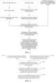
- the embodiments of the present disclosure provide a schematic flowchart of another object annotation method, as shown in FIG. 3 .
- the object annotation method in the embodiments of the present disclosure may be implemented by a control device.
- the control device herein may be an intelligent terminal, for example, a mobile intelligent terminal such as a smartphone or a tablet computer, or a desktop computer.
- the intelligent terminal may be used as a part of a mobile platform, and disposed on the mobile platform, or may be an external independent terminal device, and connected to the mobile platform.
- the control device may further be some mobile platforms automatically moving based on image recognition, for example, a driverless car, a robot, and a UAV that are provided with a processor.
- an example in which the control device is an intelligent terminal, and the intelligent terminal is disposed on a mobile platform is used.
- the intelligent terminal may obtain a reference image recorded by an image sensor from an environment space.
- the reference image includes at least one reference object.
- the reference image may be automatically obtained from the image sensor.
- the intelligent terminal in a moving process of the mobile platform, the intelligent terminal may obtain, in real time or periodically, recorded images recorded by the image sensor from the environment space, and store the obtained recorded images in a memory or a database.
- the intelligent terminal may obtain the recorded images from the memory or the database, and arbitrarily select one or more frames of recorded images from the recorded images as the reference image.
- a point cloud data frame set obtained by a three-dimensional space sensor by scanning the environment space may further be obtained.
- the point cloud data frame set may be automatically obtained from the three-dimensional space sensor.
- the intelligent terminal in a moving process of the mobile platform, the intelligent terminal may obtain, in real time or periodically, a point cloud data frame set obtained through scanning by the three-dimensional space sensor, and store the obtained point cloud data frame set in a memory or a database.
- the point cloud data frame set may be obtained from the memory or the database.
- Step S301 and step S302 may be simultaneously performed. In other embodiments, step S301 may be first performed and then step S302 is performed. Alternatively, step S302 may be first performed and then step S301 is performed. A sequence in which step S301 and step S302 are performed is not limited in the embodiments of the present disclosure.
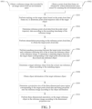
- step S303 tracking may be performed on the target object based on the point cloud data frame set, to determine point cloud trajectory data of the target object.
- the point cloud data frame set herein may include at least two point cloud data frames.
- Object detection may be first performed on a target point cloud data frame, to determine the target object, the target point cloud data frame being any point cloud data frame in the point cloud data frame set.
- the object detection may be performed on the target point cloud data frame by using a single-frame target detection method.
- the single-frame target detection method herein may include, but is not limited to: a conventional point cloud segmentation clustering method and a target detection method based on deep learning such as a method based on a multi-view 3D object detection network for autonomous driving (MV3D) model, a method based on a Voxel model, and a method based on a Pointnet model.
- the conventional point cloud segmentation clustering method usually includes the following procedures: first performing ground filtering, to obtain non-ground points; and then performing segmentation clustering and feature extraction on the non-ground points.
- the point cloud data frame set obtained by the intelligent terminal is obtained by the three-dimensional space sensor in advance, and in a moving process, a size of the three-dimensional space region indicated by the point cloud trajectory data of the target object may be inaccurate due to factors such as a distance, a viewing angle, and blocking of a shelter at some moments. Therefore, in one embodiment, when the tracking is performed on the target object based on the point cloud data frame set, bidirectional target tracking optimization may be further performed on the target object.
- the referenced bidirectional target tracking optimization refers to not only performing tracking filtering processing on the target object from front to back in time domain, but also performing tracking filtering processing on the target object from back to front.
- target point cloud data may be found and determined from the point cloud trajectory data.
- a data acquisition moment of the target point cloud data is the same as the image recording moment of the reference image, and the reference image has a recording timestamp.
- the recording timestamp records an image recording moment of the reference image. Therefore, the target point cloud data may be determined from the point cloud trajectory data according to the recording timestamp of the reference image.
- a recording timestamp of the reference image may be first obtained, and in step S304, reference point cloud data is determined from the point cloud trajectory data according to the recording timestamp of the reference image.
- a data timestamp of the reference point cloud data and the recording timestamp of the reference image meet a preset condition.
- the data timestamps of the point cloud data A, the point cloud data B, and the point cloud data C are all later than the recording timestamp 8:45:45 of the reference image, and differences between data timestamps of the three pieces of point cloud data and the recording timestamp of the reference image are all less than 10s. Therefore, all the point cloud data A, the point cloud data B, and the point cloud data C may be used as the reference point cloud data.
- a motion function is a function in which time and locations are positively correlated. That is, the target point cloud data may be estimated directly according to the first location and the second location. Because a timestamp 8:25:25 of an image acquisition moment is between the timestamp 8:25:20 of the first point cloud data and the timestamp 8:25:30 of the second point cloud data, and the target object moves towards one direction (the first direction or the second direction) at a uniform speed, it may be estimated that the target point cloud data is located between the first location and the second location. Therefore, an intermediate location may be determined according to the first location and the second location, and then point cloud data corresponding to the intermediate location is determined as the target point cloud data.
- the length value of the three-dimensional space region is not equal to the standard length value, and/or the width value of the three-dimensional space region is not equal to the standard width value, the length value and/or the width value of the three-dimensional space region are/is adjusted.
- step S310 three-dimensional annotation may be performed on the target reference object in the reference image according to the determined projection size. Then, a location of the target reference object in a three-dimensional space may be determined according to the three-dimensional annotation.
- an initial model may be trained under supervision based on a large quantity of sample images, so that a model that can more accurately perform three-dimensional annotation on a two-dimensional image may be obtained.
- a model that can more accurately perform three-dimensional annotation on a two-dimensional image may be obtained.
- the sample images may be automatically annotated.
- Three-dimensional point cloud data of an object is obtained by a three-dimensional space sensor by scanning an environment space, and three-dimensional annotation is performed, based on the three-dimensional point cloud data, on a reference image obtained through recording in the environment space.
- three-dimensional annotation is performed, based on the three-dimensional point cloud data, on a reference image obtained through recording in the environment space.
- object annotation method shown in FIG. 2 or FIG. 3 . Details are not described herein.
- Obtained three-dimensional annotated sample images may be used for training and optimizing the initial model based on the foregoing same principle.
- the mobile platform may include: an autonomous vehicle (or referred to as a self-piloting automobile), a UAV (or referred to as a drone), or a robot.
- the autonomous vehicle herein may also be referred to as a driverless car, a computer-driven car, or a wheeled mobile robot, and is an intelligent car that realizes unmanned driving through a computer system.
- the autonomous vehicle may rely on coordination among an artificial intelligence system, a visual computation system, a radar system, a monitoring apparatus system, and a global positioning system, so that a computer can automatically and safely operate the autonomous vehicle without an active operation of a person.
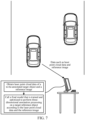
- the target object may be a vehicle, a pedestrian, or the like other than the driverless car on the road.
- the driverless car may send the laser point cloud data of the to-be-annotated target object and the reference image to the intelligent terminal connected to the driverless car.
- Step s 11 Obtain a point cloud data frame set obtained by scanning the environment space, where the point cloud data frame set may include a plurality of point cloud data frames acquired at an image acquisition moment and a plurality of point cloud data frames acquired within a delay time set by the mobile platform.
- Step s12. Track on the target object based on the point cloud data frame set, to determine point cloud trajectory data of the target object.
- Step s 13 Determine reference point cloud data from the point cloud trajectory data according to a recording timestamp of the reference image, where a data timestamp of the reference point cloud data and the recording timestamp of the reference image meet a preset condition.
- the preset condition herein may be that a timestamp range formed by data timestamps of reference point cloud data includes the recording timestamp of the reference image, and differences between the data timestamps and the recording timestamp are less than a preset difference.
- the preset condition herein may be that the data timestamp of the reference point cloud data is earlier or later than the recording timestamp of the reference image, and a difference between the data timestamp of the reference point cloud data and the recording timestamp of the reference image is less than a preset difference.
- Step s14 Perform interpolation on the reference point cloud data to obtain the target point cloud data.
- the interpolation processing includes estimating the target point cloud data by using known point cloud data.
- the interpolation processing may be interpolative processing.
- performing interpolation on the reference point cloud data to obtain the target point cloud data may be that: the reference point cloud data may include first point cloud data and second point cloud data, where a data timestamp of the first point cloud data is earlier than the recording timestamp of the reference image, and a data timestamp of the second point cloud data is later than the recording timestamp of the reference image.
- step S902 the mobile platform may perform three-dimensional annotation on at least one reference object in the reference image according to the target object and the target point cloud data, to obtain a three-dimensional annotation region.
- step S902 may include the following step s21 to step s23:
- the mobile platform may first perform matching processing between the target point cloud data and a reference enclosing box of the at least one reference object in the reference image, to determine a matching degree between the target object corresponding to the target point cloud data and the at least one reference object.
- performing the matching calculation between the minimum enclosing box and the reference enclosing box of the at least one reference object in the reference image, to determine the matching degree between the target object corresponding to the target point cloud data and the at least one reference object may be: calculating an IoU between the minimum enclosing box and the reference enclosing box of the at least one reference object in the reference image; and using the IoU as the matching degree between the target object corresponding to the target point cloud data and the at least one reference object.
- a specific implementation of performing the matching calculation between the minimum enclosing box and the reference enclosing box of the at least one reference object in the reference image, to determine the matching degree between the target object corresponding to the target point cloud data and the at least one reference object may be: determining the matching degree between the target object corresponding to the target point cloud data and the at least one reference object according to information such as a location and a size of the minimum enclosing box and information such as a location and a size of the reference enclosing box of the at least one reference object in the reference image.
- Step s22 Determine a projection size of the three-dimensional space region corresponding to the target point cloud data and being projected onto the reference image.
- determining, according to the object information, the projection size of the three-dimensional space region corresponding to the target point cloud data and being projected onto the reference image may be: obtaining a height value of the two-dimensional annotation size; and determining, according to the height value, the height value in the projection size of the three-dimensional space region corresponding to the target point cloud data and being projected onto the reference image. That is, after the height value of the two-dimensional annotation size is obtained, the height value of the two-dimensional annotation size may be determined as the height value in the projection size.
- determining, according to the object information, the projection size of the three-dimensional space region corresponding to the target point cloud data and being projected onto the reference image may be: first obtaining a standard size value set for the classification category.
- the standard size value herein is a value of an actual size corresponding to the classification category, and may include: a standard length value and/or a standard width value. Then, a length value and/or a width value in the projection size of the three-dimensional space region corresponding to the target point cloud data and being projected onto the reference image may be determined according to the standard size value.
- a specific implementation of determining, according to the standard size value, the length value in the projection size of the three-dimensional space region corresponding to the target point cloud data and being projected onto the reference image may be: adjusting a length value of the three-dimensional space region to the standard length value if a difference between the length value of the three-dimensional space region and the standard length value is greater than a preset length difference, and determining the length value in the projection size according to an adjusted length value of the three-dimensional space region.
- the length value in the projection size corresponding to the adjusted length value of the three-dimensional space region may be determined according to a projection proportional relationship between an actual size and the projection size of the three-dimensional space region.
- a specific implementation of determining, according to the standard size value, the width value in the projection size of the three-dimensional space region corresponding to the target point cloud data and being projected onto the reference image may be: adjusting a width value of the three-dimensional space region to the standard width value if a difference between the width value of the three-dimensional space region and the standard width value is greater than a preset width difference, and determining the width value in the projection size according to an adjusted width value of the three-dimensional space region.
- the width value in the projection size corresponding to the adjusted width value of the three-dimensional space region may alternatively be determined according to a projection proportional relationship.
- Step s23 Perform three-dimensional annotation on the target reference object in the reference image according to the determined projection size, to obtain a three-dimensional annotation region.
- the mobile platform may perform three-dimensional annotation on the target reference object in the reference image according to the determined projection size, to obtain a three-dimensional annotation region.
- step S903 image recognition may be performed on the three-dimensional annotation region in the reference image, to determine parameter information of the target reference object in the three-dimensional annotation region.
- the parameter information of the target reference object herein may include a length value, a width value, and a height value of the target reference object, location information of the target reference object, and information about a distance between the target reference object and the mobile platform.
- the generated speed control instruction may control the mobile platform to keep the current speed and continue to travel, or may control the mobile platform to travel at a speed higher than the current speed, and the increased speed is lower than the highest speed allowed on the current road. If the location information indicates that the target reference object is located right in front of the mobile platform, and the distance information indicates that the distance between the target reference object and the mobile platform is relatively short, the generated speed control instruction may control the mobile platform to travel at a speed lower than the current speed, to avoid collision between the mobile platform and the target reference object that is located right in front of the mobile platform.
- three-dimensional annotation may be performed on the target reference object in the reference image according to the target point cloud data of the target object, thereby improving the accuracy of the three-dimensional annotation region obtained through three-dimensional annotation.
- image recognition may be performed on the three-dimensional annotation region to obtain the parameter information, to more accurately determine a location of the target object, so that the control instruction is generated according to the parameter information to perform movement control such as obstacle avoidance and tracking on the mobile platform.
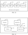
- an embodiment of the present disclosure further provides a schematic structural diagram of an object annotation apparatus shown in FIG. 11 .
- the object annotation apparatus in this embodiment of the present disclosure may include:
- the object information includes a two-dimensional annotation size of the target reference object.
- the determining unit 102 may be specifically configured to: obtain a standard size value set for the classification category, the standard size value including: a standard length value and/or a standard width value; and determine, according to the standard size value, a length value and/or a width value in the projection size of the three-dimensional space region corresponding to the target point cloud data and being projected onto the reference image.
- the determining unit 102 may be specifically configured to: adjust a width value of the three-dimensional space region to the standard width value if a difference between the width value of the three-dimensional space region and the standard width value is greater than a preset width difference, and determine the width value in the projection size according to an adjusted width value of the three-dimensional space region.
- the determining unit 102 when determining the target reference object from the at least one reference object according to the matching degree, may be specifically configured to: determine a candidate reference object from the at least one reference object according to the matching degree, a matching degree between the candidate reference object and the target object corresponding to the target point cloud data being greater than the preset threshold; and determine the target reference object according to a classification category of the candidate reference object and a classification category of the target object corresponding to the target point cloud data.
- the obtaining unit 201 when obtaining the target point cloud data obtained by scanning the environment space, may be specifically configured to: obtain a point cloud data frame set by scanning the environment space; track the target object based on the point cloud data frame set, to determine point cloud trajectory data of the target object; determine reference point cloud data from the point cloud trajectory data according to a recording timestamp of the reference image; and perform interpolation on the reference point cloud data to obtain the target point cloud data.
- the at least one first program instruction may be loaded by the processor 301 and is specifically configured to perform the following steps: obtaining object information of the target reference object; and determining, according to the object information, the projection size of the three-dimensional space region corresponding to the target point cloud data and being projected onto the reference image.
- the at least one first program instruction may be loaded by the processor 301 and is specifically configured to perform the following steps: adjusting a length value of the three-dimensional space region to the standard length value in a case that a difference between the length value of the three-dimensional space region and the standard length value is greater than a preset length difference, and determining the length value in the projection size according to an adjusted length value of the three-dimensional space region.
- the at least one first program instruction may be loaded by the processor 301 and is specifically configured to perform the following steps: performing two-dimensional image projection on the three-dimensional space region indicated by the target point cloud data, to obtain an image projection region of the target point cloud data in the reference image; determining a minimum enclosing box of the image projection region; and calculate the matching degree between the target object corresponding to the target point cloud data and the at least one reference object based on matching the minimum enclosing box and the reference enclosing box of the at least one reference object in the reference image.
- the at least one first program instruction may be loaded by the processor 301 and is specifically configured to perform the following steps: obtaining a point cloud data frame set obtained by the three-dimensional space sensor by scanning the environment space; tracking the target object based on the point cloud data frame set, to determine point cloud trajectory data of the target object; determining reference point cloud data from the point cloud trajectory data according to a recording timestamp of the reference image; and performing interpolation on the reference point cloud data to obtain the target point cloud data.
- target point cloud data of a target object may be obtained, a projection size of a three-dimensional space region corresponding to the target point cloud data and being projected onto a reference image is determined, and then three-dimensional annotation is performed on a target reference object, in the reference image, matching the target object according to the projection size, to accurately determine a location of the target reference object, in a two-dimensional image, in a three-dimensional space.
- the annotation accuracy may be improved, an actual location of the target reference object may be accurately determined, and annotation does not need to be performed manually, which can improve the annotation efficiency, and reduce the cost of annotation.
- the processor 301 may further load and execute one or more second program instructions stored in a computer storage medium, to implement the corresponding steps of the foregoing movement control method embodiment.
- the at least one second program instruction in the computer storage medium is loaded by the processor 301 to perform the following steps:
- the at least one second program instruction may be loaded by the processor 301 and is specifically configured to perform the following steps: determining a candidate reference object from the at least one reference object according to the matching degree, a matching degree between the candidate reference object and the target object corresponding to the target point cloud data being greater than the preset threshold; and determining the target reference object according to a classification category of the candidate reference object and a classification category of the target object corresponding to the target point cloud data.
Landscapes
- Engineering & Computer Science (AREA)
- Physics & Mathematics (AREA)
- General Physics & Mathematics (AREA)
- Theoretical Computer Science (AREA)
- Multimedia (AREA)
- Computer Vision & Pattern Recognition (AREA)
- Computational Linguistics (AREA)
- Computer Graphics (AREA)
- General Engineering & Computer Science (AREA)
- Software Systems (AREA)
- Computer Hardware Design (AREA)
- Geometry (AREA)
- Length Measuring Devices By Optical Means (AREA)
- Image Analysis (AREA)
Claims (13)
- Verfahren zur Bewegungssteuerung, das von einer Steuereinheit durchgeführt wird, wobei das Verfahren umfasst:Erhalten, in einem Bewegungsprozess einer mobilen Plattform, ein von einem Bildsensor aufgenommenes Referenzbild aus einem Umgebungsraum, wobei das Referenzbild ein planares Bild ist und mindestens ein Referenzobjekt umfasst;Erhalten von Zielpunktwolkendaten, die von einem dreidimensionalen Raumsensor durch Abtasten des Umgebungsraums erhalten werden, wobei die Zielpunktwolkendaten einen dreidimensionalen Raumbereich anzeigen, der von einem Zielobjekt im Umgebungsraum besetzt ist;Bestimmen eines Zielreferenzobjekts, das dem Zielobjekt entspricht, aus dem Referenzbild, wobei das Zielreferenzobjekt ein Referenzobjekt in dem Referenzbild ist, das dem Zielobjekt entspricht, das durch Abtasten durch den dreidimensionalen Raumsensor erhalten wird;Bestimmen einer Projektionsgröße des dreidimensionalen Raumbereichs, der den Zielpunktwolkendaten entspricht, und des dreidimensionalen Raumbereichs, der auf das Referenzbild projiziert wird, wobei die Projektionsgröße eine Größe eines dreidimensionalen umschließenden Kastens ist, der einen Höhenwert, einen Längenwert und einen Breitenwert enthält und eine proportionale Beziehung zu einer tatsächlichen Größe des dreidimensionalen Raumbereichs hat, die durch die Zielpunktwolkendaten angegeben wird; undDurchführen einer dreidimensionalen Beschriftung auf dem Zielreferenzobjekt im Referenzbild entsprechend der bestimmten Projektionsgröße, um einen dreidimensionalen Anmerkungsbereich zu erhalten;Durchführen einer Bilderkennung an dem dreidimensionalen Anmerkungsbereich in dem Referenzbild, um Parameterinformationen des Zielreferenzobjekts in dem dreidimensionalen Anmerkungsbereich zu bestimmen; undErzeugen eines Steuerbefehls gemäß den Parameterinformationen und Steuern der Bewegung der mobilen Plattform gemäß dem Steuerbefehl.
- Verfahren gemäß Anspruch 1, wobei das Bestimmen einer Projektionsgröße des dreidimensionalen Raumbereichs, der den Zielpunktwolkendaten entspricht, und des dreidimensionalen Raumbereichs, der auf das Referenzbild projiziert wird, umfasst:Erhalten von Objektinformationen des Zielreferenzobjekts; undBestimmen der Projektionsgröße des dreidimensionalen Raumbereichs, der den Zielpunktwolkendaten entspricht, und des dreidimensionalen Raumbereichs, der auf das Referenzbild projiziert wird, anhand der Objektinformationen.
- Verfahren nach Anspruch 2, wobei die Objektinformation eine zweidimensionale Anmerkungsgröße des Zielreferenzobjekts umfasst; und die Bestimmung der Projektionsgröße des dreidimensionalen Raumbereichs, der den Zielpunktwolkendaten entspricht, und des dreidimensionalen Raumbereichs, der auf das Referenzbild projiziert wird, gemäß der Objektinformation umfasst:Ermitteln eines Höhenwerts der zweidimensionalen Anmerkungsgröße; undBestimmen eines Höhenwerts in der Projektionsgröße des dreidimensionalen Bereichs, der den Zielpunktwolkendaten entspricht, und des dreidimensionalen Bereichs, der auf das Referenzbild projiziert wird, entsprechend dem Höhenwert.
- Verfahren nach Anspruch 2, wobei die Objektinformation eine Klassifizierungskategorie des Zielreferenzobjekts umfasst; und das Bestimmen der Projektionsgröße des dreidimensionalen Raumbereichs, der den Zielpunktwolkendaten entspricht, und des dreidimensionalen Raumbereichs, der auf das Referenzbild projiziert wird, gemäß der Objektinformation umfasst:Erhalten eines Standardgrößenwerts für die Klassifizierungskategorie, wobei der Standardgrößenwert umfasst: einen Standardlängenwert und/oder einen Standardbreitenwert; undBestimmen eines Längenwerts und/oder eines Breitenwerts in der Projektionsgröße des dreidimensionalen Raumbereichs, der den Zielpunktwolkendaten entspricht, und des dreidimensionalen Raumbereichs, der auf das Referenzbild projiziert wird, gemäß dem Standardgrößenwert.
- Verfahren nach Anspruch 4, wobei
in einem Fall, in dem der Standardgrößenwert den Standardlängenwert umfasst, das Bestimmen eines Längenwertes in der Projektionsgröße des dreidimensionalen Raumbereichs, der den Zielpunktwolkendaten entspricht, und des dreidimensionalen Raumbereichs, der auf das Referenzbild projiziert wird, gemäß dem Standardgrößenwert umfasst:Anpassen eines Längenwerts des dreidimensionalen Raumbereichs an den Standardlängenwert in einem Fall, in dem eine Differenz zwischen dem Längenwert des dreidimensionalen Raumbereichs und dem Standardlängenwert größer ist als eine voreingestellte Längendifferenz, und Bestimmen des Längenwerts in der Projektionsgröße gemäß einem angepassten Längenwert des dreidimensionalen Raumbereichs; undfür den Fall, dass der Standardgrößenwert den Standardbreitenwert umfasst, das Bestimmen eines Breitenwerts in der Projektionsgröße des dreidimensionalen Raumbereichs, der den Zielpunktwolkendaten entspricht, und des dreidimensionalen Raumbereichs, der auf das Referenzbild projiziert wird, gemäß dem Standardgrößenwert umfasst:
Anpassen eines Breitenwerts des dreidimensionalen Raumbereichs an den Standardbreitenwert für den Fall, dass eine Differenz zwischen dem Breitenwert des dreidimensionalen Raumbereichs und dem Standardbreitenwert größer als eine voreingestellte Breitendifferenz ist, und Bestimmen des Breitenwerts in der Projektionsgröße gemäß einem angepassten Breitenwert des dreidimensionalen Raumbereichs. - Verfahren gemäß Anspruch 1, wobei das Bestimmen eines dem Zielobjekt entsprechenden Zielreferenzobjekts aus dem Referenzbild umfasst:Abgleichen der Zielpunktwolkendaten und eines Referenzumschließungsrahmens des mindestens einen Referenzobjekts in dem Referenzbild, um einen Übereinstimmungsgrad zwischen dem Zielobjekt, das den Zielpunktwolkendaten entspricht, und dem mindestens einen Referenzobjekt zu bestimmen; undBestimmen des Zielreferenzobjekts aus dem mindestens einen Referenzobjekt gemäß dem Übereinstimmungsgrad, wobei ein Übereinstimmungsgrad zwischen dem Zielreferenzobjekt und dem Zielobjekt, das den Zielpunktwolkendaten entspricht, größer als ein voreingestellter Schwellenwert ist.
- Verfahren nach Anspruch 6, wobei das Abgleichen der Zielpunktwolkendaten und eines Referenzumschließungsrahmens des mindestens einen Referenzobjekts im Referenzbild zur Bestimmung des Übereinstimmungsgrads zwischen dem Zielobjekt, das den Zielpunktwolkendaten entspricht, und dem mindestens einen Referenzobjekt umfasst:Durchführen einer zweidimensionalen Bildprojektion auf den dreidimensionalen Raumbereich, der den Zielpunktwolkendaten entspricht, um einen Bildprojektionsbereich der Zielpunktwolkendaten im Referenzbild zu erhalten;Bestimmen eines minimalen Umschließungsrahmens des Bildprojektionsbereichs; undBerechnen des Übereinstimmungsgrades zwischen dem Zielobjekt, das den Zielpunktwolkendaten entspricht, und dem mindestens einen Referenzobjekt auf der Grundlage der Übereinstimmung des minimalen Umschließungsrahmens und des Referenzumschließungsrahmens des mindestens einen Referenzobjekts in dem Referenzbild.
- Verfahren nach Anspruch 7, wobei das Berechnen des Übereinstimmungsgrads zwischen dem Zielobjekt, das den Zielpunktwolkendaten entspricht, und dem mindestens einen Referenzobjekt auf der Grundlage der Übereinstimmung des minimalen Umschließungsrahmens und des Referenzumschließungsrahmens des mindestens einen Referenzobjekts im Referenzbild umfasst:Berechnen einer Schnittmenge über Vereinigung zwischen dem minimalen Umschließungsrahmen und dem Referenzumschließungsrahmen des mindestens einen Referenzobjekts im Referenzbild; undAnwenden der Schnittmenge über die Vereinigung als Übereinstimmungsgrad zwischen dem Zielobjekt, das den Zielpunktwolkendaten entspricht, und dem mindestens einen Referenzobjekt.
- Verfahren nach Anspruch 6, wobei das Bestimmen des Zielreferenzobjekts aus dem mindestens einen Referenzobjekt gemäß dem Übereinstimmungsgrad umfasst:Bestimmen eines Kandidatenreferenzobjekts aus dem mindestens einen Referenzobjekt gemäß dem Übereinstimmungsgrad, wobei der Übereinstimmungsgrad zwischen dem Kandidatenreferenzobjekt und dem Zielobjekt, das den Zielpunktwolkendaten entspricht, größer als der voreingestellte Schwellenwert ist; undBestimmen des Zielreferenzobjekts gemäß einer Klassifizierungskategorie des Kandidatenreferenzobjekts und einer Klassifizierungskategorie des Zielobjekts, die den Zielpunktwolkendaten entspricht.
- Verfahren gemäß Anspruch 1, wobei das Erhalten von Zielpunktwolkendaten, die von einem dreidimensionalen Raumsensor durch Abtasten des Umgebungsraums erhalten werden, umfasst:Erhalten eines Punktwolken-Datensatzes, der von dem dreidimensionalen Raumsensor durch Abtasten des Umgebungsraumes erhalten wird;Verfolgen des Zielobjekts auf der Grundlage des Punktwolken-Datenrahmensatzes, um Punktwolken-Trajektoriendaten des Zielobjekts zu bestimmen;Bestimmen von Referenzpunktwolkendaten aus den Punktwolken-Trajektoriendaten entsprechend einem Aufzeichnungszeitstempel des Referenzbildes; undInterpolieren der Referenzpunktwolkendaten, um die Zielpunktwolkendaten zu erhalten.
- Verfahren nach Anspruch 10, wobei der Punktwolken-Datenrahmensatz mindestens zwei Punktwolken-Datenrahmen umfasst, und das Verfolgen des Zielobjekts auf der Grundlage des Punktwolken-Datenrahmensatzes, um Punktwolken-Trajektoriendaten des Zielobjekts zu bestimmen, umfasst:Durchführen einer Objekterkennung an einem Ziel-Punktwolken-Datenrahmen, um das Zielobjekt zu bestimmen, wobei der Ziel-Punktwolken-Datenrahmen ein beliebiger Punktwolken-Datenrahmen in dem Punktwolken-Datenrahmensatz ist;Erhalten eines assoziierten Punktwolken-Datenrahmens, der mit dem Ziel-Punktwolken-Datenrahmen assoziiert ist, wobei der assoziierte Punktwolken-Datenrahmen einen Punktwolken-Datenrahmen umfasst, der einen Erfassungszeitpunkt hat, der früher oder später als der des Ziel-Punktwolken-Datenrahmens liegt; undVerfolgen des Zielobjekts auf der Grundlage des zugehörigen Punktwolken-Datenrahmens, um die Punktwolken-Trajektoriendaten des Zielobjekts zu bestimmen.
- Vorrichtung zur Bewegungssteuerung, umfassend:eine Erfassungseinheit, die so konfiguriert ist, dass sie bei einem Bewegungsvorgang einer mobilen Plattform ein von einem Bildsensor aufgezeichnetes Referenzbild aus einem Umgebungsraum erhält, wobei das Referenzbild ein planares Bild ist und mindestens ein Referenzobjekt umfasst,die Erfassungseinheit ferner konfiguriert ist, um Zielpunktwolkendaten zu erhalten, die von einem dreidimensionalen Raumsensor durch Abtasten des Umgebungsraums erhalten werden, wobei die Zielpunktwolkendaten einen dreidimensionalen Raumbereich anzeigen, der von einem Zielobjekt im Umgebungsraum besetzt ist;eine Bestimmungseinheit, die konfiguriert ist, um ein Zielreferenzobjekt zu bestimmen, das mit dem Zielobjekt aus dem Referenzbild übereinstimmt, wobei das Zielreferenzobjekt ein Referenzobjekt in dem Referenzbild ist, das dem Zielobjekt entspricht, das durch Abtasten durch den dreidimensionalen Raumsensor erhalten wird,die Bestimmungseinheit ferner konfiguriert ist, um eine Projektionsgröße des dreidimensionalen Raumbereichs zu bestimmen, der den Zielpunktwolkendaten entspricht, und wobei der dreidimensionale Raumbereich auf das Referenzbild projiziert wird, wobei die Projektionsgröße eine Größe eines dreidimensionalen umschließenden Kastens ist, der einen Höhenwert, einen Längenwert und einen Breitenwert enthält und eine proportionale Beziehung zu einer tatsächlichen Größe des dreidimensionalen Raumbereichs hat, die durch die Zielpunktwolkendaten angegeben wird; undeine Beschriftungseinheit, die so konfiguriert ist, dass sie eine dreidimensionale Beschriftung auf dem Zielreferenzobjekt in dem Referenzbild gemäß der bestimmten Projektionsgröße durchführt, um einen dreidimensionalen Beschriftungsbereich zu erhalten;eine Erkennungseinheit, die so konfiguriert ist, dass sie eine Bilderkennung an dem dreidimensionalen Beschriftungsbereich in dem Referenzbild durchführt, um Parameterinformationen des Zielreferenzobjekts in dem dreidimensionalen Beschriftungsbereich zu bestimmen; undeine Steuereinheit, die so konfiguriert ist, dass sie eine Steueranweisung entsprechend den Parameterinformationen erzeugt und die Bewegung der mobilen Plattform entsprechend der Steueranweisung steuert.
- Computerspeichermedium, wobei das Computerspeichermedium einen ersten Computerprogrammbefehl speichert, wobei der erste Computerprogrammbefehl, wenn er geladen und von einem Prozessor ausgeführt wird, den Prozessor veranlasst, das Verfahren zur Bewegungssteuerung gemäß einem der Ansprüche 1 bis 11 durchzuführen.
Applications Claiming Priority (2)
| Application Number | Priority Date | Filing Date | Title |
|---|---|---|---|
| CN201811060480.5A CN110163904B (zh) | 2018-09-11 | 2018-09-11 | 对象标注方法、移动控制方法、装置、设备及存储介质 |
| PCT/CN2019/105049 WO2020052540A1 (zh) | 2018-09-11 | 2019-09-10 | 对象标注方法、移动控制方法、装置、设备及存储介质 |
Publications (3)
| Publication Number | Publication Date |
|---|---|
| EP3852064A1 EP3852064A1 (de) | 2021-07-21 |
| EP3852064A4 EP3852064A4 (de) | 2021-11-10 |
| EP3852064B1 true EP3852064B1 (de) | 2024-07-10 |
Family
ID=67645070
Family Applications (1)
| Application Number | Title | Priority Date | Filing Date |
|---|---|---|---|
| EP19861154.3A Active EP3852064B1 (de) | 2018-09-11 | 2019-09-10 | Verfahren und vorrichtung zur kennzeichnung eines objekts, verfahren und vorrichtung zur bewegungssteuerung, vorrichtung sowie speichermedium |
Country Status (4)
| Country | Link |
|---|---|
| US (1) | US11893785B2 (de) |
| EP (1) | EP3852064B1 (de) |
| CN (1) | CN110163904B (de) |
| WO (1) | WO2020052540A1 (de) |
Families Citing this family (64)
| Publication number | Priority date | Publication date | Assignee | Title |
|---|---|---|---|---|
| CN110163904B (zh) | 2018-09-11 | 2022-04-22 | 腾讯大地通途(北京)科技有限公司 | 对象标注方法、移动控制方法、装置、设备及存储介质 |
| US11069085B2 (en) * | 2019-02-13 | 2021-07-20 | Toyota Research Institute, Inc. | Locating a vehicle based on labeling point cloud data of a scene |
| JP7250573B2 (ja) * | 2019-03-11 | 2023-04-03 | 本田技研工業株式会社 | 倒立振子型ロボット |
| DE102019206021A1 (de) * | 2019-04-26 | 2020-10-29 | Robert Bosch Gmbh | Verfahren zur Erkennung einer Funktionsfähigkeit eines Umgebungssensors, Steuergerät und Fahrzeug |
| JP7344289B2 (ja) * | 2019-06-14 | 2023-09-13 | 富士フイルム株式会社 | 点群データ処理装置、点群データ処理方法及びプログラム |
| CN112956187A (zh) * | 2019-10-11 | 2021-06-11 | 深圳市大疆创新科技有限公司 | 移动物体监控的方法、装置及计算机存储介质 |
| CN110929612A (zh) * | 2019-11-13 | 2020-03-27 | 北京云聚智慧科技有限公司 | 一种目标对象标注方法、装置及设备 |
| CN112950785B (zh) * | 2019-12-11 | 2023-05-30 | 杭州海康威视数字技术股份有限公司 | 点云标注方法、装置及系统 |
| US11776215B1 (en) * | 2019-12-16 | 2023-10-03 | Scale AI, Inc. | Pre-labeling data with cuboid annotations |
| US11461915B2 (en) * | 2020-01-06 | 2022-10-04 | Qualcomm Incorporated | Object size estimation using camera map and/or radar information |
| CN111274927A (zh) * | 2020-01-17 | 2020-06-12 | 北京三快在线科技有限公司 | 一种训练数据的生成方法、装置、电子设备和存储介质 |
| CN111310667B (zh) * | 2020-02-18 | 2023-09-01 | 北京小马慧行科技有限公司 | 确定标注是否准确的方法、装置、存储介质与处理器 |
| CN111401194B (zh) * | 2020-03-10 | 2023-09-22 | 北京百度网讯科技有限公司 | 用于自动驾驶车辆的数据处理方法和装置 |
| CN113592897B (zh) * | 2020-04-30 | 2024-03-29 | 魔门塔(苏州)科技有限公司 | 一种点云数据的标注方法及装置 |
| CN111476840B (zh) * | 2020-05-14 | 2023-08-22 | 阿丘机器人科技(苏州)有限公司 | 目标定位方法、装置、设备及计算机可读存储介质 |
| CN111767862B (zh) * | 2020-06-30 | 2024-09-17 | 广州文远知行科技有限公司 | 车辆标注方法、装置、计算机设备及可读存储介质 |
| CN114092754A (zh) * | 2020-07-31 | 2022-02-25 | 上海图森未来人工智能科技有限公司 | 一种3d点云数据中物体的标注方法和装置、存储介质 |
| CN112037120A (zh) * | 2020-07-31 | 2020-12-04 | 上海图森未来人工智能科技有限公司 | 3d点云数据中道路平面要素的标注方法和装置、存储介质 |
| CN113763307B (zh) * | 2020-08-11 | 2024-06-18 | 北京京东乾石科技有限公司 | 样本数据的获取方法和装置 |
| CN112099050A (zh) * | 2020-09-14 | 2020-12-18 | 北京魔鬼鱼科技有限公司 | 车辆外形识别装置和方法、车辆处理设备和方法 |
| CN112183657B (zh) * | 2020-10-14 | 2022-03-01 | 北京字跳网络技术有限公司 | 获取标注信息的方法、装置、电子设备和计算机可读介质 |
| DE102020127315B4 (de) * | 2020-10-16 | 2022-06-15 | Friedrich-Alexander-Universität Erlangen-Nürnberg, Körperschaft des öffentlichen Rechts | System und Verfahren zum Annotieren von Automobilradardaten |
| CN112735253B (zh) * | 2020-10-22 | 2023-03-10 | 深圳安途智行科技有限公司 | 红绿灯自动标注方法及计算机设备 |
| CN112346691A (zh) * | 2020-11-05 | 2021-02-09 | 北京电子工程总体研究所 | 一种目标高度和灰度对应的方法、计算设备及存储介质 |
| CN112527374B (zh) | 2020-12-11 | 2024-08-27 | 北京百度网讯科技有限公司 | 标注工具生成方法、标注方法、装置、设备以及存储介质 |
| WO2022126427A1 (zh) * | 2020-12-16 | 2022-06-23 | 深圳市大疆创新科技有限公司 | 点云处理方法、点云处理装置、可移动平台和计算机存储介质 |
| CN112669373B (zh) * | 2020-12-24 | 2023-12-05 | 北京亮道智能汽车技术有限公司 | 一种自动化标注方法、装置、电子设备及存储介质 |
| CN112700552B (zh) * | 2020-12-31 | 2025-06-27 | 华为技术有限公司 | 三维物体检测方法、装置、电子设备及介质 |
| US11827203B2 (en) | 2021-01-14 | 2023-11-28 | Ford Global Technologies, Llc | Multi-degree-of-freedom pose for vehicle navigation |
| CN114972136B (zh) * | 2021-02-25 | 2025-10-28 | 华为技术有限公司 | 3d目标检测模型的训练方法、3d目标检测方法及装置 |
| CN113808186B (zh) * | 2021-03-04 | 2024-01-16 | 京东鲲鹏(江苏)科技有限公司 | 训练数据生成方法、装置与电子设备 |
| CN115049700A (zh) * | 2021-03-09 | 2022-09-13 | 华为技术有限公司 | 一种目标检测方法及装置 |
| CN113096151B (zh) * | 2021-04-07 | 2022-08-09 | 地平线征程(杭州)人工智能科技有限公司 | 对目标的运动信息进行检测的方法和装置、设备和介质 |
| CN113205119B (zh) * | 2021-04-20 | 2023-10-31 | 北京百度网讯科技有限公司 | 数据标注方法、装置、电子设备及可读存储介质 |
| CN113190003B (zh) * | 2021-05-06 | 2024-05-31 | 珠海格力智能装备有限公司 | Agv避障方法、装置、计算机可读存储介质和处理器 |
| CN112907672B (zh) * | 2021-05-07 | 2021-10-08 | 上海擎朗智能科技有限公司 | 一种机器人的避让方法、装置、电子设备及存储介质 |
| CN113469042A (zh) * | 2021-06-30 | 2021-10-01 | 上海商汤临港智能科技有限公司 | 真值数据确定、神经网络训练、行驶控制方法及装置 |
| US12313743B2 (en) * | 2021-08-26 | 2025-05-27 | The Hong Kong University Of Science And Technology | Method and electronic device for performing 3D point cloud object detection using neural network |
| US11608084B1 (en) | 2021-08-27 | 2023-03-21 | Motional Ad Llc | Navigation with drivable area detection |
| CN113870390B (zh) * | 2021-09-28 | 2025-11-11 | 深圳绿米联创科技有限公司 | 目标标注处理方法、装置、电子设备及可读存储介质 |
| CN113712597A (zh) * | 2021-11-02 | 2021-11-30 | 深圳迈瑞动物医疗科技有限公司 | 一种马跟腱的检查方法和超声成像设备 |
| KR102761694B1 (ko) * | 2021-11-24 | 2025-02-03 | 경기대학교 산학협력단 | 딥러닝 기반의 객체 검출을 이용한 상대적 거리 예측 장치 및 방법 |
| US12033394B2 (en) * | 2021-12-29 | 2024-07-09 | Midea Group Co., Ltd. | Automatic robotic lawn mowing boundary detection using 3D semantic segmentation |
| CN114511765B (zh) * | 2021-12-30 | 2024-07-26 | 清华大学 | 一种车路协调数据联合标注方法及装置 |
| CN114444895B (zh) * | 2021-12-31 | 2025-04-01 | 深圳云天励飞技术股份有限公司 | 清洁质量评估方法及相关设备 |
| CN114372970B (zh) * | 2022-01-04 | 2024-02-06 | 杭州三坛医疗科技有限公司 | 一种手术参考信息生成方法及装置 |
| CN114549644B (zh) * | 2022-02-24 | 2025-02-28 | 北京百度网讯科技有限公司 | 一种数据标注方法、装置、电子设备及存储介质 |
| CN114359876B (zh) * | 2022-03-21 | 2022-05-31 | 成都奥伦达科技有限公司 | 一种车辆目标识别方法及存储介质 |
| CN114943947B (zh) * | 2022-03-22 | 2025-07-15 | 深圳元戎启行科技有限公司 | 道路交通灯的标注方法、自动驾驶计算平台及存储介质 |
| CN114663478B (zh) * | 2022-03-24 | 2026-01-27 | 苏州轻棹科技有限公司 | 一种根据多参考点预测信息估计锚点位置的方法 |
| CN115147474B (zh) * | 2022-07-01 | 2023-05-02 | 小米汽车科技有限公司 | 点云标注模型的生成方法、装置、电子设备及存储介质 |
| CN114879217B (zh) * | 2022-07-12 | 2022-10-21 | 中国工程物理研究院应用电子学研究所 | 一种目标位姿的判断方法及系统 |
| CN115311645A (zh) * | 2022-08-30 | 2022-11-08 | 深圳元戎启行科技有限公司 | 交通灯标注方法、装置、计算机设备和存储介质 |
| CN115359089A (zh) * | 2022-09-06 | 2022-11-18 | 新石器慧通(北京)科技有限公司 | 点云目标跟踪方法、电子设备、介质及车辆 |
| CN115601716A (zh) * | 2022-09-30 | 2023-01-13 | 联想(北京)有限公司(Cn) | 一种处理方法及处理装置 |
| CN115601685B (zh) * | 2022-11-11 | 2026-03-10 | 清华大学苏州汽车研究院(吴江) | 一种驾驶场景提取方法、装置、设备及介质 |
| JP7411771B1 (ja) * | 2022-12-01 | 2024-01-11 | セイコーソリューションズ株式会社 | 車両速度検出装置、車両速度検出方法及びプログラム |
| CN116403145A (zh) * | 2022-12-22 | 2023-07-07 | 广州高新兴机器人有限公司 | 一种基于机器人的违规停车检测方法、装置及机器人 |
| CN116304992A (zh) * | 2023-05-22 | 2023-06-23 | 智道网联科技(北京)有限公司 | 传感器时差确定方法、装置、计算机设备和存储介质 |
| US12462581B2 (en) * | 2023-06-05 | 2025-11-04 | Honda Motor Co., Ltd. | Systems and methods for training a neural network for generating a reasoning statement |
| GB2631271B (en) * | 2023-06-22 | 2026-01-28 | Canon Kk | Spatial positioning method |
| CN116626670B (zh) * | 2023-07-18 | 2023-11-03 | 小米汽车科技有限公司 | 自动驾驶模型的生成方法、装置、车辆及存储介质 |
| CN116994226B (zh) * | 2023-08-14 | 2025-01-21 | 苏州同睿兴科技有限公司 | 一种基于激光点云数据的轨行区域提取方法 |
| CN117637081B (zh) * | 2024-01-26 | 2024-04-26 | 江苏杰成新能源科技有限公司 | 一种用于废旧电池材料的智能修复评估方法 |
Family Cites Families (15)
| Publication number | Priority date | Publication date | Assignee | Title |
|---|---|---|---|---|
| JPS644855Y2 (de) * | 1985-11-28 | 1989-02-07 | ||
| JP5774889B2 (ja) * | 2011-03-31 | 2015-09-09 | 株式会社ソニー・コンピュータエンタテインメント | 情報処理装置、情報処理システム、および情報処理方法 |
| US10247541B2 (en) * | 2014-03-31 | 2019-04-02 | Gorilla Technology Inc. | System and method of estimating the three-dimensional size of an object for packaging or storing the object |
| CN104680532B (zh) | 2015-03-02 | 2017-12-08 | 北京格灵深瞳信息技术有限公司 | 一种对象标注方法及装置 |
| WO2017163384A1 (ja) * | 2016-03-24 | 2017-09-28 | 三菱電機株式会社 | データ処理装置、データ処理方法及びデータ処理プログラム |
| CN107798010A (zh) * | 2016-08-31 | 2018-03-13 | 法乐第(北京)网络科技有限公司 | 一种传感器数据的标注装置 |
| CN107784038B (zh) * | 2016-08-31 | 2021-03-19 | 法法汽车(中国)有限公司 | 一种传感器数据的标注方法 |
| CN107871129B (zh) | 2016-09-27 | 2019-05-10 | 北京百度网讯科技有限公司 | 用于处理点云数据的方法和装置 |
| US20180136332A1 (en) * | 2016-11-15 | 2018-05-17 | Wheego Electric Cars, Inc. | Method and system to annotate objects and determine distances to objects in an image |
| US10552691B2 (en) | 2017-04-25 | 2020-02-04 | TuSimple | System and method for vehicle position and velocity estimation based on camera and lidar data |
| CN106971403B (zh) * | 2017-04-27 | 2020-04-03 | 武汉数文科技有限公司 | 点云图像处理方法及装置 |
| CN108154560A (zh) * | 2018-01-25 | 2018-06-12 | 北京小马慧行科技有限公司 | 激光点云标注方法、装置及可读存储介质 |
| CN108416804A (zh) * | 2018-02-11 | 2018-08-17 | 深圳市优博讯科技股份有限公司 | 获取目标物体体积的方法、装置、终端设备及存储介质 |
| CN110163904B (zh) | 2018-09-11 | 2022-04-22 | 腾讯大地通途(北京)科技有限公司 | 对象标注方法、移动控制方法、装置、设备及存储介质 |
| JP7192534B2 (ja) * | 2019-01-29 | 2022-12-20 | ブラザー工業株式会社 | アプリケーションプログラム、およびプリンタ |
-
2018
- 2018-09-11 CN CN201811060480.5A patent/CN110163904B/zh active Active
-
2019
- 2019-09-10 EP EP19861154.3A patent/EP3852064B1/de active Active
- 2019-09-10 WO PCT/CN2019/105049 patent/WO2020052540A1/zh not_active Ceased
-
2020
- 2020-10-15 US US17/071,969 patent/US11893785B2/en active Active
Also Published As
| Publication number | Publication date |
|---|---|
| EP3852064A4 (de) | 2021-11-10 |
| CN110163904A (zh) | 2019-08-23 |
| US11893785B2 (en) | 2024-02-06 |
| WO2020052540A1 (zh) | 2020-03-19 |
| US20210043002A1 (en) | 2021-02-11 |
| CN110163904B (zh) | 2022-04-22 |
| EP3852064A1 (de) | 2021-07-21 |
Similar Documents
| Publication | Publication Date | Title |
|---|---|---|
| EP3852064B1 (de) | Verfahren und vorrichtung zur kennzeichnung eines objekts, verfahren und vorrichtung zur bewegungssteuerung, vorrichtung sowie speichermedium | |
| US11669972B2 (en) | Geometry-aware instance segmentation in stereo image capture processes | |
| US11915502B2 (en) | Systems and methods for depth map sampling | |
| CN110988912B (zh) | 自动驾驶车辆的道路目标与距离检测方法、系统、装置 | |
| US10810792B2 (en) | Inferring locations of 3D objects in a spatial environment | |
| CA2950791C (en) | Binocular visual navigation system and method based on power robot | |
| WO2020083024A1 (zh) | 障碍物的识别方法和装置、存储介质、电子装置 | |
| CN113096151B (zh) | 对目标的运动信息进行检测的方法和装置、设备和介质 | |
| WO2021134296A1 (zh) | 障碍物检测方法、装置、计算机设备和存储介质 | |
| CN111326023A (zh) | 一种无人机航线预警方法、装置、设备及存储介质 | |
| US9513108B2 (en) | Sensor system for determining distance information based on stereoscopic images | |
| KR20210022703A (ko) | 운동 물체 검출 및 지능형 운전 제어 방법, 장치, 매체 및 기기 | |
| Mitzel et al. | Real-time multi-person tracking with detector assisted structure propagation | |
| CN116310673A (zh) | 一种基于点云与图像特征融合的三维目标检测方法 | |
| CN114648639B (zh) | 一种目标车辆的检测方法、系统及装置 | |
| US12198447B1 (en) | Method and apparatus for 4D road scene annotation based on time series data, and electronic device | |
| US12260577B2 (en) | Method for training depth estimation model, method for estimating depth, and electronic device | |
| KR20200102108A (ko) | 차량의 객체 검출 장치 및 방법 | |
| CN119810792A (zh) | 多模态障碍物检测方法、装置、电子设备及存储介质 | |
| CN117409393A (zh) | 一种焦炉机车激光点云与视觉融合障碍物检测方法及系统 | |
| Kohara et al. | Obstacle detection based on occupancy grid maps using stereovision system | |
| CN117037141A (zh) | 一种3d目标检测方法、装置和电子设备 | |
| Li et al. | TTC4MCP: Monocular Collision Prediction Based on Self-Supervised TTC Estimation | |
| Nayak et al. | BEV detection and localisation using semantic segmentation in autonomous car driving systems | |
| Lambert et al. | Optimizing learned object detection on point clouds from 3D lidars through range and sparsity information |
Legal Events
| Date | Code | Title | Description |
|---|---|---|---|
| STAA | Information on the status of an ep patent application or granted ep patent |
Free format text: STATUS: THE INTERNATIONAL PUBLICATION HAS BEEN MADE |
|
| PUAI | Public reference made under article 153(3) epc to a published international application that has entered the european phase |
Free format text: ORIGINAL CODE: 0009012 |
|
| STAA | Information on the status of an ep patent application or granted ep patent |
Free format text: STATUS: REQUEST FOR EXAMINATION WAS MADE |
|
| 17P | Request for examination filed |
Effective date: 20200928 |
|
| AK | Designated contracting states |
Kind code of ref document: A1 Designated state(s): AL AT BE BG CH CY CZ DE DK EE ES FI FR GB GR HR HU IE IS IT LI LT LU LV MC MK MT NL NO PL PT RO RS SE SI SK SM TR |
|
| A4 | Supplementary search report drawn up and despatched |
Effective date: 20211013 |
|
| RIC1 | Information provided on ipc code assigned before grant |
Ipc: G06K 9/32 20060101ALI20211007BHEP Ipc: G06T 7/60 20170101ALI20211007BHEP Ipc: G06K 9/00 20060101AFI20211007BHEP |
|
| DAV | Request for validation of the european patent (deleted) | ||
| DAX | Request for extension of the european patent (deleted) | ||
| RAP3 | Party data changed (applicant data changed or rights of an application transferred) |
Owner name: TENCENT TECHNOLOGY (SHENZHEN) COMPANY LIMITED |
|
| REG | Reference to a national code |
Ref country code: DE Ref legal event code: R079 Free format text: PREVIOUS MAIN CLASS: G06T0007600000 Ipc: G06V0010250000 Ref document number: 602019055117 Country of ref document: DE |
|
| GRAP | Despatch of communication of intention to grant a patent |
Free format text: ORIGINAL CODE: EPIDOSNIGR1 |
|
| STAA | Information on the status of an ep patent application or granted ep patent |
Free format text: STATUS: GRANT OF PATENT IS INTENDED |
|
| RIC1 | Information provided on ipc code assigned before grant |
Ipc: G06T 7/60 20170101ALI20240321BHEP Ipc: G06V 20/70 20220101ALI20240321BHEP Ipc: G06V 20/58 20220101ALI20240321BHEP Ipc: G06V 20/10 20220101ALI20240321BHEP Ipc: G06V 10/25 20220101AFI20240321BHEP |
|
| INTG | Intention to grant announced |
Effective date: 20240404 |
|
| GRAS | Grant fee paid |
Free format text: ORIGINAL CODE: EPIDOSNIGR3 |
|
| GRAA | (expected) grant |
Free format text: ORIGINAL CODE: 0009210 |
|
| STAA | Information on the status of an ep patent application or granted ep patent |
Free format text: STATUS: THE PATENT HAS BEEN GRANTED |
|
| AK | Designated contracting states |
Kind code of ref document: B1 Designated state(s): AL AT BE BG CH CY CZ DE DK EE ES FI FR GB GR HR HU IE IS IT LI LT LU LV MC MK MT NL NO PL PT RO RS SE SI SK SM TR |
|
| REG | Reference to a national code |
Ref country code: CH Ref legal event code: EP |
|
| REG | Reference to a national code |
Ref country code: DE Ref legal event code: R096 Ref document number: 602019055117 Country of ref document: DE |
|
| REG | Reference to a national code |
Ref country code: LT Ref legal event code: MG9D |
|
| REG | Reference to a national code |
Ref country code: NL Ref legal event code: MP Effective date: 20240710 |
|
| PG25 | Lapsed in a contracting state [announced via postgrant information from national office to epo] |
Ref country code: PT Free format text: LAPSE BECAUSE OF FAILURE TO SUBMIT A TRANSLATION OF THE DESCRIPTION OR TO PAY THE FEE WITHIN THE PRESCRIBED TIME-LIMIT Effective date: 20241111 |
|
| REG | Reference to a national code |
Ref country code: AT Ref legal event code: MK05 Ref document number: 1702724 Country of ref document: AT Kind code of ref document: T Effective date: 20240710 |
|
| PG25 | Lapsed in a contracting state [announced via postgrant information from national office to epo] |
Ref country code: NL Free format text: LAPSE BECAUSE OF FAILURE TO SUBMIT A TRANSLATION OF THE DESCRIPTION OR TO PAY THE FEE WITHIN THE PRESCRIBED TIME-LIMIT Effective date: 20240710 |
|
| PG25 | Lapsed in a contracting state [announced via postgrant information from national office to epo] |
Ref country code: PT Free format text: LAPSE BECAUSE OF FAILURE TO SUBMIT A TRANSLATION OF THE DESCRIPTION OR TO PAY THE FEE WITHIN THE PRESCRIBED TIME-LIMIT Effective date: 20241111 Ref country code: NL Free format text: LAPSE BECAUSE OF FAILURE TO SUBMIT A TRANSLATION OF THE DESCRIPTION OR TO PAY THE FEE WITHIN THE PRESCRIBED TIME-LIMIT Effective date: 20240710 |
|
| PG25 | Lapsed in a contracting state [announced via postgrant information from national office to epo] |
Ref country code: NO Free format text: LAPSE BECAUSE OF FAILURE TO SUBMIT A TRANSLATION OF THE DESCRIPTION OR TO PAY THE FEE WITHIN THE PRESCRIBED TIME-LIMIT Effective date: 20241010 |
|
| PG25 | Lapsed in a contracting state [announced via postgrant information from national office to epo] |
Ref country code: GR Free format text: LAPSE BECAUSE OF FAILURE TO SUBMIT A TRANSLATION OF THE DESCRIPTION OR TO PAY THE FEE WITHIN THE PRESCRIBED TIME-LIMIT Effective date: 20241011 Ref country code: PL Free format text: LAPSE BECAUSE OF FAILURE TO SUBMIT A TRANSLATION OF THE DESCRIPTION OR TO PAY THE FEE WITHIN THE PRESCRIBED TIME-LIMIT Effective date: 20240710 Ref country code: FI Free format text: LAPSE BECAUSE OF FAILURE TO SUBMIT A TRANSLATION OF THE DESCRIPTION OR TO PAY THE FEE WITHIN THE PRESCRIBED TIME-LIMIT Effective date: 20240710 |
|
| PG25 | Lapsed in a contracting state [announced via postgrant information from national office to epo] |
Ref country code: BG Free format text: LAPSE BECAUSE OF FAILURE TO SUBMIT A TRANSLATION OF THE DESCRIPTION OR TO PAY THE FEE WITHIN THE PRESCRIBED TIME-LIMIT Effective date: 20240710 |
|
| PG25 | Lapsed in a contracting state [announced via postgrant information from national office to epo] |
Ref country code: LV Free format text: LAPSE BECAUSE OF FAILURE TO SUBMIT A TRANSLATION OF THE DESCRIPTION OR TO PAY THE FEE WITHIN THE PRESCRIBED TIME-LIMIT Effective date: 20240710 |
|
| PG25 | Lapsed in a contracting state [announced via postgrant information from national office to epo] |
Ref country code: AT Free format text: LAPSE BECAUSE OF FAILURE TO SUBMIT A TRANSLATION OF THE DESCRIPTION OR TO PAY THE FEE WITHIN THE PRESCRIBED TIME-LIMIT Effective date: 20240710 Ref country code: IS Free format text: LAPSE BECAUSE OF FAILURE TO SUBMIT A TRANSLATION OF THE DESCRIPTION OR TO PAY THE FEE WITHIN THE PRESCRIBED TIME-LIMIT Effective date: 20241110 |
|
| PG25 | Lapsed in a contracting state [announced via postgrant information from national office to epo] |
Ref country code: HR Free format text: LAPSE BECAUSE OF FAILURE TO SUBMIT A TRANSLATION OF THE DESCRIPTION OR TO PAY THE FEE WITHIN THE PRESCRIBED TIME-LIMIT Effective date: 20240710 |
|
| PG25 | Lapsed in a contracting state [announced via postgrant information from national office to epo] |
Ref country code: ES Free format text: LAPSE BECAUSE OF FAILURE TO SUBMIT A TRANSLATION OF THE DESCRIPTION OR TO PAY THE FEE WITHIN THE PRESCRIBED TIME-LIMIT Effective date: 20240710 Ref country code: RS Free format text: LAPSE BECAUSE OF FAILURE TO SUBMIT A TRANSLATION OF THE DESCRIPTION OR TO PAY THE FEE WITHIN THE PRESCRIBED TIME-LIMIT Effective date: 20241010 |
|
| PG25 | Lapsed in a contracting state [announced via postgrant information from national office to epo] |
Ref country code: RS Free format text: LAPSE BECAUSE OF FAILURE TO SUBMIT A TRANSLATION OF THE DESCRIPTION OR TO PAY THE FEE WITHIN THE PRESCRIBED TIME-LIMIT Effective date: 20241010 Ref country code: PL Free format text: LAPSE BECAUSE OF FAILURE TO SUBMIT A TRANSLATION OF THE DESCRIPTION OR TO PAY THE FEE WITHIN THE PRESCRIBED TIME-LIMIT Effective date: 20240710 Ref country code: NO Free format text: LAPSE BECAUSE OF FAILURE TO SUBMIT A TRANSLATION OF THE DESCRIPTION OR TO PAY THE FEE WITHIN THE PRESCRIBED TIME-LIMIT Effective date: 20241010 Ref country code: LV Free format text: LAPSE BECAUSE OF FAILURE TO SUBMIT A TRANSLATION OF THE DESCRIPTION OR TO PAY THE FEE WITHIN THE PRESCRIBED TIME-LIMIT Effective date: 20240710 Ref country code: IS Free format text: LAPSE BECAUSE OF FAILURE TO SUBMIT A TRANSLATION OF THE DESCRIPTION OR TO PAY THE FEE WITHIN THE PRESCRIBED TIME-LIMIT Effective date: 20241110 Ref country code: HR Free format text: LAPSE BECAUSE OF FAILURE TO SUBMIT A TRANSLATION OF THE DESCRIPTION OR TO PAY THE FEE WITHIN THE PRESCRIBED TIME-LIMIT Effective date: 20240710 Ref country code: GR Free format text: LAPSE BECAUSE OF FAILURE TO SUBMIT A TRANSLATION OF THE DESCRIPTION OR TO PAY THE FEE WITHIN THE PRESCRIBED TIME-LIMIT Effective date: 20241011 Ref country code: FI Free format text: LAPSE BECAUSE OF FAILURE TO SUBMIT A TRANSLATION OF THE DESCRIPTION OR TO PAY THE FEE WITHIN THE PRESCRIBED TIME-LIMIT Effective date: 20240710 Ref country code: ES Free format text: LAPSE BECAUSE OF FAILURE TO SUBMIT A TRANSLATION OF THE DESCRIPTION OR TO PAY THE FEE WITHIN THE PRESCRIBED TIME-LIMIT Effective date: 20240710 Ref country code: BG Free format text: LAPSE BECAUSE OF FAILURE TO SUBMIT A TRANSLATION OF THE DESCRIPTION OR TO PAY THE FEE WITHIN THE PRESCRIBED TIME-LIMIT Effective date: 20240710 Ref country code: AT Free format text: LAPSE BECAUSE OF FAILURE TO SUBMIT A TRANSLATION OF THE DESCRIPTION OR TO PAY THE FEE WITHIN THE PRESCRIBED TIME-LIMIT Effective date: 20240710 |
|
| REG | Reference to a national code |
Ref country code: DE Ref legal event code: R097 Ref document number: 602019055117 Country of ref document: DE |
|
| PG25 | Lapsed in a contracting state [announced via postgrant information from national office to epo] |
Ref country code: RO Free format text: LAPSE BECAUSE OF FAILURE TO SUBMIT A TRANSLATION OF THE DESCRIPTION OR TO PAY THE FEE WITHIN THE PRESCRIBED TIME-LIMIT Effective date: 20240710 Ref country code: DK Free format text: LAPSE BECAUSE OF FAILURE TO SUBMIT A TRANSLATION OF THE DESCRIPTION OR TO PAY THE FEE WITHIN THE PRESCRIBED TIME-LIMIT Effective date: 20240710 Ref country code: SM Free format text: LAPSE BECAUSE OF FAILURE TO SUBMIT A TRANSLATION OF THE DESCRIPTION OR TO PAY THE FEE WITHIN THE PRESCRIBED TIME-LIMIT Effective date: 20240710 |
|
| PG25 | Lapsed in a contracting state [announced via postgrant information from national office to epo] |
Ref country code: EE Free format text: LAPSE BECAUSE OF FAILURE TO SUBMIT A TRANSLATION OF THE DESCRIPTION OR TO PAY THE FEE WITHIN THE PRESCRIBED TIME-LIMIT Effective date: 20240710 Ref country code: MC Free format text: LAPSE BECAUSE OF FAILURE TO SUBMIT A TRANSLATION OF THE DESCRIPTION OR TO PAY THE FEE WITHIN THE PRESCRIBED TIME-LIMIT Effective date: 20240710 |
|
| PG25 | Lapsed in a contracting state [announced via postgrant information from national office to epo] |
Ref country code: CZ Free format text: LAPSE BECAUSE OF FAILURE TO SUBMIT A TRANSLATION OF THE DESCRIPTION OR TO PAY THE FEE WITHIN THE PRESCRIBED TIME-LIMIT Effective date: 20240710 |
|
| PG25 | Lapsed in a contracting state [announced via postgrant information from national office to epo] |
Ref country code: SK Free format text: LAPSE BECAUSE OF FAILURE TO SUBMIT A TRANSLATION OF THE DESCRIPTION OR TO PAY THE FEE WITHIN THE PRESCRIBED TIME-LIMIT Effective date: 20240710 Ref country code: IT Free format text: LAPSE BECAUSE OF FAILURE TO SUBMIT A TRANSLATION OF THE DESCRIPTION OR TO PAY THE FEE WITHIN THE PRESCRIBED TIME-LIMIT Effective date: 20240710 |
|
| REG | Reference to a national code |
Ref country code: CH Ref legal event code: PL |
|
| PLBE | No opposition filed within time limit |
Free format text: ORIGINAL CODE: 0009261 |
|
| STAA | Information on the status of an ep patent application or granted ep patent |
Free format text: STATUS: NO OPPOSITION FILED WITHIN TIME LIMIT |
|
| PG25 | Lapsed in a contracting state [announced via postgrant information from national office to epo] |
Ref country code: LU Free format text: LAPSE BECAUSE OF NON-PAYMENT OF DUE FEES Effective date: 20240910 |
|
| 26N | No opposition filed |
Effective date: 20250411 |
|
| REG | Reference to a national code |
Ref country code: BE Ref legal event code: MM Effective date: 20240930 |
|
| PG25 | Lapsed in a contracting state [announced via postgrant information from national office to epo] |
Ref country code: BE Free format text: LAPSE BECAUSE OF NON-PAYMENT OF DUE FEES Effective date: 20240930 |
|
| PG25 | Lapsed in a contracting state [announced via postgrant information from national office to epo] |
Ref country code: CH Free format text: LAPSE BECAUSE OF NON-PAYMENT OF DUE FEES Effective date: 20240930 |
|
| PG25 | Lapsed in a contracting state [announced via postgrant information from national office to epo] |
Ref country code: IE Free format text: LAPSE BECAUSE OF NON-PAYMENT OF DUE FEES Effective date: 20240910 |
|
| PG25 | Lapsed in a contracting state [announced via postgrant information from national office to epo] |
Ref country code: SE Free format text: LAPSE BECAUSE OF FAILURE TO SUBMIT A TRANSLATION OF THE DESCRIPTION OR TO PAY THE FEE WITHIN THE PRESCRIBED TIME-LIMIT Effective date: 20240710 |
|
| PGFP | Annual fee paid to national office [announced via postgrant information from national office to epo] |
Ref country code: DE Payment date: 20250919 Year of fee payment: 7 |
|
| PGFP | Annual fee paid to national office [announced via postgrant information from national office to epo] |
Ref country code: GB Payment date: 20250923 Year of fee payment: 7 |
|
| PGFP | Annual fee paid to national office [announced via postgrant information from national office to epo] |
Ref country code: FR Payment date: 20250924 Year of fee payment: 7 |
|
| PG25 | Lapsed in a contracting state [announced via postgrant information from national office to epo] |
Ref country code: CY Free format text: LAPSE BECAUSE OF FAILURE TO SUBMIT A TRANSLATION OF THE DESCRIPTION OR TO PAY THE FEE WITHIN THE PRESCRIBED TIME-LIMIT; INVALID AB INITIO Effective date: 20190910 |
|
| PG25 | Lapsed in a contracting state [announced via postgrant information from national office to epo] |
Ref country code: HU Free format text: LAPSE BECAUSE OF FAILURE TO SUBMIT A TRANSLATION OF THE DESCRIPTION OR TO PAY THE FEE WITHIN THE PRESCRIBED TIME-LIMIT; INVALID AB INITIO Effective date: 20190910 |