EP4024006A1 - Verfahren zur kartenebenenanzeige, verfahren zur erlangung einer kartenebene und zugehöriges produkt - Google Patents
Verfahren zur kartenebenenanzeige, verfahren zur erlangung einer kartenebene und zugehöriges produkt Download PDFInfo
- Publication number
- EP4024006A1 EP4024006A1 EP20868762.4A EP20868762A EP4024006A1 EP 4024006 A1 EP4024006 A1 EP 4024006A1 EP 20868762 A EP20868762 A EP 20868762A EP 4024006 A1 EP4024006 A1 EP 4024006A1
- Authority
- EP
- European Patent Office
- Prior art keywords
- vehicle
- target
- server
- map
- level
- Prior art date
- Legal status (The legal status is an assumption and is not a legal conclusion. Google has not performed a legal analysis and makes no representation as to the accuracy of the status listed.)
- Pending
Links
Images



Classifications
-
- G—PHYSICS
- G01—MEASURING; TESTING
- G01C—MEASURING DISTANCES, LEVELS OR BEARINGS; SURVEYING; NAVIGATION; GYROSCOPIC INSTRUMENTS; PHOTOGRAMMETRY OR VIDEOGRAMMETRY
- G01C21/00—Navigation; Navigational instruments not provided for in groups G01C1/00 - G01C19/00
- G01C21/38—Electronic maps specially adapted for navigation; Updating thereof
- G01C21/3885—Transmission of map data to client devices; Reception of map data by client devices
- G01C21/3893—Transmission of map data from distributed sources, e.g. from roadside stations
-
- G—PHYSICS
- G01—MEASURING; TESTING
- G01C—MEASURING DISTANCES, LEVELS OR BEARINGS; SURVEYING; NAVIGATION; GYROSCOPIC INSTRUMENTS; PHOTOGRAMMETRY OR VIDEOGRAMMETRY
- G01C21/00—Navigation; Navigational instruments not provided for in groups G01C1/00 - G01C19/00
- G01C21/38—Electronic maps specially adapted for navigation; Updating thereof
- G01C21/3885—Transmission of map data to client devices; Reception of map data by client devices
- G01C21/3896—Transmission of map data from central databases
-
- G—PHYSICS
- G01—MEASURING; TESTING
- G01C—MEASURING DISTANCES, LEVELS OR BEARINGS; SURVEYING; NAVIGATION; GYROSCOPIC INSTRUMENTS; PHOTOGRAMMETRY OR VIDEOGRAMMETRY
- G01C21/00—Navigation; Navigational instruments not provided for in groups G01C1/00 - G01C19/00
- G01C21/38—Electronic maps specially adapted for navigation; Updating thereof
- G01C21/3885—Transmission of map data to client devices; Reception of map data by client devices
- G01C21/3889—Transmission of selected map data, e.g. depending on route
-
- G—PHYSICS
- G01—MEASURING; TESTING
- G01C—MEASURING DISTANCES, LEVELS OR BEARINGS; SURVEYING; NAVIGATION; GYROSCOPIC INSTRUMENTS; PHOTOGRAMMETRY OR VIDEOGRAMMETRY
- G01C21/00—Navigation; Navigational instruments not provided for in groups G01C1/00 - G01C19/00
- G01C21/26—Navigation; Navigational instruments not provided for in groups G01C1/00 - G01C19/00 specially adapted for navigation in a road network
- G01C21/28—Navigation; Navigational instruments not provided for in groups G01C1/00 - G01C19/00 specially adapted for navigation in a road network with correlation of data from several navigational instruments
- G01C21/30—Map- or contour-matching
-
- G—PHYSICS
- G01—MEASURING; TESTING
- G01C—MEASURING DISTANCES, LEVELS OR BEARINGS; SURVEYING; NAVIGATION; GYROSCOPIC INSTRUMENTS; PHOTOGRAMMETRY OR VIDEOGRAMMETRY
- G01C21/00—Navigation; Navigational instruments not provided for in groups G01C1/00 - G01C19/00
- G01C21/26—Navigation; Navigational instruments not provided for in groups G01C1/00 - G01C19/00 specially adapted for navigation in a road network
- G01C21/34—Route searching; Route guidance
- G01C21/36—Input/output arrangements for on-board computers
- G01C21/3667—Display of a road map
- G01C21/367—Details, e.g. road map scale, orientation, zooming, illumination, level of detail, scrolling of road map or positioning of current position marker
-
- G—PHYSICS
- G01—MEASURING; TESTING
- G01C—MEASURING DISTANCES, LEVELS OR BEARINGS; SURVEYING; NAVIGATION; GYROSCOPIC INSTRUMENTS; PHOTOGRAMMETRY OR VIDEOGRAMMETRY
- G01C21/00—Navigation; Navigational instruments not provided for in groups G01C1/00 - G01C19/00
- G01C21/38—Electronic maps specially adapted for navigation; Updating thereof
- G01C21/3804—Creation or updating of map data
- G01C21/3833—Creation or updating of map data characterised by the source of data
-
- G—PHYSICS
- G01—MEASURING; TESTING
- G01C—MEASURING DISTANCES, LEVELS OR BEARINGS; SURVEYING; NAVIGATION; GYROSCOPIC INSTRUMENTS; PHOTOGRAMMETRY OR VIDEOGRAMMETRY
- G01C21/00—Navigation; Navigational instruments not provided for in groups G01C1/00 - G01C19/00
- G01C21/38—Electronic maps specially adapted for navigation; Updating thereof
- G01C21/3804—Creation or updating of map data
- G01C21/3833—Creation or updating of map data characterised by the source of data
- G01C21/3848—Data obtained from both position sensors and additional sensors
-
- G—PHYSICS
- G01—MEASURING; TESTING
- G01C—MEASURING DISTANCES, LEVELS OR BEARINGS; SURVEYING; NAVIGATION; GYROSCOPIC INSTRUMENTS; PHOTOGRAMMETRY OR VIDEOGRAMMETRY
- G01C21/00—Navigation; Navigational instruments not provided for in groups G01C1/00 - G01C19/00
- G01C21/38—Electronic maps specially adapted for navigation; Updating thereof
- G01C21/3863—Structures of map data
-
- G—PHYSICS
- G01—MEASURING; TESTING
- G01C—MEASURING DISTANCES, LEVELS OR BEARINGS; SURVEYING; NAVIGATION; GYROSCOPIC INSTRUMENTS; PHOTOGRAMMETRY OR VIDEOGRAMMETRY
- G01C21/00—Navigation; Navigational instruments not provided for in groups G01C1/00 - G01C19/00
- G01C21/38—Electronic maps specially adapted for navigation; Updating thereof
- G01C21/3863—Structures of map data
- G01C21/387—Organisation of map data, e.g. version management or database structures
-
- G—PHYSICS
- G06—COMPUTING OR CALCULATING; COUNTING
- G06F—ELECTRIC DIGITAL DATA PROCESSING
- G06F16/00—Information retrieval; Database structures therefor; File system structures therefor
- G06F16/20—Information retrieval; Database structures therefor; File system structures therefor of structured data, e.g. relational data
- G06F16/29—Geographical information databases
Definitions
- the present invention relates to the field of intelligent vehicles, and specifically, to a map level indication method, a map level obtaining method, and a related product.
- an in-vehicle system determines a corresponding map level based on a traveling status of the vehicle, and downloads corresponding map data based on the map level, to maintain safe driving. Therefore, when the traveling status of the vehicle changes definitely, for example, a geographical range changes definitely, a vehicle speed is too high, or a speed change is too fast, the map level needs to be changed in a timely manner.
- a data processing capability of the in-vehicle system is relatively low or slow, and the map level cannot be changed in a timely manner based on change information of the traveling status of the vehicle. Consequently, a map level that does not match a current traveling status may be used, thereby affecting traffic safety.
- This application provides a map level indication method, a map level obtaining method, and a related product, to improve driving safety.
- an embodiment of this application provides a map level indication method, including:
- an embodiment of this application provides a map level obtaining method, including:
- the server determines, based on the control parameter corresponding to the target vehicle, the first map level corresponding to the target vehicle. Because a processing speed and a processing capability of the server on a traveling status are higher than those of the in-vehicle system, a matched map level can be quickly calculated for the in-vehicle system, to ensure that the in-vehicle system can use the matched map level in a timely manner. Because the in-vehicle system uses the matched first map level, and performs the control operation based on the first map level, so that driving safety is improved.
- the method in this embodiment may be performed by the server, or may be performed by a chip in the server.
- the server is used as an example for description. Further, the server in this embodiment may be a map server or a cloud server.
- the method in this embodiment further includes:
- the server may receive the traveling status of the target vehicle that is uploaded by the RSU and/or the target in-vehicle system, so that a current traveling status of the target vehicle can be obtained comprehensively, to ensure that the obtained control parameter better conforms to the current traveling status of the target vehicle.
- the determined first map level better matches the current traveling status of the target vehicle. This ensures that the target in-vehicle system uses the matched first map level, so that driving safety is improved.
- the method in this embodiment further includes:
- the server may receive the traveling status of the target vehicle that is uploaded by the RSU and/or the target in-vehicle system and the traveling status of the another vehicle that is uploaded by another in-vehicle system, and comprehensively determine the control parameter of the target vehicle based on traveling statuses of a plurality of vehicles, so that the control parameter includes global information of a road on which the target vehicle travels, and the determined first map level better matches a current traveling status of the target vehicle. This ensures that driving safety is improved when the target in-vehicle system controls traveling of the target vehicle by using the first map level.
- that the server determines, based on the control parameter corresponding to the target vehicle, the first map level corresponding to the target vehicle includes: the server determines, based on a preset mapping relationship and the control parameter corresponding to the target vehicle, the first map level corresponding to the target vehicle, where the preset mapping relationship includes a correspondence between the first map level and the control parameter.
- the server can quickly determine the first map level by using the preset mapping relationship. This improves a response speed of the server for performing a map service function.
- control parameter includes one or more of a vehicle speed range, a vehicle acceleration range, a vehicle deceleration range, a vehicle autonomous driving level, and a category of a geographical environment in which the vehicle is located.
- control parameter includes rich information about the traveling status of the vehicle.
- the first map level determined by the server based on the control parameter better conforms to an actual traveling requirement of the target vehicle, so that driving safety is improved.
- the vehicle speed range in the control parameter includes vehicle speed information
- the category of the geographical environment in which the vehicle is located includes road condition information.
- the server determines a higher map level, and indicates the in-vehicle system to use higher-precision map data corresponding to the map level, so as to avoid a short-distance traffic accident of the vehicle.
- the category of the geographical environment in which the vehicle is located includes a type of a current traveling road of the target vehicle. Because different types of roads can accommodate different traffic and have different road facilities, even if a traveling speed of the target vehicle is fixed, different map levels are required when the target vehicle travels on different types of roads. Therefore, in the solutions in this embodiment, the first map level determined by the server better conforms to an actual traveling requirement of the target vehicle.
- the method before the server determines, based on the control parameter corresponding to the target vehicle, the first map level corresponding to the target vehicle, the method further includes: the server obtains, based on a traveling status of the target vehicle, the control parameter corresponding to the target vehicle.
- the first message is used to indicate the target in-vehicle system to perform the control operation corresponding to the first map level.
- the target in-vehicle system performs the control operation corresponding to the first map level includes:
- the target in-vehicle system performs the corresponding control operation based on the first map level to control traveling of the target vehicle, so that safety during traveling of the target vehicle is improved, and then traffic safety is improved.
- the map data is provided by the server for the target in-vehicle system.
- the map data is obtained by the target in-vehicle system from the server.
- the method before the server determines, based on the control parameter corresponding to the target vehicle, the first map level corresponding to the target vehicle, the method further includes: the server receives a request message sent by the target in-vehicle system, where the request message is used to request the server to indicate a map level.
- the method further includes: the target in-vehicle system sends the request message to the server, where the request message is used to request the server to indicate a map level.
- the target in-vehicle system actively sends the request message to the server.
- the server responds to the request message in a timely manner, and delivers a matched map level to the target in-vehicle system, so that the target in-vehicle system can use a map level that matches a traveling status, and control traveling of the target vehicle. This improves driving safety.
- the method before the server determines, based on the control parameter corresponding to the target vehicle, the first map level corresponding to the target vehicle, the method further includes: the server receives a request message sent by the target in-vehicle system, where the request message includes indication information of the first map level.
- the first message indicates the first map level by using acknowledgment information.
- the method further includes: the target in-vehicle system sends the request message to the server, where the request message includes the indication information of the first map level.
- the first message indicates the first map level by using acknowledgment information.
- the target in-vehicle system actively reports, to the server, a map level that the target in-vehicle system wants to use, to improve flexibility of using a map service function by the target in-vehicle system.
- the server determines, based on the control parameter of the target vehicle, a map level that can be actually used by the target in-vehicle system. After receiving the map level that can be actually used by the target in-vehicle system, the target in-vehicle system controls traveling of the target vehicle based on the map level, to ensure traveling safety of the target vehicle.
- the method before the server determines, based on the control parameter corresponding to the target vehicle, the first map level corresponding to the target vehicle, the method further includes: the server receives a request message sent by the target in-vehicle system, where the request message includes indication information of a second map level.
- the first message is used to respond to the request message by using indication information of the first map level.
- the method further includes: the target in-vehicle system sends the request message to the server, where the request message includes the indication information of the second map level.
- the first message is used to respond to the request message by using indication information of the first map level.
- the target in-vehicle system may actively report, to the server, a map level that the target in-vehicle system wants to use, to improve flexibility of using a map service function by the target in-vehicle system.
- the server determines, based on the control parameter of the target vehicle, a map level that can be actually used by the target in-vehicle system, and determines, based on the map level, whether the target in-vehicle system can use the map level that the target in-vehicle system wants to use.
- the target in-vehicle system controls traveling of the target vehicle based on the map level, to ensure traveling safety of the target vehicle.
- the method further includes: the server sends a map stop indication to the target in-vehicle system, where the map stop indication is used to indicate the target in-vehicle system to stop using the first map level.
- the method further includes:
- the server actively indicates the target in-vehicle system to stop using the map level.
- a map service for the target in-vehicle system is disabled in a timely manner.
- the target in-vehicle system stops, in a timely manner, using the first map level, so that additional overheads are reduced (for example, costs during use of the map service function can be reduced).
- the method before the server sends the map stop indication to the target in-vehicle system, the method further includes: the server receives a map stop request message sent by the target in-vehicle system, where the map stop request message includes the indication information of the first map level.
- the method further includes: the target in-vehicle system sends the map stop request message to the server, where the map stop request message includes the indication information of the first map level.
- the target in-vehicle system may actively request the server for stop of using the map level, that is, request to disable a map service function for the target in-vehicle system. This improves flexibility in using the map service function.
- the server receives a map stop request, and stops a map service for the target in-vehicle system when determining that the target in-vehicle system does not need to use the map service currently.
- the target in-vehicle system stops, in a timely manner, using the first map level, so that additional overheads are reduced (for example, costs during use of the map service function can be reduced).
- an embodiment of this application provides a server, including:
- the processing module when determining, based on the control parameter corresponding to the target vehicle, the first map level corresponding to the target vehicle, the processing module is specifically configured to: determine, based on a preset mapping relationship and the control parameter corresponding to the target vehicle, the first map level corresponding to the target vehicle, where the preset mapping relationship includes a correspondence between the first map level and the control parameter.
- control parameter includes one or more of a vehicle speed range, a vehicle acceleration range, a vehicle deceleration range, a vehicle autonomous driving level, and a category of a geographical environment in which the vehicle is located.
- the processing module before determining, based on the control parameter corresponding to the target vehicle, the first map level corresponding to the target vehicle, the processing module is further configured to obtain, based on a traveling status of the target vehicle, the control parameter corresponding to the target vehicle.
- the transceiver module is further configured to receive a traveling status of the target vehicle that is uploaded by a road side unit RSU and/or a traveling status of the target vehicle that is uploaded by the target in-vehicle system; and the processing module is further configured to obtain the control parameter based on the traveling status of the target vehicle that is uploaded by the RSU and/or the traveling status of the target vehicle that is uploaded by the target in-vehicle system.
- the transceiver module is further configured to receive a traveling status of another vehicle that is uploaded by at least one other in-vehicle system than the target in-vehicle system;
- the first message is used to indicate the target in-vehicle system to perform a control operation corresponding to the first map level, where
- the map data is provided by the server for the target in-vehicle system.
- the transceiver module before determining, based on the control parameter corresponding to the target vehicle, the first map level corresponding to the target vehicle, the transceiver module is further configured to receive a request message sent by the target in-vehicle system, where the request message is used to request the server to indicate a map level.
- the transceiver module before sending a map stop indication to the target in-vehicle system, is further configured to receive a map stop request message sent by the target in-vehicle system, where the map stop request message includes indication information of the first map level.
- an in-vehicle system including:
- the first map level is determined by the server based on a preset mapping relationship and the control parameter corresponding to the target vehicle, and the preset mapping relationship includes a correspondence between the first map level and the control parameter.
- control parameter includes one or more of a vehicle speed range, a vehicle acceleration range, a vehicle deceleration range, a vehicle autonomous control level, and a category of a geographical environment in which the vehicle is located.
- control parameter is obtained based on a traveling status of the target vehicle.
- control parameter is obtained by the server based on a traveling status of the target vehicle that is uploaded by a road side unit RSU and/or a traveling status of the target vehicle that is uploaded by the target in-vehicle system.
- control parameter is obtained by the server based on a traveling status of at least one other vehicle and the traveling status of the target vehicle that is uploaded by the RSU and/or the traveling status of the target vehicle that is uploaded by the target in-vehicle system, and the traveling status of the at least one other vehicle is uploaded by at least one other in-vehicle system than the target in-vehicle system to the server.
- the processing module when performing the control operation corresponding to the first map level, is specifically configured to:
- the map data is obtained by the target in-vehicle system from the server.
- the transceiver module before receiving the first message sent by the server, is further configured to send a request message to the server, where the request message is used to request the server to indicate a map level.
- the transceiver module is further configured to receive a map stop indication sent by the server; and the processing module is further configured to stop, according to the map stop indication, using the first map level.
- the transceiver module before receiving the map stop indication sent by the server, is further configured to send map stop request message to the server, where the map stop request message includes indication information of the first map level.
- an embodiment of this application provides an apparatus, including: a memory, configured to store a program; and a processor, configured to execute the program stored in the memory.
- the processor is configured to perform at least one method in the first aspect or the second aspect.
- an embodiment of this application provides a computer-readable storage medium.
- the computer-readable storage medium stores program code that can be executed by a device, and when being executed by the device, the program code is used to implement at least one method in the first aspect or the second aspect.
- an embodiment of this application provides a computer program product including instructions.
- the computer program product runs on a computer, the computer is enabled to perform at least one method in the first aspect or the second aspect.
- an embodiment of this application provides a chip.
- the chip includes a processor and a data interface.
- the processor reads, by using the data interface, instructions stored in a memory, to perform at least one method in the first aspect or the second aspect.
- the chip may further include a memory, the memory stores instructions, the processor is configured to execute the instructions stored in the memory, and when the instructions are executed, the processor is configured to perform at least one method in the first aspect or the second aspect.
- an electronic device includes the server in the third aspect or the in-vehicle system in the sixth aspect.
- an in-vehicle system collects traveling status information of the vehicle, determines a map level based on a traveling status of the vehicle, and then downloads/updates map data corresponding to the map level by using an electronic map corresponding to the map level, to implement safe driving. Therefore, when the traveling status of the vehicle changes definitely, the map level needs to be changed in a timely manner, and the map data needs to be downloaded/updated in a timely manner.
- a data collection capability of the in-vehicle system is relatively localized and limited. Therefore, when the traveling status of the vehicle changes fast, for example, a geographical range changes definitely, a vehicle speed is too high, or a speed change is too fast, the in-vehicle system cannot collect the traveling status of the vehicle in a timely manner, and therefore cannot determine a map level corresponding to a current traveling status in a timely manner.
- the in-vehicle system uses a map level that does not match the current traveling status. Consequently, accurate road condition information cannot be obtained, and then traffic safety is affected.
- FIG. 1A is a schematic diagram of a scenario of a map service according to an embodiment of this application.
- the scenario includes a cloud, a broadband network (LTE/5G), and intelligent connected vehicles.
- the cloud includes a cloud server and a map server, and has a high-precision map service function.
- the intelligent connected vehicles include various types of vehicles (at various autonomous driving levels or autonomous driving classes) and in-vehicle software (computing platform) and hardware (camera, radar, chip, and terminal).
- the intelligent connected vehicle accesses the cloud through the broadband network, to obtain an accurate map level provided by the cloud server or the map server, and obtain high-precision map data provided by the cloud server or the map server, so as to implement safe driving.
- intelligent connected vehicles further obtain traveling status information from each other by using cameras, radars, and the broadband network, and provide the traveling status information for the cloud server or the map server, to obtain a map level and map data that are more timely and accurate.
- FIG. 1B is a schematic diagram of an architecture of a map service system according to an embodiment of this application.
- the map service system includes a server 20 and a target in-vehicle system 10.
- the server 20 includes a map server 201 and/or a cloud server 202, and the map server 201 and the cloud server 202 have a same service function or different service functions.
- the cloud server 202 may serve as a carrier for information exchange, to implement information exchange between the target in-vehicle system 10 and the map server 201, so that map data is obtained from the map server 201.
- the target in-vehicle system 10 may directly exchange information with the map server 201 and/or the cloud server 202, to obtain map data from the map server 201 or the cloud server 202.
- the target in-vehicle system 10 includes a target vehicle 100.
- the server 20 determines, based on a control parameter corresponding to the target vehicle 100, a first map level corresponding to the target vehicle 100, and sends a first message to the target in-vehicle system 10 through a broadband network, to indicate, by using the first message, that the target in-vehicle system 10 can use the first map level.
- the map service system further includes a road side unit (Road Side Unit, RSU) 30.
- the road side unit 30 obtains a traveling status of the target vehicle 100, and sends the traveling status to the server 20 through the broadband network, so that the server 20 determines, based on the traveling status, the control parameter corresponding to the target vehicle 100.
- the target in-vehicle system 10 configures the target vehicle 100 to a completely or partially autonomous driving mode.
- the target vehicle 100 can control the target vehicle 100 in the autonomous driving mode, and may determine a current status of the vehicle and an ambient environment through a manual operation, determine a traveling status or possible behavior of at least one other vehicle in the ambient environment, determine a confidence level corresponding to a possibility that the at least one other vehicle performs the possible behavior, and control the target vehicle 100 based on the determined information.
- the vehicle 100 may include various systems, such as a travel system 1201, a sensor system 1202, a control system 1203, one or more peripheral devices 108, a power supply 110, a computer system 112, and a user interface 116.
- the vehicle 100 may include more or fewer systems, and each system may include a plurality of elements.
- all the systems and elements of the vehicle 100 may be wiredly or wirelessly interconnected to each other.
- the travel system 102 may include a component that provides power for the vehicle 100 to move.
- the travel system 102 may include an engine 118, an energy source 119, a transmission apparatus 120, and a wheel/tire 121.
- the engine 118 may be an internal combustion engine, an electric motor, an air compression engine, or a combination of other types of engines, for example, a hybrid engine including a gasoline engine and an electric motor, or a hybrid engine including an internal combustion engine and an air compression engine.
- the engine 118 converts the energy source 119 into mechanical energy.
- Examples of the energy source 119 include gasoline, diesel, other oil-based fuel, propane, other compressed gas-based fuel, ethanol, solar panels, batteries, and other power sources.
- the energy source 119 may also provide energy for another system of the vehicle 100.
- the transmission apparatus 120 may transmit mechanical power from the engine 118 to the wheel 121.
- the transmission apparatus 120 may include a gearbox, a differential, and a drive shaft.
- the transmission apparatus 120 may further include another component, for example, a clutch.
- the drive shaft may include one or more shafts that may be coupled to one or more wheels 121.
- the sensor system 104 may include several sensors that sense information about an ambient environment of the vehicle 100.
- the sensor system 104 may include a positioning system 122 (the positioning system may be a GPS, or may be a BeiDou system or another positioning system), an inertial measurement unit (inertial measurement unit, IMU) 124, a radar 126, a laser rangefinder 128, and a camera 130.
- the sensor system 104 may further include sensors (for example, an in-vehicle air quality monitor, a fuel gauge, and an oil temperature gauge) in an internal system of the monitored vehicle 100. Sensor data from one or more of these sensors can be used to detect an object and corresponding features (a location, a shape, a direction, a speed, and the like) of the object. Such detection and identification are key functions of a safety operation of the autonomous vehicle 100.
- the positioning system 122 may be configured to estimate a geographical location of the vehicle 100.
- the IMU 124 is configured to sense location and orientation changes of the vehicle 100 based on inertial acceleration.
- the IMU 124 may be a combination of an accelerometer and a gyroscope.
- the radar 126 may sense an object in the ambient environment of the vehicle 100 by using a radio signal. In some embodiments, in addition to sensing the object, the radar 126 may be further configured to sense a speed and/or a moving direction of the object.
- the laser rangefinder 128 may sense, by using a laser, an object in an environment in which the vehicle 100 is located.
- the laser rangefinder 128 may include one or more laser sources, a laser scanner, one or more detectors, and another system component.
- the camera 130 may be configured to capture a plurality of images of the ambient environment of the vehicle 100.
- the camera 130 may be a static camera or a video camera.
- the control system 106 controls operations of the vehicle 100 and the components of the vehicle 100.
- the control system 106 may include various elements, including a steering system 132, an accelerator 134, a brake unit 136, a sensor fusion algorithm 138, a computer vision system 140, a route control system 142, and an obstacle avoidance system 144.
- the steering system 132 may operate to adjust a moving direction of the vehicle 100, for example, may be a steering wheel system.
- the accelerator 134 is configured to control an operating speed of the engine 118 and further control a speed of the vehicle 100.
- the brake unit 136 is configured to control the vehicle 100 to decelerate.
- the brake unit 136 may use friction to slow down the wheel 121.
- the brake unit 136 may convert kinetic energy of the wheel 121 into a current.
- the brake unit 136 may alternatively reduce a rotation speed of the wheel 121 by using another method, to control the speed of the vehicle 100.
- the computer vision system 140 may operate to process and analyze images captured by the camera 130, to identify objects and/or features in the ambient environment of the vehicle 100.
- the objects and/or features may include traffic signals, road boundaries, and obstacles.
- the computer vision system 140 may use an object recognition algorithm, a structure from motion (Structure from Motion, SFM) algorithm, video tracking, and other computer vision technologies.
- the computer vision system 140 may be configured to: draw a map for an environment, track an object, estimate a speed of the object, and the like.
- the route control system 142 is configured to determine a travel route of the vehicle 100. In some embodiments, the route control system 142 may determine the travel route for the vehicle 100 based on data from the sensor 138, the GPS 122, and one or more predetermined maps.
- the obstacle avoidance system 144 is configured to: identify, evaluate, and avoid or bypass a potential obstacle in the environment of the vehicle 100 in another manner.
- control system 106 may add or alternatively include components other than those shown and described, or may delete some of the components shown above.
- the vehicle 100 interacts with an external sensor, another vehicle, another computer system, or a user by using the peripheral device 108.
- the peripheral device 108 may include a wireless communications system 146, an in-vehicle computer (or display) 148, a microphone 150, and/or a speaker 152.
- the peripheral device 108 provides a means for a user of the vehicle 100 to interact with the user interface 116.
- the in-vehicle computer (or display) 148 may provide information for the user of the vehicle 100.
- the user interface 116 may further operate the in-vehicle computer (or display) 148 to receive an input from the user.
- the in-vehicle computer (or display) 148 may be operated by using a touchscreen.
- the peripheral device 108 may provide a means for the vehicle 100 to communicate with another device located in the vehicle.
- the microphone 150 may receive audio (for example, a voice command or other audio input) from the user of the vehicle 100.
- the speaker 152 may output audio to the user of the vehicle 100.
- the wireless communications system 146 may wirelessly communicate with one or more devices directly or through a communications network.
- the wireless communications system 146 may use 3G cellular communication such as CDMA, EVD0, or GSM/GPRS, 4G cellular communication such as LTE, or 5G cellular communication.
- the wireless communications system 146 may communicate with a wireless local area network (wireless local area network, WLAN) through Wi-Fi.
- the wireless communications system 146 may directly communicate with a device through an infrared link, Bluetooth, or ZigBee.
- the wireless communications system 146 may include one or more dedicated short range communications (dedicated short range communications, DSRC) devices, and these devices may include public and/or private data communication between vehicles and/or roadside stations.
- DSRC dedicated short range communications
- the power supply 110 may supply power to various components of the vehicle 100.
- the power supply 110 may be a rechargeable lithium-ion or lead-acid battery.
- One or more battery packs of such batteries may be configured as the power supply to supply power to the components of the vehicle 100.
- the power supply 110 and the energy source 119 may be implemented together, for example, in some pure electric vehicles.
- the computer system 112 may include at least one processor 113.
- the processor 113 executes an instruction 115 stored in a non-transient computer-readable medium such as a data storage apparatus 114.
- the computer system 112 may alternatively be a plurality of computing devices that control an individual component or a system of the vehicle 100 in a distributed manner.
- the processor 113 may be any conventional processor, such as a commercially available CPU. Alternatively, the processor may be a dedicated device such as an ASIC or another hardware-based processor.
- FIG. 1F functionally illustrates the processor, the memory, and other elements of the computer 110 in a same block, a person of ordinary skill in the art should understand that the processor, the computer, or the memory may actually include a plurality of processors, computers, or memories that may or may not be stored in a same physical housing.
- the memory may be a hard disk drive, or another storage medium located in a housing different from that of the computer 110. Therefore, it is understood that a reference to the processor or the computer includes a reference to a set of processors or computers or memories that may or may not operate in parallel.
- some components such as a steering component and a deceleration component may include respective processors.
- the processor performs only computation related to a component-specific function.
- the processor may be located far away from the vehicle and wirelessly communicate with the vehicle. In other aspects, some of the processes described herein are performed on the processor disposed inside the vehicle, while others are performed by a remote processor. The processes include necessary steps for performing a single operation.
- the data storage apparatus 114 may include the instruction 115 (for example, program logic), and the instruction 115 may be executed by the processor 113 to perform various functions of the vehicle 100, including the functions described above.
- the data storage apparatus 114 may further include additional instructions, including instructions for sending data to, receiving data from, interacting with, and/or controlling one or more of the travel system 102, the sensor system 104, the control system 106, and the peripheral device 108.
- the data storage apparatus 114 may further store data, such as a road map, route information, a location, a direction, a speed, and other vehicle data of the vehicle, and other information. Such information may be used by the vehicle 100 and the computer system 112 when the vehicle 100 operates in an autonomous mode, a semi-autonomous mode, and/or a manual mode.
- the camera 130 may include a driver monitoring system (driver monitoring system, DMS) camera, a cockpit monitoring system (cockpit monitoring system, CMS) camera, and a rearview camera used to obtain a nextvehicle image.
- DMS camera is configured to obtain an image of a head of a driver.
- CMS camera is configured to obtain an image of an interior of the vehicle driven by the driver, where the image displays the head of the driver.
- the processor 113 obtains a spatial location of a human eye of the driver based on the image obtained by the DMS camera and the image obtained by the CMS camera.
- the user interface 116 is configured to provide information for or receive information from the user of the vehicle 100.
- the user interface 116 may include one or more input/output devices, such as the wireless communications system 146, the in-vehicle computer (or display) 148, the microphone 150, and the speaker 152, in a set of peripheral devices 108.
- the computer system 112 may control functions of the vehicle 100 based on input signals received from various systems (for example, the travel system 102, the sensor system 104, and the control system 106) and the user interface 116. For example, the computer system 112 may control the steering unit 132 by using a signal from the control system 106, to avoid obstacles detected by the sensor system 104 and the obstacle avoidance system 144. In some embodiments, the computer system 112 provides control over many aspects of the vehicle 100 and various systems thereof.
- one or more of the foregoing components may be installed separately from or associated with the vehicle 100.
- the data storage apparatus 114 may be partially or completely separated from the vehicle 1100.
- the foregoing components may be communicatively coupled together in a wired and/or wireless manner.
- FIG. 1F should not be construed as a limitation on the embodiments of the present invention.
- An autonomous vehicle traveling on a road may identify objects in the ambient environment of the vehicle 100 to determine to adjust a current speed.
- the objects may be the other vehicles, traffic control devices, or objects of other types.
- the autonomous vehicle may independently consider each identified object, and may determine a to-be-adjusted speed of the autonomous vehicle based on characteristics of each object, such as a current speed of the object, acceleration of the object, and a distance between the object and the vehicle.
- the autonomous vehicle 100 or a computing device (such as the computer system 112, the computer vision system 140, and the data storage apparatus 114 in FIG. 1F ) associated with the autonomous vehicle 100 may predict behavior of the identified object based on the characteristics of the identified object and a status (for example, traffic, rain, or ice on a road) of the ambient environment.
- a status for example, traffic, rain, or ice on a road
- all the identified objects depend on behavior of each other, and therefore all the identified objects may be considered together to predict behavior of a single identified object.
- the vehicle 100 can adjust the speed of the vehicle 100 based on the predicted behavior of the identified object.
- the autonomous vehicle can determine, based on the predicted behavior of the object, a specific stable state (for example, acceleration, deceleration, or stop) to which the vehicle needs to be adjusted.
- another factor may also be considered to determine the speed of the vehicle 100, for example, a horizontal location of the vehicle 100 on a road on which the vehicle 100 travels, a curvature of the road, and proximity between a static object and a dynamic object.
- the computing device may further provide an instruction for modifying a steering angle of the vehicle 100, so that the autonomous vehicle follows a given trajectory and/or maintains safe lateral and longitudinal distances between the autonomous vehicle and an object (for example, a car in an adjacent lane on the road) near the autonomous vehicle.
- an object for example, a car in an adjacent lane on the road
- the vehicle 100 may be a vehicle that supports autonomous driving, for example, a car, a truck, a motorcycle, a bus, a ship, an airplane, a helicopter, a lawn mower, an entertainment car, a playground vehicle, a construction device, a tram, a golf cart, a train, and a handcart. This is not specially limited in the embodiments of the present invention.
- FIG. 2 is a schematic flowchart of a map level indication method according to an embodiment of this application. The method includes but is not limited to the following steps.
- a server determines, based on a control parameter corresponding to a target vehicle, a first map level corresponding to the target vehicle.
- the server may determine, based on a preset mapping relationship and the control parameter, the first map level corresponding to the target vehicle.
- the control parameter includes one or more of a vehicle speed range, a vehicle acceleration range, a vehicle deceleration range, a vehicle autonomous driving level, and a category of a geographical environment in which the vehicle is located.
- the category of the geographical environment may include one or more of an urban road type, a highway type, a landscape type, and a geographical terrain type.
- the urban road type may include one or more of an express road, an arterial road, and a branch.
- the highway type may include one or more of a freeway, a first class highway, a second class highway, and a third class highway.
- the first class highway may be a highway that can be used for traveling of vehicles in separate directions and divided lanes and in which entrance and exit are partially controlled and/or there are some interchanges.
- the first class highway is mainly connected to an important political and economic center, leads to a key industrial and mining area, and is a national arterial highway.
- a four-lane first class highway is usually adaptable to annual average day and night traffic of 15000 to 30000 passenger cars converted from various vehicles in a prospective design lifespan.
- a six-lane first class highway is usually adaptable to annual average day and night traffic of 25000 to 55000 passenger cars converted from various vehicles in a prospective design lifespan.
- the second class highway may be an arterial highway connected to a place such as a political and economic center or a large industrial and mining area, or a suburban highway with heavy traffic.
- the second class highway is usually adaptable to annual average day and night traffic of 3000 to 7500 medium-duty trucks converted from various vehicles in a prospective design lifespan.
- the third class highway is a common arterial highway connects counties and towns above the county level. Usually, the third class highway is adaptable to traveling of various vehicles.
- the third class highway is usually adaptable to annual average day and night traffic of 1000 to 4000 medium-duty trucks converted from various vehicles in a prospective design lifespan.
- the landscape type may include one or more of a rural road, a suburban road, an urban road, and a city road.
- the geographical terrain type may include one or more of a highland, a mountain land, a plain, a basin, and a hilly land.
- Table 1 shows the foregoing preset mapping relationship by using an example in which the category of the geographical environment is the highway type.
- Table 1 Map level Control parameter Vehicle speed range (km/h) Vehicle acceleration range (m/s 2 ) Vehicle deceleration range (m/s 2 ) Vehicle autonomous driving level Category of a geographical environment in which a vehicle is located Level 1 80 to 100 1.0 to 3.0 1.0 to 3.0 L1 High-speed highway Level 2 30 to 80 0.5 to 1.0 0.5 to 1.0 L1 or L2 First class highway or second class highway Level 3 0 to 30 0.1 to 0.5 0.1 to 0.5 L3 to L5 Third class highway
- the server may determine that the first map level of the target vehicle is level 2. For another example, when a vehicle speed range corresponding to the target vehicle is 30 to 80 km/h, a vehicle acceleration is 0.5 to 1.0 m/s 2 , and a vehicle autonomous driving level is L1 or L2, the server may also determine that the first map level corresponding to the target vehicle is level 2.
- control parameter may further include a map element type and a hardware configuration level.
- the map element type may include one or more of a lane line, a lane slope, a lane curvature, a lane guide, a road boundary, a road light, a traffic light, and a traffic sign/bulletin board.
- the traffic sign/bulletin board may be, for example, one or more of open, closed, bi-directional, unidirectional, speed restriction, traffic control, license plate restriction, and the like.
- Each map level corresponds to some or all of the foregoing map element types, and different map levels may correspond to different map element types.
- the hardware configuration level may include some or all of level 1, level 2, and level 3. Each map level corresponds to some or all of the foregoing hardware configuration levels, and different map levels may correspond to different hardware configuration levels.
- a hardware configuration corresponding to the target vehicle may be a monocular camera, a binocular camera, or a trinocular camera.
- a hardware configuration corresponding to the target vehicle may be a millimeter-wave radar or an ultrasonic radar.
- a hardware configuration level of the target vehicle may be a 16-channel lidar, a 32-channel lidar, or a 64-channel lidar.
- control parameter is merely an example.
- This embodiment of the present invention is not limited thereto, and another type of control parameter may alternatively be used in actual application.
- the landscape type may further include another landscape road.
- the geographical terrain type may also include another type.
- the server sends a first message to a target in-vehicle system of the target vehicle.
- the first message includes indication information of the first map level, and indicates the first map level by using the indication information.
- the target in-vehicle system parses the first message, and determines, by using the indication information in the first message, that the first map level can be used.
- the target in-vehicle system performs a control operation corresponding to the first map level.
- control operation includes: The target in-vehicle system uses map data at a map precision level corresponding to the first map level; and/or controls traveling of the target vehicle based on a mapping relationship between the first map level and a traveling parameter, where the traveling parameter includes one or more of the vehicle speed range, the vehicle acceleration range, the vehicle deceleration range, the vehicle autonomous driving level, and a vehicle hardware configuration level.
- the target in-vehicle system determines, based on a mapping relationship between a map level and a map precision level, the map precision level corresponding to the first map level (for example, when a map level is level 1, a corresponding map precision level is also level 1), obtains a map element corresponding to the first map level (or the map precision level), then obtains, from the server, map data corresponding to the map element (or the map precision level), and uses the map data.
- the map precision level corresponding to the first map level for example, when a map level is level 1, a corresponding map precision level is also level 1
- the target in-vehicle system downloads layout information of traffic lights on a current traveling road from the server, and then displays, based on the layout information, the traffic lights on the road on an electronic map displayed in a display interface managed by the target in-vehicle system.
- the target in-vehicle system may control traveling of the target vehicle based on a mapping relationship between a map level and a traveling parameter and the first map level. Specifically, after a value range of the traveling parameter corresponding to the first map level is obtained, the traveling parameter of the target vehicle is controlled to be in the value range, to implement safe driving.
- Table 2 shows the mapping relationship between a map level and a traveling parameter.
- Map level Traveling parameter Speed range (km/h) Acceleration range (m/s 2 ) Deceleration range (m/s 2 )
- Autonomous driving level Hardware configuration level
- Level 1 80 to 100 1.0 to 3.0 1.0 to 3.0 L1
- Level 1 Level 2 30 to 80 0.5 to 1.0 0.5 to 1.0 L1 or L2
- Level 3 0 to 30 0.1 to 0.5 0.1 to 0.5 L3 to L5 Level 3
- the target in-vehicle system may control a traveling speed of the target vehicle to be in a range of 80 to 100 km/h, control an acceleration to be in a range of 1.0 to 3.0 m/s 2 , control a deceleration to be in a range of 1.0 to 3.0 m/s 2 , set an autonomous driving level of the target vehicle to L1, and set a hardware configuration level to level 1.
- the server determines the map level of the target vehicle based on the control parameter corresponding to the target vehicle. Because the control parameter includes rich information related to a current traveling status of the target vehicle, the obtained map level is more accurate. In addition, because the server has a relatively high computing capability, a map level that matches the current traveling status can be quickly calculated for the target in-vehicle system, so that the in-vehicle system can use the matched map level in a timely manner. Then, the target in-vehicle system uses map data corresponding to the map level and/or controls traveling of the target vehicle based on the map level. This improves driving safety.
- FIG. 3 is a schematic flowchart of another map level indication method according to an embodiment of this application. Content in this embodiment that is the same as that in the embodiment shown in FIG. 2 is not repeatedly described herein. The method in this embodiment includes the following steps.
- a server obtains, based on a traveling status of a target vehicle, a control parameter corresponding to the target vehicle.
- the traveling status may include current traveling status information and/or current traveling status change information of the target vehicle.
- the current traveling status information is a traveling status at a current moment or an average value of traveling statuses within a latest time period (for example, 1 second or 1 minute) before the current moment.
- the current traveling status change information is a change amount between the current traveling status information and traveling status information at a corresponding moment in a time period (for example, 1 second or 1 minute) before the current moment.
- the traveling status of the target vehicle is sent by a target in-vehicle system to the server, and/or sent by an RSU to the server.
- the traveling status of the target vehicle may be sent by the target in-vehicle system to the server, or the traveling status of the target vehicle may be sent by the RSU to the server, or the traveling status of the target vehicle may be sent by the target in-vehicle system and the RSU to the server.
- Traveling statuses of the target vehicle that are provided by the target in-vehicle system and the RSU for the server may be parameters of a same type or may be parameters of different types.
- the server may further receive a traveling status of another vehicle that is uploaded by at least one other in-vehicle system in a range managed by the server and/or receive a traveling status of at least one other vehicle that is uploaded by the RSU.
- the server obtains the control parameter of the target vehicle based on a combination of the traveling status of the target vehicle and the traveling status of the at least one other vehicle.
- global information of a road on which the target vehicle travels is determined based on a combination of the traveling status of the target vehicle and traveling statuses of a plurality of vehicles, and the control parameter of the target vehicle is determined based on the global information.
- the plurality of vehicles are vehicles in the at least one other vehicle that affect traveling of the target vehicle.
- the traveling status includes one or more of a vehicle speed, an acceleration, a deceleration, an autonomous driving level, a hardware configuration level, and a category of a geographical environment in which the vehicle is located.
- the server determines, based on the traveling status of the target vehicle, the control parameter corresponding to the target vehicle. Specifically, the server may determine the control parameter of the target vehicle based on a value range corresponding to each parameter included in the traveling status of the target vehicle.
- a process of obtaining the control parameter corresponding to the target vehicle is described by using an example in which a vehicle speed range is obtained. As shown in Table 1, the vehicle speed range in the control parameter corresponding to the target vehicle is obtained based on a vehicle speed range within which a speed of the target vehicle falls.
- the server determines, based on the control parameter corresponding to the target vehicle, a first map level corresponding to the target vehicle.
- the server sends a first message to the target in-vehicle system of the target vehicle.
- the target in-vehicle system performs a control operation corresponding to the first map level.
- the server obtains, through combination based on the received traveling status of the at least one other vehicle, the global information of the road on which the target vehicle travels, and determines the control parameter of the target vehicle based on the global information, so that a problem that a data collection capability of the in-vehicle system is limited is resolved.
- the control parameter includes rich information related to a current traveling status of the target vehicle
- the obtained map level is more accurate.
- the server has a relatively high computing capability, a map level that matches the current traveling status can be quickly calculated for the target in-vehicle system, so that the target in-vehicle system can use the matched map level in a timely manner.
- the target in-vehicle system uses map data corresponding to the map level and/or controls traveling of the target vehicle. This improves driving safety.
- FIG. 4 is a schematic flowchart of another map level indication method according to an embodiment of this application. Content in this embodiment that is the same as that in the embodiments shown in FIG. 2 and FIG. 3 is not repeatedly described herein. The method includes the following steps.
- a target in-vehicle system sends a request message to a server.
- a request function of the request message varies with a request purpose of the target in-vehicle system.
- the request message when used to request the server to indicate a map level, that is, the request message does not carry indication information of any map level, the request message is used to request the server to send the map level to the target in-vehicle system.
- the request message when the request message includes indication information of a first map level, that is, the target in-vehicle system reports, to the server by using the request message, that the target in-vehicle system wants to use the first map level, the request message is used to request the server to determine whether the target in-vehicle system can use the first map level.
- the request message when the request message includes indication information of a second map level, that is, the target in-vehicle system reports, to the server by using the request message, that the target in-vehicle system wants to use the second map level, the request message is used to request the server to determine whether the target in-vehicle system can use the second map level.
- the server determines, based on a control parameter corresponding to a target vehicle, a first map level corresponding to the target vehicle.
- the server before determining the first map level, the server first obtains, based on a traveling status of the target vehicle, the control parameter corresponding to the target vehicle.
- the control parameter corresponding to the target vehicle.
- the server sends a first message to the target in-vehicle system of the target vehicle.
- the first message is used to indicate the first map level.
- the target in-vehicle system parses the first message, and determines, by using indication information in the first message, that the first map level can be used.
- the first message may indicate the first map level by using acknowledgment information.
- the first message includes the acknowledgment information of the first map level, and the server indicates, by using the acknowledgment information, that the target in-vehicle system can use the first map level.
- the server determines that an in-vehicle system that can be used by the target in-vehicle system is the first map level, which is inconsistent with a map level that the target in-vehicle system wants to use
- the first message is used to respond to the request message by using indication information of the first map level.
- the server indicates, by using the indication information of the first map level, that the target in-vehicle system cannot use the second map level, and the map level that can be used by the target in-vehicle system is the first map level.
- the target in-vehicle system performs a control operation corresponding to the first map level.
- the target in-vehicle system may actively send a map request to the server. This improves flexibility of a map service function. Because the server has a relatively high computing capability, the request message can be responded to in a timely manner. In addition, the server determines the map level of the target vehicle based on the control parameter corresponding to the target vehicle. Because the control parameter includes rich information related to a current traveling status of the target vehicle, the obtained map level better conforms to an actual traveling requirement of the target vehicle. In addition, the target in-vehicle system uses map data corresponding to the map level and/or controls traveling of the target vehicle. This improves driving safety.
- FIG. 5 is a schematic flowchart of another map level indication method according to an embodiment of this application. Content in this embodiment that is the same as that in the embodiments shown in FIG. 2, FIG. 3 , and
- FIG. 4 is not repeatedly described herein.
- the method in this embodiment includes the following steps.
- a server determines, based on a control parameter corresponding to a target vehicle, a first map level corresponding to the target vehicle.
- the server determines, based on the control parameter corresponding to the target vehicle, the first map level corresponding to the target vehicle, the server first obtains, based on a traveling status of the target vehicle, the control parameter corresponding to the target vehicle.
- the control parameter For a detailed process of obtaining the control parameter, refer to the content in 301. Details are not described again.
- a target in-vehicle system may first send a request message to the server. For details, refer to the content in 401.
- the server sends a first message to the target in-vehicle system of the target vehicle.
- the target in-vehicle system performs a control operation corresponding to the first map level.
- the server sends a map stop indication to the target in-vehicle system.
- the map stop indication is used to indicate the target in-vehicle system to stop using the first map level.
- the server determines the map level of the target vehicle based on the control parameter corresponding to the target vehicle. Because the control parameter includes rich information related to a current traveling status of the target vehicle, the obtained map level better conforms to an actual traveling requirement of the target vehicle. In addition, because the server has a relatively high computing capability, a map level that matches the current traveling status can be quickly calculated for the target in-vehicle system. This improves a response speed of a map service function. In addition, the server actively disables a map service for the target in-vehicle system, so that additional overheads of the target in-vehicle system can be reduced.
- FIG. 6 is a schematic flowchart of another map level indication method according to an embodiment of this application. Content in this embodiment that is the same as that in the embodiments shown in FIG. 2, FIG. 3 , FIG. 4 , and FIG. 5 is not repeatedly described herein. The method in this embodiment includes the following steps.
- a server determines, based on a control parameter corresponding to a target vehicle, a first map level corresponding to the target vehicle.
- the server determines, based on the control parameter corresponding to the target vehicle, the first map level corresponding to the target vehicle, the server first obtains, based on a traveling status of the target vehicle, the control parameter corresponding to the target vehicle.
- the control parameter For a detailed process of obtaining the control parameter, refer to the content in 301. Details are not described again.
- a target in-vehicle system may first send a request message to the server. For details, refer to the content in 401. Details are not described again.
- the server sends a first message to the target in-vehicle system of the target vehicle.
- the target in-vehicle system performs a control operation corresponding to the first map level.
- the target in-vehicle system sends a map stop request message to the target in-vehicle system.
- the map stop request message includes indication information of the first map level, and the map stop request message is used to request the server to confirm that the target in-vehicle system can stop using the first map level.
- the server sends a map stop indication to the target in-vehicle system.
- the map stop indication is used to indicate that the target in-vehicle system is allowed to stop using the first map level.
- the server determines the map level of the target vehicle based on the control parameter corresponding to the target vehicle. Because the control parameter includes rich information related to a current traveling status of the target vehicle, the obtained map level better conforms to an actual traveling requirement of the target vehicle. In addition, because the server has a relatively high computing capability, a map level that matches the current traveling status can be quickly calculated for the target in-vehicle system. This improves a response speed of a map service function and improves driving safety. In addition, the target in-vehicle system may actively request the server to disable a map service, so that additional overheads of the target in-vehicle system are reduced.
- the target in-vehicle system may further exchange information with a user and/or the server through an in-vehicle terminal, a wearable device, or user equipment, to implement use or stop of the map level.
- the target in-vehicle system receives the first map level entered by the user through a touchscreen of the in-vehicle terminal. After receiving the first map level entered by the user, the in-vehicle system uses the first map level, and performs the control operation corresponding to the first map level. Alternatively, after receiving entered indication information of stopping the first map level, the in-vehicle system stops using the first map level.
- FIG. 7 is a block diagram of a structure of a server according to an embodiment of this application. As shown in FIG. 7 , the server 700 includes:
- the processing module 701 when determining, based on the control parameter corresponding to the target vehicle, the first map level corresponding to the target vehicle, the processing module 701 is specifically configured to: determine, based on a preset mapping relationship and the control parameter corresponding to the target vehicle, the first map level corresponding to the target vehicle, where the preset mapping relationship includes a correspondence between the first map level and the control parameter.
- control parameter includes one or more of a vehicle speed range, a vehicle acceleration range, a vehicle deceleration range, a vehicle autonomous driving level, and a category of a geographical environment in which the vehicle is located.
- the processing module 701 before determining, based on the control parameter corresponding to the target vehicle, the first map level corresponding to the target vehicle, the processing module 701 is further configured to obtain, based on a traveling status of the target vehicle, the control parameter corresponding to the target vehicle.
- the transceiver module 702 is further configured to receive a traveling status of the target vehicle that is uploaded by a road side unit RSU and/or a traveling status of the target vehicle that is uploaded by the target in-vehicle system; and the processing module 701 is further configured to obtain the control parameter based on the traveling status of the target vehicle that is uploaded by the RSU and/or the traveling status of the target vehicle that is uploaded by the target in-vehicle system.
- the transceiver module 702 is further configured to receive a traveling status of another vehicle that is uploaded by at least one other in-vehicle system than the target in-vehicle system;
- the first message is used to indicate the target in-vehicle system to perform a control operation corresponding to the first map level, where
- the map data is provided by the server 700 for the target in-vehicle system.
- the transceiver module 702 is further configured to receive a request message sent by the target in-vehicle system, where the request message is used to request the server to indicate a map level.
- the transceiver module 702 is further configured to send a map stop indication to the target in-vehicle system, where the map stop indication is used to indicate the target in-vehicle system to stop using the first map level.
- the transceiver module before sending the map stop indication to the target in-vehicle system, is further configured to receive a map stop request message sent by the target in-vehicle system, where the map stop request message includes indication information of the first map level.
- the server 700 is presented in a form of modules.
- the "module” herein may be an application-specific integrated circuit (application-specific integrated circuit, ASIC), a processor for executing one or more software or firmware programs, a memory, an integrated logic circuit, and/or another component that may provide the foregoing functions.
- ASIC application-specific integrated circuit
- the foregoing processing module 701 and transceiver module 702 may be implemented by using a processor 901 of a server shown in FIG. 9 .
- FIG. 8 shows an in-vehicle system according to an embodiment of this application.
- the in-vehicle system 800 includes:
- the first map level is determined by the server based on a preset mapping relationship and the control parameter corresponding to the target vehicle, and the preset mapping relationship includes a correspondence between the first map level and the control parameter.
- control parameter includes one or more of a vehicle speed range, a vehicle acceleration range, a vehicle deceleration range, a vehicle autonomous control level, and a category of a geographical environment in which the vehicle is located.
- control parameter is obtained by the server based on a traveling status of the target vehicle.
- control parameter is obtained by the server based on a traveling status of the target vehicle that is uploaded by a road side unit RSU and/or a traveling status of the target vehicle that is uploaded by the target in-vehicle system.
- control parameter is obtained by the server based on a traveling status of at least one other vehicle and the traveling status of the target vehicle that is uploaded by the RSU and/or the traveling status of the target vehicle that is uploaded by the target in-vehicle system, and the traveling status of the at least one other vehicle is uploaded by at least one other in-vehicle system than the target in-vehicle system to the server.
- the processing module 802 when performing the control operation corresponding to the first map level, is specifically configured to:
- the map data is obtained by the target in-vehicle system from the server.
- the transceiver module 801 before receiving the first message sent by the server, is further configured to send a request message to the server, where the request message is used to request the server to indicate a map level.
- the transceiver module 801 is further configured to receive a map stop indication sent by the server; and the processing module 802 is further configured to stop, according to the map stop indication, using the first map level.
- the transceiver module 801 before receiving the map stop indication sent by the server, the transceiver module 801 is further configured to send map stop request message to the server, where the map stop request message includes indication information of the first map level.
- the in-vehicle system 800 is presented in a form of modules.
- the "module” herein may be an application-specific integrated circuit (application-specific integrated circuit, ASIC), a processor for executing one or more software or firmware programs, a memory, an integrated logic circuit, and/or another component that may provide the foregoing functions.
- ASIC application-specific integrated circuit
- the foregoing transceiver module 801 and processing module 802 may be implemented by using a processor 1001 of an in-vehicle system shown in FIG. 10 .
- a server 900 may be implemented by using a structure in FIG. 9 .
- the server 900 includes at least one processor 901, at least one memory 902, and at least one communications interface 903.
- the processor 901, the memory 902, and the communications interface 903 are connected to and communicate with each other through a communications bus.
- the processor 901 may be a general-purpose central processing unit (CPU), a microprocessor, an application-specific integrated circuit (application-specific integrated circuit, ASIC), or one or more integrated circuits configured to control execution of the foregoing solution program.
- CPU central processing unit
- ASIC application-specific integrated circuit
- the communications interface 903 is configured to communicate with another device or a communications network such as the Ethernet, a radio access network (RAN), or a wireless local area network (Wireless Local Area Network, WLAN).
- a communications network such as the Ethernet, a radio access network (RAN), or a wireless local area network (Wireless Local Area Network, WLAN).
- RAN radio access network
- WLAN Wireless Local Area Network
- the memory 902 may be a read-only memory (read-only memory, ROM) or another type of static storage device that can store static information and instructions, or a random access memory (random access memory, RAM) or another type of dynamic storage device that can store information and instructions, or may be an electrically erasable programmable read-only memory (Electrically Erasable Programmable Read-Only Memory, EEPROM), a compact disc read-only memory (Compact Disc Read-Only Memory, CD-ROM) or another compact disc storage, an optical disc storage (including a compact disc, a laser disc, an optical disc, a digital versatile disc, a Blu-ray disc, or the like), a magnetic disk storage medium, another magnetic storage device, or any other medium that can be configured to carry or store expected program code in a form of an instruction or a data structure and that can be accessed by a computer.
- the memory may exist independently, and is connected to the processor through a bus. The memory may alternatively be integrated with the processor.
- the memory 902 is configured to store application program code used to execute the foregoing solution, and the processor 901 controls the execution.
- the processor 901 is configured to execute the application program code stored in the memory 902.
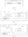
- the code stored in the memory 902 may be used to perform the map level indication method performed by the server in any one of FIG. 2 to FIG. 6 , for example, may be used to:
- an in-vehicle system 1000 may be implemented by using a structure in FIG. 10 .
- the in-vehicle system 1000 includes at least one processor 1001, at least one memory 1002, and at least one communications interface 1003.
- the processor 1001, the memory 1002, and the communications interface 1003 are connected to and communicate with each other through a communications bus.
- the processor 1001 may be a general-purpose central processing unit (CPU), a microprocessor, an application-specific integrated circuit (application-specific integrated circuit, ASIC), or one or more integrated circuits configured to control execution of the foregoing solution program.
- CPU central processing unit
- ASIC application-specific integrated circuit
- the communications interface 1003 is configured to communicate with another device or a communications network such as the Ethernet, a radio access network (RAN), or a wireless local area network (Wireless Local Area Network, WLAN).
- a communications network such as the Ethernet, a radio access network (RAN), or a wireless local area network (Wireless Local Area Network, WLAN).
- RAN radio access network
- WLAN Wireless Local Area Network
- the memory 1002 may be a read-only memory (read-only memory, ROM) or another type of static storage device that can store static information and instructions, or a random access memory (random access memory, RAM) or another type of dynamic storage device that can store information and instructions, or may be an electrically erasable programmable read-only memory (Electrically Erasable Programmable Read-Only Memory, EEPROM), a compact disc read-only memory (Compact Disc Read-Only Memory, CD-ROM) or another compact disc storage, an optical disc storage (including a compact disc, a laser disc, an optical disc, a digital versatile disc, a Blu-ray disc, or the like), a magnetic disk storage medium, another magnetic storage device, or any other medium that can be configured to carry or store expected program code in a form of an instruction or a data structure and that can be accessed by a computer.
- the memory may exist independently, and is connected to the processor through a bus. The memory may alternatively be integrated with the processor.
- the memory 1002 is configured to store application program code used to execute the foregoing solution, and the processor 1001 controls the execution.
- the processor 1001 is configured to execute the application program code stored in the memory 1002.
- the code stored in the memory 1002 may be used to perform the map level indication method performed by the target in-vehicle system in any one of FIG. 2 to FIG. 6 , for example, may be used to:
- An embodiment of the present invention further provides a computer storage medium.
- the computer storage medium may store a program, and when the program is executed, some or all steps of any map level indication method described in the foregoing method embodiments are included.
- FIG. 11 schematically shows a conceptual partial view of an example computer program product arranged according to at least some embodiments shown herein.
- the example computer program product includes a computer program for executing a computer process on a computing device.
- the example computer program product 1100 is provided by using a signal carrying medium 1101.
- the signal carrying medium 1101 may include one or more program instructions 1102.
- the one or more program instructions may provide the foregoing functions or some functions described for FIG. 2 to FIG. 6 .
- the program instructions 1102 in FIG. 11 also describe example instructions.
- the signal carrying medium 1101 may include a computer-readable medium 1703, for example but not limited to, a hard disk drive, a compact disk (CD), a digital video disc (DVD), a digital tape, a memory, a read-only memory (Read-Only Memory, ROM), or a random access memory (Random Access Memory, RAM).
- the signal carrying medium 1101 may include a computer-recordable medium 1104, for example but not limited to, a memory, a read/write (R/W) CD, an R/W DVD, or the like.
- the signal carrying medium 1101 may include a communications medium 1705, for example but not limited to, digital and/or analog communications medium (for example, an optical fiber, a waveguide, a wired communication link, or a wireless communication link). Therefore, for example, the signal carrying medium 1101 may be conveyed by the communications medium 1105 in a wireless form (for example, a wireless communications medium that complies with the IEEE 802.11 standard or another transmission protocol).
- the one or more program instructions 1102 may be, for example, one or more computer-executable instructions or one or more logic implementation instructions. In some examples, a computing device or the like described for FIG. 2 to FIG.
- 6 may be configured to provide various operations, functions, or actions in response to the program instructions 1102 transmitted to the computing device by using one or more of the computer-readable medium 1103, the computer-recordable medium 1104, and/or the communications medium 1105.
- the arrangement described herein is merely used as an example. Therefore, it may be understood by a person skilled in the art that other arrangements and other elements (for example, machines, interfaces, functions, sequences, and groups of functions) can be used instead, and that some elements may be omitted together based on an expected result.
- many of the described elements are functional entities that can be implemented as discrete or distributed components, or implemented in any suitable combination at any suitable location in combination with another component.
- the disclosed apparatuses may be implemented in other manners.
- the described apparatus embodiments are merely examples.
- division into the units is merely logical function division and may be other division in an actual implementation.
- a plurality of units or components may be combined or integrated into another system, or some features may be ignored or not performed.
- the displayed or discussed mutual couplings or direct couplings or communication connections may be implemented through some interfaces.
- the indirect couplings or communication connections between the apparatuses or units may be implemented in an electrical form or another form.
- Units described as separate parts may or may not be physically separate, and parts displayed as units may or may not be physical units, may be located in one position, or may be distributed on a plurality of network units. Some or all of the units may be selected based on actual requirements to achieve the objectives of the solutions in the embodiments.
- functional units in the embodiments of the present invention may be integrated into one processing unit, or each of the units may exist alone physically, or two or more units may be integrated into one unit.
- the integrated unit may be implemented in a form of hardware, or may be implemented in a form of a software functional unit.
- the integrated unit When the integrated unit is implemented in a form of a software functional unit and sold or used as an independent product, the integrated unit may be stored in a computer-readable memory. Based on such an understanding, the technical solutions of the present invention essentially, or the part contributing to the conventional technology, or all or some of the technical solutions may be implemented in a form of a software product.
- the computer software product is stored in a memory and includes several instructions for instructing a computer device (which may be a personal computer, a server, a network device, or the like) to perform all or some of the steps of the methods described in the embodiments of the present invention.
- the foregoing memory includes any medium that can store program code, for example, a USB flash drive, a read-only memory (ROM, Read-Only Memory), a random access memory (RAM, Random Access Memory), a removable hard disk, a magnetic disk, or an optical disc.
- ROM read-only memory
- RAM Random Access Memory
- the program may be stored in a computer-readable memory.
- the memory may include a flash memory, a read-only memory (Read-Only Memory, ROM for short), a random access memory (English: Random Access Memory, RAM for short), a magnetic disk, an optical disc, or the like.
Landscapes
- Engineering & Computer Science (AREA)
- Remote Sensing (AREA)
- Radar, Positioning & Navigation (AREA)
- General Physics & Mathematics (AREA)
- Physics & Mathematics (AREA)
- Automation & Control Theory (AREA)
- Databases & Information Systems (AREA)
- Theoretical Computer Science (AREA)
- General Engineering & Computer Science (AREA)
- Data Mining & Analysis (AREA)
- Traffic Control Systems (AREA)
- Control Of Driving Devices And Active Controlling Of Vehicle (AREA)
- Navigation (AREA)
Applications Claiming Priority (2)
| Application Number | Priority Date | Filing Date | Title |
|---|---|---|---|
| CN201910915973.0A CN112556700A (zh) | 2019-09-25 | 2019-09-25 | 地图级别指示方法、地图级别获取方法及相关产品 |
| PCT/CN2020/116532 WO2021057662A1 (zh) | 2019-09-25 | 2020-09-21 | 地图级别指示方法、地图级别获取方法及相关产品 |
Publications (2)
| Publication Number | Publication Date |
|---|---|
| EP4024006A1 true EP4024006A1 (de) | 2022-07-06 |
| EP4024006A4 EP4024006A4 (de) | 2022-11-09 |
Family
ID=75030028
Family Applications (1)
| Application Number | Title | Priority Date | Filing Date |
|---|---|---|---|
| EP20868762.4A Pending EP4024006A4 (de) | 2019-09-25 | 2020-09-21 | Verfahren zur kartenebenenanzeige, verfahren zur erlangung einer kartenebene und zugehöriges produkt |
Country Status (6)
| Country | Link |
|---|---|
| US (1) | US20220214189A1 (de) |
| EP (1) | EP4024006A4 (de) |
| JP (1) | JP2022549783A (de) |
| KR (1) | KR20220061225A (de) |
| CN (1) | CN112556700A (de) |
| WO (1) | WO2021057662A1 (de) |
Families Citing this family (1)
| Publication number | Priority date | Publication date | Assignee | Title |
|---|---|---|---|---|
| CN116278743A (zh) * | 2023-04-27 | 2023-06-23 | 上海励驰半导体有限公司 | 用于具有自动驾驶功能的车辆的控制系统和服务器 |
Family Cites Families (16)
| Publication number | Priority date | Publication date | Assignee | Title |
|---|---|---|---|---|
| FR2774468B1 (fr) * | 1998-02-03 | 2000-03-17 | Renault | Systeme et procedes de guidage dynamique d'un vehicule automobile |
| DE112009004342B4 (de) * | 2009-02-19 | 2012-12-13 | Toyota Jidosha K.K. | Mobilobjektpositionserfassungsvorrichtung |
| US8296056B2 (en) * | 2009-04-20 | 2012-10-23 | Honeywell International Inc. | Enhanced vision system for precision navigation in low visibility or global positioning system (GPS) denied conditions |
| CN101957214B (zh) * | 2010-06-03 | 2014-09-24 | 宇龙计算机通信科技(深圳)有限公司 | 一种导航提示方法及导航装置 |
| CN103718000B (zh) * | 2011-05-19 | 2017-01-18 | Sk 普兰尼特有限公司 | 实时地图数据更新系统和方法 |
| CN106355923B (zh) * | 2016-09-08 | 2018-10-09 | 江苏大学 | 车联网环境下基于实时交通信息的智慧导航系统及导航方法 |
| CN106828371A (zh) * | 2017-01-04 | 2017-06-13 | 深圳市元征科技股份有限公司 | 一种车辆控制方法及相关设备 |
| CN107462243B (zh) * | 2017-08-04 | 2019-09-20 | 浙江大学 | 一种基于高精度地图的云控自动驾驶任务生成方法 |
| US10203698B1 (en) * | 2017-08-10 | 2019-02-12 | GM Global Technology Operations LLC | System and method for providing a map to autonomous vehicles via a cloud-based system |
| KR102396731B1 (ko) * | 2018-02-27 | 2022-05-11 | 삼성전자주식회사 | 정밀 지도 데이터 제공 방법 및 이를 위한 시스템 |
| CN110276985B (zh) * | 2018-03-16 | 2020-12-15 | 华为技术有限公司 | 自动驾驶安全评估方法、装置和系统 |
| CN112602128B (zh) * | 2018-06-18 | 2023-12-12 | R·A·艾勒森 | 道路交通导航系统 |
| KR102480417B1 (ko) * | 2018-09-21 | 2022-12-22 | 삼성전자주식회사 | 전자 장치 및 전자 장치의 차량 제어 방법, 서버 및 서버의 정밀 지도 데이터 제공 방법 |
| CN109387208B (zh) * | 2018-11-13 | 2021-03-19 | 百度在线网络技术(北京)有限公司 | 一种地图数据的处理方法、装置、设备和介质 |
| CN110207719A (zh) * | 2019-05-21 | 2019-09-06 | 北京百度网讯科技有限公司 | 一种自动驾驶路径的处理方法及装置 |
| CN110031012A (zh) * | 2019-05-27 | 2019-07-19 | 爱驰汽车有限公司 | 汽车实时匹配高精地图的方法、系统、设备及存储介质 |
-
2019
- 2019-09-25 CN CN201910915973.0A patent/CN112556700A/zh active Pending
-
2020
- 2020-09-21 KR KR1020227012267A patent/KR20220061225A/ko not_active Ceased
- 2020-09-21 JP JP2022517302A patent/JP2022549783A/ja active Pending
- 2020-09-21 EP EP20868762.4A patent/EP4024006A4/de active Pending
- 2020-09-21 WO PCT/CN2020/116532 patent/WO2021057662A1/zh not_active Ceased
-
2022
- 2022-03-24 US US17/703,079 patent/US20220214189A1/en active Pending
Also Published As
| Publication number | Publication date |
|---|---|
| CN112556700A (zh) | 2021-03-26 |
| EP4024006A4 (de) | 2022-11-09 |
| JP2022549783A (ja) | 2022-11-29 |
| WO2021057662A1 (zh) | 2021-04-01 |
| US20220214189A1 (en) | 2022-07-07 |
| KR20220061225A (ko) | 2022-05-12 |
Similar Documents
| Publication | Publication Date | Title |
|---|---|---|
| CN113968216B (zh) | 一种车辆碰撞检测方法、装置及计算机可读存储介质 | |
| EP3909811B1 (de) | Adaptives einstellungsverfahren und vorrichtung für rückspiegel | |
| EP4071661A1 (de) | Automatisches fahrverfahren, zugehörige vorrichtung und computerlesbares speichermedium | |
| US9451020B2 (en) | Distributed communication of independent autonomous vehicles to provide redundancy and performance | |
| WO2021102955A1 (zh) | 车辆的路径规划方法以及车辆的路径规划装置 | |
| CN112672942B (zh) | 一种车辆换道方法及相关设备 | |
| WO2021103511A1 (zh) | 一种设计运行区域odd判断方法、装置及相关设备 | |
| CN112146671A (zh) | 路径规划方法、相关设备及计算机可读存储介质 | |
| US12409849B2 (en) | Method and apparatus for passing through barrier gate crossbar by vehicle | |
| US12319275B2 (en) | Mapping method and apparatus, vehicle, readable storage medium, and chip | |
| WO2022061702A1 (zh) | 驾驶提醒的方法、装置及系统 | |
| CN114852092A (zh) | 方向盘脱手检测方法、装置、可读存储介质及车辆 | |
| CN115123257B (zh) | 路面减速带位置识别方法、装置、车辆、存储介质及芯片 | |
| CN115042821A (zh) | 车辆控制方法、装置、车辆及存储介质 | |
| CN115205848A (zh) | 目标检测方法、装置、车辆、存储介质及芯片 | |
| JP7764590B2 (ja) | ナビゲーション方法および関連装置 | |
| EP4371834A1 (de) | Verfahren und vorrichtung zur bestimmung der richtung zum herausziehen | |
| CN113859265A (zh) | 一种驾驶过程中的提醒方法及设备 | |
| CN115042814B (zh) | 交通灯状态识别方法、装置、车辆及存储介质 | |
| CN115063987B (zh) | 车辆控制方法、装置、车辆及存储介质 | |
| US20220214189A1 (en) | Map Level Indication Method, Map Level Obtaining Method, and Related Product | |
| CN115116161A (zh) | 车辆数据采集方法、装置、存储介质以及车辆 | |
| CN114771514A (zh) | 车辆行驶控制方法、装置、设备、介质、芯片及车辆 | |
| CN114877911B (zh) | 路径规划方法、装置、车辆及存储介质 | |
| CN112639910B (zh) | 交通元素的观测方法和装置 |
Legal Events
| Date | Code | Title | Description |
|---|---|---|---|
| STAA | Information on the status of an ep patent application or granted ep patent |
Free format text: STATUS: THE INTERNATIONAL PUBLICATION HAS BEEN MADE |
|
| PUAI | Public reference made under article 153(3) epc to a published international application that has entered the european phase |
Free format text: ORIGINAL CODE: 0009012 |
|
| STAA | Information on the status of an ep patent application or granted ep patent |
Free format text: STATUS: REQUEST FOR EXAMINATION WAS MADE |
|
| 17P | Request for examination filed |
Effective date: 20220331 |
|
| AK | Designated contracting states |
Kind code of ref document: A1 Designated state(s): AL AT BE BG CH CY CZ DE DK EE ES FI FR GB GR HR HU IE IS IT LI LT LU LV MC MK MT NL NO PL PT RO RS SE SI SK SM TR |
|
| A4 | Supplementary search report drawn up and despatched |
Effective date: 20221007 |
|
| RIC1 | Information provided on ipc code assigned before grant |
Ipc: G01C 21/30 20060101AFI20220930BHEP |
|
| DAV | Request for validation of the european patent (deleted) | ||
| DAX | Request for extension of the european patent (deleted) | ||
| STAA | Information on the status of an ep patent application or granted ep patent |
Free format text: STATUS: EXAMINATION IS IN PROGRESS |
|
| 17Q | First examination report despatched |
Effective date: 20241023 |
|
| RAP1 | Party data changed (applicant data changed or rights of an application transferred) |
Owner name: SHENZHEN YINWANG INTELLIGENTTECHNOLOGIES CO., LTD. |