EP4030140A2 - Procédé et appareil permettant de déterminer un itinéraire de transport public - Google Patents
Procédé et appareil permettant de déterminer un itinéraire de transport public Download PDFInfo
- Publication number
- EP4030140A2 EP4030140A2 EP22164735.7A EP22164735A EP4030140A2 EP 4030140 A2 EP4030140 A2 EP 4030140A2 EP 22164735 A EP22164735 A EP 22164735A EP 4030140 A2 EP4030140 A2 EP 4030140A2
- Authority
- EP
- European Patent Office
- Prior art keywords
- public transport
- route
- road segment
- determining
- road
- Prior art date
- Legal status (The legal status is an assumption and is not a legal conclusion. Google has not performed a legal analysis and makes no representation as to the accuracy of the status listed.)
- Granted
Links
Images



Classifications
-
- G—PHYSICS
- G01—MEASURING; TESTING
- G01C—MEASURING DISTANCES, LEVELS OR BEARINGS; SURVEYING; NAVIGATION; GYROSCOPIC INSTRUMENTS; PHOTOGRAMMETRY OR VIDEOGRAMMETRY
- G01C21/00—Navigation; Navigational instruments not provided for in groups G01C1/00 - G01C19/00
- G01C21/26—Navigation; Navigational instruments not provided for in groups G01C1/00 - G01C19/00 specially adapted for navigation in a road network
- G01C21/28—Navigation; Navigational instruments not provided for in groups G01C1/00 - G01C19/00 specially adapted for navigation in a road network with correlation of data from several navigational instruments
- G01C21/30—Map- or contour-matching
-
- G—PHYSICS
- G01—MEASURING; TESTING
- G01C—MEASURING DISTANCES, LEVELS OR BEARINGS; SURVEYING; NAVIGATION; GYROSCOPIC INSTRUMENTS; PHOTOGRAMMETRY OR VIDEOGRAMMETRY
- G01C21/00—Navigation; Navigational instruments not provided for in groups G01C1/00 - G01C19/00
- G01C21/26—Navigation; Navigational instruments not provided for in groups G01C1/00 - G01C19/00 specially adapted for navigation in a road network
- G01C21/34—Route searching; Route guidance
- G01C21/3407—Route searching; Route guidance specially adapted for specific applications
- G01C21/3423—Multimodal routing
-
- G—PHYSICS
- G01—MEASURING; TESTING
- G01C—MEASURING DISTANCES, LEVELS OR BEARINGS; SURVEYING; NAVIGATION; GYROSCOPIC INSTRUMENTS; PHOTOGRAMMETRY OR VIDEOGRAMMETRY
- G01C21/00—Navigation; Navigational instruments not provided for in groups G01C1/00 - G01C19/00
- G01C21/26—Navigation; Navigational instruments not provided for in groups G01C1/00 - G01C19/00 specially adapted for navigation in a road network
- G01C21/34—Route searching; Route guidance
- G01C21/3407—Route searching; Route guidance specially adapted for specific applications
- G01C21/343—Calculating itineraries
-
- G—PHYSICS
- G01—MEASURING; TESTING
- G01C—MEASURING DISTANCES, LEVELS OR BEARINGS; SURVEYING; NAVIGATION; GYROSCOPIC INSTRUMENTS; PHOTOGRAMMETRY OR VIDEOGRAMMETRY
- G01C21/00—Navigation; Navigational instruments not provided for in groups G01C1/00 - G01C19/00
- G01C21/26—Navigation; Navigational instruments not provided for in groups G01C1/00 - G01C19/00 specially adapted for navigation in a road network
- G01C21/34—Route searching; Route guidance
- G01C21/3453—Special cost functions, i.e. other than distance or default speed limit of road segments
- G01C21/3469—Fuel consumption; Energy use; Emission aspects
-
- G—PHYSICS
- G01—MEASURING; TESTING
- G01C—MEASURING DISTANCES, LEVELS OR BEARINGS; SURVEYING; NAVIGATION; GYROSCOPIC INSTRUMENTS; PHOTOGRAMMETRY OR VIDEOGRAMMETRY
- G01C21/00—Navigation; Navigational instruments not provided for in groups G01C1/00 - G01C19/00
- G01C21/26—Navigation; Navigational instruments not provided for in groups G01C1/00 - G01C19/00 specially adapted for navigation in a road network
- G01C21/34—Route searching; Route guidance
- G01C21/3453—Special cost functions, i.e. other than distance or default speed limit of road segments
- G01C21/3476—Special cost functions, i.e. other than distance or default speed limit of road segments using point of interest [POI] information, e.g. a route passing visible POIs
-
- G—PHYSICS
- G01—MEASURING; TESTING
- G01C—MEASURING DISTANCES, LEVELS OR BEARINGS; SURVEYING; NAVIGATION; GYROSCOPIC INSTRUMENTS; PHOTOGRAMMETRY OR VIDEOGRAMMETRY
- G01C21/00—Navigation; Navigational instruments not provided for in groups G01C1/00 - G01C19/00
- G01C21/26—Navigation; Navigational instruments not provided for in groups G01C1/00 - G01C19/00 specially adapted for navigation in a road network
- G01C21/34—Route searching; Route guidance
- G01C21/3453—Special cost functions, i.e. other than distance or default speed limit of road segments
- G01C21/3492—Special cost functions, i.e. other than distance or default speed limit of road segments employing speed data or traffic data, e.g. real-time or historical
-
- G—PHYSICS
- G01—MEASURING; TESTING
- G01C—MEASURING DISTANCES, LEVELS OR BEARINGS; SURVEYING; NAVIGATION; GYROSCOPIC INSTRUMENTS; PHOTOGRAMMETRY OR VIDEOGRAMMETRY
- G01C21/00—Navigation; Navigational instruments not provided for in groups G01C1/00 - G01C19/00
- G01C21/38—Electronic maps specially adapted for navigation; Updating thereof
- G01C21/3804—Creation or updating of map data
- G01C21/3807—Creation or updating of map data characterised by the type of data
- G01C21/3815—Road data
-
- G—PHYSICS
- G06—COMPUTING OR CALCULATING; COUNTING
- G06Q—INFORMATION AND COMMUNICATION TECHNOLOGY [ICT] SPECIALLY ADAPTED FOR ADMINISTRATIVE, COMMERCIAL, FINANCIAL, MANAGERIAL OR SUPERVISORY PURPOSES; SYSTEMS OR METHODS SPECIALLY ADAPTED FOR ADMINISTRATIVE, COMMERCIAL, FINANCIAL, MANAGERIAL OR SUPERVISORY PURPOSES, NOT OTHERWISE PROVIDED FOR
- G06Q10/00—Administration; Management
- G06Q10/04—Forecasting or optimisation specially adapted for administrative or management purposes, e.g. linear programming or "cutting stock problem"
- G06Q10/047—Optimisation of routes or paths, e.g. travelling salesman problem
-
- G—PHYSICS
- G06—COMPUTING OR CALCULATING; COUNTING
- G06Q—INFORMATION AND COMMUNICATION TECHNOLOGY [ICT] SPECIALLY ADAPTED FOR ADMINISTRATIVE, COMMERCIAL, FINANCIAL, MANAGERIAL OR SUPERVISORY PURPOSES; SYSTEMS OR METHODS SPECIALLY ADAPTED FOR ADMINISTRATIVE, COMMERCIAL, FINANCIAL, MANAGERIAL OR SUPERVISORY PURPOSES, NOT OTHERWISE PROVIDED FOR
- G06Q10/00—Administration; Management
- G06Q10/06—Resources, workflows, human or project management; Enterprise or organisation planning; Enterprise or organisation modelling
- G06Q10/063—Operations research, analysis or management
-
- G—PHYSICS
- G08—SIGNALLING
- G08G—TRAFFIC CONTROL SYSTEMS
- G08G1/00—Traffic control systems for road vehicles
- G08G1/09—Arrangements for giving variable traffic instructions
- G08G1/0962—Arrangements for giving variable traffic instructions having an indicator mounted inside the vehicle, e.g. giving voice messages
- G08G1/0968—Systems involving transmission of navigation instructions to the vehicle
- G08G1/0969—Systems involving transmission of navigation instructions to the vehicle having a display in the form of a map
-
- G—PHYSICS
- G08—SIGNALLING
- G08G—TRAFFIC CONTROL SYSTEMS
- G08G1/00—Traffic control systems for road vehicles
- G08G1/123—Traffic control systems for road vehicles indicating the position of vehicles, e.g. scheduled vehicles; Managing passenger vehicles circulating according to a fixed timetable, e.g. buses, trains, trams
-
- G—PHYSICS
- G06—COMPUTING OR CALCULATING; COUNTING
- G06Q—INFORMATION AND COMMUNICATION TECHNOLOGY [ICT] SPECIALLY ADAPTED FOR ADMINISTRATIVE, COMMERCIAL, FINANCIAL, MANAGERIAL OR SUPERVISORY PURPOSES; SYSTEMS OR METHODS SPECIALLY ADAPTED FOR ADMINISTRATIVE, COMMERCIAL, FINANCIAL, MANAGERIAL OR SUPERVISORY PURPOSES, NOT OTHERWISE PROVIDED FOR
- G06Q2240/00—Transportation facility access, e.g. fares, tolls or parking
-
- G—PHYSICS
- G06—COMPUTING OR CALCULATING; COUNTING
- G06Q—INFORMATION AND COMMUNICATION TECHNOLOGY [ICT] SPECIALLY ADAPTED FOR ADMINISTRATIVE, COMMERCIAL, FINANCIAL, MANAGERIAL OR SUPERVISORY PURPOSES; SYSTEMS OR METHODS SPECIALLY ADAPTED FOR ADMINISTRATIVE, COMMERCIAL, FINANCIAL, MANAGERIAL OR SUPERVISORY PURPOSES, NOT OTHERWISE PROVIDED FOR
- G06Q50/00—Information and communication technology [ICT] specially adapted for implementation of business processes of specific business sectors, e.g. utilities or tourism
- G06Q50/10—Services
- G06Q50/26—Government or public services
-
- G—PHYSICS
- G06—COMPUTING OR CALCULATING; COUNTING
- G06Q—INFORMATION AND COMMUNICATION TECHNOLOGY [ICT] SPECIALLY ADAPTED FOR ADMINISTRATIVE, COMMERCIAL, FINANCIAL, MANAGERIAL OR SUPERVISORY PURPOSES; SYSTEMS OR METHODS SPECIALLY ADAPTED FOR ADMINISTRATIVE, COMMERCIAL, FINANCIAL, MANAGERIAL OR SUPERVISORY PURPOSES, NOT OTHERWISE PROVIDED FOR
- G06Q50/00—Information and communication technology [ICT] specially adapted for implementation of business processes of specific business sectors, e.g. utilities or tourism
- G06Q50/40—Business processes related to the transportation industry
Definitions
- the present disclosure relates to the field of intelligent transportation in data processing technologies and, in particular, to a method and an apparatus for determining a public transport route.
- the traffic department when determining a public transport route, the traffic department usually develops a corresponding public transport route based on the empirical information from previous planning of road traffic.
- determining the public transport route based only on human empirical information may lead to determination of the public transport route taking into account only a very small amount of information, thereby leading to incomprehensive coverage of public transport.
- the present disclosure provides a method and an apparatus for determining a public transport route.
- a method for determining a public transport route including:
- an apparatus for determining a public transport route including:
- an electronic device including:
- a non-transitory computer-readable storage medium having computer instructions stored therein, where the computer instructions are used to enable a computer to perform the method described in the first aspect.
- a computer program product including: a computer program stored in a readable storage medium, where at least one processor of an electronic device may read the computer program from the readable storage medium, and the at least one processor execute the computer program to cause the electronic device to perform the method described in the first aspect.
- the technology according to the present disclosure improves the comprehensive coverage of a determined public transport route.
- Public transport also known as mass transit, refers broadly to all modes of transportation that are open to the general public and provide transport services, usually as a commercial service for a fee, although there are a few exceptions where it is free.
- Public transport systems consist of physical elements such as roads, traffic transportation, and station facilities.
- public transport includes civil aviation, railroads, highways, waterways and other transport modes; and in a narrow sense, public transport refers to buses and railways, ferries, ropeways, and other transport modes operating on fixed lines within a city, where public transport means may include, for example, public transport vehicles, subways, light railways, buses, ferry buses, and so on.
- the public transport routes may include, for example, the following types of routes: express line, trunk line, branch line, and microcirculation. The types of routes and application scenarios of the public transport are described below.
- the express line is defined as large-stop expresses throughout an entire or partial segment of the trunk line, and it is characterized by a small number of stops on the entire or partial segment, saving time and increasing efficiency.
- a vehicle type of a public transport vehicle for a general express line includes at least one of the following: 12 m, 13.9 m, 14 m, 15 m, 16 m, and 18 m.
- a fuel of the public transport vehicle for the express line it is inadvisable to choose purely electric vehicles because of the long route, and it is advisable to choose diesel or oil-electric hybrid.
- a mileage of the public transport vehicle for the express line is usually between 20 km and 180 km.
- a group of people for the express line is those with long distance needs and commuting needs from urban district to satellite town.
- the trunk line is defined as a route on a main road, and it is characterized as a public transport route structured on the main road.
- a vehicle type of a public transport vehicle for the trunk line generally includes at least one of the following: 12 m, 13.9 m, 14 m, 15 m, 16 m, and 18 m.
- a fuel of the public transport vehicle for the trunk line may be: diesel, pure electric, or oil-electric hybrid.
- a mileage of the public transport vehicle for the trunk line is usually between 10 km and 30 km.
- a group of people of the trunk line is those with commuting needs within urban district and from urban district to satellite town.
- the branch line is defined as a branch route around a trunk line, and it is characterized as a local route that is auxiliary to the main trunk line network and radiates to surrounding branches.
- a vehicle types of a public transport vehicle for the branch line generally includes at least one of the following: 10m, 11m, 12m, 13.9m, 14m, 15m, 16m, and 18m.
- diesel, pure electric, or oil-electric hybrid may be chosen.
- a mileage of a vehicle for the branch line is usually between 8 km and 20 km.
- a group of people for the branch line is those with commuting needs in local area, with connection needs from local area to trunk line and with interchange needs of subways.
- the microcirculation is defined as a connection point route with regional nature, mostly found near communities or parks. It is characterized by the ability to connect points within the communities or parks to nearby subway stations, hubs, or trunk lines, while taking into account the needs within the communities/parks.
- a vehicle type of public transport vehicles for the microcirculation generally includes at least one of the following: 6m, 7m, 8m, 9m, 10m, 11m, and 12m.
- diesel, pure electric, or oil-electric hybrid may be chosen.
- a mileage of a vehicle for the microcirculation is usually between 1 km and 10 km.
- a group of people for the microcirculation is those with connection needs from the communities or parks to the nearby subway stations or hubs or trunk lines, as well as with medical, shopping, and door-to-door needs within the communities or parks.
- the present disclosure proposes the following technical idea: for an area where planning for a public transport route is required, road information, location information, traffic information, etc. in the area are automatically acquired, and then processed to obtain a public transport route, so that automatic generation of the public transport route may be achieved; and since the process of determining the route comprehensively relies on information from various aspects and the areas that are not covered by the public transport are determined preferentially, the comprehensive coverage of the determined public transport route is ensured.
- FIG. 1 is a schematic diagram of the system of determining a public transport route provided by an embodiment of the present disclosure.
- the system includes a preset device 101 and a server 102.
- the preset device 101 may send a route planning request to the server 102, and the route planning request is used to request a determination of a public transport route at a specified location.
- the server 102 may acquire relevant information for route determination, thereby generating a public transport route, after which the generated public transport route may, for example, be sent to the preset device.
- the preset device may be understood to be, for example, a terminal device, where the terminal device may be, for example, a computer device, a tablet computer, or a mobile phone (or known as "cellular" phone), etc.
- the terminal device may also be a portable, pocket-sized, handheld, computer-built-in mobile apparatus or device, and is not particularly limited herein.
- the preset device 101 and the server 102 in the present embodiment may conduct an interaction, where the interaction may be, for example, in a manner of a wired network, which may include, for example, coaxial cable, twisted pair, and optical fiber, etc., and where the interaction may also be, for example, in a manner of a wireless network, which may be a 2G network, a 3G network, a 4G network, a 5G network, or a wireless fidelity (WIFI) network, etc.
- a wired network which may include, for example, coaxial cable, twisted pair, and optical fiber, etc.
- a wireless network which may be a 2G network, a 3G network, a 4G network, a 5G network, or a wireless fidelity (WIFI) network, etc.
- WIFI wireless fidelity
- Embodiments of the present disclosure do not limit the specific type or specific form of the interaction, as long as it may achieve the function of the interaction between the server and the preset device.
- an executive entity of each embodiment of the present disclosure may be the above-introduced server.
- a processor, a microprocessor, etc. may act as the executive entity of each embodiment of the present disclosure in addition to the above-introduced server, and the present embodiments have no limit in this regard, any device can be used as the executive entity of the present embodiment, as long as it has the function of data sending and receiving, and data processing.
- FIG. 2 is a flowchart of the method for determining a public transport route provided by the embodiment of the present disclosure
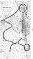
- FIG. 3 is a schematic diagram of a situation where public transport is not present provided by the embodiment of the present disclosure.
- the method includes: S201: acquiring a route planning request, where the route planning request is used to request to plan a public transport route within a first area.
- acquiring a route planning request may be implemented, for example, by receiving a route planning request from a preset device, where the route planning request is used to request to plan a public transport route within the first area.
- the route planning request may include, for example, at least one location for indicating the planning of the public transport route in the vicinity of the location, then the first area therein may, for example, be a location within a preset range of the at least one location.
- the route planning request may currently include a location A, which may, for example, be a subway station, then based on a preset radius, it is possible to, for example, determine an area within the preset radius with a position of the location A as a center of a circle, so as to obtain the first area, followed by carrying out the planning of the public transport route in the first area.
- a location A which may, for example, be a subway station
- a preset radius it is possible to, for example, determine an area within the preset radius with a position of the location A as a center of a circle, so as to obtain the first area, followed by carrying out the planning of the public transport route in the first area.
- the route planning request may directly include the first area, where the first area may, for example, be a rectangle, then the route planning request may, for example, include latitude and longitude information of four corners of the rectangle, so that the first area may be effectively determined; and in an actual implementation, a specific implementation of the first area may be selected based on actual needs. It may, for example, also be polygonal, circular, elliptical, irregular shape and so on, and is not particularly limited in the present embodiment.
- S202 identifying a plurality of road segments included in the first area in a map, and acquiring identifier of existing public transport vehicle corresponding to each road segment in a preset database.
- relevant information within the first area may be, for example, acquired in the map.
- a plurality of road segments included in the first area may be identified in the map, and herein division of the road segments may be determined, for example, based on division of the actual road segments, for example, the first area may include xx first road, xx second road, xx third road, and so on; since the information of each road segment is included in the map, the plurality of road segments included in the first area may be directly identified in the map.
- the road segments when determining the road segments included in the first area, the road segments may also be filtered based on width, height, traffic restriction, road order, and other information of the road segments, so that the road segments included in the determined first area may ensure normal passage of public transport means, for example, some alleys may be included in the first area, but buses cannot pass through the alleys, thus this part of road segments may be screened out when determining the road segments included in the first area; that is, the plurality of road segments included in the first area currently identified in the map all satisfy a preset condition, where the preset condition includes, for example, at least one of the following: width of the road segments is greater than a preset width, height restriction of the road segments is greater than a preset height, and so on.
- the preset condition includes, for example, at least one of the following: width of the road segments is greater than a preset width, height restriction of the road segments is greater than a preset height, and so on.
- the identifier of the existing public transport vehicle corresponding to each road segment may be acquired from the preset database.
- the preset database may, for example, store all the road segments in the map and the identifier of the existing public transport vehicle corresponding to each road segment, and thus the identifier of the existing public transport vehicle corresponding to each road segment among the plurality of road segments included in the first area currently determined may be acquired from the preset database.
- the identifiers of the public transport vehicles may be, for example, numbers of the public transport vehicles, and so on, for example, No. x bus, No. x subway, etc.
- the first area currently determined includes three road segments, Yinghua first road, Yinghua second road, and Yinghua third road, respectively, and then respectively acquiring the identifiers of existing public transport vehicles corresponding to these three road segments in the preset database.
- both the road segments included in the first area specifically determined, and the identifiers of existing public transport vehicles corresponding to respective road segments included in the first area may be selected based on the actual needs, and is not limited in the present embodiment.
- S203 determining a first route among the plurality of road segments based on the identifier of the existing public transport vehicle corresponding to each road segment, where the first route includes at least one road segment, there is no identical public transport vehicle in the at least one road segment, or, the number of the existing public transport vehicle corresponding to some of the road segments in the first route is smaller than or equal to a first threshold value.
- the purpose of setting up a public transport route is to facilitate travel, and then the public transport route needs to cover as large an area as possible, and thus when planning a new route, it is necessary to plan preferentially the route that is not covered by public transport.
- the first route when determining a first route among a plurality of road segments, includes at least one road segment among the plurality of road segments, there is no identical public transport vehicle in the at least one road segment, which may be commonly understood to mean that there is no through public transport route on the first route.
- the number of the existing public transport vehicle corresponding to some of the road segments is smaller than or equal to the first threshold value, which may be commonly understood to mean that there is less public transport vehicles on the some of the road segments, where a specific setting of the first threshold value may be selected based on an actual need, and is not limited in the present embodiment.
- this may be understood in combination with FIG. 3 .
- OD Oil and Destination
- the first route may be determined preferentially for the road segment between the Knowledge City and the Greenland Colorful City.
- the first route when determining the first route among the plurality of road segments included within the first area, it is possible to determine preferentially a road segment with less public transport coverage or determine preferentially a road segment with inconvenient public transport; and in an actual implementation, the first route may be determined based on other preset condition in addition to the currently introduced implementations, as long as the first route includes at least one road segment within the first area, and the determination of the first route may increases the coverage and convenience of public transport.
- S204 determining a plurality of stopping locations in the first route, generating a target public transport route based on the first route and the plurality of stopping locations, and outputting the target public transport route.
- the determination of the overall road of the public transport has been achieved, and it is understood that for the public transport, stops on the route need to be determined in addition to the need of determining the route, where the stops are stopping locations of the public transport means, and thus the stopping locations need to be determined in the first route.
- a plurality of stopping locations may be determined in the first route, for example, based on a type of a route to be planned, where the type of the route to be planned may be, for example, a bus, a shuttle bus, a ferry bus, etc., and is not limited in the present embodiment, and specially depends on which type of public transport route currently needs to be planned in the first area, and in an possible implementation, the type of the route to be planned may for example be included in the route planning request.
- a bus stop already existing in the current first route may be, for example, selected for reuse, so as to determine a plurality of stopping locations; or, for example, if the type of the route to be planned is a ferry bus, then a non-bus stop such as a community or a school in the first area may be determined as a stopping location. Implementation of determining the stopping locations is not limited in the present embodiment, as long as the stopping location is located on the first route and is determined based on the type of the route to be planned.
- a target public transport route may be generated, where the target public transport route includes the first route and the plurality of stopping locations in the first route.
- the target public transport route may be output, and in a possible implementation, for example, the target public transport route may be sent to the preset device.
- the method for determining a public transport route includes: acquiring a route planning request, where the route planning request is used to request for planning a public transport route within a first area; identifying a plurality of road segments included within the first area in a map, and acquiring identifier of existing public transport vehicle corresponding to each road segment in a preset database; determining a first route among the plurality of road segments based on the identifier of the existing public transport vehicle corresponding to each road segment, where the first route includes at least one road segment, there is no identical public transport vehicle in the at least one road segment, or the number of the existing public transport vehicle corresponding to some of the road segments in the first route is smaller than or equal to a first threshold value; determining a plurality of stopping locations in the first route, generating a target public transport route based on the first route and the plurality of stopping locations, and outputting the target public transport route.
- the public transport route is determined comprehensively based on information about this part of road and traffic information; and in this process, the public transport route is determined by combining complete road information and traffic information in the first area and the part not covered by public transport is determined preferentially, so that comprehensive coverage of the determined public transport route is improved effectively.
- FIG. 4 is a flowchart II of a method for determining a public transport route according to an embodiment of the present disclosure
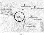
- FIG. 5 is a schematic diagram of a location of a public transport route to be planned according to an embodiment of the present disclosure
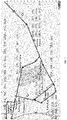
- FIG. 6 is a schematic diagram of road segments included in a first area according to an embodiment of the present disclosure
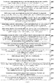
- FIG. 7 is a schematic diagram of existing public transport vehicles corresponding to a plurality of road segments according to an embodiment of the present disclosure
- FIG. 8 is a schematic diagram of at least one sub-area according to an embodiment of the present disclosure.
- the method includes: S401: acquiring a route planning request, where the route planning request is used to request for planning a public transport route within the first area.
- the first area may be understood in combination with FIG. 5 .
- the first area corresponding to the Xiangxue subway station may be determined, for example.
- an area with the Xiangxue subway station as a center and a preset length as a radius may be determined as the first are, and the planning of the public transport route may be carried out within this first area thereafter. It is also possible to determine an area with the Xiangxue subway station as the center and within a preset length and a preset width and thus determine the area as the first area.
- the present embodiment does not limit a specific implementation of determining the first area.
- the first area may be an area near a target location in question currently, or may also be an area jointly determined by a plurality of target locations, or may also be a preset area, etc., and is not limited in the present embodiment.
- S402 identifying a plurality of road segments included in the first area in the map, and acquiring identifier of existing public transport vehicle corresponding to each road segment in a preset database.
- S402 is implemented in a similar manner as the implementation of S202, and implementations of determining the route and of the identifiers of the public transport vehicles are each described below in combination with FIG. 6 and FIG. 7 .
- a plurality of road segments included in the first area corresponding to the Xiangxue subway station may be currently identified in the map, and may include, for example: Xiangxue Avenue, Xiangxue eighth Road, Kailuo Avenue, Kaichuang Avenue, Lihong second Road, Kaitai Avenue, Ruihe Road, Kaiyuan Avenue, Yunfeng Road, and Suinan Road, as shown in FIG. 6 .
- the identifier of the existing public transport vehicle corresponding to each road segment are stored in the preset database, then the identifier of the existing public transport vehicle corresponding to each road segment in FIG. 6 may be acquired.
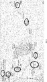
- the identifiers of the existing public transport vehicle corresponding to each road segment may be understood, for example, in combination with FIG. 7 ; assuming that the above example continues to be used, for example, the identifiers of the existing public transport vehicle corresponding to the Kaichuang Avenue includes the following: 335, 365, 371, 371A, 375, 391, and 946 as shown in FIG. 7 .
- the identifiers of existing public transport vehicles corresponding to other road segments may refer to FIG. 7 and will not be repeatedly described here.
- the road information included in the first area i.e., the plurality of road segments within the scope of the first area
- the traffic information included in the first area i.e., the identifiers of the public transport vehicles corresponding to the plurality of road segments respectively in the first area.
- the plurality of road segments in the first area and the identifiers of the public transport vehicles corresponding to each road segment respectively may be determined based on an actual road condition and traffic, and is not limited in the present embodiment.
- S403 performing a combination treatment on at least two adjacent road segments among the plurality of road segments to obtain a plurality of combined road segments.
- a first route may be determined in the plurality of road segments in the present embodiment, where the first route may include at least one road segment, and it is understood that the at least one road segment in the first route may inevitably form a continuous route, so that the determined first route is meaningful.
- At least two adjacent road segments among the plurality of road segments may be subjected to a combination treatment firstly, so as to determine a plurality of combined road segments, where the combined road segments may also be understood as units of the first route.
- various possible combinations of at least two adjacent segments among the plurality of segments may be determined, for example, so as to determine a plurality of combined road segments; alternatively, only some of combinations may be determined, so as to determine a plurality of combined road segments,. Specific implementations of the combinations are not limited in the present embodiment, and may be selected based on actual needs.
- S404 determining the number of the existing public transport vehicle corresponding to each road segment based on the identifier of the existing public transport vehicle corresponding to each road segment.
- the road segment with fewer public transport vehicles may be determined preferentially.
- the number of the existing public transport vehicle corresponding to each road segment may be determined based on the identifier of existing public transport vehicle corresponding to each road segment, which can be understand, for example, in combination with FIG. 7 , in which the identifier of the existing public transport vehicle corresponding to each road segment is marked, for example, the number of the existing public transport vehicle corresponding to Ruihe Road is 8, the number of the existing public transport vehicle corresponding to Kai Tai Avenue is 6, and the like, other roads are similar thereto, and will not be repeated here.
- S405 determining a priority corresponding to each road segment based on the number of the existing public transport vehicle corresponding to each road segment.
- the priority corresponding to each road segment may be determined. It may be understood that the route determination is performed preferentially on the road segment with a smaller number of public transport vehicles currently, so the number of the existing public transport vehicle on a road segment and the priority of the road segment are actually inversely proportional to each other, that is, the higher the number of the existing public transport vehicle on the road segment, the lower the priority of the road segment, and accordingly, the lower the number of public transport vehicles on the road segment, the higher the priority of the road segment.
- determining the priority corresponding to the road segment based on the number of the existing public transport vehicles corresponding to the road segment it may be, for example, that if the number of the existing public transport vehicle corresponding to the road segment is N, the priority corresponding to the road segment is determined to be L-N, where N is an integer greater than or equal to 0, and L is a preset positive integer.
- L may be preset to 10, assuming that the number of the existing public transport vehicle corresponding to a current road segment A is 1, then the priority corresponding to the road segment A is 9; and assuming that the number of the existing public transport vehicle corresponding to a current road segment B is 8, then the priority corresponding to the road segment B is 2. It may be seen that the number of the existing public transport vehicle of the road segment A is less than the number of the existing public transport vehicle of the road segment B. Correspondingly, the priority of the road segment A is also higher than that of the road segment B. In an actual implementation, a specific setting of L may be selected based on an actual need, and is not limited in the present embodiment.
- a first preset function may indicate an inverse relationship between the number of the existing public transport vehicle corresponding to a road segment and the priority corresponding to the road segment, for example, the number of the existing public transport vehicle corresponding to the road segment may be input into the first preset function, so as to obtain the priority corresponding to the road segment output by the first preset function.
- the present embodiment does not limit the specific implementation of the determined priority corresponding to the road segment, as long as it may ensure that the number of the existing public transport vehicle corresponding to the road segment is in inverse ratio to the priority corresponding to the road segment.
- S406 determining identifier of an existing public transport vehicle corresponding to each road segment in a combined road segment based on the identifier of the existing public transport vehicle corresponding to each road segment.
- S407 determining the number of first public transport vehicle corresponding to the combined road segment based on the identifier of the existing public transport vehicle corresponding to each road segment in the combined road segment, where the first public transport vehicle is an existing public transport vehicle corresponding to all road segments in the combined road segment.
- At least one combined road segment may be determined based on a plurality of road segments in the first area in the present embodiment, where each road segment corresponds to its own identifier of the existing public transport vehicle, and then the identifier of the existing public transport vehicle corresponding to each road segment in the combined road segment may be determined.
- the number of the first public transport vehicle corresponding to the combined road segment may be determined based on the identifier of the existing public transport vehicle corresponding to each road segment in the combined road segment, where the first public transport vehicle is an existing public transport vehicle corresponding to all road segments in the combined road segment.
- the first public transport vehicle is in fact the public transport vehicle common to road segments in the combined road segment, for example, this may be understood by continuing to use the above example and in combination with FIG. 6 and FIG. 7 .
- the public transport vehicles identified as 365, 371, 371A exist on both Kaichuang Avenue and Kaiyuan Avenue, and thus it may be determined that the public transport vehicles 365, 371, and 371A are the first public transport vehicles corresponding to the combined road segment 1.
- S408 determining a priority corresponding to the combined road segment based on the number of the first public transport vehicle corresponding to the combined road segments.
- the first public transport vehicle is a public transport vehicle that is present in each road segment of the combined road segment, then the larger the number of the first public transport vehicle, the more comprehensive the public transport coverage of the current combined road segment.
- the number of the first public transport vehicle is 0, it means that there is no through public transport vehicle in this combined road segment, and then it is more necessary to plan the public transport route, so the number of the first public transport vehicle corresponding to the combined road segment and the priority of the combined road segment are actually inversely proportional to each other.
- determining the priority corresponding to the combined road segment it may be, for example, that if the number of the first public transport vehicle corresponding to the combined road segment is M, the priority corresponding to the combined road segment is determined to be T-M, where M is an integer greater than or equal to 0, and T is a preset positive integer.
- T may be preset to 10, and assuming that the number of the first public transport vehicle corresponding to current combined road segment 1 is 3, then the priority corresponding to the combined road segment 1 is 7; then assuming that there is currently existed a combined road segment 2, and with no the same public transport vehicle exists between road segments in the combined road segment 2, then it may be determined that the number of the first public transport vehicle corresponding to the combined road segment 2 is 0, then it may be determined that the priority corresponding to the combination road section 2 is 10. It can be seen that the number of the first public transport vehicle of the combined road segment 2 is smaller, and correspondingly the priority corresponding to the combined road segment 2 is higher.
- the specific setting of T may be selected based on an actual need, and is not limited in the present embodiment.
- the number of the first public transport vehicle corresponding to the combined road segment may be input into the second preset function, so as to obtain the priority corresponding to the combined road segment output by the second preset function.
- the present embodiment does not limit the specific implementation of determining the priority corresponding to the combined road segment, as long as it may ensure that the number of the first public transport vehicle corresponding to the combined road segment is in inverse ratio to the priority corresponding to the combined road segment.
- S409 determining a first route among the plurality of road segments based on the priority corresponding to each road segment, and the priority corresponding to each combined road segment.
- the first route among the plurality of road segments may be determined based on the priority information of these two parts.
- the first route includes the first combined road segment.
- the priority corresponding to a certain combined road segment is T, which means that the number M of first public transport vehicle corresponding to the combined road segments is 0, then it is determined that there is no through public transport vehicle in the combined road segment, and therefore the priority of the combined road segment is high, and taking the coverage of public transport into account, it is determined that the first combined road segment is included in the first route;
- the combined road segment with the highest priority and the road segment with the highest priority are determined, and then the first route is determined, and it is possible to include in the first route only the combined road segment with the highest priority, or include in the first route only the road segment with the highest priority, or include in the first route both the combined road segment with the highest priority and the road segment with the highest priority in the first route.
- the specific implementation of the above may be selected based on an actual need, but it is worth stating that for road segments included in the determined first route, it is necessary to ensure that the road segments form a continuous route.
- the first route after determining that the first route includes the combined road segment with the highest priority or the road segment with the highest priority, as introduced above, the first route also includes some other road segments, the other road segments, for example, may be also road segments with high priority, or road segments consecutive to the determined road segments, etc.
- the present embodiment has no limit on this, as long as it can be ensured that the first route may include a corresponding road segments in each situation described above, and each road segment may form a continuous route,.
- Other possible implementations may be selected based on an actual need.
- a preset function may be provided, and is used, for example, to perform processing based on the priority of each road segment and the priority of each combined road segment and output the first route.
- the specific implementation for determining the first route may be selected and extended based on an actual need, and it is not limited in the present embodiment, as long as the first route is determined based on the priority of the route and the priority of the combined route.
- the first route may be currently determined, and the road segments included in the first route are: Suinan Road, Yunfeng Road, Kaiyuan Avenue, Ruihe Road, Lihong Second Road, Kaichuang Avenue, Xiangxue Eight Road, Xiangxue Avenue, and Kai Luo Avenue, which form routes for shuttle buses with the Xiangxue subway station as the center.
- S410 determining at least one sub-area in the first area.
- At least one sub-area may be determined in the first area, where the sub-area may be, for example, a community, a shopping mall, a school, a hospital, etc. in the first area.
- a point of interest in the first area may be used as a sub-area.
- points of interest for the community, shopping mall, school, hospital, and the like included in the first area can be obtained in the map so as to determine at least one sub-area.
- the first area near the Xiangxue subway station is currently determined.
- one office area, one commercial center, five communities, and one park green area shown in FIG. 8 may be determined in the first area, and these may be used as sub-areas.
- the specific determination of the sub-areas may be selected based on an actual need, and is not limited in the present embodiment.
- S411 determining at least one first stopping location in the first route based on a location of the sub-area.
- At least one first stopping location may be determined in the first route based on the location of the sub-area, where the first stopping location is used for the public transport vehicle to make a stop, and it is understood that the currently set first stopping location is actually a stop in the first route.
- a position close to a front side of a point locations of each sub-area and located on the first route may be determined as a stopping location, so as to facilitate boarding and alighting of passengers.
- a stop may be set in a front side position of the community, thereby facilitating the stopping of vehicles and the boarding and alighting of passengers, but it is necessary to ensure that the first stopping location is located on the first route.
- the specific choice of the first stopping location may be determined based on an actual need, and is not limited in the present embodiment.
- S412 determining at least one second stopping location among the existing stopping location based on the at least one first stopping location.
- the first stopping location may serve as a stop corresponding to each sub-area in the first area, but the distribution of the sub-areas may not be uniform, so that determining only the first stopping location does not ensure comprehensive coverage of the stops on the first route, so that at least one second stopping location may also be determined among the existing stopping locations based on the first stopping location.
- an existing stopping location that makes the distribution of stops on the first route relatively uniform may be selected. For example it is possible to obtain the existing stopping locations between first stopping locations and then select an existing stopping location that makes the distribution of stops relatively uniform, so as to determine at least one second stopping location.
- a bus stop with a harbor may be selected preferentially as the second stopping location.
- the present embodiment does not limit the specific implementation of determining the second stopping location, as long as the second stopping location may be located on the first route, and the second stopping location and the first stopping location may jointly make the distribution of stops relatively uniform .
- S413 determining a plurality of stopping locations including at least one first stopping location and at least one second stopping location.
- the plurality of stopping locations including at least one first stopping location and at least one second stopping location, so as to achieve the determination of the stops on the first route.
- the currently determined first route includes: Suinan Road, Yunfeng Road, Kaiyuan Avenue, Ruihe Road, Lihong Second Road, Kaichuang Avenue, Xiangxue Eight Road, Xiangxue Avenue, and Kailuo Avenue
- the determined plurality of stopping locations may include, for example, Lingnan Yazhu, Zhonghai Yucheng, Innovation Park, Chunshuli, Donghui City South, Donghui City, Wanhui Commercial, Plaza, Xiangxue City, Xiangxue Subway, Luogang Aoyuan Plaza, Guangzhou International Talent City, Xiangxue Subway, all of which are stops on this first route.
- S414 generating a target public transport route based on the first route and the plurality of stopping locations.
- the determination of a specific path and the determination of stops of a public transport route is achieved, so as to generate the target public transport route.
- the target public transport route currently determined may include information as follows: setting of stops in the route:
- Capacity and Frequency 10 vehicles (9 on line, 1 expedient), departure interval: 7:00-9:00, 17:00-19:00, at 10-minutes intervals; 9:00-17:00, at 20-minutes intervals; 20-minutes intervals on weekends.
- Bus routes with overlap of road segments 327A Road; 365 Road; 367 Road; 371A Road; 371 Road; 373 Road; 506 Road; 516 Road; 566A Road; 571A Road; 942 Road; 948 Road; and B31 Road.
- Types of road segments Suinan Road, one-way and 2 lanes; Yunfeng Road, one-way and 2 lanes; Kaiyuan Avenue, one-way and 3-4 lanes; Ruihe Road, one-way and 3 lanes; Lihong Second Road, one-way and 3 lanes; Kaichuang Avenue, one-way and 4 lanes; Xiangxue Eighth Road, one-way and 2 lanes; Xiangxue Avenue, one-way and 2 lanes; and Kailuo Avenue, one-way and 2 lanes.
- three elements of route planning may be introduced here, and the three elements are point, line, and plane.
- the point mainly refers to the determination of a stop
- the point may be classified based on a bus stop and a non-bus stop
- the non-bus stop may include, for example, a community entrance, an office building, a garden entrance, and a park entrance.
- a requirement of point selection for the classification of these points may be, for example, that for the bus stop, it is preferential to select a bus stops with a harbor, and for the non-bus stop, it is preferential to select a position of the front side of the points locations.
- the line mainly refers to the determination of the first route, and in the determination of the route, for example, the roads that are passable for the public transport means may be determined based on such as width, height, traffic restriction and road order of each road, and in the specific selection of the first route, the OD route covering a vacant direction and a blank area not accessible by public transport are selected preferentially.
- the plane mainly refers to the determination of the vehicle operation plan, and when determining the plane, for example, for a community, an O-peak time is in the morning and a D-peak time in the evening; for an office building, an O-peak time is in the evening and a D-peak time in the morning; for a commercial center, a middle of the OD time area is off-peak periods, and weekends and holidays; for a park green area, a middle of the OD time area is off-peak periods, weekends and holidays; where the O-peak for example may be understood as the peak for getting out, D peak may be understood as the peak for returning, that is, they correspond to different directions of route traffic. Based on the peak time information of these different areas, numbers of buses, intervals, the number of vehicles, etc. may be determined, that is, the "Capacity and Frequency" described above is determined.
- the specific implementation of the target public transport route determined finally may be selected based on an actual need, and is not limited in the present embodiment.
- S415 plotting and displaying the target public transport route in the map; or, sending the target public transport route to a preset device.
- the target public transport route may be drawn and displayed directly in the map, for example, to facilitate an intuitive and quick determination of the target public transport route currently determined; or, the target public transport route may be sent to the preset device, which may also quickly determine the target public transport route currently determined.
- the method for determining a public transport route involves determining a priority of a road segment based on the number of public transport vehicles on the road segment, and a priority of the combined road segment based on the number of public transport vehicles coexisting in road segments in the combined road segment, and then jointly determining the first route by combining the priority of road segments with the priority of the combined road segment.
- the first route may preferentially cover the area lacking public transport, thereby effectively improving the rationality of the determined public transport route.
- the stops for the first route are specifically determined based on each sub-area in the first route and the existing stops, thereby effectively ensuring the rationality of the determination of stops.
- FIG. 9 is a schematic diagram of a structure of a determination device for a public transport route of an embodiment of the present disclosure.
- the determination device 900 of the public transport route of the present embodiment may include: an acquisition module 901, a first processing module 902, a determination module 903, and a second processing module 904.
- the acquisition module 901 is configured to acquire a route planning request, where the route planning request is used to request for planning a public transport route within a first area;
- the determination module 903 is specifically configured to:
- the determination module 903 is specifically configured to:
- the determination module 903 is specifically configured to: determine the priority corresponding to a road segment as L-N if the number of the existing public transport vehicle corresponding to the road segment is N, where the N is an integer greater than or equal to 0, and the L is a preset positive integer.
- the determination module 903 is specifically configured to:
- the determination module 903 is specifically configured to: determine the priority corresponding to the combined road segment as T-M if the number of the first public transport vehicle corresponding to the combined road segment is M, where the M is an integer greater than or equal to 0, and the T is a preset positive integer.
- the determination module 903 is specifically configured to:
- the second processing module 904 is specifically configured to:
- the second processing module 904 is specifically configured to:
- the second processing module 904 is specifically configured to:
- the present disclosure provides a method and an apparatus for determining a public transport route, applied in the field of intelligent transportation in data processing technology, for the purpose of improving the comprehensive coverage of the determined public transport route.
- the present disclosure further provides an electronic device and a readable storage medium.
- the present disclosure further provides a computer program product, where the computer program product includes: a computer program stored in a readable storage medium, at least one processor of an electronic device may read the computer program from the readable storage medium, and the at least one processor executes the computer program to cause the electronic device to perform the solution provided by any one of the above embodiments.
- FIG. 8 illustrates a schematic block diagram of an exemplarily electronic device 800 that may be used to implement embodiments of the present disclosure.
- the electronic device is intended to represent digital computers in various forms, such as, laptops, desktop computers, workstations, personal digital assistants, servers, blade servers, mainframe computers, and other suitable computers.
- the electronic device may also represent mobile apparatuses in various forms, such as, personal digital processing, cellular phones, smart phones, wearable devices, and other similar computing apparatuses.
- the components shown herein, their connections and relationships, and their functions are used as examples only, and are not intended to limit the implementations of the present disclosure described and/or claimed herein.
- the electronic device 1000 includes a computing unit 1001 that may perform various appropriate actions and processes based on a computer program stored in a read-only memory (ROM) 1002 or loaded into a random access memory (RAM) 1003 from a storage unit 1008.
- ROM read-only memory
- RAM random access memory
- Various programs and data required for operation of the device 1000 may also be stored in RAM 1003.
- the computing unit 1001, ROM 1002, and RAM 1003 are connected to each other via a bus 1004.
- An input/output (I/O) interface 1005 is also connected to the bus 1004.
- a plurality of components in the device 1000 are connected to the I/O interface 1005, and include: an input unit 1006, such as keyboards, mice, etc.; an output unit 1007, such as various types of displays, speakers, etc.; a storage unit 1008, such as magnetic disks, optical disks, etc.; and a communication unit 1009, such as network cards, modems, wireless communication transceivers, etc.
- the communication unit 1009 allows the device 1000 to exchange information/data with other devices via a computer network such as the Internet and/or various telecommunication networks.
- the computing unit 1001 may be a variety of general and/or special processing components with processing and computing capabilities. Some examples of the computing unit 1001 include, but are not limited to, central processing units (CPUs), graphics processing units (GPUs), various special artificial intelligence (AI) computing chips, various computing units running machine learning model algorithms, digital signal processors (DSPs), and any appropriate processors, controllers, micro-controllers, etc.
- the computing unit 1001 performs the methods and processes described above, such as method for determining a public transport route.
- the method for determining the public transport route may be implemented as a computer software program that is tangibly included in a machine-readable medium, such as the memory unit 1008.
- some or all of the computer program may be loaded into and/or installed onto the device 1000 via the ROM 1002 and/or the communication unit 1009.
- the computer program When the computer program is loaded into RAM 1003 and executed by the computing unit 1001, one or more steps of the method for determining a public transport route described above may be performed.
- the computing unit 1001 may be configured to perform the method for determining a public transport route by any other appropriate mode (e.g., with the aid of firmware).
- Various implementations of the systems and techniques described above herein may be achieved in a digital electronic circuit system, an integrated circuit system, a field programmable gate array (FPGA), an application specific integrated circuit (ASIC), an application specific standard part (ASSP), a system on chip (SOC), a complex programmable logic device (CPLD), computer hardware, firmware, software, and/or combinations of them.
- FPGA field programmable gate array
- ASIC application specific integrated circuit
- ASSP application specific standard part
- SOC system on chip
- CPLD complex programmable logic device
- These various implementations may include: implementing in one or more computer programs that may be executed and/or interpreted on a programmable system including at least one programmable processor, the programmable processor may be a special or general programmable processor that may receive data and instructions from a storage system, at least one input apparatus, and at least one output apparatus, and transmit the data and instructions to the storage system, the at least one input apparatus, and the at least one output apparatus.
- the programmable processor may be a special or general programmable processor that may receive data and instructions from a storage system, at least one input apparatus, and at least one output apparatus, and transmit the data and instructions to the storage system, the at least one input apparatus, and the at least one output apparatus.
- the program codes for implementing the methods of the present disclosure may be written in any combination of one or more programming languages. These program codes may be provided to a processor or controller of a general computer, a special computer, or other programmable data processing device such that the program codes, when executed by the processor or controller, causes the functions/operations specified in the flowchart and/or block diagram to be implemented.
- the program codes may be executed entirely on a machine, partially on a machine, or partially on a machine as an independent software package and partially on a remote machine, or entirely on a remote machine or server.
- a machine-readable medium may be a tangible medium that may include or store a program for use by or in combination with an instruction-executing system, apparatus, or device.
- the machine-readable medium may be a machine-readable signal medium or a machine-readable storage medium.
- a machine-readable medium may include, but is not limited to, electronic, magnetic, optical, electromagnetic, infrared, or semiconductor systems, devices, or apparatus, or any suitable combination of the foregoing.
- machine-readable storage media may include electrical connections based on one or more wires, portable computer disks, hard disks, random access memory (RAM), read-only memory (ROM), erasable programmable read-only memories (EPROMs or flash memory), optical fibers, convenient compact disk read-only memories (CD-ROMs), optical storage devices, magnetic storage devices, or any suitable combination of the foregoing.
- RAM random access memory
- ROM read-only memory
- EPROMs or flash memory erasable programmable read-only memories
- CD-ROMs compact disk read-only memories
- magnetic storage devices magnetic storage devices, or any suitable combination of the foregoing.
- a computer having: a display device (e.g., a CRT (cathode ray tube) or LCD (liquid crystal display) monitor) for displaying information to the user; and a keyboard and pointing apparatus (e.g., a mouse or trackball) through which the user may provide an input to the computer.
- a display device e.g., a CRT (cathode ray tube) or LCD (liquid crystal display) monitor
- a keyboard and pointing apparatus e.g., a mouse or trackball
- Other types of devices may further be used to provide interaction with the user; for example, a feedback provided to the user may be any form of sensory feedback (e.g., visual feedback, auditory feedback, or haptic feedback); and the input from the user may be received in any form (including acoustic input, voice input, or haptic input).
- the systems and techniques described herein may be implemented in a computing system including a back-end component (e.g., as a data server), or a computing system including a middleware component (e.g., an application server), or a computing system including a front-end component (e.g., a user computer having a graphical user interface or a web browser through which a user may interact with the implementation of the systems and techniques described herein), or a computing system including any combination of such back-end component, middleware component, or front-end component.
- the components of the system may be interconnected via any form or medium of digital data communication (e.g., a communication network). Examples of the communication network include local area networks (LANs), wide area networks (WANs), and the Internet.
- a computer system may include a client and a server.
- the client and server are generally located away from each other and interact by a communication network.
- a relationship between the client and the server is generated by computer programs that run on corresponding computers and have a client-server relationship with each other.
- the server may be a cloud server, also known as a cloud computing server or cloud host, which is a host product in the cloud computing service system to solve the defects of difficult management and weak business scalability existed in the traditional physical host and VPS service ("Virtual Private Server", or "VPS" for short).
- the server may also be a server for a distributed system, or a server combined with a block-chain.
Landscapes
- Engineering & Computer Science (AREA)
- Radar, Positioning & Navigation (AREA)
- Remote Sensing (AREA)
- Physics & Mathematics (AREA)
- General Physics & Mathematics (AREA)
- Automation & Control Theory (AREA)
- Business, Economics & Management (AREA)
- Human Resources & Organizations (AREA)
- Strategic Management (AREA)
- Economics (AREA)
- Tourism & Hospitality (AREA)
- General Business, Economics & Management (AREA)
- Theoretical Computer Science (AREA)
- Entrepreneurship & Innovation (AREA)
- Marketing (AREA)
- Operations Research (AREA)
- Development Economics (AREA)
- Game Theory and Decision Science (AREA)
- Quality & Reliability (AREA)
- Educational Administration (AREA)
- Health & Medical Sciences (AREA)
- General Health & Medical Sciences (AREA)
- Primary Health Care (AREA)
- Navigation (AREA)
- Traffic Control Systems (AREA)
- Information Retrieval, Db Structures And Fs Structures Therefor (AREA)
- Management, Administration, Business Operations System, And Electronic Commerce (AREA)
Applications Claiming Priority (1)
| Application Number | Priority Date | Filing Date | Title |
|---|---|---|---|
| CN202110729822.3A CN113514071B (zh) | 2021-06-29 | 2021-06-29 | 公共交通路线的确定方法及装置 |
Publications (3)
| Publication Number | Publication Date |
|---|---|
| EP4030140A2 true EP4030140A2 (fr) | 2022-07-20 |
| EP4030140A3 EP4030140A3 (fr) | 2022-10-26 |
| EP4030140B1 EP4030140B1 (fr) | 2024-02-28 |
Family
ID=78066211
Family Applications (1)
| Application Number | Title | Priority Date | Filing Date |
|---|---|---|---|
| EP22164735.7A Active EP4030140B1 (fr) | 2021-06-29 | 2022-03-28 | Procédé et appareil permettant de déterminer un itinéraire de transport public |
Country Status (5)
| Country | Link |
|---|---|
| US (1) | US11867518B2 (fr) |
| EP (1) | EP4030140B1 (fr) |
| JP (1) | JP7358528B2 (fr) |
| KR (1) | KR20220007035A (fr) |
| CN (1) | CN113514071B (fr) |
Families Citing this family (3)
| Publication number | Priority date | Publication date | Assignee | Title |
|---|---|---|---|---|
| CN114648057B (zh) * | 2022-02-22 | 2025-08-29 | 浙江大华技术股份有限公司 | 交通路线的生成方法、装置、电子装置和存储介质 |
| US12352585B2 (en) | 2023-11-21 | 2025-07-08 | Suzhou University of Science and Technology | Park-and-ride route generation method, system, device, and medium |
| CN117809474B (zh) * | 2023-11-21 | 2024-10-22 | 苏州科技大学 | 停车换乘路线的生成方法、系统、设备及介质 |
Family Cites Families (29)
| Publication number | Priority date | Publication date | Assignee | Title |
|---|---|---|---|---|
| US20070138347A1 (en) * | 2004-12-16 | 2007-06-21 | Ehlers Gregory A | System and method for providing information to an operator of a vehicle |
| US20100299177A1 (en) * | 2009-05-22 | 2010-11-25 | Disney Enterprises, Inc. | Dynamic bus dispatching and labor assignment system |
| US8688532B2 (en) * | 2009-12-11 | 2014-04-01 | General Motors Llc | Real-time ride share system |
| CN102129770B (zh) * | 2010-01-19 | 2013-01-16 | 北京四维图新科技股份有限公司 | 构建公交网络的方法及装置 |
| JP5476148B2 (ja) * | 2010-02-09 | 2014-04-23 | 株式会社構造計画研究所 | バス路線評価支援装置、バス路線評価支援方法及びバス路線評価支援プログラム |
| CN103942948B (zh) * | 2014-04-10 | 2016-03-16 | 中南大学 | 基于分段拼接的城市公交线路网络的生成方法 |
| CN105468595A (zh) | 2014-08-12 | 2016-04-06 | 中国科学院深圳先进技术研究院 | 公交线路规划方法及系统 |
| CN105023426B (zh) * | 2015-05-18 | 2017-06-30 | 南京邮电大学 | 一种城市公交路线选择方法 |
| US9562785B1 (en) * | 2015-07-20 | 2017-02-07 | Via Transportation, Inc. | Continuously updatable computer-generated routes with continuously configurable virtual bus stops for passenger ride-sharing of a fleet of ride-sharing vehicles and computer transportation systems and computer-implemented methods for use thereof |
| US20170109764A1 (en) * | 2015-10-19 | 2017-04-20 | Xerox Corporation | System and method for mobility demand modeling using geographical data |
| CN107167151B (zh) * | 2016-03-08 | 2021-03-05 | 阿里巴巴(中国)有限公司 | 公交车线路设置方法、路线规划方法及装置 |
| CN105808877B (zh) * | 2016-03-21 | 2019-03-19 | 南通大学 | 一种基于站点停靠能力的公交线网布设方法 |
| US20180143027A1 (en) * | 2016-11-22 | 2018-05-24 | Microsoft Technology Licensing, Llc | Dynamic route planning for demand-based transport |
| JP6828409B2 (ja) | 2016-12-13 | 2021-02-10 | 住友電気工業株式会社 | 経路探索システム、経路探索装置、経路探索方法及びコンピュータプログラム |
| CN106651034B (zh) * | 2016-12-23 | 2020-10-27 | 中山大学 | 一种公交线网规划方法 |
| CN107194128B (zh) * | 2017-06-30 | 2020-05-05 | 东南大学 | 基于中心辐射型网络框架的多模式公共交通网络设计方法 |
| CN108805356A (zh) * | 2018-06-11 | 2018-11-13 | 苏州规划设计研究院股份有限公司 | 小区域公交线路优化方法及系统 |
| CN108831149B (zh) * | 2018-06-14 | 2020-12-22 | 重庆同枥信息技术有限公司 | 一种基于历史od信息定制公交线路开行方法及系统 |
| CN108647910B (zh) * | 2018-06-15 | 2022-04-01 | 武汉轻工大学 | 城市公交站点的设置方法、装置、终端及计算机存储介质 |
| CN110929910B (zh) * | 2018-09-20 | 2024-02-09 | 京东科技控股股份有限公司 | 公交线路调整方法和装置 |
| CN109493601B (zh) * | 2018-11-21 | 2021-02-09 | 青岛大学 | 一种公交支线设置方法 |
| CN109902878B (zh) * | 2019-03-05 | 2023-05-02 | 创新先进技术有限公司 | 用于优化公共交通线路的方法及装置 |
| CN110490381B (zh) * | 2019-08-16 | 2020-10-30 | 深圳市都市交通规划设计研究院有限公司 | 基于混合整数规划的公交主干线规划方法 |
| CN110598930B (zh) * | 2019-09-11 | 2023-11-07 | 长沙理工大学 | 一种公交线路优化调整方法及装置 |
| CN110598942B (zh) * | 2019-09-18 | 2023-10-20 | 北京工业大学 | 一种考虑区域全覆盖的接驳地铁的社区公交线网与发车频率同步优化方法 |
| CN112700073B (zh) * | 2019-10-22 | 2024-04-12 | 华为云计算技术有限公司 | 公交线路规划方法和装置 |
| CN111897868B (zh) * | 2020-07-31 | 2022-06-10 | 浙江大学 | 用于分析与规划公交线路的可视分析方法和系统 |
| CN112419704A (zh) | 2020-11-06 | 2021-02-26 | 杭州图软科技有限公司 | 一种基于大数据的公共交通路线规划方法及其系统 |
| CN112906981A (zh) * | 2021-03-19 | 2021-06-04 | 上海市城市建设设计研究总院(集团)有限公司 | 基于计算机的换乘覆盖率公共交通线路站点设置评价方法 |
-
2021
- 2021-06-29 CN CN202110729822.3A patent/CN113514071B/zh active Active
- 2021-12-30 KR KR1020210193140A patent/KR20220007035A/ko not_active Withdrawn
-
2022
- 2022-02-18 JP JP2022023348A patent/JP7358528B2/ja active Active
- 2022-03-24 US US17/703,865 patent/US11867518B2/en active Active
- 2022-03-28 EP EP22164735.7A patent/EP4030140B1/fr active Active
Also Published As
| Publication number | Publication date |
|---|---|
| US20220214175A1 (en) | 2022-07-07 |
| KR20220007035A (ko) | 2022-01-18 |
| JP2022068292A (ja) | 2022-05-09 |
| JP7358528B2 (ja) | 2023-10-10 |
| EP4030140A3 (fr) | 2022-10-26 |
| EP4030140B1 (fr) | 2024-02-28 |
| CN113514071B (zh) | 2024-04-16 |
| US11867518B2 (en) | 2024-01-09 |
| CN113514071A (zh) | 2021-10-19 |
Similar Documents
| Publication | Publication Date | Title |
|---|---|---|
| EP4030140A2 (fr) | Procédé et appareil permettant de déterminer un itinéraire de transport public | |
| He et al. | Optimal locations of US fast charging stations for long-distance trip completion by battery electric vehicles | |
| Gorev et al. | Demand-responsive transit systems in areas with low transport demand of “smart city” | |
| CN107240254B (zh) | 交通路况预测方法及终端设备 | |
| CN107036617A (zh) | 一种出租车与地铁组合的出行路线规划方法及系统 | |
| CN103295394B (zh) | 基于广义gps数据的出租车候客站点备选地址确定方法 | |
| CN105243836A (zh) | 一种拼车方法和设备 | |
| CN109978267B (zh) | 基于城市轨道交通数据的城市微循环公交线路规划方法 | |
| CN106960406A (zh) | 一种考虑居民出行od的公交服务覆盖率计算方法 | |
| CN106682812B (zh) | 综合运输体系客运方式分担率-距离转移曲线确定方法 | |
| CN106203662A (zh) | 一种基于etc系统实现高速公路通行预约的方法 | |
| CN106920412A (zh) | 适用于车路协同的智能交通运行系统及方法 | |
| CN112396852A (zh) | 一种红绿灯信息显示方法及装置 | |
| CN103034906A (zh) | 基于云计算的多模态交通联运系统 | |
| CN112669604B (zh) | 城市交通调度方法及装置 | |
| Hasan et al. | Smart peer car pooling system | |
| CN106855406A (zh) | 一种基于手机app的公共导航方法 | |
| CN108090611A (zh) | 一种基于云计算的智能交通方案 | |
| Song et al. | MaaS for sustainable urban development | |
| Yahya et al. | The Development and Distribution Pattern of Railway Network for Urban Public Transport Using GIS from 1990 Until 2019 in The Klang Valley and Kuala Lumpur, Malaysia | |
| CN117146848A (zh) | 路径规划方法、装置及电子设备 | |
| Chen et al. | A preliminary discussion on the application of big data in urban residents travel guidance | |
| US20220270478A1 (en) | System and Method for Deployment of a Hyperloop Commuting Network | |
| CN114627672B (zh) | 基于多智能体的景区旅游客流停车分配方法与系统 | |
| CN117057455A (zh) | 全过程出行链的交通可达性分析方法、装置、设备及介质 |
Legal Events
| Date | Code | Title | Description |
|---|---|---|---|
| STAA | Information on the status of an ep patent application or granted ep patent |
Free format text: STATUS: UNKNOWN |
|
| PUAI | Public reference made under article 153(3) epc to a published international application that has entered the european phase |
Free format text: ORIGINAL CODE: 0009012 |
|
| STAA | Information on the status of an ep patent application or granted ep patent |
Free format text: STATUS: REQUEST FOR EXAMINATION WAS MADE |
|
| 17P | Request for examination filed |
Effective date: 20220328 |
|
| AK | Designated contracting states |
Kind code of ref document: A2 Designated state(s): AL AT BE BG CH CY CZ DE DK EE ES FI FR GB GR HR HU IE IS IT LI LT LU LV MC MK MT NL NO PL PT RO RS SE SI SK SM TR |
|
| PUAL | Search report despatched |
Free format text: ORIGINAL CODE: 0009013 |
|
| AK | Designated contracting states |
Kind code of ref document: A3 Designated state(s): AL AT BE BG CH CY CZ DE DK EE ES FI FR GB GR HR HU IE IS IT LI LT LU LV MC MK MT NL NO PL PT RO RS SE SI SK SM TR |
|
| RIC1 | Information provided on ipc code assigned before grant |
Ipc: G06Q 50/30 20120101ALN20220919BHEP Ipc: G06Q 50/26 20120101ALN20220919BHEP Ipc: G06Q 10/06 20120101ALI20220919BHEP Ipc: G06Q 10/04 20120101ALI20220919BHEP Ipc: G08G 1/123 20060101ALI20220919BHEP Ipc: G01C 21/34 20060101AFI20220919BHEP |
|
| RIC1 | Information provided on ipc code assigned before grant |
Ipc: G06Q 50/30 20120101ALN20231005BHEP Ipc: G06Q 50/26 20120101ALN20231005BHEP Ipc: G06Q 10/063 20230101ALI20231005BHEP Ipc: G06Q 10/047 20230101ALI20231005BHEP Ipc: G08G 1/123 20060101ALI20231005BHEP Ipc: G01C 21/34 20060101AFI20231005BHEP |
|
| GRAP | Despatch of communication of intention to grant a patent |
Free format text: ORIGINAL CODE: EPIDOSNIGR1 |
|
| STAA | Information on the status of an ep patent application or granted ep patent |
Free format text: STATUS: GRANT OF PATENT IS INTENDED |
|
| RIC1 | Information provided on ipc code assigned before grant |
Ipc: G06Q 50/30 20120101ALN20231109BHEP Ipc: G06Q 50/26 20120101ALN20231109BHEP Ipc: G06Q 10/063 20230101ALI20231109BHEP Ipc: G06Q 10/047 20230101ALI20231109BHEP Ipc: G08G 1/123 20060101ALI20231109BHEP Ipc: G01C 21/34 20060101AFI20231109BHEP |
|
| RIC1 | Information provided on ipc code assigned before grant |
Ipc: G06Q 50/30 20120101ALN20231120BHEP Ipc: G06Q 50/26 20120101ALN20231120BHEP Ipc: G06Q 10/063 20230101ALI20231120BHEP Ipc: G06Q 10/047 20230101ALI20231120BHEP Ipc: G08G 1/123 20060101ALI20231120BHEP Ipc: G01C 21/34 20060101AFI20231120BHEP |
|
| INTG | Intention to grant announced |
Effective date: 20231207 |
|
| GRAS | Grant fee paid |
Free format text: ORIGINAL CODE: EPIDOSNIGR3 |
|
| GRAA | (expected) grant |
Free format text: ORIGINAL CODE: 0009210 |
|
| STAA | Information on the status of an ep patent application or granted ep patent |
Free format text: STATUS: THE PATENT HAS BEEN GRANTED |
|
| P01 | Opt-out of the competence of the unified patent court (upc) registered |
Effective date: 20240112 |
|
| AK | Designated contracting states |
Kind code of ref document: B1 Designated state(s): AL AT BE BG CH CY CZ DE DK EE ES FI FR GB GR HR HU IE IS IT LI LT LU LV MC MK MT NL NO PL PT RO RS SE SI SK SM TR |
|
| REG | Reference to a national code |
Ref country code: GB Ref legal event code: FG4D |
|
| REG | Reference to a national code |
Ref country code: CH Ref legal event code: EP |
|
| REG | Reference to a national code |
Ref country code: DE Ref legal event code: R096 Ref document number: 602022002099 Country of ref document: DE |
|
| REG | Reference to a national code |
Ref country code: IE Ref legal event code: FG4D |
|
| REG | Reference to a national code |
Ref country code: LT Ref legal event code: MG9D |
|
| PG25 | Lapsed in a contracting state [announced via postgrant information from national office to epo] |
Ref country code: IS Free format text: LAPSE BECAUSE OF FAILURE TO SUBMIT A TRANSLATION OF THE DESCRIPTION OR TO PAY THE FEE WITHIN THE PRESCRIBED TIME-LIMIT Effective date: 20240628 |
|
| REG | Reference to a national code |
Ref country code: NL Ref legal event code: MP Effective date: 20240228 |
|
| PG25 | Lapsed in a contracting state [announced via postgrant information from national office to epo] |
Ref country code: LT Free format text: LAPSE BECAUSE OF FAILURE TO SUBMIT A TRANSLATION OF THE DESCRIPTION OR TO PAY THE FEE WITHIN THE PRESCRIBED TIME-LIMIT Effective date: 20240228 |
|
| PGFP | Annual fee paid to national office [announced via postgrant information from national office to epo] |
Ref country code: DE Payment date: 20240409 Year of fee payment: 3 |
|
| PG25 | Lapsed in a contracting state [announced via postgrant information from national office to epo] |
Ref country code: GR Free format text: LAPSE BECAUSE OF FAILURE TO SUBMIT A TRANSLATION OF THE DESCRIPTION OR TO PAY THE FEE WITHIN THE PRESCRIBED TIME-LIMIT Effective date: 20240529 |
|
| PG25 | Lapsed in a contracting state [announced via postgrant information from national office to epo] |
Ref country code: HR Free format text: LAPSE BECAUSE OF FAILURE TO SUBMIT A TRANSLATION OF THE DESCRIPTION OR TO PAY THE FEE WITHIN THE PRESCRIBED TIME-LIMIT Effective date: 20240228 Ref country code: RS Free format text: LAPSE BECAUSE OF FAILURE TO SUBMIT A TRANSLATION OF THE DESCRIPTION OR TO PAY THE FEE WITHIN THE PRESCRIBED TIME-LIMIT Effective date: 20240528 Ref country code: NL Free format text: LAPSE BECAUSE OF FAILURE TO SUBMIT A TRANSLATION OF THE DESCRIPTION OR TO PAY THE FEE WITHIN THE PRESCRIBED TIME-LIMIT Effective date: 20240228 |
|
| PG25 | Lapsed in a contracting state [announced via postgrant information from national office to epo] |
Ref country code: ES Free format text: LAPSE BECAUSE OF FAILURE TO SUBMIT A TRANSLATION OF THE DESCRIPTION OR TO PAY THE FEE WITHIN THE PRESCRIBED TIME-LIMIT Effective date: 20240228 |
|
| PG25 | Lapsed in a contracting state [announced via postgrant information from national office to epo] |
Ref country code: RS Free format text: LAPSE BECAUSE OF FAILURE TO SUBMIT A TRANSLATION OF THE DESCRIPTION OR TO PAY THE FEE WITHIN THE PRESCRIBED TIME-LIMIT Effective date: 20240528 Ref country code: NO Free format text: LAPSE BECAUSE OF FAILURE TO SUBMIT A TRANSLATION OF THE DESCRIPTION OR TO PAY THE FEE WITHIN THE PRESCRIBED TIME-LIMIT Effective date: 20240528 Ref country code: NL Free format text: LAPSE BECAUSE OF FAILURE TO SUBMIT A TRANSLATION OF THE DESCRIPTION OR TO PAY THE FEE WITHIN THE PRESCRIBED TIME-LIMIT Effective date: 20240228 Ref country code: LT Free format text: LAPSE BECAUSE OF FAILURE TO SUBMIT A TRANSLATION OF THE DESCRIPTION OR TO PAY THE FEE WITHIN THE PRESCRIBED TIME-LIMIT Effective date: 20240228 Ref country code: IS Free format text: LAPSE BECAUSE OF FAILURE TO SUBMIT A TRANSLATION OF THE DESCRIPTION OR TO PAY THE FEE WITHIN THE PRESCRIBED TIME-LIMIT Effective date: 20240628 Ref country code: HR Free format text: LAPSE BECAUSE OF FAILURE TO SUBMIT A TRANSLATION OF THE DESCRIPTION OR TO PAY THE FEE WITHIN THE PRESCRIBED TIME-LIMIT Effective date: 20240228 Ref country code: GR Free format text: LAPSE BECAUSE OF FAILURE TO SUBMIT A TRANSLATION OF THE DESCRIPTION OR TO PAY THE FEE WITHIN THE PRESCRIBED TIME-LIMIT Effective date: 20240529 Ref country code: FI Free format text: LAPSE BECAUSE OF FAILURE TO SUBMIT A TRANSLATION OF THE DESCRIPTION OR TO PAY THE FEE WITHIN THE PRESCRIBED TIME-LIMIT Effective date: 20240228 Ref country code: ES Free format text: LAPSE BECAUSE OF FAILURE TO SUBMIT A TRANSLATION OF THE DESCRIPTION OR TO PAY THE FEE WITHIN THE PRESCRIBED TIME-LIMIT Effective date: 20240228 Ref country code: BG Free format text: LAPSE BECAUSE OF FAILURE TO SUBMIT A TRANSLATION OF THE DESCRIPTION OR TO PAY THE FEE WITHIN THE PRESCRIBED TIME-LIMIT Effective date: 20240228 |
|
| PGFP | Annual fee paid to national office [announced via postgrant information from national office to epo] |
Ref country code: FR Payment date: 20240403 Year of fee payment: 3 |
|
| PG25 | Lapsed in a contracting state [announced via postgrant information from national office to epo] |
Ref country code: PL Free format text: LAPSE BECAUSE OF FAILURE TO SUBMIT A TRANSLATION OF THE DESCRIPTION OR TO PAY THE FEE WITHIN THE PRESCRIBED TIME-LIMIT Effective date: 20240228 Ref country code: PT Free format text: LAPSE BECAUSE OF FAILURE TO SUBMIT A TRANSLATION OF THE DESCRIPTION OR TO PAY THE FEE WITHIN THE PRESCRIBED TIME-LIMIT Effective date: 20240628 |
|
| REG | Reference to a national code |
Ref country code: AT Ref legal event code: MK05 Ref document number: 1661629 Country of ref document: AT Kind code of ref document: T Effective date: 20240228 |
|
| PG25 | Lapsed in a contracting state [announced via postgrant information from national office to epo] |
Ref country code: SE Free format text: LAPSE BECAUSE OF FAILURE TO SUBMIT A TRANSLATION OF THE DESCRIPTION OR TO PAY THE FEE WITHIN THE PRESCRIBED TIME-LIMIT Effective date: 20240228 Ref country code: PT Free format text: LAPSE BECAUSE OF FAILURE TO SUBMIT A TRANSLATION OF THE DESCRIPTION OR TO PAY THE FEE WITHIN THE PRESCRIBED TIME-LIMIT Effective date: 20240628 Ref country code: PL Free format text: LAPSE BECAUSE OF FAILURE TO SUBMIT A TRANSLATION OF THE DESCRIPTION OR TO PAY THE FEE WITHIN THE PRESCRIBED TIME-LIMIT Effective date: 20240228 Ref country code: LV Free format text: LAPSE BECAUSE OF FAILURE TO SUBMIT A TRANSLATION OF THE DESCRIPTION OR TO PAY THE FEE WITHIN THE PRESCRIBED TIME-LIMIT Effective date: 20240228 |
|
| PG25 | Lapsed in a contracting state [announced via postgrant information from national office to epo] |
Ref country code: DK Free format text: LAPSE BECAUSE OF FAILURE TO SUBMIT A TRANSLATION OF THE DESCRIPTION OR TO PAY THE FEE WITHIN THE PRESCRIBED TIME-LIMIT Effective date: 20240228 |
|
| PG25 | Lapsed in a contracting state [announced via postgrant information from national office to epo] |
Ref country code: SM Free format text: LAPSE BECAUSE OF FAILURE TO SUBMIT A TRANSLATION OF THE DESCRIPTION OR TO PAY THE FEE WITHIN THE PRESCRIBED TIME-LIMIT Effective date: 20240228 |
|
| PG25 | Lapsed in a contracting state [announced via postgrant information from national office to epo] |
Ref country code: CZ Free format text: LAPSE BECAUSE OF FAILURE TO SUBMIT A TRANSLATION OF THE DESCRIPTION OR TO PAY THE FEE WITHIN THE PRESCRIBED TIME-LIMIT Effective date: 20240228 Ref country code: EE Free format text: LAPSE BECAUSE OF FAILURE TO SUBMIT A TRANSLATION OF THE DESCRIPTION OR TO PAY THE FEE WITHIN THE PRESCRIBED TIME-LIMIT Effective date: 20240228 |
|
| PG25 | Lapsed in a contracting state [announced via postgrant information from national office to epo] |
Ref country code: AT Free format text: LAPSE BECAUSE OF FAILURE TO SUBMIT A TRANSLATION OF THE DESCRIPTION OR TO PAY THE FEE WITHIN THE PRESCRIBED TIME-LIMIT Effective date: 20240228 |
|
| PG25 | Lapsed in a contracting state [announced via postgrant information from national office to epo] |
Ref country code: SK Free format text: LAPSE BECAUSE OF FAILURE TO SUBMIT A TRANSLATION OF THE DESCRIPTION OR TO PAY THE FEE WITHIN THE PRESCRIBED TIME-LIMIT Effective date: 20240228 |
|
| PG25 | Lapsed in a contracting state [announced via postgrant information from national office to epo] |
Ref country code: SM Free format text: LAPSE BECAUSE OF FAILURE TO SUBMIT A TRANSLATION OF THE DESCRIPTION OR TO PAY THE FEE WITHIN THE PRESCRIBED TIME-LIMIT Effective date: 20240228 Ref country code: SK Free format text: LAPSE BECAUSE OF FAILURE TO SUBMIT A TRANSLATION OF THE DESCRIPTION OR TO PAY THE FEE WITHIN THE PRESCRIBED TIME-LIMIT Effective date: 20240228 Ref country code: RO Free format text: LAPSE BECAUSE OF FAILURE TO SUBMIT A TRANSLATION OF THE DESCRIPTION OR TO PAY THE FEE WITHIN THE PRESCRIBED TIME-LIMIT Effective date: 20240228 Ref country code: EE Free format text: LAPSE BECAUSE OF FAILURE TO SUBMIT A TRANSLATION OF THE DESCRIPTION OR TO PAY THE FEE WITHIN THE PRESCRIBED TIME-LIMIT Effective date: 20240228 Ref country code: DK Free format text: LAPSE BECAUSE OF FAILURE TO SUBMIT A TRANSLATION OF THE DESCRIPTION OR TO PAY THE FEE WITHIN THE PRESCRIBED TIME-LIMIT Effective date: 20240228 Ref country code: CZ Free format text: LAPSE BECAUSE OF FAILURE TO SUBMIT A TRANSLATION OF THE DESCRIPTION OR TO PAY THE FEE WITHIN THE PRESCRIBED TIME-LIMIT Effective date: 20240228 Ref country code: AT Free format text: LAPSE BECAUSE OF FAILURE TO SUBMIT A TRANSLATION OF THE DESCRIPTION OR TO PAY THE FEE WITHIN THE PRESCRIBED TIME-LIMIT Effective date: 20240228 |
|
| PG25 | Lapsed in a contracting state [announced via postgrant information from national office to epo] |
Ref country code: LU Free format text: LAPSE BECAUSE OF NON-PAYMENT OF DUE FEES Effective date: 20240328 |
|
| PG25 | Lapsed in a contracting state [announced via postgrant information from national office to epo] |
Ref country code: MC Free format text: LAPSE BECAUSE OF FAILURE TO SUBMIT A TRANSLATION OF THE DESCRIPTION OR TO PAY THE FEE WITHIN THE PRESCRIBED TIME-LIMIT Effective date: 20240228 |
|
| PG25 | Lapsed in a contracting state [announced via postgrant information from national office to epo] |
Ref country code: MC Free format text: LAPSE BECAUSE OF FAILURE TO SUBMIT A TRANSLATION OF THE DESCRIPTION OR TO PAY THE FEE WITHIN THE PRESCRIBED TIME-LIMIT Effective date: 20240228 Ref country code: LU Free format text: LAPSE BECAUSE OF NON-PAYMENT OF DUE FEES Effective date: 20240328 |
|
| REG | Reference to a national code |
Ref country code: DE Ref legal event code: R097 Ref document number: 602022002099 Country of ref document: DE |
|
| PG25 | Lapsed in a contracting state [announced via postgrant information from national office to epo] |
Ref country code: IT Free format text: LAPSE BECAUSE OF FAILURE TO SUBMIT A TRANSLATION OF THE DESCRIPTION OR TO PAY THE FEE WITHIN THE PRESCRIBED TIME-LIMIT Effective date: 20240228 |
|
| REG | Reference to a national code |
Ref country code: BE Ref legal event code: MM Effective date: 20240331 |
|
| PG25 | Lapsed in a contracting state [announced via postgrant information from national office to epo] |
Ref country code: IT Free format text: LAPSE BECAUSE OF FAILURE TO SUBMIT A TRANSLATION OF THE DESCRIPTION OR TO PAY THE FEE WITHIN THE PRESCRIBED TIME-LIMIT Effective date: 20240228 |
|
| PLBE | No opposition filed within time limit |
Free format text: ORIGINAL CODE: 0009261 |
|
| STAA | Information on the status of an ep patent application or granted ep patent |
Free format text: STATUS: NO OPPOSITION FILED WITHIN TIME LIMIT |
|
| PG25 | Lapsed in a contracting state [announced via postgrant information from national office to epo] |
Ref country code: BE Free format text: LAPSE BECAUSE OF NON-PAYMENT OF DUE FEES Effective date: 20240331 |
|
| PG25 | Lapsed in a contracting state [announced via postgrant information from national office to epo] |
Ref country code: IE Free format text: LAPSE BECAUSE OF NON-PAYMENT OF DUE FEES Effective date: 20240328 |
|
| PG25 | Lapsed in a contracting state [announced via postgrant information from national office to epo] |
Ref country code: IE Free format text: LAPSE BECAUSE OF NON-PAYMENT OF DUE FEES Effective date: 20240328 Ref country code: BE Free format text: LAPSE BECAUSE OF NON-PAYMENT OF DUE FEES Effective date: 20240331 |
|
| 26N | No opposition filed |
Effective date: 20241129 |
|
| PG25 | Lapsed in a contracting state [announced via postgrant information from national office to epo] |
Ref country code: SI Free format text: LAPSE BECAUSE OF FAILURE TO SUBMIT A TRANSLATION OF THE DESCRIPTION OR TO PAY THE FEE WITHIN THE PRESCRIBED TIME-LIMIT Effective date: 20240228 |
|
| PG25 | Lapsed in a contracting state [announced via postgrant information from national office to epo] |
Ref country code: CY Free format text: LAPSE BECAUSE OF FAILURE TO SUBMIT A TRANSLATION OF THE DESCRIPTION OR TO PAY THE FEE WITHIN THE PRESCRIBED TIME-LIMIT; INVALID AB INITIO Effective date: 20220328 |
|
| REG | Reference to a national code |
Ref country code: DE Ref legal event code: R119 Ref document number: 602022002099 Country of ref document: DE |
|
| REG | Reference to a national code |
Ref country code: CH Ref legal event code: H13 Free format text: ST27 STATUS EVENT CODE: U-0-0-H10-H13 (AS PROVIDED BY THE NATIONAL OFFICE) Effective date: 20251023 |
|
| PG25 | Lapsed in a contracting state [announced via postgrant information from national office to epo] |
Ref country code: TR Free format text: LAPSE BECAUSE OF FAILURE TO SUBMIT A TRANSLATION OF THE DESCRIPTION OR TO PAY THE FEE WITHIN THE PRESCRIBED TIME-LIMIT Effective date: 20240228 |
|
| PG25 | Lapsed in a contracting state [announced via postgrant information from national office to epo] |
Ref country code: DE Free format text: LAPSE BECAUSE OF NON-PAYMENT OF DUE FEES Effective date: 20251001 |
|
| PG25 | Lapsed in a contracting state [announced via postgrant information from national office to epo] |
Ref country code: FR Free format text: LAPSE BECAUSE OF NON-PAYMENT OF DUE FEES Effective date: 20250331 |
|
| PG25 | Lapsed in a contracting state [announced via postgrant information from national office to epo] |
Ref country code: CH Free format text: LAPSE BECAUSE OF NON-PAYMENT OF DUE FEES Effective date: 20250331 |