EP4215877A1 - Procédé et système pour déterminer une prévision optimisée relative à la météo ou à l'état de la route - Google Patents
Procédé et système pour déterminer une prévision optimisée relative à la météo ou à l'état de la route Download PDFInfo
- Publication number
- EP4215877A1 EP4215877A1 EP22152737.7A EP22152737A EP4215877A1 EP 4215877 A1 EP4215877 A1 EP 4215877A1 EP 22152737 A EP22152737 A EP 22152737A EP 4215877 A1 EP4215877 A1 EP 4215877A1
- Authority
- EP
- European Patent Office
- Prior art keywords
- data
- vehicle
- road
- road section
- forecast
- Prior art date
- Legal status (The legal status is an assumption and is not a legal conclusion. Google has not performed a legal analysis and makes no representation as to the accuracy of the status listed.)
- Withdrawn
Links
Images


Classifications
-
- G—PHYSICS
- G01—MEASURING; TESTING
- G01C—MEASURING DISTANCES, LEVELS OR BEARINGS; SURVEYING; NAVIGATION; GYROSCOPIC INSTRUMENTS; PHOTOGRAMMETRY OR VIDEOGRAMMETRY
- G01C21/00—Navigation; Navigational instruments not provided for in groups G01C1/00 - G01C19/00
- G01C21/26—Navigation; Navigational instruments not provided for in groups G01C1/00 - G01C19/00 specially adapted for navigation in a road network
- G01C21/34—Route searching; Route guidance
- G01C21/36—Input/output arrangements for on-board computers
- G01C21/3691—Retrieval, searching and output of information related to real-time traffic, weather, or environmental conditions
-
- B—PERFORMING OPERATIONS; TRANSPORTING
- B60—VEHICLES IN GENERAL
- B60W—CONJOINT CONTROL OF VEHICLE SUB-UNITS OF DIFFERENT TYPE OR DIFFERENT FUNCTION; CONTROL SYSTEMS SPECIALLY ADAPTED FOR HYBRID VEHICLES; ROAD VEHICLE DRIVE CONTROL SYSTEMS FOR PURPOSES NOT RELATED TO THE CONTROL OF A PARTICULAR SUB-UNIT
- B60W40/00—Estimation or calculation of non-directly measurable driving parameters for road vehicle drive control systems not related to the control of a particular sub unit, e.g. by using mathematical models
- B60W40/02—Estimation or calculation of non-directly measurable driving parameters for road vehicle drive control systems not related to the control of a particular sub unit, e.g. by using mathematical models related to ambient conditions
- B60W40/06—Road conditions
-
- B—PERFORMING OPERATIONS; TRANSPORTING
- B60—VEHICLES IN GENERAL
- B60W—CONJOINT CONTROL OF VEHICLE SUB-UNITS OF DIFFERENT TYPE OR DIFFERENT FUNCTION; CONTROL SYSTEMS SPECIALLY ADAPTED FOR HYBRID VEHICLES; ROAD VEHICLE DRIVE CONTROL SYSTEMS FOR PURPOSES NOT RELATED TO THE CONTROL OF A PARTICULAR SUB-UNIT
- B60W50/00—Details of control systems for road vehicle drive control not related to the control of a particular sub-unit, e.g. process diagnostic or vehicle driver interfaces
- B60W50/0097—Predicting future conditions
-
- G—PHYSICS
- G08—SIGNALLING
- G08G—TRAFFIC CONTROL SYSTEMS
- G08G1/00—Traffic control systems for road vehicles
- G08G1/01—Detecting movement of traffic to be counted or controlled
- G08G1/0104—Measuring and analyzing of parameters relative to traffic conditions
- G08G1/0108—Measuring and analyzing of parameters relative to traffic conditions based on the source of data
- G08G1/0112—Measuring and analyzing of parameters relative to traffic conditions based on the source of data from the vehicle, e.g. floating car data [FCD]
-
- G—PHYSICS
- G08—SIGNALLING
- G08G—TRAFFIC CONTROL SYSTEMS
- G08G1/00—Traffic control systems for road vehicles
- G08G1/01—Detecting movement of traffic to be counted or controlled
- G08G1/0104—Measuring and analyzing of parameters relative to traffic conditions
- G08G1/0125—Traffic data processing
- G08G1/0129—Traffic data processing for creating historical data or processing based on historical data
-
- G—PHYSICS
- G08—SIGNALLING
- G08G—TRAFFIC CONTROL SYSTEMS
- G08G1/00—Traffic control systems for road vehicles
- G08G1/01—Detecting movement of traffic to be counted or controlled
- G08G1/0104—Measuring and analyzing of parameters relative to traffic conditions
- G08G1/0137—Measuring and analyzing of parameters relative to traffic conditions for specific applications
- G08G1/0141—Measuring and analyzing of parameters relative to traffic conditions for specific applications for traffic information dissemination
-
- G—PHYSICS
- G08—SIGNALLING
- G08G—TRAFFIC CONTROL SYSTEMS
- G08G1/00—Traffic control systems for road vehicles
- G08G1/09—Arrangements for giving variable traffic instructions
- G08G1/0962—Arrangements for giving variable traffic instructions having an indicator mounted inside the vehicle, e.g. giving voice messages
- G08G1/0967—Systems involving transmission of highway information, e.g. weather, speed limits
- G08G1/096708—Systems involving transmission of highway information, e.g. weather, speed limits where the received information might be used to generate an automatic action on the vehicle control
- G08G1/096716—Systems involving transmission of highway information, e.g. weather, speed limits where the received information might be used to generate an automatic action on the vehicle control where the received information does not generate an automatic action on the vehicle control
-
- G—PHYSICS
- G08—SIGNALLING
- G08G—TRAFFIC CONTROL SYSTEMS
- G08G1/00—Traffic control systems for road vehicles
- G08G1/09—Arrangements for giving variable traffic instructions
- G08G1/0962—Arrangements for giving variable traffic instructions having an indicator mounted inside the vehicle, e.g. giving voice messages
- G08G1/0967—Systems involving transmission of highway information, e.g. weather, speed limits
- G08G1/096733—Systems involving transmission of highway information, e.g. weather, speed limits where a selection of the information might take place
- G08G1/096741—Systems involving transmission of highway information, e.g. weather, speed limits where a selection of the information might take place where the source of the transmitted information selects which information to transmit to each vehicle
-
- G—PHYSICS
- G08—SIGNALLING
- G08G—TRAFFIC CONTROL SYSTEMS
- G08G1/00—Traffic control systems for road vehicles
- G08G1/09—Arrangements for giving variable traffic instructions
- G08G1/0962—Arrangements for giving variable traffic instructions having an indicator mounted inside the vehicle, e.g. giving voice messages
- G08G1/0967—Systems involving transmission of highway information, e.g. weather, speed limits
- G08G1/096733—Systems involving transmission of highway information, e.g. weather, speed limits where a selection of the information might take place
- G08G1/09675—Systems involving transmission of highway information, e.g. weather, speed limits where a selection of the information might take place where a selection from the received information takes place in the vehicle
-
- G—PHYSICS
- G08—SIGNALLING
- G08G—TRAFFIC CONTROL SYSTEMS
- G08G1/00—Traffic control systems for road vehicles
- G08G1/09—Arrangements for giving variable traffic instructions
- G08G1/0962—Arrangements for giving variable traffic instructions having an indicator mounted inside the vehicle, e.g. giving voice messages
- G08G1/0967—Systems involving transmission of highway information, e.g. weather, speed limits
- G08G1/096766—Systems involving transmission of highway information, e.g. weather, speed limits where the system is characterised by the origin of the information transmission
- G08G1/096775—Systems involving transmission of highway information, e.g. weather, speed limits where the system is characterised by the origin of the information transmission where the origin of the information is a central station
-
- H—ELECTRICITY
- H04—ELECTRIC COMMUNICATION TECHNIQUE
- H04L—TRANSMISSION OF DIGITAL INFORMATION, e.g. TELEGRAPHIC COMMUNICATION
- H04L67/00—Network arrangements or protocols for supporting network services or applications
- H04L67/01—Protocols
- H04L67/12—Protocols specially adapted for proprietary or special-purpose networking environments, e.g. medical networks, sensor networks, networks in vehicles or remote metering networks
-
- H—ELECTRICITY
- H04—ELECTRIC COMMUNICATION TECHNIQUE
- H04W—WIRELESS COMMUNICATION NETWORKS
- H04W4/00—Services specially adapted for wireless communication networks; Facilities therefor
- H04W4/30—Services specially adapted for particular environments, situations or purposes
- H04W4/40—Services specially adapted for particular environments, situations or purposes for vehicles, e.g. vehicle-to-pedestrians [V2P]
- H04W4/44—Services specially adapted for particular environments, situations or purposes for vehicles, e.g. vehicle-to-pedestrians [V2P] for communication between vehicles and infrastructures, e.g. vehicle-to-cloud [V2C] or vehicle-to-home [V2H]
-
- B—PERFORMING OPERATIONS; TRANSPORTING
- B60—VEHICLES IN GENERAL
- B60W—CONJOINT CONTROL OF VEHICLE SUB-UNITS OF DIFFERENT TYPE OR DIFFERENT FUNCTION; CONTROL SYSTEMS SPECIALLY ADAPTED FOR HYBRID VEHICLES; ROAD VEHICLE DRIVE CONTROL SYSTEMS FOR PURPOSES NOT RELATED TO THE CONTROL OF A PARTICULAR SUB-UNIT
- B60W2552/00—Input parameters relating to infrastructure
- B60W2552/40—Coefficient of friction
-
- B—PERFORMING OPERATIONS; TRANSPORTING
- B60—VEHICLES IN GENERAL
- B60W—CONJOINT CONTROL OF VEHICLE SUB-UNITS OF DIFFERENT TYPE OR DIFFERENT FUNCTION; CONTROL SYSTEMS SPECIALLY ADAPTED FOR HYBRID VEHICLES; ROAD VEHICLE DRIVE CONTROL SYSTEMS FOR PURPOSES NOT RELATED TO THE CONTROL OF A PARTICULAR SUB-UNIT
- B60W2555/00—Input parameters relating to exterior conditions, not covered by groups B60W2552/00, B60W2554/00
- B60W2555/20—Ambient conditions, e.g. wind or rain
-
- B—PERFORMING OPERATIONS; TRANSPORTING
- B60—VEHICLES IN GENERAL
- B60W—CONJOINT CONTROL OF VEHICLE SUB-UNITS OF DIFFERENT TYPE OR DIFFERENT FUNCTION; CONTROL SYSTEMS SPECIALLY ADAPTED FOR HYBRID VEHICLES; ROAD VEHICLE DRIVE CONTROL SYSTEMS FOR PURPOSES NOT RELATED TO THE CONTROL OF A PARTICULAR SUB-UNIT
- B60W2556/00—Input parameters relating to data
- B60W2556/35—Data fusion
-
- B—PERFORMING OPERATIONS; TRANSPORTING
- B60—VEHICLES IN GENERAL
- B60W—CONJOINT CONTROL OF VEHICLE SUB-UNITS OF DIFFERENT TYPE OR DIFFERENT FUNCTION; CONTROL SYSTEMS SPECIALLY ADAPTED FOR HYBRID VEHICLES; ROAD VEHICLE DRIVE CONTROL SYSTEMS FOR PURPOSES NOT RELATED TO THE CONTROL OF A PARTICULAR SUB-UNIT
- B60W2556/00—Input parameters relating to data
- B60W2556/45—External transmission of data to or from the vehicle
Definitions
- the disclosure relates to a method for operating a computer-based system in a vehicle, for determining an updated and optimized forecast relating to at least a weather or a road condition of a road section in a network of roads, said method comprising the following steps: providing a first set of data from a remote provider of information related to at least a weather or a road condition in at least said road section, said first set of data corresponding to said forecast; transmitting said first set of data to said vehicle; and providing a second set of data based on at least the operation of the vehicle or present conditions in the surroundings of the vehicle.
- the disclosure also relates to a computer-based system for carrying out a method as mentioned above.
- the status and condition of the road in a defined road network at a given point in time can be determined with the aid of knowledge of the current and expected weather, and also by means of other criteria which determines the condition and status of a particular road.
- criteria may for example include the occurrence of ice or water on the surface of the road, the expected friction between the tyres of a vehicle and the road surface, the air temperature and also the road temperature. Many other criteria may also be taken into account.
- the condition of the road surface also depends on e.g. whether there has been any road service recently involving, for example, snow ploughs and similar equipment.
- information related to forecasts regarding weather conditions can generally be provided by means of institutions such as national weather agencies. Such institutions rely on weather stations which provide information about the weather in a certain region. However, such information can be unreliable. One source of uncertainty is the fact that such forecast information is often locally based. For roads located just a short distance from the weather station, the weather situation may be completely different. Also, changes in weather conditions or road conditions may occur very quickly. Normally, weather information from the above-mentioned institutions is updated every hour. During such a time period, the weather may change considerably in different road sections. This also contributes to the uncertainty of the forecasts from the institutions.
- the patent document US 9799219 teaches an arrangement in which weather data from a weather communication centre is transmitted to a remote server and further to navigation units which are arranged in vehicles. Each vehicle which uses the arrangement also has a number of control units which are used to provide data which is related to local weather conditions. Said document also teaches that weather data can be modified in the server based on data from the vehicle.
- a method for operating a computer-based system in a vehicle for determining an updated and optimized forecast relating to at least a weather or a road condition of a road section in a network of roads.
- the method comprises the following steps: providing a first set of data from a remote provider of information related to at least a weather or a road condition in at least said road section, said first set of data corresponding to said forecast; transmitting said first set of data to said vehicle; and providing a second set of data based on at least the operation of the vehicle or present conditions in the surroundings of the vehicle.
- the method furthermore comprises the following steps: combining, in said computer-based system, said first set of data with said second set of data for obtaining said updated and optimized forecast; and providing the updated and optimized forecast to a user.
- the first set of data may be provided in the form of a set of parameters (P) indicating road condition information being associated with said road section and being valid during a pre-determined period of time.
- P parameters
- said first set of data may be provided in the form of at least one of the following parameters (P1-P7), which are provided as either values or probability distributions:
- At least one of said parameters may be associated with a predicted uncertainty related to a deviation of a parameter value or a probability related to a parameter, at a given point in time.
- access to said parameters may be allowed via an online application programming interface (API).
- API application programming interface
- said second set of data (10) may be provided by onboard system data obtained in said vehicle; said onboard system data corresponding to a road condition presently existing in the vicinity of said vehicle, an environmental condition in the surroundings of the vehicle, or a current condition of operation of the vehicle, or any combination of said conditions.
- said onboard system data may be provided in the form of measurement data from at least one sensor system arranged in the vehicle.
- said measurement data may be provided from at least one of the following sensors or signals being associated with the sensor system in the vehicle:
- said first set of data may be combined with said second set of data in a fusion process which may involve a pre-processing stage or a fusion algorithm stage or a post-processing stage, or a combination of said stages.
- an output set of data may be fed from said fusion process to at least one of the following destinations:
- a pre-processing stage which compensates for detected faults or ignorances in said computer-based system or related to said second set of data.
- a fusion algorithm stage comprising a prediction and updating process implemented by means of Kalman filtering and smoothing, or any other suitable similar algorithm.
- a post-processing stage utilizing a fused posterior distribution of output data.
- the disclosure also relates to a computer-based system in a vehicle, for determining an updated and optimized forecast relating to at least a weather or a road condition of a road section in a network of roads.
- the system comprises: a vehicle communication unit which is configured for receiving a first set of data of information related to at least a weather or a road condition in at least said road section from a remove provider, said first set of data corresponding to said forecast; and a set of sensor devices providing a second set of data based on at least the operation of the vehicle or present conditions in the surroundings of the vehicle.
- said system is furthermore configured to combine said first set of data with said second set of data for obtaining said updated and optimized forecast, and for providing the updated and optimized forecast to a user.
- FIG. 1 there is shown an overview of a conventional network 1 of roads on which vehicles may travel. Purely as examples, a number of vehicles 2 are indicated in Figure 1 .
- a particular vehicle 2 can be described as travelling on a particular road of the network 1. It is assumed that there is a need for information related to road surface conditions and suitably also weather conditions on a certain road section 3 on which it can be expected that any of the vehicles 2 will travel (or is currently travelling on).
- a road section is used to describe a selected section, distance or length of a road in which it is possible to prepare a forecast of for example a weather condition or a road surface condition. More precisely, a road section 3 can be located where a vehicle 2 is currently travelling, or it can alternatively be where a vehicle 2 is intended to be travelling at a future point in time, as shown in Figure 1 . The latter case can be relevant when a vehicle 2 is provided with a navigation system in which a certain route for travelling has been determined by the driver of the vehicle 2. According to known technology, a navigation system which is used in a vehicle 2 will contain a memory unit having information on upcoming road sections 3 on which the vehicle will travel in order to reach a predetermined destination.
- a road section 3 may vary in length, suitably from a few meters up to 750 meters based for example on the property variation of the surface of the road section 3 in question.
- Structures such as for example a bridge has unique properties from its connecting roads and will be isolated and may thus be regarded as a unique road section, whereas a strip such as a flat uniform highway most likely results in longer road sections.
- road section can also be used to specify sections on virtually all the roads which are located within a given radius from the current position of a certain vehicle in the network 1 of roads.
- vehicles 2 which are travelling on the network 1 of roads may obtain access to data related to weather and road status which is supplied via a remote provider of such information, as shown in a simplified form by means of reference numeral 4 in Figure 1 .
- a remote provider 4 can be in the form of a private company or a national or regional institution which supplies forecasts related to weather and road condition information to different types of users, for example transport companies, authorities and also to individual drivers of vehicles.
- the remote provider 4 comprises at least a computer server 4a, a database 4b associated with the server 4a, and also a communication unit 4c.
- the remote provider 4 can be regarded as being "remote" in the sense that it can be physically located at a short or long distance from both the network of roads 1 and from the vehicles 2, so that information related to said forecasts is suitably communicated via the communication unit 4c which is configured for providing a wireless communication channel 5.
- a communication channel 5 is constituted by a conventional link or channel which transmits data via an internet connection or alternatively via any other known wired or wireless communication connection.
- the remote provider 4 is arranged for transmitting data related to information corresponding to a forecast of weather conditions or road surface conditions, or both, via the communication unit 4c and the communication channel 5. Such information is here referred to as a "first set of data", as shown with reference numeral 6 in Figure 1 .
- the transmission of such a forecast reaches the network 1 of roads via the communication channel 5.
- the information in the first set of data 6 is suitably arranged so that it comprises a separate forecast for the road element 3 as mentioned above as well as separate forecasts for any other road element which can be said to form part of the network 1 of roads.
- the remote provider 4 may also transmit a more complete forecast covering the entire network 1 of roads as a whole. The information which is covered by the first set of data 6 will be described in greater detail below.
- the remote provider 4 may also transmit other related information, such as information on the formation of traffic congestion and queues.
- each one of the vehicles 2 which are within the network 1 or roads and within the transmission range of the communication unit 4c is provided with its own vehicle communication unit 7, which is adapted for wireless communication.
- the vehicle communication unit 7, which is shown for only one of the vehicles 2 in Figure 1 is furthermore configured for detecting and receiving the first set of data 6, which means that the vehicle 2 in question has access to information related to the forecast as supplied by the remote provider 4. It is obvious that the driver of each vehicle 2 is mainly interested in information which is relates to those road sections 3 on which the vehicle 2 is intended to be travelling on.
- the forecast information from the remote provider 4 is suitably transmitted to one or more vehicles 2 as a result of the vehicle 2 sending a request for such information via the vehicle communication unit 7 to the remote provider 4.
- each vehicle 2 as shown in Figure 1 is provided with a sensor system in the form of a set 8 of sensor devices which are configured for providing a second set of data 9 in the form of onboard system data, i.e. data which is consequently obtained in the vehicle 2 itself.
- data can be used for detecting certain parameters related to the existing road surface condition or weather conditions, or both, in the vicinity of the vehicle 2.
- the second set of data 9 can also be based on the actual operation of the vehicle 2 and the manner in which the operation of the vehicle 2 depends on the current weather and road conditions. The information which is related to said second set of data 9 will be described in greater detail below.
- each vehicle 2 which is configured for operating in accordance with the disclosure, is provided with a computer-based control system 10 which is arranged in the vehicle 2 and which is configured for receiving and processing the first set of data 6 and the second said of data 9 in order to provide an updated and optimized forecast, i.e. as compared with the original forecast provided by the remote provider 4.
- the control system 10 can furthermore be configured for transmitting a request directed to the remote provider 4 in order to obtain forecast data in that or those road sections 3 which may be relevant for the corresponding vehicle 2 to travel on.
- the present disclosure relates to a method for operating a computer-based system 10 in a vehicle 2 for determining an updated and optimized forecast relating to at least a weather or a road condition of a road section 3 in a network 1 of roads.
- the method comprising the following steps: providing a first set of data 6 from a remote provider 4 of information related to at least a weather or a road condition in at least said road section 3, wherein the first set of data 6 corresponds to said forecast; transmitting the first set of data 6 to the vehicle 2; and providing a second set of data 9 based on at least the operation of the vehicle 2 or conditions in the surroundings of the vehicle 2.
- the method also comprises the following steps: combining, in said computer-based system 10, said first set of data 6 with said second set of data 9 for obtaining the updated and optimized forecast; and providing the updated and optimized forecast to a user.
- the above-mentioned first set of data 6 from the remote provider 4 is constituted by a set of parameters (P) which together indicate road condition information which is associated with the road section 3.
- P parameters
- Such road condition information is suitably valid during a pre-determined period of time, after which it can be replaced with updated forecast data. It can be expected that the road condition information is updated by the remote provider 4 every 15 or 30 minutes, for example.
- the following parameters (P 1 -P n ) can be provided and transmitted by the remote provider 4:
- the parameters (P 1 -P n ) can be provided either in the form of values or in the form of probability distributions.
- a first parameter (Pi) can be provided in the form of a temperature value being expressed as an expected temperature T with a range within the temperature is expected to be, i.e. T 1 ⁇ x degrees centigrade.
- each parameter is generally associated with a predicted uncertainty which is related to a deviation of the parameter value or a probability related to a parameter, and which is valid at a given point in time.
- the parameters from the remote provider 4 are available over an online application programming interface (API).
- API application programming interface
- the coordinates in latitudes and longitudes for the position of interest can be sent by a vehicle 2 to the API which finds the nearest road section and returns all parameters associated with that road section. Consequently, a prediction of the current state of the road section as regards weather and road condition is provided by the remote provider 4.
- the second set of data 9 is provided by an onboard system and is obtained in each vehicle 2.
- the onboard system data corresponds to a road condition which is presently existing in the vicinity of the vehicle 2, or alternatively an environmental condition in the surroundings of the vehicle 2, or alternatively a current condition of operation of the vehicle 2, or any combination of these conditions.
- the onboard system data can be provided in the form of measurement data from at least one sensor system 8 which is arranged in the vehicle 2.
- the sensor system 8 may comprise a laser sensor which can be used together with a camera and a computing unit in order to predict the road condition up to approximately 20 meters in front of the vehicle 2.
- the sensor system 8 could be configured to provide measurement data from a number of sensors or signals in the vehicle 2 so as to provide, for example, one or more of the following signals:
- the measurement data which is provided by means of the sensor system 8 will be used to provide information of at least one of the following parameters which are related to the road section 3:
- the parameters originating from the sensor system 8 are accompanied with a predicted uncertainty describing what the deviation is for each parameter at a given time instance.
- the same principles regarding a predicted uncertainty which is applied to different parameters are used for the first set of data 6 and the second set of data 9.
- the first set of data 6 are combined, or fused, with said second set of data 9 in a fusion process, which now will be described in greater detail with reference to Figure 2 .
- the fusion process is implemented by means of a fusion system 12, which is suitably implemented in a computer hardware unit in each vehicle 2. It is an important feature of the method according to this disclosure that it can be implemented in many different types of hardware arrangements in different vehicle types.
- the fusion system 12 forms part of the above-mentioned computer-based system 10 in each vehicle 2 (see also Figure 1 ).
- the fusion system 12 has an input section 13 to which forecast data in the form of the above-mentioned first set of data 6 from the remote provider 4 is fed.
- the input section 13 will receive a preliminary forecast which will constitute one or multiple forecasts given different possible scenarios, each with a given probability.
- the forecast/-s will constitute a prediction of the road condition prior to making any observations which are related to the vehicle 2 and the sensor system 8.
- data from the sensor system 8 is also fed to the input section 13, i.e. in the form of the above-mentioned second set of data 9.
- the input section 13 is fed with observations made from a sensor system 8 providing information on the road weather conditions, or alternatively an environmental condition in the surroundings of the vehicle 2, or alternatively a current condition of operation of the vehicle 2, installed on the vehicle 2.
- the sensor observations will be used to update the prediction given by the forecast.
- the input information to the fusion system 12 constitutes all valuable and fusible signals provided by forecast and the onboard sensor together with its corresponding uncertainties. Examples of signals are listed below:
- the fusion system 12 provides a fusion process in which the first set of data 6 is combined with the second set of data 9 for obtaining said updated and optimized forecast.
- This updated forecast is supplied at an output section 14, which feeds output data in the form of a the optimized forecast information to certain applications, suitably a first application 15 in the vehicle 2 which is related to advanced driver-assistance systems (ADAS) or possibly also autonomous driving (AD), in which the updated forecast data can be used.
- ADAS advanced driver-assistance systems
- AD autonomous driving
- the optimized forecast information is transmitted to an online application programming interface (API) 16.
- API application programming interface
- the optimized forecast information can be transmitted via the application programming interface 16 to a remote storage, such as a so-called cloud storage 17, which is provided with a database for storing the output set of data.
- the data can then be available and transmitted to other users, for example by feeding it to the remote provider 4 and making it accessible in the form of the above-mentioned first set of data 6.
- the first set of data 6 is combined with the second set of data 9 in a fusion process for obtaining an updated and optimized forecast.
- this process involves a pre-processing stage, a fusion algorithm stage and a post-processing stage.
- a pre-processing stage in which the fusion system 12 is shown in an alternative manner, it is indicated that the fusion system 12 can be divided into three parts, or processes, more precisely a pre-processing step 18, a fusion algorithm step 19 which combines the observations from multiple sources, i.e. suitably the first set of data 6 and the second set of data 9, and a post-processing step 20.
- the post-processing step 20 is implemented in order to apply climatological knowledge, optimize performance for certain scenarios and apply the effects of winter maintenance measures not predicted.
- the input to the pre-processing step 18 is received within the host vehicle domain through a receiver 21 adapted for the forecast API 22.
- the sensor system 8 input is received through a connection within the software of the computer system 10 of the vehicle 2 (see Figures 1 and 2 ), assuming that the two systems are executed within the same domain.
- a part of the post-processing step 20 is to counter-act and prevent observed scenarios of misbehavior. In other words, this step compensates for any faults or ignorance in the fusion system 12 or in any of the sensor 8 inputs.
- the main input to the fusion system 12 is the forecast from the remote provider 4.
- the forecast will constitute of one or multiple forecasts given different scenarios and provided with a corresponding probability, as described above.
- An example procedure is that the set of probable forecasts are combined and provided as the prior distribution to the fusion step.
- that forecast would instantly be set as the prior distribution.
- the combined forecast is altered to more resemble the measurement in the fusion step.
- the posterior distribution would be matched to the most similar forecast (or potentially a mix of them) and inherit the rest of its properties, which has not been measured and thus updated.
- the fusion algorithm process 19 may constitute a customized version of a classic sensor fusion algorithm, e.g., Kalman filtering, made suitable for the present disclosure.
- Classic filtering may be divided in two parts, being the prediction step, where we predict what road condition we will face resulting in a predicted density, followed by the update step, where we update our prediction with measurements which result in a posterior density being our output for each time step as well as the input to the prediction step for the next time step.
- Figure 4 shows the basic concept of sensor fusion, according to an embodiment.
- a vehicle will include road condition information in the fusion calculations for a predefined range, e.g. 1 km, and predictions will be made separately for the road sections contained within that range. As soon as a new road section appears within the predefined 1 km range, that section will be initiated with the predicted forecast. When updating the road section, the distance to it as well as the climatological difference to the current section will be considered. Consequently, it can be learned, from the present road section, how the upcoming sections might differ from the forecast prior to facing them.
- the prediction step (see Figure 4 ) is where we define our prior distribution, i.e. our prediction of what the current state is.
- the prior distribution would preferably consist of the nowcast, from the remote provider 4, for the first initialization of a road section. It is considered to be a good yet unmeasured prediction.
- the prior distribution would rather consist of the posterior distribution from the previous update step passed through a motion model, given that there is one, or that the conditions have not just changed, i.e. we just made a turn off the highway etc.
- nowcast refers to the prediction of all road sections in the present point of time. This is as opposed to a “forecast”, which describes certain conditions before they actually occur.
- the prediction step is shown in the equations below according to principles in which the prediction step equations are associated with a standard Kalman filter.
- k ⁇ 1 A k ⁇ 1 x ⁇ k ⁇ 1
- k ⁇ 1 A k ⁇ 1 P k ⁇ 1
- an update step we update our prior distribution with observations made in real-time from the output of information from the the sensor system 8 in the vehicle 2, such as from a laser, for instance.
- the observations made are associated with a measurement model matrix and an estimated measurement noise determining to what extent the measurement should be trusted, and how to interpret it.
- the combination of posterior mean and covariance constitutes both the output from the fusion algorithm at each time step as well as the input to the prediction in the upcoming time step.
- the components in the Kalman filter represent different information about the system.
- the Kalman Gain, K k determines how much we should trust the new information.
- the Innovation covariance, S k is the predicted covariance of the measurement.
- the Innovation, v k captures the new information in our measurement.
- the update step equations are suitably associated with a standard Kalman filter.
- the host vehicle travels along a highway in minus degrees air temperature, but where the road surface temperature is well above zero degrees Celsius.
- the host vehicle travels along a highway being predicted as filled with snow. We make detections of no snow as well as wet surface on a road of temperature below zero degrees Celsius. We are then able to draw the conclusion that a winter maintenance measure has been carried out and furthermore determine what measure it was. The same measure may then be applied for each road section up until the next highway exit or even further if we also know the standard winter maintenance route for that road.
- the posterior distribution of our signals might be vastly different from one of the fusion inputs. We might find scenarios where, for instance, numerical signals are conflicting with the road condition of highest probability. If we know the numerical signals to be more certain than the road condition classification, then the road condition probabilities may be altered to the corresponding signals of high certainty.
- the post-processing step will be to counter-act and prevent observed scenarios of misbehavior. In other words, this step compensates for any faults or ignorance in the fusion system or in any of the sensor inputs.
- the designated consumer or user of the process implemented by the fusion system 12 is an ADAS or AD application within the automotive industry, as indicated by means of reference numeral 23 in Figure 3 .
- the fusion system 12 will provide the refined output from a forecast from a remote provider 4 and onboard sensor system and constitute the interface towards the consumer. Therefore, it is crucial that the fusion system 12 is compliant with set requirements from an automotive producer.
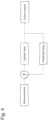
- Figure 5 shows a visualization of how some of the functionalities in the different sections of the fusion system 12 could be designed.
- the example visualized in Fig 5 describes how the set of probable forecasts (f1, f2, f3), generally corresponding to the first set of data 6, are combined and provided as the prior distribution to the fusion step.
- the second input to the fusion system is observations (m1) from measurements by means of the sensor system 8 in the vehicle 2.
- the circles inside each forecast are representing values for the different road condition properties, altogether constituting a forecast.
- the combined forecast is altered to more resemble the measurement in the fusion step.
- the posterior distribution would be matched to the most similar forecast (or potentially a mix of them) looking at the observed properties and inherit the rest of its properties, which have not been measured and thus updated.
- the output from the fusion system 12 will result in all the input parameters and its corresponding uncertainties if any, however refined and fused from the two or multiple sources. According to the disclosure, the fused result will be much more accurate, less uncertain and adapt to unexpected scenarios than previously known systems and methods. Some of the key deliverables are documented below.
- the output will be consumed by both the host application 23 (see Figure 3 ), probably being an ADAS or AD application, and an in-vehicle transmitter 24 sending points of measurement or the updated forecast over an online API 25 to an online cloud storage of mobile observations and updated forecasts. This is most likely transmitted over 4G/5G connection, however, entirely provided by the host.
- the system may face three different setups and will deliver the parameter accordingly.
- the three setups available are the following:
- our system may either apply different confidence to the estimates of the upcoming conditions or deliver three different signals corresponding to the current setup.
- a signal describing the risk of reduced friction coefficient potentially to multiple extents. It could either be a flag describing whether the vehicle may face reduced friction coefficient or not. It could also constitute of multiple flags describing whether the vehicle may face reduced friction coefficient below [1, 0.8, 0.6, 0.4, 0.2] for instance. It could furthermore constitute of a probability between 0 and 1 to whether the vehicle faces slippery conditions.
- the road condition class parameter contains information regarding what road condition that the vehicle most likely faces.
- the different classes contained are the following:
- the disclosure also relates to a computer-based system 10 in a vehicle 2, for determining an updated and optimized forecast relating to at least a weather or a road condition of a road section 3 in a network 1 of roads.
- the system 10 comprises: a vehicle communication unit 7 which is configured for receiving a first set of data 6 of information related to at least a weather or a road condition in at least said road section 3 from a remove provider 4, said first set of data 6 corresponding to said forecast; and a set 8 of sensor devices providing a second set of data 9 based on at least the operation of the vehicle 2 or present conditions in the surroundings of the vehicle 2.
- said system 10 is configured to combine said first set of data 6 with said second set of data 9 for obtaining said updated and optimized forecast, and for providing the updated and optimized forecast to a user.
Landscapes
- Engineering & Computer Science (AREA)
- Physics & Mathematics (AREA)
- General Physics & Mathematics (AREA)
- Radar, Positioning & Navigation (AREA)
- Remote Sensing (AREA)
- Life Sciences & Earth Sciences (AREA)
- Atmospheric Sciences (AREA)
- Automation & Control Theory (AREA)
- Analytical Chemistry (AREA)
- Chemical & Material Sciences (AREA)
- Computer Networks & Wireless Communication (AREA)
- Signal Processing (AREA)
- Environmental Sciences (AREA)
- Environmental & Geological Engineering (AREA)
- Ecology (AREA)
- Biodiversity & Conservation Biology (AREA)
- Transportation (AREA)
- Mechanical Engineering (AREA)
- Health & Medical Sciences (AREA)
- Medical Informatics (AREA)
- General Health & Medical Sciences (AREA)
- Computing Systems (AREA)
- Human Computer Interaction (AREA)
- Mathematical Physics (AREA)
- Traffic Control Systems (AREA)
Priority Applications (4)
| Application Number | Priority Date | Filing Date | Title |
|---|---|---|---|
| EP22152737.7A EP4215877A1 (fr) | 2022-01-21 | 2022-01-21 | Procédé et système pour déterminer une prévision optimisée relative à la météo ou à l'état de la route |
| US18/730,579 US20250109962A1 (en) | 2022-01-21 | 2023-01-20 | A method and system for determining an optimized forecast relating to weather or a road condition |
| EP23743583.9A EP4466518A4 (fr) | 2022-01-21 | 2023-01-20 | Procédé et système de détermination d'une prévision optimisée relative à une condition météorologique ou routière |
| PCT/SE2023/050051 WO2023140776A1 (fr) | 2022-01-21 | 2023-01-20 | Procédé et système de détermination d'une prévision optimisée relative à une condition météorologique ou routière |
Applications Claiming Priority (1)
| Application Number | Priority Date | Filing Date | Title |
|---|---|---|---|
| EP22152737.7A EP4215877A1 (fr) | 2022-01-21 | 2022-01-21 | Procédé et système pour déterminer une prévision optimisée relative à la météo ou à l'état de la route |
Publications (1)
| Publication Number | Publication Date |
|---|---|
| EP4215877A1 true EP4215877A1 (fr) | 2023-07-26 |
Family
ID=80225764
Family Applications (2)
| Application Number | Title | Priority Date | Filing Date |
|---|---|---|---|
| EP22152737.7A Withdrawn EP4215877A1 (fr) | 2022-01-21 | 2022-01-21 | Procédé et système pour déterminer une prévision optimisée relative à la météo ou à l'état de la route |
| EP23743583.9A Pending EP4466518A4 (fr) | 2022-01-21 | 2023-01-20 | Procédé et système de détermination d'une prévision optimisée relative à une condition météorologique ou routière |
Family Applications After (1)
| Application Number | Title | Priority Date | Filing Date |
|---|---|---|---|
| EP23743583.9A Pending EP4466518A4 (fr) | 2022-01-21 | 2023-01-20 | Procédé et système de détermination d'une prévision optimisée relative à une condition météorologique ou routière |
Country Status (3)
| Country | Link |
|---|---|
| US (1) | US20250109962A1 (fr) |
| EP (2) | EP4215877A1 (fr) |
| WO (1) | WO2023140776A1 (fr) |
Cited By (1)
| Publication number | Priority date | Publication date | Assignee | Title |
|---|---|---|---|---|
| DE102024100210A1 (de) * | 2024-01-04 | 2025-07-10 | Valeo Schalter Und Sensoren Gmbh | Bestimmen eines Umfangs von einem Fahrzeug bereitzustellenden Umgebungsinformationen nach der Art eines elektronischen Horizonts |
Citations (5)
| Publication number | Priority date | Publication date | Assignee | Title |
|---|---|---|---|---|
| EP2757539A1 (fr) * | 2013-01-22 | 2014-07-23 | RoadIT AB | Procédé et dispositif de collecte et de traitement de données relatives à l'état d'une route |
| EP2889583A1 (fr) * | 2013-12-19 | 2015-07-01 | Conti Temic microelectronic GmbH | Procédé et dispositif de fabrication d'une carte de sécurité adaptée pour un véhicule automobile |
| DE102015225094A1 (de) * | 2015-12-14 | 2017-06-14 | Robert Bosch Gmbh | Vorrichtung und Verfahren zum Bereitstellen eines Hinweissignals sowie Vorrichtung und Verfahren zum Ermitteln von Verkehrsdaten |
| US9799219B2 (en) | 2010-11-08 | 2017-10-24 | Tomtom Traffic B.V. | Vehicle data system and method |
| EP3581454A1 (fr) * | 2018-06-12 | 2019-12-18 | Volvo Car Corporation | Système et procédé d'utilisation de données météorologiques agrégées pour l'état de surface de la route et des estimations de frottement de la route |
Family Cites Families (10)
| Publication number | Priority date | Publication date | Assignee | Title |
|---|---|---|---|---|
| US20060106637A1 (en) * | 2003-01-09 | 2006-05-18 | General Electric Company | Business system decisioning framework |
| US7512487B1 (en) * | 2006-11-02 | 2009-03-31 | Google Inc. | Adaptive and personalized navigation system |
| US20140222321A1 (en) * | 2013-02-06 | 2014-08-07 | Iteris, Inc. | Traffic state estimation with integration of traffic, weather, incident, pavement condition, and roadway operations data |
| US9187099B2 (en) * | 2013-10-17 | 2015-11-17 | Richard M. Powers | Systems and methods for predicting weather performance for a vehicle |
| US10699347B1 (en) * | 2016-02-24 | 2020-06-30 | Allstate Insurance Company | Polynomial risk maps |
| WO2017155889A1 (fr) * | 2016-03-07 | 2017-09-14 | University Of Iowa Research Foundation | Système d'aide à la décision en matière de conditions météorologiques et de fret |
| US10311728B2 (en) * | 2017-08-11 | 2019-06-04 | Here Global B.V. | Method and apparatus for providing a confidence-based road event message |
| CN109754594B (zh) * | 2017-11-01 | 2021-07-27 | 腾讯科技(深圳)有限公司 | 一种路况信息获取方法及其设备、存储介质、终端 |
| US11099551B2 (en) * | 2018-01-31 | 2021-08-24 | Hitachi, Ltd. | Deep learning architecture for maintenance predictions with multiple modes |
| CN112099508A (zh) * | 2020-09-22 | 2020-12-18 | 北京百度网讯科技有限公司 | 自动驾驶车辆的数据管理方法和装置 |
-
2022
- 2022-01-21 EP EP22152737.7A patent/EP4215877A1/fr not_active Withdrawn
-
2023
- 2023-01-20 WO PCT/SE2023/050051 patent/WO2023140776A1/fr not_active Ceased
- 2023-01-20 EP EP23743583.9A patent/EP4466518A4/fr active Pending
- 2023-01-20 US US18/730,579 patent/US20250109962A1/en active Pending
Patent Citations (5)
| Publication number | Priority date | Publication date | Assignee | Title |
|---|---|---|---|---|
| US9799219B2 (en) | 2010-11-08 | 2017-10-24 | Tomtom Traffic B.V. | Vehicle data system and method |
| EP2757539A1 (fr) * | 2013-01-22 | 2014-07-23 | RoadIT AB | Procédé et dispositif de collecte et de traitement de données relatives à l'état d'une route |
| EP2889583A1 (fr) * | 2013-12-19 | 2015-07-01 | Conti Temic microelectronic GmbH | Procédé et dispositif de fabrication d'une carte de sécurité adaptée pour un véhicule automobile |
| DE102015225094A1 (de) * | 2015-12-14 | 2017-06-14 | Robert Bosch Gmbh | Vorrichtung und Verfahren zum Bereitstellen eines Hinweissignals sowie Vorrichtung und Verfahren zum Ermitteln von Verkehrsdaten |
| EP3581454A1 (fr) * | 2018-06-12 | 2019-12-18 | Volvo Car Corporation | Système et procédé d'utilisation de données météorologiques agrégées pour l'état de surface de la route et des estimations de frottement de la route |
Cited By (1)
| Publication number | Priority date | Publication date | Assignee | Title |
|---|---|---|---|---|
| DE102024100210A1 (de) * | 2024-01-04 | 2025-07-10 | Valeo Schalter Und Sensoren Gmbh | Bestimmen eines Umfangs von einem Fahrzeug bereitzustellenden Umgebungsinformationen nach der Art eines elektronischen Horizonts |
Also Published As
| Publication number | Publication date |
|---|---|
| US20250109962A1 (en) | 2025-04-03 |
| EP4466518A1 (fr) | 2024-11-27 |
| WO2023140776A1 (fr) | 2023-07-27 |
| EP4466518A4 (fr) | 2026-01-21 |
Similar Documents
| Publication | Publication Date | Title |
|---|---|---|
| US10066961B2 (en) | Methods and systems for predicting driving conditions | |
| US9799219B2 (en) | Vehicle data system and method | |
| EP1566665B1 (fr) | Dispositif et procédé pour assurer des paramètres ambiants et pour déterminer des données météorologiques | |
| JP6800565B2 (ja) | 適合化予測のために広域的シーンコンテクストを使用する方法およびシステム並びに対応するプログラム、該システムを備えた乗り物 | |
| US20180150086A1 (en) | Positioning System Based on Geofencing Framework | |
| Mahoney III et al. | Realizing the potential of vehicle-based observations | |
| US20180319405A1 (en) | Method, apparatus, and processing device for controlling functions in a vehicle | |
| US20170357669A1 (en) | Method for operating a coefficient of friction database, and coefficient of friction database | |
| US20140062725A1 (en) | Surface detection and indicator | |
| US8744736B2 (en) | Method and apparatus for updating travel time estimation | |
| EP3189513B1 (fr) | Procedes et systemes pour l'identification d'elements navigables affectes par des conditions meteorologiques | |
| US20080269985A1 (en) | Travel information collection apparatus | |
| CN110044373B (zh) | 一种精细化交通气象服务信息生成方法 | |
| EP2610782A1 (fr) | Procédé de planification de la route d'un véhicule | |
| JP2017173299A (ja) | 交通管理決定に基づく車両交通支援 | |
| CN109377758B (zh) | 一种行驶时间预估方法及系统 | |
| CN119694132A (zh) | 一种公路高危路段预警方法及系统 | |
| US20190012606A1 (en) | Freight and weather decision support system | |
| US20250109962A1 (en) | A method and system for determining an optimized forecast relating to weather or a road condition | |
| US20230245509A1 (en) | Safety system and method for motor vehicles | |
| JP6393766B2 (ja) | 列車運行予測システム、列車運行予測方法、運転時分算出装置、および運転時分算出方法 | |
| CN120806782A (zh) | 跨境整车业务的eta计算方法、装置、设备及介质 | |
| Siems‐Anderson | The use of vehicle‐based observations in weather prediction and decision support | |
| JP2008158562A (ja) | 交通情報配信センタ、車両用プローブ装置、交通情報システム及び交通情報配信センタの交通情報配信方法 | |
| Hill | Concept of operations for road weather connected vehicle applications |
Legal Events
| Date | Code | Title | Description |
|---|---|---|---|
| PUAI | Public reference made under article 153(3) epc to a published international application that has entered the european phase |
Free format text: ORIGINAL CODE: 0009012 |
|
| STAA | Information on the status of an ep patent application or granted ep patent |
Free format text: STATUS: THE APPLICATION HAS BEEN PUBLISHED |
|
| AK | Designated contracting states |
Kind code of ref document: A1 Designated state(s): AL AT BE BG CH CY CZ DE DK EE ES FI FR GB GR HR HU IE IS IT LI LT LU LV MC MK MT NL NO PL PT RO RS SE SI SK SM TR |
|
| STAA | Information on the status of an ep patent application or granted ep patent |
Free format text: STATUS: REQUEST FOR EXAMINATION WAS MADE |
|
| 17P | Request for examination filed |
Effective date: 20240124 |
|
| RBV | Designated contracting states (corrected) |
Designated state(s): AL AT BE BG CH CY CZ DE DK EE ES FI FR GB GR HR HU IE IS IT LI LT LU LV MC MK MT NL NO PL PT RO RS SE SI SK SM TR |
|
| STAA | Information on the status of an ep patent application or granted ep patent |
Free format text: STATUS: EXAMINATION IS IN PROGRESS |
|
| 17Q | First examination report despatched |
Effective date: 20250318 |
|
| STAA | Information on the status of an ep patent application or granted ep patent |
Free format text: STATUS: THE APPLICATION IS DEEMED TO BE WITHDRAWN |
|
| 18D | Application deemed to be withdrawn |
Effective date: 20250719 |