EP4290467A1 - Procédé et appareil de superposition de données en nuage de points et dispositif, support et véhicule - Google Patents
Procédé et appareil de superposition de données en nuage de points et dispositif, support et véhicule Download PDFInfo
- Publication number
- EP4290467A1 EP4290467A1 EP22908817.4A EP22908817A EP4290467A1 EP 4290467 A1 EP4290467 A1 EP 4290467A1 EP 22908817 A EP22908817 A EP 22908817A EP 4290467 A1 EP4290467 A1 EP 4290467A1
- Authority
- EP
- European Patent Office
- Prior art keywords
- point cloud
- cloud data
- index value
- ramp
- vehicle
- Prior art date
- Legal status (The legal status is an assumption and is not a legal conclusion. Google has not performed a legal analysis and makes no representation as to the accuracy of the status listed.)
- Pending
Links
Images




Classifications
-
- G—PHYSICS
- G01—MEASURING; TESTING
- G01S—RADIO DIRECTION-FINDING; RADIO NAVIGATION; DETERMINING DISTANCE OR VELOCITY BY USE OF RADIO WAVES; LOCATING OR PRESENCE-DETECTING BY USE OF THE REFLECTION OR RERADIATION OF RADIO WAVES; ANALOGOUS ARRANGEMENTS USING OTHER WAVES
- G01S17/00—Systems using the reflection or reradiation of electromagnetic waves other than radio waves, e.g. lidar systems
- G01S17/88—Lidar systems specially adapted for specific applications
- G01S17/89—Lidar systems specially adapted for specific applications for mapping or imaging
-
- B—PERFORMING OPERATIONS; TRANSPORTING
- B60—VEHICLES IN GENERAL
- B60W—CONJOINT CONTROL OF VEHICLE SUB-UNITS OF DIFFERENT TYPE OR DIFFERENT FUNCTION; CONTROL SYSTEMS SPECIALLY ADAPTED FOR HYBRID VEHICLES; ROAD VEHICLE DRIVE CONTROL SYSTEMS FOR PURPOSES NOT RELATED TO THE CONTROL OF A PARTICULAR SUB-UNIT
- B60W40/00—Estimation or calculation of non-directly measurable driving parameters for road vehicle drive control systems not related to the control of a particular sub unit, e.g. by using mathematical models
- B60W40/02—Estimation or calculation of non-directly measurable driving parameters for road vehicle drive control systems not related to the control of a particular sub unit, e.g. by using mathematical models related to ambient conditions
- B60W40/06—Road conditions
- B60W40/076—Slope angle of the road
-
- B—PERFORMING OPERATIONS; TRANSPORTING
- B60—VEHICLES IN GENERAL
- B60W—CONJOINT CONTROL OF VEHICLE SUB-UNITS OF DIFFERENT TYPE OR DIFFERENT FUNCTION; CONTROL SYSTEMS SPECIALLY ADAPTED FOR HYBRID VEHICLES; ROAD VEHICLE DRIVE CONTROL SYSTEMS FOR PURPOSES NOT RELATED TO THE CONTROL OF A PARTICULAR SUB-UNIT
- B60W40/00—Estimation or calculation of non-directly measurable driving parameters for road vehicle drive control systems not related to the control of a particular sub unit, e.g. by using mathematical models
- B60W40/10—Estimation or calculation of non-directly measurable driving parameters for road vehicle drive control systems not related to the control of a particular sub unit, e.g. by using mathematical models related to vehicle motion
- B60W40/11—Pitch movement
-
- G—PHYSICS
- G01—MEASURING; TESTING
- G01C—MEASURING DISTANCES, LEVELS OR BEARINGS; SURVEYING; NAVIGATION; GYROSCOPIC INSTRUMENTS; PHOTOGRAMMETRY OR VIDEOGRAMMETRY
- G01C21/00—Navigation; Navigational instruments not provided for in groups G01C1/00 - G01C19/00
- G01C21/38—Electronic maps specially adapted for navigation; Updating thereof
- G01C21/3804—Creation or updating of map data
- G01C21/3807—Creation or updating of map data characterised by the type of data
- G01C21/383—Indoor data
-
- G—PHYSICS
- G01—MEASURING; TESTING
- G01C—MEASURING DISTANCES, LEVELS OR BEARINGS; SURVEYING; NAVIGATION; GYROSCOPIC INSTRUMENTS; PHOTOGRAMMETRY OR VIDEOGRAMMETRY
- G01C21/00—Navigation; Navigational instruments not provided for in groups G01C1/00 - G01C19/00
- G01C21/38—Electronic maps specially adapted for navigation; Updating thereof
- G01C21/3804—Creation or updating of map data
- G01C21/3833—Creation or updating of map data characterised by the source of data
- G01C21/3848—Data obtained from both position sensors and additional sensors
-
- G—PHYSICS
- G01—MEASURING; TESTING
- G01S—RADIO DIRECTION-FINDING; RADIO NAVIGATION; DETERMINING DISTANCE OR VELOCITY BY USE OF RADIO WAVES; LOCATING OR PRESENCE-DETECTING BY USE OF THE REFLECTION OR RERADIATION OF RADIO WAVES; ANALOGOUS ARRANGEMENTS USING OTHER WAVES
- G01S13/00—Systems using the reflection or reradiation of radio waves, e.g. radar systems; Analogous systems using reflection or reradiation of waves whose nature or wavelength is irrelevant or unspecified
- G01S13/86—Combinations of radar systems with non-radar systems, e.g. sonar, direction finder
-
- G—PHYSICS
- G01—MEASURING; TESTING
- G01S—RADIO DIRECTION-FINDING; RADIO NAVIGATION; DETERMINING DISTANCE OR VELOCITY BY USE OF RADIO WAVES; LOCATING OR PRESENCE-DETECTING BY USE OF THE REFLECTION OR RERADIATION OF RADIO WAVES; ANALOGOUS ARRANGEMENTS USING OTHER WAVES
- G01S13/00—Systems using the reflection or reradiation of radio waves, e.g. radar systems; Analogous systems using reflection or reradiation of waves whose nature or wavelength is irrelevant or unspecified
- G01S13/88—Radar or analogous systems specially adapted for specific applications
- G01S13/89—Radar or analogous systems specially adapted for specific applications for mapping or imaging
-
- G—PHYSICS
- G01—MEASURING; TESTING
- G01S—RADIO DIRECTION-FINDING; RADIO NAVIGATION; DETERMINING DISTANCE OR VELOCITY BY USE OF RADIO WAVES; LOCATING OR PRESENCE-DETECTING BY USE OF THE REFLECTION OR RERADIATION OF RADIO WAVES; ANALOGOUS ARRANGEMENTS USING OTHER WAVES
- G01S13/00—Systems using the reflection or reradiation of radio waves, e.g. radar systems; Analogous systems using reflection or reradiation of waves whose nature or wavelength is irrelevant or unspecified
- G01S13/88—Radar or analogous systems specially adapted for specific applications
- G01S13/93—Radar or analogous systems specially adapted for specific applications for anti-collision purposes
- G01S13/931—Radar or analogous systems specially adapted for specific applications for anti-collision purposes of land vehicles
-
- G—PHYSICS
- G01—MEASURING; TESTING
- G01S—RADIO DIRECTION-FINDING; RADIO NAVIGATION; DETERMINING DISTANCE OR VELOCITY BY USE OF RADIO WAVES; LOCATING OR PRESENCE-DETECTING BY USE OF THE REFLECTION OR RERADIATION OF RADIO WAVES; ANALOGOUS ARRANGEMENTS USING OTHER WAVES
- G01S17/00—Systems using the reflection or reradiation of electromagnetic waves other than radio waves, e.g. lidar systems
- G01S17/88—Lidar systems specially adapted for specific applications
- G01S17/93—Lidar systems specially adapted for specific applications for anti-collision purposes
- G01S17/931—Lidar systems specially adapted for specific applications for anti-collision purposes of land vehicles
-
- G—PHYSICS
- G01—MEASURING; TESTING
- G01S—RADIO DIRECTION-FINDING; RADIO NAVIGATION; DETERMINING DISTANCE OR VELOCITY BY USE OF RADIO WAVES; LOCATING OR PRESENCE-DETECTING BY USE OF THE REFLECTION OR RERADIATION OF RADIO WAVES; ANALOGOUS ARRANGEMENTS USING OTHER WAVES
- G01S7/00—Details of systems according to groups G01S13/00, G01S15/00, G01S17/00
- G01S7/02—Details of systems according to groups G01S13/00, G01S15/00, G01S17/00 of systems according to group G01S13/00
- G01S7/41—Details of systems according to groups G01S13/00, G01S15/00, G01S17/00 of systems according to group G01S13/00 using analysis of echo signal for target characterisation; Target signature; Target cross-section
-
- G—PHYSICS
- G01—MEASURING; TESTING
- G01S—RADIO DIRECTION-FINDING; RADIO NAVIGATION; DETERMINING DISTANCE OR VELOCITY BY USE OF RADIO WAVES; LOCATING OR PRESENCE-DETECTING BY USE OF THE REFLECTION OR RERADIATION OF RADIO WAVES; ANALOGOUS ARRANGEMENTS USING OTHER WAVES
- G01S7/00—Details of systems according to groups G01S13/00, G01S15/00, G01S17/00
- G01S7/48—Details of systems according to groups G01S13/00, G01S15/00, G01S17/00 of systems according to group G01S17/00
- G01S7/4802—Details of systems according to groups G01S13/00, G01S15/00, G01S17/00 of systems according to group G01S17/00 using analysis of echo signal for target characterisation; Target signature; Target cross-section
-
- G—PHYSICS
- G01—MEASURING; TESTING
- G01S—RADIO DIRECTION-FINDING; RADIO NAVIGATION; DETERMINING DISTANCE OR VELOCITY BY USE OF RADIO WAVES; LOCATING OR PRESENCE-DETECTING BY USE OF THE REFLECTION OR RERADIATION OF RADIO WAVES; ANALOGOUS ARRANGEMENTS USING OTHER WAVES
- G01S7/00—Details of systems according to groups G01S13/00, G01S15/00, G01S17/00
- G01S7/48—Details of systems according to groups G01S13/00, G01S15/00, G01S17/00 of systems according to group G01S17/00
- G01S7/4808—Evaluating distance, position or velocity data
-
- B—PERFORMING OPERATIONS; TRANSPORTING
- B60—VEHICLES IN GENERAL
- B60W—CONJOINT CONTROL OF VEHICLE SUB-UNITS OF DIFFERENT TYPE OR DIFFERENT FUNCTION; CONTROL SYSTEMS SPECIALLY ADAPTED FOR HYBRID VEHICLES; ROAD VEHICLE DRIVE CONTROL SYSTEMS FOR PURPOSES NOT RELATED TO THE CONTROL OF A PARTICULAR SUB-UNIT
- B60W2520/00—Input parameters relating to overall vehicle dynamics
- B60W2520/16—Pitch
-
- G—PHYSICS
- G01—MEASURING; TESTING
- G01S—RADIO DIRECTION-FINDING; RADIO NAVIGATION; DETERMINING DISTANCE OR VELOCITY BY USE OF RADIO WAVES; LOCATING OR PRESENCE-DETECTING BY USE OF THE REFLECTION OR RERADIATION OF RADIO WAVES; ANALOGOUS ARRANGEMENTS USING OTHER WAVES
- G01S13/00—Systems using the reflection or reradiation of radio waves, e.g. radar systems; Analogous systems using reflection or reradiation of waves whose nature or wavelength is irrelevant or unspecified
- G01S13/88—Radar or analogous systems specially adapted for specific applications
- G01S13/93—Radar or analogous systems specially adapted for specific applications for anti-collision purposes
- G01S13/931—Radar or analogous systems specially adapted for specific applications for anti-collision purposes of land vehicles
- G01S2013/932—Radar or analogous systems specially adapted for specific applications for anti-collision purposes of land vehicles using own vehicle data, e.g. ground speed, steering wheel direction
-
- G—PHYSICS
- G01—MEASURING; TESTING
- G01S—RADIO DIRECTION-FINDING; RADIO NAVIGATION; DETERMINING DISTANCE OR VELOCITY BY USE OF RADIO WAVES; LOCATING OR PRESENCE-DETECTING BY USE OF THE REFLECTION OR RERADIATION OF RADIO WAVES; ANALOGOUS ARRANGEMENTS USING OTHER WAVES
- G01S13/00—Systems using the reflection or reradiation of radio waves, e.g. radar systems; Analogous systems using reflection or reradiation of waves whose nature or wavelength is irrelevant or unspecified
- G01S13/88—Radar or analogous systems specially adapted for specific applications
- G01S13/93—Radar or analogous systems specially adapted for specific applications for anti-collision purposes
- G01S13/931—Radar or analogous systems specially adapted for specific applications for anti-collision purposes of land vehicles
- G01S2013/9323—Alternative operation using light waves
-
- G—PHYSICS
- G01—MEASURING; TESTING
- G01S—RADIO DIRECTION-FINDING; RADIO NAVIGATION; DETERMINING DISTANCE OR VELOCITY BY USE OF RADIO WAVES; LOCATING OR PRESENCE-DETECTING BY USE OF THE REFLECTION OR RERADIATION OF RADIO WAVES; ANALOGOUS ARRANGEMENTS USING OTHER WAVES
- G01S13/00—Systems using the reflection or reradiation of radio waves, e.g. radar systems; Analogous systems using reflection or reradiation of waves whose nature or wavelength is irrelevant or unspecified
- G01S13/88—Radar or analogous systems specially adapted for specific applications
- G01S13/93—Radar or analogous systems specially adapted for specific applications for anti-collision purposes
- G01S13/931—Radar or analogous systems specially adapted for specific applications for anti-collision purposes of land vehicles
- G01S2013/9327—Sensor installation details
- G01S2013/93271—Sensor installation details in the front of the vehicles
Definitions
- the embodiments of the present invention relate to the technical field of automatic driving, and in particular to a layering method and apparatus for point cloud data, a device, a medium and a vehicle.
- the embodiments of the present invention provide a layering method and apparatus for point cloud data, a device, a medium and a vehicle for overcoming the problem of inaccurately layering the point cloud data.
- an embodiment of the present invention provides a layering method for point cloud data, the layering method including:
- the embodiment of the present invention divides a vehicle driving trajectory into the ramp region and the non-ramp region by determining pitch angles for characterizing the vehicle attitudes according to different vehicle pitch angles in the case of the vehicle driving on the ramp pavement and the non-ramp pavement, and then layers the non-ramp region, thereby solving the problem of dividing the point cloud data at different layers into the point cloud data in a same layer, improving the accuracy of a layering result of the point cloud data, and then facilitating an improvement on the making accuracy of subsequent high-definition maps.
- the method provided by the embodiment of the present invention further includes: visually displaying the point cloud data in different layers according to a layering result of the non-ramp region, and generating planes corresponding to different layer heights for creating maps corresponding to the various planes.
- the point cloud data in different layers may be visually displayed according to a layering result of the point cloud data, so that different operators make maps for different layers respectively, to improve the mapping efficiency.
- a created high-definition map may be applied to a positioning process of an autonomous vehicle, and may provide information about a number of layers of a pavement where the autonomous vehicle is currently located for the autonomous vehicle in a scene of the elevated bridge and the parking lot, particularly, the underground parking lot.
- the dividing the to-be-processed trajectory into a ramp region and a non-ramp region according to a size relationship between the vehicle pitch angles corresponding to the various frames of point cloud data includes:
- the making a to-be-processed trajectory corresponding to a set of all the first point cloud data serve as the ramp region, and making a to-be-processed trajectory corresponding to a set of all second point cloud data in addition to the first point cloud data serve as the non-ramp region includes:
- the extending the first index value range by adding several index values at two ends of the index value range, to obtain a target index value range with the extended range includes: extending the first index value range by adding index values according with monotonicity at two ends of the index value range respectively according to the monotonicity between height information, corresponding to various index values in the first index value range, of the target vehicle, to obtain the target index value range with the extended range, wherein the monotonicity includes a monotonously increasing character or a monotonously decreasing character.
- the first index value range corresponding to the ramp region may be extended by determining other index values which have a difference of elevation, according with the monotonously increasing character, with height information of the intermediate index value. Therefore, the extended target index value range can correspond to one finished ramp region, and then the determining precision of the ramp region is effectively improved.
- the determining vehicle pitch angles relative to a horizontal plane in the case of a target vehicle collecting the various frames of point cloud data includes:
- the region dividing unit includes:
- the layering module includes:
- an embodiment of the present invention provides a storage medium, which stores a computer program thereon; and the program implements, when executed by a processor, the method according to any implementation mode of the first aspect.
- an embodiment of the present invention provides an electronic device, the electronic device including:
- the point cloud data may be collected by a ranging sensor (for example, a radar, a laser scanner or the like) arranged on the target vehicle; or an image of each trajectory point may be collected using an image collecting apparatus (for example, a depth camera, a binocular camera or the like) arranged on the target vehicle as well, and then the point cloud data of various trajectory points are obtained based on the images of the various trajectory points.
- a ranging sensor for example, a radar, a laser scanner or the like
- an image collecting apparatus for example, a depth camera, a binocular camera or the like
- the embodiment of present invention does not limit the specific obtaining manner of the point cloud data; and any manner capable of obtaining the point cloud data observed at each trajectory point corresponding to the target scene may be applied to the embodiment of present invention.
- an initial pitch angle of the vehicle relative to the standard coordinate system may be obtained according to relative relationship between the vehicle body coordinate system and the standard coordinate system, where the vehicle body coordinate system is defined on a vehicle body, and is a coordinate system fixedly connected with the vehicle body, for example, the vehicle body coordinate system may be defined at a center of a rear axle of the vehicle body; and if the vehicle is located in the horizontal plane, the vehicle body coordinate system may be horizontality as well.
- the vehicle attitude may be determined based on data fused by a plurality of sensors, and then the initial vehicle pitch angle of the attitude relative to the horizontal plane is determined, where the plurality of sensors may include the IMUs, global positioning systems (GPS), radars and/or image sensors.
- the plurality of sensors may include the IMUs, global positioning systems (GPS), radars and/or image sensors.
- the initial vehicle pitch angle of the vehicle attitude may be filtered, so as to solve interference caused by a minor jitter of the vehicle during driving, and then improve the accuracy of the vehicle pitch angles.
- a mean filtering manner may be used, specifically, for the initial vehicle pitch angle corresponding to the current frame of point cloud data, mean filtering is performed on the initial vehicle pitch angle corresponding to the current frame of point cloud data through the vehicle pitch angles corresponding to a front frame of point cloud data and a next frame of point cloud data; and a pitch angle value obtained after mean filtering serves as the vehicle pitch angle corresponding to the current frame of point cloud data.
- a Gaussian filtering manner a median filtering manner or the like may be used for filtering the vehicle pitch angle corresponding to each frame of point cloud data.
- the embodiment does not specifically limit the filtering manner.
- a value variation range of the pitch angles in four peak regions A outlined in the drawing is relatively large, corresponding to the pitch angles of the vehicle driving in the ramp section, where the ramp section may be that the vehicle drives from a section at a higher layer to a section at a lower layer, or from a section at a lower higher layer to a section at a higher layer.
- a value variation range of the pitch angles in regions B outlined in FIG. 1b is relatively small, corresponding to the non-ramp section.
- a driving trajectory corresponding to the ramp section may be determined by calculating the vehicle pitch angles relative to the horizontal plane in the case of the target vehicle collecting the various frames of point cloud data; that is, a trajectory corresponding to each peak region A shown in FIG. 1b is found out, and then the trajectory corresponding to the non-ramp region in the to-be-processed trajectory may be determined, which is the trajectory corresponding to each region B as shown in FIG. 1b .
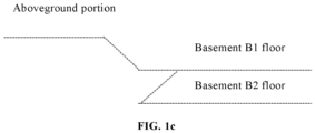
- FIG. 1c is a lateral view of a basement trajectory provided by embodiment 1 of the present invention.
- the vehicle may pass through a slope section.
- the vehicle attitude is parallel to the horizontal plane; and the value of the vehicle pitch angle may vary in the value range with the smaller values usually.
- the value of the vehicle pitch angle may vary in the value range with the larger values usually. Based on the above principle, whether the vehicle drives in the ramp region or the non-ramp region may be determined according to the size relationship between the vehicle pitch angles corresponding to the various frames of point cloud data.
- an angle may be preset as a critical angle of the vehicle in the non-ramp region and the ramp region, where the preset angle may be determined according to empirical values of the pitch angles of the vehicle driving in the non-ramp section and the ramp section for many times.
- the vehicle pitch angle may vary between 5° and 10°.
- the preset angle may be set as 5°.
- the point cloud data corresponding to those of the vehicle pitch angles larger than a preset angle in the various frames of point cloud data may serve as first point cloud data of the target vehicle driving uphill or downhill. Due to the non-ramp regions at different heights being connected with each other through the ramp regions, and the continuity of the to-be-processed trajectory, after the first point cloud data corresponding to the ramp region is determined, a to-be-processed trajectory corresponding to a set of all second point cloud data can control addition to the first point cloud data may serve as the non-ramp region.
- the non-ramp region in each to-be-processed trajectory includes a plurality of non-ramp sub-regions with a same height value.
- the non-ramp sub-regions with average height values in the set range may serve as a non-ramp pavement region in the same layer according to the average height values of the non-ramp sub-regions, thereby dividing the non-ramp region into a plurality of layers, where the average height values of the non-ramp sub-regions may be determined according to vehicle height information corresponding to each point cloud frame, where the vehicle height information may be obtained through the GPS.
- the non-ramp region may be divided into a plurality of non-ramp sub-regions according to the continuity between the point cloud frame numbers of various sub-regions.
- the non-ramp region with the same height information may be obtained; that is, sections, where the vehicle drives in different time period, at the same height are clustered together, where a clustering height may be set as 2 m.
- the non-ramp region may be divided into a plurality of layers in an order of the average height information of different non-ramp sub-regions from large to small.
- this embodiment Compared with a manner in the related art of layering the point cloud data through plane fitting and division on the to-be-processed trajectory, due to the situation that a pavement is not completely horizontal, so as to be easily fitted into a plurality of layers, this embodiment does not focus on whether a pavement corresponding to the non-ramp region in each layer is horizontal in the layering process, and has no need for considering whether point cloud data in other planes is used during plane fitting either. Therefore, the point cloud data layering solution provided by this embodiment effectively improves the accuracy of point cloud data layering.
- the to-be-processed trajectory may be divided into the ramp region and the non-ramp region by determining the pitch angles for characterizing the vehicle attitudes according to different vehicle pitch angles in the case of the vehicle driving on the ramp section and the non-ramp section; and then the non-ramp region is layered.
- the technical solution provided by this embodiment solves the problem of dividing the point cloud data at different layers into the point cloud data in a same layer, improves the layering accuracy of the point cloud data, and then facilitates an improvement on the making accuracy of subsequent high-definition maps.
- the point cloud frame number index values corresponding to the first point cloud data and the point cloud frame number index values corresponding to the second point cloud data may be stored.
- the ramp sections may be determined first; and then the non-ramp sections, communicating back and forth, at different heights may be divided based on the ramp sections.
- the point cloud frame number index values corresponding to all the first point cloud data may be divided into a plurality of first index value ranges according to the continuity between the point cloud frame number index values corresponding to the first point cloud data, where the number of the first index value ranges is used for representing the number of times of the target vehicle driving uphill or downhill.
- the index values stored in step S220 may be divided into 4 group, for example, [245, 283], [996, 1020], [1642, 1666] and [1883, 1910].
- step S220 is to preliminarily divide the various frames of point cloud data into the first point cloud data corresponding to the ramp region and the second point cloud data corresponding to the non-ramp region according to a relationship between the vehicle pitch angle corresponding to each frame of point cloud data and the preset angle.
- this embodiment may extend each first index value range corresponding to the first point cloud data.
- the first index value range may be extended by adding index values according with the monotonously increasing character at the two ends of each first index value range based on the monotonously increasing character of vehicle heights in the case of the target vehicle driving uphill, so as to obtain the target index value range with the extended range.
- the first index value range may be extended by adding index values according with the monotonously decreasing character at the two ends of each first index value range based on the monotonously increasing character of vehicle heights in the case of the target vehicle driving uphill, so as to obtain the target index value range with the extended range.
- the step of extending the first index value range by adding index values according with monotonicity at two ends of the index value range respectively according to the monotonicity between height information, corresponding to various index values in the first index value range, of the target vehicle includes: determining an intermediate index value corresponding to a middle portion of a ramp in the first index value range, and determining various height difference absolute values between target vehicle height information corresponding to the intermediate index value and target vehicle height information corresponding to other index values; and determining to-be-added index values at the two ends of the index value range according to the monotonously increasing character between the various height difference absolute values of the vehicle during ramp driving, and forming, by combining the to-be-added index values with the index values in the original index value range, the target index value range with the extended range according to the size relationship between the index values.
- end point values at the two ends of each first index value range are added to obtain a sum, and a half of the sum may serve as the intermediate index value corresponding to the middle portion of the ramp.
- extension may be made from the middle portion of the ramp to the two sides respectively, for example, forward extension is made from frame 264, and then other index values smaller than the intermediate index value are judged, for example, whether height difference absolute values between height information, corresponding to frame 263, frame 262, frame 261 and other point cloud frames, of the target vehicle and height information corresponding to frame 264 accord with the monotonously increasing character is judged; and the index values according with the monotonously increasing character serve as the index values in the target index value range.
- the height difference absolute values between the height information corresponding to the extended point cloud frames and the height information corresponding to the intermediate point cloud frame does not accord with the monotonously increasing character, it shows to extend to one end of the ramp.
- the intermediate index value may extend to other end based on the intermediate index value, for example, other index values larger than the intermediate index value are judged, for example, whether height difference absolute values between height information, corresponding to frame 265, frame 266, frame 267 and other point cloud frames, of the target vehicle and the height information corresponding to the frame 264 accord with the monotonously increasing character is judged; and the index values according with the monotonously increasing character serve as the index values in the target index value range.
- the height difference absolute values between the height information corresponding to the extended point cloud frames and the height information corresponding to the intermediate point cloud frame does not accord with the monotonously increasing character, it is determined to extend to the other end of the ramp.
- the to-be-processed trajectory may be divided into a plurality of sections (which are sequentially: non-ramp section, ramp section, non-ramp section, ramp section, non-ramp section and so on) based on each target index value range, where the number of the ramp sections determined in this embodiment represents the number of times of the target vehicle driving uphill or downhill.
- the point cloud frame number index values corresponding to the second point cloud data in addition to the first point cloud data may be divided into a plurality of second index value ranges according to the continuity between the point cloud frame number index values, that is, the index value ranges for the point cloud data belonging to the non-ramp region are determined.
- the to-be-processed trajectory may be divided into [0, 219], [220, 295], [296, 970] and [971, 1034] (referring to following Table 1 specifically), where the second index value ranges corresponding to the non-ramp sub-regions are: [0, 219] and [296, 970].
- Table 1 Region Division Table Non-ramp sub-region Ramp sub-region Non-ramp sub-region Ramp sub-region . . . . . [0, 219] [220,295] [296,970] [971, 1034] . . . . . .
- step S260 layering the non-ramp region according to height information.
- the specific layering manner of step S260 may refer to the description in the above embodiment, and shall not be described any further.
- the target index value range obtained after extension more comprehensively covers the point cloud frame data, thereby improving the accuracy of ramp region division.
- the extended target index value range can correspond to one finished ramp, thereby effectively improving the determining precision of the ramp region and further the determining precision of the non-ramp region.
- FIG. 3 is a flow chart of a layering method for point cloud data provided by embodiment 3 of the present invention. On the basis of the above embodiment, this embodiment provides an application method for point cloud data, as shown in FIG. 3 ,
- the point cloud data at different layer heights may be visually displayed.
- the point cloud data at different layer heights may be represented by different colors, or different shapes, which is not limited in this embodiment.
- maps are created, in order to the improve the production efficiency, different operators may make maps for the point cloud data at different layer heights respectively.
- plane fitting may be performed on the point cloud data in each layer based on a preset plane fitting algorithm, to obtain a corresponding plane
- the preset plane fitting algorithm may be a plane fitting algorithm using a plane extraction technology based on random sample consensus (RANSAC)
- RANSAC random sample consensus
- points in the plane may be colored.
- the various frames of point cloud data may be projected under a pixel coordinate system, and to-be-colored point clouds are endowed with colors of pixel points obtained by projection, to color all map elements in the plane, thereby obtaining maps corresponding to various planes.
- a map may further be made for the ramp region according to a map creation manner corresponding to the non-ramp region, so as to obtain a map containing the ramp region and the non-ramp region in a scene of a parking lot and the like.
- the vehicle may be positioned based on the created high-definition map; and the to-be-processed trajectory used for mapping may be layered using the layering method for the point cloud data provided by the embodiment of the present invention, and then the high-definition map is layered, to obtain information about a number of layers where the vehicle is currently located.
- the point cloud data at different layer heights may be visually displayed using the layering result of the point cloud data; and different operators may make maps for different layers, the mapping efficiency is improved, where a created map may be applied to a positioning process of the vehicle, and provides information about a number of layers of a pavement where the autonomous vehicle is currently located for the autonomous vehicle.
- FIG. 4 is a structural block diagram of a layering apparatus for point cloud data provided by embodiment 4 of the present invention. As shown in FIG. 4 , the apparatus includes a pitch angle determining module 410, a region dividing module 420 and a layering module 430, where
- the apparatus provided by the embodiment of the present invention further includes: a mapping module, configured to visually display the point cloud data in different layers according to a layering result of the non-ramp region after layering each non-ramp region according to the height information, and generating planes corresponding to different layer heights for creating maps corresponding to the various planes.
- a mapping module configured to visually display the point cloud data in different layers according to a layering result of the non-ramp region after layering each non-ramp region according to the height information, and generating planes corresponding to different layer heights for creating maps corresponding to the various planes.
- the region dividing module 420 includes:
- the region dividing unit includes:
- the ramp region determining sub-unit includes: a ramp region determining assembly, configured to extend the first index value range by adding index values according with monotonicity at two ends of the index value range respectively according to the monotonicity between height information, corresponding to various index values in the first index value range, of the target vehicle for arbitrary one first index value range, to obtain the target index value range with the extended range, and make to-be-processed trajectories corresponding to various target index value ranges serve as the ramp regions respectively, where the monotonicity includes a monotonously increasing character or a monotonously decreasing character.
- the ramp region determining assembly is specifically configured to:
- each vehicle pitch angle is a filtered vehicle pitch angle.
- the layering module 430 includes:
- the pitch angle determining module 410 is specifically configured to:
- the layering apparatus for the point cloud data provided by the embodiment of the present invention may implement the layering method for the point cloud data provided by any embodiment of the present invention, and has corresponding functional modules and beneficial effects for implementing the method.
- the technical details not exhaustively described in the above embodiments may refer to the layering method for the point cloud data provided by any embodiment of the present invention.
- FIG. 5 is a structural block diagram of an electronic device provided by embodiment 5 of the present invention. As shown in FIG. 5 , the electronic device includes:
- another embodiment of the present application provides a vehicle, the vehicle including the apparatus described in any one of the above embodiments or including the electronic device described above.
- the vehicle may also include: a vehicle-to-everything (V2X) module 65, a radar 66 and a camera 67.
- V2X vehicle-to-everything
- the V2X module 65 is used to communicate with other vehicles, roadside devices, etc.; the radar 66 or the camera 67 is used to perceive road environment information in front and/or other directions, to obtain original point cloud data; and the radar 66 or the camera 67 may be configured in the front and/or rear of the vehicle body.
- V2X vehicle-to-everything
- another embodiment of the present invention provides a storage medium having executable instructions stored thereon.
- the instructions when executed by the processor, enable the processor to implement the layering method for the point cloud data described in any one of the above implementation modes.
- B corresponding to A represents that B is associated with A, and may be determined according to A.
- determining B according to A does not mean that B is determined according to A only, and may further be determined according to A and/or other information.
- various functional units in various embodiments of the present invention may be integrated in one processing unit, or each unit may exist individually and physically, or two or more units may be integrated in one unit.
- the integrated units may be implemented in a form of hardware, and may also be implemented in a form of a software function unit.
- the integrated units may be stored in a computer-available memory.
- the technical solution of the present invention in essence or from the view of part contributing to the prior art, or all or part of the technical solution may be embodied in the form of a software product; and the computer software product is stored in the memory and includes a plurality of requests which are used to enable a computer device (which may be a personal computer, a server, or a network device, etc.) to implement all or part of the steps of the methods described in the various embodiments of the present invention.
- the storage medium includes a read only memory (ROM), a random access memory (RAM), a programmable read-only memory (PROM), an erasable programmable read only memory (EPROM), a one-time programmable read-only memory (OTPROM), an electrically erasable programmable read only memory (EEPROM), a compact disc read only memory (CD-ROM) or other optical disk storage, a magnetic disk storage, a magnetic tape storage, or any other computer-readable media that can be used to carry or store data.
- ROM read only memory
- RAM random access memory
- PROM programmable read-only memory
- EPROM erasable programmable read only memory
- OTPROM one-time programmable read-only memory
- EEPROM electrically erasable programmable read only memory
- CD-ROM compact disc read only memory
- CD-ROM compact disc read only memory
Landscapes
- Engineering & Computer Science (AREA)
- Remote Sensing (AREA)
- Radar, Positioning & Navigation (AREA)
- Physics & Mathematics (AREA)
- General Physics & Mathematics (AREA)
- Computer Networks & Wireless Communication (AREA)
- Automation & Control Theory (AREA)
- Electromagnetism (AREA)
- Mathematical Physics (AREA)
- Transportation (AREA)
- Mechanical Engineering (AREA)
- Navigation (AREA)
Applications Claiming Priority (2)
| Application Number | Priority Date | Filing Date | Title |
|---|---|---|---|
| CN202210455299.4A CN117011447A (zh) | 2022-04-28 | 2022-04-28 | 一种点云数据的分层方法、装置、设备、介质及车辆 |
| PCT/CN2022/137936 WO2023207123A1 (fr) | 2022-04-28 | 2022-12-09 | Procédé et appareil de superposition de données en nuage de points et dispositif, support et véhicule |
Publications (2)
| Publication Number | Publication Date |
|---|---|
| EP4290467A1 true EP4290467A1 (fr) | 2023-12-13 |
| EP4290467A4 EP4290467A4 (fr) | 2026-01-21 |
Family
ID=88308937
Family Applications (1)
| Application Number | Title | Priority Date | Filing Date |
|---|---|---|---|
| EP22908817.4A Pending EP4290467A4 (fr) | 2022-04-28 | 2022-12-09 | Procédé et appareil de superposition de données en nuage de points et dispositif, support et véhicule |
Country Status (2)
| Country | Link |
|---|---|
| US (1) | US20230331238A1 (fr) |
| EP (1) | EP4290467A4 (fr) |
Families Citing this family (3)
| Publication number | Priority date | Publication date | Assignee | Title |
|---|---|---|---|---|
| CN117421385A (zh) * | 2023-10-30 | 2024-01-19 | 北京四维图新科技股份有限公司 | 高精地图的高度调节方法、装置、设备及存储介质 |
| CN118478908B (zh) * | 2024-07-15 | 2024-10-01 | 上海友道智途科技有限公司 | 一种基于高度分层的车辆可行驶边界规划方法及车辆 |
| CN119229216B (zh) * | 2024-11-28 | 2025-03-11 | 西南科技大学 | 一种基于霍夫变换的双阶段关键区域语义地图构建方法 |
Family Cites Families (7)
| Publication number | Priority date | Publication date | Assignee | Title |
|---|---|---|---|---|
| US8170725B2 (en) * | 2009-02-18 | 2012-05-01 | GM Global Technology Operations LLC | Vehicle stability enhancement control adaptation to driving skill based on highway on/off ramp maneuver |
| CN107918753B (zh) * | 2016-10-10 | 2019-02-22 | 腾讯科技(深圳)有限公司 | 点云数据处理方法及装置 |
| CN111108342B (zh) * | 2016-12-30 | 2023-08-15 | 辉达公司 | 用于高清地图创建的视觉测程法和成对对准 |
| US10775488B2 (en) * | 2017-08-17 | 2020-09-15 | Uatc, Llc | Calibration for an autonomous vehicle LIDAR module |
| US10768304B2 (en) * | 2017-12-13 | 2020-09-08 | Luminar Technologies, Inc. | Processing point clouds of vehicle sensors having variable scan line distributions using interpolation functions |
| US20200132473A1 (en) * | 2018-10-26 | 2020-04-30 | Ford Global Technologies, Llc | Systems and methods for determining vehicle location in parking structures |
| CN112991162B (zh) * | 2019-12-12 | 2023-09-19 | 北京魔门塔科技有限公司 | 一种点云数据的分层方法及装置 |
-
2022
- 2022-12-09 EP EP22908817.4A patent/EP4290467A4/fr active Pending
-
2023
- 2023-06-26 US US18/340,990 patent/US20230331238A1/en active Pending
Also Published As
| Publication number | Publication date |
|---|---|
| US20230331238A1 (en) | 2023-10-19 |
| EP4290467A4 (fr) | 2026-01-21 |
Similar Documents
| Publication | Publication Date | Title |
|---|---|---|
| EP4290467A1 (fr) | Procédé et appareil de superposition de données en nuage de points et dispositif, support et véhicule | |
| CN112204343B (zh) | 高清晰地图数据的可视化 | |
| US11619516B2 (en) | Method for detecting map error information, apparatus, device, vehicle and storage medium | |
| EP2372308B1 (fr) | Système de traitement d'image et procédé de contrôle de véhicule | |
| CN112154445A (zh) | 高精度地图中车道线的确定方法和装置 | |
| EP2372607A2 (fr) | Système de génération de références de correspondance de scènes et système de mesure de la position | |
| CN108021862A (zh) | 道路标志识别 | |
| CN114550042B (zh) | 一种道路消失点提取方法、车载传感器标定方法及装置 | |
| CN114280582A (zh) | 激光雷达的标定校准方法、装置、存储介质及电子设备 | |
| DE102017128619A1 (de) | Fahrzeugsteuerung unter verwendung von strassenwinkeldaten | |
| EP4462361B1 (fr) | Procédé et appareil de télémétrie monoculaire de conduite intelligente de véhicule, et dispositif, support et véhicule | |
| CN109583312A (zh) | 车道线识别方法、装置、设备及存储介质 | |
| CN116142172A (zh) | 一种基于体素坐标系的泊车方法及装置 | |
| CN117011447A (zh) | 一种点云数据的分层方法、装置、设备、介质及车辆 | |
| WO2020132965A1 (fr) | Procédé et appareil pour déterminer des paramètres d'installation d'un dispositif de réalisation d'image embarqué, et procédé et appareil de commande de conduite | |
| DE102022106226A1 (de) | Anzeigekorrektursystem, Anzeigesystem, Anzeigekorrekturverfahren und Programm | |
| US20240029451A1 (en) | Visual presentation of vehicle positioning relative to surrounding objects | |
| CN116071714B (zh) | 车道偏离检测方法、系统、电子设备及可读存储介质 | |
| EP2991358A2 (fr) | Communication de contenu à base de nuage à un conducteur | |
| CN117848357A (zh) | 地图构建方法、车载设备、车辆以及计算机程序产品 | |
| CN115511938B (zh) | 基于单目摄像头的高度确定方法和装置 | |
| CN117168476A (zh) | 一种地图构建、车辆控制方法及装置 | |
| CN111712855A (zh) | 地面信息处理方法、装置和无人驾驶车辆 | |
| CN116934870A (zh) | 单应性矩阵的确定方法、装置及车辆 | |
| CN113066133B (zh) | 一种基于路面标识几何特征的车载摄像头在线自标定方法 |
Legal Events
| Date | Code | Title | Description |
|---|---|---|---|
| STAA | Information on the status of an ep patent application or granted ep patent |
Free format text: STATUS: UNKNOWN |
|
| STAA | Information on the status of an ep patent application or granted ep patent |
Free format text: STATUS: THE INTERNATIONAL PUBLICATION HAS BEEN MADE |
|
| PUAI | Public reference made under article 153(3) epc to a published international application that has entered the european phase |
Free format text: ORIGINAL CODE: 0009012 |
|
| STAA | Information on the status of an ep patent application or granted ep patent |
Free format text: STATUS: REQUEST FOR EXAMINATION WAS MADE |
|
| 17P | Request for examination filed |
Effective date: 20230628 |
|
| AK | Designated contracting states |
Kind code of ref document: A1 Designated state(s): AL AT BE BG CH CY CZ DE DK EE ES FI FR GB GR HR HU IE IS IT LI LT LU LV MC ME MK MT NL NO PL PT RO RS SE SI SK SM TR |
|
| RAP3 | Party data changed (applicant data changed or rights of an application transferred) |
Owner name: MOMENTA (SUZHOU) TECHNOLOGY CO., LTD. |
|
| RAP3 | Party data changed (applicant data changed or rights of an application transferred) |
Owner name: MOMENTA (SUZHOU) TECHNOLOGY CO., LTD. |
|
| DAV | Request for validation of the european patent (deleted) | ||
| DAX | Request for extension of the european patent (deleted) | ||
| A4 | Supplementary search report drawn up and despatched |
Effective date: 20251219 |
|
| RIC1 | Information provided on ipc code assigned before grant |
Ipc: G06T 17/00 20060101AFI20251215BHEP Ipc: G01C 21/04 20060101ALI20251215BHEP |