EP4501735A1 - Procédé et appareil de commande de véhicule, et dispositif et support de stockage - Google Patents
Procédé et appareil de commande de véhicule, et dispositif et support de stockage Download PDFInfo
- Publication number
- EP4501735A1 EP4501735A1 EP23870043.9A EP23870043A EP4501735A1 EP 4501735 A1 EP4501735 A1 EP 4501735A1 EP 23870043 A EP23870043 A EP 23870043A EP 4501735 A1 EP4501735 A1 EP 4501735A1
- Authority
- EP
- European Patent Office
- Prior art keywords
- road
- perception
- road segment
- vehicle
- environmental condition
- Prior art date
- Legal status (The legal status is an assumption and is not a legal conclusion. Google has not performed a legal analysis and makes no representation as to the accuracy of the status listed.)
- Pending
Links
Images




Classifications
-
- B—PERFORMING OPERATIONS; TRANSPORTING
- B60—VEHICLES IN GENERAL
- B60W—CONJOINT CONTROL OF VEHICLE SUB-UNITS OF DIFFERENT TYPE OR DIFFERENT FUNCTION; CONTROL SYSTEMS SPECIALLY ADAPTED FOR HYBRID VEHICLES; ROAD VEHICLE DRIVE CONTROL SYSTEMS FOR PURPOSES NOT RELATED TO THE CONTROL OF A PARTICULAR SUB-UNIT
- B60W50/00—Details of control systems for road vehicle drive control not related to the control of a particular sub-unit, e.g. process diagnostic or vehicle driver interfaces
-
- B—PERFORMING OPERATIONS; TRANSPORTING
- B60—VEHICLES IN GENERAL
- B60W—CONJOINT CONTROL OF VEHICLE SUB-UNITS OF DIFFERENT TYPE OR DIFFERENT FUNCTION; CONTROL SYSTEMS SPECIALLY ADAPTED FOR HYBRID VEHICLES; ROAD VEHICLE DRIVE CONTROL SYSTEMS FOR PURPOSES NOT RELATED TO THE CONTROL OF A PARTICULAR SUB-UNIT
- B60W60/00—Drive control systems specially adapted for autonomous road vehicles
- B60W60/001—Planning or execution of driving tasks
-
- B—PERFORMING OPERATIONS; TRANSPORTING
- B60—VEHICLES IN GENERAL
- B60W—CONJOINT CONTROL OF VEHICLE SUB-UNITS OF DIFFERENT TYPE OR DIFFERENT FUNCTION; CONTROL SYSTEMS SPECIALLY ADAPTED FOR HYBRID VEHICLES; ROAD VEHICLE DRIVE CONTROL SYSTEMS FOR PURPOSES NOT RELATED TO THE CONTROL OF A PARTICULAR SUB-UNIT
- B60W60/00—Drive control systems specially adapted for autonomous road vehicles
- B60W60/001—Planning or execution of driving tasks
- B60W60/0011—Planning or execution of driving tasks involving control alternatives for a single driving scenario, e.g. planning several paths to avoid obstacles
-
- G—PHYSICS
- G01—MEASURING; TESTING
- G01C—MEASURING DISTANCES, LEVELS OR BEARINGS; SURVEYING; NAVIGATION; GYROSCOPIC INSTRUMENTS; PHOTOGRAMMETRY OR VIDEOGRAMMETRY
- G01C21/00—Navigation; Navigational instruments not provided for in groups G01C1/00 - G01C19/00
- G01C21/26—Navigation; Navigational instruments not provided for in groups G01C1/00 - G01C19/00 specially adapted for navigation in a road network
- G01C21/34—Route searching; Route guidance
- G01C21/36—Input/output arrangements for on-board computers
- G01C21/3602—Input other than that of destination using image analysis, e.g. detection of road signs, lanes, buildings, real preceding vehicles using a camera
-
- G—PHYSICS
- G01—MEASURING; TESTING
- G01C—MEASURING DISTANCES, LEVELS OR BEARINGS; SURVEYING; NAVIGATION; GYROSCOPIC INSTRUMENTS; PHOTOGRAMMETRY OR VIDEOGRAMMETRY
- G01C21/00—Navigation; Navigational instruments not provided for in groups G01C1/00 - G01C19/00
- G01C21/26—Navigation; Navigational instruments not provided for in groups G01C1/00 - G01C19/00 specially adapted for navigation in a road network
- G01C21/34—Route searching; Route guidance
- G01C21/36—Input/output arrangements for on-board computers
- G01C21/3691—Retrieval, searching and output of information related to real-time traffic, weather, or environmental conditions
-
- G—PHYSICS
- G06—COMPUTING OR CALCULATING; COUNTING
- G06N—COMPUTING ARRANGEMENTS BASED ON SPECIFIC COMPUTATIONAL MODELS
- G06N20/00—Machine learning
-
- G—PHYSICS
- G06—COMPUTING OR CALCULATING; COUNTING
- G06V—IMAGE OR VIDEO RECOGNITION OR UNDERSTANDING
- G06V10/00—Arrangements for image or video recognition or understanding
- G06V10/70—Arrangements for image or video recognition or understanding using pattern recognition or machine learning
- G06V10/762—Arrangements for image or video recognition or understanding using pattern recognition or machine learning using clustering, e.g. of similar faces in social networks
-
- G—PHYSICS
- G06—COMPUTING OR CALCULATING; COUNTING
- G06V—IMAGE OR VIDEO RECOGNITION OR UNDERSTANDING
- G06V10/00—Arrangements for image or video recognition or understanding
- G06V10/70—Arrangements for image or video recognition or understanding using pattern recognition or machine learning
- G06V10/764—Arrangements for image or video recognition or understanding using pattern recognition or machine learning using classification, e.g. of video objects
-
- G—PHYSICS
- G06—COMPUTING OR CALCULATING; COUNTING
- G06V—IMAGE OR VIDEO RECOGNITION OR UNDERSTANDING
- G06V10/00—Arrangements for image or video recognition or understanding
- G06V10/70—Arrangements for image or video recognition or understanding using pattern recognition or machine learning
- G06V10/77—Processing image or video features in feature spaces; using data integration or data reduction, e.g. principal component analysis [PCA] or independent component analysis [ICA] or self-organising maps [SOM]; Blind source separation
- G06V10/774—Generating sets of training patterns; Bootstrap methods, e.g. bagging or boosting
-
- G—PHYSICS
- G06—COMPUTING OR CALCULATING; COUNTING
- G06V—IMAGE OR VIDEO RECOGNITION OR UNDERSTANDING
- G06V20/00—Scenes; Scene-specific elements
- G06V20/50—Context or environment of the image
- G06V20/56—Context or environment of the image exterior to a vehicle by using sensors mounted on the vehicle
-
- B—PERFORMING OPERATIONS; TRANSPORTING
- B60—VEHICLES IN GENERAL
- B60W—CONJOINT CONTROL OF VEHICLE SUB-UNITS OF DIFFERENT TYPE OR DIFFERENT FUNCTION; CONTROL SYSTEMS SPECIALLY ADAPTED FOR HYBRID VEHICLES; ROAD VEHICLE DRIVE CONTROL SYSTEMS FOR PURPOSES NOT RELATED TO THE CONTROL OF A PARTICULAR SUB-UNIT
- B60W2420/00—Indexing codes relating to the type of sensors based on the principle of their operation
- B60W2420/40—Photo, light or radio wave sensitive means, e.g. infrared sensors
- B60W2420/403—Image sensing, e.g. optical camera
-
- B—PERFORMING OPERATIONS; TRANSPORTING
- B60—VEHICLES IN GENERAL
- B60W—CONJOINT CONTROL OF VEHICLE SUB-UNITS OF DIFFERENT TYPE OR DIFFERENT FUNCTION; CONTROL SYSTEMS SPECIALLY ADAPTED FOR HYBRID VEHICLES; ROAD VEHICLE DRIVE CONTROL SYSTEMS FOR PURPOSES NOT RELATED TO THE CONTROL OF A PARTICULAR SUB-UNIT
- B60W2520/00—Input parameters relating to overall vehicle dynamics
- B60W2520/10—Longitudinal speed
-
- B—PERFORMING OPERATIONS; TRANSPORTING
- B60—VEHICLES IN GENERAL
- B60W—CONJOINT CONTROL OF VEHICLE SUB-UNITS OF DIFFERENT TYPE OR DIFFERENT FUNCTION; CONTROL SYSTEMS SPECIALLY ADAPTED FOR HYBRID VEHICLES; ROAD VEHICLE DRIVE CONTROL SYSTEMS FOR PURPOSES NOT RELATED TO THE CONTROL OF A PARTICULAR SUB-UNIT
- B60W2552/00—Input parameters relating to infrastructure
-
- B—PERFORMING OPERATIONS; TRANSPORTING
- B60—VEHICLES IN GENERAL
- B60W—CONJOINT CONTROL OF VEHICLE SUB-UNITS OF DIFFERENT TYPE OR DIFFERENT FUNCTION; CONTROL SYSTEMS SPECIALLY ADAPTED FOR HYBRID VEHICLES; ROAD VEHICLE DRIVE CONTROL SYSTEMS FOR PURPOSES NOT RELATED TO THE CONTROL OF A PARTICULAR SUB-UNIT
- B60W2555/00—Input parameters relating to exterior conditions, not covered by groups B60W2552/00, B60W2554/00
- B60W2555/20—Ambient conditions, e.g. wind or rain
-
- B—PERFORMING OPERATIONS; TRANSPORTING
- B60—VEHICLES IN GENERAL
- B60W—CONJOINT CONTROL OF VEHICLE SUB-UNITS OF DIFFERENT TYPE OR DIFFERENT FUNCTION; CONTROL SYSTEMS SPECIALLY ADAPTED FOR HYBRID VEHICLES; ROAD VEHICLE DRIVE CONTROL SYSTEMS FOR PURPOSES NOT RELATED TO THE CONTROL OF A PARTICULAR SUB-UNIT
- B60W2556/00—Input parameters relating to data
-
- B—PERFORMING OPERATIONS; TRANSPORTING
- B60—VEHICLES IN GENERAL
- B60W—CONJOINT CONTROL OF VEHICLE SUB-UNITS OF DIFFERENT TYPE OR DIFFERENT FUNCTION; CONTROL SYSTEMS SPECIALLY ADAPTED FOR HYBRID VEHICLES; ROAD VEHICLE DRIVE CONTROL SYSTEMS FOR PURPOSES NOT RELATED TO THE CONTROL OF A PARTICULAR SUB-UNIT
- B60W2556/00—Input parameters relating to data
- B60W2556/45—External transmission of data to or from the vehicle
Definitions
- This application relates to the field of intelligent driving, and in particular, to a vehicle control technology.
- Driving perception as the first link in autonomous driving or assisted driving, is an important link for the interaction between a vehicle and the outside world.
- the key to driving perception is to enable the vehicle to better simulate a driver's perception capability, to implement safe driving of the vehicle on a road.
- implementation of vehicle control mainly includes the following operations. First, a road image set that includes a large quantity of road images is constructed. Then, a perception model is trained based on the road image set, and the perception model is deployed on the vehicle for use, so that the vehicle is controlled, based on the perception model, to travel on the road.
- the perception model is needed to be capable of accurately perceiving all possible situations that may occur during traveling of the vehicle.
- a capacity of the perception model is limited, and the vehicle may face various situations when traveling in the real world. Therefore, this method is difficult to achieve accurate perception, consequently affecting driving safety.
- Embodiments of this application provide a vehicle control method and apparatus, a device, and a storage medium, to achieve accurate perception and ensure driving safety.
- the technical solutions are as follows:
- a vehicle control method performed by a computer device, the method including:
- the environmental condition includes a combination of different lighting categories and different weather categories, or the environmental condition includes different lighting categories, or the environmental condition includes different weather categories.
- a vehicle control method performed by a computer device, the method including:
- a vehicle control apparatus deployed on a computer device, the apparatus including:
- a vehicle control apparatus deployed on a computer device, the apparatus including:
- a computer device including a processor and a memory, the memory having a computer program stored therein, the computer program being loaded and executed by the processor to perform the foregoing vehicle control method.
- a computer-readable storage medium having a computer program stored thereon, the computer program being loaded and executed by a processor to perform the foregoing vehicle control method.
- a computer program product including a computer program stored in a computer-readable storage medium, a processor of a computer device reading the computer program from the computer-readable storage medium, and the processor executing the computer program to cause the computer device to perform the foregoing vehicle control method.
- the vehicle control solution provided in embodiments of this application can implement slice-based perception.
- road image sets of the road segment under different environmental conditions are constructed, so that perception models of the road segment under the different environmental conditions are trained based on the road image sets of the road segment under the different environmental conditions, to form a perception model library.
- a perception model is configured to perform a perception task on a vehicle under an environmental condition on a road segment.
- the most adapted perception model can be dynamically called from the perception model library for driving perception based on at least one road segment of the vehicle being or to be travelled by the vehicle and an environmental condition corresponding to a respective road segment of the at least one road segment.
- the most adapted perception model can be used for driving perception for different to-be-traveled road segments and the different environmental conditions. Therefore, through a plurality of adapted perception models, all possible situations that may occur during the traveling of the vehicle can be accurately perceived, providing a good perception effect, and ensuring driving safety.
- first, second, and the like are configured for distinguishing identical or similar items with substantially the same effects and functions. There is no logical or temporal dependency between the “first”, “second”, and “n th " (if any), and no limitation is imposed on the quantity and execution order. Although the following descriptions use the terms first, second, and the like to describe various elements, these elements are not be limited by the terms.
- first element may be referred to as a second element, and similarly, the second element may be referred to as the first element without departing from a scope of various examples.
- Both the first element and the second element may be elements, and in some cases, may be separate and different elements.
- At least one means one or more than one.
- at least one element can be one element, two elements, three elements, or any integer number of elements greater than or equal to one.
- a plurality of means two or more than two.
- a plurality of elements may be two elements, three elements, or any integer number greater than or equal to two.
- Information including but not limited to user equipment information, user personal information, and the like
- data including but not limited to data used for analysis, stored data, displayed data, and the like
- signals involved in this application are all authorized by the users or fully authorized by all parties, and collection, use, and processing of related data need to comply with relevant laws, regulations, and standards of relevant countries and regions.
- the vehicle is a vehicle that requires driver assistance or does not require driver control at all, for example, the vehicle may include an autonomous driving car, an unmanned vehicle, a computer-driven car, a driverless vehicle, and a self-driving car.
- the vehicle mentioned in embodiments of this application can automatically travel on a road without the need for driver control.
- the driving perception is an important link for the interaction between a vehicle and the outside world.
- the key to driving perception is to be capable of enabling the vehicle to better simulate a driver's perception capability, to implement safe driving of the vehicle on a road.
- the driving perception is achieved based on a perception algorithm in the field of autonomous driving or assisted driving.
- the perception algorithm is an important part of implementing the autonomous driving or the assisted driving.
- the perception algorithm have also been greatly improved.
- the perception algorithm implement the driving perception based on a perception model.
- the driving perception can detect various obstacles and collect various pieces of information on the road.
- the obstacles include dynamic obstacles and static obstacles, such as other vehicles, pedestrians, buildings.
- the various pieces of information on the road include but are not limited to drivable areas, lane lines, traffic signs, traffic lights, and the like.
- the driving perception requires the assistance of various sensors.
- a type of the sensor includes but is not limited to a camera, a laser radar, a millimeter-wave radar, and the like.
- the slice-based perception is relative to a single perception model in related art.
- the single perception model is used for driving perception.
- the same perception model is used for all vehicles, the road segments, and all environmental conditions. This requires that the perception model can accurately perceive all possible situations that may occur during traveling of a vehicle.
- a capacity of the single perception model is limited, for example, a quantity of layers of the model is limited or a quantity of feature channels in each layer is limited.
- a vehicle may face various situations when traveling in the real world, including various long tail situations that are difficult to perceive, such as a tree in the middle of the road, blurry pedestrians crossing the road at night.
- the vehicle also faces different environmental conditions, such as different lighting categories such as day and night, and different weather categories such as rainy days, snowy days, and foggy days.
- the single perception model is difficult to adapt to the various situations mentioned above.
- it is difficult to achieve accurate perception based on the single perception model in other words, perception failure may occur.
- the perception failure directly affects driving safety. For example, if the perception failure occurs in an autonomous driving mode at high speed, it may cause serious traffic accidents.
- a current level of publics trusting in autonomous driving is low, which increases the difficulty of implementing and promoting autonomous driving.
- corresponding perception models are trained for different road segments and different environmental conditions, to form a perception model library.
- the most adapted target perception model is dynamically selected, based on a to-be-traveled road segment of a to-be-controlled vehicle during traveling and a target environmental condition when the to-be-controlled vehicle is on a corresponding to-be-traveled road segment, from the perception model library to perform a perception task.
- the slice-based perception can achieve more accurate perception and greatly reduce the perception difficulty of the model, thereby achieving more precise and robust perception effects, improving user experience, and ultimately promoting the implementation and promotion of the autonomous driving.
- FIG. 1 is a schematic diagram of an implementation environment of a vehicle control method according to an exemplary embodiment.
- the vehicle control method is applied to an autonomous driving scenario or an assisted driving scenario, and the vehicle control method provides a slice-based driving perception solution.
- the vehicle control method provided in this embodiment of this application may be executed by a computer device.
- the computer device may be a terminal, or a terminal and a server.
- the terminal may be in a vehicle, and the server may be a cloud server.
- the implementation environment includes vehicles 101 and a cloud server 102.
- the vehicles 101 and the cloud server 102 may communicate via a mobile network or a wireless network, which is not limited in this application.
- an adapted application client is installed on a terminal in the vehicle 101, and the vehicle 101 communicates with the cloud server 102 through the application client, which is not limited in this application.
- the terminal may be a smart phone, a tablet computer, an on-board terminal, a smart speaker, or a smartwatch, but is not limited thereto.
- the cloud server 102 may be an independent physical server, may be a server cluster or a distributed system including a plurality of physical servers, or may be a cloud server that provides basic cloud computing services such as a cloud service, a cloud database, cloud computing, a cloud function, cloud storage, a network service, cloud communication, a middleware service, a domain name service, a security service, a content delivery network (CDN), or big data and an artificial intelligence platform.
- basic cloud computing services such as a cloud service, a cloud database, cloud computing, a cloud function, cloud storage, a network service, cloud communication, a middleware service, a domain name service, a security service, a content delivery network (CDN), or big data and an artificial intelligence platform.
- the cloud server 102 included in the implementation environment may be any server that provides background services, which is not limited in this application.
- FIG. 2 is a schematic diagram of another implementation environment of a vehicle control method according to an exemplary embodiment. FIG. 2 is further described based on FIG. 1 .
- the vehicle control method mainly includes the following operations.
- Operation 1 Collect data.
- the operation is configured for acquiring road images from vehicles located on various roads.
- massive road images are reflowed from the vehicles located on the various roads, so that the cloud server can acquire the road images.
- Operation 2 Segment a road into segments.
- the operation is configured for segmenting a road into road segments, for example, as shown in FIG. 2 , the road is segmented into road segment 1, road segment 2, ..., and road segment n.
- Operation 3 Divide an environment.
- the operation is configured for dividing the environment, for example, as shown in FIG. 2 , the environment is divided into environmental condition 1, environmental condition 2, ..., and environmental condition m.
- the road segment is mapped to different perception units based on different environmental conditions.
- the different perception units are the road segment under the different environmental conditions.
- Operation 4 Construct road image sets of the perception units. The operation is configured for constructing road image sets of road segments under the different environmental conditions based on the massive reflowed road images.
- Operation 5 Construct a perception model library.
- the operation is configured for training perception models of the perception units based on the road image sets of the perception units, for example, as shown in FIG. 2 , perception model 1-1, perception model 1-2, ..., and perception model 1-m, to form the perception model library.
- perception models of the road segment under the different environmental conditions are trained based on the road image sets of the road segment under the different environmental conditions.
- Operation 6 Acquire vehicle traveling information and select a model.
- the operation is configured for dynamically selecting and delivering, based on road segment information during traveling of a vehicle and an environmental condition when the vehicle is on a corresponding road segment, the most adapted perception model from the perception model library to perform a perception task.
- Operation 7 Reflow data and iterate the model.
- the vehicle automatically transmits the road images during the traveling, to implement a closed-loop iteration of model training-model delivery-data reflow-model training.
- a slice-based perception solution uses a method of breaking the whole into parts, so that different perception units are segmented based on different road segments and different environmental conditions, the road image sets of the perception units are constructed, and customized perception models of the perception units are trained based on the road image sets of the perception units.
- a complete perception model library is established in the cloud.
- the most adapted perception model is dynamically selected, based on the road segment during the traveling of the vehicle and the environmental condition when the vehicle is on the corresponding road segment, from the perception model library of the cloud server to perform the perception task.
- roads in the real world are segmented into a large quantity of road segments.
- road image sets of the road segment under different environmental conditions are constructed, so that perception models of the road segment under the different environmental conditions are trained based on the road image sets of the road segment under the different environmental conditions, to form the perception model library.
- the vehicle can dynamically call the most adapted perception model from the perception model library for driving perception based on the road segment during the traveling and the environmental condition when the vehicle is on the corresponding road segment.
- FIG. 3 is a flowchart of a vehicle control method according to an exemplary embodiment. A perspective of a vehicle performing the method is used as an example. Refer to FIG. 3 .
- the flowchart of the method provided in this embodiment of this application includes:
- 301 Acquire current traveling information of a to-be-controlled vehicle, the traveling information being configured for indicating a to-be-traveled road segment of the to-be-controlled vehicle during traveling and a target environmental condition when the to-be-controlled vehicle is on a corresponding to-be-traveled road segment.
- the to-be-controlled vehicle is generally any vehicle controlled by using a slice-based perception solution.
- Road segments are obtained by segmenting a road.
- a road can be segmented into a plurality of road segments to form a plurality of road slices or a plurality of road units.
- the to-be-traveled road segment is a road segment that the to-be-controlled vehicle needs to pass through during traveling.
- the to-be-traveled road segments may be road segments on a current navigation route planned by the to-be-controlled vehicle.
- the to-be-controlled vehicle may have just planned the navigation route and has not passed through the road segments.
- the to-be-traveled road segment may be a to-be-traveled road segment where the to-be-controlled vehicle is currently located, which is not limited in this application.
- the environmental condition includes a combination of different lighting categories and different weather categories, or the environmental condition includes different lighting categories, or the environmental condition includes different weather categories, which is not limited in this application.
- a quantity of categories for lighting and weather can be set based on an actual requirement, which is not limited in this application.
- the current traveling information may be acquired in real-time.
- a target perception model of the to-be-traveled road segment under the target environmental condition from a perception model library, the perception model library being configured to store perception models of a plurality of road segments under different environmental conditions, and for any one of the road segments, the perception models of the road segment under the different environmental conditions being trained based on road image sets of the road segment under the different environmental conditions.
- the to-be-controlled vehicle can actively request the cloud server to deliver a target perception model that matches the traveling information, or the cloud server can also actively push, based on the traveling information reported by the to-be-controlled vehicle, the target perception model that matches the traveling information to the to-be-controlled vehicle, which is not limited in this application.
- the target perception model that matches the traveling information may be a target perception model of the to-be-traveled road segment in a target environment.
- the perception model library is stored on the cloud server, so that the perception model library is also referred to as a cloud perception model library.
- a road segment corresponds to a plurality of perception models, which correspond to different environmental conditions.
- FIG. 2 is used as an example. It is assumed that a road is segmented into a plurality of road segments, namely road segment 1 to road segment n.
- perception models (perception model 1-1 to perception model 1-m) of road segment 1 under different environmental conditions (environmental condition 1 to environmental condition m) may be trained.
- the perception models of road segment 1 under the different environmental conditions are trained by the cloud server based on road image sets of road segment 1 under the different environmental conditions.
- n and m are both positive integers. In other words, there is a correspondence between the perception model, the road segment, and the environmental condition. If the road segment and the environmental condition are known, the target perception model can be acquired from the perception model library based on the correspondence.
- the acquired target perception model is perception model 1-1 trained based on the road image sets of road segment 1 under environmental condition 1.
- all matching target perception models may be delivered to the to-be-controlled vehicle in advance after path planning.
- the path planning generally generates the current navigation route.
- a plurality of to-be-traveled road segments are obtained.
- the plurality of to-be-traveled road segments may be the road segments on the current navigation route of the to-be-controlled vehicle.
- target perception models of the to-be-traveled road segments under corresponding target environmental conditions can be acquired from the perception model library in response to acquisition of the plurality of to-be-traveled road segments.
- a target perception model matches a to-be-traveled road segment and a target environmental condition when the to-be-controlled vehicle is on a corresponding to-be-traveled road segment.
- the target perception model may be acquired in real time.
- the target perception model is acquired when the to-be-controlled vehicle is on the to-be-traveled road segment.
- the to-be-traveled road segment is the to-be-traveled road segment where the to-be-controlled vehicle is currently located.
- a manner of acquiring the target perception model of the to-be-traveled road segment under the target environmental condition from the perception model library may be that the to-be-controlled vehicle acquires the target perception model of the to-be-traveled road segment under the target environmental condition from the perception model library.
- the acquired target perception model matches the to-be-traveled road segment where the to-be-controlled vehicle is currently located, and the target environmental condition when the to-be-controlled vehicle is on the corresponding to-be-traveled road segment.
- the perception task can be configured for detecting various obstacles and collecting various pieces of information on a road.
- the perception task is performed to obtain the perception result, and then the to-be-controlled vehicle is controlled, based on the perception result, to travel on the to-be-traveled road segment, thereby implementing safe driving of the vehicle on the road.
- the implementation of 303 may alternatively be different depending on different manners of acquiring the target perception model.
- the calling the target perception model to perform a perception task on the to-be-traveled road segment to obtain a perception result, and controlling, based on the perception result, the to-be-controlled vehicle to travel on the to-be-traveled road segment includes: calling, during the traveling of the to-be-controlled vehicle, when the to-be-controlled vehicle reaches a to-be-traveled road segment, a target perception model matching a to-be-traveled road segment where the to-be-controlled vehicle is currently located from the plurality of target perception models to perform the perception task, and controlling, based on the obtained perception result, the to-be-controlled vehicle to travel on the to-be-traveled road segment where the to-be-controlled vehicle is currently located.
- the perception task may be performed in real-time
- the to-be-controlled vehicle may
- the calling the target perception model to perform a perception task on the to-be-traveled road segment to obtain a perception result, and controlling, based on the perception result, the to-be-controlled vehicle to travel on the to-be-traveled road segment includes: calling the acquired target perception model to perform the perception task on the to-be-traveled road segment where the to-be-controlled vehicle is currently located, and controlling, based on the obtained perception result, the to-be-controlled vehicle to travel on the to-be-traveled road segment where the to-be-controlled vehicle is currently located.
- the vehicle control solution provided in embodiments of this application can implement slice-based perception.
- road image sets of the road segment under different environmental conditions are constructed, so that perception models of the road segment under the different environmental conditions are trained based on the road image sets of the road segment under the different environmental conditions, to form a perception model library.
- a perception model is configured to perform a perception task on a vehicle under an environmental condition on a road segment.
- the most adapted target perception model can be dynamically called from the perception model library for driving perception based on a to-be-traveled road segment of the to-be-controlled vehicle during the traveling and an environmental condition when the to-be-controlled vehicle is on a corresponding to-be-traveled road segment. Because different perception models are trained for different road segments and different environmental conditions, during the traveling of the vehicle, the most adapted target perception model can be used for driving perception for different to-be-traveled road segments and the different environmental conditions. Therefore, through a plurality of adapted target perception models, all possible situations that may occur during the traveling of the vehicle can be accurately perceived, providing a good perception effect, and ensuring driving safety.
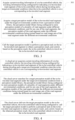
- FIG. 4 is a flowchart of another vehicle control method according to an exemplary embodiment.
- a perspective of the cloud server performing the vehicle control method is used as an example. Refer to FIG. 4 .
- the flowchart of the method provided in this embodiment of this application includes: 401:
- the cloud server acquires current traveling information of a to-be-controlled vehicle, the traveling information being configured for indicating a to-be-traveled road segment of the to-be-controlled vehicle during traveling and a target environmental condition when the to-be-controlled vehicle is on a corresponding to-be-traveled road segment.
- the to-be-controlled vehicle can automatically report the current traveling information to the cloud server, which is not limited in this application.
- the cloud server searches for a target perception model of the to-be-traveled road segment under the target environmental condition from a perception model library, the perception model library being configured to store perception models of a plurality of road segments under different environmental conditions, and for any one of the road segments, the perception models of the road segment under the different environmental conditions being trained based on road image sets of the road segment under the different environmental conditions.
- the cloud server trains perception models of the plurality of road segments under the different environmental conditions based on road image sets of the plurality of road segments under the different environmental conditions to obtain the perception model library.
- the first operation in constructing the perception model library is to segment a road into segments.
- a reason why the road needs to be segmented is that vegetation, buildings, road facility styles, and the like in different areas are different. Even for the same area, vegetation, buildings, road facility styles, and the like of different road segments in the area may also be different.
- the perception model To make the perception model have a better perception effect, the road needs to be segmented into a large quantity of small road segments.
- the road is segmented to obtain road segments of the road.
- the target geographic range may be a world range or a national range, which is not limited in this application.
- all types of roads may be segmented using the same segmentation granularity.
- each type of road may be segmented using a segmentation granularity of a plurality of kilometers (for example, 10 kilometers), to segment each road into a large quantity of small road segments.
- various roads can be segmented based on road types.
- different types of roads can alternatively be segmented based on different segmentation granularities. For example, a road with a more complex condition corresponds a smaller segmentation granularity.
- a segmentation granularity matching a road type of the road is acquired; and the road is segmented based on the segmentation granularity to obtain road segments of the road.
- An overlapping area exists between any two adjacent road segments of the road.
- the road types include, but are not limited to, highways, urban expressways, urban roads, and country roads, which is not limited in this application.
- a specific overlapping area for example, 500 meters is provided between any two adjacent road segments, which is not limited in this application.
- the environmental conditions may be further divided.
- the road segment is mapped to different perception units based on the different environmental conditions.
- the different perception units are the road segment under the different environmental conditions.
- road image sets of the perception units are constructed.
- the road image sets of the road segment under the different environmental conditions are constructed, and the perception model library is constructed based on the road image sets.
- perception models of the perception units are trained based on the road image sets of the perception units, to form the perception model library.
- perception models of the road segment under the different environmental conditions are trained based on the road image sets of the road segment under the different environmental conditions.
- a road image set includes a road image of the road segment under an environmental condition.
- a perception model library can be configured to perform a perception task, which is not limited in this application.
- training the perception models of the road segment under the different environmental conditions based on the road image sets of the road segment under the different environmental conditions includes: training, for a target perception task, the perception models of the road segment under the different environmental conditions based on the road image sets of the road segment under the different environmental conditions and a model training method matching the target perception task, the trained perception model being configured to perform the target perception task, and the target perception task being any perception task related to the autonomous driving or the assisted driving.
- the cloud server delivers the target perception model to the to-be-controlled vehicle, the to-be-controlled vehicle being configured to: call the target perception model to perform a perception task on the to-be-traveled road segment to obtain a perception result; and control, based on the obtained perception result, the to-be-controlled vehicle to travel on the to-be-traveled road segment.
- the vehicle control solution provided in embodiments of this application can implement slice-based perception.
- road image sets of the road segment under different environmental conditions are constructed, so that perception models of the road segment under the different environmental conditions are trained based on the road image sets of the road segment under the different environmental conditions, to form a perception model library.
- a perception model is configured to perform a perception task on a vehicle under an environmental condition on a road segment.
- the most adapted target perception model can be dynamically called from the perception model library for driving perception based on a to-be-traveled road segment of the to-be-controlled vehicle during the traveling and an environmental condition when the to-be-controlled vehicle is on a corresponding to-be-traveled road segment. Because different perception models are trained for different road segments and different environmental conditions, during the traveling of the vehicle, the most adapted target perception model can be used for driving perception for different to-be-traveled road segments and the different environmental conditions. Therefore, through a plurality of adapted target perception models, all possible situations that may occur during the traveling of the vehicle can be accurately perceived, providing a good perception effect, and ensuring driving safety.
- FIG. 5 is a flowchart of another vehicle control method according to an exemplary embodiment. Interaction between the cloud server and to-be-controlled vehicle is used as an example. Refer to FIG. 5 .
- the flowchart of the method provided in this embodiment of this application includes: 501: The cloud server acquires road network data and determines roads within a target geographic range based on the road network data.
- the cloud server can pull a map via a map interface, and then acquires the road network data via the map, which is not limited in this application.
- the cloud server acquires, for any one of the roads within the target geographic range, a segmentation granularity matching a road type of the road; and segments the road based on the segmentation granularity.
- the cloud server constructs, for any one of segmented road segments, road image sets of the road segment under different environmental conditions.
- this embodiment of this application may collect road images in a manner of crowdsourcing collection.
- massive road images can be reflowed from vehicles all over the world by cooperating with various device manufacturers and car manufacturers, and the reflowed road images are automatically divided into corresponding road segments in the cloud based on position information when the vehicles collect or reflow the road images, to obtain sample data sets of the road segments.
- the sample data sets of the road segments need to be further divided based on the environmental conditions, to form road image sets of the road segments under the different environmental conditions.
- the device manufacturers are merchants that sell vehicle accessories.
- constructing the road image sets of the road segment under the different environmental conditions includes: acquiring road images collected by a plurality of vehicles within the target geographic range and position information of the plurality of vehicles when the road images are collected; classifying, based on the position information, the acquired road images into different road segments within the target geographic range to obtain sample data sets of the road segments within the target geographic range; and classifying, for any one of the road segments, the sample data set of the road segment based on a divided environmental condition to obtain road image sets of the road segment under the different environmental conditions.
- an environment classification model can be used to automatically identify and classify road images under the different environmental conditions.
- the classifying the sample data set of the road segment based on a divided environmental condition includes: classifying the sample data set of the road segment based on an environment classification model to obtain environmental conditions corresponding to road images in the sample data set; and using road images with a same environmental condition as a road image set of the road segment under an environmental condition.
- each segmented road image set can be manually annotated with various targets that need to be perceived by autonomous driving or assisted driving, such as pedestrians, other vehicles, lane lines, zebra crossings, drivable areas, traffic lights, and traffic signs, which is not limited in this application.
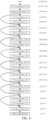
- FIG. 6 is a schematic diagram of a structure of a deep learning model according to an exemplary embodiment.
- the environment classification model uses a residual block as a basic convolution module, and n is a quantity of categories of environmental conditions output by the environment classification model, such as a quantity of categories of environmental conditions divided based on different lighting and weather conditions.
- the environment classification model includes a convolution layer, a first pooling layer, a plurality of residual blocks connected in sequence, a second pooling layer, and a fully connected layer.
- the convolution layer includes a 7*7 convolution kernel, 64 channels, and a step of 2.
- the first pooling layer is the largest pooling layer, and includes a step of 2.
- the second pooling layer is an average pooling layer.
- a plurality of residual blocks connected in sequence are included between the first pooling layer and the second pooling layer.
- a head and a tail of a solid arrow correspond to feature maps of the same size
- a head and a tail of a dashed arrow correspond to feature maps of different sizes.
- the first convolution layer is configured to perform feature extraction on the road image to obtain a first feature map
- the first pooling layer is configured to downsample the first feature map to obtain a second feature map
- the plurality of residual blocks connected in sequence are configured to perform feature extraction on the second feature map to obtain a third feature map
- the second pooling layer is configured to downsample the third feature map to obtain a fourth feature map
- the fully connected layer is configured to output, based on the fourth feature map, an environmental condition corresponding to the road image.
- the fully connected layer is responsible for outputting probabilities that the road image belongs to the environmental conditions, and a category with the highest probability is the environmental condition corresponding to the road image.
- the cloud server trains perception models of the plurality of road segments under the different environmental conditions based on the road image sets of the plurality of road segments under the different environmental conditions to obtain a perception model library.
- perception models related to the autonomous driving or the assisted driving, including target detection, semantic segmentation, image classification, and the like.
- the operation uses dynamic target (also referred to as a dynamic obstacle) detection as an example to describe a training process of a perception model.
- dynamic target also referred to as a dynamic obstacle
- this embodiment of this application defines the dynamic target as three categories: vehicles, pedestrians, and riders.
- training, for any one of the road segments, perception models of the road segment under the different environmental conditions based on road image sets of the road segment under the different environmental conditions includes: 5041: Generate, for a road image set of the road segment under an environmental condition, anchors on road images included in the road image set.
- the anchors are a series of detection boxes set in advance, also referred to as prior boxes.
- a quantity and sizes of the anchors may be determined by performing k-means clustering on all annotation boxes of all the road images in the road image set.
- the annotation box is configured to annotate a target contained in a road image.
- the annotation box is a real boundary box manually annotated on the road image.
- widths and heights of annotation boxes of the foregoing three types of targets are considered as features, and k-mean clustering is performed to cluster all annotation boxes into class B, and then a centroid of class B is used as a width and height of a corresponding anchor.
- B refers to a quantity of anchors.
- the generating anchors on road images included in the road image set includes: clustering annotation boxes on the road images included in the road image set to obtain a plurality of classes, each class including a plurality of data points, and the data points being generated based on height values and width values of the annotation boxes; using a quantity of classes obtained by clustering as a quantity of anchors corresponding to the road image set, and using height values and width values corresponding to centroids of the classes as sizes of the anchors corresponding to the road image set; and generating the anchors on the road images included in the road image set based on the determined quantity of anchors and the determined sizes of the anchors.
- the anchors are generated at positions on each road image based on the determined quantity of anchors and the determined sizes of the anchors.
- each anchor is regarded as a training sample.
- annotation content includes a category label, offset, and confidence.
- the annotation category is configured for indicating a category of a target included in the anchor
- the annotation offset is configured for indicating offset between the anchor and a similar annotation box
- the annotation confidence is configured for indicating a degree of confidence that the anchor includes the target.
- a similar annotation box of the anchor is an annotation box having the largest intersection-over-union with the anchor. Then, a category label of the annotation box is used as a category label of the anchor, and offset of the anchor relative to the annotation box is calculated.
- a plurality of anchors are first generated on an input road image, and then prediction categories, prediction offset, and prediction confidence of the anchors are generated. Positions of corresponding anchors can be adjusted based on the prediction offset to obtain predicted boxes. Finally, a predicted box that needs to be output can be screened based on maximum value suppression.
- FIG. 7 is an example of a structure of the deep learning model.
- the deep learning model includes a plurality of residual components (Res Blocks) and a plurality of CBL components.
- the CBL component includes Conv (convolution layer), BN (regularization layer), and a Relu activation function.
- the Res Block draws on a residual structure in a residual network, including a plurality of convolution layers and a plurality of BN layers.
- FIG. 7 shows a possible structure of the Res Block, including two convolution layers and two BN layers.
- the Res Block further includes a Relu activation function and identity mapping. Downsampling at the identity mapping is configured for compressing a size of an input feature map to facilitate addition to the output feature map.
- 2x and 4x in FIG. 7 respectively indicate that a corresponding Res Block is repeated twice and four times.
- a quantity of anchors at the position of the output feature map is B, and resolution of the output feature map is 1/16 of an input image.
- a quantity of channels of the output feature map is B*(4+1+c).
- Four channels are used to provide offset of center point horizontal coordinates, center point vertical coordinates, width values, and height values of the anchors.
- One channel is used to provide confidence of whether a corresponding anchor includes a target, and c channels are used to provide a category of a target.
- the quantity of channels of the output feature map is B*8.
- a target detection problem is regarded as a regression problem, the foregoing offset is also referred to as an offset regressor.
- a loss value of a loss function is calculated based on the prediction categories, prediction offset, and prediction confidence of the anchors on the output feature map, the annotation categories, annotation offset, and annotation confidence of the anchors.
- the first line is a center point loss
- the second line is a width and height loss.
- S represents the width and height of the output feature map.
- B represents the quantity of anchors at the position on the output feature map.
- Q ij obj represents whether the target appears in a j th anchor at an i th position of the output feature map. If there is the target at a position of ( i,j ), a value is 1. If there is no target at the position of (i,j), the value is 0.
- ( x ij , y ij , w ij , h ij ) represent the prediction offset of the anchor, which include prediction offset of the center horizontal coordinate, the center vertical coordinate, the width value, and the height value of the anchor respectively.
- ( x ⁇ ij , ⁇ ij , ⁇ ij , ⁇ ij , ⁇ ij ) represent the annotation offset of the anchor, which include annotation offset of the center horizontal coordinate, the center vertical coordinate, the width value, and the height value of the anchor respectively.
- the third line is a confidence loss.
- the fourth line is a category loss, that is, a sum of losses of categories is calculated on the output feature map.
- ⁇ , ⁇ , ⁇ represent weight values of the losses. For example, the weight value ⁇ is the largest.
- i,j,k,c are all integers, and k,c are greater than 0.
- c represents a quantity of categories of the target.
- Q i obj represents whether the target appears at the i th position of the output feature map.
- C ij represents the prediction confidence.
- ⁇ ij represents the annotation confidence.
- p i ( k ) represents the prediction category.
- p ⁇ i ( k ) represents the annotation category.
- the cloud server acquires current traveling information of the to-be-controlled vehicle, the traveling information being configured for indicating a to-be-traveled road segment of the to-be-controlled vehicle during traveling and a target environmental condition when the to-be-controlled vehicle is on a corresponding to-be-traveled road segment.
- the cloud server searches for a target perception model of the to-be-traveled road segment under the target environmental condition from the perception model library, and sends the target perception model to the to-be-controlled vehicle.
- the cloud server searches for target perception models of the to-be-traveled road segments under corresponding target environmental conditions from the perception model library in response to acquisition of the plurality of to-be-traveled road segments.
- a target perception model matches a to-be-traveled road segment during traveling of the to-be-controlled vehicle and a target environmental condition when the to-be-controlled vehicle is on a corresponding to-be-traveled road segment.
- the target perception model is acquired in real time, so that the to-be-traveled road segment is a to-be-traveled road segment where the to-be-controlled vehicle is currently located.
- a manner of acquiring the target perception model of the to-be-traveled road segment under the target environmental condition from a perception model library may be that the cloud server acquires the target perception model of the to-be-traveled road segment under the target environmental condition from the perception model library.
- the target perception model matches the to-be-traveled road segment where the to-be-controlled vehicle is currently located, and the target environmental condition when the to-be-controlled vehicle is on the corresponding to-be-traveled road segment.
- the to-be-traveled road segment is a road segment on a current navigation route of the to-be-controlled vehicle.
- Acquiring the target environmental condition when the to-be-controlled vehicle is on the corresponding to-be-traveled road segment includes: acquiring a road condition of the to-be-controlled vehicle during the traveling based on the current navigation route; determining, based on the road condition and traveling speed of the to-be-controlled vehicle during the traveling, time when the to-be-controlled vehicle is on the to-be-traveled road segments; and determining, for any one of the to-be-traveled road segments, based on the time when the to-be-controlled vehicle is on the to-be-traveled road segment, the target environmental condition when the to-be-controlled vehicle is on the to-be-traveled road segment.
- the current navigation route is a traveling path currently and automatically planned by the to-be-controlled vehicle.
- environmental conditions include lighting and weather
- a lighting category of the to-be-controlled vehicle when the to-be-controlled vehicle is on each road segment can be determined by estimating time when the to-be-controlled vehicle is on the road segment, and then a weather category of the to-be-controlled vehicle when the to-be-controlled vehicle is on the road segment can be determined by pulling a weather forecast, so that perception models of the road segments under different lighting and weather conditions can be delivered from the cloud server to the to-be-controlled vehicle in advance.
- the manner of acquiring target perception models of the to-be-traveled road segments under corresponding target environmental conditions from the perception model library may be to acquire the road condition of the to-be-controlled vehicle during the traveling based on the current navigation route; and determine, based on the road condition and traveling speed of the to-be-controlled vehicle during the traveling, time when the to-be-controlled vehicle is on the to-be-traveled road segments.
- the target perception models of the to-be-traveled road segments under the corresponding target environmental conditions are acquired from the perception model library in sequence based on the time when the to-be-controlled vehicle is on the to-be-traveled road segments.
- the cloud server can acquire the corresponding perception models from the perception model library and deliver the perception models to the to-be-controlled vehicle in sequence based on the time when the to-be-controlled vehicle is on the to-be-traveled road segments.
- a target perception model of a to-be-traveled road segment that the to-be-controlled vehicle passes first is delivered first, and a target perception model of a road segment that the to-be-controlled vehicle passes later is delivered later.
- the to-be-controlled vehicle calls the target perception model to perform a perception task on the to-be-traveled road segment to obtain a perception result; and controls, based on the obtained perception result, the to-be-controlled vehicle to travel on the to-be-traveled road segment.
- the foregoing environment classification model and various sensors are deployed on the to-be-controlled vehicle.
- the target perception model When the target perception model is called, an environmental condition of the to-be-traveled road segment where the to-be-controlled vehicle is currently located can be determined based on the environment classification model and the sensors, to select a target perception model that needs to be called currently.
- the calling a target perception model matching a to-be-traveled road segment where the to-be-controlled vehicle is currently located from the plurality of target perception models to perform the perception task includes: acquiring, based on an environment classification model deployed on the to-be-controlled vehicle, a first environmental condition of the to-be-traveled road segment where the to-be-controlled vehicle is currently located; acquiring, based on a sensor deployed on the to-be-controlled vehicle, a second environmental condition of the to-be-traveled road segment where the to-be-controlled vehicle is currently located; determining, based on the first environmental condition and the second environmental condition, a final environmental condition of the to-be-traveled road segment where the to-be-controlled vehicle is currently located; and calling a target perception model of the to-be-traveled road segment where the to-be-controlled vehicle is currently located under the final environmental condition from the plurality of target perception models.
- the to-be-controlled vehicle can acquire positioning information in real time based on a global position system (GPS) module deployed on the to-be-controlled vehicle, and then determines, based on the acquired positioning information, the to-be-traveled road segment where the to-be-controlled vehicle is currently located.
- GPS global position system
- the environmental condition of the to-be-traveled road segment where the to-be-controlled vehicle is currently located which is referred to as the first environmental condition in this specification, can be determined by the deployed environment classification model.
- the environmental condition of the to-be-traveled road segment where the to-be-controlled vehicle is currently located can alternatively be determined by the sensor deployed on the to-be-controlled vehicle.
- a rain sensor is used to identify whether it is raining on the road segment where the to-be-controlled vehicle is currently located
- a light sensor is used to identify a lighting category of the road segment where the to-be-controlled vehicle is currently located.
- the environmental condition of the to-be-traveled road segment where the to-be-controlled vehicle is currently located is comprehensively determined based on the first environmental condition output by the environment classification model and the second environmental condition output by the sensor.
- the first environmental condition output by the environment classification model is used to correct the second environmental condition output by the sensor.
- the second environmental condition of the sensor is used as a reference.
- the environmental condition of the to-be-controlled vehicle when the to-be-controlled vehicle is on the to-be-traveled road segment may be determined by the cloud server based on related information reported by the to-be-controlled vehicle, or may be determined by the to-be-controlled vehicle based on the related information, which is not limited in this application.
- the cloud server acquires road images collected by a plurality of to-be-controlled vehicles during traveling; updates, based on the road images collected by the plurality of to-be-controlled vehicles, road image sets of the road segments under the different environmental conditions within the target geographic range; and trains, based on updated road image sets of the road segments under the different environmental conditions, perception models of the road segments under the different environmental conditions.
- a data reflow module can be disposed inside a perception model to automatically reflow the road images when a vehicle is in an autonomous driving mode or an assisted driving mode, thereby implementing a closed-loop iteration of model training-model delivery-data reflow-model training.
- the vehicle control solution provided in embodiments of this application can implement slice-based perception.
- road image sets of the road segment under different environmental conditions are constructed, so that perception models of the road segment under the different environmental conditions are trained based on the road image sets of the road segment under the different environmental conditions, to form a perception model library.
- a perception model is configured to perform a perception task on a vehicle under an environmental condition on a road segment.
- the most adapted target perception model can be dynamically called from the perception model library for driving perception based on a to-be-traveled road segment of the to-be-controlled vehicle during the traveling and an environmental condition when the to-be-controlled vehicle is on a corresponding to-be-traveled road segment. Because different perception models are trained for different road segments and different environmental conditions, during the traveling of the vehicle, the most adapted target perception model can be used for driving perception for different to-be-traveled road segments and the different environmental conditions. Therefore, through a plurality of adapted target perception models, all possible situations that may occur during the traveling of the vehicle can be accurately perceived, providing a good perception effect, and ensuring driving safety.
- FIG. 8 is a schematic diagram of a structure of a vehicle control apparatus according to an exemplary embodiment. Refer to FIG. 8 .
- the apparatus includes:
- the vehicle control solution provided in embodiments of this application can implement slice-based perception.
- road image sets of the road segment under different environmental conditions are constructed, so that perception models of the road segment under the different environmental conditions are trained based on the road image sets of the road segment under the different environmental conditions, to form a perception model library.
- a perception model is configured to perform a perception task on a vehicle under an environmental condition on a road segment.
- the most adapted target perception model can be dynamically called from the perception model library for driving perception based on a to-be-traveled road segment of the to-be-controlled vehicle during the traveling and an environmental condition when the to-be-controlled vehicle is on a corresponding to-be-traveled road segment. Because different perception models are trained for different road segments and different environmental conditions, during the traveling of the vehicle, the most adapted target perception model can be used for driving perception for different to-be-traveled road segments and the different environmental conditions. Therefore, through a plurality of adapted target perception models, all possible situations that may occur during the traveling of the vehicle can be accurately perceived, providing a good perception effect, and ensuring driving safety.
- a quantity of the to-be-traveled road segments is more than one, and the plurality of to-be-traveled road segments are road segments on a current navigation route of the to-be-controlled vehicle.
- the second acquisition module is configured to acquire target perception models of the to-be-traveled road segments under corresponding target environmental conditions from the perception model library in response to acquisition of the plurality of to-be-traveled road segments. For a plurality of target perception models, a target perception model matches a to-be-traveled road segment and a target environmental condition when the to-be-controlled vehicle is on a corresponding to-be-traveled road segment.
- the control module is configured to call, during the traveling of the to-be-controlled vehicle, when the to-be-controlled vehicle reaches a to-be-traveled road segment, a target perception model matching a to-be-traveled road segment where the to-be-controlled vehicle is currently located from the plurality of target perception models to perform the perception task, and control, based on the obtained perception result, the to-be-controlled vehicle to travel on the to-be-traveled road segment where the to-be-controlled vehicle is currently located.
- the second acquisition module is configured to: acquire a road condition of the to-be-controlled vehicle during the traveling based on the current navigation route; determine, based on the road condition and traveling speed of the to-be-controlled vehicle during the traveling, time when the to-be-controlled vehicle is on the to-be-traveled road segments; and determine, for any one of the to-be-traveled road segments, based on the time when the to-be-controlled vehicle is on the to-be-traveled road segment, the target environmental condition when the to-be-controlled vehicle is on the to-be-traveled road segment.
- the to-be-traveled road segment is a road segment on the current navigation route of the to-be-controlled vehicle.
- the second acquisition module is configured to: acquire a road condition of the to-be-controlled vehicle during the traveling based on the current navigation route; determine, based on the road condition and traveling speed of the to-be-controlled vehicle during the traveling, time when the to-be-controlled vehicle is on the to-be-traveled road segments; and acquire, based on the time when the to-be-controlled vehicle is on the to-be-traveled road segments, the target perception models of the to-be-traveled road segments under the corresponding target environmental conditions from the perception model library in sequence.
- the to-be-traveled road segment is a to-be-traveled road segment where the to-be-controlled vehicle is currently located.
- the second acquisition module is configured to acquire a target perception model of the to-be-traveled road segment under the target environmental condition from a perception model library.
- the acquired target perception model matches the to-be-traveled road segment where the to-be-controlled vehicle is currently located, and the target environmental condition when the to-be-controlled vehicle is on the corresponding to-be-traveled road segment.
- the control module is configured to call the acquired target perception model to perform the perception task on the to-be-traveled road segment where the to-be-controlled vehicle is currently located to obtain the perception result, and control, based on the obtained perception result, the to-be-controlled vehicle to travel on the to-be-traveled road segment where the to-be-controlled vehicle is currently located.
- control module is configured to: acquire, based on an environment classification model deployed on the to-be-controlled vehicle, a first environmental condition of the to-be-traveled road segment where the to-be-controlled vehicle is currently located; acquire, based on a sensor deployed on the to-be-controlled vehicle, a second environmental condition of the to-be-traveled road segment where the to-be-controlled vehicle is currently located; determine, based on the first environmental condition and the second environmental condition, a final environmental condition of the to-be-traveled road segment where the to-be-controlled vehicle is currently located; and call a target perception model of the to-be-traveled road segment where the to-be-controlled vehicle is currently located under the final environmental condition from the plurality of target perception models.
- FIG. 9 is a schematic diagram of a structure of another vehicle control apparatus according to an exemplary embodiment. Refer to FIG. 9 .
- the apparatus includes:
- the vehicle control solution provided in embodiments of this application can implement slice-based perception.
- road image sets of the road segment under different environmental conditions are constructed, so that perception models of the road segment under the different environmental conditions are trained based on the road image sets of the road segment under the different environmental conditions, to form a perception model library.
- a perception model is configured to perform a perception task on a vehicle under an environmental condition on a road segment.
- the most adapted target perception model can be dynamically called from the perception model library for driving perception based on a to-be-traveled road segment of the to-be-controlled vehicle during the traveling and an environmental condition when the to-be-controlled vehicle is on a corresponding to-be-traveled road segment. Because different perception models are trained for different road segments and different environmental conditions, during the traveling of the vehicle, the most adapted target perception model can be used for driving perception for different to-be-traveled road segments and the different environmental conditions. Therefore, through a plurality of adapted target perception models, all possible situations that may occur during the traveling of the vehicle can be accurately perceived, providing a good perception effect, and ensuring driving safety.
- the apparatus further includes: a segmentation module, configured to: acquire, for any one of roads within a target geographic range, a segmentation granularity matching a road type of the road; and segment the road based on the segmentation granularity to obtain road segments of the road, an overlapping area existing between any two adjacent road segments of the road.
- a segmentation module configured to: acquire, for any one of roads within a target geographic range, a segmentation granularity matching a road type of the road; and segment the road based on the segmentation granularity to obtain road segments of the road, an overlapping area existing between any two adjacent road segments of the road.
- the apparatus further includes: a construction module, configured to: acquire road images collected by a plurality of vehicles within the target geographic range and position information of the plurality of vehicles when the road images are collected; and classify, based on the position information, the acquired road images into different road segments within the target geographic range to obtain sample data sets of the road segments within the target geographic range; and classify, for any one of the road segments, the sample data set of the road segment based on a divided environmental condition to obtain road image sets of the road segment under the different environmental conditions, a road image set including a road image of the road segment under an environmental condition.
- a construction module configured to: acquire road images collected by a plurality of vehicles within the target geographic range and position information of the plurality of vehicles when the road images are collected; and classify, based on the position information, the acquired road images into different road segments within the target geographic range to obtain sample data sets of the road segments within the target geographic range; and classify, for any one of the road segments, the sample data set of the road segment based on a divided environmental condition
- the perception models of the road segment under the different environmental conditions are trained based on the road image sets of the road segment under the different environmental conditions and a model training method matching the target perception task.
- the perception model is configured to perform the target perception task.
- the apparatus further includes:
- the training module is further configured to:
- the training module is further configured to:
- the construction module is configured to:
- the vehicle control apparatus When the vehicle control apparatus provided in the foregoing embodiment performs vehicle control, only division of the foregoing function modules is used as an example for description. In actual application, the foregoing functions may be allocated to different function modules for implementation based on requirements. In other words, an internal structure of the apparatus is divided into different function modules, to complete all or some of the foregoing described functions.
- the vehicle control apparatus and vehicle control method embodiments provided in the foregoing embodiments are based on the same conception. For details of the specific implementation process, reference may be made to the method embodiments, and details are not described herein again.
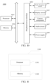
- FIG. 10 is a block diagram of a structure of a computer device 1000 according to an exemplary embodiment of this application.
- the computer device 1000 may be implemented as a terminal in a vehicle.
- the computer device 1000 includes: a processor 1001 and a memory 1002.
- the processor 1001 may include one or more processing cores, for example, a 4-core processor or an 8-core processor.
- the processor 1001 may be implemented in at least one hardware form of a digital signal processor (DSP), a field-programmable gate array (FPGA), and a programmable logic array (PLA).
- the processor 1001 may also include a main processor and a coprocessor.
- the main processor is a processor configured to process data in an awake state, and is also referred to as a central processing unit (CPU).
- the coprocessor is a low-power processor configured to process data in a standby state.
- the processor 1001 may be integrated with a graphics processing unit (GPU).
- the GPU is configured to render and draw content that needs to be displayed on a display screen.
- the processor 1001 may further include an artificial intelligence (AI) processor.
- the AI processor is configured to process computing operations related to machine learning.
- the memory 1002 may include one or more computer-readable storage media.
- the computer-readable storage medium may be non-transient.
- the memory 1002 may further include a high-speed random access memory and a nonvolatile memory, for example, one or more disk storage devices or flash storage devices.
- the non-transitory computer-readable storage medium in the memory 1002 is configured to store a computer program, and the computer program is configured to be executed by the processor 1001 to implement the vehicle control method provided in the method embodiments of this application.
- the computer device 1000 further includes: a peripheral device interface 1003 and at least one peripheral device.
- the processor 1001, the memory 1002, and the peripheral device interface 1003 may be connected via a bus or a signal cable.
- Each peripheral device may be connected to the peripheral device interface 1003 via a bus, a signal cable, or a circuit board.
- the peripheral device includes at least one of a radio frequency circuit 1004, a display screen 1005, a camera component 1006, an audio circuit 1007, and a power supply 1008.
- FIG. 10 constitutes no limitation on the computer device 1000, and the computer device 1000 may include more or fewer components than those shown in the figure, or some components may be combined, or a different component deployment may be used.
- FIG. 11 is a schematic diagram of a structure of a computer device 1100 according to an embodiment of this application.
- the computer device 1100 may be implemented as a cloud server.
- the computer device 1100 may be a server.
- the computer device 1100 may vary a lot due to different configurations or performance, and may include one or more central processing units (CPU) 1101 and one or more memories 1102.
- the memory 1102 stores a computer program, and the computer program is loaded and executed by the central processing unit 1101 to implement the vehicle control method provided in the foregoing method embodiments.
- the computer device 1100 may further include components such as a wired or wireless network interface, a keyboard, and an input/output (I/O) interface, to facilitate input and output.
- the computer device 1100 may further include another component configured to implement a function of a device. Details are not further described herein.
- a computer-readable storage medium such as a memory including program code.
- the program code may be executed by a processor of a computer device to implement the vehicle control method provided in the foregoing embodiments.
- the computer-readable storage medium may be a read-only memory (ROM), a random access memory (RAM), a compact disc read-only memory (CD-ROM), a magnetic tape, a floppy disk, and an optical data storage device.
- a computer program product including a computer program.
- the computer program is stored in a computer-readable storage medium, a processor of a computer device reads the computer program from the computer-readable storage medium, and the processor executes the computer program to cause the computer device to perform the foregoing vehicle control method.
- the computer program may be stored in a computer-readable storage medium.
- the foregoing storage medium may be a read-only memory, a magnetic disk, an optical disc, or the like.
Landscapes
- Engineering & Computer Science (AREA)
- Theoretical Computer Science (AREA)
- General Physics & Mathematics (AREA)
- Physics & Mathematics (AREA)
- Remote Sensing (AREA)
- Radar, Positioning & Navigation (AREA)
- Automation & Control Theory (AREA)
- Computer Vision & Pattern Recognition (AREA)
- Multimedia (AREA)
- Software Systems (AREA)
- Medical Informatics (AREA)
- Artificial Intelligence (AREA)
- Computing Systems (AREA)
- Evolutionary Computation (AREA)
- Databases & Information Systems (AREA)
- Health & Medical Sciences (AREA)
- General Health & Medical Sciences (AREA)
- Transportation (AREA)
- Mechanical Engineering (AREA)
- Human Computer Interaction (AREA)
- Ecology (AREA)
- Biodiversity & Conservation Biology (AREA)
- Atmospheric Sciences (AREA)
- Life Sciences & Earth Sciences (AREA)
- Environmental & Geological Engineering (AREA)
- Environmental Sciences (AREA)
- Data Mining & Analysis (AREA)
- General Engineering & Computer Science (AREA)
- Mathematical Physics (AREA)
- Traffic Control Systems (AREA)
Applications Claiming Priority (2)
| Application Number | Priority Date | Filing Date | Title |
|---|---|---|---|
| CN202211186055.7A CN116985840A (zh) | 2022-09-27 | 2022-09-27 | 车辆控制方法、装置、设备及存储介质 |
| PCT/CN2023/113976 WO2024066798A1 (fr) | 2022-09-27 | 2023-08-21 | Procédé et appareil de commande de véhicule, et dispositif et support de stockage |
Publications (2)
| Publication Number | Publication Date |
|---|---|
| EP4501735A1 true EP4501735A1 (fr) | 2025-02-05 |
| EP4501735A4 EP4501735A4 (fr) | 2025-06-11 |
Family
ID=88523820
Family Applications (1)
| Application Number | Title | Priority Date | Filing Date |
|---|---|---|---|
| EP23870043.9A Pending EP4501735A4 (fr) | 2022-09-27 | 2023-08-21 | Procédé et appareil de commande de véhicule, et dispositif et support de stockage |
Country Status (4)
| Country | Link |
|---|---|
| US (1) | US20240416956A1 (fr) |
| EP (1) | EP4501735A4 (fr) |
| CN (1) | CN116985840A (fr) |
| WO (1) | WO2024066798A1 (fr) |
Families Citing this family (3)
| Publication number | Priority date | Publication date | Assignee | Title |
|---|---|---|---|---|
| TWI903297B (zh) * | 2023-12-06 | 2025-11-01 | 鴻海精密工業股份有限公司 | 自動駕駛模型的訓練方法、系統、電子設備及存儲介質 |
| CN119380557B (zh) * | 2024-09-30 | 2025-11-18 | 贵州中南交通科技有限公司 | 基于物联网的公路感知一体化系统 |
| CN119169413B (zh) * | 2024-11-20 | 2025-03-25 | 福瑞泰克智能系统有限公司 | 评测数据的确定方法和装置、存储介质及电子设备 |
Family Cites Families (16)
| Publication number | Priority date | Publication date | Assignee | Title |
|---|---|---|---|---|
| US10678240B2 (en) * | 2016-09-08 | 2020-06-09 | Mentor Graphics Corporation | Sensor modification based on an annotated environmental model |
| US11573573B2 (en) * | 2017-06-06 | 2023-02-07 | Plusai, Inc. | Method and system for distributed learning and adaptation in autonomous driving vehicles |
| EP3685366A1 (fr) * | 2017-09-18 | 2020-07-29 | Telefonaktiebolaget LM Ericsson (Publ) | Système et procédé de fourniture de recommandations de conduite précises sur la base d'un balayage assisté par réseau d'un environnement ambiant |
| US11378956B2 (en) * | 2018-04-03 | 2022-07-05 | Baidu Usa Llc | Perception and planning collaboration framework for autonomous driving |
| DE102019124339B3 (de) * | 2019-09-11 | 2020-09-24 | Audi Ag | Steuervorrichtung für ein Kraftfahrzeug sowie Betriebsverfahren für die Steuervorrichtung |
| US11868136B2 (en) * | 2019-12-19 | 2024-01-09 | Woven By Toyota, U.S., Inc. | Geolocalized models for perception, prediction, or planning |
| CN111599183B (zh) * | 2020-07-22 | 2020-10-27 | 中汽院汽车技术有限公司 | 一种自动驾驶场景分类识别系统及方法 |
| CN112277951B (zh) * | 2020-10-29 | 2021-08-20 | 北京罗克维尔斯科技有限公司 | 车辆感知模型生成方法、车辆自动驾驶控制方法及装置 |
| CN112744226A (zh) * | 2021-01-18 | 2021-05-04 | 国汽智控(北京)科技有限公司 | 基于驾驶环境感知的自动驾驶智能自适应方法及系统 |
| CN113596102B (zh) * | 2021-07-05 | 2023-07-18 | 哈尔滨工业大学(深圳) | 车路协同式交通系统、路侧系统和数据处理方法 |
| CN113428177B (zh) * | 2021-07-16 | 2023-03-14 | 中汽创智科技有限公司 | 一种车辆控制方法、装置、设备及存储介质 |
| CN114179829A (zh) * | 2021-12-24 | 2022-03-15 | 中汽创智科技有限公司 | 多端协同的车辆行驶方法、装置、系统及介质 |
| CN114419586A (zh) * | 2022-01-11 | 2022-04-29 | 长沙慧联智能科技有限公司 | 一种细粒度道路区域识别方法、场景切换控制方法及装置 |
| CN114120653A (zh) * | 2022-01-26 | 2022-03-01 | 苏州浪潮智能科技有限公司 | 一种集中式车群决策控制方法、装置及电子设备 |
| CN115071731B (zh) * | 2022-06-30 | 2025-05-30 | 徐工汉云技术股份有限公司 | 一种基于大数据平台无人驾驶模型的建立方法及无人驾驶系统 |
| CN115056784B (zh) * | 2022-07-04 | 2023-12-05 | 小米汽车科技有限公司 | 车辆控制方法、装置、车辆、存储介质及芯片 |
-
2022
- 2022-09-27 CN CN202211186055.7A patent/CN116985840A/zh active Pending
-
2023
- 2023-08-21 EP EP23870043.9A patent/EP4501735A4/fr active Pending
- 2023-08-21 WO PCT/CN2023/113976 patent/WO2024066798A1/fr not_active Ceased
-
2024
- 2024-08-23 US US18/814,092 patent/US20240416956A1/en active Pending
Also Published As
| Publication number | Publication date |
|---|---|
| WO2024066798A1 (fr) | 2024-04-04 |
| EP4501735A4 (fr) | 2025-06-11 |
| CN116985840A (zh) | 2023-11-03 |
| US20240416956A1 (en) | 2024-12-19 |
Similar Documents
| Publication | Publication Date | Title |
|---|---|---|
| EP4501735A1 (fr) | Procédé et appareil de commande de véhicule, et dispositif et support de stockage | |
| EP2876620B1 (fr) | Système d'assistance à la conduite et procédé d'assistance à la conduite | |
| CN111874006A (zh) | 路线规划处理方法和装置 | |
| CN107918753A (zh) | 点云数据处理方法及装置 | |
| JP7376992B2 (ja) | 情報処理装置、情報処理方法、及び、プログラム | |
| US11961272B2 (en) | Long range localization with surfel maps | |
| CN116457800A (zh) | 用于自动驾驶车辆中的地图变化检测的架构 | |
| US20230202507A1 (en) | Control system for autonomous vehicle simulator | |
| US11645775B1 (en) | Methods and apparatus for depth estimation on a non-flat road with stereo-assisted monocular camera in a vehicle | |
| CN117591847B (zh) | 基于车况数据的模型指向评测方法和装置 | |
| US12073607B2 (en) | Recognition model distribution system and updating method of recognition model | |
| CN112418081A (zh) | 一种空地联合快速勘察交通事故的方法及系统 | |
| CN114722931A (zh) | 车载数据处理方法、装置、数据采集设备和存储介质 | |
| WO2020241815A1 (fr) | Appareil embarqué, procédé d'aide à la conduite et système d'aide à la conduite | |
| Marques et al. | An evaluation of machine learning methods for speed-bump detection on a GoPro dataset | |
| US20230024799A1 (en) | Method, system and computer program product for the automated locating of a vehicle | |
| US12139172B2 (en) | Predicting near-curb driving behavior on autonomous vehicles | |
| CN116048067B (zh) | 停车路径规划方法、装置、车辆以及存储介质 | |
| US12151691B2 (en) | Filtering perception-related artifacts | |
| US12560696B2 (en) | Radar tracking association with velocity matching by leveraging kinematics priors | |
| CN110446106B (zh) | 一种前置摄像头文件的识别方法、电子设备及存储介质 | |
| WO2020241813A1 (fr) | Système de fourniture d'informations de conduite, appareil embarqué et procédé de fourniture d'informations de conduite | |
| CN113762030A (zh) | 数据处理方法、装置、计算机设备及存储介质 | |
| CN117593892B (zh) | 真值数据的获取方法和装置、存储介质及电子设备 | |
| US20250095383A1 (en) | Associating detected objects and traffic lanes using computer vision |
Legal Events
| Date | Code | Title | Description |
|---|---|---|---|
| STAA | Information on the status of an ep patent application or granted ep patent |
Free format text: STATUS: THE INTERNATIONAL PUBLICATION HAS BEEN MADE |
|
| PUAI | Public reference made under article 153(3) epc to a published international application that has entered the european phase |
Free format text: ORIGINAL CODE: 0009012 |
|
| STAA | Information on the status of an ep patent application or granted ep patent |
Free format text: STATUS: REQUEST FOR EXAMINATION WAS MADE |
|
| 17P | Request for examination filed |
Effective date: 20241030 |
|
| AK | Designated contracting states |
Kind code of ref document: A1 Designated state(s): AL AT BE BG CH CY CZ DE DK EE ES FI FR GB GR HR HU IE IS IT LI LT LU LV MC ME MK MT NL NO PL PT RO RS SE SI SK SM TR |
|
| A4 | Supplementary search report drawn up and despatched |
Effective date: 20250513 |
|
| RIC1 | Information provided on ipc code assigned before grant |
Ipc: G06V 20/56 20220101ALI20250507BHEP Ipc: G06V 10/774 20220101ALI20250507BHEP Ipc: G06V 10/764 20220101ALI20250507BHEP Ipc: G06V 10/762 20220101ALI20250507BHEP Ipc: G01C 21/36 20060101ALI20250507BHEP Ipc: G06V 10/70 20220101ALI20250507BHEP Ipc: B60W 40/02 20060101ALI20250507BHEP Ipc: B60W 60/00 20200101ALI20250507BHEP Ipc: B60W 50/00 20060101AFI20250507BHEP |
|
| DAV | Request for validation of the european patent (deleted) | ||
| DAX | Request for extension of the european patent (deleted) |