KR20170119066A - Gps 및 경사센서를 활용한 토공량 산출시스템 - Google Patents
Gps 및 경사센서를 활용한 토공량 산출시스템 Download PDFInfo
- Publication number
- KR20170119066A KR20170119066A KR1020160046737A KR20160046737A KR20170119066A KR 20170119066 A KR20170119066 A KR 20170119066A KR 1020160046737 A KR1020160046737 A KR 1020160046737A KR 20160046737 A KR20160046737 A KR 20160046737A KR 20170119066 A KR20170119066 A KR 20170119066A
- Authority
- KR
- South Korea
- Prior art keywords
- tin
- work
- plan
- earthwork
- coordinate data
- Prior art date
- Legal status (The legal status is an assumption and is not a legal conclusion. Google has not performed a legal analysis and makes no representation as to the accuracy of the status listed.)
- Ceased
Links
Images





Classifications
-
- G—PHYSICS
- G01—MEASURING; TESTING
- G01F—MEASURING VOLUME, VOLUME FLOW, MASS FLOW OR LIQUID LEVEL; METERING BY VOLUME
- G01F23/00—Indicating or measuring liquid level or level of fluent solid material, e.g. indicating in terms of volume or indicating by means of an alarm
- G01F23/22—Indicating or measuring liquid level or level of fluent solid material, e.g. indicating in terms of volume or indicating by means of an alarm by measuring physical variables, other than linear dimensions, pressure or weight, dependent on the level to be measured, e.g. by difference of heat transfer of steam or water
-
- E—FIXED CONSTRUCTIONS
- E02—HYDRAULIC ENGINEERING; FOUNDATIONS; SOIL SHIFTING
- E02F—DREDGING; SOIL-SHIFTING
- E02F9/00—Component parts of dredgers or soil-shifting machines, not restricted to one of the kinds covered by groups E02F3/00 - E02F7/00
- E02F9/20—Drives; Control devices
- E02F9/2004—Control mechanisms, e.g. control levers
-
- G—PHYSICS
- G01—MEASURING; TESTING
- G01B—MEASURING LENGTH, THICKNESS OR SIMILAR LINEAR DIMENSIONS; MEASURING ANGLES; MEASURING AREAS; MEASURING IRREGULARITIES OF SURFACES OR CONTOURS
- G01B13/00—Measuring arrangements characterised by the use of fluids
- G01B13/02—Measuring arrangements characterised by the use of fluids for measuring length, width or thickness
- G01B13/03—Measuring arrangements characterised by the use of fluids for measuring length, width or thickness by measuring coordinates of points
-
- G—PHYSICS
- G01—MEASURING; TESTING
- G01C—MEASURING DISTANCES, LEVELS OR BEARINGS; SURVEYING; NAVIGATION; GYROSCOPIC INSTRUMENTS; PHOTOGRAMMETRY OR VIDEOGRAMMETRY
- G01C3/00—Measuring distances in line of sight; Optical rangefinders
-
- G—PHYSICS
- G01—MEASURING; TESTING
- G01C—MEASURING DISTANCES, LEVELS OR BEARINGS; SURVEYING; NAVIGATION; GYROSCOPIC INSTRUMENTS; PHOTOGRAMMETRY OR VIDEOGRAMMETRY
- G01C9/00—Measuring inclination, e.g. by clinometers, by levels
-
- G—PHYSICS
- G01—MEASURING; TESTING
- G01S—RADIO DIRECTION-FINDING; RADIO NAVIGATION; DETERMINING DISTANCE OR VELOCITY BY USE OF RADIO WAVES; LOCATING OR PRESENCE-DETECTING BY USE OF THE REFLECTION OR RERADIATION OF RADIO WAVES; ANALOGOUS ARRANGEMENTS USING OTHER WAVES
- G01S19/00—Satellite radio beacon positioning systems; Determining position, velocity or attitude using signals transmitted by such systems
- G01S19/01—Satellite radio beacon positioning systems transmitting time-stamped messages, e.g. GPS [Global Positioning System], GLONASS [Global Orbiting Navigation Satellite System] or GALILEO
- G01S19/13—Receivers
- G01S19/14—Receivers specially adapted for specific applications
-
- G—PHYSICS
- G06—COMPUTING OR CALCULATING; COUNTING
- G06T—IMAGE DATA PROCESSING OR GENERATION, IN GENERAL
- G06T17/00—Three-dimensional [3D] modelling for computer graphics
- G06T17/20—Finite element generation, e.g. wire-frame surface description, tesselation
-
- B—PERFORMING OPERATIONS; TRANSPORTING
- B60—VEHICLES IN GENERAL
- B60Y—INDEXING SCHEME RELATING TO ASPECTS CROSS-CUTTING VEHICLE TECHNOLOGY
- B60Y2200/00—Type of vehicle
- B60Y2200/40—Special vehicles
- B60Y2200/41—Construction vehicles, e.g. graders, excavators
- B60Y2200/412—Excavators
Landscapes
- Engineering & Computer Science (AREA)
- Physics & Mathematics (AREA)
- General Physics & Mathematics (AREA)
- Remote Sensing (AREA)
- Radar, Positioning & Navigation (AREA)
- Computer Graphics (AREA)
- Mining & Mineral Resources (AREA)
- Fluid Mechanics (AREA)
- Thermal Sciences (AREA)
- Geometry (AREA)
- Software Systems (AREA)
- Theoretical Computer Science (AREA)
- Electromagnetism (AREA)
- Civil Engineering (AREA)
- General Engineering & Computer Science (AREA)
- Structural Engineering (AREA)
- Computer Networks & Wireless Communication (AREA)
- Operation Control Of Excavators (AREA)
- Component Parts Of Construction Machinery (AREA)
Abstract
Description
도 2는 본 발명에 따른 일실시예를 개략적으로 나타내는 블록도.
도 3은 본 발명에 따른 일실시예에서 TIN생성모듈부의 계획면을 나타내는 예시도.
도 4는 본 발명에 따른 일실시예에서 TIN생성모듈부의 계획면에 불규칙삼각망이 표시된 상태를 나타내는 예시도.
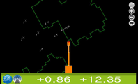
도 5는 본 발명에 따른 일실시예에서 작업TIN생성모듈에 따른 좌표데이터의 포인트를 나타내는 예시도.
도 6은 본 발명에 따른 일실시예에서 작업TIN생성모듈에 따른 토공 작업면의 불규칙삼각망이 표시된 상태를 나타내는 예시도.
도 7은 본 발명에 따른 일실시예에서 TIN생성모듈부의 종단면 출력상태를 나타내는 예시도.
도 8은 본 발명에 따른 일실시예에서 도면변환TIN모듈에 따른 도면변환상태를 나타내는 예시도.
도 9는 본 발명에 따른 일실시예에서 도면변환TIN모듈에 따른 3차원 도면 변환과정을 나타내는 예시도.

5 : 붐 7 : 암
9 : 버켓 10 : 장비컨트롤러
20 : 좌표측정부 21 : GPS수신기
23 : 경사센서 30 : TIN생성모듈부
31 : 계획TIN생성모듈 33 : 작업TIN생성모듈
35 : 도면변환TIN모듈 40 : 수량산출부
45 : 모드선택수단
a : 붐 길이 b : 암 길이 c : 버켓 길이
θ1 : 붐의 각도 θ2 : 붐과 암 사이의 각도
θ3 : 암과 버켓 사이의 각도
Claims (9)
- 굴삭장비의 운전석 내에 설치되고 화면출력과 함께 입력설정가능한 디스플레이 기능을 갖는 장비컨트롤러와;
굴삭장비의 GPS위치정보데이터와 굴삭장비의 차량 본체에서 버켓까지의 거리정보데이터를 검출하여 지반의 토공 작업지점에 따른 포인트 좌표데이터 값을 측량하는 좌표측정부와;
외부로부터 평면상의 2차원 도면을 입체화시킨 3차원 도면을 입력하여 전체 또는 부분 계획면에 대한 불규칙삼각망을 생성시키는 계획TIN생성모듈과, 굴삭장비의 토공 작업으로 상기 좌표측정부로부터 측정된 X축, Y축, Z축의 좌표데이터가 입력되고 토공 작업면에 대한 불규칙삼각망을 생성시키는 작업TIN생성모듈과, 상기 작업TIN생성모듈로부터 입력된 좌표데이터를 토대로 3차원 도면으로 변환하되 입체적인 불규칙삼각망을 생성시키는 도면변환TIN모듈을 포함하여 구성되는 TIN생성모듈부와;
상기 TIN생성모듈부의 계획TIN생성모듈의 계획면을 기반으로 상기 작업TIN생성모듈의 측정 좌표데이터를 비교하여 토공 작업에 따른 부피를 산출하는 수량산출부;를 포함하여 이루어지는 GPS 및 경사센서를 활용한 토공량 산출시스템.
- 청구항 1에 있어서,
상기 장비컨트롤러에서는 상기 좌표측정부로부터 측량된 좌표데이터 값을 출력하되 X축, Y축, Z축과 함께 토공 작업면 기준치까지의 남은 토공 작업량을 표시하도록 출력하는 GPS 및 경사센서를 활용한 토공량 산출시스템.
- 청구항 1에 있어서,
상기 좌표측정부는, 굴삭장비의 토공 작업에 대한 위치정보를 수신하여 작업기준점을 제공하는 GPS수신기와, 굴삭장비의 붐과 암 및 버켓의 각 절점마다 설치되고 개개의 회전각도를 검출가능한 경사센서를 포함하여 이루어지는 GPS 및 경사센서를 활용한 토공량 산출시스템.
- 청구항 1에 있어서,
상기 TIN생성모듈부에서는 계획면 또는 토공 작업면 상에 생성되는 불규칙삼각망의 경우 상기 장비컨트롤러의 화면상에 기본적인 계획면 또는 토공 작업면의 선과는 차별된 다른 색상의 선으로 표시될 수 있게 출력하는 GPS 및 경사센서를 활용한 토공량 산출시스템.
- 청구항 1에 있어서,
상기 TIN생성모듈부에서는 불규칙삼각망이 생성된 계획면에 굴삭장비의 작업진행방향을 기준으로 설계 종단면을 나타내는 토공 작업면 도면이 상기 장비컨트롤러의 화면상에 부분적으로 출력될 수 있게 형성하는 GPS 및 경사센서를 활용한 토공량 산출시스템.
- 청구항 1에 있어서,
상기 TIN생성모듈부는 상기 작업TIN생성모듈로부터 상기 좌표측정부에서 측정된 좌표데이터대로 토공 작업면에 대한 불규칙삼각망을 생성시키되 상기 계획TIN생성모듈로부터 생성된 계획면과는 다른 도면작업층의 토공 작업면을 형성하도록 이루어지는 GPS 및 경사센서를 활용한 토공량 산출시스템.
- 청구항 1에 있어서,
상기 수량산출부에는 상기 장비컨트롤러를 통해 상기 TIN생성모듈부에 대한 계획면의 기준을 모드별로 선택가능하게 형성하는 모드선택수단을 포함하여 이루어지는 GPS 및 경사센서를 활용한 토공량 산출시스템.
- 청구항 7에 있어서,
상기 모드선택수단을 통해 계획면의 기준을 전체 계획면 모드로 설정하면,
상기 수량산출부에서는 상기 계획TIN생성모듈에 입력된 계획면에서 전체 계획면에 대한 좌표데이터를 기준으로 상기 좌표측정부로부터 측정한 좌표데이터와 비교하여 토공 작업에 따른 부피를 산출하도록 이루어지는 GPS 및 경사센서를 활용한 토공량 산출시스템.
- 청구항 7에 있어서,
상기 모드선택수단을 통해 계획면의 기준을 부분 계획면 모드로 설정하면,
상기 수량산출부에서는 상기 계획TIN생성모듈에 입력된 계획면에서 구역별로 구분된 부분 계획면에 대한 좌표데이터를 기준으로 상기 좌표측정부로부터 측정한 좌표데이터와 비교하여 토공 작업에 따른 부피를 산출하도록 이루어지는 GPS 및 경사센서를 활용한 토공량 산출시스템.
Priority Applications (1)
| Application Number | Priority Date | Filing Date | Title |
|---|---|---|---|
| KR1020160046737A KR20170119066A (ko) | 2016-04-18 | 2016-04-18 | Gps 및 경사센서를 활용한 토공량 산출시스템 |
Applications Claiming Priority (1)
| Application Number | Priority Date | Filing Date | Title |
|---|---|---|---|
| KR1020160046737A KR20170119066A (ko) | 2016-04-18 | 2016-04-18 | Gps 및 경사센서를 활용한 토공량 산출시스템 |
Publications (1)
| Publication Number | Publication Date |
|---|---|
| KR20170119066A true KR20170119066A (ko) | 2017-10-26 |
Family
ID=60301144
Family Applications (1)
| Application Number | Title | Priority Date | Filing Date |
|---|---|---|---|
| KR1020160046737A Ceased KR20170119066A (ko) | 2016-04-18 | 2016-04-18 | Gps 및 경사센서를 활용한 토공량 산출시스템 |
Country Status (1)
| Country | Link |
|---|---|
| KR (1) | KR20170119066A (ko) |
Cited By (5)
| Publication number | Priority date | Publication date | Assignee | Title |
|---|---|---|---|---|
| KR101988352B1 (ko) | 2018-05-25 | 2019-09-30 | (주)대우건설 | 블록 지반 모델링과 3차원 위치정보를 이용한 토공량 산정 시스템 |
| KR102287849B1 (ko) * | 2020-12-03 | 2021-08-10 | (주)영신디엔씨 | Ict 및 iot기반의 도로지반 또는 도로포장 롤러다짐공정의 실시간 모니터링 시스템 |
| KR20220010220A (ko) | 2020-07-17 | 2022-01-25 | 현대두산인프라코어(주) | 블록 지반 모델링을 이용한 굴삭기 토공량 산출 시스템 및 그 방법 |
| KR102396846B1 (ko) * | 2021-11-26 | 2022-05-12 | (주)호산이엔 | 토목시설물 모델링 방법 및 그 방법을 수행하기 위한 전자 장치 |
| CN116163362A (zh) * | 2023-01-02 | 2023-05-26 | 中冶武勘工程技术有限公司 | 利用三维倾斜摄影进行滑坡治理中土方开挖施工方法 |
-
2016
- 2016-04-18 KR KR1020160046737A patent/KR20170119066A/ko not_active Ceased
Cited By (5)
| Publication number | Priority date | Publication date | Assignee | Title |
|---|---|---|---|---|
| KR101988352B1 (ko) | 2018-05-25 | 2019-09-30 | (주)대우건설 | 블록 지반 모델링과 3차원 위치정보를 이용한 토공량 산정 시스템 |
| KR20220010220A (ko) | 2020-07-17 | 2022-01-25 | 현대두산인프라코어(주) | 블록 지반 모델링을 이용한 굴삭기 토공량 산출 시스템 및 그 방법 |
| KR102287849B1 (ko) * | 2020-12-03 | 2021-08-10 | (주)영신디엔씨 | Ict 및 iot기반의 도로지반 또는 도로포장 롤러다짐공정의 실시간 모니터링 시스템 |
| KR102396846B1 (ko) * | 2021-11-26 | 2022-05-12 | (주)호산이엔 | 토목시설물 모델링 방법 및 그 방법을 수행하기 위한 전자 장치 |
| CN116163362A (zh) * | 2023-01-02 | 2023-05-26 | 中冶武勘工程技术有限公司 | 利用三维倾斜摄影进行滑坡治理中土方开挖施工方法 |
Similar Documents
| Publication | Publication Date | Title |
|---|---|---|
| KR101766846B1 (ko) | 고정밀 gps 측량이 가능한 굴삭작업 가이드 및 컨트롤 시스템 | |
| AU2022209235B2 (en) | Display control device and display control method | |
| US10385543B2 (en) | Construction management system, construction management method, and management device | |
| JP7133562B2 (ja) | 材料移動機械のための拡張現実ディスプレイ | |
| CN106715800B (zh) | 用于运土机械的导向系统 | |
| KR102259549B1 (ko) | 작업 기계 | |
| JP6322612B2 (ja) | 施工管理システム及び形状計測方法 | |
| CN110574078B (zh) | 显示控制装置、显示控制方法、记录介质以及显示系统 | |
| KR101144727B1 (ko) | 스테레오 비전 기술을 이용한 굴삭작업 지원 시스템 | |
| KR101944816B1 (ko) | 굴삭 작업 검측 자동화 시스템 | |
| JP6585697B2 (ja) | 施工管理システム | |
| CN108885102A (zh) | 形状测量系统、作业机械及形状测量方法 | |
| US20210017733A1 (en) | Dimension-specifying device and dimension-specifying method | |
| KR101629716B1 (ko) | 굴삭작업을 위한 좌표측량 시스템 및 그 방법 | |
| KR101944817B1 (ko) | 휴대단말기를 이용한 굴삭 작업 검측 자동화 시스템 | |
| Yoo et al. | Development of a 3D local terrain modeling system of intelligent excavation robot | |
| AU2021201940A1 (en) | Construction method, work machine control system, and work machine | |
| JP6606230B2 (ja) | 形状計測システム | |
| JP7065002B2 (ja) | 作業機械 | |
| JP7357979B2 (ja) | 検測装置 | |
| JP6815462B2 (ja) | 形状計測システム及び形状計測方法 | |
| JP2018178711A (ja) | 施工現場の形状情報の生成方法及び作業機械の制御システム | |
| KR101988352B1 (ko) | 블록 지반 모델링과 3차원 위치정보를 이용한 토공량 산정 시스템 | |
| KR102966499B1 (ko) | 블록 지반 모델링을 이용한 굴삭기 토공량 산출 시스템 | |
| KR20220010220A (ko) | 블록 지반 모델링을 이용한 굴삭기 토공량 산출 시스템 및 그 방법 |
Legal Events
| Date | Code | Title | Description |
|---|---|---|---|
| A201 | Request for examination | ||
| PA0109 | Patent application |
Patent event code: PA01091R01D Comment text: Patent Application Patent event date: 20160418 |
|
| PA0201 | Request for examination | ||
| E902 | Notification of reason for refusal | ||
| PE0902 | Notice of grounds for rejection |
Comment text: Notification of reason for refusal Patent event date: 20170720 Patent event code: PE09021S01D |
|
| PG1501 | Laying open of application | ||
| AMND | Amendment | ||
| E601 | Decision to refuse application | ||
| PE0601 | Decision on rejection of patent |
Patent event date: 20180321 Comment text: Decision to Refuse Application Patent event code: PE06012S01D Patent event date: 20170720 Comment text: Notification of reason for refusal Patent event code: PE06011S01I |
|
| X091 | Application refused [patent] | ||
| AMND | Amendment | ||
| PX0901 | Re-examination |
Patent event code: PX09011S01I Patent event date: 20180321 Comment text: Decision to Refuse Application Patent event code: PX09012R01I Patent event date: 20171120 Comment text: Amendment to Specification, etc. |
|
| PX0601 | Decision of rejection after re-examination |
Comment text: Decision to Refuse Application Patent event code: PX06014S01D Patent event date: 20180516 Comment text: Amendment to Specification, etc. Patent event code: PX06012R01I Patent event date: 20180419 Comment text: Decision to Refuse Application Patent event code: PX06011S01I Patent event date: 20180321 Comment text: Amendment to Specification, etc. Patent event code: PX06012R01I Patent event date: 20171120 Comment text: Notification of reason for refusal Patent event code: PX06013S01I Patent event date: 20170720 |
|
| X601 | Decision of rejection after re-examination | ||
| J201 | Request for trial against refusal decision | ||
| PJ0201 | Trial against decision of rejection |
Patent event date: 20180615 Comment text: Request for Trial against Decision on Refusal Patent event code: PJ02012R01D Patent event date: 20180516 Comment text: Decision to Refuse Application Patent event code: PJ02011S01I Patent event date: 20180321 Comment text: Decision to Refuse Application Patent event code: PJ02011S01I Appeal kind category: Appeal against decision to decline refusal Decision date: 20190628 Appeal identifier: 2018101002523 Request date: 20180615 |
|
| J301 | Trial decision |
Free format text: TRIAL NUMBER: 2018101002523; TRIAL DECISION FOR APPEAL AGAINST DECISION TO DECLINE REFUSAL REQUESTED 20180615 Effective date: 20190628 |
|
| PJ1301 | Trial decision |
Patent event code: PJ13011S01D Patent event date: 20190628 Comment text: Trial Decision on Objection to Decision on Refusal Appeal kind category: Appeal against decision to decline refusal Request date: 20180615 Decision date: 20190628 Appeal identifier: 2018101002523 |