EP0169954B1 - Elektronisches Navigations- und Informationssystem für den Verkehr - Google Patents
Elektronisches Navigations- und Informationssystem für den Verkehr Download PDFInfo
- Publication number
- EP0169954B1 EP0169954B1 EP84401584A EP84401584A EP0169954B1 EP 0169954 B1 EP0169954 B1 EP 0169954B1 EP 84401584 A EP84401584 A EP 84401584A EP 84401584 A EP84401584 A EP 84401584A EP 0169954 B1 EP0169954 B1 EP 0169954B1
- Authority
- EP
- European Patent Office
- Prior art keywords
- information
- road
- vehicle
- storage
- cartographic data
- Prior art date
- Legal status (The legal status is an assumption and is not a legal conclusion. Google has not performed a legal analysis and makes no representation as to the accuracy of the status listed.)
- Expired
Links
- 230000015654 memory Effects 0.000 claims abstract description 36
- 238000003860 storage Methods 0.000 claims abstract description 34
- 230000009471 action Effects 0.000 claims description 10
- 230000033001 locomotion Effects 0.000 claims description 9
- 230000000007 visual effect Effects 0.000 claims description 5
- 230000006870 function Effects 0.000 claims description 4
- 238000012545 processing Methods 0.000 claims description 4
- 230000005540 biological transmission Effects 0.000 claims description 3
- 230000006835 compression Effects 0.000 claims 6
- 238000007906 compression Methods 0.000 claims 6
- 239000007787 solid Substances 0.000 claims 1
- 238000012546 transfer Methods 0.000 abstract description 2
- 241001080024 Telles Species 0.000 description 5
- 230000010365 information processing Effects 0.000 description 5
- 238000000034 method Methods 0.000 description 5
- 238000012800 visualization Methods 0.000 description 5
- 230000008859 change Effects 0.000 description 4
- 238000010586 diagram Methods 0.000 description 4
- 238000010276 construction Methods 0.000 description 3
- 238000006073 displacement reaction Methods 0.000 description 3
- 230000002265 prevention Effects 0.000 description 3
- 238000013479 data entry Methods 0.000 description 2
- 238000013461 design Methods 0.000 description 2
- 238000012986 modification Methods 0.000 description 2
- 230000004048 modification Effects 0.000 description 2
- 229930182555 Penicillin Natural products 0.000 description 1
- JGSARLDLIJGVTE-MBNYWOFBSA-N Penicillin G Chemical compound N([C@H]1[C@H]2SC([C@@H](N2C1=O)C(O)=O)(C)C)C(=O)CC1=CC=CC=C1 JGSARLDLIJGVTE-MBNYWOFBSA-N 0.000 description 1
- 241001417494 Sciaenidae Species 0.000 description 1
- 239000004783 Serene Substances 0.000 description 1
- 238000013459 approach Methods 0.000 description 1
- 230000001174 ascending effect Effects 0.000 description 1
- 238000004891 communication Methods 0.000 description 1
- 230000000295 complement effect Effects 0.000 description 1
- 230000008878 coupling Effects 0.000 description 1
- 238000010168 coupling process Methods 0.000 description 1
- 238000005859 coupling reaction Methods 0.000 description 1
- 230000003247 decreasing effect Effects 0.000 description 1
- 238000009826 distribution Methods 0.000 description 1
- 230000000694 effects Effects 0.000 description 1
- 239000011521 glass Substances 0.000 description 1
- 238000005286 illumination Methods 0.000 description 1
- 239000004973 liquid crystal related substance Substances 0.000 description 1
- 231100000897 loss of orientation Toxicity 0.000 description 1
- 238000004519 manufacturing process Methods 0.000 description 1
- 229940049954 penicillin Drugs 0.000 description 1
- 238000003825 pressing Methods 0.000 description 1
- 238000004886 process control Methods 0.000 description 1
- MTCFGRXMJLQNBG-UHFFFAOYSA-N serine Chemical compound OCC(N)C(O)=O MTCFGRXMJLQNBG-UHFFFAOYSA-N 0.000 description 1
- 230000011664 signaling Effects 0.000 description 1
- 230000003068 static effect Effects 0.000 description 1
- 230000029305 taxis Effects 0.000 description 1
- 238000012549 training Methods 0.000 description 1
- 230000001960 triggered effect Effects 0.000 description 1
- 238000012795 verification Methods 0.000 description 1
Images


Classifications
-
- G—PHYSICS
- G01—MEASURING; TESTING
- G01C—MEASURING DISTANCES, LEVELS OR BEARINGS; SURVEYING; NAVIGATION; GYROSCOPIC INSTRUMENTS; PHOTOGRAMMETRY OR VIDEOGRAMMETRY
- G01C21/00—Navigation; Navigational instruments not provided for in groups G01C1/00 - G01C19/00
- G01C21/26—Navigation; Navigational instruments not provided for in groups G01C1/00 - G01C19/00 specially adapted for navigation in a road network
- G01C21/34—Route searching; Route guidance
Definitions
- the invention relates to a simple, optimized and complete electronic guidance system for traffic, in particular urban and road traffic, to replace the daily operations of any driver of a vehicle who has to find his way and be guided to read a map or plan.
- This system replaces the tedious reading of a map with a flow diagram showing a route diagrammed as the user crosses sections of his route. It replaces maps and maps on paper, but also coordinates, on the sole initiative of the driver, obtaining cultural, municipal, prevention or commercial information specific to his route, also replacing the reading of specialized guides , books, newspapers and even information which, although useful, cannot reach it today. It fills a communication gap, individualized in a journey, important for security and for trade.
- the invention is also likely to apply to maritime, river or air navigation, as well as to process control, training, education, teaching and tourism.
- Road maps do not have an alphabetical index of the locality served by the roads, and it may sometimes take a long search before finding your locality of destination.
- the index exists, but you also have to refer to the map to try to define your route taking into account the information contained therein, such as one-way for example, or by visually comparing a route by compared to another.
- the person who moves in this same geographical area is only likely to make information interrelations between the names of the routes, the sites, and the places which he meets, only with information previously memorized by it, or that it finds in guides, books or newspapers, without however having them at its disposal in its displacement.
- the driver can be interested at the same time in what he sees, and if he can, ask the native about the date of construction of a monument or the address of a nearby restaurant. If it is not answered, it will lack information.
- the document FR-A 2448 202 describes an electronic device indicating routes, guidance and information for traffic comprising memory media for receiving cartographic data and general information, and defined as an on-board electronic processing and for viewing the information receiving said storage media and capable of selecting a route and of indicating, visually or phonically, the actions to be taken to follow the route.
- this on-board equipment selects a predetermined route between two road nodes neighboring the departure point and the arrival point respectively, and the indications which it gives are limited to the identity of the known road nodes which are the stages of the 'route.
- One of the aims of the invention is to provide a simple and complete electronic system for optimized guidance and information for traffic, allowing the choice of a route, and the effective guidance throughout this route by means information that is directly and easily noticeable.
- Another object of the invention is to provide a device for reading, identifying, coding, compacting, memorizing and updating, which provides a cartographic reading of a traffic area and which couples into a memory , to the names of the routes of the sites and the places, of the abstracts of cartographic, municipal, historical, tourist, economic, political, commercial, technical or advertising information, so as to give interest to any route taken, and to inform the user in the information section he chooses.
- Another object of the invention is to provide memory media carrying guidance information and general information, which can be marketed easily, whether they are different or confused, further allowing the coupling of information of a different nature, then that until now this information was considered foreign to each other, and the subject of publishing documents that are difficult to reconcile although complementary to each other.
- Another aim is to provide a storage device which can be found in town, as are widely used today cash dispensers with magnetic cards, which makes available at all points inexpensive and susceptible storage media. to be updated by the storage device.
- the invention thus presents itself as a complete traffic assistance system providing indications necessary for the serene and informed driving of a vehicle.
- This optimized electronic guidance and traffic information system can be used in any geographic area, regardless of the means of transport used.
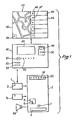
- the data coding and memorizing apparatus 40 ensures the coding and memorizing of the cartographic data of a determined area, urban for example.
- a sensitive screen 42 is shown an oriented map, and by means of an electronic pencil, the sections of tracks can be followed on the screen after having identified them by means of a keyboard not shown.
- the cartographic information thus coded and stored is for example, for each section of track: the orientation relative to the north, the length, the width of the track, the points of clearance, the names and the landmarks such as public monuments , churches, squares, etc.
- general, municipal, historical, tourist, economic, political, commercial or advertising information can be stored in memory for example.
- This information is stored in memories such as 43 for municipal information, 44 for historical information, etc.
- This information relates to the identified section of track and the correlation between the section of track and the information of a given type is ensured by means of the correlation button 45 and the buttons for controlling the respective memories 46, 47 for example.
- the general information of memories 43, 44, etc. are coupled to the names of the channels or their coordinates, with a correlation signal such as the display of the name of a channel on a screen of the electronic device.
- embedded 2 makes it possible to relate general information, in the form of readable or audible text, for example.
- the coding and memorizing apparatus 40 is capable of compacting the various data and information items to make them recordable on a medium of small dimensions. In the event of modification of certain data or information, this device is capable of ensuring the corresponding updates.
- the storage device 41 is presented as an automatic distributor of prepaid tickets. It includes a coin receiver 49, a credit card or payment card receiver 50, a dialog screen 48, and control buttons for choosing the memory media that it is capable of delivering. These media can be in the form of memory cards, coated blocks, magnetic tapes, or memory disks.
- the device can hold it in stock and receive it from the outside via an inlet slot 53. It loads data and / or information onto a card and delivers the card through an outlet slot 54.
- the buttons command allow you to select map data (button 51) or information of a particular type, municipal, historic, tourist, economic, political, commercial or advertising for example (button 52 corresponding to the type of information chosen). These practical elements are given for information only and can be replaced by technical equivalents.
- the storage device 41 comprises a memory capable of being periodically loaded by the coding and memorizing device 40, for storing compacted data and information, with a view to their transfer, after payment, by reproduction on the memory media. .
- the memory media 1, 1a are non-volatile, protected and non-reproducible media containing cartographic data usually read from a city map or a road map, and general information, in correlation with the remarkable points of the routes followed. These memory media can be updated by the storage device 41. They possibly carry a microprocessor 3.
- a cartographic data medium is specific to a city, a district, a geographical area, generally covered by a city map or a road map.
- Primary information relates to traffic routes such as streets, roads, squares, bridges, etc.
- Identification information that is to say the type of lane (street, avenue, dead end, square ...) and its name; the information of specific characteristics, i.e. the length, the width, the orientation compared to the north, the authorized direction if there is only one, and the increasing direction of the numbers of the track, for example, in the case of urban roads; and the identifying information of the intersecting lanes, i.e. their name, their position on the right or left in relation to the increasing direction of the lane numbers, and the angel they make with the lane example.
- Secondary information relates to the practicability of the track, the presence of works for example, easily recognizable landmarks on the track or in its vicinity, points of tourist interest, prevention indications (dangerous crossings, limitation speed), for example, or general information.
- the cartographic support carries permanent but revisable information, that is to say capable of being updated. It covers a well-defined geographic area. Another cartographic support corresponds to an adjacent area, so that the replacement of one support by another can ensure continuity, in the guidance, as in the case of the adjacent folds of a geographical map.
- a first cartographic support can be provided, essentially relating to traffic information, and a second support containing essentially tourist, historical, commercial, economic, or other type of information.
- Different cartographic supports can contain information of different scale, for example at 1/50 000e and 1/10 OOOe.
- the on-board electronic device 2 for information processing and display includes a set of memories and microprocessors. It is likely to receive one or two memory media such as 1 and 1 a. It includes a keyboard 4, two control buttons 5 and 6, one for progression 5, the other for go back 6, a button 7 for on-off control, and a number of locations display or display which will be described in relation to Figures 2 and 3.
- the keyboard 4 has letter keys and number keys, arranged in a conventional manner.
- the keyboard is preferably arranged at the bottom of the device. Data can be recorded by touch on a screen.
- the device 2 also has a certain number of viewing locations. In the following description, these locations correspond to specific screens, but they can also correspond to specific areas on a single screen for example.
- the apparatus 2 also has a frame 55 provided with control buttons 56 which correspond respectively to municipal, historical, tourist, economic, political, commercial or advertising information, likely to be contained in the memory medium 1 a, in correlation with the cartographic information of the support 1.
- the device 2 can also be equipped with a speaker 57.
- FIGS. 2 and 3 the screens having the same role are identified by the same references. These flat screens, cathodic, liquid crystal, luminescent, or bright, occupy most of the surface of the device 2.
- In the center is the space devoted to the main display, whose arrangement varies according to the mode of representation chosen. Around this central space are arranged screens corresponding to information essential to follow the chosen route, or useful.
- the two screens 8 and 9 in line to the left and to the right of the on-off button 7, display the name of the departure lane and the arrival lane, respectively. This display is not changed throughout the journey. It recalls the data used for the definition of the route.
- screen 10 displaying the name of the lane followed by the vehicle.
- screen 11 displays the length of the section of track that the vehicle is traveling, which constitutes useful information for driving the vehicle.
- a screen 12 of the landmarks which displays the names and the symbols of the compulsory passage points of the route, recorded before the departure by the user at middle of the keyboard.
- This screen permanently lists these waypoints.
- provision may be made to enhance the illumination of said passage point on the screen 12 by a flash for example.
- screen 13 there are respectively on the left and on the right, two screens 14 and 15 corresponding: the first, at the distance remaining to be traveled on the current route, the second at the total length of this route.
- Screen 15 displays this distance before departure, which allows comparisons between routes passing through different intermediate points.
- the distance remaining to be covered, which appears on screen 14, is evaluated, from the total length, by subtracting the lengths of sections appearing on screen 11.
- screens corresponding to traffic information facilitating driving in addition to the external indications of the road display.
- the two screens 24 and 25 indicate the rank, in the section followed, of the next lane in which we must turn, respectively to the left 24 or to the right 25.
- the display of the rank 3 on screen 25 means that two lanes must be passed to the right before turning into the third, and gives an “instruction to do” to the user well before he begins to change course. Just reading the street rank where you have to turn is a useful indication and driving aid.
- FIG. 2 illustrates a first embodiment corresponding to a representation of the directions of movement by arrows or oriented indicators.
- the central part of the device 2 carries an axial arrow 26 corresponding to the heading of the vehicle, and two transverse arrows 27 and 28 corresponding to the instructions “turn left” and “turn right”, respectively.
- the heel of arrow 26 and illuminated to symbolize the vehicle.
- the tip of arrow 26 is illuminated when the instruction is to go straight
- the left arrow 27 is illuminated when the instruction is to turn left
- the right arrow 28 is illuminated when the instruction is to turn right.
- FIG. 3 illustrates a second embodiment corresponding to a representation of the path sections.
- the central part of the device is a screen 29 comprising two parts separated by a line 34 visible or not.
- the section 30 on which the vehicle is located On the left side of this screen is shown the section 30 on which the vehicle is located and the section 31 which the vehicle must travel, and which forms an angle with the section 30.
- the user has in advance a display of its next change of direction, the angle of the two sections 30 and 31 corresponding to the heading change angle to be expected.
- the two sections 30 and 31 are illuminated.
- the screen 29 represents the intersecting lanes 32, 33 which are not to be taken, but which make it possible to better know where the vehicle is located. These intersecting paths are only shown for the length of their first section from section 30, this is why their segments to the left and to the right of said section 30 may be of different length.
- the route can be displayed continuously, so that it takes place at the rate of progression of the vehicle.
- We can thus have a fishbone representation, which straightens as the tracks scroll on its first section, at the base of the screen.
- the vehicle is then represented by a light point on the route to be followed, magnified by the magnifying glass effect.
- a fourth embodiment is provided, providing guidance from the intersecting tracks, in succession to the left and to the right of the route followed.
- the only modification resides in the enlargement of the screens 22 and 23 of the intersecting lanes, so as to display there no longer the identification of the first intersecting lane to be crossed, but the list of all the intersecting lanes, left and right, respectively, of the route.
- This list presentation has a triple function. First of all, the selection of departure and arrival lanes can be obtained by scrolling through the alphabetical list of lanes, and stopping it at the desired lane, which is selected by touching on the screen.
- the operation of the on-board electronic information processing and display device is analyzed in the following manner: first of all, we take the cartographic support 1 corresponding to the circulation area (city, rural area, region, for example). example) and it is inserted into the device 2. The same is done with the support 1a corresponding to the desired general information, historical, tourist or other. Then, using the keyboard 4, the departure lane is defined by its name, which is displayed on screens 8 and 10, and the direction of the vehicle in relation to the lane numbers (ascending or descending); we then define, still using the keyboard, the destination channel, which is displayed on screen 9; it is also possible to impose passage through one or more intermediate points, which are displayed on the screen 12. The data entry phase is then completed.
- the device 2 is programmed to define a route from the data provided to it. The length of this route is then displayed on screens 14 and 15. The user has the option of refusing a route and requesting another. He also has the option of returning to the first, if the second route does not suit him.
- the route being defined we then enter the actual guidance phase, with, depending on the mode of representation, the arrow 26 which lights up (FIG. 2), or the sections of tracks 30 and 31 which appear on the screen 29 (figure 3). It is then that the progress button 5 must intervene, to control the successive display of information relating to the route to be followed, as the vehicle progresses.
- the progress button must be pressed each time the user approaches a new segment of the route, that is to say each time the indication of a screens 22 and 23 displaying the names of the intersecting paths. He commands arrows 26, 27,28.
- the progress button In the second embodiment ( Figure 3), the progress button must be pressed each time the section is changed. It controls the registration of the section followed on screen 29 and the appearance of a new section.
- the progress button controls the presentation of the fishbone route when the device is not linked to the vehicle.
- the button 56 lights up and if the driver wishes, it can be operated by pressing. He can then hear through the speaker 57, or read from the screen 13, the corresponding general information which is related to the particular point of the route where he is passing.
- the electronic guidance device provides information on movement, whether or not linked to the running of a vehicle, by arrowed signal, by stepping or continuous scrolling of a cartographic representation, or by scrolling of names. intersecting lanes, describing a route to be followed between a starting point and a destination point, presenting, in correlation, the actions to be taken, all the information necessary for guidance, driving assistance, and simultaneously information cultural.
- the device can receive instructions via the keyboard, or phonically.
- the program included in the on-board device makes it possible to calculate, represent and inform at least one route chosen by the user.
- the electronic guidance system for public transport networks, and in particular for the metropolitan network. It can be applied to guiding the visit of tourist sites or museums for example.
- the guidance system according to the invention can be described as an intelligent guide.
Landscapes
- Engineering & Computer Science (AREA)
- Radar, Positioning & Navigation (AREA)
- Remote Sensing (AREA)
- Automation & Control Theory (AREA)
- Physics & Mathematics (AREA)
- General Physics & Mathematics (AREA)
- Navigation (AREA)
- Traffic Control Systems (AREA)
- Processing Or Creating Images (AREA)
- Devices For Indicating Variable Information By Combining Individual Elements (AREA)
- Instructional Devices (AREA)
Claims (16)
Priority Applications (6)
| Application Number | Priority Date | Filing Date | Title |
|---|---|---|---|
| EP84401584A EP0169954B2 (de) | 1984-07-27 | 1984-07-27 | Elektronisches Navigations- und Informationssystem für den Verkehr |
| DE8484401584T DE3475842D1 (en) | 1984-07-27 | 1984-07-27 | Electronic information and navigation system for traffic |
| AT84401584T ATE39584T1 (de) | 1984-07-27 | 1984-07-27 | Elektronisches navigations- und informationssystem fuer den verkehr. |
| PCT/FR1985/000202 WO1986001023A1 (fr) | 1984-07-27 | 1985-07-24 | Systeme electronique de guidage et d'information pour la circulation |
| JP60503299A JPH0654411B2 (ja) | 1984-07-27 | 1985-07-24 | 交通用電子案内装置 |
| US07/349,935 US4951211A (en) | 1984-07-27 | 1989-04-28 | Electronic guiding and information system for traffic |
Applications Claiming Priority (1)
| Application Number | Priority Date | Filing Date | Title |
|---|---|---|---|
| EP84401584A EP0169954B2 (de) | 1984-07-27 | 1984-07-27 | Elektronisches Navigations- und Informationssystem für den Verkehr |
Publications (3)
| Publication Number | Publication Date |
|---|---|
| EP0169954A1 EP0169954A1 (de) | 1986-02-05 |
| EP0169954B1 true EP0169954B1 (de) | 1988-12-28 |
| EP0169954B2 EP0169954B2 (de) | 1995-09-06 |
Family
ID=8192903
Family Applications (1)
| Application Number | Title | Priority Date | Filing Date |
|---|---|---|---|
| EP84401584A Expired - Lifetime EP0169954B2 (de) | 1984-07-27 | 1984-07-27 | Elektronisches Navigations- und Informationssystem für den Verkehr |
Country Status (6)
| Country | Link |
|---|---|
| US (1) | US4951211A (de) |
| EP (1) | EP0169954B2 (de) |
| JP (1) | JPH0654411B2 (de) |
| AT (1) | ATE39584T1 (de) |
| DE (1) | DE3475842D1 (de) |
| WO (1) | WO1986001023A1 (de) |
Families Citing this family (57)
| Publication number | Priority date | Publication date | Assignee | Title |
|---|---|---|---|---|
| DE3512127A1 (de) * | 1985-04-03 | 1986-10-16 | Robert Bosch Gmbh, 7000 Stuttgart | Ortungs- und navigationssystem fuer landfahrzeuge |
| US5422812A (en) * | 1985-05-30 | 1995-06-06 | Robert Bosch Gmbh | Enroute vehicle guidance system with heads up display |
| JP2602014B2 (ja) * | 1986-08-23 | 1997-04-23 | 博之 杉山 | ナビゲーション装置 |
| BE905721A (fr) * | 1986-11-07 | 1987-03-02 | Rouck Cartographie S A De | Appareil d'optimalisation multi-dimensionnelle de routings. |
| GB2197736B (en) * | 1986-11-11 | 1991-02-06 | Logicblend Ltd | Information transmission system |
| DE3640109A1 (de) * | 1986-11-24 | 1988-06-01 | Konrad Kattengel | Leitsystem fuer ein fahrzeug innerhalb eines strassennetzes |
| FR2652413A1 (fr) * | 1987-09-24 | 1991-03-29 | Fourneau Claude | Systeme informatique a logiciel routier integre sur vehicules pour guidage routier avec affichage et simulation directe sur ecran. |
| JP2746604B2 (ja) * | 1988-06-16 | 1998-05-06 | アイシン・エィ・ダブリュ株式会社 | ナビゲーション装置 |
| WO1990001763A1 (en) * | 1988-07-29 | 1990-02-22 | Lionel James Barden | Personnel guidance system |
| US5646856A (en) * | 1989-06-08 | 1997-07-08 | Kaesser; Juergen | Vehicle navigation system |
| US5067081A (en) * | 1989-08-30 | 1991-11-19 | Person Carl E | Portable electronic navigation aid |
| US5197009A (en) * | 1990-01-24 | 1993-03-23 | Mid America Technologies, Inc. | Apparatus for and method of creating delivery route maps |
| DE4008460A1 (de) * | 1990-03-16 | 1991-09-19 | Bosch Gmbh Robert | Navigationssystem |
| US5177685A (en) * | 1990-08-09 | 1993-01-05 | Massachusetts Institute Of Technology | Automobile navigation system using real time spoken driving instructions |
| US5243528A (en) * | 1990-09-12 | 1993-09-07 | Motorola, Inc. | Land vehicle navigation apparatus with visual display |
| US5220507A (en) * | 1990-11-08 | 1993-06-15 | Motorola, Inc. | Land vehicle multiple navigation route apparatus |
| EP0510172B1 (de) * | 1990-11-08 | 1995-07-05 | Motorola, Inc. | Mehrstreckenauswahlnavigationsvorrichtung für ein landfahrzeug |
| JPH04187851A (ja) * | 1990-11-20 | 1992-07-06 | Toyota Motor Corp | 筒内直接噴射式火花点火機関 |
| US5696684A (en) * | 1991-07-04 | 1997-12-09 | Robert Bosch Gmbh | Electronic guide device |
| US5544060A (en) * | 1991-10-16 | 1996-08-06 | Zexel Usa Corporation | Vehicle mounted navigation system with preview function |
| FR2683355A1 (fr) * | 1991-10-30 | 1993-05-07 | Bertrand Georges | Lecteur de cartes numerisees portable. |
| JP2611592B2 (ja) * | 1991-12-09 | 1997-05-21 | 三菱電機株式会社 | 移動体用ナビゲーション装置及びその表示方法 |
| US10361802B1 (en) | 1999-02-01 | 2019-07-23 | Blanding Hovenweep, Llc | Adaptive pattern recognition based control system and method |
| US8352400B2 (en) | 1991-12-23 | 2013-01-08 | Hoffberg Steven M | Adaptive pattern recognition based controller apparatus and method and human-factored interface therefore |
| US5430653A (en) * | 1992-10-12 | 1995-07-04 | Masprodenkoh Kabushikikaisha | Navigation system with route determination process capable of determining a desired route readily and quickly |
| JP2598857B2 (ja) * | 1992-10-12 | 1997-04-09 | マスプロ電工株式会社 | 車両の走行経路設定装置 |
| GB2278196A (en) * | 1993-05-18 | 1994-11-23 | William Michael Frederi Taylor | Information system using GPS |
| EP0672890B2 (de) * | 1994-03-18 | 2009-01-07 | Aisin Aw Co., Ltd. | Reiseführersystem |
| EP0673010B1 (de) * | 1994-03-18 | 2003-06-04 | Aisin Aw Co., Ltd. | Führungssystem |
| US5648768A (en) * | 1994-12-30 | 1997-07-15 | Mapsys, Inc. | System and method for identifying, tabulating and presenting information of interest along a travel route |
| US5682525A (en) | 1995-01-11 | 1997-10-28 | Civix Corporation | System and methods for remotely accessing a selected group of items of interest from a database |
| US5774828A (en) * | 1995-04-07 | 1998-06-30 | Delco Electronics Corporation | Mapless GPS navigation system with user modifiable data base |
| US5964821A (en) * | 1995-04-07 | 1999-10-12 | Delco Electronics Corporation | Mapless GPS navigation system with sortable destinations and zone preference |
| US5887269A (en) * | 1995-04-07 | 1999-03-23 | Delco Elecronics Corporation | Data product authorization control for GPS navigation system |
| US5627547A (en) * | 1995-04-07 | 1997-05-06 | Delco Electronics Corporation | Mapless GPS navigation system in vehicle entertainment system |
| WO1997006522A1 (en) * | 1995-08-09 | 1997-02-20 | Toyota Jidosha Kabushiki Kaisha | Travel plan preparing device |
| US5724316A (en) * | 1995-09-26 | 1998-03-03 | Delco Electronics Corporation | GPS based time determining system and method |
| US20060284767A1 (en) * | 1995-11-14 | 2006-12-21 | Taylor William M F | GPS explorer |
| US5951620A (en) * | 1996-01-26 | 1999-09-14 | Navigation Technologies Corporation | System and method for distributing information for storage media |
| KR100279366B1 (ko) * | 1996-07-31 | 2001-01-15 | 모리 하루오 | 차량용네비게이션장치 |
| JPH10207352A (ja) * | 1997-01-23 | 1998-08-07 | Sony Corp | 位置情報符号化装置及び方法、及び位置情報復号化装置及び方法、並びに、地図情報処理装置及び方法 |
| US6199013B1 (en) | 1997-07-15 | 2001-03-06 | Navigation Technologies Corp. | Maneuver generation program and method |
| US6199014B1 (en) | 1997-12-23 | 2001-03-06 | Walker Digital, Llc | System for providing driving directions with visual cues |
| NL1010928C2 (nl) * | 1998-12-30 | 2000-07-03 | Jorg Van Beek | Weergave-systeem voor wegenkaarten. |
| US7966078B2 (en) | 1999-02-01 | 2011-06-21 | Steven Hoffberg | Network media appliance system and method |
| US6442449B1 (en) * | 1999-10-15 | 2002-08-27 | Andrew Blasy | System and method for providing directions between locations |
| JP3636026B2 (ja) * | 2000-04-10 | 2005-04-06 | トヨタ自動車株式会社 | 旅行情報提供サーバ |
| US6696932B2 (en) * | 2000-09-08 | 2004-02-24 | Eaton Corporation | Intelligent indicators for a motor vehicle |
| EP1202030B1 (de) * | 2000-10-31 | 2006-04-26 | Matsushita Electric Industrial Co., Ltd. | Navigationsvorrichtung |
| US6701249B1 (en) | 2001-12-18 | 2004-03-02 | Navigation Technologies Corp | Navigation system with wireless logging for billing |
| JP4031282B2 (ja) * | 2002-04-17 | 2008-01-09 | 株式会社ザナヴィ・インフォマティクス | ナビゲーション装置およびナビゲーション制御プログラム |
| US20050131638A1 (en) * | 2003-12-11 | 2005-06-16 | Sencaj Randall W. | Route sequence viewing in navigation system |
| US20050187668A1 (en) * | 2004-02-23 | 2005-08-25 | Baumgarte Joseph W. | System or method for loading software onto a vehicle |
| US20100015991A1 (en) * | 2008-07-15 | 2010-01-21 | Kota Enterprises, Llc | System and method for calling a geosoc |
| US8504073B2 (en) | 2008-08-12 | 2013-08-06 | Teaneck Enterprises, Llc | Customized content delivery through the use of arbitrary geographic shapes |
| US7921223B2 (en) | 2008-12-08 | 2011-04-05 | Lemi Technology, Llc | Protected distribution and location based aggregation service |
| US20100205060A1 (en) * | 2009-02-09 | 2010-08-12 | Yahoo! Inc. | Context-sensitive route generation system |
Family Cites Families (13)
| Publication number | Priority date | Publication date | Assignee | Title |
|---|---|---|---|---|
| US3522664A (en) * | 1967-11-20 | 1970-08-04 | Westinghouse Electric Corp | Interface device and display system |
| FR2448202A1 (fr) * | 1979-01-31 | 1980-08-29 | Fleischmann Pascal | Appareil indicateur d'itineraires |
| DE2941331A1 (de) * | 1979-10-11 | 1981-04-23 | Siemens AG, 1000 Berlin und 8000 München | Autarke navigationseinrichtung fuer strassenfahrzeuge |
| US4481584A (en) * | 1981-07-30 | 1984-11-06 | Holland Bobby H | Highway information system |
| JPS5828777A (ja) * | 1981-08-13 | 1983-02-19 | アルプス電気株式会社 | 車載用コ−ス誘導装置 |
| JPH0619276B2 (ja) * | 1981-08-17 | 1994-03-16 | 工業技術院長 | 携帯地図表示装置組体 |
| JPS5871408A (ja) * | 1981-10-23 | 1983-04-28 | Nippon Denso Co Ltd | 道路地図表示装置 |
| JPS58111969A (ja) * | 1981-12-25 | 1983-07-04 | 日産自動車株式会社 | 車両用走行経路表示装置 |
| MX152578A (es) * | 1982-03-10 | 1985-09-09 | Natividad Gene Esparza | Mejoras a sistema electronico computarizado para la obtencion de coordenadas urbanas |
| JPS59132099A (ja) * | 1983-01-17 | 1984-07-30 | 株式会社デンソー | 車両用走行案内システム |
| DE3468762D1 (en) * | 1983-05-27 | 1988-02-18 | Vdo Schindling | Information input arrangement |
| JPS60196617A (ja) * | 1984-03-19 | 1985-10-05 | Mitsubishi Electric Corp | 車載ナビゲ−シヨン装置 |
| JPS60229799A (ja) * | 1984-04-27 | 1985-11-15 | 三菱電機株式会社 | 車載用ナビゲ−タ |
-
1984
- 1984-07-27 DE DE8484401584T patent/DE3475842D1/de not_active Expired
- 1984-07-27 EP EP84401584A patent/EP0169954B2/de not_active Expired - Lifetime
- 1984-07-27 AT AT84401584T patent/ATE39584T1/de not_active IP Right Cessation
-
1985
- 1985-07-24 JP JP60503299A patent/JPH0654411B2/ja not_active Expired - Lifetime
- 1985-07-24 WO PCT/FR1985/000202 patent/WO1986001023A1/fr not_active Ceased
-
1989
- 1989-04-28 US US07/349,935 patent/US4951211A/en not_active Expired - Lifetime
Also Published As
| Publication number | Publication date |
|---|---|
| EP0169954B2 (de) | 1995-09-06 |
| EP0169954A1 (de) | 1986-02-05 |
| US4951211A (en) | 1990-08-21 |
| DE3475842D1 (en) | 1989-02-02 |
| WO1986001023A1 (fr) | 1986-02-13 |
| JPS61502989A (ja) | 1986-12-18 |
| JPH0654411B2 (ja) | 1994-07-20 |
| ATE39584T1 (de) | 1989-01-15 |
Similar Documents
| Publication | Publication Date | Title |
|---|---|---|
| EP0169954B2 (de) | Elektronisches Navigations- und Informationssystem für den Verkehr | |
| CH650607A5 (fr) | Dispositif pour l'obtention de coordonnees urbaines. | |
| US7460953B2 (en) | Method of operating a navigation system using images | |
| US5944768A (en) | Navigation system | |
| EP1612707B1 (de) | Verfahren zur Informationssammlung für eine geographische Datenbank zur Verwendung in einem Navigationssystem | |
| EP0720003B1 (de) | Navigationsvorrichtung | |
| FR2694392A1 (fr) | Procédé d'assistance à la navigation. | |
| FR2760282A1 (fr) | Procede et systeme de guidage dynamique pour vehicule automobile | |
| JP4742916B2 (ja) | ナビゲーションシステム | |
| JP2016109493A (ja) | ナビゲーション装置、及びナビゲーションプログラム | |
| CA1245358A (fr) | Systeme electronique de guidage et d'information pour la circulation | |
| WO2002015064A3 (en) | On-line interactive travel booking | |
| JP2004157125A (ja) | ナビゲーション装置及びナビゲーションプログラム | |
| CN101799296A (zh) | 信息提供系统及信息提供方法的程序 | |
| JP6870827B2 (ja) | 地図情報処理装置、地図情報処理方法およびプログラム | |
| JPH09159481A (ja) | 地図表示装置、ナビゲーション装置及び地図情報処理のためのコンピュータプログラムを記憶した媒体 | |
| JP3651784B2 (ja) | ナビゲーション装置 | |
| JP3508132B2 (ja) | ナビゲーション装置及びナビゲーション方法 | |
| JP3508129B2 (ja) | ナビゲーション装置及びナビゲーション方法 | |
| WO2003023733A1 (fr) | Procede et dispositifs pour l'assistance aux deplacements touristiques | |
| JP3849454B2 (ja) | ナビゲーション装置及びナビゲーション方法 | |
| BE896108A (fr) | Procede et dispositif pour l'obtention de coordonnees urbaines et leur localisation | |
| JP3632899B2 (ja) | ナビゲーション装置及びナビゲーション方法 | |
| FR2652413A1 (fr) | Systeme informatique a logiciel routier integre sur vehicules pour guidage routier avec affichage et simulation directe sur ecran. | |
| JP2003005631A (ja) | ナビゲーション装置及びナビゲーション方法 |
Legal Events
| Date | Code | Title | Description |
|---|---|---|---|
| PUAI | Public reference made under article 153(3) epc to a published international application that has entered the european phase |
Free format text: ORIGINAL CODE: 0009012 |
|
| AK | Designated contracting states |
Designated state(s): AT BE CH DE FR GB IT LI LU NL SE |
|
| RHK1 | Main classification (correction) |
Ipc: G09B 29/10 |
|
| 17P | Request for examination filed |
Effective date: 19860725 |
|
| 17Q | First examination report despatched |
Effective date: 19870930 |
|
| RAP3 | Party data changed (applicant data changed or rights of an application transferred) |
Owner name: JODON DE VILLEROCHE, GERARD |
|
| GRAA | (expected) grant |
Free format text: ORIGINAL CODE: 0009210 |
|
| AK | Designated contracting states |
Kind code of ref document: B1 Designated state(s): AT BE CH DE FR GB IT LI LU NL SE |
|
| REF | Corresponds to: |
Ref document number: 39584 Country of ref document: AT Date of ref document: 19890115 Kind code of ref document: T |
|
| REF | Corresponds to: |
Ref document number: 3475842 Country of ref document: DE Date of ref document: 19890202 |
|
| ITF | It: translation for a ep patent filed | ||
| GBT | Gb: translation of ep patent filed (gb section 77(6)(a)/1977) | ||
| PLBI | Opposition filed |
Free format text: ORIGINAL CODE: 0009260 |
|
| 26 | Opposition filed |
Opponent name: SOFRACIN SOCIETE Effective date: 19890926 |
|
| NLR1 | Nl: opposition has been filed with the epo |
Opponent name: SOFRACIN SOCIETE |
|
| ITTA | It: last paid annual fee | ||
| PLAB | Opposition data, opponent's data or that of the opponent's representative modified |
Free format text: ORIGINAL CODE: 0009299OPPO |
|
| PLAB | Opposition data, opponent's data or that of the opponent's representative modified |
Free format text: ORIGINAL CODE: 0009299OPPO |
|
| EPTA | Lu: last paid annual fee | ||
| R26 | Opposition filed (corrected) |
Opponent name: SOFRACIN SOCIETE Effective date: 19890926 |
|
| R26 | Opposition filed (corrected) |
Opponent name: SOFRACIN SOCIETE Effective date: 19890926 |
|
| EAL | Se: european patent in force in sweden |
Ref document number: 84401584.2 |
|
| PUAH | Patent maintained in amended form |
Free format text: ORIGINAL CODE: 0009272 |
|
| STAA | Information on the status of an ep patent application or granted ep patent |
Free format text: STATUS: PATENT MAINTAINED AS AMENDED |
|
| 27A | Patent maintained in amended form |
Effective date: 19950906 |
|
| AK | Designated contracting states |
Kind code of ref document: B2 Designated state(s): AT BE CH DE FR GB IT LI LU NL SE |
|
| REG | Reference to a national code |
Ref country code: CH Ref legal event code: AEN |
|
| NLR2 | Nl: decision of opposition | ||
| ITF | It: translation for a ep patent filed | ||
| GBTA | Gb: translation of amended ep patent filed (gb section 77(6)(b)/1977) |
Effective date: 19951213 |
|
| NLR3 | Nl: receipt of modified translations in the netherlands language after an opposition procedure | ||
| REG | Reference to a national code |
Ref country code: GB Ref legal event code: IF02 |
|
| PGFP | Annual fee paid to national office [announced via postgrant information from national office to epo] |
Ref country code: AT Payment date: 20030620 Year of fee payment: 20 |
|
| PGFP | Annual fee paid to national office [announced via postgrant information from national office to epo] |
Ref country code: SE Payment date: 20030625 Year of fee payment: 20 Ref country code: NL Payment date: 20030625 Year of fee payment: 20 Ref country code: BE Payment date: 20030625 Year of fee payment: 20 |
|
| PGFP | Annual fee paid to national office [announced via postgrant information from national office to epo] |
Ref country code: LU Payment date: 20030627 Year of fee payment: 20 Ref country code: CH Payment date: 20030627 Year of fee payment: 20 |
|
| PGFP | Annual fee paid to national office [announced via postgrant information from national office to epo] |
Ref country code: GB Payment date: 20030630 Year of fee payment: 20 |
|
| PGFP | Annual fee paid to national office [announced via postgrant information from national office to epo] |
Ref country code: DE Payment date: 20030714 Year of fee payment: 20 |
|
| PGFP | Annual fee paid to national office [announced via postgrant information from national office to epo] |
Ref country code: FR Payment date: 20030728 Year of fee payment: 20 |
|
| PG25 | Lapsed in a contracting state [announced via postgrant information from national office to epo] |
Ref country code: LI Free format text: LAPSE BECAUSE OF EXPIRATION OF PROTECTION Effective date: 20040726 Ref country code: GB Free format text: LAPSE BECAUSE OF EXPIRATION OF PROTECTION Effective date: 20040726 Ref country code: CH Free format text: LAPSE BECAUSE OF EXPIRATION OF PROTECTION Effective date: 20040726 |
|
| PG25 | Lapsed in a contracting state [announced via postgrant information from national office to epo] |
Ref country code: NL Free format text: LAPSE BECAUSE OF EXPIRATION OF PROTECTION Effective date: 20040727 Ref country code: LU Free format text: LAPSE BECAUSE OF EXPIRATION OF PROTECTION Effective date: 20040727 Ref country code: AT Free format text: LAPSE BECAUSE OF EXPIRATION OF PROTECTION Effective date: 20040727 |
|
| BE20 | Be: patent expired |
Owner name: *JODON DE VILLEROCHE GERARD Effective date: 20040727 |
|
| REG | Reference to a national code |
Ref country code: GB Ref legal event code: PE20 |
|
| EUG | Se: european patent has lapsed | ||
| REG | Reference to a national code |
Ref country code: CH Ref legal event code: PL |
|
| NLV7 | Nl: ceased due to reaching the maximum lifetime of a patent | ||
| APAH | Appeal reference modified |
Free format text: ORIGINAL CODE: EPIDOSCREFNO |