EP2149131B1 - Procédé et dispositif d'identification d'informations importantes pour le trafic - Google Patents
Procédé et dispositif d'identification d'informations importantes pour le trafic Download PDFInfo
- Publication number
- EP2149131B1 EP2149131B1 EP08759674A EP08759674A EP2149131B1 EP 2149131 B1 EP2149131 B1 EP 2149131B1 EP 08759674 A EP08759674 A EP 08759674A EP 08759674 A EP08759674 A EP 08759674A EP 2149131 B1 EP2149131 B1 EP 2149131B1
- Authority
- EP
- European Patent Office
- Prior art keywords
- data
- map data
- traffic
- information
- state machine
- Prior art date
- Legal status (The legal status is an assumption and is not a legal conclusion. Google has not performed a legal analysis and makes no representation as to the accuracy of the status listed.)
- Active
Links
Images

Classifications
-
- G—PHYSICS
- G01—MEASURING; TESTING
- G01C—MEASURING DISTANCES, LEVELS OR BEARINGS; SURVEYING; NAVIGATION; GYROSCOPIC INSTRUMENTS; PHOTOGRAMMETRY OR VIDEOGRAMMETRY
- G01C21/00—Navigation; Navigational instruments not provided for in groups G01C1/00 - G01C19/00
- G01C21/26—Navigation; Navigational instruments not provided for in groups G01C1/00 - G01C19/00 specially adapted for navigation in a road network
-
- G—PHYSICS
- G06—COMPUTING OR CALCULATING; COUNTING
- G06V—IMAGE OR VIDEO RECOGNITION OR UNDERSTANDING
- G06V20/00—Scenes; Scene-specific elements
- G06V20/50—Context or environment of the image
- G06V20/56—Context or environment of the image exterior to a vehicle by using sensors mounted on the vehicle
- G06V20/58—Recognition of moving objects or obstacles, e.g. vehicles or pedestrians; Recognition of traffic objects, e.g. traffic signs, traffic lights or roads
- G06V20/582—Recognition of moving objects or obstacles, e.g. vehicles or pedestrians; Recognition of traffic objects, e.g. traffic signs, traffic lights or roads of traffic signs
-
- G—PHYSICS
- G08—SIGNALLING
- G08G—TRAFFIC CONTROL SYSTEMS
- G08G1/00—Traffic control systems for road vehicles
- G08G1/16—Anti-collision systems
- G08G1/161—Decentralised systems, e.g. inter-vehicle communication
- G08G1/163—Decentralised systems, e.g. inter-vehicle communication involving continuous checking
Definitions
- the invention relates to a method and a device for detecting traffic-related information in a moving vehicle according to the preamble of claims 1 and 12.
- Traffic-related information may be in particular traffic signs indicating, for example, the maximum speed.
- the invention basically refers to all information that can be optically recorded and that dictate a specific driving behavior. It is envisaged that the image data of a visual sensor, in particular an optical camera looking in the direction of travel, and the map data of a navigation system for the purpose of recognition are each pre-evaluated and the results of the pre-evaluation combined and interpreted.
- the DE 199 38 267 A1 proposes a system for the electronic detection of traffic signs, which are detected by a video camera, interpreted below and displayed within the vehicle.
- the recognized traffic signs are to be stored in a navigable, electronic route map location-based in order to improve the quality of the digital map and to allow a better correlation of traffic signs to navigated route data.
- the DE 199 38 266 A1 proposed, if not unambiguous recognition of a traffic sign or one of several traffic signs to automatically perform a logical balance such that more extensive traffic flow parameters and / or traffic signs are used for interpretation and from the minimum possible speed limit is determined.
- the storage of these data is location-correlated, whereby the driver is granted a correction option.
- the DE 103 54 910 A1 discloses an autonomous vehicle equipped with a self-steering navigation system and observing roadside road signs.
- a camera picks up traffic signs along the highway.
- An image processor analyzes these images and determines the character content contained in the traffic signs.
- map information about the motorway is stored in a navigation Daterrbank.
- An electronic control unit with artificial intelligence now determines a current position of the self-propelled motor vehicle and a road condition on the basis of the map information stored in the navigation database and the character content read by the image processor. Based on the result of the determinations, a processor then controls a steering operation, a speed reduction / increase operation, and an operation associated with the self-steering navigation operation.
- this system is initially limited to motorways, as it limits the characters used and interpretation and recognition of the characters is much easier than on many other roads, especially in cities with often confusing signs.
- the EP 1 114 371 B1 describes a method and a device for traffic sign recognition and navigation.
- traffic sign recognition data are prepared and navigation data are provided for locating the vehicle, the traffic sign recognition data and the navigation data being compared with one another and, if necessary, updated.
- these data are sent to a common evaluation unit, which is a currently valid Determines the speed limit and, if necessary, generates control signals.
- the beats EP 1 145 186 B1 a system having at least one map-based navigation system and a system for displaying contents by traffic signals recorded by a camera, in which the system for traffic sign recognition begins to work with increased performance, if it is known on the basis of card-based information that the vehicle passes an area which is problematic in the detection of traffic signs.
- a multiprocessor system is exploited for the use of free data capacity in the entire motor vehicle.
- the increased computing capacity is only available if the underlying card-based system already has information that a possibly difficult to evaluate situation for image acquisition could arise.
- the EP 1 503 354 A1 shows a method for generating traffic information by interpreting traffic scenarios and navigation information in a vehicle comprising the features of the preamble of claim 1.
- Traffic signs can be detected by a video-based detection or traffic sign information can in the digital map of a Navigation system be included.
- This input information is fed to a situation evaluation module, which generates traffic information by means of relevance evaluation, prioritization, geometry and topology evaluation or consistency assessment from the input information. Traffic rules are taken into account in different evaluation steps and can be taken, for example, from country information regarding the current country and the interpretation of traffic rules in the current country of the navigation system.
- the object of the invention to propose a possibility for the recognition of traffic-relevant information on the basis of image data of a visual sensor and map data of a navigation system, which subjects the recognized image data and the recognized map data to a joint analysis, is easily adaptable and delivers reliable information quickly.
- the proposed system should output information about the currently permissible maximum speed.
- the image data In the method for identifying traffic-relevant information of the type mentioned in the introduction, it is provided in particular for the image data to be searched in a first scene interpretation for contained traffic-relevant information and to be compressed to the relevant image data.
- the image raw data are in the upstream processing 7 with methods of image processing such as the edge finding, the Kreisfindung, the tracking, the classification using a processed classifier worked.
- the result is then detected traffic signs associated with a class.
- These are in turn condensed in the scene interpretation image data 10 as a sub-block of the fusion module 2 on the relevant Informationnen, an interpretation of the respective "scene" is carried out.
- the traffic-related information may be specific traffic signs, in particular speed limiting traffic signs, lane markings, obstacles or the like which have an effect on driving behavior and in particular on the permissible or appropriate maximum speed.
- the map information is searched in a second scene interpretation for contained traffic-relevant information and also compressed to relevant map information.
- the traffic-related information of the map data can be, for example, information entered in the map material about speed limits, overtaking prohibition or other current information of a telematics system, such as accidents, obstacles, construction sites and the like. Also information about topological conditions, such as area of a descent, roundabout traffic, as well as information about the currently traveled road section, such as the road class, number of lanes, internal or external road, right or left, country.
- the first and second scene interpretation can also exchange certain information in order to clear up initial ambiguities in the recognition of traffic-related information in the image data or map data on the basis of the other available data and to be able to perform effective image compression.
- the compressed image information can preferably be output as vectors in a defined data format.
- the image and map data recognized as relevant and compressed are fed to a set of rules and to a state machine for interpreting the image and map data, wherein the set of rules evaluates the image data and the map data and forwards an action to be performed to the state machine.
- the state machine carries out a transition between predefined states on the basis of the action to be performed given by the rules, and outputs information associated with the transition or the state (new) reached by the transition.
- states are defined in the state machine which characterize properties of the moving motor vehicle and possibly the environment.
- Such information includes, for example, the speed of the vehicle, the response of safety-related sensors such as, the yaw rates, the acceleration or deceleration data, information on the nature and condition of the road, status information on the visual sensor and / or the map material, especially its age, and / or the like.
- data is accessed from the sensor cluster of an ESP system.
- the combinations of vehicle or environmental properties to be considered by the system according to the invention are predefined as states of the state space and characterize the state in which the traveling motor vehicle is currently located in its environment, detached from a rule-conform interpretation of the state on the basis of the recognition of traffic-relevant information ,
- the state of the moving vehicle may change. This happens, for example, when the vehicle enters an area of limited speed from an area without speed limit, which can be defined in particular by a road sign, but also by a specific structural situation of the road (two-lane road with fixed central roof rail) or other circumstances.
- the image data of the visual sensor and / or the map data of a navigation system determine the presence of such traffic-relevant information
- the condensed information is evaluated in the set of rules and the result of this evaluation is sent as the action to be executed to the state machine.
- the state machine evaluates the action of the rule to be executed as a transition in its state space, in which, starting from the initial state, it is changed to a new or possibly the same final state again.
- the transition or the newly reached state can be linked to a specific information output assigned to the state, for example to the driver that he has driven from a traffic-free road section into a speed-limited section at the speed of 80 km / h is.
- this output by the state machine information can be implemented in addition to information of the driver for direct intervention in the motor vehicle by unfolding, for example, a braking effect, with a specification of a speed for a limiter, a specification of a speed for Adaptive Cruise Control according to the invention is when the motor vehicle is moving faster than the current traffic-related information on the maximum speed indicate.
- the system according to the invention has a modular structure in its structure, which makes it possible to easily change and adapt the functions of the method according to the invention and the associated device.
- new traffic signs or other information can be maintained, which are further processed by the system already exploitable condensed image or map data without further adjustments in the rules or the state machine are necessary.
- rule sets can be easily changed and adapted. For example, it is possible to simply specify rule sets for different countries and to reload the system modularly by updating the rules when crossing the border. Alternatively, if only one rule is used, certain rules can be activated / deactivated in one country and it is planned to completely exchange the rules country-specific. Another alternative is the country-specific exchange of rules in the regulations, which are dependent on country-specific requirements with regard to the existing legal standards for road traffic. Changes in the state machine are usually not necessary because there is defined by the rule interpretation basically independent state of the motor vehicle.
- the individual units or modules of the system can be built arbitrarily complex, without the simple modular structure of the entire system is changed. This allows rapid real-time processing even when detecting complex data. With little effort, an adaptation to possibly conceivable in the future other input sources (for example, third-party vehicle data from telematics applications) can take place, to which the present invention also relates.
- the textual interpretation of the relevant image and map data is carried out using specific rule sets in the rules and the action specified by the rules parameterizes a behavior to be observed on the basis of the recognized rule.
- This part of the recognition of traffic-related information which makes a content assessment of the captured image and / or map data required, integrated into a logically independent block, which in an externally specified change, for example, by changing the capabilities of the input signal sources by changing the Road traffic regulations or driving to another country with changed traffic rules, can be easily adapted.
- An illustration of the set of rules which can be used particularly advantageously according to the invention can be achieved by a matrix which can be evaluated by an algorithm.
- This is particularly useful when the relevant image and map data and possibly other data such as status information on the state of the visual sensor or vehicle information such as speed, ambient temperature, road conditions (wet, snow, black ice), ESP data or the like as vector information and the rules and state machine in this form.
- a suitable matrix operation By means of a suitable matrix operation, a corresponding action can then be derived from the recognized image or map data in a mathematically simple form.
- the rules are stored in the form of two arrays, no "classical" matrix operations are used to evaluate the rules.
- the state machine has defined states in which the vehicle and / or its surroundings can (or may) be located, wherein the actions of the rule to be executed in the state machine transition from a defined state to another defined state or to cause oneself.
- the definition according to the invention of a state space with preselected, predefined states creates a simple, modular system in which a statement about the effects of a rule based on the recognition of traffic-relevant information without high computing power both for the definition of a new state of vehicle and / or environment as well can be achieved for the output of information in a display or to a vehicle control.
- each transition itself in the state machine with an output of information connected, for example, to a display instrument of the vehicle.
- a necessary data output is realized particularly quickly in a transition to be carried out.
- the state machine also returns its current state to the rules, so that the rules can also take into account the state of the vehicle and / or the environment in the interpretation of the relevant image or map data.
- the relevant, compressed image data and the relevant, compressed map data can be supplied to the rules and the state machine at the same time, so that the current state is reported back by the state machine during the evaluation of the rule in the rule.
- the rule may also provide, for example, that a current status information must be present in the rules and regulations before the rule is evaluated.
- the state machine can be subdivided into a main state machine, which in particular maps the output behavior of the state machine and processes, for example, the state of the vehicle characterizing information, and one or more environment state machines, which map specific and especially temporally variable environmental conditions of the vehicle, for example a construction site or alternate traffic sign route ,
- a parallel processing of several transitions can also be implemented on the basis of an action to be performed given by the rules.
- the first and the second scene interpretation in the compression to relevant image or map data i. in the presence and recognition of traffic-relevant data, a trigger signal to a trigger controller, which then generates a total trigger signal for the arithmetic unit and the state machine.
- the overall trigger signal causes the policy and state machine to process the condensed or relevant image and map data present at their internal inputs.
- the policy determines the action to be performed, and the state machine determines its state from the present information so that it can transition from its initial state to a new state upon receipt of the action to be performed.
- the rule can send after completion of its rule interpretation and optionally together with the output of the action an additional trigger signal to the state machine, so that it makes the transition immediately.
- the trigger controller may form an OR combination of the two trigger signals of the first and second scene interpretation for generating the total trigger signal.
- a preferred variant of the trigger control provides, when a first trigger signal from the first or the second scene interpretation concerns a counter, for example a distance counter, which integrates the current vehicle speed, and either at the end a maximum counter value, in the example of a maximum traveled distance, or the presence of the second trigger signal from the second or the first scene interpretation to generate the total trigger signal.
- a counter for example a distance counter, which integrates the current vehicle speed, and either at the end a maximum counter value, in the example of a maximum traveled distance, or the presence of the second trigger signal from the second or the first scene interpretation to generate the total trigger signal.
- the rules and the state machine can preferably receive the total trigger signal at the same time, so that the rule evaluation and the state recognized in the state machine are based on the same data and the transition triggered by the action of the rule also starts from the correct state in the state machine.
- the total trigger signal GT are generated such that upon application of the trigger of the preprocessing of the image recognition data immediately triggered the total trigger signal GT and is waited only for concern of the trigger of the preprocessing of the map information.
- relevant image and / or map data are selected in the first and / or second scene interpretation on the basis of predetermined criteria.
- relevant image and / or card data acquired at different times can be put into a temporal context.
- the traffic signs or other information detected by the sensor at different times are thus placed in an overall context and, for example, this determines, for example, the point in time at which a traffic sign is actually passed through the moving motor vehicle.
- a local selection of relevant images are taken, with a temporal and spatial correlation between the signals allows an even more accurate interpretation of the scene.
- the local and temporal correlation of data is useful, for example, in gantries where information relevant to the lane is difficult to determine without spatially resolved detection.
- map data it is also possible to generate from the current speed vector of the motor vehicle a preview of the information that is likely to be relevant shortly.
- the first and second scene interpretation in particular exchange the already condensed image or map data, so that recognized information can be used for a scene interpretation in the other scene interpretation.
- the image data of the visual sensor in a scene interpretation interpretation upstream on a preselection of image data to be examined and a status information can be reduced.
- the status information may indicate, for example, the quality status of the camera (darkness, soiled windshield, or the like).
- This status information can also be used within the framework of the rule, in order to make a statement as to which of the two data is more likely to be true in the case of deviating information between image and map data.
- the first and the second scene interpretation can exchange information in order to achieve optimum compression of the image and map data in each scene interpretation.
- the recognition of traffic-relevant information in one of the scene interpretations should be transmitted directly to the other scene interpretation.
- raw vehicle data such as vehicle sensor data such as ESP, speed or the like
- camera status data such as brightness, image quality or the like
- the invention also relates to a device for detecting traffic-related information in a moving vehicle with a connection to the system of a virtual sensor for obtaining image data, a connection to a navigation system for obtaining map data and a connection to a display instrument to present or process the results of the recognition.
- the inventively proposed device is set up in particular for carrying out the above-described method steps.
- the device has means for scene interpretation for compressing the obtained image data of the visual sensor and the map data of the navigation system and for forwarding the compressed image and map data to a computing unit with a set of rules and a state machine on.
- the means for scene interpretation may, in particular, be devices with image processing and recognition software.
- the means for scene interpretation can in particular be filter means which filter the map data to the desired traffic-relevant information.
- the set of rules is set up to evaluate the condensed image and map data obtained from the scene interpretation and to forward the actions to be executed to the state machine.
- the state machine according to the invention is set up to carry out a transition based on the action to be carried out in its state space with predefined states and to output information associated with the new state or the transition via the connection to the indicating instrument.
- the display instrument may be an optical display, an acoustic output device or a control device, which directly intervenes in vehicle functions and, for example, initiates a braking when the vehicle is faster than a predetermined maximum speed allows. It is also envisaged that a link to other driver assistance systems, such as Cruise Control, Adaptive Cruise Control or Limiter is made.
- the means for the first and second scene interpretation is followed by a trigger control (trigger) for generating a total trigger signal, which serves in particular as a start signal for the rules and the state machine is due to the monitoring
- a trigger control for generating a total trigger signal, which serves in particular as a start signal for the rules and the state machine is due to the monitoring
- the validity periods of Verkahrs Schweizer always executed. If a character no longer appears to be valid, the state machine can trigger the rules again.
- the state machine can also be triggered by a separate trigger signal of the set of rules.
- the means for first and second scene interpretation, the trigger and the arithmetic unit with the set of rules and the state machine form a common fusion module, in which the connections between the individual units are implemented by particularly fast internal interfaces, the less are susceptible to interference as external interfaces.
- the entire fusion module may be formed as a device unit having a computing unit with memory, arithmetic unit and external terminals, and in which the method described above is implemented.
- the means for the upstream preparation of the image data can also be contained in the fusion module, so that the camera or the visual sensor and optionally other sensors can be connected directly to the fusion module. This can also be done by tapping the appropriate information on a data bus. Then, the preparation of all data in the fusion module according to the invention take place, whose output interface is preferably also reconnected to the data bus and the traffic-relevant Provides information in a standardized data format that can be evaluated by various other devices of the vehicle.
- the modular design of the proposed system (method and apparatus) for identifying traffic-related information is a particular advantage in the implementation of such devices in a motor vehicle, because the division of the interpretation of the combined image and map data in a set of rules and a state machine is simple and is flexible to handle.
- the interpretation requirements can be integrated into a transparent and easy-to-handle set of rules that can be easily adapted to possible changes.
- the framework contains the actual decision logic that is applied to the state machines with comparatively little complexity to generate the corresponding outputs. Changes to the rules and regulations can be easily managed in the program and, if necessary, updated as part of the usual inspections.
- state machines is a programmatically very robust system that offers high process reliability even in safety-relevant applications and surprisingly despite the static structure for the description of conditions of a moving motor vehicle in the field of traffic-relevant information, especially traffic signs and speed limits are used can.
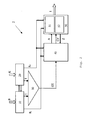
- FIG. 1 schematically illustrated device 1 for the detection of traffic-related information, in particular of traffic signs, has a so-called fusion module 2 with connections to a camera-designed visual sensor 3, a navigation system 4 and a vehicle information system 5. From the camera 3 image data B, from the navigation system map data K and from the vehicle information system 5, which may be integrated into a vehicle CAN bus, transmitted vehicle data F to the fusion module 2, which from these data, the desired traffic-related information I determined.
- the traffic-relevant information I determined by the fusion module 2, for example the currently valid maximum speed, are output by the fusion module 2 to a display instrument 6.
- the display instrument 6 may be an optical display which serves the driver information.
- the meter may be a control interface to a vehicle controller that, for example, automatically affects the speed of the vehicle when a vehicle speed above the current maximum speed is detected.
- the indicating instrument may be any device which further processes the traffic-relevant information I ascertained by the fusion module 2 according to the invention.
- an upstream processing 7 takes place in which the image raw data B 'originating directly from the camera 3 is examined by an image recognition algorithm for the preselection of possibly traffic-relevant information I, such as by methods of classical image processing with edge / circle detection and subsequent classification, and, for example, by deleting non-interest image areas are processed.
- the processed images are then fed as actual image data B to the fusion module 2.
- the image raw data B ' are examined in a parallel upstream processing 7 also for status information of the camera 3, which are fed to the fusion module 2 as additional camera status data S.
- the image data B and the camera status data S represent intermediate results of a first evaluation step, to which the camera raw data B 'of the camera 3 is subjected.
- This preliminary evaluation can be integrated into the camera 3 as well as executed within the scope of the application according to the invention as a first method step within the fusion module 2.
- the aim of the present invention is to provide in a moving vehicle a way of detecting traffic-related information that provides this information particularly reliable.
- different, available raw data are used, which are supplied in particular by a visual sensor or a camera 3 and a navigation system 4 as image data B and map data K.
- the information of a digital road map also has some disadvantages.
- the information contained in the digital road map as map data K may be out of date.
- temporary speed controls in, for example, construction sites and the speed information of variable message signs, which are increasingly used for intelligent traffic guidance are not available in the digital data.
- the digital road map provides information about the topology of the particular road section being traveled (eg area of an exit, area of a roundabout) and a turning event (leaving the Most Probable Path) and processes it in the fusion module.
- the advantages of the two individual systems are to be combined, so that reliable information I about the currently permissible maximum speed or other traffic-relevant information can be provided.
- the system according to the invention should be easy to integrate into a vehicle and also later expandable.
- a speedy image editing must be done, which allows capturing and evaluating the traffic-related information I in real time.
- the fusion module 2 receives the map data K, which is still available as raw data, and the image data B, which has already been subjected to the upstream processing 7, in each case via an external interface.
- the signals B are transmitted only via an internal interface.
- the camera status information or data S and the vehicle data F are further fed, wherein the aforementioned external interfaces can be completely or partially formed by a single vehicle data bus, such as a CAN bus.
- the information and data supplied in Fig. 2 are unspecified, stand all the units shown available.
- the image data B are fed to a first scene interpretation 10 and the map data K to a second scene interpretation 20, which select the decisive image and / or map data based on predetermined criteria and compress it to relevant image data B r or map data K r .
- the compressed data B r and K r as well as the possibly provided camera status information S and vehicle data F are preferably displayed within the fusion module 2 as data vectors.
- the transmission takes place via internal interfaces, which enable a particularly efficient data transmission.
- the external interfaces can serve a direct connection to on-board sensors, for example the camera 3.
- the map data K of the digital road map and / or vehicle data F can be transmitted via a CAN bus.
- the output of the recognized, traffic-relevant information I to the display instrument 6 can also take place via a CAN bus.
- the relevant image data B r and the relevant map data K r are supplied from a scene interpretation means 10, 20 to a rule 40 and a state machine 50.
- the set of rules evaluates the image data B r and the map data K r and, in response to this evaluation, passes an action A to be executed to the state machine 50.
- states Z which represent a state of the moving motor vehicle and / or the immediate vehicle environment, are predefined in the state machine 50. These states are preferably defined by quantities that can be measured substantially objectively and thus differ from the statements of the set of rules 40 which, based on the measured data, carries out an interpretation of these measured data in the sense of actions to be carried out.
- the state machine 50 describes the possible states of the vehicle and its surroundings finally.
- the different, predefined states z must therefore represent the entire reality.
- the state machine 50 returns the current state Z, which was determined on the basis of the relevant image data B r and the relevant map data K r, to the rules 40.
- the actions A to be performed specified by the rules 40 are within the state machine 50 by transitions implemented between an initial state and a target state, wherein depending on the nature of the transition, the output and the target state may be the same or different.
- the desired relevant information I is output to the display instrument 6.
- the information can be output permanently as status information. Alternatively, an information of the driver can be done only when changing the speed limit or a warning of the driver when the current maximum speed is exceeded.
- a truncated trigger trigger control 30 is provided by the scene interpretations 10, 20 of the image data B or map data K always receives a trigger signal T when a scene interpretation 10, 20 in the supplied data B, K has detected relevant information I and has compressed it into relevant image data B r or relevant map data K r . Based on this trigger signal T, the trigger 30 generates a total trigger signal GT, which is fed to the rules 40 and the state machine 50 and initiates their arithmetic operations.
- the image data B which is preferably already preprocessed in the upstream preparation 7, is supplied to a scene interpretation 10 for the image data B, the aim of which is to obtain usable input data for the set of rules B described in more detail later and to compress the abundance of the individual image data to the relevant information.
- the image data B which is still present as pixel data, in the input of the scene interpretation 10 are converted into logical data information (relevant image data B r ) by translating the information recognized in a camera image into relevant traffic information defined in the scene processing 10,
- the image processing takes place in the upstream processing 7.
- the image data B are classified traffic signs with additional information such as filing, size, confidence level in the estimation and quality of image processing.
- the scene interpretation 10 is aimed at recognizing certain traffic signs in order to determine the currently valid maximum speed.
- scene interpretation 10 may be designed to select data at the current maximum speed.
- the interpretation in the closed scene means concretely that, according to predetermined criteria, the speed limit signs or cancellation signs relevant for the own vehicle are selected and irrelevant signs are sorted out.
- irrelevant characters can be sorted out using the characters on the side so that the relevant traffic information I can be condensed to the speed limit applicable to one's own lane. If there is information from the digital road map that the vehicle is in the region of a deceleration strip, corresponding characters arranged only on the side of the strip can be assigned to this strip.
- the determined logical data are provided as relevant image data B r via an internal interface to the rule 40 and the state machine 50 available.
- the goal of scene interpretation 20 is to compress the map data K provided by the digital road map to relevant map data K r .
- This is basically comparable with the scene compression 10 described above for the camera-based traffic sign recognition.
- current map information is combined with map information of a preview in order to compact the relevant traffic information which is made available to the rule 40 and the state machine 50 via a further internal interface after completion of the scene interpretation.
- the provided relevant data B r and K r are preferably transmitted in vector form, in which each vector entry is associated with previously defined information.
- the scene interpretations 10, 20 each generate a trigger signal T as soon as a scene interpretation 10, 20 detects a relevant change in the scene with respect to the information to be examined compared to a previous time step.
- the trigger signals T are supplied to a trigger 30, also referred to as trigger control, which generates an overall trigger signal GT based on these trigger signals T, which is supplied to the rules 40 and preferably also to the state machine 50.
- a trigger 30 also referred to as trigger control
- the rules 40 and the state machine 50 Upon receipt of the total trigger signal GT, the rules 40 and the state machine 50 begin interpreting and evaluating the provided relevant data B r and K r , the rules 40 interpreting this data according to predetermined rule information stored in a matrix and the state machine 50 from this data evaluates a current state of the vehicle and / or its environment.
- the fusion module 2 which is preferably constructed as an arithmetic unit, since the rules 40 and the state machine 50 only require computing time if there is a change in the traffic-relevant information I.
- the scene interpretations 10, 20 have an increased computing power available in order to compress the relevant data from the input data as quickly as possible.
- the trigger 30 can be realized by an OR combination of the two individual trigger signals T.
- the total trigger signal GT is determined as follows. If the trigger signal T is a scene interpretation 10 or 20, then a counter is activated, which is designed for example as a distance counter and as a time counter and continues counting on the basis of the current vehicle speed for a certain distance. This counter thus integrates the current vehicle speed. If the second trigger signal T of the other scene interpretation 20 or 10 is present before the expiration of a predefined maximum distance, the total trigger signal GT is activated immediately. If, until the expiration of the maximum distance of the distance counter, activation of the second trigger signal T does not occur, then the total trigger signal GT is set when the counter or the maximum distance expires. This indicates that only one of the two scene interpretations 10, 20 could identify traffic-relevant information.
- temporal asynchronisms can thus be intercepted, which often arise because the traffic sign and its location in the digital map information often do not coincide identically.
- a set of rules 40 is evaluated based on the relevant data B r and K r of the scene interpretations 10, 20, which evaluates the information contained in the relevant data B r and K r according to the prevailing traffic rules.
- These actions A to be executed are converted in the state machine 50 into transitions which are used in the state machine 50 to change from a first to a second state, which may also be identical to the first state.
- the rules 40 may be country-specific, in order to take into account the different traffic rules in different states.
- the proposed structure of the policy 40 also makes it possible to flexibly implement changes in the traffic rules (for example, due to legislative changes).
- the state machine 50 provides a main state machine 51, which determines the output behavior of the fusion module 2 and essentially specifies the information I to be output.
- the main state machine 51 may substantially map the states associated with the traveling vehicle in terms of the currently allowed maximum speed.
- the mapping of particular environmental conditions is possible through one or more environmental state machines 52.
- the results of the recognition of traffic-relevant information I overall can be improved and the calculation of the required information can be accelerated.
- the output of the traffic-relevant information I is coupled to the transition or the reaching of a new state can. In both cases, therefore, an information I assigned to the state is output.
- the vehicle data F which in particular also include the current speed of the vehicle via telematics systems or information received from other vehicles or barks in the surroundings of the vehicle via an interface camera system navigation system, are included as additional information in the evaluation carried out in the fusion module 2 and can preferably also in vector form. Limiting types are thereby made adaptable and can be designed as limiting, unlimited or changeable.
- the fusion module 2 or the method running therein makes it possible for the driver to obtain information about traffic-relevant information and in particular the currently permissible maximum speed even in adverse environmental conditions, even if there are only temporary speed restrictions or information presented by variable message signs.
Landscapes
- Engineering & Computer Science (AREA)
- Physics & Mathematics (AREA)
- General Physics & Mathematics (AREA)
- Radar, Positioning & Navigation (AREA)
- Remote Sensing (AREA)
- Multimedia (AREA)
- Theoretical Computer Science (AREA)
- Automation & Control Theory (AREA)
- Traffic Control Systems (AREA)
- Navigation (AREA)
Claims (14)
- Procédé de détection d'informations importantes pour le trafic (I) dans un véhicule en mouvement, dans lequel des données images (B) d'un capteur (3) optique et des données cartographiques (K) d'un système de navigation (4) sont respectivement pré-analysées pour la détection et dans lequel les résultats de la pré-analyse sont rassemblés et interprétés,- les données images (B) étant, dans une première interprétation de scène (10), examinées à la recherche d'informations importantes pour le trafic (I) contenues et compressées en données images (Br) importantes, et- les données cartographiques (K) étant, dans une deuxième interprétation de scène (20), examinées à la recherche d'informations importantes pour le trafic (I) contenues, et compressées en données cartographiques importantes (Kr), caractérisé en ce que- les données images importantes (Br) et les données cartographiques importantes (Kr) sont conduites à un régulateur (40) et à un automate à états (50) pour l'interprétation des données images et cartographiques, le régulateur (40) permettant une résolution de situations contradictoires dans les données images importantes (Br) et les données cartographiques importantes (Kr) en fonction des règles de circulation en vigueur, et transmettant une action à exécuter (A) à l'automate à états (50), et l'automate à états (50) exécutant, sur la base de l'action à exécuter (A) qui lui est prédéterminée par le régulateur (40), une transition dans son espace d'état avec des états prédéfinis qui caractérisent des caractéristiques du véhicule en mouvement et éventuellement de l'environnement, en principe indépendamment des règles de circulation en vigueur, dans lequel, en partant d'un état initial prédéfini, il y a changement vers un état final nouveau ou éventuellement de nouveau vers le même état prédéfini, et délivrant une information importante pour le trafic (I) affectée à la transition ou à l'état (Z) atteint par la transition, et- l'automate à états (50) retournant au régulateur (40) son état actuel pour permettre au régulateur (40), lors de l'interprétation des données images et données cartographiques importantes (Br, Kr), de prendre également en compte l'état (Z) du véhicule et/ou de l'environnement.
- Procédé selon la revendication 1,
caractérisé en ce que,
dans le régulateur (40), l'interprétation du contenu des données images et données cartographiques importantes (Br, Kr) s'effectue à l'aide de groupes régulateurs spécifiques, et en ce que l'action (A) prédéterminée par le régulateur (40) paramètre un comportement à respecter sur la base d'une règle détectée. - Procédé selon une des revendications précédentes,
caractérisé en ce que
l'automate à états (50) délivre à un instrument d'affichage du véhicule l'information (I) affectée à la transition ou à l'état (Z) atteint par la transition. - Procédé selon une des revendications précédentes,
caractérisé en ce que
l'automate à états (50) est divisé en une machine d'état principal (51) qui traite des informations caractérisant l'état du véhicule, et une ou plusieurs machines d'état de l'environnement (52) qui reproduisent des conditions variables de l'environnement. - Procédé selon une des revendications précédentes,
caractérisé en ce que
la première et la deuxième interprétation de scène (10, 20), lors de la compression en données images et données cartographiques importantes (Br, Kr), envoient un signal de déclenchement (T) à une commande de déclenchement (30) qui produit un signal de déclenchement global (GT) pour le régulateur (40) et pour l'automate à états (50), le signal de déclenchement global (GT) ayant pour effet que le régulateur (40) et l'automate à états (50) traitent les données images et données cartographiques importantes (Br, Kr) présentes au niveau de leurs entrées internes. - Procédé selon la revendication 5,
caractérisé en ce que la commande de déclenchement (30) forme une fonction logique OU des deux signaux de déclenchement (T) de la première et de la deuxième interprétation de scène (10, 20) pour la production du signal de déclenchement global (GT). - Procédé selon la revendication 6,
caractérisé en ce que la fonction logique OU est une fonction logique OU retardée. - Procédé selon la revendication 7,
caractérisé en ce que, en présence d'un premier signal de déclenchement (T) de la première ou de la deuxième interprétation de scène (10, 20), la commande de déclenchement (30) active un compteur et produit le signal de déclenchement global (GT) soit lorsqu'une valeur de comptage maximale est atteinte, soit en présence du deuxième signal de déclenchement (T). - Procédé selon une des revendications précédentes,
caractérisé en ce que,
dans la première et/ou la deuxième interprétation de scène (10, 20), des données images et données cartographiques importantes (Br, Kr) sont sélectionnées à l'aide de critères prédéterminés, par le fait que, à différents moments, des données image et/ou cartographiques (B, K) détectées sont placées dans un contexte temporel et/ou par le fait qu'une sélection locale de données images importantes (Br) est effectuée. - Procédé selon une des revendications précédentes,
caractérisé en ce que
la première et la deuxième interprétation de scène (10, 20) échangent des informations. - Procédé selon une des revendications précédentes,
caractérisé en ce que
des données de véhicule (F) et/ou des données de statut de caméra (S) sont disponibles lors de la détection d'informations importantes pour le trafic (I). - Dispositif pour la détection d'informations importantes pour le trafic (I) dans un véhicule en mouvement avec une connexion à un système d'un capteur (3) optique pour l'obtention de données images (B, B'), une connexion à un système de navigation (4) pour l'obtention de données cartographiques (K), et une connexion à un instrument d'affichage (6) pour la représentation ou respectivement le traitement des résultats de la détection, dispositif qui est aménagé en particulier pour la réalisation du procédé selon une des revendications 1 à 11,
caractérisé en ce que- des moyens pour l'interprétation de scène (10, 20) sont prévus pour la compression des données images (B) obtenues du capteur (3) optique et des données cartographiques (K) du système de navigation (4) en données images et données cartographiques importantes (Br, Kr), et pour la transmission des données images et données cartographiques importantes (Br, Kr) à une unité de calcul avec un régulateur (40) et un automate à états (50),- en ce que le régulateur (40) est aménagé pour permettre une résolution de situations contradictoires dans les données images et données cartographiques importantes (Br, Kr) en fonction des règles de circulation en vigueur, et pour transmettre à l'automate à états (50) une action à exécuter (A), et- en ce que l'automate à états (50) est aménagé pour, sur la base de l'action à exécuter (A) qui lui est prédéterminée par le régulateur (40), effectuer une transition dans son espace d'état avec des états (Z) prédéfinis qui caractérisent des caractéristiques du véhicule en mouvement et éventuellement de l'environnement, en principe indépendamment des règles de circulation en vigueur, dans lequel, en partant d'un état initial prédéfini, il y a changement vers un état final nouveau ou éventuellement de nouveau vers le même état final prédéfini, et pour délivrer, via la connexion à l'instrument d'affichage (6), des informations importantes pour le trafic (I) affectées à la transition ou à l'état Z atteint par la transition, l'automate à états (50) retournant son état (Z) actuel au régulateur (40) pour permettre au régulateur (40), lors de l'interprétation des données images et données cartographiques importantes (Br, Kr), de prendre également en compte l'état (Z) du véhicule et/ou de l'environnement. - Dispositif selon la revendication 12,
caractérisé en ce
qu'une commande de déclenchement (30) pour la production d'un signal de déclenchement global (GT) est montée en aval des moyens pour la première et la deuxième interprétation de scène (10, 20), le signal de déclenchement global (GT) ayant pour effet que le régulateur (40) et l'automate à états (50) traitent les données images et données cartographiques compressées ou respectivement importantes (Br, Kr) présentes au niveau de leurs entrées internes. - Dispositif selon la revendication 12 ou 13,
caractérisé en ce que
les moyens pour la première et la deuxième interprétation de scène (10, 20), la commande de déclenchement (30) et l'unité de calcul, forment, avec le régulateur (40) et l'automate à états (50), un module de fusion (2) commun dans lequel les liaisons entre les différentes unités (10, 20, 30, 40, 50) sont réalisées par des interfaces internes.
Applications Claiming Priority (2)
| Application Number | Priority Date | Filing Date | Title |
|---|---|---|---|
| DE102007024695 | 2007-05-25 | ||
| PCT/EP2008/056031 WO2008145543A1 (fr) | 2007-05-25 | 2008-05-16 | Procédé et dispositif d'identification d'informations importantes pour le trafic |
Publications (2)
| Publication Number | Publication Date |
|---|---|
| EP2149131A1 EP2149131A1 (fr) | 2010-02-03 |
| EP2149131B1 true EP2149131B1 (fr) | 2013-04-03 |
Family
ID=39679317
Family Applications (2)
| Application Number | Title | Priority Date | Filing Date |
|---|---|---|---|
| EP08759674A Active EP2149131B1 (fr) | 2007-05-25 | 2008-05-16 | Procédé et dispositif d'identification d'informations importantes pour le trafic |
| EP08759680.5A Active EP2149132B1 (fr) | 2007-05-25 | 2008-05-16 | Procédé et dispositif d'identification d'informations importantes pour le trafic |
Family Applications After (1)
| Application Number | Title | Priority Date | Filing Date |
|---|---|---|---|
| EP08759680.5A Active EP2149132B1 (fr) | 2007-05-25 | 2008-05-16 | Procédé et dispositif d'identification d'informations importantes pour le trafic |
Country Status (5)
| Country | Link |
|---|---|
| US (2) | US8346706B2 (fr) |
| EP (2) | EP2149131B1 (fr) |
| JP (2) | JP2010535367A (fr) |
| DE (2) | DE102008023972A1 (fr) |
| WO (2) | WO2008145543A1 (fr) |
Families Citing this family (72)
| Publication number | Priority date | Publication date | Assignee | Title |
|---|---|---|---|---|
| US7382276B2 (en) * | 2006-02-21 | 2008-06-03 | International Business Machine Corporation | System and method for electronic road signs with in-car display capabilities |
| DE102008036559A1 (de) * | 2008-08-06 | 2010-02-11 | Adc Automotive Distance Control Systems Gmbh | Fahrerassistenzsystem mit reduzierten Daten aus einer digitalen Straßenkarte |
| EP2307252B1 (fr) * | 2008-08-06 | 2016-08-10 | ADC Automotive Distance Control Systems GmbH | Système d assistance au conducteur à données réduites provenant d' une carte routière numérique |
| JP5272605B2 (ja) * | 2008-09-18 | 2013-08-28 | 日産自動車株式会社 | 運転操作支援装置、及び運転操作支援方法 |
| US20110196714A1 (en) * | 2010-02-09 | 2011-08-11 | Avaya, Inc. | Method and apparatus for overriding apparent geo-pod attributes |
| WO2010043255A1 (fr) * | 2008-10-15 | 2010-04-22 | Zuerrer Alper | Dispositif mobile de communication de données de représentation orientée utilisateur, et procédé correspondant |
| US10319376B2 (en) | 2009-09-17 | 2019-06-11 | Avaya Inc. | Geo-spatial event processing |
| DE102009043764A1 (de) * | 2009-09-30 | 2011-04-07 | GM Global Technology Operations, Inc., Detroit | Navigationsvorrichtung und Navigationsverfahren für ein Fahrzeug |
| DE102009048066A1 (de) | 2009-10-01 | 2011-04-07 | Conti Temic Microelectronic Gmbh | Verfahren zur Verkehrszeichenerkennung |
| DE102009051783A1 (de) * | 2009-11-03 | 2011-05-05 | Thorsten Hohenadel | Vorrichtung und Verfahren zur Geschwindigkeitsbegrenzung eines Fahrzeugs |
| DE102010042900A1 (de) | 2010-10-26 | 2012-04-26 | Robert Bosch Gmbh | Verfahren und Vorrichtung zum Bestimmen einer Querreglerparametrierung für eine Querregelung eines Fahrzeugs |
| DE102010062633A1 (de) * | 2010-12-08 | 2012-06-14 | Robert Bosch Gmbh | Verfahren und Vorrichtung zur Erkennung von Verkehrszeichen in der Umgebung eines Fahrzeuges und Abgleich mit Verkehrszeicheninformationen aus einer digitalen Karte |
| KR20120068292A (ko) * | 2010-12-17 | 2012-06-27 | 한국전자통신연구원 | 차량 충돌 방지 장치 및 방법 |
| JP5423696B2 (ja) | 2011-02-09 | 2014-02-19 | 株式会社デンソー | 標識認識装置 |
| DE102011001248A1 (de) | 2011-03-14 | 2012-09-20 | Dr. Ing. H.C. F. Porsche Aktiengesellschaft | Verfahren zur Unterstützung eines Fahrers |
| US8498778B2 (en) | 2011-04-21 | 2013-07-30 | Continental Automotive Systems, Inc | Navigation system controlled turn signals |
| US8904517B2 (en) | 2011-06-28 | 2014-12-02 | International Business Machines Corporation | System and method for contexually interpreting image sequences |
| DE102011109387A1 (de) | 2011-08-04 | 2013-02-07 | Conti Temic Microelectronic Gmbh | Verfahren zur Erkennung von Verkehrszeichen |
| DE102012219106A1 (de) | 2011-11-21 | 2013-05-23 | Continental Teves Ag & Co. Ohg | SIGNALGEBER, SYSTEM UND VERFAHREN ZUR HERVORHEBUNG VON OBJEKTEN IM STRAßENVERKEHR SOWIE VERWENDUNG DES SYSTEMS UND VERWENDUNG DES SIGNALGEBERS |
| DE102011121442A1 (de) * | 2011-12-16 | 2013-06-20 | Gm Global Technology Operations, Llc | Autonomes Anfahren |
| US9043133B2 (en) * | 2011-12-29 | 2015-05-26 | Intel Corporation | Navigation systems and associated methods |
| DE102012201156B4 (de) | 2012-01-26 | 2023-02-23 | Robert Bosch Gmbh | Verfahren, Datenverarbeitungsvorrichtung und Computerprogramm zum Bereitstellen von einer Geschwindigkeitswarnungsinformation für ein Navigationsgerät |
| WO2013113421A1 (fr) | 2012-02-03 | 2013-08-08 | Continental Teves Ag & Co. Ohg | Transmetteur de signal, système et procédé de mise en évidence d'objets dans le trafic routier, utilisation du système et utilisation du transmetteur de signal |
| DE102012004625A1 (de) | 2012-03-06 | 2013-09-12 | Volkswagen Aktiengesellschaft | Verfahren und Vorrichtung zur Aktualisierung und Anpassung von Karteninformationen in einem Navigationssystem |
| US9195914B2 (en) | 2012-09-05 | 2015-11-24 | Google Inc. | Construction zone sign detection |
| US9056395B1 (en) | 2012-09-05 | 2015-06-16 | Google Inc. | Construction zone sign detection using light detection and ranging |
| US8996228B1 (en) | 2012-09-05 | 2015-03-31 | Google Inc. | Construction zone object detection using light detection and ranging |
| CN102889892B (zh) * | 2012-09-13 | 2015-11-25 | 东莞宇龙通信科技有限公司 | 实景导航的方法及导航终端 |
| US9383753B1 (en) | 2012-09-26 | 2016-07-05 | Google Inc. | Wide-view LIDAR with areas of special attention |
| US9234618B1 (en) | 2012-09-27 | 2016-01-12 | Google Inc. | Characterizing optically reflective features via hyper-spectral sensor |
| US9097800B1 (en) | 2012-10-11 | 2015-08-04 | Google Inc. | Solid object detection system using laser and radar sensor fusion |
| DE102012220357A1 (de) * | 2012-11-08 | 2014-06-12 | Bayerische Motoren Werke Aktiengesellschaft | Verfahren zur Ausgabe mindestens einer Geschwindigkeitsinformation in einem Fahrzeug, Informationssystem und Ausgabevorrichtung |
| US20140327772A1 (en) * | 2013-05-03 | 2014-11-06 | Magna Electrics Inc. | Vehicle vision system with traffic sign comprehension |
| US9719801B1 (en) | 2013-07-23 | 2017-08-01 | Waymo Llc | Methods and systems for calibrating sensors using road map data |
| DE102013013065A1 (de) * | 2013-08-06 | 2015-02-12 | Daimler Ag | Verfahren zum Bestimmen eines Geschwindigkeitsvektors für ein Gestenerkennungssystem in einem Kraftwagen und Vorrichtung zum Durchführen des Verfahrens |
| DE102013219909A1 (de) | 2013-10-01 | 2015-04-02 | Conti Temic Microelectronic Gmbh | Verfahren und Vorrichtung zur Erkennung von Verkehrszeichen |
| DE102013220005A1 (de) * | 2013-10-02 | 2015-04-02 | Continental Automotive Gmbh | Verfahren und Vorrichtung zur Anzeige der Umgebung eines Fahrzeugs und Fahrerassistenzsystem |
| WO2015077766A1 (fr) * | 2013-11-25 | 2015-05-28 | Pcms Holdings, Inc. | Systèmes et procédés de fourniture d'informations d'augmentation de la réalité associées à un élément de signalisation |
| US9335178B2 (en) * | 2014-01-28 | 2016-05-10 | GM Global Technology Operations LLC | Method for using street level images to enhance automated driving mode for vehicle |
| US9304515B2 (en) * | 2014-04-24 | 2016-04-05 | Lenovo Enterprise Solutions (Singapore) Pte. Ltd. | Regional operation modes for autonomous vehicles |
| JP6321532B2 (ja) * | 2014-11-28 | 2018-05-09 | 株式会社デンソー | 車両の走行制御装置 |
| JP6062473B2 (ja) | 2015-03-17 | 2017-01-18 | 本田技研工業株式会社 | 道路標識判断装置及び道路標識判断方法 |
| JP6154839B2 (ja) | 2015-03-18 | 2017-06-28 | 本田技研工業株式会社 | 道路標識判断装置及び道路標識判断方法 |
| US10453337B2 (en) * | 2015-06-25 | 2019-10-22 | Here Global B.V. | Method and apparatus for providing safety levels estimate for a travel link based on signage information |
| US9463794B1 (en) | 2015-09-04 | 2016-10-11 | Google Inc. | Stop sign detection and response |
| JP6274177B2 (ja) | 2015-10-19 | 2018-02-07 | トヨタ自動車株式会社 | 車両制御システム |
| DE102015226840A1 (de) * | 2015-11-03 | 2017-05-04 | Robert Bosch Gmbh | Verfahren zum Betreiben einer Längsregelungsvorrichtung eines Kraftfahrzeugs in einem Kreisverkehr |
| GB2561746B (en) | 2015-11-13 | 2022-02-09 | Flir Systems | Video sensor fusion and model based virtual and augmented reality systems and methods |
| US11328155B2 (en) | 2015-11-13 | 2022-05-10 | FLIR Belgium BVBA | Augmented reality labels systems and methods |
| KR102489401B1 (ko) * | 2015-11-19 | 2023-01-18 | 주식회사 에이치엘클레무브 | 교통표지판 인식장치 및 그의 제한속도 제공방법 |
| US10061322B1 (en) * | 2017-04-06 | 2018-08-28 | GM Global Technology Operations LLC | Systems and methods for determining the lighting state of a vehicle |
| DE102017207790B4 (de) * | 2017-05-09 | 2018-12-27 | Continental Teves Ag & Co. Ohg | Verfahren zum Fusionieren von Daten auf hoher Fusionsebene für ein Strassenmodell zum beispielhaften Anwenden bei mehrspurigen Geschwindigkeitsbegrenzungs-Inferenzen, und eine Vorrichtung zur Durchführung des Verfahrens |
| US11874126B1 (en) | 2017-09-15 | 2024-01-16 | Apple Inc. | Map with location-based observations, actions, and rules |
| KR102421855B1 (ko) * | 2017-09-28 | 2022-07-18 | 삼성전자주식회사 | 주행 차로를 식별하는 방법 및 장치 |
| US20200234587A1 (en) * | 2017-09-29 | 2020-07-23 | Toyota Motor Europe | Systems and methods for driver assistance |
| DE102018133178A1 (de) | 2018-12-20 | 2020-06-25 | Jenoptik Robot Gmbh | Verfahren und Steuergerät zum Einrichten einer Verkehrsüberwachung für einen Überwachungsort und System zum Durchführen einer Verkehrsüberwachung für einen Überwachungsort |
| US11250697B2 (en) * | 2018-12-26 | 2022-02-15 | Uatc, Llc | Missing traffic face detector |
| US11127292B2 (en) * | 2019-01-18 | 2021-09-21 | GM Global Technology Operations LLC | Methods and apparatus for detetermining lane-level static and dynamic information |
| CN113710558B (zh) * | 2019-04-23 | 2024-11-19 | 日立安斯泰莫株式会社 | 车辆控制装置以及计算机程序 |
| CN110717999B (zh) * | 2019-10-08 | 2023-08-29 | 北京百度网讯科技有限公司 | 通信方法、装置、电子设备及存储介质 |
| US11183055B2 (en) | 2020-03-12 | 2021-11-23 | Here Global B.V. | Methods and systems for classifying a speed sign |
| DE102020117086A1 (de) | 2020-06-29 | 2021-12-30 | Bayerische Motoren Werke Aktiengesellschaft | Verfahren und System zum Validieren von Kartendaten für ein Fahrzeug |
| WO2022261175A1 (fr) * | 2021-06-09 | 2022-12-15 | NetraDyne, Inc. | Systèmes et procédés de détection d'événements de croisement d'intersection à l'aide de techniques de classification d'images complètes |
| CN115757366B (zh) * | 2022-01-19 | 2026-02-13 | 德普深(厦门)数据科技有限公司 | 一种基于面向多源信息融合的数据预处理方法 |
| DE102022104930A1 (de) | 2022-03-02 | 2023-09-07 | Bayerische Motoren Werke Aktiengesellschaft | Verfahren und vorrichtung zur geschwindigkeitssteuerung eines automatisierten kraftfahrzeugs |
| JP7582247B2 (ja) * | 2022-05-02 | 2024-11-13 | トヨタ自動車株式会社 | 情報処理装置、運転診断方法及びプログラム |
| JP7578117B2 (ja) | 2022-05-02 | 2024-11-06 | トヨタ自動車株式会社 | 情報処理装置、運転診断方法及びプログラム |
| EP4332824A1 (fr) | 2022-09-02 | 2024-03-06 | Continental Automotive Technologies GmbH | Système et procédé de traduction de règles de trafic en langage naturel en logique formelle pour véhicules en mouvement autonomes |
| DE102023115404A1 (de) * | 2023-06-13 | 2024-12-19 | Dr. Ing. H.C. F. Porsche Aktiengesellschaft | Verfahren und System zur Verbesserung der Erkennung von Verkehrszeichen mit Zusatzzeichen für ein Fahrerassistenzsystem |
| DE102023002715B3 (de) * | 2023-07-03 | 2024-05-29 | Mercedes-Benz Group AG | Verfahren zur Ortung eines gestohlenen Fahrzeugs |
| US12674677B2 (en) | 2023-07-31 | 2026-07-07 | Ford Global Technologies, Llc | Enhanced navigation prompt systems and methods |
| DE102024211806A1 (de) | 2024-12-11 | 2026-06-11 | Cariad Se | Verfahren zum Generieren von Code |
Family Cites Families (28)
| Publication number | Priority date | Publication date | Assignee | Title |
|---|---|---|---|---|
| US5390287A (en) * | 1989-04-26 | 1995-02-14 | Obata; Takashi | Deduction inference system for solving complex propositional logic problems in response to signals from a plurality of system sensors |
| JPH08247775A (ja) * | 1995-03-15 | 1996-09-27 | Toshiba Corp | 移動体の自己位置同定装置および自己位置同定方法 |
| US5671140A (en) * | 1995-07-06 | 1997-09-23 | The United States Of America As Represented By The Secretary Of The Navy | Fuzzy controller for target intercept guidance |
| DE19842176A1 (de) * | 1998-09-15 | 2000-03-16 | Bosch Gmbh Robert | Verfahren und Vorrichtung zur Verkehrszeichenerkennung und Navigation |
| DE19852631C2 (de) | 1998-11-14 | 2001-09-06 | Daimler Chrysler Ag | Vorrichtung und Verfahren zur Verkehrszeichenerkennung |
| DE19938261B4 (de) | 1999-08-12 | 2013-07-11 | Volkswagen Ag | Verfahren und Einrichtung zur navigierten Befahrbarkeit von elektronisch gespeicherten Straßennetzen |
| DE19938267B4 (de) | 1999-08-12 | 2007-01-25 | Volkswagen Ag | Verfahren und Einrichtung zur elektronischen Erkennung von Verkehrszeichen in Kraftfahrzeugen |
| DE19938266A1 (de) | 1999-08-12 | 2001-02-15 | Volkswagen Ag | Verfahren und Einrichtung zur elektronischen bzw. elektronisch visuellen Erkennung von Verkehrszeichen |
| DE10007813A1 (de) | 2000-02-21 | 2001-09-06 | Becker Gmbh | Navigationssystem für ein Kraftfahrzeug und Verfahren zum Betreiben eines Navigationssystems |
| DE60236351D1 (de) * | 2001-03-08 | 2010-06-24 | California Inst Of Techn | Raumzeitliche echtzeit-kohärenzschätzung zur autonom-modusidentifikation und invarianzverfolgung |
| JP2003323699A (ja) * | 2002-05-08 | 2003-11-14 | Matsushita Electric Ind Co Ltd | 安全運転支援装置 |
| DE10254806B4 (de) | 2002-11-22 | 2008-07-24 | Robert Bosch Gmbh | Verfahren zur Informationsverarbeitung |
| KR20040091788A (ko) | 2003-04-22 | 2004-11-02 | 현대자동차주식회사 | 고속도로 자율주행 시스템 및 그의 제어방법 |
| DE10334620B4 (de) | 2003-07-30 | 2023-07-06 | Robert Bosch Gmbh | Generierung von Verkehrshinweisen durch die Interpretation von Verkehrszeichenszenarien und Navigationsinformation in einem Fahrzeug |
| JP4277717B2 (ja) * | 2004-03-17 | 2009-06-10 | 株式会社日立製作所 | 車両位置推定装置およびこれを用いた運転支援装置 |
| US7233683B2 (en) * | 2005-01-04 | 2007-06-19 | Deere & Company | Method and system for guiding a vehicle with vision-based adjustment |
| JP2006275690A (ja) * | 2005-03-29 | 2006-10-12 | Fujitsu Ten Ltd | 運転支援装置 |
| US7460951B2 (en) * | 2005-09-26 | 2008-12-02 | Gm Global Technology Operations, Inc. | System and method of target tracking using sensor fusion |
| US7680749B1 (en) * | 2006-11-02 | 2010-03-16 | Google Inc. | Generating attribute models for use in adaptive navigation systems |
| US8155826B2 (en) * | 2007-03-30 | 2012-04-10 | Aisin Aw Co., Ltd. | Vehicle behavior learning apparatuses, methods, and programs |
| JP4446201B2 (ja) * | 2007-03-30 | 2010-04-07 | アイシン・エィ・ダブリュ株式会社 | 画像認識装置及び画像認識方法 |
| JP4437556B2 (ja) * | 2007-03-30 | 2010-03-24 | アイシン・エィ・ダブリュ株式会社 | 地物情報収集装置及び地物情報収集方法 |
| US8917904B2 (en) * | 2008-04-24 | 2014-12-23 | GM Global Technology Operations LLC | Vehicle clear path detection |
| US8935055B2 (en) * | 2009-01-23 | 2015-01-13 | Robert Bosch Gmbh | Method and apparatus for vehicle with adaptive lighting system |
| US8775063B2 (en) * | 2009-01-26 | 2014-07-08 | GM Global Technology Operations LLC | System and method of lane path estimation using sensor fusion |
| US8180107B2 (en) * | 2009-02-13 | 2012-05-15 | Sri International | Active coordinated tracking for multi-camera systems |
| US8384532B2 (en) * | 2009-04-02 | 2013-02-26 | GM Global Technology Operations LLC | Lane of travel on windshield head-up display |
| US8977489B2 (en) * | 2009-05-18 | 2015-03-10 | GM Global Technology Operations LLC | Turn by turn graphical navigation on full windshield head-up display |
-
2008
- 2008-05-16 JP JP2010511565A patent/JP2010535367A/ja active Pending
- 2008-05-16 EP EP08759674A patent/EP2149131B1/fr active Active
- 2008-05-16 JP JP2010511564A patent/JP5611819B2/ja not_active Expired - Fee Related
- 2008-05-16 EP EP08759680.5A patent/EP2149132B1/fr active Active
- 2008-05-16 US US12/601,062 patent/US8346706B2/en active Active
- 2008-05-16 US US12/601,416 patent/US8452524B2/en active Active
- 2008-05-16 WO PCT/EP2008/056031 patent/WO2008145543A1/fr not_active Ceased
- 2008-05-16 DE DE102008023972A patent/DE102008023972A1/de not_active Withdrawn
- 2008-05-16 WO PCT/EP2008/056041 patent/WO2008145545A1/fr not_active Ceased
- 2008-05-16 DE DE102008023970A patent/DE102008023970A1/de not_active Withdrawn
Also Published As
| Publication number | Publication date |
|---|---|
| DE102008023970A1 (de) | 2008-11-27 |
| DE102008023972A1 (de) | 2008-11-27 |
| EP2149132A1 (fr) | 2010-02-03 |
| JP2010528398A (ja) | 2010-08-19 |
| EP2149132B1 (fr) | 2013-05-01 |
| US20100241605A1 (en) | 2010-09-23 |
| US8346706B2 (en) | 2013-01-01 |
| US20100198488A1 (en) | 2010-08-05 |
| US8452524B2 (en) | 2013-05-28 |
| JP5611819B2 (ja) | 2014-10-22 |
| EP2149131A1 (fr) | 2010-02-03 |
| WO2008145543A1 (fr) | 2008-12-04 |
| WO2008145545A1 (fr) | 2008-12-04 |
| JP2010535367A (ja) | 2010-11-18 |
Similar Documents
| Publication | Publication Date | Title |
|---|---|---|
| EP2149132B1 (fr) | Procédé et dispositif d'identification d'informations importantes pour le trafic | |
| EP3663719B1 (fr) | Procédé de fourniture de données de carte dans un véhicule automobile, véhicule automobile et dispositif central de traitement des données | |
| DE102015224192B4 (de) | Erkennen einer Freifläche | |
| EP2740076A1 (fr) | Procédé de reconnaissance de panneaux de signalisation routière | |
| DE102019127229A1 (de) | System und verfahren zum bestimmen einer vertrautheit eines fahrzeugdatensatzes | |
| DE102019127190A1 (de) | System und verfahren zum beurteilen des bekanntseins eines gelernten fahrzeugdatensatzes eines fahrerassistenzsystems | |
| DE102017203838A1 (de) | Verfahren und System zur Umfelderfassung | |
| WO2017097555A1 (fr) | Procédé pour assiter le conducteur d'un véhicule automobile concernant une manœuvre de dépassement imminente et véhicule automobile | |
| DE102013212255A1 (de) | Verfahren zum Austausch von Informationen zwischen mindestens zwei Fahrzeugen | |
| EP2583263A1 (fr) | Procédé pour fusionner un système de reconnaissance d'un panneau de signalisation et un système de reconnaissance de voie d'un véhicule automobile | |
| DE102018203353A1 (de) | Steuereinheit und Verfahren zum Betreiben einer Fahrfunktion an einer Signalisierungsanlage | |
| WO2013091742A1 (fr) | Procédé pour générer et exploiter des informations pertinentes sur la circulation par des véhicules d'un pool de véhicules | |
| DE102018111935A1 (de) | Bildverarbeitungssystem, Bildverarbeitungsverfahren, Informationsverarbeitungsvorrichtung und Aufzeichnungsmedium | |
| DE102017209347A1 (de) | Verfahren und Vorrichtung zum Steuern eines Fahrzeugs | |
| DE102017209370B4 (de) | Verfahren zur Ermittlung einer Überholinformation | |
| DE102018211858B4 (de) | Verfahren zum Betreiben eines Fahrzeugverbundes | |
| DE102023129844A1 (de) | Autonomes fahrsystem zur erstellung einer geplanten route auf der grundlage von botschaften, die von strassenschildern angezeigt werden | |
| DE102023004803A1 (de) | System und Verfahren zur Durchführung des Spurwechsels und der Spurzusammenführung | |
| DE102010043673A1 (de) | Navigationssystem und Navigationsverfahren mit Verkehrsbeeinträchtigungs-Erkennungsfunktion | |
| DE102019001092A1 (de) | Verfahren zum Betreiben eines Fahrerassistenzsystems, sowie elektronische Recheneinrichtung, Computerprogrammprodukt und Datenträger | |
| DE102021200027B4 (de) | Verfahren zum Betreiben eines Assistenzsystems eines Kraftfahrzeugs, Computerprogrammprodukt sowie Assistenzsystem | |
| EP4297534A1 (fr) | Procédé et dispositif de commande destinés à l'adaptation automatique d'une fonction d'éclairage du dispositif d'éclairage d'un véhicule | |
| DE102018218137B4 (de) | System, Verfahren und Computerprogrammprodukt zur Erzeugung eines Kontext abhängigen Hinweises auf ein Einsatzfahrzeug für einen Fahrzeugführer eines Egofahrzeuges | |
| DE102016222215A1 (de) | Kraftfahrzeug mit einem Fahrerassistenzsystem, das eine Kamera aufweist | |
| WO2017036939A1 (fr) | Procédé et dispositif de documentation automatique d'infractions routières |
Legal Events
| Date | Code | Title | Description |
|---|---|---|---|
| PUAI | Public reference made under article 153(3) epc to a published international application that has entered the european phase |
Free format text: ORIGINAL CODE: 0009012 |
|
| 17P | Request for examination filed |
Effective date: 20091105 |
|
| AK | Designated contracting states |
Kind code of ref document: A1 Designated state(s): AT BE BG CH CY CZ DE DK EE ES FI FR GB GR HR HU IE IS IT LI LT LU LV MC MT NL NO PL PT RO SE SI SK TR |
|
| AX | Request for extension of the european patent |
Extension state: AL BA MK RS |
|
| RIN1 | Information on inventor provided before grant (corrected) |
Inventor name: FECHNER, THOMAS Inventor name: SCHORN, MATTHIAS Inventor name: KRESSEL, ULRICH Inventor name: GROITZSCH, STEPHAN |
|
| 17Q | First examination report despatched |
Effective date: 20100702 |
|
| DAX | Request for extension of the european patent (deleted) | ||
| REG | Reference to a national code |
Ref country code: DE Ref legal event code: R079 Ref document number: 502008009629 Country of ref document: DE Free format text: PREVIOUS MAIN CLASS: G08G0001096700 Ipc: G08G0001160000 |
|
| GRAP | Despatch of communication of intention to grant a patent |
Free format text: ORIGINAL CODE: EPIDOSNIGR1 |
|
| RIC1 | Information provided on ipc code assigned before grant |
Ipc: G08G 1/16 20060101AFI20121114BHEP Ipc: G01C 21/26 20060101ALI20121114BHEP Ipc: G06K 9/00 20060101ALI20121114BHEP |
|
| GRAS | Grant fee paid |
Free format text: ORIGINAL CODE: EPIDOSNIGR3 |
|
| GRAA | (expected) grant |
Free format text: ORIGINAL CODE: 0009210 |
|
| AK | Designated contracting states |
Kind code of ref document: B1 Designated state(s): AT BE BG CH CY CZ DE DK EE ES FI FR GB GR HR HU IE IS IT LI LT LU LV MC MT NL NO PL PT RO SE SI SK TR |
|
| REG | Reference to a national code |
Ref country code: GB Ref legal event code: FG4D Free format text: NOT ENGLISH |
|
| REG | Reference to a national code |
Ref country code: CH Ref legal event code: EP Ref country code: AT Ref legal event code: REF Ref document number: 605144 Country of ref document: AT Kind code of ref document: T Effective date: 20130415 |
|
| REG | Reference to a national code |
Ref country code: IE Ref legal event code: FG4D Free format text: LANGUAGE OF EP DOCUMENT: GERMAN |
|
| REG | Reference to a national code |
Ref country code: DE Ref legal event code: R096 Ref document number: 502008009629 Country of ref document: DE Effective date: 20130529 |
|
| PG25 | Lapsed in a contracting state [announced via postgrant information from national office to epo] |
Ref country code: SI Free format text: LAPSE BECAUSE OF FAILURE TO SUBMIT A TRANSLATION OF THE DESCRIPTION OR TO PAY THE FEE WITHIN THE PRESCRIBED TIME-LIMIT Effective date: 20130403 |
|
| REG | Reference to a national code |
Ref country code: NL Ref legal event code: VDEP Effective date: 20130403 |
|
| REG | Reference to a national code |
Ref country code: LT Ref legal event code: MG4D |
|
| PG25 | Lapsed in a contracting state [announced via postgrant information from national office to epo] |
Ref country code: ES Free format text: LAPSE BECAUSE OF FAILURE TO SUBMIT A TRANSLATION OF THE DESCRIPTION OR TO PAY THE FEE WITHIN THE PRESCRIBED TIME-LIMIT Effective date: 20130714 Ref country code: NL Free format text: LAPSE BECAUSE OF FAILURE TO SUBMIT A TRANSLATION OF THE DESCRIPTION OR TO PAY THE FEE WITHIN THE PRESCRIBED TIME-LIMIT Effective date: 20130403 Ref country code: PT Free format text: LAPSE BECAUSE OF FAILURE TO SUBMIT A TRANSLATION OF THE DESCRIPTION OR TO PAY THE FEE WITHIN THE PRESCRIBED TIME-LIMIT Effective date: 20130805 Ref country code: FI Free format text: LAPSE BECAUSE OF FAILURE TO SUBMIT A TRANSLATION OF THE DESCRIPTION OR TO PAY THE FEE WITHIN THE PRESCRIBED TIME-LIMIT Effective date: 20130403 Ref country code: IS Free format text: LAPSE BECAUSE OF FAILURE TO SUBMIT A TRANSLATION OF THE DESCRIPTION OR TO PAY THE FEE WITHIN THE PRESCRIBED TIME-LIMIT Effective date: 20130803 Ref country code: SE Free format text: LAPSE BECAUSE OF FAILURE TO SUBMIT A TRANSLATION OF THE DESCRIPTION OR TO PAY THE FEE WITHIN THE PRESCRIBED TIME-LIMIT Effective date: 20130403 Ref country code: LT Free format text: LAPSE BECAUSE OF FAILURE TO SUBMIT A TRANSLATION OF THE DESCRIPTION OR TO PAY THE FEE WITHIN THE PRESCRIBED TIME-LIMIT Effective date: 20130403 Ref country code: GR Free format text: LAPSE BECAUSE OF FAILURE TO SUBMIT A TRANSLATION OF THE DESCRIPTION OR TO PAY THE FEE WITHIN THE PRESCRIBED TIME-LIMIT Effective date: 20130704 Ref country code: NO Free format text: LAPSE BECAUSE OF FAILURE TO SUBMIT A TRANSLATION OF THE DESCRIPTION OR TO PAY THE FEE WITHIN THE PRESCRIBED TIME-LIMIT Effective date: 20130703 |
|
| PG25 | Lapsed in a contracting state [announced via postgrant information from national office to epo] |
Ref country code: BG Free format text: LAPSE BECAUSE OF FAILURE TO SUBMIT A TRANSLATION OF THE DESCRIPTION OR TO PAY THE FEE WITHIN THE PRESCRIBED TIME-LIMIT Effective date: 20130703 Ref country code: CY Free format text: LAPSE BECAUSE OF FAILURE TO SUBMIT A TRANSLATION OF THE DESCRIPTION OR TO PAY THE FEE WITHIN THE PRESCRIBED TIME-LIMIT Effective date: 20130403 Ref country code: HR Free format text: LAPSE BECAUSE OF FAILURE TO SUBMIT A TRANSLATION OF THE DESCRIPTION OR TO PAY THE FEE WITHIN THE PRESCRIBED TIME-LIMIT Effective date: 20130403 Ref country code: LV Free format text: LAPSE BECAUSE OF FAILURE TO SUBMIT A TRANSLATION OF THE DESCRIPTION OR TO PAY THE FEE WITHIN THE PRESCRIBED TIME-LIMIT Effective date: 20130403 Ref country code: PL Free format text: LAPSE BECAUSE OF FAILURE TO SUBMIT A TRANSLATION OF THE DESCRIPTION OR TO PAY THE FEE WITHIN THE PRESCRIBED TIME-LIMIT Effective date: 20130403 |
|
| BERE | Be: lapsed |
Owner name: ADC AUTOMOTIVE DISTANCE CONTROL SYSTEMS G.M.B.H. Effective date: 20130531 Owner name: CONTINENTAL TEVES A.G. & CO. OHG Effective date: 20130531 Owner name: CONTINENTAL ENGINEERING SERVICES G.M.B.H. Effective date: 20130531 |
|
| REG | Reference to a national code |
Ref country code: CH Ref legal event code: PL |
|
| PG25 | Lapsed in a contracting state [announced via postgrant information from national office to epo] |
Ref country code: SK Free format text: LAPSE BECAUSE OF FAILURE TO SUBMIT A TRANSLATION OF THE DESCRIPTION OR TO PAY THE FEE WITHIN THE PRESCRIBED TIME-LIMIT Effective date: 20130403 Ref country code: DK Free format text: LAPSE BECAUSE OF FAILURE TO SUBMIT A TRANSLATION OF THE DESCRIPTION OR TO PAY THE FEE WITHIN THE PRESCRIBED TIME-LIMIT Effective date: 20130403 Ref country code: MC Free format text: LAPSE BECAUSE OF FAILURE TO SUBMIT A TRANSLATION OF THE DESCRIPTION OR TO PAY THE FEE WITHIN THE PRESCRIBED TIME-LIMIT Effective date: 20130403 Ref country code: EE Free format text: LAPSE BECAUSE OF FAILURE TO SUBMIT A TRANSLATION OF THE DESCRIPTION OR TO PAY THE FEE WITHIN THE PRESCRIBED TIME-LIMIT Effective date: 20130403 Ref country code: CH Free format text: LAPSE BECAUSE OF NON-PAYMENT OF DUE FEES Effective date: 20130531 Ref country code: LI Free format text: LAPSE BECAUSE OF NON-PAYMENT OF DUE FEES Effective date: 20130531 Ref country code: CZ Free format text: LAPSE BECAUSE OF FAILURE TO SUBMIT A TRANSLATION OF THE DESCRIPTION OR TO PAY THE FEE WITHIN THE PRESCRIBED TIME-LIMIT Effective date: 20130403 |
|
| PLBE | No opposition filed within time limit |
Free format text: ORIGINAL CODE: 0009261 |
|
| STAA | Information on the status of an ep patent application or granted ep patent |
Free format text: STATUS: NO OPPOSITION FILED WITHIN TIME LIMIT |
|
| REG | Reference to a national code |
Ref country code: IE Ref legal event code: MM4A |
|
| PG25 | Lapsed in a contracting state [announced via postgrant information from national office to epo] |
Ref country code: RO Free format text: LAPSE BECAUSE OF FAILURE TO SUBMIT A TRANSLATION OF THE DESCRIPTION OR TO PAY THE FEE WITHIN THE PRESCRIBED TIME-LIMIT Effective date: 20130403 Ref country code: IT Free format text: LAPSE BECAUSE OF FAILURE TO SUBMIT A TRANSLATION OF THE DESCRIPTION OR TO PAY THE FEE WITHIN THE PRESCRIBED TIME-LIMIT Effective date: 20130403 Ref country code: BE Free format text: LAPSE BECAUSE OF NON-PAYMENT OF DUE FEES Effective date: 20130531 |
|
| 26N | No opposition filed |
Effective date: 20140106 |
|
| GBPC | Gb: european patent ceased through non-payment of renewal fee |
Effective date: 20130703 |
|
| REG | Reference to a national code |
Ref country code: DE Ref legal event code: R097 Ref document number: 502008009629 Country of ref document: DE Effective date: 20140106 |
|
| PG25 | Lapsed in a contracting state [announced via postgrant information from national office to epo] |
Ref country code: IE Free format text: LAPSE BECAUSE OF NON-PAYMENT OF DUE FEES Effective date: 20130516 Ref country code: GB Free format text: LAPSE BECAUSE OF NON-PAYMENT OF DUE FEES Effective date: 20130703 |
|
| REG | Reference to a national code |
Ref country code: AT Ref legal event code: MM01 Ref document number: 605144 Country of ref document: AT Kind code of ref document: T Effective date: 20130516 |
|
| PG25 | Lapsed in a contracting state [announced via postgrant information from national office to epo] |
Ref country code: AT Free format text: LAPSE BECAUSE OF NON-PAYMENT OF DUE FEES Effective date: 20130516 |
|
| PG25 | Lapsed in a contracting state [announced via postgrant information from national office to epo] |
Ref country code: MT Free format text: LAPSE BECAUSE OF FAILURE TO SUBMIT A TRANSLATION OF THE DESCRIPTION OR TO PAY THE FEE WITHIN THE PRESCRIBED TIME-LIMIT Effective date: 20130403 |
|
| PG25 | Lapsed in a contracting state [announced via postgrant information from national office to epo] |
Ref country code: TR Free format text: LAPSE BECAUSE OF FAILURE TO SUBMIT A TRANSLATION OF THE DESCRIPTION OR TO PAY THE FEE WITHIN THE PRESCRIBED TIME-LIMIT Effective date: 20130403 |
|
| PG25 | Lapsed in a contracting state [announced via postgrant information from national office to epo] |
Ref country code: HU Free format text: LAPSE BECAUSE OF FAILURE TO SUBMIT A TRANSLATION OF THE DESCRIPTION OR TO PAY THE FEE WITHIN THE PRESCRIBED TIME-LIMIT; INVALID AB INITIO Effective date: 20080516 Ref country code: LU Free format text: LAPSE BECAUSE OF NON-PAYMENT OF DUE FEES Effective date: 20130516 |
|
| REG | Reference to a national code |
Ref country code: FR Ref legal event code: PLFP Year of fee payment: 9 |
|
| REG | Reference to a national code |
Ref country code: FR Ref legal event code: PLFP Year of fee payment: 10 |
|
| REG | Reference to a national code |
Ref country code: FR Ref legal event code: PLFP Year of fee payment: 11 |
|
| REG | Reference to a national code |
Ref country code: DE Ref legal event code: R084 Ref document number: 502008009629 Country of ref document: DE |
|
| REG | Reference to a national code |
Ref country code: DE Ref legal event code: R081 Ref document number: 502008009629 Country of ref document: DE Owner name: CONTINENTAL ENGINEERING SERVICES GMBH, DE Free format text: FORMER OWNERS: ADC AUTOMOTIVE DISTANCE CONTROL SYSTEMS GMBH, 88131 LINDAU, DE; CONTINENTAL ENGINEERING SERVICES GMBH, 60489 FRANKFURT, DE; CONTINENTAL TEVES AG & CO. OHG, 60488 FRANKFURT, DE Ref country code: DE Ref legal event code: R081 Ref document number: 502008009629 Country of ref document: DE Owner name: CONTINENTAL AUTONOMOUS MOBILITY GERMANY GMBH, DE Free format text: FORMER OWNERS: ADC AUTOMOTIVE DISTANCE CONTROL SYSTEMS GMBH, 88131 LINDAU, DE; CONTINENTAL ENGINEERING SERVICES GMBH, 60489 FRANKFURT, DE; CONTINENTAL TEVES AG & CO. OHG, 60488 FRANKFURT, DE Ref country code: DE Ref legal event code: R081 Ref document number: 502008009629 Country of ref document: DE Owner name: AUMOVIO AUTONOMOUS MOBILITY GERMANY GMBH, DE Free format text: FORMER OWNERS: ADC AUTOMOTIVE DISTANCE CONTROL SYSTEMS GMBH, 88131 LINDAU, DE; CONTINENTAL ENGINEERING SERVICES GMBH, 60489 FRANKFURT, DE; CONTINENTAL TEVES AG & CO. OHG, 60488 FRANKFURT, DE |
|
| PGFP | Annual fee paid to national office [announced via postgrant information from national office to epo] |
Ref country code: FR Payment date: 20240529 Year of fee payment: 17 |
|
| PGFP | Annual fee paid to national office [announced via postgrant information from national office to epo] |
Ref country code: DE Payment date: 20250531 Year of fee payment: 18 |
|
| REG | Reference to a national code |
Ref country code: DE Ref legal event code: R081 Ref document number: 502008009629 Country of ref document: DE Owner name: AUMOVIO AUTONOMOUS MOBILITY GERMANY GMBH, DE Free format text: FORMER OWNERS: CONTINENTAL AUTONOMOUS MOBILITY GERMANY GMBH, 85057 INGOLSTADT, DE; CONTINENTAL ENGINEERING SERVICES GMBH, 60489 FRANKFURT, DE Ref country code: DE Ref legal event code: R081 Ref document number: 502008009629 Country of ref document: DE Owner name: CONTINENTAL ENGINEERING SERVICES GMBH, DE Free format text: FORMER OWNERS: CONTINENTAL AUTONOMOUS MOBILITY GERMANY GMBH, 85057 INGOLSTADT, DE; CONTINENTAL ENGINEERING SERVICES GMBH, 60489 FRANKFURT, DE |
|
| PG25 | Lapsed in a contracting state [announced via postgrant information from national office to epo] |
Ref country code: FR Free format text: LAPSE BECAUSE OF NON-PAYMENT OF DUE FEES Effective date: 20250531 |