EP3049762B1 - Verfahren zur berechnung des oberflächen vektors eines schiffes und verfahren zur bestimmung des drift vektors des schiffes an jedem punkt seines verlaufs. - Google Patents
Verfahren zur berechnung des oberflächen vektors eines schiffes und verfahren zur bestimmung des drift vektors des schiffes an jedem punkt seines verlaufs. Download PDFInfo
- Publication number
- EP3049762B1 EP3049762B1 EP14799389.3A EP14799389A EP3049762B1 EP 3049762 B1 EP3049762 B1 EP 3049762B1 EP 14799389 A EP14799389 A EP 14799389A EP 3049762 B1 EP3049762 B1 EP 3049762B1
- Authority
- EP
- European Patent Office
- Prior art keywords
- ship
- vector
- speed
- background
- calculating
- Prior art date
- Legal status (The legal status is an assumption and is not a legal conclusion. Google has not performed a legal analysis and makes no representation as to the accuracy of the status listed.)
- Active
Links
Images



Classifications
-
- G—PHYSICS
- G01—MEASURING; TESTING
- G01C—MEASURING DISTANCES, LEVELS OR BEARINGS; SURVEYING; NAVIGATION; GYROSCOPIC INSTRUMENTS; PHOTOGRAMMETRY OR VIDEOGRAMMETRY
- G01C21/00—Navigation; Navigational instruments not provided for in groups G01C1/00 - G01C19/00
- G01C21/20—Instruments for performing navigational calculations
- G01C21/203—Instruments for performing navigational calculations specially adapted for water-borne vessels
-
- B—PERFORMING OPERATIONS; TRANSPORTING
- B63—SHIPS OR OTHER WATERBORNE VESSELS; RELATED EQUIPMENT
- B63B—SHIPS OR OTHER WATERBORNE VESSELS; EQUIPMENT FOR SHIPPING
- B63B71/00—Designing vessels; Predicting their performance
-
- B—PERFORMING OPERATIONS; TRANSPORTING
- B63—SHIPS OR OTHER WATERBORNE VESSELS; RELATED EQUIPMENT
- B63B—SHIPS OR OTHER WATERBORNE VESSELS; EQUIPMENT FOR SHIPPING
- B63B79/00—Monitoring properties or operating parameters of vessels in operation
-
- B—PERFORMING OPERATIONS; TRANSPORTING
- B63—SHIPS OR OTHER WATERBORNE VESSELS; RELATED EQUIPMENT
- B63B—SHIPS OR OTHER WATERBORNE VESSELS; EQUIPMENT FOR SHIPPING
- B63B79/00—Monitoring properties or operating parameters of vessels in operation
- B63B79/30—Monitoring properties or operating parameters of vessels in operation for diagnosing, testing or predicting the integrity or performance of vessels
-
- B—PERFORMING OPERATIONS; TRANSPORTING
- B63—SHIPS OR OTHER WATERBORNE VESSELS; RELATED EQUIPMENT
- B63J—AUXILIARIES ON VESSELS
- B63J99/00—Subject matter not provided for in other groups of this subclass
-
- G—PHYSICS
- G01—MEASURING; TESTING
- G01P—MEASURING LINEAR OR ANGULAR SPEED, ACCELERATION, DECELERATION, OR SHOCK; INDICATING PRESENCE, ABSENCE, OR DIRECTION, OF MOVEMENT
- G01P15/00—Measuring acceleration; Measuring deceleration; Measuring shock, i.e. sudden change of acceleration
-
- G—PHYSICS
- G01—MEASURING; TESTING
- G01P—MEASURING LINEAR OR ANGULAR SPEED, ACCELERATION, DECELERATION, OR SHOCK; INDICATING PRESENCE, ABSENCE, OR DIRECTION, OF MOVEMENT
- G01P5/00—Measuring speed of fluids, e.g. of air stream; Measuring speed of bodies relative to fluids, e.g. of ship, of aircraft
-
- B—PERFORMING OPERATIONS; TRANSPORTING
- B63—SHIPS OR OTHER WATERBORNE VESSELS; RELATED EQUIPMENT
- B63B—SHIPS OR OTHER WATERBORNE VESSELS; EQUIPMENT FOR SHIPPING
- B63B79/00—Monitoring properties or operating parameters of vessels in operation
- B63B79/10—Monitoring properties or operating parameters of vessels in operation using sensors, e.g. pressure sensors, strain gauges or accelerometers
- B63B79/15—Monitoring properties or operating parameters of vessels in operation using sensors, e.g. pressure sensors, strain gauges or accelerometers for monitoring environmental variables, e.g. wave height or weather data
-
- B—PERFORMING OPERATIONS; TRANSPORTING
- B63—SHIPS OR OTHER WATERBORNE VESSELS; RELATED EQUIPMENT
- B63B—SHIPS OR OTHER WATERBORNE VESSELS; EQUIPMENT FOR SHIPPING
- B63B79/00—Monitoring properties or operating parameters of vessels in operation
- B63B79/20—Monitoring properties or operating parameters of vessels in operation using models or simulation, e.g. statistical models or stochastic models
Definitions
- the present invention relates to a method for measuring the surface speed of a ship and measuring current and wind from the analysis of the drift of said vessel.
- a first solution consists in carrying out navigation tests before the operational commissioning of the ship. These tests consist of measuring the bottom speed of the ship on a given round trip in a short period of time, during which the current and wind conditions are considered sufficiently stable. This return trip on the same navigation route makes it possible to cancel the drift of the ship related to the current and the wind. In this case the average background speed on the return trip can be likened to the surface speed.
- This type of operation can be repeated several times in different navigational conditions (propulsion schemes). The repetition of this type of operation makes it possible to establish a correspondence table between engine speed and surface speed that can be used by the flight crew to estimate the surface speed of the ship under normal conditions of navigation.
- This solution gives approximate surface speed values in actual sailing conditions, and requires obtaining information on the engine speed of the ship, through a specific onboard sensor.
- This method can not for example be used by an on-shore service to simultaneously measure the surface speed of a large number of ships in operations (with a variable load depending on the routes) operating in a given area, vessels whose service does not knows precisely neither the loading conditions nor the engine speed of the said vessels.
- Another solution is to use an on-board speed sensor, specifically to measure the relative speed of the vessel relative to the water surface.
- This type of sensor is commonly called loch, and generally provides information on a single component of the vector surface (the longitudinal component corresponding to the projection of the velocity vector on the axis of the ship).
- the surface speed measured by means of a log is available on board the vessel and an on-shore service in charge of the surveillance of the maritime traffic for example does not have this information. It may in some cases be communicated to it by the ship using a radio transmission means, but can not be measured directly on the ground from the information commonly acquired by this type of monitoring service.
- Drifting buoys are a solution for measuring this parameter. These drifting buoys are used to track the movement of a body of water (Lagrangian drift) and to measure the surface current. They transmit their position periodically by means of satellite telecommunication. The disadvantage of this equipment is that they are not very adapted to the coastal zone because of the high density of maritime traffic and the risk of grounding of equipment. In addition, data is available on a non-real-time basis and material acquisition and deployment costs are high.
- HF or VHF radars High Frequency for High Frequency
- the echoes received from the radars are numerous and varied in response to the countless types of waves that wave the surface of the sea. It is known to be able to differentiate them and to identify the waves whose wavelength is equal to half of those emitted by the radar.
- Doppler shift The theoretical propagation speed of these waves in the absence of surface current being perfectly known, it is then possible to deduce by difference (Doppler shift) with the measured speed, the speed of the current.
- Doppler shift difference
- the common measurements of the two radars then make it possible to map the surface currents.
- the area of the measurement areas remains rather small and the spatial resolution of the measurements is low (of the order of 25 km2), especially when the measurement distance is far from the radar.
- HF radars allow measurements to be made up to 200 km away from the coast. These equipments are very expensive.
- Another solution is the measurement from satellite platforms.
- Surface current can be measured using satellite radar images (called SAR images for Synthetic Aperture Radar).
- SAR images Synthetic Aperture Radar
- This solution makes it possible to obtain radial measurements of the current over large areas but at low resolution.
- an altimeter installed on a satellite and to measure the surface current by interpreting the differences of level of the surface of the oceans (geostrophic hypothesis).
- this method is limited because of the small number of satellite altimeters available to provide the most regular spatial and temporal coverage possible, and also because the current measurements concern large-scale movements of the entire water column. and not directly the surface current.
- Another solution is to use a current meter to measure the flow velocity of water at a fixed position (Eulerian current measurement). This measurement can be carried out using buoy- mounted mechanical current meters or ADCP (Acoustic Doppler Current Profiler) current meters.
- ADCP Acoustic Doppler Current Profiler
- the measurements made using this type of instrument are localized (no measurement over large geographical areas possible) and the maintenance of instruments deployed at sea is expensive.
- Doppler current meter often called by its English abbreviation VM-ADCP Vessel Mounted ADCP.
- the Doppler current meter equipped on a ship is a device capable of recording a profile of the velocities and directions of the current. These data can be transmitted in near real time, if the vessel carrying out the measurements is equipped with suitable telecommunications means.
- VM-ADCP Vessel Mounted ADCP VM-ADCP Vessel Mounted ADCP.
- the Doppler current meter equipped on a ship is a device capable of recording a profile of the velocities and directions of the current. These data can be transmitted in near real time, if the vessel carrying out the measurements is equipped with suitable telecommunications means.
- few ships are equipped with this type of expensive measuring instrument, which is difficult to calibrate. These vessels therefore do not provide continuous measurements over large sea areas.
- Another known solution is to use the navigation parameters of a ship (bottom speed, heading, surface speed) to derive information on the ocean currents by analyzing the drift of the ship.
- This technique is commonly referred to as dead reckoning and is used to estimate gross surface current.
- the position, course and speed of the ship are measured at a given moment.
- a second measurement of the same parameters is made at another time, typically a few hours later.
- These two bearings of parameters of navigation carried out at different times make it possible to estimate the surface current (or drift current).
- a ship navigating in a non-surface area will arrive at a given time at a predicted position. In the presence of current, the ship will have deviated from its course and will not be in the expected position.
- Marine wind parameter The measurement of the wind on the ocean surface can be carried out by means similar to those described for the measurement of the surface current.
- One solution is to use an anemometer and a wind vane installed on a buoy.
- Another solution is to use radar measurements, which can be terrestrial or satellite (wind measurement by scatterometry or SAR imagery).
- These solutions suffer from the same drawbacks as those mentioned for the measurement of the current, namely high implementation and maintenance costs, low spatial coverage when the solution allows measurement with high spatial and temporal resolution (case of wind measurements). at fixed points), and conversely a wide spatial coverage but with a low spatial and temporal resolution (case of the satellite means).
- the document KR 2013/0104860 describes a ship's path control method, using fixed information, which contains ship loading data, tide data, and variable information, which contains ship position data, meteorological data . This information makes it possible to calculate a plurality of secondary points where the ship can reach its cruising speed in a given time, which makes it possible to determine an optimal path.
- the document US2012 / 0259489 describes for example a system for automatic control of a ship to optimize its route by taking into account environmental parameters such as wind and current measured using sensors installed on board the ship.
- the optimization system presented consists in adapting the surface speed of the ship (ie its engine speed) in order to follow a planned (ie imposed, not real) planned route.
- the described system requires measurements of environmental parameters such as wind and current at the ship's position using sensors specifically installed on board. It also requires knowing the speed of the ship, determined using another onboard sensor dedicated to this purpose and directly connected to the engine block.
- the document EP 0319395 also describes a marine navigation control system that uses environmental data such as wind and current. As for the system previously mentioned, this document describes a system requiring the installation on board the vessel of a speed sensor for measuring the speed of the ship's surface, a speed measurement that can be used to derive a measurement of the current. of drift.
- the object of the present invention is to overcome these drawbacks and to provide a method for calculating the surface speed of a vessel and measure the surface and wind currents while being simple to implement.
- the invention proposes a method of calculating the vector surface of at least one ship and calculating each vector drifting at any point in the trajectory of said ship, in accordance with independent claims 1 and 9.
- the invention also proposes a program product. computer according to independent claim 12.
- An Automatic Identification System hereinafter referred to as AIS (Automatic Identification System) and specified in ITU 1371.1 and its successive versions, is a VHF telecommunication system; VDES (VHF Data Exchange System) being developed in international standards organizations, backed by AIS, is considered in the process as part of the AIS system.
- AIS allows the automated exchange of information between ships, such as identity, position, heading, speed, cargo ...
- Coastal AIS stations are deployed on the coastline to regulate these automated transmissions and to collect the information transmitted by ships in VHF range of this equipment.
- Many countries around the world have AIS networks and receive real-time information on the trajectory of ships.
- Other data collection and localization systems exist such as coastal and satellite radars, LRIT (Long Range Identification and Tracking), VMS (Vessel Monitoring System). These systems use satellite telecommunications facilities such as Inmarsat (company name: International maritime satellite organization), Iridium (company name for a global telecommunications system) or Argos (global positioning and data collection system geopositioned by satellite)
- measurement is meant a physical quantity observed in a given medium and obtained using a sensor.
- a measurement of surface current at a given moment and at a given position corresponds for example to a value of the current actually observed and acquired by means of a measuring instrument.
- Data from a database means any data from measurements, whether processed or not.
- Ship means a ship operating with a motor.
- a ship's position is understood to mean its geographical position at a given moment.
- the proximity of a ship is understood to mean spatial and temporal proximity.
- the spatial proximity may be defined by an area centered on the position of said vessel and radius less than or equal to 2km, or even less than or equal to 10km.
- the temporal proximity is defined by a time interval of two hours centered on a given moment. It may also be considered in some cases, a longer period of time, typically 7 hours.
- external means any remote sensing means such as radar or optical or telerception systems such as AIS, Iridium, Inmarsat or Argos, for example, not on board a ship and making it possible to collect at least one parameter of said vessel such as position, heading, speed bottom, road bottom as well as wind and current nearby.
- Cruise speed means the speed of a vessel corresponding to a constant engine speed during one or more phases of the journey between the exit of the departure port and the entry into the arrival port. This cruising speed does not include the acceleration and deceleration phases when leaving the departure port and at the arrival of the destination port.
- a ship's journey from its port of departure to its port of arrival may involve several phases of navigation during which the engine speeds differ. In the context of the present invention, the ship is considered during all these phases as evolving in cruising speed.
- Vessel heading means the direction in which the bow is pointing or the angle formed by the north and the direction pointed by its bow.
- vector surface is meant the velocity vector whose direction is given by the heading of the ship and whose standard corresponds to the value of the speed of movement of the ship in a reference linked to the surface of the water.
- Surface velocity means the standard of the surface vector.
- drift vector is meant the velocity vector resulting from the action of wind and current on the ship and its cargo. In some cases we can also consider the action of the swell.
- bottom vector is understood to mean the speed vector whose direction is given by the direction of movement of the ship and whose standard corresponds to the value of the speed of movement of the ship in a frame of reference linked to the seabed.
- deep road refers to the angle between the direction followed by the vessel subjected to drift due to wind or current and the North.
- bottom speed means the norm of the vector background.
- a current is a current value characterized by its intensity and direction at a depth of between 0 and 20 meters (s). We can also consider in some cases a depth between 0 and 40 meters (s) or between 0 and 200 meters (s).
- Wind is a wind value characterized by its intensity and direction at an altitude of 0 to 10 meters. We can also consider in some cases an altitude between 0 and 30 meters (s) or between 0 and 100 meters (s).
- the parameters of step a) or the measurements of step b) are acquired in real time.
- real-time it is meant that the values of the parameters are transmitted or collected by means of processing without waiting for the end of the measurement campaign.
- parameters measured using sensors installed on ships and transmitted by AIS are issued in real time.
- Parameter measurements made from a coastal radar and transmitted to a processing means are also considered real-time.
- the collection of parameters by a satellite means which must fly over a station on the ground before transmitting its measurements is also considered realized in real time.
- the parameters of step a) or the measurements of step b) are acquired in deferred time.
- Deferred time means that the values of the parameters are not transmitted in real time.
- Data stored in a file and processed after a measurement campaign are for example considered as data available in time-deferred.
- obtaining the parameters of step a) takes place during a time interval of at least two seconds.
- the application of the method for a period of at least two seconds allows to collect several information of position, heading, bottom speed and bottom road for the same ship when these data are transmitted by AIS. It is then possible to apply the method in several positions of the ship while using the same environmental data collected in step b).
- the multiple values of the surface vector obtained may for example be averaged to consolidate the calculation of the surface vector.
- the parameters of step a) are collected by remote sensing means external to said vessel, such as radar or optical systems.
- the parameters of step a) are received by receiving means and transmitted by the ship using a telecommunication means, such as AIS, Iridium, Inmarsat or Argos.
- a telecommunication means such as AIS, Iridium, Inmarsat or Argos.
- the method can be applied to ships that have or do not have telecommunications means for transmitting the parameters of the ship.
- the method also makes it possible to use an additional means for consolidating the position and bottom velocity information obtained by AIS, Argos, Iridium or Inmarsat. This remotely sensed information makes it possible to apply the process without being on the ship.
- step d) is performed by a system not located on the ship.
- the calculation of the intensity step e) and the direction of the vessel surface speed vector is performed by summing the drift vector and the bottom vector obtained in steps c) and d).
- the value series of the bottom speed of the ship is constituted by values corresponding to times when the vector of the ship's surface is collinear with its bottom vector.
- the surface vector is collinear with the background vector.
- the method of calculating the surface speed is improved by limiting itself to the exploitation of data characteristic of the dynamics of the ship, such as data corresponding to the instants where the speed is minimal, the maximum base speed or when the drift speed is zero.
- the collinearity of the fund and surface vectors is not strict and the background and surface vectors are collinear when their axis differs by less than 5 degrees.
- said method comprises a step of representing the drifting vector of the ship or its components related to wind or current in real time or in deferred time in a determined space.
- the method allows the display of the current or the wind for the interpretation of the information by the end user.
- the method also makes it possible to obtain a high spatial and temporal resolution of the measurements, while being in real time.
- the invention also relates to a computer program product comprising a series of instructions which, when loaded into a computer, causes the computer to carry out the steps of the method.
- FIG. 1 it is shown a ship in cruise mode, it undergoes the effects of the wind and the marine currents: its bottom speed Uf (relative to a reference linked to the bottom) varies proportionally with the forces of current and / or the wind exerted on the whole ship (hull and cargo).
- the intensity and direction of the drifting vector is related to the strength of the sea current and the force of the wind that apply to the ship. This is particularly the case of a ship with strong draft that will be both sensitive to the forces exerted by the wind and the current. In the case of a low draft ship for which the force of the wind can be neglected, it will only experience the force exerted by the current. The vector drift will then be confused with the current vector.
- the method consists in using the drift information of a ship in cruise mode to obtain the current and / or the wind (for example at any point of its trajectory) in a determined space.
- the process first seeks to characterize the different vectors drift, background and surface.
- step a) of the method it is necessary to obtain parameters whose position, course, speed, ground, route based on data accessible in databases. data or in real time.
- step b) of the method it is necessary to obtain by means external to said vessel 1 at least one parameter selected from the wind and the current in the vicinity of said vessel 1 from data accessible in databases or in real time.
- step b) retrieves environmental information. For example, the process recovers the marine current and / or the wind at this position or at a close position. This information can be retrieved by applying the process to a nearby ship.
- the speed information bottom and bottom can also be calculated from at least two ship positions relatives. It is possible to retrieve all this information from a real-time data stream or from a database.
- this information is used to define the drift vector Ud from the current and / or the wind at the position of the ship.
- the drift vector linked to the ship For example, in the case of a low draft ship, the current is the only drift that the ship will undergo. While in the case of a high draft vessel (eg a container ship), the current vector (standard and direction) and the wind vector (norm and direction) are used to define the drift vector Ud at a point in time. position of the ship.
- this information is used to define the Uf background vector.
- Step e) is used to calculate the vector Us of the ship. Indeed, by vector sum of the relation Uf - Ud, we obtain the vector Us.
- FIG. figure 2 Another way of proceeding for the calculation of the Us surface vector is shown in FIG. figure 2 .
- the ordinate of this figure corresponds to the norm of the background vector, noted Nf
- the abscissa corresponds to time, noted t.
- the plot of Nf values, noted 3a represents the set of Nf values during several tidal cycles.
- the curve has a pseudo-period corresponding to the oscillation of the tide in the case where the ship sails in an area influenced by tidal currents.
- Curve 3b represents the values Nf from the same values Nf but after the application of a filtering of the tidal wave.
- Circles 4 represent the moments when the vectors and the surface vectors are collinear.
- the average or median of several values of the standard Nf is an approximation of the intensity of the surface velocity. Improving the accuracy of the Ns approximation from the Nf values by increasing the number of Nf values entering the averaging or median calculation or by selecting data from selected positions when the vectors are melting and surface are collinear. At these moments, the drifting vector is either zero or opposite to the direction of movement of the ship, or in the same direction as the direction of movement of the ship. By this method, therefore, the norm of the Us surface vector is obtained.
- the method makes it possible to represent each drifting vector and its components due to wind or current on a marine chart at any point in the trajectory of a ship.
- the figure 3 represents the process of deducing vectors drift, surface and bottom in a space determined for another position of the ship.
- the method of deduction includes collecting and reading information relating to the position, course, and course parameters of a vessel traveling at cruising speed at different times.
- the deduction method also comprises the implementation of the parameter calculation method previously seen for each collected position of the ship 1, so as to obtain the intensity and the direction of each vector drifting at any point in the trajectory of a ship. .
- the vessel 1 On the vessel 1 are positioned the Uf1 background vector, the Us1 surface vector and the Ud1 drift vector.
- the angle formed by the vector surface Us1 and the vector Uf1 background is noted al.
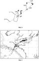
- the figure 4 represents results obtained using the method that is the subject of the present invention.
- Channel and Atlantic current vectors are represented at the position of many vessels using vessel parameters collected using three AIS receivers installed on the coast (one vector per vessel).
- measurements made using two HF radars zone located inside the black frame 5 and results of the method implemented according to an example of embodiment for measuring the current on large geographical areas.
- This figure shows that the process can be used at reduced costs without using sensors for measuring wind or current on board ships
- the figure 4 illustrates remarkably the gain obtained in terms of measurement area area thanks to the method compared to what is conventionally done using HF radars.
- the vectors represented in the frame 5 in the center of the map were measured using two HF radars. They are aligned with the vectors located outside the frame 5 and not far from the area it delimits. All other Channel and Atlantic vectors were calculated using the method described above using vessel navigation parameters collected using 3 AIS receivers.
- the figure 5 represents a graph showing the west-east component of the current vector measured at each position of a given ship as a function of latitude. This figure 5 illustrates the highly qualitative nature of current measurements obtained using the method object of the present invention.
- the figure 6 illustrates current vectors 9 measured using the method that is the subject of the present invention at any point on the trajectory of a given ship in a given space.
- step 20 navigation parameters are collected in real time or delayed time.
- wind and / or current measurements are made near the ship; these measurements are made either by means of a remote sensing device making it possible to carry out the measurements without using an on-board sensor on board the ship, or carried out using measuring means located near the ship (but not embarked ) and teletransmitted to a center on land or to another ship using a telecommunication means such as AIS or Argos for example.
- step 22 the drift vector is calculated using the current and / or wind measurements obtained in step 21.
- step 23 the bottom vector is calculated using the navigation parameters obtained in step 20
- step 24 the area vector is calculated using the results of steps 22 and 23; the surface vector is obtained by summing the background vector and the vector drifts.
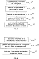
- step 25 the vessel surface speed is calculated at a given instant by means of the method described in FIG. figure 7 .
- navigation parameters of the ship are collected in real time or delayed time at any time and at any point of the trajectory of the ship in a specific space. These parameters make it possible to calculate the bottom speed.
- step 27 the vector background and the vector surface are summed to calculate the vector drift at any point of the trajectory.
- the standard of the surface vector used at this stage is that obtained in step 25.
Landscapes
- Engineering & Computer Science (AREA)
- Radar, Positioning & Navigation (AREA)
- Remote Sensing (AREA)
- Ocean & Marine Engineering (AREA)
- Chemical & Material Sciences (AREA)
- Mechanical Engineering (AREA)
- Combustion & Propulsion (AREA)
- Physics & Mathematics (AREA)
- General Physics & Mathematics (AREA)
- Automation & Control Theory (AREA)
- Aviation & Aerospace Engineering (AREA)
- Navigation (AREA)
- Traffic Control Systems (AREA)
- Testing Or Calibration Of Command Recording Devices (AREA)
- Radar Systems Or Details Thereof (AREA)
- Combined Controls Of Internal Combustion Engines (AREA)
- Measuring Fluid Pressure (AREA)
- Indicating Or Recording The Presence, Absence, Or Direction Of Movement (AREA)
Claims (12)
- Verfahren zum Berechnen des Überwasser-Vektors mindestens eines Schiffes (1) und Berechnen jedes Abdrift-Vektors an jedem Punkt der Bahn des Schiffes (1), das sich mit Motor bei voller Fahrt fortbewegt, die folgenden Schritte aa) bis cc) umfassend:- aa) Anwenden des Verfahrens zum Berechnen der Überwassergeschwindigkeit des Schiffes (1) entsprechend den folgenden Schritten a) bis e), die in einer bestimmten Position des Schiffes (1) ausgeführt werden:- a) Erhalten von Parametern des Schiffes (1), darunter die Position, den Kurs, die Fahrt über Grund, den Weg über Grund;- b) Erhalten von ausgewählten Messungen aus dem Wind und der Strömung, mithilfe von Mitteln außerhalb des Schiffes (1), wobei die Messungen in der Nähe des Schiffes (1) durchgeführt werden, wobei die Nähe räumlich und zeitlich ist, wobei die räumliche Nähe eine zentrierte Zone auf der Position des Schiffes und die zeitliche Nähe ein Zeitintervall ist;- c) Definieren des Abdrift-Vektors ausgehend von einer oder den in Schritt b) erhaltenen Messungen, die aus dem Wind und der Strömung ausgewählt werden;- d) Definieren des Vektors über Grund ausgehend von den ausgewählten Parametern, aus der Position, der Fahrt über Grund, und dem Weg über Grund, die in Schritt a) erhalten wurden;- e) Berechnen der Norm und der Richtung des Überwasser-Vektors des Schiffes (1) ausgehend von dem Abdrift-Vektor des Schrittes c) und dem Vektor über Grund des Schrittes d);- bb) Erhalten der Navigationsparameter des Schiffes (1), darunter die Position, den Kurs, die Fahrt über Grund, den Weg über Grund, die in Echtzeit oder versetzter Zeit zu jedem Zeitpunkt und an jedem Punkt der Bahn des Schiffes (1) in einem bestimmten Raum gesammelt werden, um die Fahrt über Grund zu berechnen;- cc) Berechnen an jedem Punkt der Bahn des Schiffes (1) des Abdrift-Vektors durch Summieren des Überwasser-Vektors, dessen Norm in Schritt aa) berechnet worden ist, und dessen Richtung durch den Kurs des Schiffes gegeben ist, und des Vektors über Grund, der ausgehend von den in Schritt bb) erhaltenen Parametern berechnet wird.
- Verfahren nach Anspruch 1, dadurch gekennzeichnet, dass die Parameter des Schrittes a) oder die Messungen des Schrittes b) in Echtzeit erfasst werden.
- Verfahren nach Anspruch 1, dadurch gekennzeichnet, dass die Parameter des Schrittes a) oder die Messungen des Schrittes b) in versetzter Zeit erfasst werden.
- Verfahren nach einem der Ansprüche 2 oder 3, dadurch gekennzeichnet, dass der Erhalt der Parameter des Schrittes a) während eines Zeitintervalls von mindestens zwei Sekunden erfolgt.
- Verfahren nach einem der Ansprüche 1 bis 4, dadurch gekennzeichnet, dass die Parameter des Schrittes a) durch Ferndetektionsmittel außerhalb des Schiffes gesammelt werden.
- Verfahren nach einem der Ansprüche 1 bis 4, dadurch gekennzeichnet, dass die Parameter des Schrittes a) durch Empfangsmittel empfangen werden und durch das Schiff (1) mithilfe eines Telekommunikationsmittels gesendet werden.
- Verfahren nach einem der Ansprüche 1 bis 6, dadurch gekennzeichnet, dass der Schritt d) durch ein System durchgeführt wird, das sich nicht an Bord des Schiffes (1) befindet.
- Verfahren nach einem der Ansprüche 1 bis 7, dadurch gekennzeichnet, dass die Berechnung des Schrittes e) der Intensität und der Richtung des Überwassergeschwindigkeits-Vektors des Schiffes (1) durch Summieren des Abdrift-Vektors und des Vektors über Grund, durchgeführt wird, die in den Schritten c) und d) erhalten werden.
- Verfahren zum Berechnen des Überwasser-Vektors mindestens eines Schiffes (1) und Berechnen jedes Abdrift-Vektors an jedem Punkt der Bahn des Schiffes (1), das sich mit Motor bei voller Fahrt fortbewegt, die folgenden Schritte aa) bis cc) umfassend:- aa) Anwenden des Verfahrens zum Berechnen der Überwassergeschwindigkeit des Schiffes (1) entsprechend den folgenden Schritten a) bis c), die in einer bestimmten Position des Schiffes (1) ausgeführt werden:- a) Erhalten einer Reihe von Werten der Fahrt über Grund des Schiffes (1) zu verschiedenen Zeitpunkten, wobei die Werte ausgehend von mindestens zwei Positionen des Schiffes (1) berechnet werden,- b) Bearbeiten der Reihe von Werten zu verschiedenen Zeitpunkten, die in dem vorstehenden Schritt erhalten wurde, mithilfe einer Signalbearbeitungstechnik, die angepasst ist, um die Komponenten des Signals zu filtern, die der Überwasserströmung oder dem Wind geschuldet sind,- c) Berechnen der Norm des Überwasser-Vektors des Schiffes (1) bei voller Fahrt ausgehend von dem Ergebnis der Bearbeitung der Reihe von Werten;- bb) Erhalten der Navigationsparameter des Schiffes (1), darunter die Position, den Kurs, die Fahrt über Grund, den Weg über Grund, die in Echtzeit oder versetzter Zeit zu jedem Zeitpunkt und an jedem Punkt der Bahn des Schiffes (1) in einem bestimmten Raum gesammelt werden, um die Fahrt über Grund zu berechnen;- cc) Berechnen an jedem Punkt der Bahn des Schiffes (1) des Abdrift-Vektors durch Summieren des Überwasser-Vektors, dessen Norm in Schritt aa) berechnet worden ist, und dessen Richtung durch den Kurs des Schiffes gegeben ist und des Vektors über Grund, der ausgehend von den in Schritt bb) erhaltenen Parametern berechnet wird.
- Verfahren nach Anspruch 9, dadurch gekennzeichnet, dass die Wertreihe der Fahrt über Grund des Schiffes (1) aus Werten gebildet wird, die den Zeitpunkten entsprechen, an denen der Überwasser-Vektor des Schiffes (1) kollinear mit seinem Vektor über Grund ist.
- Verfahren nach einem der Ansprüche 1 bis 10, dadurch gekennzeichnet, dass das Verfahren einen Repräsentationsschritt des Abdrift-Vektors des Schiffes (1) oder seiner Komponenten im Zusammenhang mit dem Wind oder der Strömung in Echtzeit oder versetzter Zeit in einem bestimmten Raum umfasst.
- Computerprogrammprodukt, eine Reihe von Befehlen umfassend, die, wenn sie in einen Computer geladen wird, für die Ausführung der Schritte des Verfahrens nach einem der Ansprüche 1 bis 11 durch den Computer sorgt.
Priority Applications (2)
| Application Number | Priority Date | Filing Date | Title |
|---|---|---|---|
| HUE14799389 HUE044162T2 (hu) | 2013-11-12 | 2014-11-12 | Eljárás legalább egy hajó felületi vektorának kiszámítására, és eljárás a hajó útvonalának pontjaiban a sodródási vektor meghatározására |
| PL14799389T PL3049762T3 (pl) | 2013-11-12 | 2014-11-12 | Sposób obliczania prędkości powierzchniowej co najmniej jednego statku oraz sposób oceny każdego wektora dryfu w dowolnym punkcie trajektorii wymienionego statku |
Applications Claiming Priority (2)
| Application Number | Priority Date | Filing Date | Title |
|---|---|---|---|
| FR1302593A FR3013136B1 (fr) | 2013-11-12 | 2013-11-12 | Procede de calculs de parametres d'au moins un navire et procede de deduction de chaque vecteur derive en tout point de la trajectoire dudit navire |
| PCT/EP2014/074327 WO2015071286A1 (fr) | 2013-11-12 | 2014-11-12 | Procédé de calcul de la vitesse surface d'au moins un navire et procédé de déduction de chaque vecteur dérive en tout point de la trajectoire dudit navire |
Publications (2)
| Publication Number | Publication Date |
|---|---|
| EP3049762A1 EP3049762A1 (de) | 2016-08-03 |
| EP3049762B1 true EP3049762B1 (de) | 2019-02-20 |
Family
ID=50473352
Family Applications (1)
| Application Number | Title | Priority Date | Filing Date |
|---|---|---|---|
| EP14799389.3A Active EP3049762B1 (de) | 2013-11-12 | 2014-11-12 | Verfahren zur berechnung des oberflächen vektors eines schiffes und verfahren zur bestimmung des drift vektors des schiffes an jedem punkt seines verlaufs. |
Country Status (17)
| Country | Link |
|---|---|
| US (1) | US9958276B2 (de) |
| EP (1) | EP3049762B1 (de) |
| JP (1) | JP6567665B2 (de) |
| KR (1) | KR20170078835A (de) |
| CN (1) | CN107430004B (de) |
| AU (1) | AU2014350296A1 (de) |
| BR (1) | BR112017009877A2 (de) |
| CA (1) | CA2929198A1 (de) |
| CY (1) | CY1121726T1 (de) |
| DK (1) | DK3049762T3 (de) |
| ES (1) | ES2725629T3 (de) |
| FR (1) | FR3013136B1 (de) |
| HU (1) | HUE044162T2 (de) |
| PL (1) | PL3049762T3 (de) |
| PT (1) | PT3049762T (de) |
| WO (1) | WO2015071286A1 (de) |
| ZA (1) | ZA201703152B (de) |
Families Citing this family (9)
| Publication number | Priority date | Publication date | Assignee | Title |
|---|---|---|---|---|
| WO2015151218A1 (ja) * | 2014-03-31 | 2015-10-08 | 富士通株式会社 | 情報処理システム、情報処理方法、情報処理プログラムおよび移動端末装置 |
| CN109572930B (zh) * | 2019-01-31 | 2020-12-04 | 烟台中集来福士海洋工程有限公司 | 一种半潜式平台流载荷的估算方法 |
| CN111815795B (zh) * | 2020-07-10 | 2022-03-25 | 上海埃威航空电子有限公司 | 基于蓝牙的ais船舶停泊离泊自动定位计时方法 |
| CN112257811B (zh) * | 2020-11-11 | 2022-04-19 | 珠海大横琴科技发展有限公司 | 一种船只分类方法、装置、电子设备及存储介质 |
| JP2022185437A (ja) * | 2021-06-02 | 2022-12-14 | 朋樹 瀧本 | Ipネットワークを介したvdesメッセージ伝送方法 |
| JP2024062802A (ja) * | 2022-10-25 | 2024-05-10 | ナブテスコ株式会社 | 船舶制御システム、外力ベクトル推定装置、船舶制御システムの制御方法、船舶制御システムの制御プログラム |
| EP4403877B1 (de) * | 2023-01-17 | 2025-10-29 | Abb Schweiz Ag | Verfahren zur identifizierung eines schiffs, schiffsidentifizierungsvorrichtung und schwimmendes objekt und landanlage mit einer schiffsidentifizierungsvorrichtung |
| CN116482401A (zh) * | 2023-02-22 | 2023-07-25 | 广州市番高领航科技有限公司 | 一种基于无人船动力输出与轨迹偏航推算水流速度和方向的方法 |
| CN119942286B (zh) * | 2025-01-14 | 2025-09-12 | 武汉理工大学 | 融合遥感影像和ais数据的非合作船舶轨迹动态补全与监测系统 |
Family Cites Families (34)
| Publication number | Priority date | Publication date | Assignee | Title |
|---|---|---|---|---|
| FR2623911B1 (fr) * | 1987-12-01 | 1990-05-11 | Federation Fse Voile | Systeme de controle ou d'aide a la navigation maritime ou la circulation |
| US6032603A (en) * | 1997-01-23 | 2000-03-07 | Olcott; Bernard | Method and apparatus to increase the velocity of sailing vessels |
| US6234853B1 (en) * | 2000-02-11 | 2001-05-22 | Brunswick Corporation | Simplified docking method and apparatus for a multiple engine marine vessel |
| US6446003B1 (en) * | 2000-07-12 | 2002-09-03 | Trimble Navigation Limited | Method for determining drift with a digital compass |
| CN2501802Y (zh) * | 2001-06-15 | 2002-07-24 | 中国船舶重工集团公司第七研究院第七一一研究所 | 船用风向风速测量装置 |
| US6885919B1 (en) * | 2003-06-02 | 2005-04-26 | Brunswick Corporation | Method for controlling the operation of a marine vessel |
| JP4447371B2 (ja) * | 2004-05-11 | 2010-04-07 | ヤマハ発動機株式会社 | 推進機制御装置、推進機制御装置制御プログラム、推進機制御装置制御方法及び航走制御装置 |
| US7458332B2 (en) * | 2005-07-22 | 2008-12-02 | Jim Wilson | High speed marine vessel |
| US7267068B2 (en) * | 2005-10-12 | 2007-09-11 | Brunswick Corporation | Method for maneuvering a marine vessel in response to a manually operable control device |
| US7305928B2 (en) * | 2005-10-12 | 2007-12-11 | Brunswick Corporation | Method for positioning a marine vessel |
| NO20061745L (no) * | 2006-04-20 | 2007-10-22 | Rolls Royce Marine As | Azipull |
| US8126602B2 (en) * | 2006-12-19 | 2012-02-28 | Morvillo Robert A | Method and apparatus for controlling a water-jet driven marine vessel |
| WO2008096376A1 (en) | 2007-02-08 | 2008-08-14 | Marorka | Route selecting method and apparatus |
| IL192518A (en) * | 2008-06-30 | 2013-02-28 | Michael Naumov | Method and device for the autonomous determination of wind speed vector |
| US20100023262A1 (en) * | 2008-07-24 | 2010-01-28 | Haney Mark T | Driftline navigation system |
| GB2462414B (en) * | 2008-08-04 | 2012-08-22 | Natasha Labram | Device and method for linking wired marine electronic components to wireless devices |
| US8626366B2 (en) * | 2008-12-29 | 2014-01-07 | General Electric Company | System and method for controlling a marine vessel through a waterway |
| US8050630B1 (en) * | 2009-04-28 | 2011-11-01 | Brunswick Corporation | Method for monitoring the operation of a global position system receiver |
| JP5276720B2 (ja) * | 2009-11-04 | 2013-08-28 | 川崎重工業株式会社 | 操船制御方法及び操船制御システム |
| JP5337722B2 (ja) * | 2010-01-07 | 2013-11-06 | ヤマハ発動機株式会社 | 船舶用推進制御装置および船舶 |
| EP2354798B1 (de) * | 2010-02-05 | 2013-12-11 | Raymarine UK Limited | Verfahren und Vorrichtung zur Bestimmung der Windbedingungen rund um ein Segelboot |
| WO2011142870A2 (en) * | 2010-02-18 | 2011-11-17 | Morvillo Robert A | Variable trim deflector system and method for controlling a marine vessel |
| CN201780609U (zh) * | 2010-04-30 | 2011-03-30 | 浙江省交通科学研究所 | 船舶航行数据记录系统 |
| CN102168978B (zh) * | 2010-12-17 | 2012-10-31 | 北京航空航天大学 | 一种船用惯性导航系统摇摆基座开环对准方法 |
| US9157746B2 (en) * | 2011-11-16 | 2015-10-13 | The Boeing Company | Vessel routing system |
| KR101346184B1 (ko) * | 2012-03-15 | 2013-12-31 | 삼성중공업 주식회사 | 선박 네비게이션시스템 및 상기 선박 네비게이션시스템의 경로제어방법 |
| JP6076611B2 (ja) * | 2012-04-11 | 2017-02-08 | 古野電気株式会社 | 航路計画装置及び航路計画検証方法 |
| US9718530B2 (en) * | 2012-04-17 | 2017-08-01 | Garmin Switzerland Gmbh | Marine vessel display system |
| CN103714717A (zh) * | 2012-10-09 | 2014-04-09 | 北京东方道迩信息技术股份有限公司 | 一种基于sar数据的船舶动态跟踪与行为模式识别方法 |
| US9248898B1 (en) * | 2013-03-06 | 2016-02-02 | Brunswick Corporation | Systems and methods for controlling speed of a marine vessel |
| US8924054B1 (en) * | 2013-03-14 | 2014-12-30 | Brunswick Corporation | Systems and methods for positioning a marine vessel |
| CN103631148B (zh) * | 2013-08-28 | 2017-03-15 | 中国人民解放军海军大连舰艇学院 | 一种基于ais的船舶驾驶实时虚拟增强仿真系统及方法 |
| CN203606382U (zh) * | 2013-12-13 | 2014-05-21 | 国家海洋技术中心 | 一种投弃式电磁海流剖面测量探头 |
| US9690295B1 (en) * | 2015-08-20 | 2017-06-27 | Brunswick Corporation | Heading control on a marine vessel |
-
2013
- 2013-11-12 FR FR1302593A patent/FR3013136B1/fr active Active
-
2014
- 2014-11-12 US US15/032,996 patent/US9958276B2/en active Active
- 2014-11-12 CA CA2929198A patent/CA2929198A1/fr not_active Abandoned
- 2014-11-12 PT PT14799389T patent/PT3049762T/pt unknown
- 2014-11-12 CN CN201480084443.1A patent/CN107430004B/zh active Active
- 2014-11-12 JP JP2017526601A patent/JP6567665B2/ja active Active
- 2014-11-12 BR BR112017009877-6A patent/BR112017009877A2/pt not_active Application Discontinuation
- 2014-11-12 AU AU2014350296A patent/AU2014350296A1/en not_active Abandoned
- 2014-11-12 DK DK14799389.3T patent/DK3049762T3/da active
- 2014-11-12 PL PL14799389T patent/PL3049762T3/pl unknown
- 2014-11-12 KR KR1020177015318A patent/KR20170078835A/ko not_active Ceased
- 2014-11-12 ES ES14799389T patent/ES2725629T3/es active Active
- 2014-11-12 EP EP14799389.3A patent/EP3049762B1/de active Active
- 2014-11-12 WO PCT/EP2014/074327 patent/WO2015071286A1/fr not_active Ceased
- 2014-11-12 HU HUE14799389 patent/HUE044162T2/hu unknown
-
2017
- 2017-05-08 ZA ZA2017/03152A patent/ZA201703152B/en unknown
-
2019
- 2019-05-07 CY CY20191100485T patent/CY1121726T1/el unknown
Non-Patent Citations (1)
| Title |
|---|
| None * |
Also Published As
| Publication number | Publication date |
|---|---|
| US20160290812A1 (en) | 2016-10-06 |
| KR20170078835A (ko) | 2017-07-07 |
| ES2725629T3 (es) | 2019-09-25 |
| FR3013136A1 (fr) | 2015-05-15 |
| ZA201703152B (en) | 2019-06-26 |
| JP2017534526A (ja) | 2017-11-24 |
| PT3049762T (pt) | 2019-05-30 |
| PL3049762T3 (pl) | 2019-10-31 |
| CY1121726T1 (el) | 2020-07-31 |
| AU2014350296A1 (en) | 2017-06-01 |
| EP3049762A1 (de) | 2016-08-03 |
| JP6567665B2 (ja) | 2019-08-28 |
| FR3013136B1 (fr) | 2021-03-19 |
| CN107430004B (zh) | 2020-10-09 |
| WO2015071286A1 (fr) | 2015-05-21 |
| DK3049762T3 (da) | 2019-05-13 |
| HUE044162T2 (hu) | 2019-10-28 |
| CA2929198A1 (fr) | 2015-05-21 |
| CN107430004A (zh) | 2017-12-01 |
| US9958276B2 (en) | 2018-05-01 |
| BR112017009877A2 (pt) | 2018-02-14 |
Similar Documents
| Publication | Publication Date | Title |
|---|---|---|
| EP3049762B1 (de) | Verfahren zur berechnung des oberflächen vektors eines schiffes und verfahren zur bestimmung des drift vektors des schiffes an jedem punkt seines verlaufs. | |
| FR2930649A1 (fr) | Systeme de positionnement acoustique sous-marin | |
| WO2012013525A1 (fr) | Procede de determination d'un volume de protection dans le cas de deux pannes satellitaires simultanees | |
| EP4217761B1 (de) | Verfahren zur ortung eines flugzeugs im flug | |
| EP3671268A1 (de) | Messverfahren und -system der geschwindigkeit eines trägers in bezug auf den boden | |
| EP1712930B1 (de) | System und Verfahren zur Ermittlung der Momentangeschwindigkeit eines Objektes | |
| FR2936669A1 (fr) | Procede pour optimiser une acquisition d'un signal a spectre etale provenant d'un satellite par un recepteur mobile | |
| FR2993973A1 (fr) | Procede de traitement d'un plan de vol | |
| EP1828802B1 (de) | Einrichtung zur autonomen bestimmung absoluter geographischer koordinaten einer sich in bezug auf immersion ändernden mobilen einrichtung | |
| EP1782098B1 (de) | Verfahren zur antennenwinkelkalibration durch relative distanzmessung | |
| EP3577494A1 (de) | Bake, system und verfahren zur unterstützung der präzisionsnavigation | |
| EP2626725B1 (de) | Bestimmungsverfahren einer Verlässlichkeitsanzeige in Bezug auf die eingeschlagene Bewegungsbahn eines mobilen Geräts | |
| EP2367025B1 (de) | Prüfungsverfahren und -system der Präzisionsleistungen eines satellitengesteuerten Navigationssystems | |
| EP2367024B1 (de) | Berechnungsverfahren und -system zur Einschätzung der Präzisionsleistung eines satellitengesteuerten Navigationssystems | |
| EP3871005B1 (de) | Verfahren zur korrektur einer zuvor geschätzten position eines fahrzeugs | |
| WO2011048224A1 (fr) | Procede de localisation et de cartographie simultanees par filtrage non lineaire elastique | |
| EP4343379A1 (de) | Verfahren und vorrichtung zur erkennung von hindernissen im nahen zustand mittels eines passiven multistatischen gnss-radars für mobile plattformen | |
| FR3084752A1 (fr) | Dispositif et procede de verification de l'authenticite de signaux gnss | |
| WO2025012131A1 (fr) | Procédé de calcul et/ou de surveillance du fonctionnement d'un système de positionnement par satellites embarqué dans un véhicule, et dispositif et produit programme d'ordinateur associés | |
| EP4290267A1 (de) | Verfahren zur lokalisierung einer navigationseinheit | |
| EP4232849A1 (de) | Verfahren zur erkennung der maskierung eines oder mehrerer satelliten, elektronische detektionsvorrichtung und zugehöriges computerprogrammprodukt | |
| WO2013017753A1 (fr) | Dispositif de mesure, dans un plan prédéfini, du positionnement d'un matériel déposé au fond de l'eau et procédé associé | |
| EP4237796A1 (de) | Rnp-navigation ohne gnss | |
| FR2954976A1 (fr) | Procede de localisation d'une source perturbatrice d'un signal dans le domaine de la radionavigation | |
| FR2955671A1 (fr) | Procede de detection de cibles marines et dispositif associe |
Legal Events
| Date | Code | Title | Description |
|---|---|---|---|
| PUAI | Public reference made under article 153(3) epc to a published international application that has entered the european phase |
Free format text: ORIGINAL CODE: 0009012 |
|
| 17P | Request for examination filed |
Effective date: 20160428 |
|
| AK | Designated contracting states |
Kind code of ref document: A1 Designated state(s): AL AT BE BG CH CY CZ DE DK EE ES FI FR GB GR HR HU IE IS IT LI LT LU LV MC MK MT NL NO PL PT RO RS SE SI SK SM TR |
|
| AX | Request for extension of the european patent |
Extension state: BA ME |
|
| DAX | Request for extension of the european patent (deleted) | ||
| RAP1 | Party data changed (applicant data changed or rights of an application transferred) |
Owner name: E-ODYN |
|
| RIN1 | Information on inventor provided before grant (corrected) |
Inventor name: GUICHOUX, YANN |
|
| STAA | Information on the status of an ep patent application or granted ep patent |
Free format text: STATUS: EXAMINATION IS IN PROGRESS |
|
| 17Q | First examination report despatched |
Effective date: 20170707 |
|
| REG | Reference to a national code |
Ref country code: DE Ref legal event code: R079 Ref document number: 602014041366 Country of ref document: DE Free format text: PREVIOUS MAIN CLASS: G01C0021200000 Ipc: B63B0009000000 |
|
| RIC1 | Information provided on ipc code assigned before grant |
Ipc: B63B 9/00 20060101AFI20180525BHEP Ipc: G01C 21/20 20060101ALI20180525BHEP Ipc: B63J 99/00 20090101ALI20180525BHEP Ipc: G01P 5/00 20060101ALI20180525BHEP |
|
| GRAP | Despatch of communication of intention to grant a patent |
Free format text: ORIGINAL CODE: EPIDOSNIGR1 |
|
| STAA | Information on the status of an ep patent application or granted ep patent |
Free format text: STATUS: GRANT OF PATENT IS INTENDED |
|
| INTG | Intention to grant announced |
Effective date: 20180913 |
|
| GRAS | Grant fee paid |
Free format text: ORIGINAL CODE: EPIDOSNIGR3 |
|
| GRAA | (expected) grant |
Free format text: ORIGINAL CODE: 0009210 |
|
| STAA | Information on the status of an ep patent application or granted ep patent |
Free format text: STATUS: THE PATENT HAS BEEN GRANTED |
|
| AK | Designated contracting states |
Kind code of ref document: B1 Designated state(s): AL AT BE BG CH CY CZ DE DK EE ES FI FR GB GR HR HU IE IS IT LI LT LU LV MC MK MT NL NO PL PT RO RS SE SI SK SM TR |
|
| REG | Reference to a national code |
Ref country code: GB Ref legal event code: FG4D Free format text: NOT ENGLISH |
|
| REG | Reference to a national code |
Ref country code: CH Ref legal event code: EP |
|
| REG | Reference to a national code |
Ref country code: DE Ref legal event code: R096 Ref document number: 602014041366 Country of ref document: DE |
|
| REG | Reference to a national code |
Ref country code: AT Ref legal event code: REF Ref document number: 1097810 Country of ref document: AT Kind code of ref document: T Effective date: 20190315 |
|
| REG | Reference to a national code |
Ref country code: IE Ref legal event code: FG4D Free format text: LANGUAGE OF EP DOCUMENT: FRENCH |
|
| REG | Reference to a national code |
Ref country code: DK Ref legal event code: T3 Effective date: 20190508 |
|
| REG | Reference to a national code |
Ref country code: NL Ref legal event code: FP |
|
| REG | Reference to a national code |
Ref country code: PT Ref legal event code: SC4A Ref document number: 3049762 Country of ref document: PT Date of ref document: 20190530 Kind code of ref document: T Free format text: AVAILABILITY OF NATIONAL TRANSLATION Effective date: 20190510 |
|
| REG | Reference to a national code |
Ref country code: SE Ref legal event code: TRGR |
|
| REG | Reference to a national code |
Ref country code: LT Ref legal event code: MG4D |
|
| REG | Reference to a national code |
Ref country code: NO Ref legal event code: T2 Effective date: 20190220 |
|
| PG25 | Lapsed in a contracting state [announced via postgrant information from national office to epo] |
Ref country code: LT Free format text: LAPSE BECAUSE OF FAILURE TO SUBMIT A TRANSLATION OF THE DESCRIPTION OR TO PAY THE FEE WITHIN THE PRESCRIBED TIME-LIMIT Effective date: 20190220 |
|
| REG | Reference to a national code |
Ref country code: GR Ref legal event code: EP Ref document number: 20190401515 Country of ref document: GR Effective date: 20190708 |
|
| PG25 | Lapsed in a contracting state [announced via postgrant information from national office to epo] |
Ref country code: HR Free format text: LAPSE BECAUSE OF FAILURE TO SUBMIT A TRANSLATION OF THE DESCRIPTION OR TO PAY THE FEE WITHIN THE PRESCRIBED TIME-LIMIT Effective date: 20190220 Ref country code: IS Free format text: LAPSE BECAUSE OF FAILURE TO SUBMIT A TRANSLATION OF THE DESCRIPTION OR TO PAY THE FEE WITHIN THE PRESCRIBED TIME-LIMIT Effective date: 20190620 Ref country code: LV Free format text: LAPSE BECAUSE OF FAILURE TO SUBMIT A TRANSLATION OF THE DESCRIPTION OR TO PAY THE FEE WITHIN THE PRESCRIBED TIME-LIMIT Effective date: 20190220 Ref country code: RS Free format text: LAPSE BECAUSE OF FAILURE TO SUBMIT A TRANSLATION OF THE DESCRIPTION OR TO PAY THE FEE WITHIN THE PRESCRIBED TIME-LIMIT Effective date: 20190220 |
|
| REG | Reference to a national code |
Ref country code: AT Ref legal event code: MK05 Ref document number: 1097810 Country of ref document: AT Kind code of ref document: T Effective date: 20190220 |
|
| REG | Reference to a national code |
Ref country code: ES Ref legal event code: FG2A Ref document number: 2725629 Country of ref document: ES Kind code of ref document: T3 Effective date: 20190925 |
|
| REG | Reference to a national code |
Ref country code: HU Ref legal event code: AG4A Ref document number: E044162 Country of ref document: HU |
|
| PG25 | Lapsed in a contracting state [announced via postgrant information from national office to epo] |
Ref country code: RO Free format text: LAPSE BECAUSE OF FAILURE TO SUBMIT A TRANSLATION OF THE DESCRIPTION OR TO PAY THE FEE WITHIN THE PRESCRIBED TIME-LIMIT Effective date: 20190220 Ref country code: SK Free format text: LAPSE BECAUSE OF FAILURE TO SUBMIT A TRANSLATION OF THE DESCRIPTION OR TO PAY THE FEE WITHIN THE PRESCRIBED TIME-LIMIT Effective date: 20190220 Ref country code: EE Free format text: LAPSE BECAUSE OF FAILURE TO SUBMIT A TRANSLATION OF THE DESCRIPTION OR TO PAY THE FEE WITHIN THE PRESCRIBED TIME-LIMIT Effective date: 20190220 Ref country code: AL Free format text: LAPSE BECAUSE OF FAILURE TO SUBMIT A TRANSLATION OF THE DESCRIPTION OR TO PAY THE FEE WITHIN THE PRESCRIBED TIME-LIMIT Effective date: 20190220 |
|
| REG | Reference to a national code |
Ref country code: DE Ref legal event code: R097 Ref document number: 602014041366 Country of ref document: DE |
|
| REG | Reference to a national code |
Ref country code: DE Ref legal event code: R079 Ref document number: 602014041366 Country of ref document: DE Free format text: PREVIOUS MAIN CLASS: B63B0009000000 Ipc: B63B0071000000 |
|
| PG25 | Lapsed in a contracting state [announced via postgrant information from national office to epo] |
Ref country code: SM Free format text: LAPSE BECAUSE OF FAILURE TO SUBMIT A TRANSLATION OF THE DESCRIPTION OR TO PAY THE FEE WITHIN THE PRESCRIBED TIME-LIMIT Effective date: 20190220 |
|
| PLBE | No opposition filed within time limit |
Free format text: ORIGINAL CODE: 0009261 |
|
| STAA | Information on the status of an ep patent application or granted ep patent |
Free format text: STATUS: NO OPPOSITION FILED WITHIN TIME LIMIT |
|
| PG25 | Lapsed in a contracting state [announced via postgrant information from national office to epo] |
Ref country code: AT Free format text: LAPSE BECAUSE OF FAILURE TO SUBMIT A TRANSLATION OF THE DESCRIPTION OR TO PAY THE FEE WITHIN THE PRESCRIBED TIME-LIMIT Effective date: 20190220 |
|
| 26N | No opposition filed |
Effective date: 20191121 |
|
| PG25 | Lapsed in a contracting state [announced via postgrant information from national office to epo] |
Ref country code: SI Free format text: LAPSE BECAUSE OF FAILURE TO SUBMIT A TRANSLATION OF THE DESCRIPTION OR TO PAY THE FEE WITHIN THE PRESCRIBED TIME-LIMIT Effective date: 20190220 |
|
| PG25 | Lapsed in a contracting state [announced via postgrant information from national office to epo] |
Ref country code: MK Free format text: LAPSE BECAUSE OF FAILURE TO SUBMIT A TRANSLATION OF THE DESCRIPTION OR TO PAY THE FEE WITHIN THE PRESCRIBED TIME-LIMIT Effective date: 20190220 |
|
| PGFP | Annual fee paid to national office [announced via postgrant information from national office to epo] |
Ref country code: PT Payment date: 20251105 Year of fee payment: 12 |
|
| PGFP | Annual fee paid to national office [announced via postgrant information from national office to epo] |
Ref country code: HU Payment date: 20251114 Year of fee payment: 12 |
|
| PGFP | Annual fee paid to national office [announced via postgrant information from national office to epo] |
Ref country code: LU Payment date: 20251127 Year of fee payment: 12 |
|
| PGFP | Annual fee paid to national office [announced via postgrant information from national office to epo] |
Ref country code: DE Payment date: 20251127 Year of fee payment: 12 |
|
| REG | Reference to a national code |
Ref country code: CH Ref legal event code: U11 Free format text: ST27 STATUS EVENT CODE: U-0-0-U10-U11 (AS PROVIDED BY THE NATIONAL OFFICE) Effective date: 20260108 |
|
| PGFP | Annual fee paid to national office [announced via postgrant information from national office to epo] |
Ref country code: GB Payment date: 20251127 Year of fee payment: 12 |
|
| PGFP | Annual fee paid to national office [announced via postgrant information from national office to epo] |
Ref country code: NO Payment date: 20251126 Year of fee payment: 12 Ref country code: MC Payment date: 20251128 Year of fee payment: 12 |
|
| PGFP | Annual fee paid to national office [announced via postgrant information from national office to epo] |
Ref country code: IT Payment date: 20251127 Year of fee payment: 12 Ref country code: FI Payment date: 20251126 Year of fee payment: 12 Ref country code: DK Payment date: 20251126 Year of fee payment: 12 |
|
| PGFP | Annual fee paid to national office [announced via postgrant information from national office to epo] |
Ref country code: NL Payment date: 20251127 Year of fee payment: 12 Ref country code: FR Payment date: 20251126 Year of fee payment: 12 |
|
| PGFP | Annual fee paid to national office [announced via postgrant information from national office to epo] |
Ref country code: BE Payment date: 20251127 Year of fee payment: 12 Ref country code: TR Payment date: 20251107 Year of fee payment: 12 Ref country code: GR Payment date: 20251126 Year of fee payment: 12 |
|
| PGFP | Annual fee paid to national office [announced via postgrant information from national office to epo] |
Ref country code: SE Payment date: 20251201 Year of fee payment: 12 |
|
| PGFP | Annual fee paid to national office [announced via postgrant information from national office to epo] |
Ref country code: IE Payment date: 20251127 Year of fee payment: 12 Ref country code: CZ Payment date: 20251106 Year of fee payment: 12 Ref country code: CY Payment date: 20251110 Year of fee payment: 12 |
|
| PGFP | Annual fee paid to national office [announced via postgrant information from national office to epo] |
Ref country code: MT Payment date: 20251114 Year of fee payment: 12 |
|
| PGFP | Annual fee paid to national office [announced via postgrant information from national office to epo] |
Ref country code: PL Payment date: 20251106 Year of fee payment: 12 Ref country code: BG Payment date: 20251126 Year of fee payment: 12 |
|
| PGFP | Annual fee paid to national office [announced via postgrant information from national office to epo] |
Ref country code: ES Payment date: 20251208 Year of fee payment: 12 |
|
| PGFP | Annual fee paid to national office [announced via postgrant information from national office to epo] |
Ref country code: CH Payment date: 20260108 Year of fee payment: 12 |