EP0945706A2 - Speicherverwaltung für Navigationssystem - Google Patents
Speicherverwaltung für Navigationssystem Download PDFInfo
- Publication number
- EP0945706A2 EP0945706A2 EP99302263A EP99302263A EP0945706A2 EP 0945706 A2 EP0945706 A2 EP 0945706A2 EP 99302263 A EP99302263 A EP 99302263A EP 99302263 A EP99302263 A EP 99302263A EP 0945706 A2 EP0945706 A2 EP 0945706A2
- Authority
- EP
- European Patent Office
- Prior art keywords
- parcel
- data
- cache
- parcels
- memory
- Prior art date
- Legal status (The legal status is an assumption and is not a legal conclusion. Google has not performed a legal analysis and makes no representation as to the accuracy of the status listed.)
- Granted
Links
Images




Classifications
-
- G—PHYSICS
- G01—MEASURING; TESTING
- G01C—MEASURING DISTANCES, LEVELS OR BEARINGS; SURVEYING; NAVIGATION; GYROSCOPIC INSTRUMENTS; PHOTOGRAMMETRY OR VIDEOGRAMMETRY
- G01C21/00—Navigation; Navigational instruments not provided for in groups G01C1/00 - G01C19/00
- G01C21/26—Navigation; Navigational instruments not provided for in groups G01C1/00 - G01C19/00 specially adapted for navigation in a road network
-
- G—PHYSICS
- G06—COMPUTING OR CALCULATING; COUNTING
- G06F—ELECTRIC DIGITAL DATA PROCESSING
- G06F12/00—Accessing, addressing or allocating within memory systems or architectures
- G06F12/02—Addressing or allocation; Relocation
- G06F12/0223—User address space allocation, e.g. contiguous or non contiguous base addressing
- G06F12/023—Free address space management
-
- Y—GENERAL TAGGING OF NEW TECHNOLOGICAL DEVELOPMENTS; GENERAL TAGGING OF CROSS-SECTIONAL TECHNOLOGIES SPANNING OVER SEVERAL SECTIONS OF THE IPC; TECHNICAL SUBJECTS COVERED BY FORMER USPC CROSS-REFERENCE ART COLLECTIONS [XRACs] AND DIGESTS
- Y10—TECHNICAL SUBJECTS COVERED BY FORMER USPC
- Y10S—TECHNICAL SUBJECTS COVERED BY FORMER USPC CROSS-REFERENCE ART COLLECTIONS [XRACs] AND DIGESTS
- Y10S707/00—Data processing: database and file management or data structures
- Y10S707/99941—Database schema or data structure
- Y10S707/99943—Generating database or data structure, e.g. via user interface
Definitions
- the present application relates to navigation systems and in particular, the present application relates to memory management for a navigation system that facilitates use and access of a geographic database.
- Computer-based navigation systems are available that provide end-users with various navigating functions and features. For example, some navigation systems are installed in vehicles and are able to provide end-users (i.e., drivers of the vehicles) with optimum routes to travel by roads between locations in a geographic region. Using input from the end-user, and optionally from equipment that can determine one's physical location (such as a GPS system), a navigation application program in the navigation system can examine various routes between two locations to determine an optimum route to travel from a starting location to a destination location in a geographic region. The navigation application program may then provide the end-user with information about the optimum route in the form of instructions that identify the maneuvers required to be taken by the end-user to travel from the starting location to the destination location.
- end-users i.e., drivers of the vehicles
- a navigation application program in the navigation system can examine various routes between two locations to determine an optimum route to travel from a starting location to a destination location in a geographic region.
- the navigation application program may then provide the
- the instructions may take the form of audio instructions that are provided along the way as the end-user is traveling the route.
- Some navigation application programs are able to show detailed maps on computer displays illustrating routes to destinations, the types of maneuvers to be taken at various locations along the routes, locations of certain types of features, and so on.
- the navigation system or application uses one or more detailed databases that include data which represent physical features in a geographic region.
- the detailed database may include data representing the roads and intersections in a geographic region and also may include information about the roads and intersections in a geographic region, such as turn restrictions at intersections, speed limits along the roads, street names of the various roads, address ranges along the various roads, and so on.
- a relatively large database may be provided.
- Storage media such as CD-ROM discs or PCMCIA cards, are capable of handling databases of the size and complexity sufficient to provide suitable functionality.
- computer-based navigation systems are provided on various platforms including some with relatively limited computer hardware resources. For example, navigation systems that are located in vehicles or that are hand-held may have limited memory resources and relatively slow media access rates. These relatively limited hardware resources make it difficult to provide the relatively high level of functionality expected or required by end-users as well as suitably fast performance. Aside from being undesirable, slow performance in a navigation system may render the system useless for its intended purpose in certain circumstances.
- the driver may require information from the navigation system about a desired route in a matter of seconds in order to utilize the information while driving. If the navigation system requires more than several seconds to calculate a route, the driver may have moved beyond the point at which the routing information provided by the navigation system is relevant. Therefore, there is a need to utilize the hardware resources in a navigation system efficiently in order to provide a suitable level of performance.
- Some navigation applications may be provided on computer platforms that have greater memory and other hardware resources. On these kinds of platforms, similar considerations apply, but on a different scale. On computer platforms that have greater memory and other hardware resources, even greater functionality can be provided if the available resources are used efficiently. Accordingly, it would be desirable to provide a method and system that utilizes the resources of a navigation system efficiently thereby enabling the system to provide better performance.
- a method and system for managing memory resources in a system used in conjunction with a navigation application program that accesses geographic data.
- the geographic data are comprised of a plurality of data records.
- the plurality of data records are organized into parcels or groupings, each of which contains a portion of the plurality of data records, such that the data records in each portion of the plurality of data records that forms each parcel are accessed together.
- One or more buffers that each form a contiguous portion of the memory of the navigation system are provided as a cache to store a plurality of parcels.
- One or more data structures located outside the contiguous portion of memory identify the parcels of data stored in the cache and the locations in the cache at which the parcels are stored.
- the one or more data structures located outside the contiguous portion of memory in which the parcels are cached are used to manage the parcel cache to use it efficiently. These one or more data structures located outside the contiguous memory in which the parcels are cached are also used to defragment the parcel cache.
- Figure 1 is a block diagram illustrating a navigation system
- Figure 2 is a block diagram illustrating parts of the navigation application software of Figure 1.
- Figure 3 shows a map of a geographic region used to illustrate application of a parcelization method to spatially organized geographic data.
- Figure 4 is a diagram showing the arrangement of parcels of data in the geographic database of Figures 1 and 2 according to the parcelization method illustrated in Figure 3.
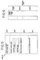
- Figure 5 is a diagram illustrating the utilization of memory resources in the navigation system of Figure 1.
- Figure 6 is a diagram illustrating one of the buffers in the parcel cache of Figure 5.
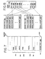
- Figure 7 is a block diagram illustrating usage of one of the buffers in Figure 6.
- Figure 8 is a diagram showing the contents of the header pool of Figure 7 and an associated hash table used therewith.
- Figure 9 is a diagram showing the information stored in each parcel header of Figure 8.
- Figure 10 is a block diagram illustrating data flow between the parcel queue and the parcel cache illustrated in Figures 5-7.
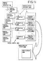
- Figure 11 is a block diagram illustrating components of the parcel queue shown in Figure 10.
- Figure 12 is a flow chart illustrating the steps implemented by the parcel queue manager of Figure 11 to limit pre-caching.
- Figure 13 is a diagram illustrating a defragmentation step performed by the parcel cache manager of Figures 2 and 11.
- Figure 14 is a diagram illustrating another defragmentation step.
- FIG. 1 there is a block diagram of a navigation system 10.
- the navigation system 10 is installed in a vehicle 11, such as a car or truck, although in alternative embodiments, the navigation system 10 may be located outside of a vehicle or may be implemented in various other platforms or environments, as described below.
- the navigation system 10 is a combination of hardware and software components.
- the navigation system 10 includes a processor 12, a drive 14 connected to the processor 12, and a non-volatile memory storage device 16 for storing a navigation application software program 18, as well as other information, such as configuration parameters 19.
- the processor 12 may be of any type used in navigation systems, such as 32-bit processors using a flat address space, such as a Hitachi SHI, an Intel 80386, an Intel 960, a Motorola 68020 (or other processors having similar or greater addressing space). Processor types other than these, as well as processors that may be developed in the future, may also be suitable.
- the navigation system 10 may also include a positioning system 24.
- the positioning system 24 may utilize GPS-type technology, a dead reckoning-type system, or combinations of these, or other systems, all of which are known in the art.
- the positioning system 24 may include suitable sensing devices 25 that measure the speed, direction, and so on, of the vehicle.
- the positioning system 24 may also include appropriate technology to obtain a GPS signal, in a manner which is known in the art.
- the positioning system 24 outputs a signal 26 to the processor 12.
- the signal 26 may be used by the navigation application software 18 that is run on the processor 12 to determine the location, direction, travel distance, speed, etc., of the navigation system 10.
- the navigation system 10 also includes a user interface 31.
- the user interface 31 includes appropriate equipment that allows the end-user to input information into the navigation system.
- This input information may include a request to use the navigation features of the navigation system.
- the input information may include a request for a route to a desired destination.
- the input information may also include other kinds of information, such as configuration information.
- the equipment used to input information into the navigation system may include a keypad, a keyboard, a microphone, etc., as well as appropriate software, such as a voice recognition program.
- the user interface 31 also includes suitable equipment that provides information back to the end-user. This equipment may include a display 27, speakers 29, or other means.
- the navigation system 10 uses a map database 40 stored on a storage medium 32.
- the storage medium 32 is installed in the drive 14 so that the map database 40 can be read and used by the navigation system.
- the storage medium 32 may be removable and replaceable so that a storage medium with an appropriate map database for the geographic region in which the vehicle is traveling can be used.
- the storage medium 32 may be replaceable so that the map database 40 on it can be updated easily.
- the geographic data may be published by Navigation Technologies of Sunnyvale, California.
- the storage medium 32 is a CD-ROM disc.
- the storage medium 32 may be a PCMCIA card in which case the drive 14 would be substituted with a PCMCIA slot.
- Various other storage media may be used, including fixed or hard disks, DVD (digital video disks) or other currently available storage media, as well as storage media that may be developed in the future.
- the storage medium 32 and the geographic database 40 do not have to be physically provided at the location of the navigation system.
- the storage medium 32, upon which some or all of the geographic data 40 are stored may be located remotely from the rest of the navigation system and portions of the geographic data provided via a communications link, as needed.
- the navigation application 18 includes software programming that provides separate navigation functions (or subprograms) 28. These navigation functions 28 include, for example, a route calculation function 33, a map display function 34, and a route guidance function 35 (wherein detailed directions are provided for reaching a desired destination).
- the navigation application program 18 may include other functions or subprograms 36 in addition or alternatively to these, such as a vehicle positioning (e.g., map matching) function. Although these navigation application functions 28 are represented as separate subprograms or applications within the navigation application program 18, these functions 28 may be combined or otherwise provided.
- the navigation application program 18 also includes user interface programming 37 that supports the user interface equipment 31 (in Figure 1).
- this user interface programming 37 may provide for the graphical display of information to the end-user via the user interface 31, the display of menus, prompts, and so on.
- the navigation system 10 may also include an operating system program 38.
- the navigation application 18 may also include specific functions 39 that access the geographic database 40. In a preferred embodiment, these functions 39 are located between the various navigation applications 28 and the geographic database 40, or more particularly between the navigation functions 28 and the operating system 38.
- These functions 39 may include memory management functions, such as a cache manager function 59 and a queue manager function 404, that facilitate sharing access to the geographic database 40 among the navigating functions 28.
- geographic data In conjunction with parcelization, another way that some of the geographic data can be organized to facilitate their use is to organize the data spatially.
- geographic data When geographic data are organized spatially, features that are close together physically in the geographic region are represented by data records that are physically (or logically) close together in the database. Geographic data can be both parcelized and spatial organized to take advantage of both these techniques.
- the data may be first separately organized into different types based upon the navigation functions 28 that access them.
- some or all of the navigation functions 28 may have separate collections of the geographic data.
- Each of the separate collections includes the essential portions of the data needed to perform the respective function, but omits portions that are unnecessary for performing the function.
- there may be separate types of data in the geographic database such as routing, cartographic (map display), maneuver (route guidance), points of interest, names, and so on, associated with one or more of the navigation functions 28.
- Some of these kinds of data may be parcelized spatially in order to facilitate use of the data by the navigation functions 28.
- Spatially-parcelized data are arranged so that the data that represent geographically proximate features are located logically and/or physically proximate in the database 40 and/or on the medium 32.
- spatial parcelization of their respective data provides for reading closely related geographic data from the medium more quickly and loading related geographic data into memory where they can be used. This kind of organization minimizes accessing of the storage medium 32 and may speed up operation of these navigation functions.
- the routing, cartographic, and point of interest data are included among the kinds of data that may be spatially organized.
- a simple parcelization method may provide for separating the geographic data into a plurality of parcels or groupings wherein the data in each parcel represent features encompassed within a separate one of a plurality of regular sized rectangles which together form a regular, rectangular grid over the geographic region.
- Another method for parcelization is to separate the data into parcels encompassed within rectangular areas where each of the rectangles is formed by a bisection of rectangles encompassing parts of the region until a parcel size below a maximum threshold is obtained.
- parcelization procedures are disclosed in the copending application Ser. No.
- Figure 3 shows a map 111 ofa geographic region 112.
- a plurality of positions 114 are shown to be located on the map 111.
- Each of the positions 114 represents a place or point in the geographic area 112 at which there is located a feature about which information is included in the geographic database 40 of Figures 1 and 2.
- the positions 114 may correspond to the physical locations of end points of road segments, points along road segments, points-of-interest (such as hotels, civic centers, etc.), and so on, which are represented by the data in the geographic database 40.
- Each of these locations 114 has a unique physical location (latitude, longitude, and optionally absolute or relative altitude) and each of the locations 114 can be uniquely identified by its two dimensional (or three dimensional) geographic coordinates (i.e., latitude, longitude, and optionally altitude).
- a grid 117 overlays the geographic region 112 represented by the map 111.
- the grid 117 divides the geographic region 112 into a plurality of rectangular areas 119. These rectangular areas 119 may be all the same size or may have different sizes depending upon the procedure used for parcelization.
- the grid lines of the grid 117 represent the boundaries of rectangular areas 119. The locations of the boundaries may depend on the parcelization procedure used. In general, when using any of the procedures for spatial parcelization, the data records of a particular type of data which represent features that are encompassed within each rectangular area 119 are grouped together in a separate parcel of data. Therefore, each parcel 120 of spatially organized data (in Figure 4) includes one or more data records which represent the geographic features encompassed within a separate one of the plurality of rectangles 119 (as shown in Figure 3).
- the parcel 120 is then stored to form the database 40 so that the data in each parcel 120 are logically and/or physically grouped together. Since the parcel represents the quantity of data that is accessed at the same time from the medium by the navigation system, when a parcel of data is accessed, all of its data records are read into the memory of the navigation system at the same time. With reference to the map 111 of Figure 3, this means that all the data records of a spatially organized type of data encompassed within each rectangle 119 are accessed together as a group. It can be appreciated that for certain kinds of navigation functions, it is desirable to have in memory at the same time all the data records that represent features that are physically close together in the geographic region.
- the parcels 120 are formed for these types of data, the parcels are ordered. Various types of ordering may be used. In general, it is preferred that the parcels be ordered in a manner that minimizes searches for data.
- One way to order spatially organized parcels is to use a depth-first ordering from a kd-tree index within each type of data. This provides an ordering similar to Peano-key ordering. Parcels may be stored on disk (i.e., medium 32 in Figures 1 and 2) in this approximate Peano key order. One or more indices, such a kd-tree, can be used to access parcels spatially.
- This index is useful for initial location of an arbitrary position, such as when a program in a navigation system initially locates the map data corresponding to a current vehicle position.
- each may also be assigned a unique parcel identifier (e.g., a "parcel ID").
- the parcel ID may be used to identify the parcel and/or its location on the medium.
- each parcel of non-spatially organized data does not necessarily correspond to any of the rectangular areas 119 in Figure 3.
- data that represents the names of streets may be organized alphabetically instead of spatially.
- data that represents administrative or political entities such as countries, states, cities, and so on, are other kinds of data that are not spatially organized.
- data that represents administrative or political entities may be organized by administrative hierarchy.
- these non-spatially organized types of data are parcelized as well.
- the various separate navigation functions 28 of the navigation application 18 use the data in the geographic database 40 stored on the storage medium 32 in order to provide useful navigation features to the end-user of the navigation system 10.
- the navigation application 18 includes functions 39 that access the geographic database 40. These accessing functions 39 work with the various navigation applications 28 and the geographic database 40. More particularly, these functions 39 may operate between the navigation functions 28 and the operating system 38.
- the data in the geographic database 40 on the medium 32 may be compressed, arranged, organized, parcelized, and indexed on the medium 32 to facilitate their use for various navigation functions.
- the accessing functions 39 deal with the organization and arrangement of the geographic database 40 on the storage medium 32 in order to return data for use by the navigation functions 28.
- This function 55 may be used to convert a query for data from the navigation functions 28 into an identification of parcels on the medium that contain the requested data.
- This query conversion function 55 may utilize data finding functions 56. These data finding functions 56 may utilize various indices, some of which may be stored on the medium, as well as information about the file structure of the geographic data on the medium, to find the requested data.
- the data finding function 56 may determine an address location or file offset at which the desired parcel of data is located on the medium.
- the data finding function 56 may also determine the location of the desired data within the parcel.
- the navigation application may also include a data conversion function 57.
- the data conversion function 57 may provide for decompressing the data and transforming the data into a format that can be used readily by the navigating functions 28.
- the data conversion function may also provide for conversion from different versions or releases of the geographic database 40 as well as provide for updating the geographic database.
- the accessing functions 39 may also provide for an acceptable level of performance in navigation systems that use the geographic database 40, provided that certain minimum resources are provided by the platform of the navigation system. Moreover, the access functions 39 may provide for efficiently utilizing additional resources above the minimum to provide even greater performance.
- the accessing functions 39 use approximately 128 K of memory (aside from the parcel cache memory, described below), although in alternative embodiments, the access functions may use even less, such as 64 K, or even 16 K.
- all the functions of accessing the geographic data may be implemented by the respective navigation functions 28 instead of providing separate functions for this purpose. In this alternative, the operation of these accessing functions would be similar.
- the first pass seeks to discard a single parcel to satisfy the request. If this fails to provide enough room after processing the oldest 75% of the cache, a second pass is made that discards blocks based strictly upon LRU. Finally, if there is still not enough room, all pre-cache requests are canceled (by the parcel queue manager 404).
- the embodiments disclosed above provide a parcel cache that uses memory resources relatively efficiently. Also, the disclosed embodiments result in relatively little fragmentation. These advantages are achieved in part by separating the parcel header information from the parcel data. This results in parcel sizes that generally fit into the available blocks and avoids relatively large unusable portions of memory.
- Another advantage provided by the disclosed embodiments is that by using a hash table to determine which parcels are located in the cache, the cache does not have to be examined directly to determine its contents. This is particularly beneficial in larger systems with relatively large caches since a relatively large cache can take a significant amount of time to examine. Thus, cache sizes from several hundred kilobytes to several gigabytes are supported. This makes the disclosed embodiments versatile so that the same cache system can be used in both relatively small systems, such as hand-held navigation systems and in-vehicle systems with relatively little memory, and relatively larger systems, such as networked servers with lots of memory.
- Another advantage provided by the disclosed embodiments is that the parcel cache can be defragmented efficiently. Memory blocks are moved when necessary. Defragmentation is configurable so that it can be tailored to the requirements of the particular hardware platform and type of usage. Defragmentation can be turned off completely for large cache/fast media environments.
- Another advantage provided by the disclosed embodiments is that they handle parcels of different sizes relatively well. This allows the geographic data to be stored on the medium in parcel sizes that organize the geographic data most efficiently.
- the parcels of geographic data may be stored in the parcel cache in either compressed or de-compressed form. For example, if a parcel has been decompressed to satisfy a request from the application, the decompressed parcel may be stored in the parcel cache in its decompressed form, thereby avoiding the need to decompress the parcel again if the data in the parcel is needed a second time.
- the parcel header may include information that indicates the decompressed size of the parcel so that sufficient space in the parcel cache can be made available to hold the parcel in its decompressed form.
- the parcels may be stored in the parcel cache in the same compressed format in which they are stored on the medium. Storing the parcels in their compressed form in the parcel cache has the advantage that less memory is required per parcel thereby allowing more parcels to be stored.
- Both compressed and decompressed parcels may be stored in the cache at the same time. For example, if parcels are stored in the parcel cache in response to a pre-cache request, they may be stored in compressed form, and then de-compressed only if they are actually needed. Once a parcel has decompressed to satisfy a request from the application, the parcel may then be stored in its de-compressed form, and the compressed copy of the parcel is discarded.
- each header pool is formed from a part of each buffer of memory that is used for parcel cache and contains headers that refer to the parcels in its respective buffer of memory.
- the header pool may be located in another portion of memory outside the buffer of memory that contains the parcels which are represented by the parcel headers contained in the header pool.
- the navigation system should be understood to include any computer-based system that provides navigation functions to an end-user regardless of hardware platform or architecture.
- the navigation system may include any kind of portable system, such as hand-held systems or systems installed on personal digital assistants or personal computers.
- the navigation system may include navigation application software installed on a personal computer, such as a desktop computer.
- the navigation system may be implemented in various different environments, including networked environments and client-server platform environments.
- the navigation application program and the geographic database need not be located in the same location, but may connected over a network.
- the geographic database may be located remotely from the end user and the data transmitted to the end-user over a wireless network.
- the cache was described as holding parcels of geographic data.
- the cache may hold geographic data that is not parcelized or that is organized using a different kind of arrangement.
- the cache can be used to hold individual data records that are not organized into parcels. These data records may be either compressed or not compressed. If the geographic data in the cache is not organized into parcels (or similar groupings), data structures, similar to the hash table and parcel headers, would be provided that identify the data in the cache and the locations of the data in the cache. In other respects, this embodiment would operate and be used similarly.
- the initial buffer for the parcel cache is passed by the application into the parcel cache subsystem upon initialization. Additional buffers for the parcel cache may be passed into the parcel cache subsystem at later times to increase the amount of space in the parcel cache. After being added to the parcel cache, one of these additional buffers may be requested to be returned to the application. This may not be possible (if there is any locked parcel in the buffer), or it may be possible only after relocating parcels from this buffer into other buffers or only after discarding parcels from this buffer Thus, several options may be provided with the request to return the additional buffer. to the application, including (in the present embodiment) an option to suspend the requesting task or process until locked parcels become unlocked (by other tasks or processes).
- Subsector Parcels The size of a parcel may be a multiple of a "subsector" unit which subdivides the smallest addressable unit (known as a "sector") of the medium. This may be done to conserve storage space on the medium by reducing wastage due to the parcel data content not exactly filling its storage space.
- the size of a parcel is constrained to be a multiple of 256 bytes, so the wasted data in a parcel amounts to less than 256 bytes (instead of amounting to less than 2 K if the size of the parcel were constrained to be a multiple of 2 Kb).
- the parcel would be read in one I/O request into a multiple sector temporary buffer and then only its pages would be copied into the cache.
- the page size would be the subsector unit. There would be no wasted cache space, but space would be required for the temporary buffers and extra processing would be required to copy from the temporary buffer into the cache.
- the parcel would be read in up to three I/O requests, such that the first and last requests would be for a single sector into a temporary buffer, and the middle request would be directly into the parcel cache.
- the page size in this third embodiment would be the subsector unit. There would be no wasted cache space, and the temporary buffer and copying would be limited to only the first and third I/O requests, but three separate I/O requests would be required.
Landscapes
- Engineering & Computer Science (AREA)
- Radar, Positioning & Navigation (AREA)
- Remote Sensing (AREA)
- Automation & Control Theory (AREA)
- Physics & Mathematics (AREA)
- General Physics & Mathematics (AREA)
- Navigation (AREA)
- Information Retrieval, Db Structures And Fs Structures Therefor (AREA)
- Memory System Of A Hierarchy Structure (AREA)
- Instructional Devices (AREA)
Applications Claiming Priority (2)
| Application Number | Priority Date | Filing Date | Title |
|---|---|---|---|
| US09/049,747 US6073076A (en) | 1998-03-27 | 1998-03-27 | Memory management for navigation system |
| US49747 | 1998-03-27 |
Publications (3)
| Publication Number | Publication Date |
|---|---|
| EP0945706A2 true EP0945706A2 (de) | 1999-09-29 |
| EP0945706A3 EP0945706A3 (de) | 2003-07-23 |
| EP0945706B1 EP0945706B1 (de) | 2010-02-03 |
Family
ID=21961486
Family Applications (1)
| Application Number | Title | Priority Date | Filing Date |
|---|---|---|---|
| EP99302263A Expired - Lifetime EP0945706B1 (de) | 1998-03-27 | 1999-03-24 | Speicherverwaltung für Navigationssystem |
Country Status (4)
| Country | Link |
|---|---|
| US (1) | US6073076A (de) |
| EP (1) | EP0945706B1 (de) |
| JP (1) | JP4489860B2 (de) |
| DE (1) | DE69941994D1 (de) |
Cited By (12)
| Publication number | Priority date | Publication date | Assignee | Title |
|---|---|---|---|---|
| WO2001050089A1 (de) * | 1999-12-30 | 2001-07-12 | Robert Bosch Gmbh | Verfahren zum betrieb eines navigationssystems |
| WO2002052227A1 (es) * | 2000-12-22 | 2002-07-04 | Geofactory Technologies, S.A. | Sistema de visualizacion de mapas digitales en internet |
| EP1158428A3 (de) * | 2000-05-23 | 2004-05-26 | Navigation Technologies Corporation | Methode und System des Zugriffes auf räumlich und in Blöcken organisierte geographische Daten |
| WO2004021218A3 (en) * | 2002-08-29 | 2005-01-20 | Matsushita Electric Industrial Co Ltd | Content processing apparatus and content display apparatus based on location information |
| EP1526359A1 (de) * | 2003-10-20 | 2005-04-27 | Lg Electronics Inc. | Verfahren zum Kartendatenmanagement für ein Fahrzeug |
| EP1251335A3 (de) * | 2001-04-19 | 2007-03-14 | Navteq North America, LLC | Navigationssystem mit verteilter Arbeitsumgebung |
| EP1139211A3 (de) * | 2000-03-31 | 2007-10-31 | Pioneer Corporation | Navigationssystem |
| EP1736950A4 (de) * | 2004-04-13 | 2010-07-07 | Pioneer Corp | Kartenzeicheneinrichtung, navigationseinrichtung, dateiaktualisierungsverfahren, dateiaktualisierungsprogramm und informationsaufzeichnungsmedium, worauf das dateiaktualisierungsprogramm aufgezeichnet wird |
| US7944970B2 (en) | 2005-06-21 | 2011-05-17 | Samsung Electronics Co., Ltd. | Apparatus and method for displaying 3-dimensional graphics |
| US7987183B2 (en) | 1999-05-19 | 2011-07-26 | Sony Corporation | Information receiving system, information receiving method, information providing device, information providing method, information providing method providing medium, information processing device, information processing method and information processing method providing medium |
| DE10204095B4 (de) * | 2001-06-15 | 2012-01-19 | Mitsubishi Denki K.K. | Fahrzeugmontierte Navigationsvorrichtung |
| CN103582803A (zh) * | 2011-06-14 | 2014-02-12 | 克朗设备有限公司 | 共享与自动化工业车辆相关联的地图数据的方法和装置 |
Families Citing this family (73)
| Publication number | Priority date | Publication date | Assignee | Title |
|---|---|---|---|---|
| GB9723654D0 (en) * | 1997-11-10 | 1998-01-07 | Philips Electronics Nv | Distributed database access via virtual environment browser |
| JP3514626B2 (ja) * | 1998-04-14 | 2004-03-31 | インクリメント・ピー株式会社 | ルート情報提供システム及びそれに用いるwwwサーバ、並びに、ルート情報提供方法及びそれに用いるwwwサーバ |
| US6393149B2 (en) * | 1998-09-17 | 2002-05-21 | Navigation Technologies Corp. | Method and system for compressing data and a geographic database formed therewith and methods for use thereof in a navigation application program |
| US7215641B1 (en) * | 1999-01-27 | 2007-05-08 | Cisco Technology, Inc. | Per-flow dynamic buffer management |
| EP1598639B1 (de) * | 1999-03-23 | 2008-08-06 | Sony Deutschland GmbH | System und Verfahren zum automatischen Verwalten von Geolokalisationsinformation |
| US6460046B1 (en) * | 1999-06-01 | 2002-10-01 | Navigation Technologies Corp. | Method and system for forming, storing and using sets of data values |
| DE69936922T2 (de) * | 1999-06-22 | 2008-05-15 | Mitsubishi Denki K.K. | Mobilendgerät und server in einem navigationssystem |
| JP4642953B2 (ja) * | 1999-09-09 | 2011-03-02 | クラリオン株式会社 | 音声検索装置、および、音声認識ナビゲーション装置 |
| JP3494143B2 (ja) * | 1999-11-18 | 2004-02-03 | トヨタ自動車株式会社 | 経路案内情報提供システムおよび経路案内情報提供方法 |
| US6587787B1 (en) * | 2000-03-15 | 2003-07-01 | Alpine Electronics, Inc. | Vehicle navigation system apparatus and method providing enhanced information regarding geographic entities |
| US6591270B1 (en) * | 2000-07-28 | 2003-07-08 | Navigation Technologies Corporation | Method for organizing map data |
| US6703947B1 (en) | 2000-09-22 | 2004-03-09 | Tierravision, Inc. | Method for organizing and compressing spatial data |
| US7130803B1 (en) * | 2000-10-13 | 2006-10-31 | Couch John P | Unique virtual dynamically-capable addressing system and method of mail and parcel delivery and forwarding |
| US6397143B1 (en) * | 2000-10-26 | 2002-05-28 | George Peschke | Layout based method for map navigation |
| US6611751B2 (en) | 2001-03-23 | 2003-08-26 | 981455 Alberta Ltd. | Method and apparatus for providing location based data services |
| KR100424462B1 (ko) * | 2001-11-21 | 2004-03-26 | 삼성전자주식회사 | 휴대용 단말기의 방향 및 위치 정보 표시장치 및 그 제어방법 |
| US6704645B1 (en) | 2001-12-11 | 2004-03-09 | Garmin Ltd. | System and method for estimating impedance time through a road network |
| US7283905B1 (en) | 2001-12-11 | 2007-10-16 | Garmin Ltd. | System and method for estimating impedance time through a road network |
| US6574554B1 (en) * | 2001-12-11 | 2003-06-03 | Garmin Ltd. | System and method for calculating a navigation route based on non-contiguous cartographic map databases |
| US6545637B1 (en) | 2001-12-20 | 2003-04-08 | Garmin, Ltd. | Systems and methods for a navigational device with improved route calculation capabilities |
| US6581003B1 (en) * | 2001-12-20 | 2003-06-17 | Garmin Ltd. | Systems and methods for a navigational device with forced layer switching based on memory constraints |
| US7277794B1 (en) | 2001-12-21 | 2007-10-02 | Garmin Ltd. | Guidance with feature accounting for insignificant roads |
| US6892135B1 (en) | 2001-12-21 | 2005-05-10 | Garmin Ltd. | Navigation system, method and device with automatic next turn page |
| US6847890B1 (en) | 2001-12-21 | 2005-01-25 | Garmin Ltd. | Guidance with feature accounting for insignificant roads |
| US7184886B1 (en) | 2001-12-21 | 2007-02-27 | Garmin Ltd. | Navigation system, method and device with detour algorithm |
| US6999873B1 (en) | 2001-12-21 | 2006-02-14 | Garmin Ltd. | Navigation system, method and device with detour algorithm |
| US6975940B1 (en) | 2001-12-21 | 2005-12-13 | Garmin Ltd. | Systems, functional data, and methods for generating a route |
| US7243134B2 (en) | 2002-06-25 | 2007-07-10 | Motorola, Inc. | Server-based navigation system having dynamic transmittal of route information |
| US7082443B1 (en) | 2002-07-23 | 2006-07-25 | Navteq North America, Llc | Method and system for updating geographic databases |
| US9342459B2 (en) * | 2002-08-06 | 2016-05-17 | Qualcomm Incorporated | Cache management in a mobile device |
| US20060058953A1 (en) | 2004-09-07 | 2006-03-16 | Cooper Clive W | System and method of wireless downloads of map and geographic based data to portable computing devices |
| US8171479B2 (en) * | 2004-09-30 | 2012-05-01 | Citrix Systems, Inc. | Method and apparatus for providing an aggregate view of enumerated system resources from various isolation layers |
| US7853947B2 (en) * | 2004-09-30 | 2010-12-14 | Citrix Systems, Inc. | System for virtualizing access to named system objects using rule action associated with request |
| US8117559B2 (en) * | 2004-09-30 | 2012-02-14 | Citrix Systems, Inc. | Method and apparatus for virtualizing window information |
| US7752600B2 (en) * | 2004-09-30 | 2010-07-06 | Citrix Systems, Inc. | Method and apparatus for providing file-type associations to multiple applications |
| US8095940B2 (en) | 2005-09-19 | 2012-01-10 | Citrix Systems, Inc. | Method and system for locating and accessing resources |
| US7680758B2 (en) | 2004-09-30 | 2010-03-16 | Citrix Systems, Inc. | Method and apparatus for isolating execution of software applications |
| US20060180314A1 (en) * | 2005-02-17 | 2006-08-17 | Control Flow Inc. | Co-linear tensioner and methods of installing and removing same |
| JP4725181B2 (ja) * | 2005-04-28 | 2011-07-13 | アイシン・エィ・ダブリュ株式会社 | ナビゲーションシステム及びキャッシュ管理方法 |
| US7706971B2 (en) * | 2005-07-21 | 2010-04-27 | The Boeing Company | System and method for data mapping and map discrepancy reporting |
| US7783612B2 (en) * | 2005-09-21 | 2010-08-24 | The Boeing Company | Creation of optimized terrain databases |
| US7779034B2 (en) * | 2005-10-07 | 2010-08-17 | Citrix Systems, Inc. | Method and system for accessing a remote file in a directory structure associated with an application program executing locally |
| CN102929658B (zh) * | 2005-10-07 | 2015-06-17 | 茨特里克斯系统公司 | 访问目录结构中文件的方法和系统 |
| US8131825B2 (en) | 2005-10-07 | 2012-03-06 | Citrix Systems, Inc. | Method and a system for responding locally to requests for file metadata associated with files stored remotely |
| US7925320B2 (en) | 2006-03-06 | 2011-04-12 | Garmin Switzerland Gmbh | Electronic device mount |
| GB0624191D0 (en) * | 2006-12-04 | 2007-01-10 | Nxp Bv | Road toll system |
| US8171483B2 (en) | 2007-10-20 | 2012-05-01 | Citrix Systems, Inc. | Method and system for communicating between isolation environments |
| DE102007062991B3 (de) * | 2007-12-21 | 2009-05-07 | Navigon Ag | Verfahren zur Erzeugung einer elektronisch speicherbaren, digitalen Landkarte und Navigationsgerät mit digitaler Landkarte |
| US7792934B2 (en) * | 2008-01-02 | 2010-09-07 | Citrix Systems International Gmbh | Loading of server-stored user profile data |
| JP4900725B2 (ja) | 2008-03-31 | 2012-03-21 | アイシン・エィ・ダブリュ株式会社 | 地図更新システム及び地図更新プログラム |
| US20100222996A1 (en) * | 2009-02-27 | 2010-09-02 | Navteq North America, Llc | Dual Representation of an Address in a Database |
| US8090797B2 (en) | 2009-05-02 | 2012-01-03 | Citrix Systems, Inc. | Methods and systems for launching applications into existing isolation environments |
| CN101980325B (zh) * | 2010-09-20 | 2012-08-22 | 北京腾瑞万里科技有限公司 | 地图图幅的读取方法及装置 |
| DE102010063336B4 (de) * | 2010-12-17 | 2023-08-24 | Bayerische Motoren Werke Aktiengesellschaft | Verfahren zur Erzeugung von standarisierten Navigationsdaten |
| US8683008B1 (en) | 2011-08-04 | 2014-03-25 | Google Inc. | Management of pre-fetched mapping data incorporating user-specified locations |
| US8280414B1 (en) | 2011-09-26 | 2012-10-02 | Google Inc. | Map tile data pre-fetching based on mobile device generated event analysis |
| US8868332B2 (en) * | 2011-10-26 | 2014-10-21 | Right There Ware LLC | Method and system for navigation using bounded geograhic regions |
| US9275374B1 (en) | 2011-11-15 | 2016-03-01 | Google Inc. | Method and apparatus for pre-fetching place page data based upon analysis of user activities |
| US9063951B1 (en) | 2011-11-16 | 2015-06-23 | Google Inc. | Pre-fetching map data based on a tile budget |
| US8886715B1 (en) * | 2011-11-16 | 2014-11-11 | Google Inc. | Dynamically determining a tile budget when pre-fetching data in a client device |
| US8711181B1 (en) | 2011-11-16 | 2014-04-29 | Google Inc. | Pre-fetching map data using variable map tile radius |
| US9305107B2 (en) | 2011-12-08 | 2016-04-05 | Google Inc. | Method and apparatus for pre-fetching place page data for subsequent display on a mobile computing device |
| US9197713B2 (en) | 2011-12-09 | 2015-11-24 | Google Inc. | Method and apparatus for pre-fetching remote resources for subsequent display on a mobile computing device |
| US9389088B2 (en) | 2011-12-12 | 2016-07-12 | Google Inc. | Method of pre-fetching map data for rendering and offline routing |
| US8803920B2 (en) | 2011-12-12 | 2014-08-12 | Google Inc. | Pre-fetching map tile data along a route |
| US9804971B2 (en) | 2012-01-17 | 2017-10-31 | International Business Machines Corporation | Cache management of track removal in a cache for storage |
| US20140025444A1 (en) * | 2012-07-23 | 2014-01-23 | Payurtoll LLC | Universal Toll Tag Device and Systems and Methods to Automate Toll Payments |
| US9436606B2 (en) | 2014-01-02 | 2016-09-06 | Qualcomm Incorporated | System and method to defragment a memory |
| US9633474B2 (en) * | 2014-05-20 | 2017-04-25 | Here Global B.V. | Method and apparatus for generating a composite indexable linear data structure to permit selection of map elements based on linear elements |
| US10268590B2 (en) * | 2015-02-23 | 2019-04-23 | Netflix, Inc. | Efficient computer-implemented techniques for managing graphics memory |
| US9686357B1 (en) | 2016-08-02 | 2017-06-20 | Palantir Technologies Inc. | Mapping content delivery |
| US9674278B1 (en) * | 2016-08-03 | 2017-06-06 | Palantir Technologies Inc. | Geographic data management server |
| CN107918612B (zh) * | 2016-10-08 | 2019-03-05 | 腾讯科技(深圳)有限公司 | 键值存储系统数据结构的实现方法和装置 |
Family Cites Families (21)
| Publication number | Priority date | Publication date | Assignee | Title |
|---|---|---|---|---|
| JPS58133696A (ja) * | 1982-02-03 | 1983-08-09 | Hitachi Ltd | 記憶制御方式 |
| JPS61250671A (ja) * | 1985-04-27 | 1986-11-07 | 株式会社デンソー | 地図表示装置 |
| NL8602654A (nl) * | 1986-10-23 | 1988-05-16 | Philips Nv | Werkwijze voor het in kavels verdelen en in een massageheugen bitsgewijs opslaan van een gegevensbestand, alsook voor het adresseren van een kavel, en inrichting voor het uitvoeren van de werkwijze. |
| US4876651A (en) * | 1988-05-11 | 1989-10-24 | Honeywell Inc. | Digital map system |
| DE3904344A1 (de) * | 1989-02-14 | 1990-08-16 | Bosch Gmbh Robert | Verfahren zum lesen von navigationsdaten einer compact-disc |
| JPH03296841A (ja) * | 1990-04-16 | 1991-12-27 | Nec Corp | キャッシュ制御方式 |
| JPH04283844A (ja) * | 1991-03-12 | 1992-10-08 | Oki Electric Ind Co Ltd | ディスクキャッシュ装置 |
| JPH05225059A (ja) * | 1992-02-10 | 1993-09-03 | Hokkaido Nippon Denki Software Kk | キャッシュメモリ管理方式 |
| US5848373A (en) * | 1994-06-24 | 1998-12-08 | Delorme Publishing Company | Computer aided map location system |
| JP3425276B2 (ja) * | 1995-08-11 | 2003-07-14 | 株式会社日立製作所 | 情報通知システム |
| JP2964926B2 (ja) * | 1995-08-29 | 1999-10-18 | 富士ゼロックス株式会社 | データベース管理装置及び方法 |
| JPH0981429A (ja) * | 1995-09-19 | 1997-03-28 | Mitsubishi Electric Corp | キャッシュ管理装置 |
| JP3462322B2 (ja) * | 1995-11-30 | 2003-11-05 | 沖電気工業株式会社 | テキスト音声読み上げシステム |
| JPH09179492A (ja) * | 1995-12-25 | 1997-07-11 | Toyota Motor Corp | 地図表示装置 |
| US5781195A (en) * | 1996-04-16 | 1998-07-14 | Microsoft Corporation | Method and system for rendering two-dimensional views of a three-dimensional surface |
| JP3042415B2 (ja) * | 1996-09-04 | 2000-05-15 | 住友電気工業株式会社 | キャッシュメモリ装置およびキャッシュ制御方法 |
| US5953722A (en) * | 1996-10-25 | 1999-09-14 | Navigation Technologies Corporation | Method and system for forming and using geographic data |
| US5968109A (en) * | 1996-10-25 | 1999-10-19 | Navigation Technologies Corporation | System and method for use and storage of geographic data on physical media |
| US5966135A (en) * | 1996-10-30 | 1999-10-12 | Autodesk, Inc. | Vector-based geographic data |
| US5978730A (en) * | 1997-02-20 | 1999-11-02 | Sony Corporation | Caching for pathfinding computation |
| US6016485A (en) * | 1998-02-13 | 2000-01-18 | Etak, Inc. | System for pathfinding |
-
1998
- 1998-03-27 US US09/049,747 patent/US6073076A/en not_active Expired - Lifetime
- 1998-12-16 JP JP37797598A patent/JP4489860B2/ja not_active Expired - Fee Related
-
1999
- 1999-03-24 EP EP99302263A patent/EP0945706B1/de not_active Expired - Lifetime
- 1999-03-24 DE DE69941994T patent/DE69941994D1/de not_active Expired - Lifetime
Cited By (19)
| Publication number | Priority date | Publication date | Assignee | Title |
|---|---|---|---|---|
| US8209326B2 (en) | 1999-05-19 | 2012-06-26 | Sony Corporation | Information system, method, device and method providing system for conveying predetermined information as comment data |
| US7987183B2 (en) | 1999-05-19 | 2011-07-26 | Sony Corporation | Information receiving system, information receiving method, information providing device, information providing method, information providing method providing medium, information processing device, information processing method and information processing method providing medium |
| US6473691B1 (en) | 1999-12-30 | 2002-10-29 | Robert Bosch Gmbh | Method for operating a navigation system |
| WO2001050089A1 (de) * | 1999-12-30 | 2001-07-12 | Robert Bosch Gmbh | Verfahren zum betrieb eines navigationssystems |
| EP1139211A3 (de) * | 2000-03-31 | 2007-10-31 | Pioneer Corporation | Navigationssystem |
| EP1158428A3 (de) * | 2000-05-23 | 2004-05-26 | Navigation Technologies Corporation | Methode und System des Zugriffes auf räumlich und in Blöcken organisierte geographische Daten |
| WO2002052227A1 (es) * | 2000-12-22 | 2002-07-04 | Geofactory Technologies, S.A. | Sistema de visualizacion de mapas digitales en internet |
| US7801904B2 (en) | 2001-04-19 | 2010-09-21 | Navteq North America, Llc | Navigation system with distributed computing architecture |
| EP1251335A3 (de) * | 2001-04-19 | 2007-03-14 | Navteq North America, LLC | Navigationssystem mit verteilter Arbeitsumgebung |
| DE10204095B4 (de) * | 2001-06-15 | 2012-01-19 | Mitsubishi Denki K.K. | Fahrzeugmontierte Navigationsvorrichtung |
| US7461528B2 (en) | 2002-08-29 | 2008-12-09 | Panasonic Corporation | Content processing apparatus and content display apparatus based on location information |
| WO2004021218A3 (en) * | 2002-08-29 | 2005-01-20 | Matsushita Electric Industrial Co Ltd | Content processing apparatus and content display apparatus based on location information |
| CN1312641C (zh) * | 2003-10-20 | 2007-04-25 | Lg电子有限公司 | 管理车用地图数据的方法 |
| US7440849B2 (en) | 2003-10-20 | 2008-10-21 | Lg Electronics Inc. | Method for managing map data for vehicle |
| EP1526359A1 (de) * | 2003-10-20 | 2005-04-27 | Lg Electronics Inc. | Verfahren zum Kartendatenmanagement für ein Fahrzeug |
| EP1736950A4 (de) * | 2004-04-13 | 2010-07-07 | Pioneer Corp | Kartenzeicheneinrichtung, navigationseinrichtung, dateiaktualisierungsverfahren, dateiaktualisierungsprogramm und informationsaufzeichnungsmedium, worauf das dateiaktualisierungsprogramm aufgezeichnet wird |
| US7944970B2 (en) | 2005-06-21 | 2011-05-17 | Samsung Electronics Co., Ltd. | Apparatus and method for displaying 3-dimensional graphics |
| EP1737249B1 (de) * | 2005-06-21 | 2015-07-15 | Samsung Electronics Co., Ltd. | Vorrichtung und Verfahren zum Darstellen dreidimensionaler Graphik |
| CN103582803A (zh) * | 2011-06-14 | 2014-02-12 | 克朗设备有限公司 | 共享与自动化工业车辆相关联的地图数据的方法和装置 |
Also Published As
| Publication number | Publication date |
|---|---|
| JP4489860B2 (ja) | 2010-06-23 |
| DE69941994D1 (de) | 2010-03-25 |
| JPH11327979A (ja) | 1999-11-30 |
| EP0945706A3 (de) | 2003-07-23 |
| EP0945706B1 (de) | 2010-02-03 |
| US6073076A (en) | 2000-06-06 |
Similar Documents
| Publication | Publication Date | Title |
|---|---|---|
| US6073076A (en) | Memory management for navigation system | |
| EP0838771B1 (de) | Zwischenebene für Navigationssystem | |
| US6081803A (en) | Support for alternative names in a geographic database used with a navigation program and methods for use and formation thereof | |
| US6393149B2 (en) | Method and system for compressing data and a geographic database formed therewith and methods for use thereof in a navigation application program | |
| US6507850B1 (en) | Segment aggregation and interleaving of data types in a geographic database and methods for use thereof in a navigation application | |
| JP4498486B2 (ja) | 地理データベースにおけるデータ型のインタリービング、及びそれをナビゲーション応用に使用する方法 | |
| US6092076A (en) | Method and system for map display in a navigation application | |
| EP1139066B1 (de) | Deduktive Datenbankarchitektur für geographische Daten | |
| EP1473543B1 (de) | Verfahren, Vorrichtung und Computerprogramm zum Fusionieren und Verwenden mehreren Kartendatenbanken. | |
| US6184823B1 (en) | Geographic database architecture for representation of named intersections and complex intersections and methods for formation thereof and use in a navigation application program | |
| US6122593A (en) | Method and system for providing a preview of a route calculated with a navigation system | |
| US6330858B1 (en) | Method and system for scrolling a map display in a navigation application | |
| US7082443B1 (en) | Method and system for updating geographic databases | |
| US7266560B2 (en) | Parcelized geographic data medium with internal spatial indices and method and system for use and formation thereof | |
| US6473770B1 (en) | Segment aggregation and interleaving of data types in a geographic database and methods for use thereof in a navigation application | |
| EP1251335B1 (de) | Navigationssystem mit dezentralisierter Architektur | |
| JPH0996537A (ja) | 経路探索装置 | |
| JP2004125500A (ja) | 車両用ナビゲーション装置 |
Legal Events
| Date | Code | Title | Description |
|---|---|---|---|
| PUAI | Public reference made under article 153(3) epc to a published international application that has entered the european phase |
Free format text: ORIGINAL CODE: 0009012 |
|
| AK | Designated contracting states |
Kind code of ref document: A2 Designated state(s): AT BE CH CY DE DK ES FI FR GB GR IE IT LI LU MC NL PT SE |
|
| AX | Request for extension of the european patent |
Free format text: AL;LT;LV;MK;RO;SI |
|
| 17P | Request for examination filed |
Effective date: 20000117 |
|
| RAP1 | Party data changed (applicant data changed or rights of an application transferred) |
Owner name: NAVIGATION TECHNOLOGIES CORPORATION |
|
| PUAL | Search report despatched |
Free format text: ORIGINAL CODE: 0009013 |
|
| RIC1 | Information provided on ipc code assigned before grant |
Ipc: 7G 09B 29/00 B Ipc: 7G 06T 17/50 B Ipc: 7G 11B 27/00 B Ipc: 7G 06F 17/30 B Ipc: 7G 06F 12/00 B Ipc: 7G 06F 9/38 B Ipc: 7G 01C 21/26 B Ipc: 7G 01C 21/20 A |
|
| AK | Designated contracting states |
Designated state(s): AT BE CH CY DE DK ES FI FR GB GR IE IT LI LU MC NL PT SE |
|
| AX | Request for extension of the european patent |
Extension state: AL LT LV MK RO SI |
|
| AKX | Designation fees paid |
Designated state(s): BE CH DE DK ES FI FR GB IT LI LU NL SE |
|
| 17Q | First examination report despatched |
Effective date: 20040426 |
|
| RAP1 | Party data changed (applicant data changed or rights of an application transferred) |
Owner name: NAVTEQ NORTH AMERICA, LLC |
|
| RAP1 | Party data changed (applicant data changed or rights of an application transferred) |
Owner name: NAVTEQ NORTH AMERICA, LLC |
|
| GRAP | Despatch of communication of intention to grant a patent |
Free format text: ORIGINAL CODE: EPIDOSNIGR1 |
|
| GRAS | Grant fee paid |
Free format text: ORIGINAL CODE: EPIDOSNIGR3 |
|
| GRAA | (expected) grant |
Free format text: ORIGINAL CODE: 0009210 |
|
| AK | Designated contracting states |
Kind code of ref document: B1 Designated state(s): BE CH DE DK ES FI FR GB IT LI LU NL SE |
|
| REG | Reference to a national code |
Ref country code: GB Ref legal event code: FG4D |
|
| REG | Reference to a national code |
Ref country code: CH Ref legal event code: EP |
|
| REF | Corresponds to: |
Ref document number: 69941994 Country of ref document: DE Date of ref document: 20100325 Kind code of ref document: P |
|
| REG | Reference to a national code |
Ref country code: NL Ref legal event code: VDEP Effective date: 20100203 |
|
| PG25 | Lapsed in a contracting state [announced via postgrant information from national office to epo] |
Ref country code: ES Free format text: LAPSE BECAUSE OF FAILURE TO SUBMIT A TRANSLATION OF THE DESCRIPTION OR TO PAY THE FEE WITHIN THE PRESCRIBED TIME-LIMIT Effective date: 20100514 |
|
| PG25 | Lapsed in a contracting state [announced via postgrant information from national office to epo] |
Ref country code: FI Free format text: LAPSE BECAUSE OF FAILURE TO SUBMIT A TRANSLATION OF THE DESCRIPTION OR TO PAY THE FEE WITHIN THE PRESCRIBED TIME-LIMIT Effective date: 20100203 |
|
| PG25 | Lapsed in a contracting state [announced via postgrant information from national office to epo] |
Ref country code: SE Free format text: LAPSE BECAUSE OF FAILURE TO SUBMIT A TRANSLATION OF THE DESCRIPTION OR TO PAY THE FEE WITHIN THE PRESCRIBED TIME-LIMIT Effective date: 20100203 Ref country code: NL Free format text: LAPSE BECAUSE OF FAILURE TO SUBMIT A TRANSLATION OF THE DESCRIPTION OR TO PAY THE FEE WITHIN THE PRESCRIBED TIME-LIMIT Effective date: 20100203 Ref country code: BE Free format text: LAPSE BECAUSE OF FAILURE TO SUBMIT A TRANSLATION OF THE DESCRIPTION OR TO PAY THE FEE WITHIN THE PRESCRIBED TIME-LIMIT Effective date: 20100203 |
|
| REG | Reference to a national code |
Ref country code: CH Ref legal event code: PL |
|
| PLBE | No opposition filed within time limit |
Free format text: ORIGINAL CODE: 0009261 |
|
| STAA | Information on the status of an ep patent application or granted ep patent |
Free format text: STATUS: NO OPPOSITION FILED WITHIN TIME LIMIT |
|
| 26N | No opposition filed |
Effective date: 20101104 |
|
| PG25 | Lapsed in a contracting state [announced via postgrant information from national office to epo] |
Ref country code: DK Free format text: LAPSE BECAUSE OF FAILURE TO SUBMIT A TRANSLATION OF THE DESCRIPTION OR TO PAY THE FEE WITHIN THE PRESCRIBED TIME-LIMIT Effective date: 20100203 |
|
| PG25 | Lapsed in a contracting state [announced via postgrant information from national office to epo] |
Ref country code: LI Free format text: LAPSE BECAUSE OF NON-PAYMENT OF DUE FEES Effective date: 20100331 Ref country code: CH Free format text: LAPSE BECAUSE OF NON-PAYMENT OF DUE FEES Effective date: 20100331 |
|
| PG25 | Lapsed in a contracting state [announced via postgrant information from national office to epo] |
Ref country code: IT Free format text: LAPSE BECAUSE OF FAILURE TO SUBMIT A TRANSLATION OF THE DESCRIPTION OR TO PAY THE FEE WITHIN THE PRESCRIBED TIME-LIMIT Effective date: 20100203 |
|
| PGFP | Annual fee paid to national office [announced via postgrant information from national office to epo] |
Ref country code: GB Payment date: 20120326 Year of fee payment: 14 |
|
| PGFP | Annual fee paid to national office [announced via postgrant information from national office to epo] |
Ref country code: DE Payment date: 20120327 Year of fee payment: 14 |
|
| PGFP | Annual fee paid to national office [announced via postgrant information from national office to epo] |
Ref country code: FR Payment date: 20120413 Year of fee payment: 14 |
|
| PG25 | Lapsed in a contracting state [announced via postgrant information from national office to epo] |
Ref country code: LU Free format text: LAPSE BECAUSE OF NON-PAYMENT OF DUE FEES Effective date: 20100324 |
|
| GBPC | Gb: european patent ceased through non-payment of renewal fee |
Effective date: 20130324 |
|
| REG | Reference to a national code |
Ref country code: FR Ref legal event code: ST Effective date: 20131129 |
|
| REG | Reference to a national code |
Ref country code: DE Ref legal event code: R119 Ref document number: 69941994 Country of ref document: DE Effective date: 20131001 |
|
| PG25 | Lapsed in a contracting state [announced via postgrant information from national office to epo] |
Ref country code: GB Free format text: LAPSE BECAUSE OF NON-PAYMENT OF DUE FEES Effective date: 20130324 Ref country code: FR Free format text: LAPSE BECAUSE OF NON-PAYMENT OF DUE FEES Effective date: 20130402 Ref country code: DE Free format text: LAPSE BECAUSE OF NON-PAYMENT OF DUE FEES Effective date: 20131001 |