EP2207015A2 - Kartenanzeigevorrichtung und Programm dafür - Google Patents
Kartenanzeigevorrichtung und Programm dafür Download PDFInfo
- Publication number
- EP2207015A2 EP2207015A2 EP10155636A EP10155636A EP2207015A2 EP 2207015 A2 EP2207015 A2 EP 2207015A2 EP 10155636 A EP10155636 A EP 10155636A EP 10155636 A EP10155636 A EP 10155636A EP 2207015 A2 EP2207015 A2 EP 2207015A2
- Authority
- EP
- European Patent Office
- Prior art keywords
- administrative district
- address
- point
- inputted
- district
- Prior art date
- Legal status (The legal status is an assumption and is not a legal conclusion. Google has not performed a legal analysis and makes no representation as to the accuracy of the status listed.)
- Ceased
Links
- 238000004590 computer program Methods 0.000 claims 2
- 238000000034 method Methods 0.000 abstract description 27
- 230000001755 vocal effect Effects 0.000 description 3
- 230000003247 decreasing effect Effects 0.000 description 2
- 238000001514 detection method Methods 0.000 description 2
- 238000012986 modification Methods 0.000 description 2
- 230000004048 modification Effects 0.000 description 2
- 230000000007 visual effect Effects 0.000 description 2
- 238000004891 communication Methods 0.000 description 1
- 230000002708 enhancing effect Effects 0.000 description 1
- 230000002747 voluntary effect Effects 0.000 description 1
Images





Classifications
-
- G—PHYSICS
- G01—MEASURING; TESTING
- G01C—MEASURING DISTANCES, LEVELS OR BEARINGS; SURVEYING; NAVIGATION; GYROSCOPIC INSTRUMENTS; PHOTOGRAMMETRY OR VIDEOGRAMMETRY
- G01C21/00—Navigation; Navigational instruments not provided for in groups G01C1/00 - G01C19/00
- G01C21/26—Navigation; Navigational instruments not provided for in groups G01C1/00 - G01C19/00 specially adapted for navigation in a road network
- G01C21/34—Route searching; Route guidance
- G01C21/36—Input/output arrangements for on-board computers
- G01C21/3605—Destination input or retrieval
- G01C21/3611—Destination input or retrieval using character input or menus, e.g. menus of POIs
Definitions
- the present invention relates to a map display device and a program therefor.
- Some conventional map display devices retrieve a destination by inputting an address of the destination on an administrative district-to-district basis in decreasing order of district size, for example: Administrative divisions of Japan (the Tokyo metropolitan area, Hokkaido, and other prefectures) ⁇ Municipalities (Cities, Wards, Towns and Villages) ⁇ A large hamlet, or Ooaza (a large collection of dwellings) ⁇ A small hamlet, or Koaza (a small collection of dwellings) ⁇ House number. Every inputted address of the retrieved point is stored as historic records of the inputted addresses of the past-retrieved points.
- the conventional map display device For retrieving a new point, the conventional map display device requires the user to input an address of the new point, for instance in Japan on an administrative district-to-district basis; from "Administrative divisions of Japan” down to "House number.” This is time-consuming work and bothersome to the user. This problem deepens in the case of retrieval of a new point whose address is similar to the address of the past-retrieved point. In this case, regardless of the similarity between the address of the new point and the address of the past-retrieved point, said conventional map display device requires the user to input the address of the new point from the ground up by selecting each administrative district in decreasing order of district size. This bothers the user as well as takes user's time.
- the present invention provides a map display device that makes full use of historic records of the inputted addresses of the past-retrieved points, which simplifying a process for inputting the address of a point located near the past-retrieved point and thereby facilitating easy point retrieval.
- a map display device for retrieving a point at an inputted address and for displaying a map that covers a retrieved point at the inputted address, comprising: a storage means for storing historic records of the inputted addresses of the retrieved points, wherein the addresses are stored preferably in the country standard address notation and in Japan for instance on an administrative district-to-district basis; and a control means for displaying an input page from which an address, for instance in Japan, is inputted on an administrative district-to-district basis as well as for displaying an administrative district name of past-retrieved point in an administrative district item field.
- map display device for retrieving a point at an inputted address and for displaying a map that covers a retrieved point at the inputted address, comprising: a storage means for storing information about the retrieved point; and a control means for reading out historic records of the inputted addresses of the past-retrieved points and for displaying them in the form of a list, wherein the address of the past-retrieved point is selected from the list and displayed in an input page, e.g. a Japanese syllables or a Latin character input page, and thereon the past-retrieved point whose address was set in the input page is retrieved.
- the input page may display the addresses in Japanese syllables and/or English letters and/or any other language letters.
- a program for a map display device for retrieving a point at an inputted address and for displaying a map that covers a retrieved point at the inputted address, wherethrough: historic records of the inputted addresses of the retrieved points are stored on an administrative district -to-district basis; and an input page from which an address is inputted on an administrative district-to-district basis is displayed as well as an administrative district name of past-retrieved point is displayed in an administrative district item field.
- a map display device for retrieving a point at an inputted address and for displaying a map that covers a retrieved point at the inputted address, wherethrough: information about the retrieved point is stored; and historic records of the inputted addresses of the past -retrieved points are read out and displayed in the form of a list, and thereon the address of the past -retrieved point is selected from the list and displayed in an input page, e.g. a Japanese syllables input page, and further thereon the past-retrieved point whose selected address was set in the input page is retrieved.
- an input page e.g. a Japanese syllables input page
- FIG.1 is a schematic illustration of a map display device as an example of the
- FIG.2 illustrates an input page used in the present embodiment.
- FIG.3 is a flowchart showing a process of point retrieval based on addresses according to the present embodiment.
- FIG.4 illustrates a process for inputting an address of a point to be retrieved according to the preferred embodiment.
- FIG.5 shows historic records of the inputted addresses of points that were retrieved seven times in the past.
- FIG.6 illustrates data structure of the historic records of the inputted addresses of the past-retrieved points shown in FIG. 5 .
- FIG.7 illustrates a process for inputting an address of a point to be retrieved based on data structure shown in FIG. 6 .
- FIG.8 explains how to ensure data-portability between different systems by deriving address information from data ported from other systems.
- FIG.9 illustrates other exemplary process of point retrieval based on addresses according to the preferred embodiment.
- FIG.1 is a schematic illustration of a map display device as an example of the present embodiments.
- a map display device comprising: an input unit 1 for inputting information, such as a departure point, a destination point, or the like, necessary for route guidance; a present position detection unit 2 for detecting a present position of a vehicle; an information storing unit 3 for storing cartographic data used in drawing a map necessary for route search, guide data for visual/vocal route guidance, programs (i.e., applications and/or operating systems) for map display, route search, vocal guidance, or the like; a central processing unit 4 serving as a navigation processing means for controlling every processing by the system, including map-display processing, route search processing, and visual/vocal route guidance processing, by reading out the cartographic data from the information storing unit 3 or by temporarily storing the cartographic data read out from the unit 3; an information transmit-receive unit 5 for transmitting/receiving road information, traffic information, and detected information about the present position of the vehicle; and an output unit 6 for outputting the route guidance.
- an input unit 1 for inputting information, such as a departure point,
- the central processing unit 4 includes a control means 11 for displaying an input page from which an address is inputted on an administrative district-to-district basis as well as for displaying an administrative district name of past-retrieved point in an administrative district item field shown in the input page.
- FIG.2 illustrates an input page used in the present embodiment.
- the input page shows administrative district item fields; for example, from top to bottom, "Administrative divisions of Japan” (the Tokyo metropolitan area, Hokkaido, and other prefectures), “Cities, Towns and Villages", “Wards”, “Ooaza, or a large hamlet,” (a large collection of dwellings), “Koaza/Cho-me, or a small hamlet” (a small collection of dwellings), “Banchi, or House number.”
- the input page goes to an item input page as shown in FIG. 2 (b) .
- the right side of the item input page is allocated for a description (i.e. name) of an administrative district.
- the administrative district names are preliminarily stored in the information storing unit 3.
- names of "Administrative divisions of Japan" stored preliminarily in the unit 3 are displayed in the form of a list, for instance in the order of the Japanese syllables.
- FIG.2 (c) for example, Aichi-prefecture is selected and inputted for the name of "Administrative divisions of Japan" in the field 1.
- names of "Cities, Towns, and Villages” are displayed in the form of a list in the order of the Japanese syllables or in other suitable language letters. Then, the user is prompted to select his/her desired name of "Cities, Towns, and Villages” from that list.
- "Nagoya-city” is selected for the field 2.
- the foregoing embodiment modified for use in the United States would have 3 or 4 administrative item fields, i.e., state/city/street address or state/city/zip code (or country)/street address. Further modified embodiments may comprise more or less administrative fields depending on the address notation of a specific country. An embodiment for Germany may comprise for instance 5 administrative fields, i.e., street/zip code/city/state/country.
- a click on the administrative district item field produces a list of administrative district names that are stored preliminarily in the information storing unit 3. This list gives the user an opportunity to voluntary select and input his/her desired administrative district.
- every inputted address of the retrieved point is accumulatively stored in the unit 3. Referring to such stored addresses of the retrieved points, as shown in FIG.2 (a) , the input page in its initial state is capable of displaying the administrative district name that was inputted last time or the administrative district name having the largest number of input times among other administrative district names of the past-retrieved points.
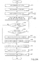
- FIG.3 is a flowchart showing a process of point retrieval based on addresses according to the present embodiment.
- the administrative district item field is clicked, the administrative district names are displayed in the form of a list in the order of the Japanese syllables on the right side of the item input page. Then, the user is prompted to select his/her desired administrative district name from the list, and thereby the address of the new point is inputted.
- Step3 When input of the address of the point is finished, retrieval of the new point (coordinates of the new point) is started (Step3).
- data about the retrieved new point i.e., each piece of data about each administrative district name of the retrieved new point in the fields 1 through n, is stored into the unit 3 (Step4).
- data about the address of the retrieved new point is stored into the unit 3 on a field-to-field basis (i.e., on an administrative district -to-district basis). This helps the user to input his/her desired address on an administrative district-to-district basis, which simplifying a process for inputting the address of a point.
- FIG.4 illustrates a process for inputting an address of a point to be retrieved according to the preferred embodiment.
- FIG. 4(a) shows an initial state of the input page.
- the left side of the input page displays administrative district items while the right side of the input page is blank.
- the input of the administrative district name in each field is done with a click.
- the input page goes to the item input page.
- the administrative district names are displayed in the form of a list on the right side. Then, the user is prompted to select his/her desired name of the administrative district from the list.
- a series of said processes is repeated to the number of the administrative district item fields, and thereby the address of a point is inputted as a whole.
- retrieval of the point (coordinates of the point) is started.
- data about the address of the retrieved point i.e., each piece of data about each administrative district name of the retrieved point is stored into the unit 3 on a field-to-field basis (i.e., on an administrative district-to-district basis).
- the input page in its initial state displays, as shown in FIG.4(b) , the address that was inputted last time around.
- the address input page in its initial state helps to simplify a process for inputting a new address. For example, if the new address slightly differs from a past-inputted address in administrative district items of "Ooaza, or a large hamlet,” (a large collection of dwellings), "Koaza/Cho-me, or a small hamlet” (a small collection of dwellings), and “Banchi, or House number,” the user is allowed to input the new address based on the input page in its initial state, by changing the names of only "Koaza/Cho-me, or a small hamlet” (a small collection of dwellings), and “Banchi, or House number,” as shown in FIG.4(d) while having left the names of "Administrative divisions of Japan” (the Tokyo metropolitan area, Hokkaido, and other prefectures), "Cities, Towns and Village
- the map display device makes full use of the address that was inputted last time around, which simplifying a process for inputting an address of a new point located near the past-retrieved point whose address was inputted last time, and thereby facilitating easy point retrieval.
- data about every address of every past-retrieved point is stored on a field-to-field basis (i.e., administrative district-to-district basis).
- a field-to-field basis i.e., administrative district-to-district basis.
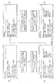
- FIG. 5 shows historic records of the inputted addresses of points that were retrieved seven times in the past.
- FIG. 6 illustrates data structure of the historic records of the inputted addresses of the past-retrieved points shown in FIG. 5 .
- the data structure of the historic records takes the form of a treelike chart in which data about upper administrative district item field is linked to data about lower administrative district item field.
- "Aichi-prefecture" in the administrative district item field 1 links up with “Nagoya-city,” “Okazaki-city,” and “Anjo-city” in the administrative district item field 2.
- "Nagoya-city” in the field 2 links up with “Midori-ward” and “Minami-ward” in the administrative district item field 3.
- "Okazaki-city” in the field 2 links up with "Wakamatsu-cho” and “Oka-cho” in the field 3.
- "Anjo-city” in the field 2 links up with "Fujii-cho” in the item field 3.
- every data in the field 3 links up with data in the administrative district item field 4.
- the data in the field 4 links up with data in the administrative district field 5.
- Said data structure can eliminate duplication of storing the same administrative district names, and thereby saving memory space in the map display device. This enables a limited memory space to store voluminous historic records of the inputted addresses of the past-retrieved points.
- FIG. 7 illustrates a process for inputting an address of a point to be retrieved based on data structure shown in FIG. 6 .
- FIG.7(a) shows an initial state of the input page on which the historic records of the inputted address of the past -retrieved point is displayed.
- a mark ⁇ at the right end of the administrative district item field indicates that the field has a plurality of the administrative district names inputted in the past.
- the mark ⁇ tells that the historic records of the inputted address of the past-retrieved points allow the user to select his/her desired administrative district name therefrom.
- "Aichi-prefecture" is selected for the field 1 of "Administrative divisions of Japan".
- selection of the upper administrative district name may cause automatic sequential input of the lower administrative district names based on the historic records of the inputted address of the past-retrieved points. If there is a plurality of administrative district names for one field, they are displayed in the form of a list so that the user can select his/her desired administrative district name from that list. If there is only one administrative district name for one field, it is automatically selected as the user-desired administrative district name and displayed in the field. Such automatic selection of the administrative district name can simplify the process for inputting the address.
- the selection of the upper administrative district name is carried out under circumstances where there is a plurality of administrative district names for one lower administrative district item field below the selected upper administrat ive district item field.
- the latest record of the inputted address of the past-retrieved point i.e., the administrative district name that was inputted last time around, is automatically selected for the lower administrative district item field. If such lower administrative district name according to the latest record is unwanted by the user, the other administrative district names for the lower administrative district item field are displayed one by one in the order in which they were inputted for the point retrieval.
- address data or the like is exchanged between two computers that differ with each other; for instance, between a map display device and a personal computer.
- the difference between the map display device and the personal computer sometimes causes lack of data-portability between them.
- data stored in the personal computer is exported to the map display device.
- portability of the address data concerning the administrative district names is sometimes lost while the portability of coordinates data about the administrative districts is maintained.
- the data processing unit in the map display device is designed to derive address information from the coordinates data exported from other systems, for example, a personal computer, a portable telephone, a navigation device, etc.
- the derived address information serving as the address data concerning administrative district name is stored into the unit 3 and used in inputting the administrative district name into each administrative district item field.
- the address data i.e., the address information derived from the coordinates data, stored in other systems may be used in the map display device. This enhances the usefulness of the simplified process for inputting the address of a point to be retrieved.
- FIG.9 illustrates other exemplary process of point retrieval based on addresses according to the preferred embodiment.
- Step S11 press a destination-setting button provided on a menu page displayed on the map display device.
- Step S12 press a destination-selecting button provided on that next page.
- Step S13 select a desired registered point from the list.
- Step S14 select a map that covers an area including the selected registered point.
- Said map is provided with the following on-screen keys; "Details” key with which a detailed map is displayed, “Wide area” key with which a wide-area map is displayed, “Back” key with which the page returns to a previous page, and "Set” key with which a destination is set.
- Step S15 judge whether "Set” key is pressed.
- Step S19 the process goes to Step S19 and the desired registered point (selected in Step S13) is set as a destination.
- Step S16 judge whether "Back” key is pressed. If it is judged that "Back” key is pressed, the page goes to the input page, e.g. to a Japanese syllables input page, as shown in FIG.9(c) (Step S17).
- Step S18 After pressing "Transliterate” key, the page goes to another page as shown in FIG.9(d) (Step S18) and then "Aichi-prefecture, Anjo-city, Ogawa-cho" is set as a destination (Step S19). Upon set of the destination, a route to the destination is searched (Step S20). Then, route guidance along the searched route is started (Step S21).
- the map display according to the present invention makes full use of historic records of the inputted addresses of the past-retrieved points, which simplifying a process for input ting the address of a point located near the past-retrieved point, and thereby facilitating easy point retrieval.
- the map display device may be an in-car map display device comprising present position detection means, input means, and communication means, wherewith the following processes are carried out.
- present position data, guide data, etc. are transmitted from the in-car map display device to a information center, the center searches for a route and sends back the searched route together with guide information thereof, etc. to the in-car map display device.
- the map display device Upon receipt of the searched route, the guide information thereof, etc., the map display device outputs them to the user.
- the information center comprising retrieval means, route search means, etc. contains cartographic data, address data, point data, and data about historic records of inputted address of the past -retrieved points stored in the form of the treelike chart as shown in FIG.6 .
- the information center receives said data related to point retrieval from the in-car map display device, the information center sends back to the in-ear map display device as shown in FIG.7 pieces of information about an input page from which an address is inputted on an administrative-district-to-district basis.
- the in -car map display device calls up the input page.
- the information center Upon clicking the left or right side of the administrative district item field provided on the input page, the information center starts to retrieve the address data and the data about historic records of the inputted address of the past -retrieved point. Then, the center sends back the retrieved data to the in-car map display device.
- a point retrieval request from the in-car map display device causes the information center to retrieve data necessary for the address input in the in-car map display device, which simplifying the process for inputting the address and thereby enhancing the usefulness of the simplified address input for easy point retrieval.
- the present invention provides a map display device that makes full use of historic records of the inputted addresses of the past-retrieved points, which simplifying a process for inputting the address of a point located near the past-retrieved point and thereby facilitating easy point retrieval.
- address notation and the displayed informations are adapted for Japan, it will become apparent to those skilled in the art that various changes and modifications, like the language, the language letters and specific address notation may be adapted to any country or region.
Landscapes
- Engineering & Computer Science (AREA)
- Radar, Positioning & Navigation (AREA)
- Remote Sensing (AREA)
- Human Computer Interaction (AREA)
- Automation & Control Theory (AREA)
- Physics & Mathematics (AREA)
- General Physics & Mathematics (AREA)
- Navigation (AREA)
- Information Retrieval, Db Structures And Fs Structures Therefor (AREA)
- Instructional Devices (AREA)
- Traffic Control Systems (AREA)
Applications Claiming Priority (2)
| Application Number | Priority Date | Filing Date | Title |
|---|---|---|---|
| JP2002349216A JP4560760B2 (ja) | 2002-11-29 | 2002-11-29 | 地図表示装置およびプログラム |
| EP03027273.6A EP1462766B1 (de) | 2002-11-29 | 2003-11-28 | Kartenanzeigevorrichtung und -programm |
Related Parent Applications (3)
| Application Number | Title | Priority Date | Filing Date |
|---|---|---|---|
| EP03027273.6A Division-Into EP1462766B1 (de) | 2002-11-29 | 2003-11-28 | Kartenanzeigevorrichtung und -programm |
| EP03027273.6A Division EP1462766B1 (de) | 2002-11-29 | 2003-11-28 | Kartenanzeigevorrichtung und -programm |
| EP03027273.6 Division | 2003-11-28 |
Publications (2)
| Publication Number | Publication Date |
|---|---|
| EP2207015A2 true EP2207015A2 (de) | 2010-07-14 |
| EP2207015A3 EP2207015A3 (de) | 2014-09-10 |
Family
ID=32751827
Family Applications (2)
| Application Number | Title | Priority Date | Filing Date |
|---|---|---|---|
| EP03027273.6A Expired - Lifetime EP1462766B1 (de) | 2002-11-29 | 2003-11-28 | Kartenanzeigevorrichtung und -programm |
| EP10155636.3A Ceased EP2207015A3 (de) | 2002-11-29 | 2003-11-28 | Kartenanzeigevorrichtung und Programm dafür |
Family Applications Before (1)
| Application Number | Title | Priority Date | Filing Date |
|---|---|---|---|
| EP03027273.6A Expired - Lifetime EP1462766B1 (de) | 2002-11-29 | 2003-11-28 | Kartenanzeigevorrichtung und -programm |
Country Status (4)
| Country | Link |
|---|---|
| US (1) | US7218246B2 (de) |
| EP (2) | EP1462766B1 (de) |
| JP (1) | JP4560760B2 (de) |
| CN (2) | CN2690977Y (de) |
Families Citing this family (20)
| Publication number | Priority date | Publication date | Assignee | Title |
|---|---|---|---|---|
| ATE389867T1 (de) * | 2004-04-30 | 2008-04-15 | Harman Becker Automotive Sys | Fahrzeugmultimediasystem und -verfahren zur aktivierung einer funktion eines solchen systems |
| WO2007056449A2 (en) | 2005-11-07 | 2007-05-18 | Google Inc. | Mapping in mobile devices |
| JP2010515898A (ja) * | 2007-01-10 | 2010-05-13 | トムトム インターナショナル ベスローテン フエンノートシャップ | ナビゲーション装置における省電力の方法、及び、省電力ナビゲーション装置 |
| JP4293242B2 (ja) * | 2007-01-22 | 2009-07-08 | 株式会社デンソー | 車両用ナビゲーション装置 |
| WO2009054130A1 (ja) * | 2007-10-23 | 2009-04-30 | Panasonic Corporation | 目的地表示装置および目的地表示方法 |
| JP5182614B2 (ja) * | 2007-12-07 | 2013-04-17 | アイシン・エィ・ダブリュ株式会社 | 検索装置、ナビゲーション装置、及び検索プログラム |
| US8401780B2 (en) * | 2008-01-17 | 2013-03-19 | Navteq B.V. | Method of prioritizing similar names of locations for use by a navigation system |
| JP2009210539A (ja) * | 2008-03-06 | 2009-09-17 | Aisin Aw Co Ltd | 目的地検索支援装置、及び目的地検索支援プログラム |
| JP4636391B2 (ja) * | 2008-03-12 | 2011-02-23 | アイシン・エィ・ダブリュ株式会社 | 目的地設定支援装置、及び目的地設定支援プログラム |
| US8249804B2 (en) * | 2008-08-20 | 2012-08-21 | Mitac International Corporation | Systems and methods for smart city search |
| JP5367346B2 (ja) * | 2008-11-26 | 2013-12-11 | アルパイン株式会社 | ナビゲーション装置及び目的地設定方法 |
| JP5426911B2 (ja) * | 2009-03-30 | 2014-02-26 | 株式会社ゼンリン | 住所候補表示システム |
| CN102521717B (zh) * | 2011-12-30 | 2016-03-30 | 山东中创软件工程股份有限公司 | 一种配置管理资源库信息统计的方法与装置 |
| DE102012201964B3 (de) * | 2012-02-09 | 2013-06-06 | Behr-Hella Thermocontrol Gmbh | Verfahren zur Auswahl eines Eingabeparameters |
| JP2013246673A (ja) * | 2012-05-28 | 2013-12-09 | Oki Electric Ind Co Ltd | 照会システム、照会端末、及び、プログラム |
| KR101431666B1 (ko) * | 2013-01-03 | 2014-08-20 | 주식회사 다음커뮤니케이션 | 위치 정보 제공 방법 및 서버 장치 |
| JP6044377B2 (ja) * | 2013-02-07 | 2016-12-14 | 株式会社デンソー | 地点検索装置 |
| CN104424227B (zh) * | 2013-08-26 | 2019-10-11 | 阿尔派株式会社 | 内容检索装置及内容检索方法 |
| CN112182324A (zh) * | 2020-10-09 | 2021-01-05 | 浪潮云信息技术股份公司 | 一种判断地址中行政区划名称从属关系的方法 |
| CN114357091B (zh) * | 2020-10-13 | 2026-01-02 | 浙江宇视科技有限公司 | 关系确定、图像采集器数量确定方法、装置、设备及介质 |
Citations (1)
| Publication number | Priority date | Publication date | Assignee | Title |
|---|---|---|---|---|
| JPH09229708A (ja) | 1996-02-14 | 1997-09-05 | Zexel Corp | 車両ナビゲーション・システムにおける目的地を選択する方法および装置 |
Family Cites Families (21)
| Publication number | Priority date | Publication date | Assignee | Title |
|---|---|---|---|---|
| US5191532A (en) * | 1987-12-05 | 1993-03-02 | Aisin Aw Co., Ltd. | Navigation apparatus |
| JP2857490B2 (ja) * | 1990-11-21 | 1999-02-17 | 株式会社日立製作所 | 学習機能をもつ地図システム |
| JP2917856B2 (ja) | 1995-05-15 | 1999-07-12 | 住友電気工業株式会社 | ナビゲーション装置における項目検索装置 |
| JPH09204480A (ja) * | 1996-01-26 | 1997-08-05 | Hitachi Ltd | 金融取引システムにおける取引地点管理方法 |
| JP3724036B2 (ja) * | 1996-02-06 | 2005-12-07 | 富士通株式会社 | 情報入力装置 |
| JP3186655B2 (ja) * | 1996-07-31 | 2001-07-11 | アイシン・エィ・ダブリュ株式会社 | 車両用ナビゲーション装置及び記憶媒体 |
| KR100279366B1 (ko) * | 1996-07-31 | 2001-01-15 | 모리 하루오 | 차량용네비게이션장치 |
| US5839088A (en) * | 1996-08-22 | 1998-11-17 | Go2 Software, Inc. | Geographic location referencing system and method |
| JPH1137783A (ja) * | 1997-07-18 | 1999-02-12 | Fujitsu Ten Ltd | ナビゲーション装置 |
| DE19742054A1 (de) * | 1997-09-24 | 1999-04-01 | Philips Patentverwaltung | Eingabesystem wenigstens für Orts- und/oder Straßennamen |
| KR100269135B1 (ko) * | 1997-12-09 | 2000-10-16 | 윤종용 | 지리정보서비스장치및그방법 |
| JPH11224265A (ja) * | 1998-02-06 | 1999-08-17 | Pioneer Electron Corp | 情報検索装置及び情報検索方法並びに情報検索プログラムを記録した記録媒体 |
| JP3797405B2 (ja) * | 1998-03-23 | 2006-07-19 | アイシン・エィ・ダブリュ株式会社 | 車両用ナビゲーション装置及び記憶媒体 |
| JP2000010472A (ja) * | 1998-06-25 | 2000-01-14 | Zenrin Co Ltd | 地図表示装置及び方法 |
| JP3944671B2 (ja) * | 1999-08-06 | 2007-07-11 | アイシン・エィ・ダブリュ株式会社 | ナビゲーション装置 |
| JP2002048581A (ja) * | 2000-08-01 | 2002-02-15 | Alpine Electronics Inc | ナビゲーション装置 |
| CN1338720A (zh) * | 2000-08-10 | 2002-03-06 | 神乎科技股份有限公司 | 地理位置信息系统 |
| JP4631150B2 (ja) * | 2000-10-31 | 2011-02-16 | ソニー株式会社 | 情報処理装置及び方法、並びに記録媒体 |
| JP2002175301A (ja) * | 2000-12-07 | 2002-06-21 | Nippon Telegraph & Telephone West Corp | 地図情報検索装置および方法 |
| JP2002304355A (ja) * | 2001-04-05 | 2002-10-18 | Seiko Epson Corp | データ登録装置及びデータ登録方法 |
| US6484094B1 (en) * | 2002-02-19 | 2002-11-19 | Alpine Electronics, Inc. | Display method and apparatus for navigation system |
-
2002
- 2002-11-29 JP JP2002349216A patent/JP4560760B2/ja not_active Expired - Fee Related
-
2003
- 2003-07-31 CN CNU032758790U patent/CN2690977Y/zh not_active Expired - Fee Related
- 2003-07-31 CN CNB031524443A patent/CN1326032C/zh not_active Expired - Fee Related
- 2003-11-26 US US10/722,137 patent/US7218246B2/en not_active Expired - Lifetime
- 2003-11-28 EP EP03027273.6A patent/EP1462766B1/de not_active Expired - Lifetime
- 2003-11-28 EP EP10155636.3A patent/EP2207015A3/de not_active Ceased
Patent Citations (2)
| Publication number | Priority date | Publication date | Assignee | Title |
|---|---|---|---|---|
| JPH09229708A (ja) | 1996-02-14 | 1997-09-05 | Zexel Corp | 車両ナビゲーション・システムにおける目的地を選択する方法および装置 |
| EP1150268A1 (de) * | 1996-02-14 | 2001-10-31 | Visteon Technologies, Inc. | Verfahren und Vorrichtung zur Auswahl des Zieles bei einem Navigationssystem im Fahrzeug |
Also Published As
| Publication number | Publication date |
|---|---|
| EP1462766B1 (de) | 2019-08-07 |
| CN2690977Y (zh) | 2005-04-06 |
| EP1462766A3 (de) | 2007-05-23 |
| US20040164877A1 (en) | 2004-08-26 |
| JP4560760B2 (ja) | 2010-10-13 |
| CN1326032C (zh) | 2007-07-11 |
| EP2207015A3 (de) | 2014-09-10 |
| EP1462766A2 (de) | 2004-09-29 |
| US7218246B2 (en) | 2007-05-15 |
| JP2004184563A (ja) | 2004-07-02 |
| CN1504867A (zh) | 2004-06-16 |
Similar Documents
| Publication | Publication Date | Title |
|---|---|---|
| EP1462766B1 (de) | Kartenanzeigevorrichtung und -programm | |
| EP0822530B1 (de) | Fahrzeugnavigationssystem und Speichermedium | |
| EP1087207B1 (de) | Punktssuchausgabesystem mittels einer Telefonnummer und Speichermedium | |
| EP1816438B1 (de) | Verfahren und Vorrichtung zur Suche nach Punkten von Interesse nach Namen oder Telefonnummer | |
| US20080167809A1 (en) | Search function for portable navigation device | |
| US6807480B1 (en) | Navigation system and a memory medium | |
| CN101641568A (zh) | 用于便携式导航装置的改进的搜索功能 | |
| US20090144268A1 (en) | Facility information output device, facility information output method, and computer-readable medium storing facility information output program | |
| JP4226491B2 (ja) | 検索データの更新システムおよびナビゲーション装置 | |
| EP2023090A2 (de) | Navigationsvorrichtung und Navigationsprogramm | |
| JP4444677B2 (ja) | 検索データの更新方法および更新システム | |
| EP2141610A2 (de) | Navigationsvorrichtung, Fahrzeug und Navigationsprogramm | |
| EP0827124B1 (de) | Fahrzeugsnavigationssystem mit Beschleunigung von Stadtnamenselektion und Programmspeichermedium | |
| JPH1096647A (ja) | 車両用ナビゲーション装置及び記憶媒体 | |
| EP2261822A1 (de) | Punktsuchvorrichtung, Punktsuchverfahren und Computerprogrammprodukt | |
| US20070192022A1 (en) | Method for selecting a location | |
| EP2101152A2 (de) | Unterstützungsvorrichtung und -programm zum Einstellen von Zielen | |
| JP4873529B2 (ja) | 施設検索装置及びその方法並びにプログラム | |
| EP2194470A1 (de) | Suchvorrichtung und Suchverfahren sowie computerlesbares Medium zur Speicherung des Suchprogramms | |
| JP2001296136A (ja) | ナビゲーション装置及び記憶媒体 | |
| KR100848834B1 (ko) | 네비게이션 장치를 이용한 통합 검색 장치 및 방법 | |
| KR100213763B1 (ko) | 차량항법시스템의 지명검색방법 | |
| JP2006138743A (ja) | ナビゲーション装置及び記憶媒体 | |
| JP2006228149A (ja) | 地域検索装置、ナビゲーション装置、その制御方法及び制御プログラム | |
| KR20090107712A (ko) | 더블 인덱싱을 이용한 한글 데이터 검색 방법 및 시스템 |
Legal Events
| Date | Code | Title | Description |
|---|---|---|---|
| PUAI | Public reference made under article 153(3) epc to a published international application that has entered the european phase |
Free format text: ORIGINAL CODE: 0009012 |
|
| AC | Divisional application: reference to earlier application |
Ref document number: 1462766 Country of ref document: EP Kind code of ref document: P |
|
| AK | Designated contracting states |
Kind code of ref document: A2 Designated state(s): AT BE BG CH CY CZ DE DK EE ES FI FR GB GR HU IE IT LI LU MC NL PT RO SE SI SK TR |
|
| PUAL | Search report despatched |
Free format text: ORIGINAL CODE: 0009013 |
|
| AK | Designated contracting states |
Kind code of ref document: A3 Designated state(s): AT BE BG CH CY CZ DE DK EE ES FI FR GB GR HU IE IT LI LU MC NL PT RO SE SI SK TR |
|
| RIC1 | Information provided on ipc code assigned before grant |
Ipc: G01C 21/36 20060101AFI20140806BHEP |
|
| 17P | Request for examination filed |
Effective date: 20150309 |
|
| RBV | Designated contracting states (corrected) |
Designated state(s): AT BE BG CH CY CZ DE DK EE ES FI FR GB GR HU IE IT LI LU MC NL PT RO SE SI SK TR |
|
| 17Q | First examination report despatched |
Effective date: 20180820 |
|
| RIN1 | Information on inventor provided before grant (corrected) |
Inventor name: WATARU, CHIBA |
|
| STAA | Information on the status of an ep patent application or granted ep patent |
Free format text: STATUS: THE APPLICATION HAS BEEN REFUSED |
|
| 18R | Application refused |
Effective date: 20191015 |