EP2573586A1 - Verfahren und System zur Steuerung eines Luftfahrzeugs in der Anflugphase auf eine Landebahn - Google Patents
Verfahren und System zur Steuerung eines Luftfahrzeugs in der Anflugphase auf eine Landebahn Download PDFInfo
- Publication number
- EP2573586A1 EP2573586A1 EP12185165A EP12185165A EP2573586A1 EP 2573586 A1 EP2573586 A1 EP 2573586A1 EP 12185165 A EP12185165 A EP 12185165A EP 12185165 A EP12185165 A EP 12185165A EP 2573586 A1 EP2573586 A1 EP 2573586A1
- Authority
- EP
- European Patent Office
- Prior art keywords
- aircraft
- satellites
- position information
- faf
- approach
- Prior art date
- Legal status (The legal status is an assumption and is not a legal conclusion. Google has not performed a legal analysis and makes no representation as to the accuracy of the status listed.)
- Granted
Links
- 238000013459 approach Methods 0.000 title claims abstract description 98
- 238000000034 method Methods 0.000 title claims abstract description 24
- 230000003416 augmentation Effects 0.000 claims description 21
- 238000012545 processing Methods 0.000 claims description 11
- 101000972822 Homo sapiens Protein NipSnap homolog 2 Proteins 0.000 claims 1
- 102100022564 Protein NipSnap homolog 2 Human genes 0.000 claims 1
- 235000013929 Psidium pyriferum Nutrition 0.000 claims 1
- 244000236580 Psidium pyriferum Species 0.000 claims 1
- 230000000630 rising effect Effects 0.000 claims 1
- 238000005259 measurement Methods 0.000 description 5
- 230000008901 benefit Effects 0.000 description 4
- 238000010586 diagram Methods 0.000 description 3
- 238000012544 monitoring process Methods 0.000 description 3
- RZVHIXYEVGDQDX-UHFFFAOYSA-N 9,10-anthraquinone Chemical compound C1=CC=C2C(=O)C3=CC=CC=C3C(=O)C2=C1 RZVHIXYEVGDQDX-UHFFFAOYSA-N 0.000 description 2
- 208000035690 Familial cold urticaria Diseases 0.000 description 2
- 206010064570 familial cold autoinflammatory syndrome Diseases 0.000 description 2
- 230000003321 amplification Effects 0.000 description 1
- 238000001391 atomic fluorescence spectroscopy Methods 0.000 description 1
- 238000010276 construction Methods 0.000 description 1
- 230000000694 effects Effects 0.000 description 1
- 230000007717 exclusion Effects 0.000 description 1
- 208000032215 forsythe-wakeling syndrome Diseases 0.000 description 1
- 238000000883 frequency modulation spectroscopy Methods 0.000 description 1
- 238000003199 nucleic acid amplification method Methods 0.000 description 1
- 230000008520 organization Effects 0.000 description 1
- 230000036578 sleeping time Effects 0.000 description 1
- 230000002123 temporal effect Effects 0.000 description 1
Images


Classifications
-
- G—PHYSICS
- G01—MEASURING; TESTING
- G01S—RADIO DIRECTION-FINDING; RADIO NAVIGATION; DETERMINING DISTANCE OR VELOCITY BY USE OF RADIO WAVES; LOCATING OR PRESENCE-DETECTING BY USE OF THE REFLECTION OR RERADIATION OF RADIO WAVES; ANALOGOUS ARRANGEMENTS USING OTHER WAVES
- G01S19/00—Satellite radio beacon positioning systems; Determining position, velocity or attitude using signals transmitted by such systems
- G01S19/01—Satellite radio beacon positioning systems transmitting time-stamped messages, e.g. GPS [Global Positioning System], GLONASS [Global Orbiting Navigation Satellite System] or GALILEO
- G01S19/13—Receivers
- G01S19/24—Acquisition or tracking or demodulation of signals transmitted by the system
- G01S19/28—Satellite selection
-
- G—PHYSICS
- G01—MEASURING; TESTING
- G01S—RADIO DIRECTION-FINDING; RADIO NAVIGATION; DETERMINING DISTANCE OR VELOCITY BY USE OF RADIO WAVES; LOCATING OR PRESENCE-DETECTING BY USE OF THE REFLECTION OR RERADIATION OF RADIO WAVES; ANALOGOUS ARRANGEMENTS USING OTHER WAVES
- G01S19/00—Satellite radio beacon positioning systems; Determining position, velocity or attitude using signals transmitted by such systems
- G01S19/01—Satellite radio beacon positioning systems transmitting time-stamped messages, e.g. GPS [Global Positioning System], GLONASS [Global Orbiting Navigation Satellite System] or GALILEO
- G01S19/13—Receivers
- G01S19/14—Receivers specially adapted for specific applications
- G01S19/15—Aircraft landing systems
-
- G—PHYSICS
- G01—MEASURING; TESTING
- G01S—RADIO DIRECTION-FINDING; RADIO NAVIGATION; DETERMINING DISTANCE OR VELOCITY BY USE OF RADIO WAVES; LOCATING OR PRESENCE-DETECTING BY USE OF THE REFLECTION OR RERADIATION OF RADIO WAVES; ANALOGOUS ARRANGEMENTS USING OTHER WAVES
- G01S19/00—Satellite radio beacon positioning systems; Determining position, velocity or attitude using signals transmitted by such systems
- G01S19/01—Satellite radio beacon positioning systems transmitting time-stamped messages, e.g. GPS [Global Positioning System], GLONASS [Global Orbiting Navigation Satellite System] or GALILEO
- G01S19/13—Receivers
- G01S19/20—Integrity monitoring, fault detection or fault isolation of space segment
Definitions
- the present invention relates to the field of aircraft navigation and more particularly to the determination of the calculated position of an aircraft, based on the GNSS ("Global Navigation Satellite System”) satellite navigation, such as GPS, during the flight. final approach part of a precision approach in automatic mode, up to an automatic landing also called “autoland” in English terminology.
- the invention relates more particularly to a method and a device for controlling the aircraft during said final approach, such as the lateral and vertical deviation information supplied to an autopilot and in particular to the guidance laws of the aircraft. Precision approach does not undergo jumps that could affect the performance of the approach and the automatic landing.
- landing aid systems that allow an aircraft to fly precision approach operations. These systems provide an undeniable operational benefit, allowing to guide the aircraft safely thanks to a vertical guidance to a decision height corresponding to minima generally less than or equal to 200 feet (about 60 meters) which are a function of the category (cat-I to cat-III) of the precision approach considered. These minima are even null for Cat-IIIC category approaches. Some of these approaches may correspond to a fully automatic landing.
- the main landing aid systems that can be used to achieve precision approaches are ILS ("Instrument Landing System") and MLS ("Microwave Landing System"). These landing aid systems use one or more dedicated ground stations for this purpose and means, on board the aircraft, for receiving signals emitted by said ground stations.
- augmentation techniques make it possible to improve the accuracy, integrity, continuity and availability of the position information used by said landing aid systems.
- ICAO International Civil Aviation Organization
- GBAS Ground Based Augmentation System
- GLS Ground Based Augmentation Landing System
- said position information is calculated in 3 dimensions from distance measurements, called pseudo-distance between the GNSS satellites and one or more GNSS receivers aboard the aircraft.
- the performance and temporal behavior of the 3-dimensional GNSS position depend on different contributors of errors related to the constellation of satellites, the effects of the GPS signal propagation in the atmosphere and the quality of the receiver on the one hand, and the geometry of the GNSS constellation on the other hand. For example, in the case of the existing GPS constellation, a user receiver sees satellites rise and / or fold due to their movement in orbit around the earth, orbit whose revolution is 23 hours 56 minutes.
- a satellite can also be removed from the GPS-based position calculation due to a failure of said satellite detected by the receiver through an augmentation system such as SBAS, GBAS or ABAS.
- This addition or withdrawal of one or more satellites in the calculation of the position of the aircraft, during the approach, can induce position jumps of a few meters. These positional jumps, which are acceptable in the context of approaches limited to a decision height, for example 200 feet (about 60 meters), may no longer be acceptable for precision approaches with a lower decision height. especially in case of automatic landing.
- EP1 965 219 A1 describes a method for predicting the performance of a satellite navigation system. However, this document does not teach any solution to avoid such positional jumps.
- the present invention aims to overcome the aforementioned drawbacks. It relates to a method of piloting an aircraft during an approach for landing on an airstrip, said approach being previously selected and the guidance of the aircraft during said approach using position information of the aircraft obtained from at least one GNSS satellite navigation system.
- This method thus has the advantage of avoiding a jump in the value of said position which would be due to the exclusion of a satellite relative to the aircraft during the final approach, since the satellites could be excluded during this final approach is not taken into account, since the beginning of the final approach, for the determination of the position of the aircraft.
- the set of satellites corresponds to the satellites likely to lie down, with respect to the aircraft, during said time interval. This avoids a jump in the value of said position that would be due to the sunset of a satellite relative to the aircraft during the final approach.
- this set of satellites further comprises the satellites that can rise, relative to the aircraft, during said time interval. This avoids a jump in the value of said position which would be due to the lifting of a satellite relative to the aircraft during the final approach.
- said first time t FAF is determined by calculating an estimated ETF arrival time FAF of the aircraft at the final approach start position and said second time t TD is determined by calculating an estimated time of arrival ETA TD of the aircraft at the landing position on the runway.
- said position information of the aircraft is obtained by combining information from at least one GNSS satellite navigation system and at least one augmentation system.
- Said at least one augmentation system may in particular be of the SBAS type, of the ABAS type or of the GBAS type.
- the use of information from an augmentation system improves the integrity of the position information.
- the use of augmentation systems of the SBAS or ABAS type also makes it possible to carry out an approach on an airport not equipped with ground stations.
- said position information of the aircraft is obtained by using a plurality of GNSS satellite navigation systems.
- This has the advantage of allowing the calculation of the position information even if the number of non-excluded satellites belonging to the same satellite navigation system and usable during the final approach was insufficient to calculate such position information.
- the use of satellites belonging to other satellite navigation systems makes it possible to compensate for such an insufficiency.
- it can improve the accuracy, integrity and continuity of said position information.
- the processing unit is furthermore able to receive information from an augmentation system and to determine the position information of the aircraft from at least signals received from the navigation system.
- this control system comprises means capable of receiving signals from a plurality of GNSS satellite navigation systems, the processing unit determining the position information of the aircraft from at least the signals received from said plurality of GNSS satellite navigation systems.
- the invention also relates to an aircraft comprising a steering system as mentioned above.
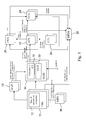
- the figure 1 represents a control system of an aircraft according to the invention.
- This control system comprises several flight control computers of the aircraft, in particular a Flight Management System (FMS) 10 and a multi-mode receiver 14 MMR ("Multi Mode Receiver"). English).
- This receiver 14 comprises in particular means 30 for receiving GNSS signals, for example GPS. It also includes one or more computers 15 supporting the xLS functions available on the aircraft, where the term xLS generically indicates the different landing assistance systems such as ILS, MLS, GLS ...
- the flight management computer 10 FMS includes a navigation database 12.
- This database contains in particular information relating to approaches to landing strips.
- the flight management computer 10 is connected to a man-machine interface 16 which can for example be of the MFD ("Multi Function Display” in English) or MCDU ("Multipurpose Control and Display Unit") type. in English).
- the control system also comprises a guidance computer 18, for example of the AFS ("Auto Flight System") type, which is capable of calculating aircraft guidance commands, which can be used by the autopilot in the same mode. automatic guidance or by a flight director.
- This guidance calculator is connected to a man-machine interface 20, for example of the FCU type ("Flight Control Unit" in English).
- the different computers of the control system are preferably subject to redundancy for reasons of operational safety.
- the control system may comprise two or three FMSs, two MMRs, two or three AFSs, two FCUs, two RMPs, two EFISs, two FWSs and two DFDRs.
- the control system can be implemented both by means of calculators specific to each function (FMS, MMR, FWS 7) generally called LRU ("Line Replacement Unit” in English), as in the form of a distributed modular architecture type IMA ("Integrated Modular Avionics" in English) in which the different functions are implemented in non-specific computers communicating with each other.
- LRU Line Replacement Unit
- IMA Integrated Modular Avionics
- a pilot of the aircraft selects an approach of said runway from among the possible approaches for this runway, recorded in the navigation database 12 of the flight management computer 10. It may in particular select this approach by means of the interface MCDU 16. This selection can be made either during the construction of the flight plan in the FMS, or during a cruise phase of the aircraft, before the approach. In the remainder of the document, only the case where the type of the selected approach is such that the guidance of the aircraft along the approach axis, in particular along the final approach axis, will be considered. 3, is achieved using position information of the aircraft obtained from at least one GNSS satellite navigation system.
- the final approach corresponds to the part of the approach comprised of a point FAF ("Final Approach Fix”) corresponding to the beginning of the final approach and a TD point ("Touch Down” in English) corresponding to the landing of the aircraft on runway 2, in particular the point of touchdown of the aircraft on the runway.
- FAF is generally a predetermined point mentioned in the navigation database 12.
- the instants T FAF and T TD are determined by the FMS which carries out for this, in a known manner, an estimation of the arrival time (called ETA, that is to say "Estimated Time of Arrival In English) of the aircraft at each of the points FAF and TD.
- the FMS thus determines the estimated arrival times ETA FAF and ETA TD respectively corresponding to the times T FAF and T TD .
- predetermined time margins ⁇ t FAF and ⁇ t TD are taken into account with respect to ETA FAF and ETA TD estimated arrival times, making it possible to overcome the uncertainties associated with estimating said arrival times.
- said predetermined time margins ⁇ t FAF and ⁇ t TD in a time interval of between 1 second and 30 seconds, preferably 10 seconds, depending on the accuracy of the estimation of the hours of operation. arrival ETA FAF and ETA TD .
- a set of satellites of said satellite navigation system which can be excluded from the calculation of said position information of the aircraft during at least part of the flight time interval is determined.
- time between said first and second instants T FAF and T TD is determined.
- the satellites likely to be excluded from said calculation preferably correspond to the satellites likely to lie, relative to the aircraft, during said time interval.
- the values of the instants T FAF and T TD are transmitted by the flight management computer 10 to the GNSS receiver 30 integrated in the multi-mode receiver MMR 14.
- the set of satellites of the satellite navigation system may be excluded from the calculation of the position information of the aircraft is then determined by calculation means integrated in said GNSS receiver 30.
- these calculation means may be part of a position calculation unit 34.
- said set of satellites In order to have the best possible estimate of the satellites likely to lie down during said time interval, it is preferable to determine said set of satellites shortly before the start of the final approach phase corresponding to the passage of the aircraft to point FAF. For example, the determination of said set of satellites can be performed at a time within the time interval [T FAF - 1 min; T FAF ].
- the current time t (k) corresponds to the moment when the determination of said set of satellites is made.
- the previous instant t (k-1) is chosen so as to have a sufficiently significant difference in the elevation angle of the satellite to obtain a sufficient precision of its variation as a function of time.
- t (k-1) earlier than a second at t (k).
- the figure 5 illustrates the concept of elevation angle ⁇ i of a satellite Si with respect to the aircraft 1.
- a horizontal plane 5 located at the altitude of the aircraft.
- the x and y axes shown in the figure are included in this horizontal plane and the z axis is perpendicular to said plane.
- a line segment between the aircraft 1 and the satellite Si is considered.
- the elevation angle ⁇ i of the satellite Si relative to the aircraft is the angle between said line segment and said horizontal plane 5.
- the orthogonal projection of said line segment on the horizontal plane 5 forms an angle ⁇ with respect to the x axis.
- the elevation angle is sometimes referred to as the elevation angle.
- Equation 1 makes it possible to determine an approximation of the variation ⁇ of the elevation of the satellite relative to the aircraft as a function of time.
- This variation ⁇ takes into account both the movement of the satellite and the movement of the aircraft. It is used in equation 2 to estimate the sleeping time of the satellite Si relative to the aircraft.
- the approximation that is made consists of considering the variation ⁇ as constant during the time interval between T FAF and T TD .
- the mask angle ⁇ mask is the angle below which it is considered on the one hand that the signals emitted by the satellite may no longer be received by the aircraft, for example due to the presence of obstacles and obstacles. On the other hand, the measures might not be sufficiently precise. In aeronautics, the value of this mask angle is usually 5 degrees for the satellites of the GPS navigation system and 10 degrees for the satellites of the Galileo system.
- the embodiment described above makes it possible to determine, in approximate but simple manner, the bedtimes of the satellites relative to the aircraft during the approach.
- a mode of determination based on calendar or ephemeris type information relating to the various satellites, for example contained in a database, which could be used in combination with information relating to the trajectory of the aircraft, to calculate the times of sunset of the different satellites with respect to the aircraft.
- the figure 4 is a schematic diagram of the GNSS receiver 30.
- a radio frequency (RF) reception head 38 receives high frequency signals from the different GNSS satellites (received by means of one or more antennas). In particular, it performs an amplification and a descent in frequency of said signals.
- the signals leaving said radiofrequency reception head 38 are processed by a signal processing module 32 which calculates pseudo-distance measurements for each of the GNSS satellites visible from the aircraft.
- the position calculation unit 34 receives these pseudo-distance measurements and uses them to determine the position of the aircraft, excluding the pseudo-distance measurements which correspond to satellites belonging to said set of satellites determined before the start of the flight. the final approach.
- this preferred mode is to freeze, before the start of the final approach, a set of satellites that will be used to determine the position of the aircraft throughout the final approach.
- the position information determined by the GNSS receiver position calculation unit 34 is used to guide the aircraft along its final approach course. For this, this position information is transmitted to the xLS calculator 15 which determines deflections of the aircraft relative to the final approach course. These deviations are transmitted to the AFS guidance computer 18 which determines guidance instructions for the aircraft.
- the guidance of the aircraft according to these guidance instructions is implemented either by an autopilot receiving said guidance instructions or by a pilot of the aircraft using a flight director receiving said guidance instructions.
- the guidance of the aircraft along its final approach course, according to said position information of the aircraft, is carried out up to a decision height corresponding to the approach considered. This guidance can go as far as the automatic landing in the case of certain approaches.
- the determination of the position information of the aircraft by the position calculation unit 34 takes into account not only the information coming from the GNSS satellites, but also information coming from a satellite system. increase and processed by an integrity monitoring unit 36 as shown in FIG. figure 4 . This makes it possible to improve in particular the integrity of said position information of the aircraft.
- the augmentation technique used may be of the SBAS or ABAS type, which makes it possible to improve the integrity of said position information of the aircraft without resorting to a ground station.
- a GBAS augmentation technique using ground stations.
- the satellites whose information is used for the determination of said position information belong to a plurality of GNSS satellite navigation systems.
- the GNSS navigation systems that may be used are for example and without limitation: GPS (United States), Galileo (Europe), GLONASS ( Russia), Compass / Beidou (China) ...
- This embodiment has the advantage of allowing the determination of the information of position of the aircraft even if the number of non-excluded satellites belonging to a satellite constellation of one of said GNSS navigation systems is insufficient to determine said position information with the required accuracy and integrity. Indeed, by combining the information from satellites belonging to several constellations corresponding to different GNSS satellite navigation systems, enough measurements of pseudo-distances relating to these satellites are obtained to determine an information of position of the aircraft.
Landscapes
- Engineering & Computer Science (AREA)
- Radar, Positioning & Navigation (AREA)
- Remote Sensing (AREA)
- Computer Networks & Wireless Communication (AREA)
- Physics & Mathematics (AREA)
- General Physics & Mathematics (AREA)
- Aviation & Aerospace Engineering (AREA)
- Position Fixing By Use Of Radio Waves (AREA)
- Traffic Control Systems (AREA)
- Navigation (AREA)
Applications Claiming Priority (1)
| Application Number | Priority Date | Filing Date | Title |
|---|---|---|---|
| FR1158446A FR2980618A1 (fr) | 2011-09-22 | 2011-09-22 | Procede et systeme de determination d'une information de position d'un aeronef lors d'une approche d'une piste d'atterrissage. |
Publications (2)
| Publication Number | Publication Date |
|---|---|
| EP2573586A1 true EP2573586A1 (de) | 2013-03-27 |
| EP2573586B1 EP2573586B1 (de) | 2014-09-10 |
Family
ID=46851340
Family Applications (1)
| Application Number | Title | Priority Date | Filing Date |
|---|---|---|---|
| EP20120185165 Not-in-force EP2573586B1 (de) | 2011-09-22 | 2012-09-20 | Verfahren und System zur Steuerung eines Luftfahrzeugs in der Anflugphase auf eine Landebahn |
Country Status (4)
| Country | Link |
|---|---|
| US (1) | US8818582B2 (de) |
| EP (1) | EP2573586B1 (de) |
| CN (1) | CN103018761B (de) |
| FR (1) | FR2980618A1 (de) |
Cited By (1)
| Publication number | Priority date | Publication date | Assignee | Title |
|---|---|---|---|---|
| FR3010807A1 (fr) * | 2013-09-13 | 2015-03-20 | Airbus Operations Sas | Procede et dispositif d'aide au pilotage d'un aeronef lors d'une phase d'approche en vue d'un atterrissage. |
Families Citing this family (22)
| Publication number | Priority date | Publication date | Assignee | Title |
|---|---|---|---|---|
| FR3002032B1 (fr) * | 2013-02-08 | 2016-02-12 | Dassault Aviat | Systeme et procede d'aide a la navigation d'un aeronef |
| US9223314B2 (en) | 2013-03-14 | 2015-12-29 | Aglunction, LLC | Hovering control for helicopters using a GNSS vector |
| US8862290B1 (en) * | 2013-04-18 | 2014-10-14 | Ge Aviation Systems Llc | Flight system for an aircraft having an autoland system |
| KR101715336B1 (ko) * | 2014-10-31 | 2017-03-10 | 한국항공우주연구원 | 항공기 착륙을 위한 통합 착륙 수신 장치 및 그 제어 방법 |
| CN106448275B (zh) * | 2014-12-30 | 2023-03-17 | 大连现代高技术集团有限公司 | 基于可视化的飞机泊位实时引导系统 |
| FR3039691B1 (fr) * | 2015-07-31 | 2017-07-21 | Airbus Operations Sas | Procede et systeme d'aide au guidage d'un aeronef le long d'un axe d'approche d'une piste d'atterrissage |
| US9734728B2 (en) * | 2015-08-20 | 2017-08-15 | Honeywell International Inc. | Systems and methods for destination selection for vehicle indications and alerts |
| KR101827820B1 (ko) * | 2015-10-26 | 2018-02-09 | 한국항공우주연구원 | 위성 항법 신호를 이용한 항공기 착륙 수신 장치 및 그 제어 방법 |
| DE102015119308B4 (de) | 2015-11-10 | 2019-02-21 | Deutsches Zentrum für Luft- und Raumfahrt e.V. | Verfahren und Vorrichtung zum Bereitstellen von Daten für eine Satellitennavigation-basierte automatische Landung an ein Flugzeug |
| FR3046228B1 (fr) * | 2015-12-29 | 2018-01-05 | Thales | Procede de representation graphique tridimensionnelle d'une piste d'atterrissage sur un dispositif de visualisation d'aeronef |
| US11865337B2 (en) | 2016-01-29 | 2024-01-09 | Brent C. Reider | Regulated and interactive muscle stimulation |
| US11724100B2 (en) | 2016-01-29 | 2023-08-15 | Brent C. Reider | Regulated and interactive muscle stimulation using sensory regulated EMG triggered stimulation for forging neural pathways |
| US10646711B2 (en) | 2016-01-29 | 2020-05-12 | Brent C. Reider | Interactive muscle training system and method |
| FR3058016B1 (fr) * | 2016-10-21 | 2019-08-23 | Airbus Operations | Procede et dispositif de gestion de configurations d'un aeronef. |
| US10176721B2 (en) * | 2016-12-06 | 2019-01-08 | Honeywell International Inc. | System and method to depict geodetic reference datum non-compliance regions, airports, and flight planning elements on avionics based displays |
| US10066944B1 (en) * | 2017-03-29 | 2018-09-04 | Rockwell Collins, Inc. | Multi-mode receiver (MMR) based inertial integration |
| FR3075994B1 (fr) | 2017-12-21 | 2023-11-24 | Airbus Operations Sas | Procede d'aide au pilotage d'un aeronef, permettant d'assurer la disponibilite d'un pilote automatique ou d'un regulateur de la poussee |
| FR3075993B1 (fr) * | 2017-12-21 | 2020-01-17 | Airbus Operations | Procede et systeme automatiques d'aide au pilotage d'un aeronef |
| CN108074421B (zh) * | 2018-01-29 | 2021-07-20 | 飞联网(上海)科技有限责任公司 | 一种基于时间的终端区进场效率测度方法 |
| CN108931990A (zh) * | 2018-07-19 | 2018-12-04 | 四川腾盾科技有限公司 | 一种大展弦比无人机无动力空滑着陆控制方法 |
| US11163067B2 (en) * | 2020-04-02 | 2021-11-02 | The Boeing Company | Interface device and method for retrofitting an airplane with GNSS landing capability |
| CN111596315B (zh) * | 2020-05-23 | 2022-07-22 | 中国电子科技集团公司第二十研究所 | 一种用于实时监测双频多星座星基增强系统性能的方法 |
Citations (1)
| Publication number | Priority date | Publication date | Assignee | Title |
|---|---|---|---|---|
| EP1965219A1 (de) | 2007-03-01 | 2008-09-03 | Selex Communications S.P.A. | Verfahren und Vorrichtung für die Vorhersage der Qualität von Satellitennavigationssystemen |
Family Cites Families (24)
| Publication number | Priority date | Publication date | Assignee | Title |
|---|---|---|---|---|
| US4635064A (en) * | 1985-04-04 | 1987-01-06 | Sundstrand Data Control, Inc. | Microwave landing system |
| US5343395A (en) * | 1992-08-26 | 1994-08-30 | Watts Alan B | Aircraft landing guidance system and method |
| US5702070A (en) * | 1995-09-20 | 1997-12-30 | E-Systems, Inc. | Apparatus and method using relative GPS positioning for aircraft precision approach and landing |
| JP2950296B2 (ja) * | 1997-07-15 | 1999-09-20 | 日本電気株式会社 | 航空機の所定空間通過検出装置 |
| US6067484A (en) * | 1998-03-23 | 2000-05-23 | Airsys Atm, Inc. | Differential GPS landing system |
| US6313786B1 (en) * | 1998-07-02 | 2001-11-06 | Snaptrack, Inc. | Method and apparatus for measurement processing of satellite positioning system (SPS) signals |
| US6178363B1 (en) * | 1998-12-22 | 2001-01-23 | The Boeing Company | Inertially augmented GPS landing system |
| US6239745B1 (en) * | 1999-07-30 | 2001-05-29 | Rockwell Collins, Inc. | Satellite landing system having instrument landing system look alike guidance |
| US6825805B2 (en) * | 2002-08-29 | 2004-11-30 | Qualcomm Incorporated | Search procedure for position determination system |
| US6856905B2 (en) * | 2003-04-29 | 2005-02-15 | Garmin At, Inc. | Systems and methods for fault detection and exclusion in navigational systems |
| FR2861051B1 (fr) * | 2003-10-17 | 2006-03-03 | Thales Sa | Procede de guidage d'un aeronef en phase d'approche et balise sol correspondante |
| US7373223B2 (en) * | 2004-02-13 | 2008-05-13 | The Boeing Company | Global navigation satellite system landing systems and methods |
| CN101109640A (zh) * | 2006-07-19 | 2008-01-23 | 北京航空航天大学 | 基于视觉的无人驾驶飞机自主着陆导航系统 |
| FR2915610B1 (fr) * | 2007-04-24 | 2009-07-10 | Thales Sa | Procede de calcul d'une trajectoire d'approche d'un aeronef vers un aeroport |
| FR2916060B1 (fr) * | 2007-05-11 | 2009-07-10 | Airbus France Sa | Procede et dispositif de surveillance d'une position horizontale d'un avion roulant au sol. |
| US7970503B2 (en) * | 2007-09-12 | 2011-06-28 | The Boeing Company | Method and apparatus for detecting anomalies in landing systems utilizing a global navigation satellite system |
| DE102009041652B4 (de) * | 2009-09-17 | 2017-12-28 | Airbus Defence and Space GmbH | -Verfahren zum automatischen Landen eines Luftfahrzeugs |
| FR2955562B1 (fr) * | 2010-01-27 | 2013-05-17 | Airbus Operations Sas | Procede et dispositif d'aide au pilotage d'un aeronef lors d'une phase finale d'approche |
| US20110231038A1 (en) * | 2010-03-17 | 2011-09-22 | Cmc Electronics Inc. | Aircraft landing system using relative gnss |
| EP2367023B1 (de) * | 2010-03-17 | 2015-01-28 | CMC Electronics Inc. | Système d'atterrissage d'avion au moyen de GNSS relative |
| FR2972541B1 (fr) * | 2011-03-08 | 2013-04-12 | Airbus Operations Sas | Procede pour optimiser l'atterrissage d'un aeronef sur une piste. |
| CN102955162A (zh) * | 2011-08-16 | 2013-03-06 | 神基科技股份有限公司 | 卫星定位方法 |
| KR101817805B1 (ko) * | 2011-08-30 | 2018-02-21 | 한국전자통신연구원 | Gps 수신기 및 항법해 산출 방법 |
| KR101952746B1 (ko) * | 2011-12-23 | 2019-02-27 | 엘지전자 주식회사 | 이동 단말기 및 그의 측위 위성 선택 방법 |
-
2011
- 2011-09-22 FR FR1158446A patent/FR2980618A1/fr not_active Withdrawn
-
2012
- 2012-09-17 US US13/621,313 patent/US8818582B2/en not_active Expired - Fee Related
- 2012-09-20 CN CN201210353246.8A patent/CN103018761B/zh active Active
- 2012-09-20 EP EP20120185165 patent/EP2573586B1/de not_active Not-in-force
Patent Citations (1)
| Publication number | Priority date | Publication date | Assignee | Title |
|---|---|---|---|---|
| EP1965219A1 (de) | 2007-03-01 | 2008-09-03 | Selex Communications S.P.A. | Verfahren und Vorrichtung für die Vorhersage der Qualität von Satellitennavigationssystemen |
Cited By (2)
| Publication number | Priority date | Publication date | Assignee | Title |
|---|---|---|---|---|
| FR3010807A1 (fr) * | 2013-09-13 | 2015-03-20 | Airbus Operations Sas | Procede et dispositif d'aide au pilotage d'un aeronef lors d'une phase d'approche en vue d'un atterrissage. |
| US9915953B2 (en) | 2013-09-13 | 2018-03-13 | Airbus Operations (S.A.S.) | Method and a device for aiding piloting of an aircraft during an approach phase for landing |
Also Published As
| Publication number | Publication date |
|---|---|
| US20130079958A1 (en) | 2013-03-28 |
| CN103018761B (zh) | 2016-08-03 |
| US8818582B2 (en) | 2014-08-26 |
| FR2980618A1 (fr) | 2013-03-29 |
| CN103018761A (zh) | 2013-04-03 |
| EP2573586B1 (de) | 2014-09-10 |
Similar Documents
| Publication | Publication Date | Title |
|---|---|---|
| EP2573586B1 (de) | Verfahren und System zur Steuerung eines Luftfahrzeugs in der Anflugphase auf eine Landebahn | |
| EP3267156B1 (de) | Vorrichtung und methode zur berechnung der vorhersage einer geschätzten navigationsleistung | |
| EP2648017B1 (de) | Bordsystem zur Unterstützung der Steuerung eines Luftschiffs, das auf einem GNSS-System mit redundanter und ungleichartiger Architektur für ein hohes Integritätsniveau beruht | |
| EP2722721B1 (de) | Steuerungsassistenzverfahren eines Luftfahrzeugs bei der Landung, und Steuerungsassistenzsystem, das in der Lage ist, dieses Verfahren umzusetzen | |
| FR2611399A1 (fr) | Systeme d'aide a l'atterrissage mettant en oeuvre des satellites de navigation | |
| FR3053780A1 (fr) | Dispositif et methode de calcul de prediction de performance de navigation requise | |
| EP1460504B1 (de) | System zur Steuerung eines Flugzeuges, zumindest zur Steuerung des Flugzeuges bei ungenauem Landeanflug und der darauf folgenden Landung | |
| EP1902276B1 (de) | Einrichtung zum unterstützen eines vertikalführungsanflugs für ein flugzeug | |
| EP3995927B1 (de) | Landungshilfssystem und -verfahren für ein luftfahrzeug | |
| EP3346282B1 (de) | Elektronische vorrichtung zur überwachung mindestens eines satellitennavigationssignals in der annäherungsphase an eine landebahn, entsprechendes überwachungsverfahren und entsprechendes computerprogramm | |
| FR3006049A1 (fr) | Procede et systeme de selection d'une trajectoire d'approche | |
| WO2015129243A1 (ja) | 衛星測位用電波干渉検知機構、衛星測位用電波干渉検知方法および該衛星測位用電波干渉検知機構を備えた補強情報送信システム | |
| FR3044810A1 (fr) | Systeme d’aide a la gestion du vol d’un aeronef lors d’une phase d’atterrissage. | |
| EP3657210B1 (de) | Navigationsverfahren und -system eines luftfahrzeugs | |
| EP1281093B1 (de) | Vorrichtung und verfahren zur augenblicklichen bestimmung der orientierung aus satellitenpositionssignalen | |
| EP2765390B1 (de) | Navigationshilfssystem und -verfahren für Luftfahrzeug | |
| FR3072490B1 (fr) | Systeme et procede d'aide a l'atterrissage d'un aeronef | |
| FR2927455A1 (fr) | Procedes d'optimisation de la localisation d'un aeronef au sol et en phases de decollage et d'atterrissage | |
| EP1459979B1 (de) | Verfahren und Vorrichtung zur Bestimmung von mindestens einer Angabe bezüglich der vertikalen Position eines Luftfahrzeuges | |
| EP4439108A1 (de) | Verfahren und vorrichtung zur schätzung einer position und geschwindigkeit eines flugzeugs während einer anzugsphase für automatische landung | |
| FR2815145A1 (fr) | Procede et systeme de navigation pour aeronef, notamment en phase d'approche | |
| EP3770626A1 (de) | Verfahren zur validierung mindestens einer vorbestimmten positionsdateninformation, die in einer datenbank eines luftfahrzeugs gespeichert ist, entsprechendes computerprogramm und entsprechende vorrichtung | |
| EP2015097A1 (de) | Verfahren zur Bestimmung der Schutzgrenze um eine Position eines mobilen Körpers, die mit Hilfe von Satellitensignalen berechnet wird | |
| EP4576045A1 (de) | Verfahren und elektronische vorrichtung zur unterstützung der vorbereitung eines flugs eines flugzeugs, entsprechendes computerprogramm | |
| FR2958759A1 (fr) | Procede et dispositif de recalage de la position d'un aeronef lors d'un vol. |
Legal Events
| Date | Code | Title | Description |
|---|---|---|---|
| PUAI | Public reference made under article 153(3) epc to a published international application that has entered the european phase |
Free format text: ORIGINAL CODE: 0009012 |
|
| AK | Designated contracting states |
Kind code of ref document: A1 Designated state(s): AL AT BE BG CH CY CZ DE DK EE ES FI FR GB GR HR HU IE IS IT LI LT LU LV MC MK MT NL NO PL PT RO RS SE SI SK SM TR |
|
| AX | Request for extension of the european patent |
Extension state: BA ME |
|
| 17P | Request for examination filed |
Effective date: 20130927 |
|
| RBV | Designated contracting states (corrected) |
Designated state(s): AL AT BE BG CH CY CZ DE DK EE ES FI FR GB GR HR HU IE IS IT LI LT LU LV MC MK MT NL NO PL PT RO RS SE SI SK SM TR |
|
| GRAP | Despatch of communication of intention to grant a patent |
Free format text: ORIGINAL CODE: EPIDOSNIGR1 |
|
| INTG | Intention to grant announced |
Effective date: 20140627 |
|
| RIC1 | Information provided on ipc code assigned before grant |
Ipc: G01S 19/15 20100101ALI20140618BHEP Ipc: G08G 5/02 20060101ALI20140618BHEP Ipc: G01S 19/20 20100101ALI20140618BHEP Ipc: G01S 19/28 20100101AFI20140618BHEP |
|
| GRAS | Grant fee paid |
Free format text: ORIGINAL CODE: EPIDOSNIGR3 |
|
| GRAA | (expected) grant |
Free format text: ORIGINAL CODE: 0009210 |
|
| RAP1 | Party data changed (applicant data changed or rights of an application transferred) |
Owner name: ECOLE NATIONALE DE L'AVIATION CIVILE (E.N.A.C.) Owner name: AIRBUS OPERATIONS (S.A.S.) |
|
| AK | Designated contracting states |
Kind code of ref document: B1 Designated state(s): AL AT BE BG CH CY CZ DE DK EE ES FI FR GB GR HR HU IE IS IT LI LT LU LV MC MK MT NL NO PL PT RO RS SE SI SK SM TR |
|
| REG | Reference to a national code |
Ref country code: GB Ref legal event code: FG4D Free format text: NOT ENGLISH |
|
| REG | Reference to a national code |
Ref country code: CH Ref legal event code: EP |
|
| REG | Reference to a national code |
Ref country code: IE Ref legal event code: FG4D Free format text: LANGUAGE OF EP DOCUMENT: FRENCH |
|
| REG | Reference to a national code |
Ref country code: AT Ref legal event code: REF Ref document number: 686968 Country of ref document: AT Kind code of ref document: T Effective date: 20141015 |
|
| REG | Reference to a national code |
Ref country code: DE Ref legal event code: R096 Ref document number: 602012003046 Country of ref document: DE Effective date: 20141023 |
|
| PG25 | Lapsed in a contracting state [announced via postgrant information from national office to epo] |
Ref country code: LT Free format text: LAPSE BECAUSE OF FAILURE TO SUBMIT A TRANSLATION OF THE DESCRIPTION OR TO PAY THE FEE WITHIN THE PRESCRIBED TIME-LIMIT Effective date: 20140910 Ref country code: SE Free format text: LAPSE BECAUSE OF FAILURE TO SUBMIT A TRANSLATION OF THE DESCRIPTION OR TO PAY THE FEE WITHIN THE PRESCRIBED TIME-LIMIT Effective date: 20140910 Ref country code: FI Free format text: LAPSE BECAUSE OF FAILURE TO SUBMIT A TRANSLATION OF THE DESCRIPTION OR TO PAY THE FEE WITHIN THE PRESCRIBED TIME-LIMIT Effective date: 20140910 Ref country code: ES Free format text: LAPSE BECAUSE OF FAILURE TO SUBMIT A TRANSLATION OF THE DESCRIPTION OR TO PAY THE FEE WITHIN THE PRESCRIBED TIME-LIMIT Effective date: 20140910 Ref country code: NO Free format text: LAPSE BECAUSE OF FAILURE TO SUBMIT A TRANSLATION OF THE DESCRIPTION OR TO PAY THE FEE WITHIN THE PRESCRIBED TIME-LIMIT Effective date: 20141210 Ref country code: GR Free format text: LAPSE BECAUSE OF FAILURE TO SUBMIT A TRANSLATION OF THE DESCRIPTION OR TO PAY THE FEE WITHIN THE PRESCRIBED TIME-LIMIT Effective date: 20141211 |
|
| REG | Reference to a national code |
Ref country code: NL Ref legal event code: VDEP Effective date: 20140910 |
|
| REG | Reference to a national code |
Ref country code: LT Ref legal event code: MG4D |
|
| PG25 | Lapsed in a contracting state [announced via postgrant information from national office to epo] |
Ref country code: HR Free format text: LAPSE BECAUSE OF FAILURE TO SUBMIT A TRANSLATION OF THE DESCRIPTION OR TO PAY THE FEE WITHIN THE PRESCRIBED TIME-LIMIT Effective date: 20140910 Ref country code: CY Free format text: LAPSE BECAUSE OF FAILURE TO SUBMIT A TRANSLATION OF THE DESCRIPTION OR TO PAY THE FEE WITHIN THE PRESCRIBED TIME-LIMIT Effective date: 20140910 Ref country code: LV Free format text: LAPSE BECAUSE OF FAILURE TO SUBMIT A TRANSLATION OF THE DESCRIPTION OR TO PAY THE FEE WITHIN THE PRESCRIBED TIME-LIMIT Effective date: 20140910 Ref country code: RS Free format text: LAPSE BECAUSE OF FAILURE TO SUBMIT A TRANSLATION OF THE DESCRIPTION OR TO PAY THE FEE WITHIN THE PRESCRIBED TIME-LIMIT Effective date: 20140910 |
|
| REG | Reference to a national code |
Ref country code: AT Ref legal event code: MK05 Ref document number: 686968 Country of ref document: AT Kind code of ref document: T Effective date: 20140910 |
|
| PG25 | Lapsed in a contracting state [announced via postgrant information from national office to epo] |
Ref country code: NL Free format text: LAPSE BECAUSE OF FAILURE TO SUBMIT A TRANSLATION OF THE DESCRIPTION OR TO PAY THE FEE WITHIN THE PRESCRIBED TIME-LIMIT Effective date: 20140910 |
|
| PG25 | Lapsed in a contracting state [announced via postgrant information from national office to epo] |
Ref country code: IS Free format text: LAPSE BECAUSE OF FAILURE TO SUBMIT A TRANSLATION OF THE DESCRIPTION OR TO PAY THE FEE WITHIN THE PRESCRIBED TIME-LIMIT Effective date: 20150110 Ref country code: CZ Free format text: LAPSE BECAUSE OF FAILURE TO SUBMIT A TRANSLATION OF THE DESCRIPTION OR TO PAY THE FEE WITHIN THE PRESCRIBED TIME-LIMIT Effective date: 20140910 Ref country code: EE Free format text: LAPSE BECAUSE OF FAILURE TO SUBMIT A TRANSLATION OF THE DESCRIPTION OR TO PAY THE FEE WITHIN THE PRESCRIBED TIME-LIMIT Effective date: 20140910 Ref country code: PT Free format text: LAPSE BECAUSE OF FAILURE TO SUBMIT A TRANSLATION OF THE DESCRIPTION OR TO PAY THE FEE WITHIN THE PRESCRIBED TIME-LIMIT Effective date: 20150112 Ref country code: RO Free format text: LAPSE BECAUSE OF FAILURE TO SUBMIT A TRANSLATION OF THE DESCRIPTION OR TO PAY THE FEE WITHIN THE PRESCRIBED TIME-LIMIT Effective date: 20140910 Ref country code: SK Free format text: LAPSE BECAUSE OF FAILURE TO SUBMIT A TRANSLATION OF THE DESCRIPTION OR TO PAY THE FEE WITHIN THE PRESCRIBED TIME-LIMIT Effective date: 20140910 |
|
| PG25 | Lapsed in a contracting state [announced via postgrant information from national office to epo] |
Ref country code: AT Free format text: LAPSE BECAUSE OF FAILURE TO SUBMIT A TRANSLATION OF THE DESCRIPTION OR TO PAY THE FEE WITHIN THE PRESCRIBED TIME-LIMIT Effective date: 20140910 Ref country code: PL Free format text: LAPSE BECAUSE OF FAILURE TO SUBMIT A TRANSLATION OF THE DESCRIPTION OR TO PAY THE FEE WITHIN THE PRESCRIBED TIME-LIMIT Effective date: 20140910 |
|
| REG | Reference to a national code |
Ref country code: DE Ref legal event code: R097 Ref document number: 602012003046 Country of ref document: DE |
|
| REG | Reference to a national code |
Ref country code: IE Ref legal event code: MM4A |
|
| PG25 | Lapsed in a contracting state [announced via postgrant information from national office to epo] |
Ref country code: BE Free format text: LAPSE BECAUSE OF NON-PAYMENT OF DUE FEES Effective date: 20140930 Ref country code: MC Free format text: LAPSE BECAUSE OF FAILURE TO SUBMIT A TRANSLATION OF THE DESCRIPTION OR TO PAY THE FEE WITHIN THE PRESCRIBED TIME-LIMIT Effective date: 20140910 |
|
| PLBE | No opposition filed within time limit |
Free format text: ORIGINAL CODE: 0009261 |
|
| STAA | Information on the status of an ep patent application or granted ep patent |
Free format text: STATUS: NO OPPOSITION FILED WITHIN TIME LIMIT |
|
| PG25 | Lapsed in a contracting state [announced via postgrant information from national office to epo] |
Ref country code: DK Free format text: LAPSE BECAUSE OF FAILURE TO SUBMIT A TRANSLATION OF THE DESCRIPTION OR TO PAY THE FEE WITHIN THE PRESCRIBED TIME-LIMIT Effective date: 20140910 |
|
| 26N | No opposition filed |
Effective date: 20150611 |
|
| PG25 | Lapsed in a contracting state [announced via postgrant information from national office to epo] |
Ref country code: IT Free format text: LAPSE BECAUSE OF FAILURE TO SUBMIT A TRANSLATION OF THE DESCRIPTION OR TO PAY THE FEE WITHIN THE PRESCRIBED TIME-LIMIT Effective date: 20140910 Ref country code: IE Free format text: LAPSE BECAUSE OF NON-PAYMENT OF DUE FEES Effective date: 20140920 |
|
| REG | Reference to a national code |
Ref country code: FR Ref legal event code: PLFP Year of fee payment: 4 |
|
| PG25 | Lapsed in a contracting state [announced via postgrant information from national office to epo] |
Ref country code: SI Free format text: LAPSE BECAUSE OF FAILURE TO SUBMIT A TRANSLATION OF THE DESCRIPTION OR TO PAY THE FEE WITHIN THE PRESCRIBED TIME-LIMIT Effective date: 20140910 |
|
| REG | Reference to a national code |
Ref country code: CH Ref legal event code: PL |
|
| PG25 | Lapsed in a contracting state [announced via postgrant information from national office to epo] |
Ref country code: SM Free format text: LAPSE BECAUSE OF FAILURE TO SUBMIT A TRANSLATION OF THE DESCRIPTION OR TO PAY THE FEE WITHIN THE PRESCRIBED TIME-LIMIT Effective date: 20140910 |
|
| PG25 | Lapsed in a contracting state [announced via postgrant information from national office to epo] |
Ref country code: MT Free format text: LAPSE BECAUSE OF FAILURE TO SUBMIT A TRANSLATION OF THE DESCRIPTION OR TO PAY THE FEE WITHIN THE PRESCRIBED TIME-LIMIT Effective date: 20140910 Ref country code: BG Free format text: LAPSE BECAUSE OF FAILURE TO SUBMIT A TRANSLATION OF THE DESCRIPTION OR TO PAY THE FEE WITHIN THE PRESCRIBED TIME-LIMIT Effective date: 20140910 |
|
| PG25 | Lapsed in a contracting state [announced via postgrant information from national office to epo] |
Ref country code: LU Free format text: LAPSE BECAUSE OF NON-PAYMENT OF DUE FEES Effective date: 20140920 Ref country code: HU Free format text: LAPSE BECAUSE OF FAILURE TO SUBMIT A TRANSLATION OF THE DESCRIPTION OR TO PAY THE FEE WITHIN THE PRESCRIBED TIME-LIMIT; INVALID AB INITIO Effective date: 20120920 Ref country code: CH Free format text: LAPSE BECAUSE OF NON-PAYMENT OF DUE FEES Effective date: 20150930 Ref country code: TR Free format text: LAPSE BECAUSE OF FAILURE TO SUBMIT A TRANSLATION OF THE DESCRIPTION OR TO PAY THE FEE WITHIN THE PRESCRIBED TIME-LIMIT Effective date: 20140910 Ref country code: LI Free format text: LAPSE BECAUSE OF NON-PAYMENT OF DUE FEES Effective date: 20150930 |
|
| REG | Reference to a national code |
Ref country code: FR Ref legal event code: PLFP Year of fee payment: 5 |
|
| REG | Reference to a national code |
Ref country code: FR Ref legal event code: PLFP Year of fee payment: 6 |
|
| PG25 | Lapsed in a contracting state [announced via postgrant information from national office to epo] |
Ref country code: MK Free format text: LAPSE BECAUSE OF FAILURE TO SUBMIT A TRANSLATION OF THE DESCRIPTION OR TO PAY THE FEE WITHIN THE PRESCRIBED TIME-LIMIT Effective date: 20140910 |
|
| REG | Reference to a national code |
Ref country code: FR Ref legal event code: PLFP Year of fee payment: 7 |
|
| PG25 | Lapsed in a contracting state [announced via postgrant information from national office to epo] |
Ref country code: AL Free format text: LAPSE BECAUSE OF FAILURE TO SUBMIT A TRANSLATION OF THE DESCRIPTION OR TO PAY THE FEE WITHIN THE PRESCRIBED TIME-LIMIT Effective date: 20140910 |
|
| PGFP | Annual fee paid to national office [announced via postgrant information from national office to epo] |
Ref country code: DE Payment date: 20190918 Year of fee payment: 8 Ref country code: FR Payment date: 20190927 Year of fee payment: 8 |
|
| PGFP | Annual fee paid to national office [announced via postgrant information from national office to epo] |
Ref country code: GB Payment date: 20190920 Year of fee payment: 8 |
|
| REG | Reference to a national code |
Ref country code: DE Ref legal event code: R119 Ref document number: 602012003046 Country of ref document: DE |
|
| GBPC | Gb: european patent ceased through non-payment of renewal fee |
Effective date: 20200920 |
|
| PG25 | Lapsed in a contracting state [announced via postgrant information from national office to epo] |
Ref country code: DE Free format text: LAPSE BECAUSE OF NON-PAYMENT OF DUE FEES Effective date: 20210401 Ref country code: FR Free format text: LAPSE BECAUSE OF NON-PAYMENT OF DUE FEES Effective date: 20200930 |
|
| PG25 | Lapsed in a contracting state [announced via postgrant information from national office to epo] |
Ref country code: GB Free format text: LAPSE BECAUSE OF NON-PAYMENT OF DUE FEES Effective date: 20200920 |